|
Welcome! Scroll Down for Posts and Archives.
Other Menu Options at Top |
|
|
|
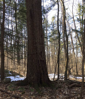
Have you been out in the woods lately? If so, what do you look at out there? What do you think about? I like to explore and look for clues to the past, and think about the folks that used to occupy and work in the places through which I walk. 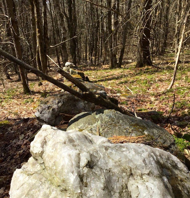 A Very Straight Example of a Stone Wall in the Vermont Forest. Lately, I've been drawn toward stone walls I find in the forest. They have their stories to tell. Their stories go back millions of years to the forming of our landscape. Glaciation, melting of ice, torrential downpours, blizzards and high winds, lots of moving water and earth, and lots of time, all worked together to bring us the hills and rocks, lakes and streams, the landscape that we see today. And these stone walls also tell stories of the people who built them; who toiled and sweated over these stones, rocks and boulders. 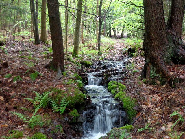 Since about the 1760's, settlers in our area began finding stones in the soil and piling them up. Those farmers had plenty of stones to work with, as they were not too far under the soil. When they were initially clearing these fields, they tossed the stones and boulders aside, to the edges of the fields, basically as piles of refuse. When those settlers and their kids and grandchildren needed material for building walls, the stones were readily available. 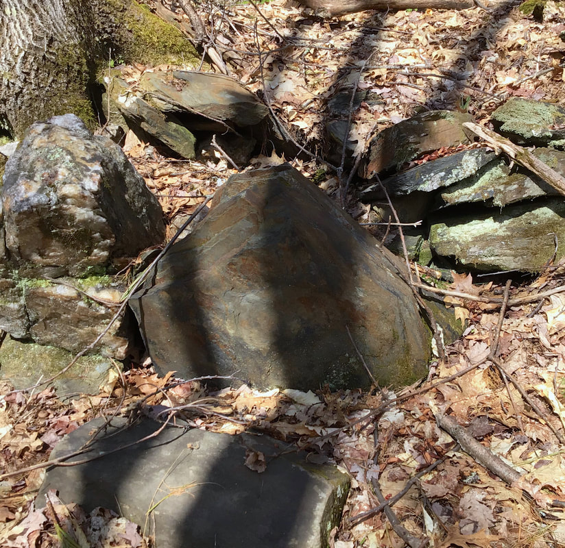 The big wall building boom around here was from about 1810 to the 1840's, which coincided with the sheep boom. Sheep raising and wool production became the big thing for local farmers. Prized Merino sheep were imported in large numbers from Spain. Most of the abandoned, rugged stone walls out in the woods, especially in the higher country, were built during this period by the farmers who lived nearby. Their sheep needed cleared fields, and fencing or walls to keep them from roaming. 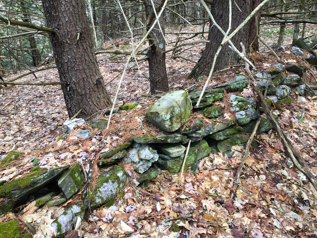 The stones that had been tossed aside a generation or two earlier, made an excellent source for delineating field boundaries and keeping the sheep inside. The walls only needed to be about four and a half feet tall, so that the sheep wouldn't be able to see over the walls, 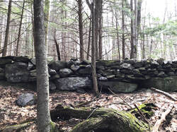 A Well Preserved Section of a Rustic Wall in the Woods Thousands of miles of stone walls were built in Vermont and New Hampshire during the sheep boom. Now, about two hundred years later, they still exist in many locations, out in the woods. I recently followed the perimeter of an old field by following stone walls. As I attempted to follow the first wall, it disappeared near a vernal pool. I attempted to follow the line that it made, but as I ascended a knoll, I lost the wall completely. Later, as I was heading down the other side, I suddenly noticed a stone wall appearing to rise up out of the earth. Parts of it were in fine shape, but some sections were totally buried. I followed it downhill.  Old Stone Wall Appearing to Rise Up out of the Ground. As I continued downhill, following the wall, I noticed that some sections were totally buried. I could see clues to where the old wall lay underneath. Trees that had since grown, had pushed stones up, so that they were lying near or on their roots. As suddenly as a wall became buried, ten or twenty feet beyond, it came out from underground again. 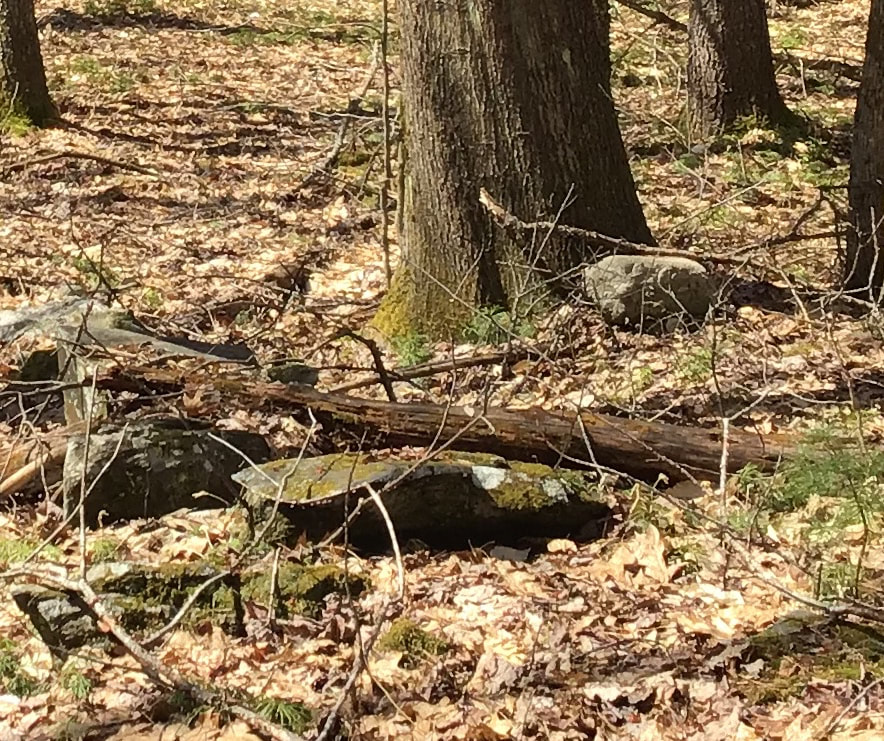 Remnants of Stone Wall. Most of the Wall is Buried Here. I noticed sections of the wall that were almost buried, in the process of becoming an invisible portion of a long, straight wall. One reason why certain sections of the wall had become buried, is tree blow-downs. I could see how some trees would trash a wall as they came down, scattering the wall stones. Then, all that dead wood is just left there, alongside and on top of the wall, to rot away over the decades, helping to build up and enrich the soil, and slowly burying what's left of the stone wall. 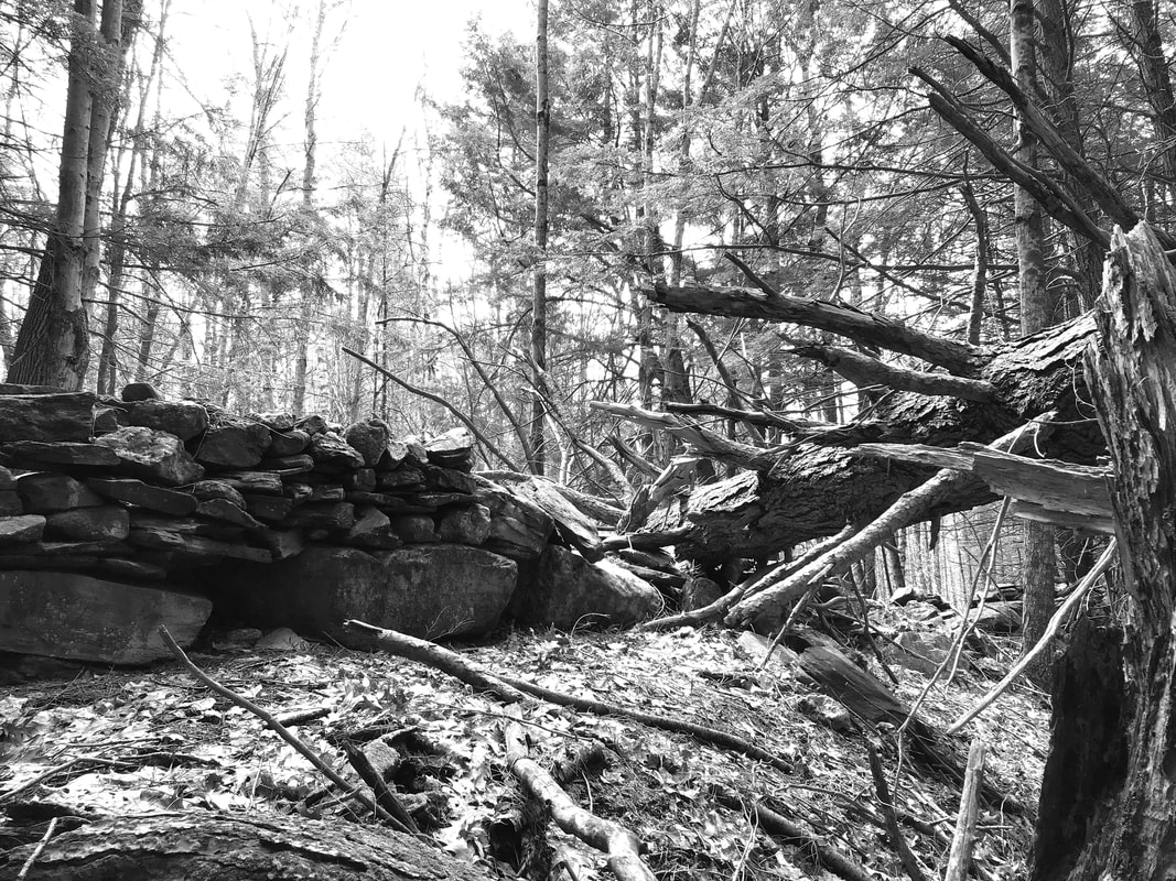 This Large Old Tree Blew Down and Wrought Havoc on a section of an Old Stone Wall. The forest stone wall seems to be constantly in the process of being buried and or destroyed. In addition to falling, dying trees, leaves annually fall and blow around, and tend to bank up against the walls, in protected areas. The leaves too, build up the soil. In addition, earthquakes, many too small for us to notice, have their dismantling effect on the old walls, slowly, but surely. 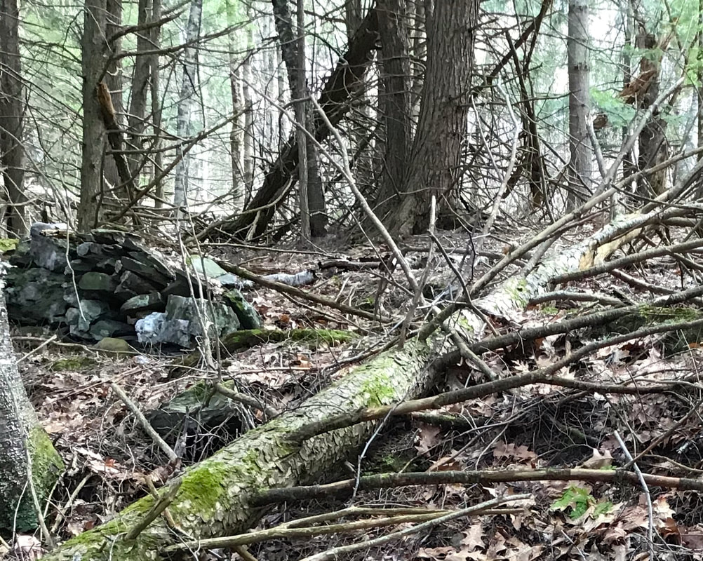 As I walk along the walls, I think about the folks who moved every one of these stones, and other boulders now unseen, that are now buried under forest litter and humus. How those farmers, with their enterprising spirit, prepared their fields and worked in this very area so long ago. I could imagine the sounds of the sheep, the voices of the farmers, and the sounds of the stones being moved by manual labor and basic machines such as iron bars used as levers. In one place I saw a large, attractive granite stone that appeared to have been placed in its location and used for a bench, with a grand view, back in the day when the fields were cleared. I could picture a couple or a group of folks having their lunch there, and I sensed their spirits in the peace of the morning, with a breeze in the tree crowns above. 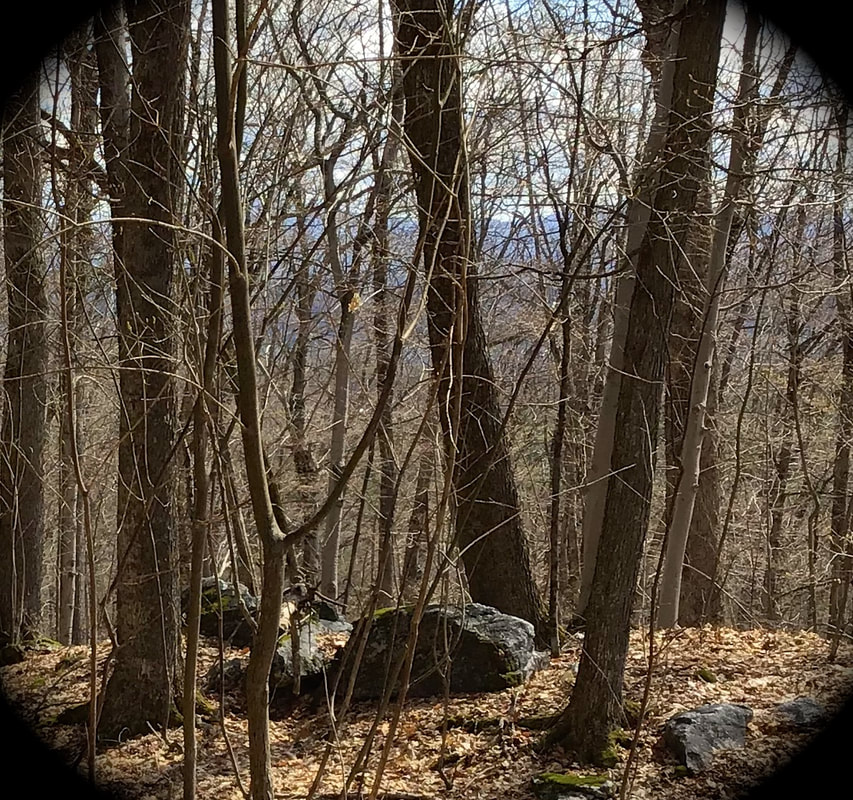 Thanks for traipsing down Old Roads, Rivers and Rails of the Upper Valley, with me, Bob Totz. To subscribe to this blog, simply send an email to me at [email protected] If Sources, and suggestions for further research:
Reading the Forested Landscape by Tom Wessels. Series of videos, Part 1: https://www.youtube.com/watch?v=zcLQz-oR6sw&t=131s The History and Structure of Stone Walls by Kevin Gardner. (Video - 1 hour 40 mins. ): www.youtube.com/watch?v=eld9wbmszcU Interesting article on the Merino Sheep craze in 19th century Vermont: https://www.newenglandhistoricalsociety.com/spanish-sheep-craze-that-forever-changed-vermont/ Source for Vermont LiDAR mapping: maps.vermont.gov/vcgi/html5viewer/?viewer=vtmapviewer Conway Daily Sun article: Why the stone walls? Follow the sheep boom, bust If you liked the previous story, you may enjoy: Strafford Vermont's Abandoned Rock Wall Foundations
5 Comments
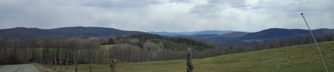 Above is a portion of a photo taken of the hills to the east of scenic Strafford Vermont, on April 16th, 2020. I was on my way back from Tunbridge, where I had just picked up my 1990 Jeep Wrangler after getting some repairs done. On my way home through Strafford, I took this photo of a pretty view from out the Jeep window. It turned out to be one of those photos that holds a lot of information when looked at more closely. Here is what I saw in this one photo: Among other things, Mount Cardigan can be seen in the distance, as I found out once I could see the most distant hills more clearly. 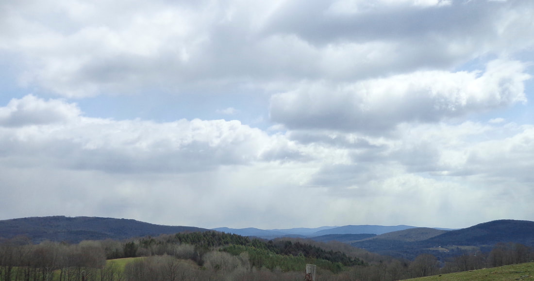 I like to focus in on certain areas. For instance, in the photo above, I want to emphasize the beautiful clouds, the rays of the sun, and patches of blue sky. As I continue to focus on the distant hills, I can also pan to different areas. In the view below, I'm focusing on a cluster of homes in South Strafford, while keeping the foreground in the photo. 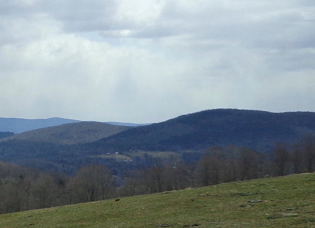 Below is a view focusing on the most distant hills, in New Hampshire: 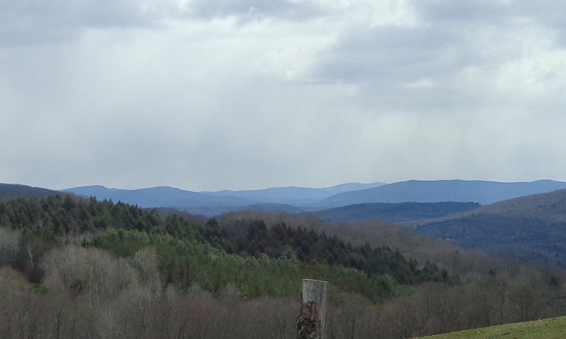 Below, the focus is on one of the nearer vistas. 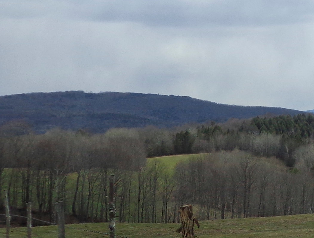 And here is a closer view: If you're familiar with the views to New Hampshire, from the higher points in Strafford, Tunbridge and Norwich, then you may recognize Moose Mountain on the right, and Mt. Cardigan just to the left of Moose Mountain, peeking out. Here's a closer look: 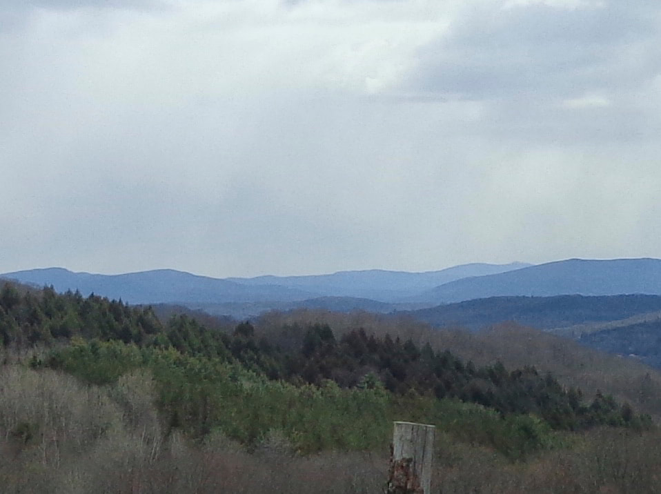 Finally, a close-up, somewhat blurry, look at Mount Cardigan, with Moose Mountain, a bit closer, to the right. 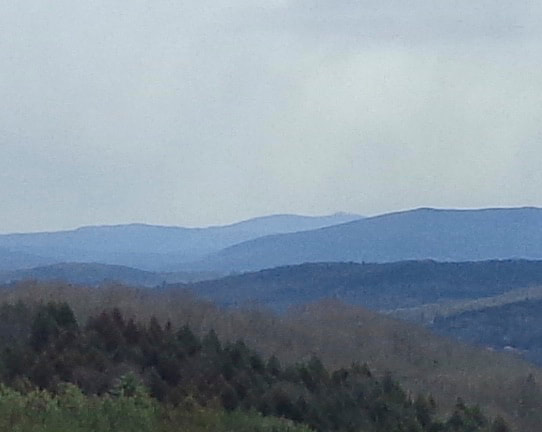 And, lastly, here is the original photo with the Jeep in the picture: 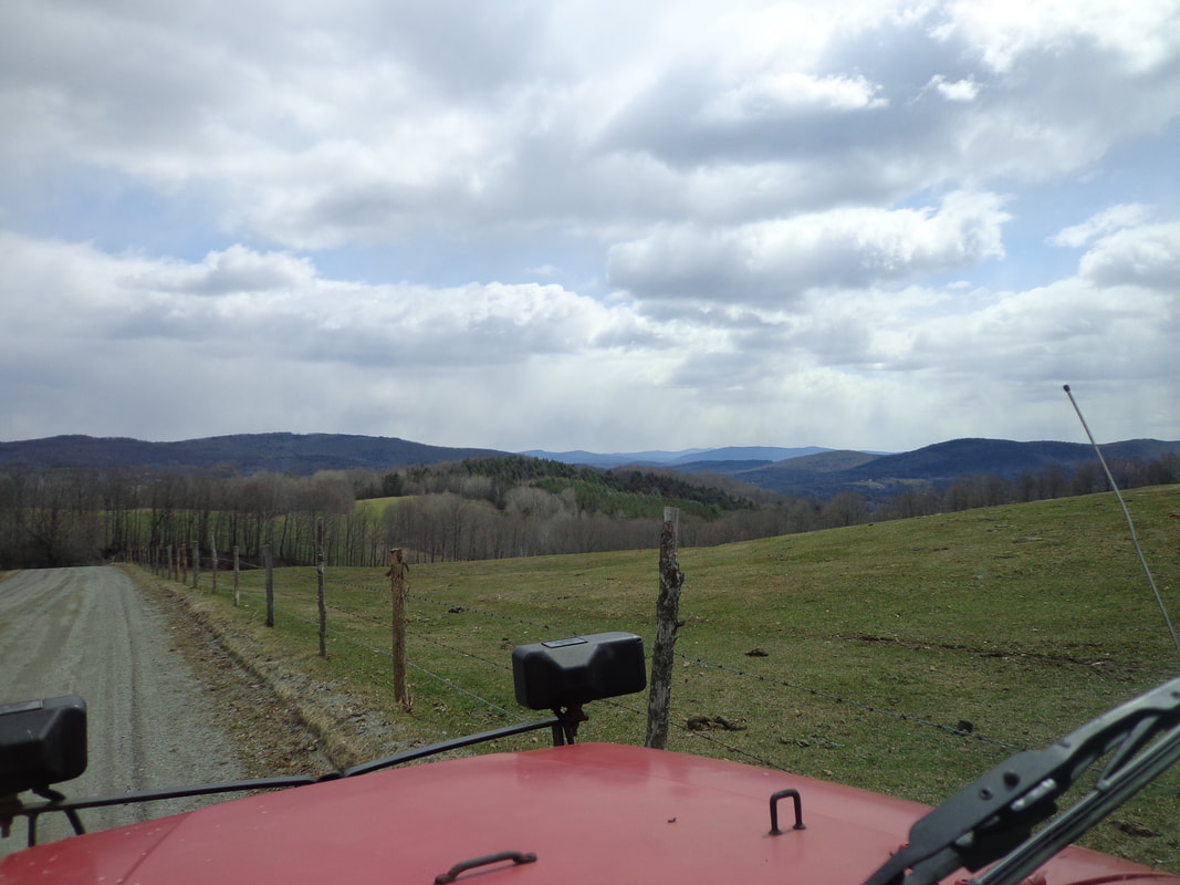 As I headed down into Strafford, I stopped at the Kibling Cemetery. Here's a photo I took from the cemetery of the Pompy valley looking toward South Strafford: 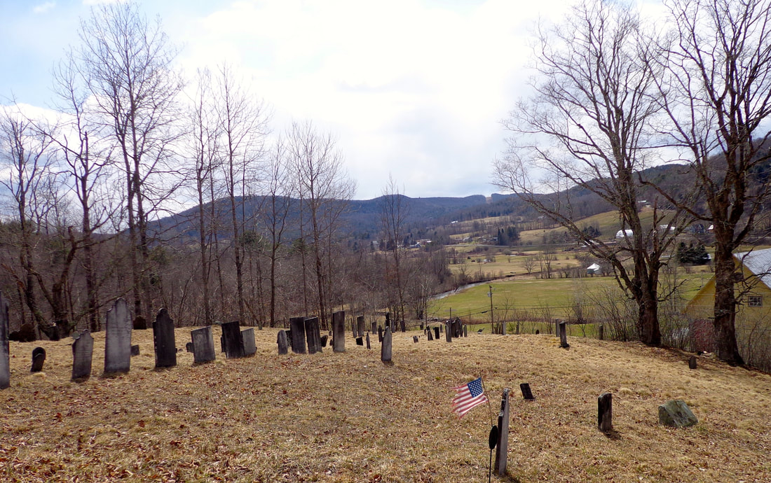 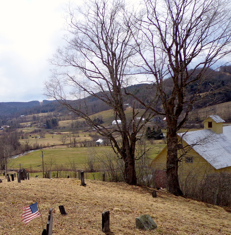 Above is a cropped view from the previous photo, emphasizing the maple trees and barn in the foreground. On my way back home, coming down New Boston Road, I stopped to take this last photo, showing Mounts Cube and Moosilauke in the distance: Mount Moosilauke is partially hidden by clouds, on the left. Mount Cube is more prominent, to the right. 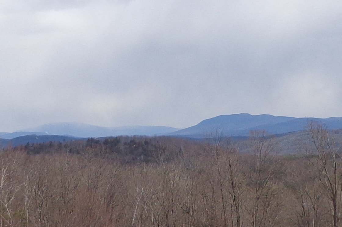 Happy Mother's Day, and may all your views be beautiful!
Thanks again for traveling down Old Roads, Rivers and Rails of the Upper Valley, with me, Bob Totz. If you or someone you know would like to subscribe to this blog, just send an email to me at [email protected] 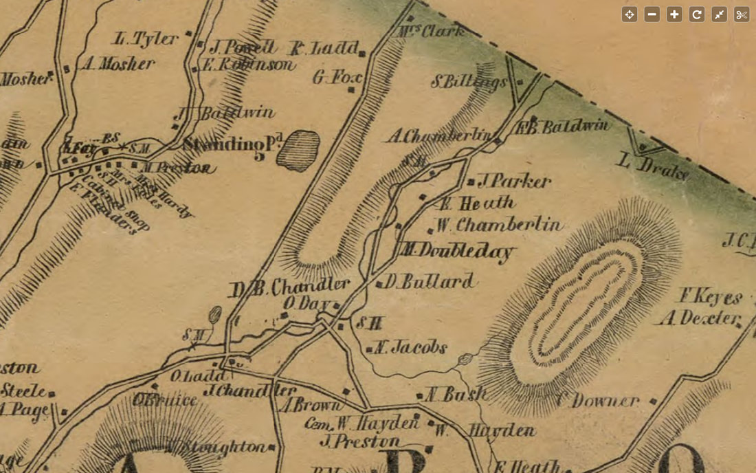 Day District of Sharon Vermont. 1855. In part one of this article, we focused on our spring hike out to the old man-made reservoir that was a source of water for the Sunny Brook Trout Farm. As we left the reservoir, we headed uphill and into the woods on an old road. 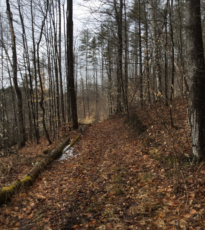 Heading Out on the Old Woods Road. The road led us uphill, and soon we were approaching an old stone foundation. 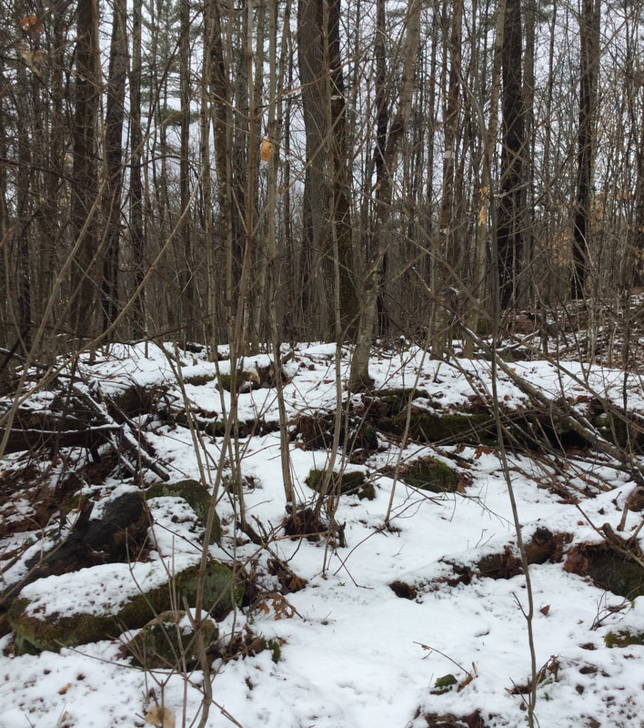 As we approached, I could make out the shape of an old stone wall poking out of the snow. 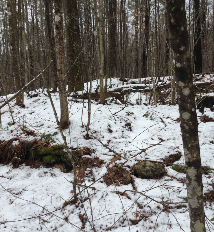 Though difficult to see with the old crusty snow, we could tell there was some serious history half-hidden here. 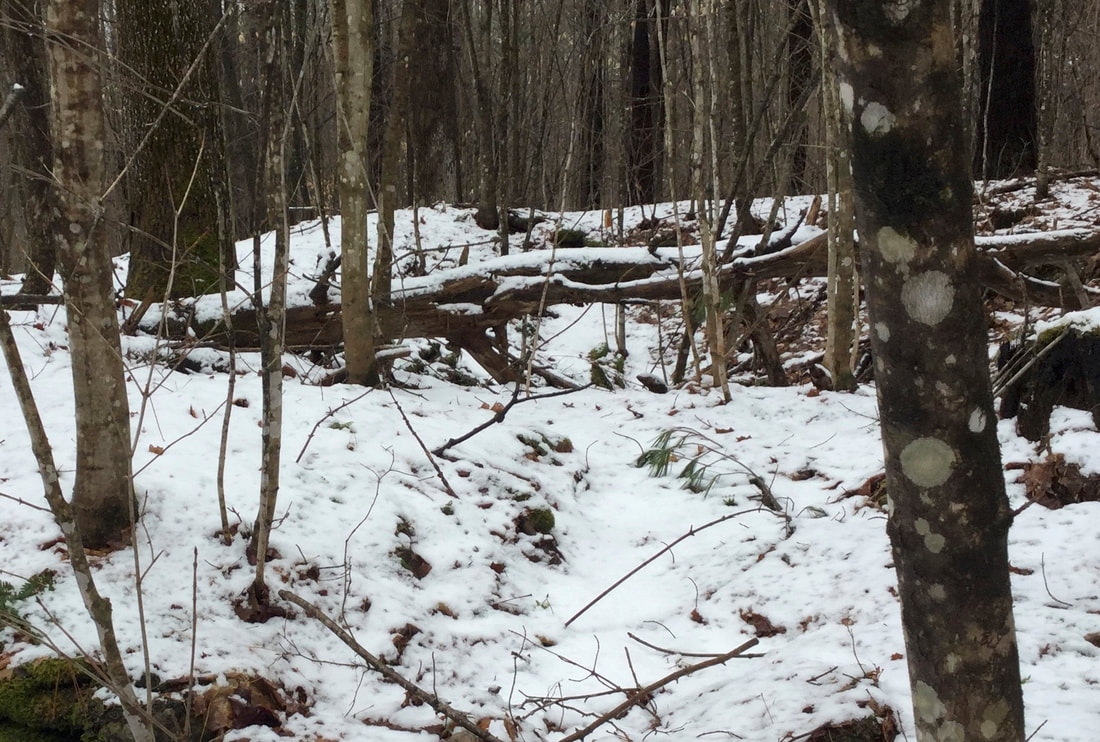 A Closer View of the Old Foundation. Dead Trees Have Fallen into the Hole. With snow, fallen trees and debris all around the area, we had to use our imagination a bit, to try and see an old homestead in what is now forest. The forest around us was fairly young, but the presence of an ancient majestic maple, just above the foundation called to mind days of sugaring and farming here, in the `19th century. 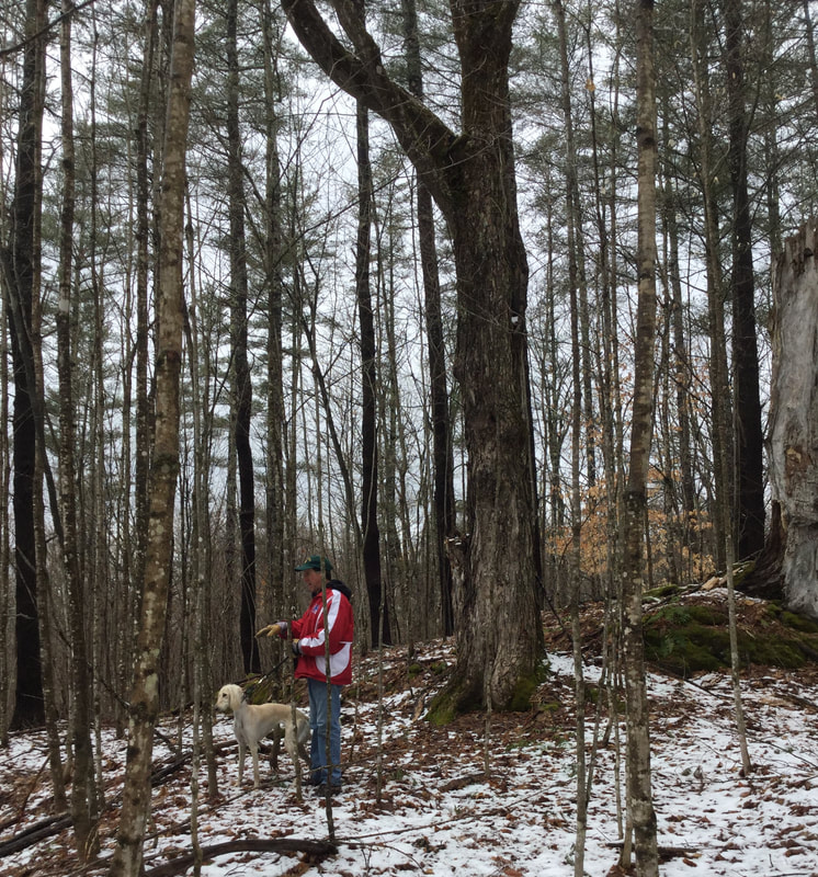 Dave Phillips Stands in Front of the Majestic Old Maple Tree, Just above the Stone Foundation. Here is another look at the foundation, looking down from the big maple tree: 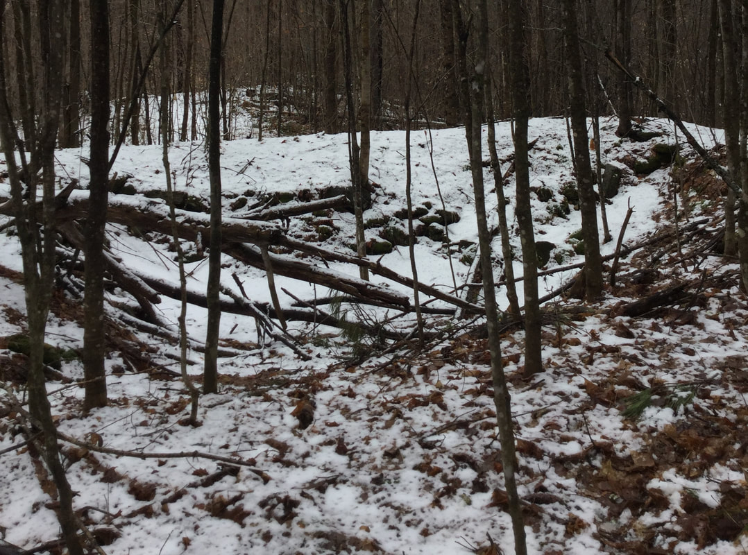 To the left of the old cellar hole, was another low wall that may have been the foundation of an ell, or other living space that did not have a cellar hole underneath: 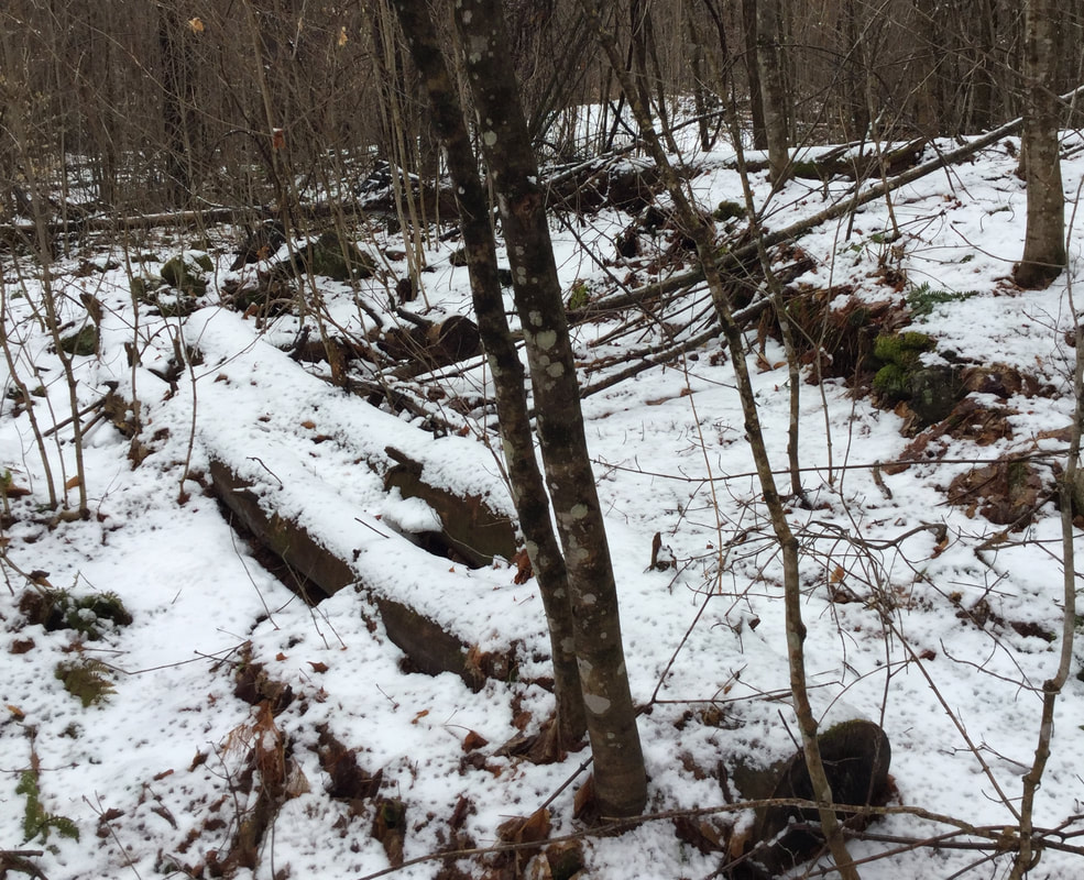 Foundation Stones Adjacent to Main Cellar Hole. Soon we were heading uphill again, in the forest, along an old road, where we came upon the most... AMAZING STONE WALL! 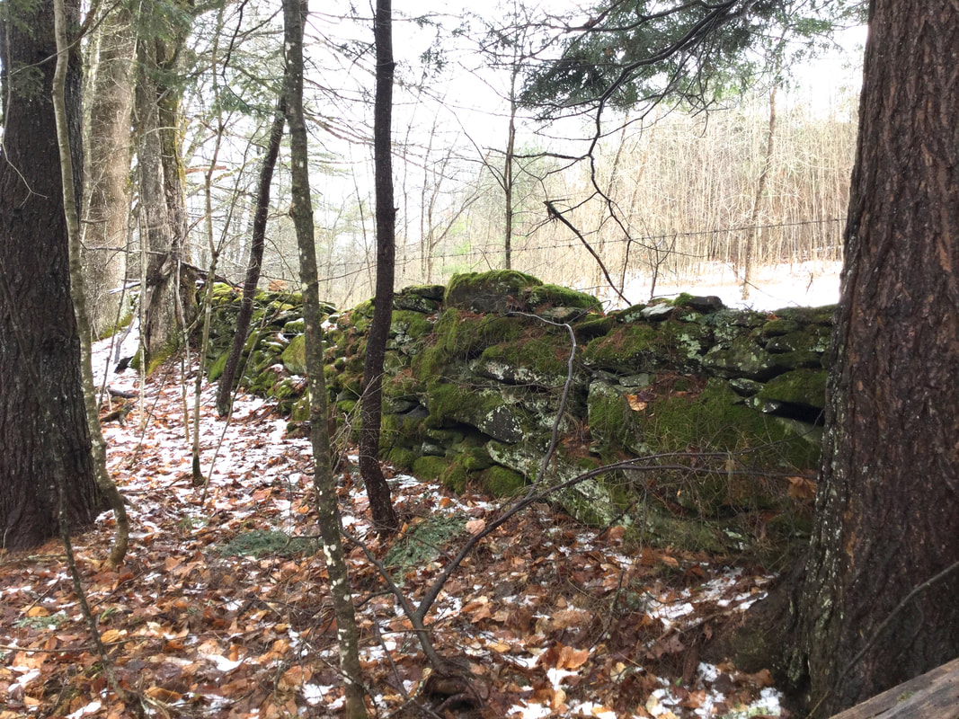 Dave had told me about this wall earlier, and I had been looking forward to seeing it. To me, old stone walls are, to some degree, works of art. Even though they were built for a variety of functional reasons, I can't help thinking that sometimes the builders had a desire to create something that would be visually pleasing, as well as durable and functional. 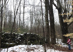 Dave Phillips Stands to the Right, Admiring the Large Old Stone Wall. In the photo above, Dave and his pup stand to the right, giving an idea as to the size of the wall. By the looks of this wall, I could see that something very durable was built many years ago. And it is visually pleasing as well. Large old trees line the wall. They may have been planted there, or possibly they grew close to the wall by chance. Though some of them were ancient and dying, some of the old trees still had plenty of life left in them. 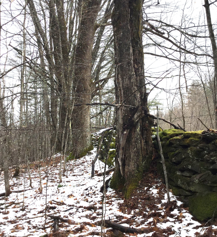 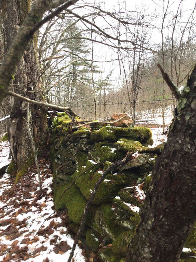 As we investigated the old stone wall, we pondered why it had been built here, so tall and sturdy. It almost seemed like it said "Here is the estate of someone who is wealthy and wanted a beautiful wall to show the boundary of their property on this side." One interesting feature, attesting to the intelligence of the builder(s) of this wall: There appears to be a culvert that was built right into the stone wall at the low spot, to allow water to pass under it without undercutting the integrity of the wall. It seems to have worked well for probably well over a hundred years, maybe two hundred? 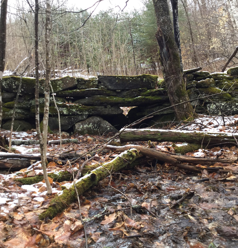 Clever Stone Culvert Built into the Wall Here is a good look at the workmanship displayed in this wall: 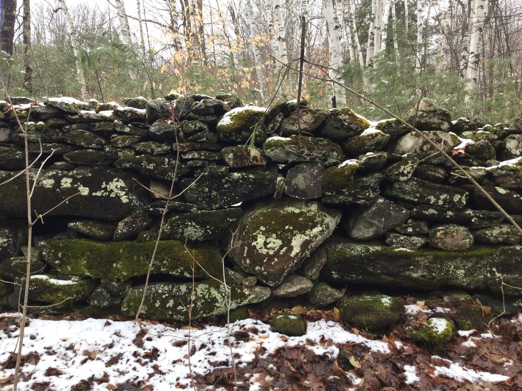 And here is a look at a corner of the wall: 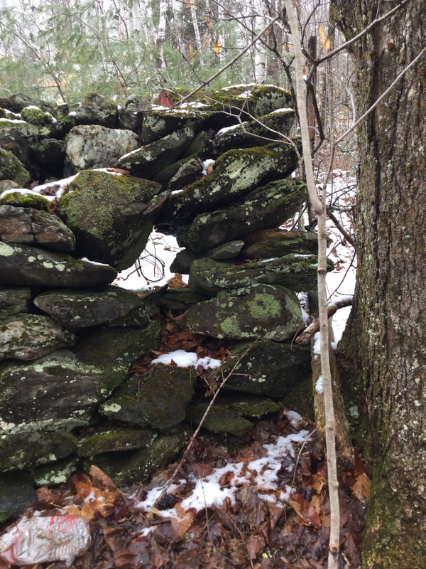 Below is a look at the same corner, just to the right, showing the remains of an old gate. 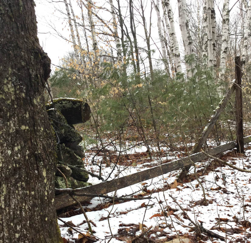 As Dave and I headed back towards the old reservoir, we discussed the origin and use of the road, and the tall wall. Perhaps the road was used as a shortcut to upper pastures, or possibly for visiting the neighbors' farm(s). There is a road that connects with Route 132 above the Sunny Brook Farm, called Muir Road. Today, it is a dead end road. However, back in 1855, and up until the early 20th century, it appeared that Muir Road also connected with Route 132, or Quation Brook Road, as it was probably called in earlier days. I wonder where the name "Quation" came from? Here is a close up of that area from the 1855 Windsor County map: It appears to me that the road to the right, (east) would be Muir Road, and Quation Brook Road would be the western path. 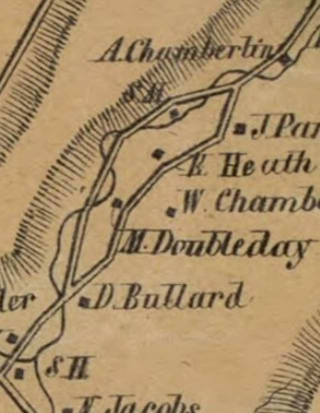 Close-up of Road Behind Sunny Brook Farm. This May Be Muir Road Today. In the close-up above, from 1855, we can see that there were homesteads of D. Bullard, M. Doubleday, W. Chamberlain, Heath, and Parker. It's possible that the old stone foundation we visisted belonged to one of those families. 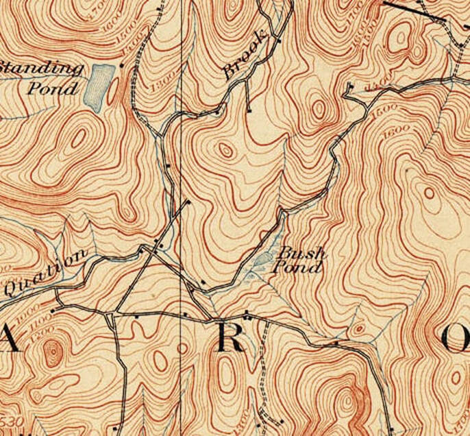 Day District, Sharon Vermont, 1896, Showing Two Ends of Muir Road, Not Connected.  Day District, Sharon Vermont, 1949. The Double Dashed Line above the Day School Indicates Muir Road. LIDAR technology uses laser technology to map the surface of the earth from the air, without being obscured by vegetation. The following are a series of screenshots from the Vermont Center for Geographic Information, using LIDAR technology, each one a bit closer to the area where we found the great stone wall. LIDAR can show where fields used to be, and where stone walls can be found, even when partially or totally buried, by the subtle changes in elevation shown on the images. 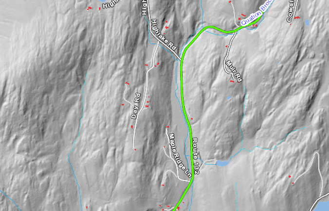 The image above shows the area in question to the right of Route 132. 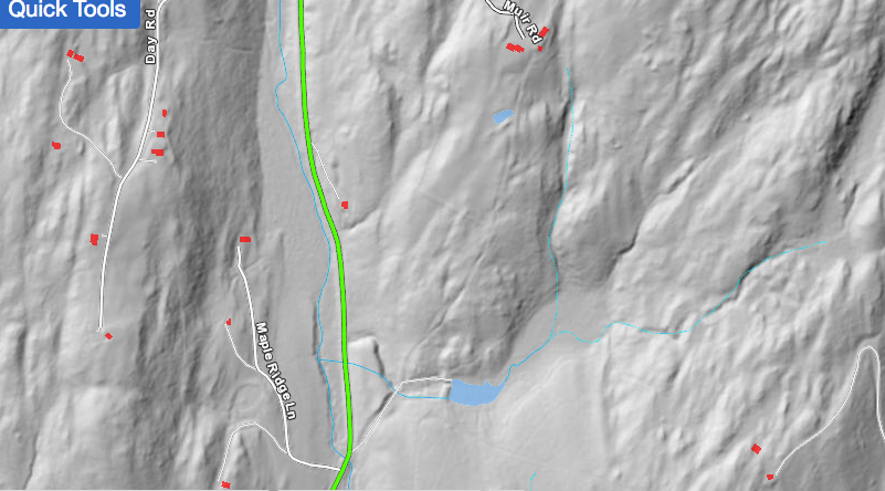 Here is a closer look. 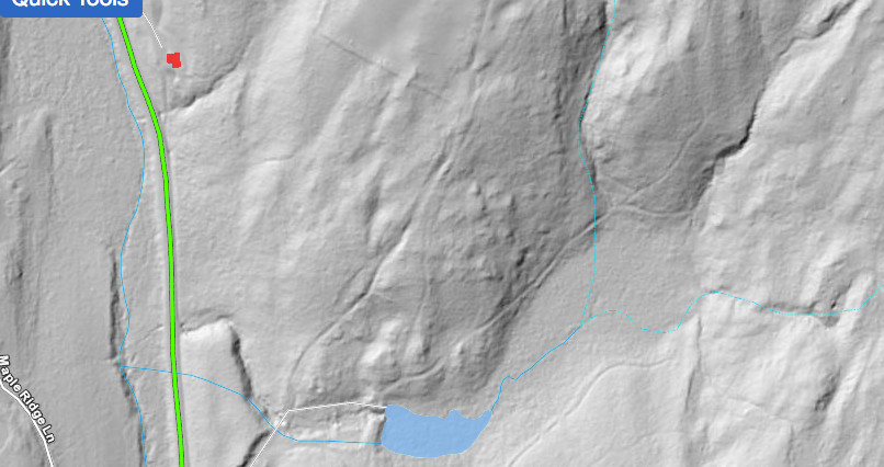 In the image above, the old reservoir is shown in blue at the bottom. We had turned away from the old reservoir dam and up into the woods, where a road can be seen leading northeast. It appears to me that Muir Road was to the west of where we were walking. It's possible we were on a path or old road that connects to what is now Cowslip Road, which is the next right turn off Rt 132 after Muir Road, heading north. 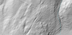 In the close-up image above, notice a very straight line running diagonal, lower right to upper left. I believe this may represent the tall stone wall that we found. Here's one last view, from Google Earth, showing Sunny Brook Farm, Muir Road, and Coswlip Road: 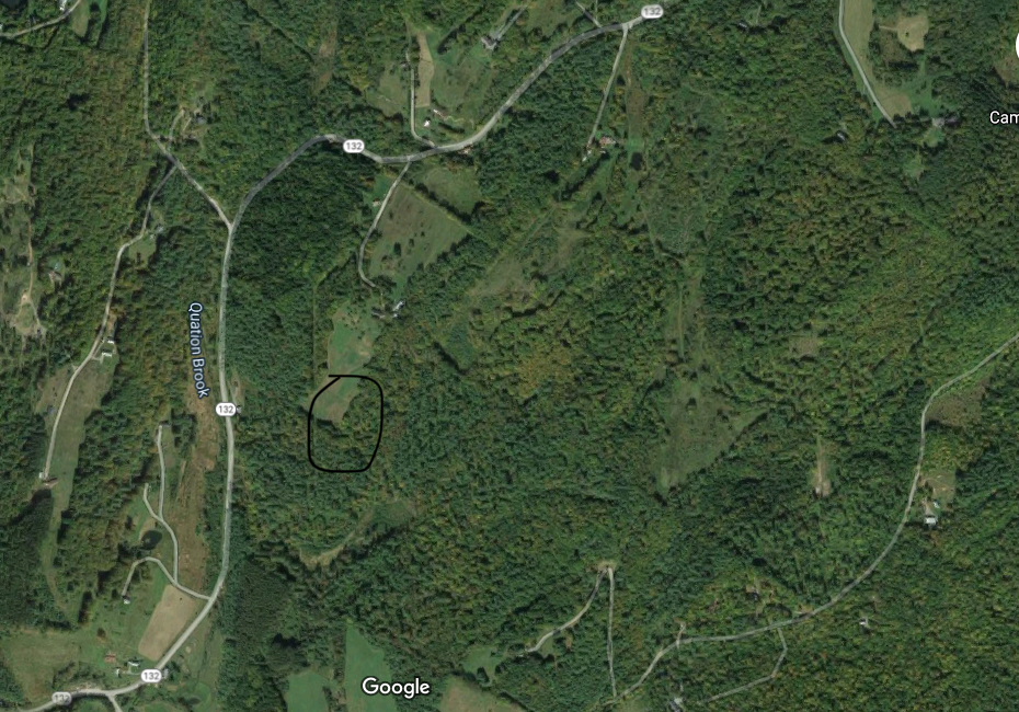 Circled above is the general location where I believe the tall wall was found, just below a field. This is a very interesting area, as are so many old back woods areas in Vermont, where farms used to thrive. Emigration in the mid-1800's often left old farmsteads to decay and return to the forest along with their pastures and fields. Today, we look for signs of the past, and the largest clues are the stone walls, and stone foundations, often along the older roads that are no longer in use, yet still exist out back. Thanks for hiking down Old Roads, Rivers and Rails of the Upper Valley with me, Bob Totz Comments and New Subscribers are always welcome! To subscribe, simply send an email to [email protected] SOURCES:
USGS Topographic Maps: https://ngmdb.usgs.gov/topoview/viewer/#12/43.7799/-72.4312 LIDAR Map: https://maps.vermont.gov/vcgi/html5viewer/?viewer=vtmapviewer Satellite View: Courtesy Google Maps https://www.google.com/maps 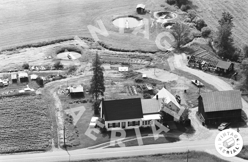 Sunny Brook Trout Farm in 1968. Aerial view by vintageaerial.com An invitation to hike on an old, long unused Vermont road, to see some old relics in the woods was something I did not expect on a Tuesday morning. Happily, I called up Dave Phillips and accepted his offer. Both Dave and I have a love of old roads, foundations, stone walls, history and relics. 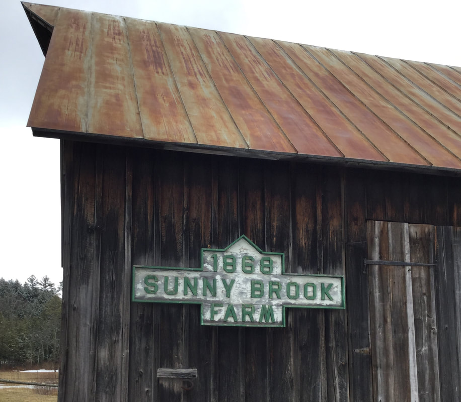 Maybe you can't go to work, but that doesn't mean you can't go for a walk. I usually walk daily, locally, in my neighborhood, but Dave's offer was a welcome one, and I headed west on Beaver Meadow Road, for a springtime walk at the old Sunny Brook Trout Farm.  The Day District, and Sunny Brook Farm, in Sharon Vermont near the intersection of Beaver Meadow Road, Route 132, and Carpenter Street. 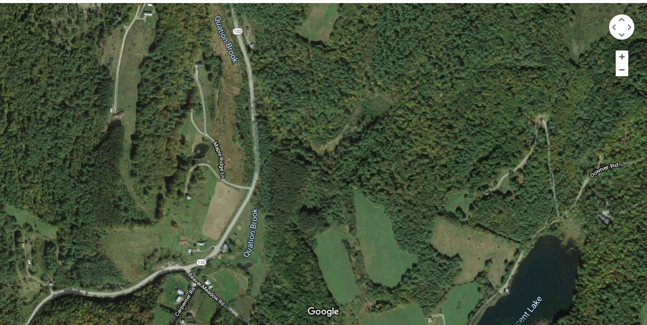 Since 1988, when I lived in Sharon, for a couple of years, I've been fascinated with this area, which is known as the "Day District", after the Day family who farmed here years ago. I've often wondered how Beaver Meadow Road, Downer Forest Road, and Route 132, looked 100 or 200 years ago. I'm thinking there were different pathways between farmsteads, that were used as roads back then, and eventually, some became public, and got the maintenance they required, while others settled back into the hills and woods. 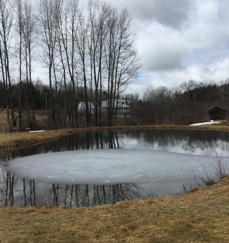 The one pond remaining from the Sunnybrook Trout Farm Days. Dave met me at his back door, with his dog, who was along for the walk. As we strolled across the back field, Dave gave me some history of the Trout Farm that was active on this property, for fifty years, from 1930-1980. The gentleman who ran the trout farm, Harold Day, must have been very busy, and must have loved his work. Dave thought Harold Day's father had started the trout farm back in 1930. There is only one pond remaining on the property today, but as you can see from the air photo at the top of this article, there were several ponds back in the day. 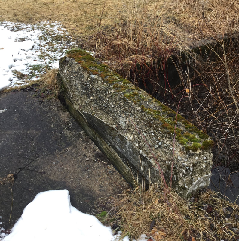 Cement Bridge over Quation Brook on the Former Trout Farm. The ponds were all fed by Quation Brook, which runs through this property. There are several small, old cement bridges spanning the brook on the farm. From there, the stream continues down alongside of Route 132 from the intersection with Beaver Meadow Road, to the White River. 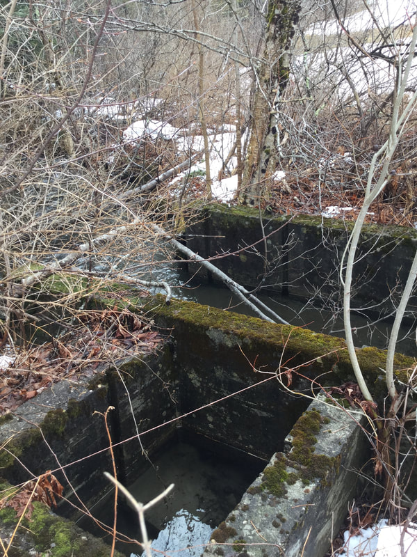 Cement Structure along the Brook, Formerly Used for Trapping Fish. Along the river, Mr. Day had installed concrete gates for trapping the fish. There are several concrete bridges and gates scattered about the brook, that are no longer used, but slowly deteriorating as ninety year old cement tends to do. Stones fall out, year after year, returning back to the stream bed. 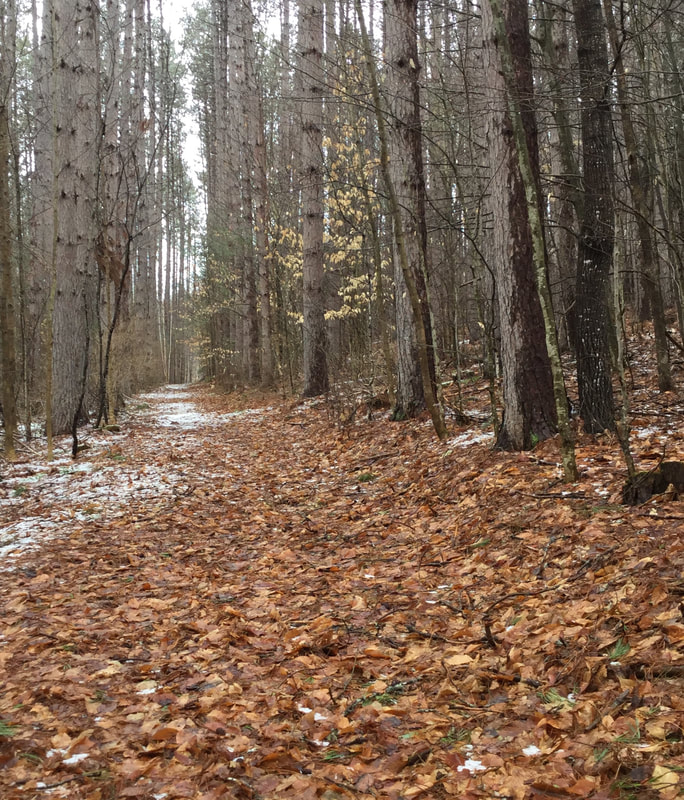 The Old Woods Road Soon, we headed out of the field, and into the woods. As we walked along, we pondered the origin of the road on which we were walking. 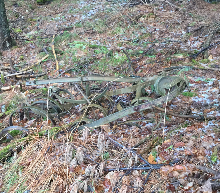 Old Relics Remain, Rusting by the Roadside. This road had been used by the trout farm, for there was some old, rusting equipment lying around. There were also some pipes poking out of the ground, formerly used to direct water flow to the ponds. After having walked uphill for a while, we came upon a clearing in the forest, with a large, prominent pine tree. 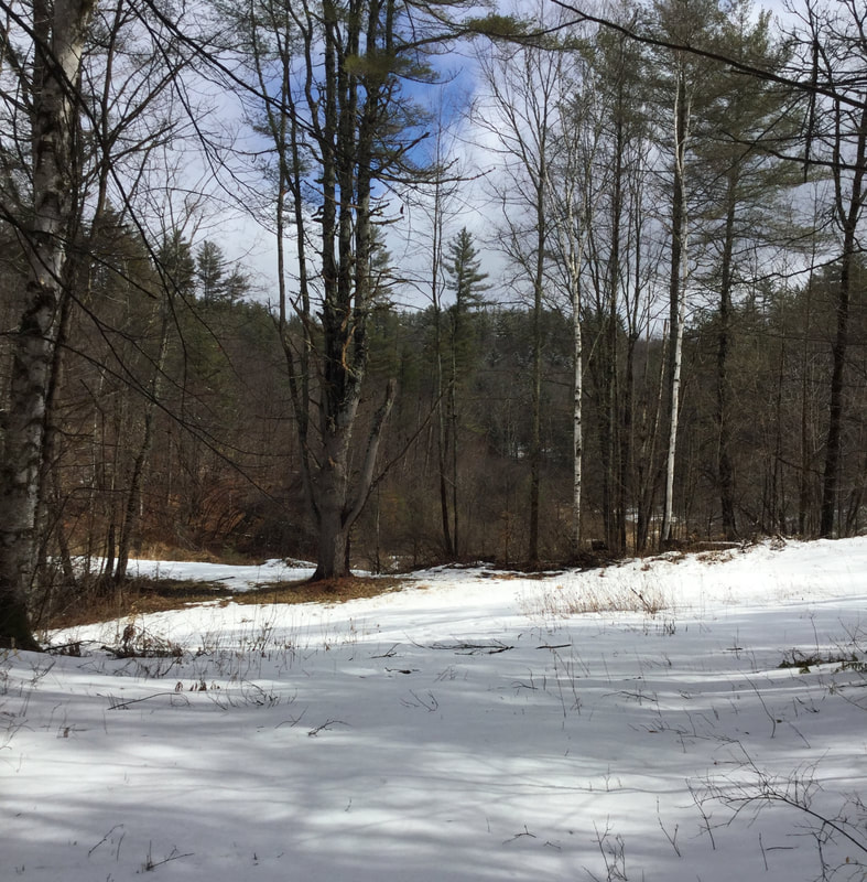 An Interesting Clearing To the right was a road that ascended, but we took the left. 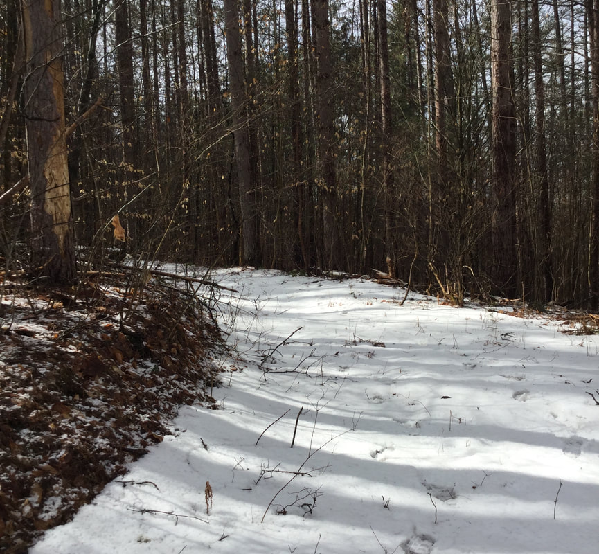 Roadway Leading to the Former Reservoir THE FORMER RESERVOIR FOR THE SUNNY BROOK TROUT POND We headed downhill, past the big pine tree, and over a berm that traversed above a low marshy, wet area. 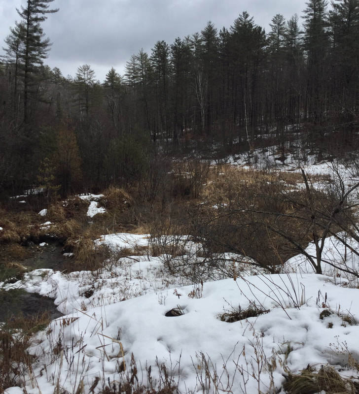 It turns out, this berm was part of a dam, back in the days of the Trout Farm. The dam held back a LOT of water! It must have been something to see when there was a pond or reservoir here. There are a fair amount of large man-made ponds around this area, such as Lake Mitchell, and the C.C.C. pond, and the big "Lonely" pond on Beaver Meadow Road, below the old barn, in Sharon. Unfortunately, this one blew out, big time. 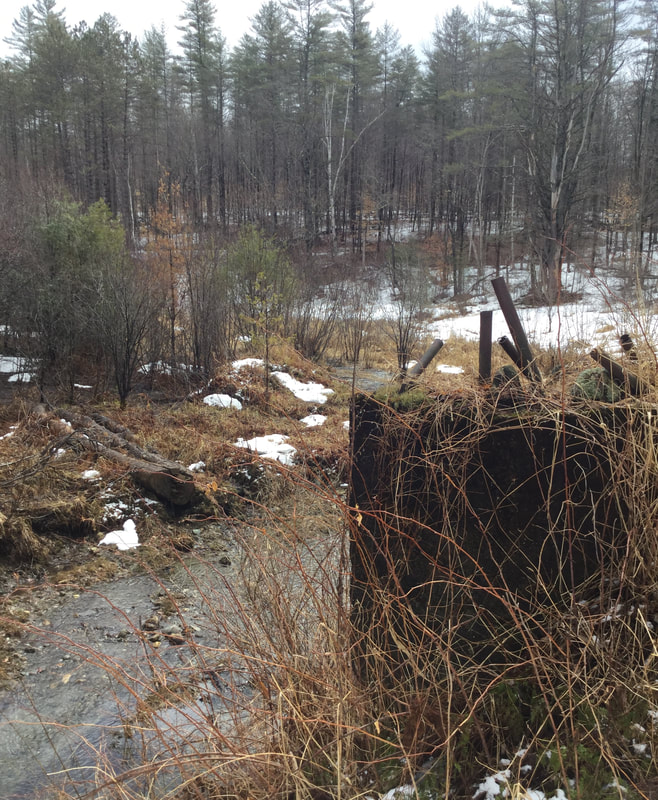 Site of the Former Dam, at the Sunny Brook Trout Farm Reservoir Dave told me that back when the dam broke, it devastated a portion of Route 132. I think that was in the 1980's, so I'm sure there are folks around here that remember the event. 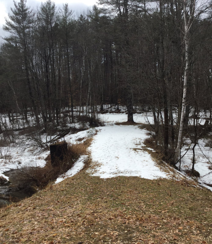 Looking Back at the Berm We headed around the west edge of the former pond, and continued back into the woods. 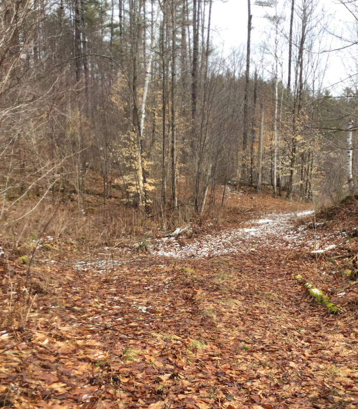 We Continued Uphill, Back into the Forest. 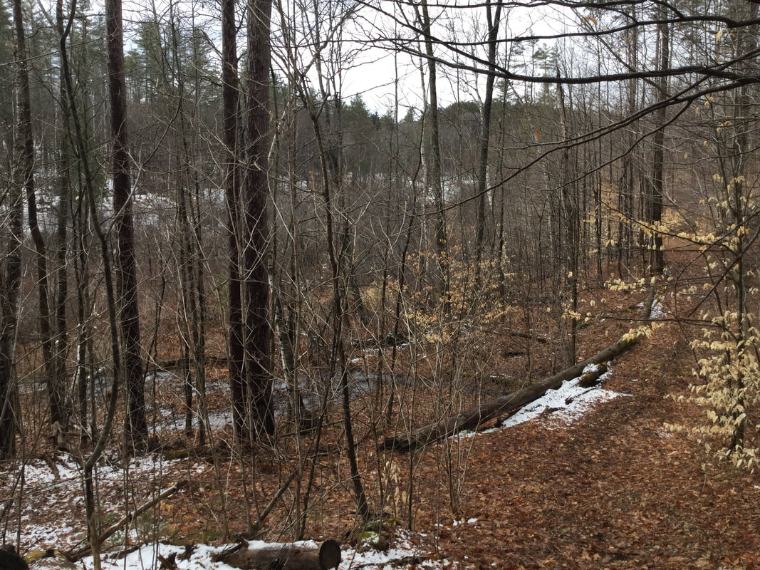 Looking Back, at What Used to Be a Reservoir 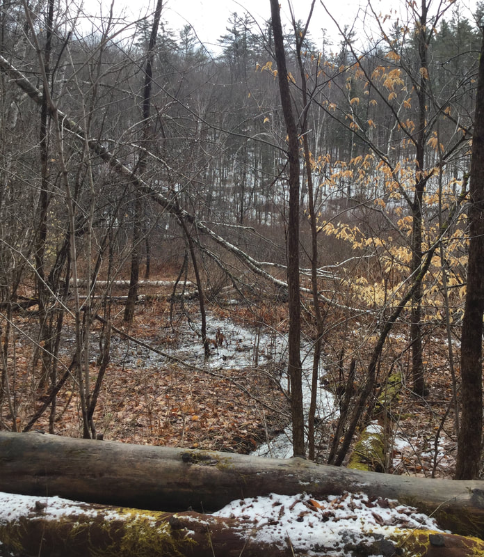 Looking East, Toward the Former Lake/Pond/Reservoir We began to hike westward, uphill, toward some more clues to the past that Dave had recently noticed during a hike in the woods. END OF PART ONE In part two, we'll explore the rest of this hike, and see what else we might find in this interesting, historic part of the Day District in Sharon Vermont. Please feel free to comment on this post, especially if you have any first hand knowledge of the Trout Farm and the time that the dam burst. 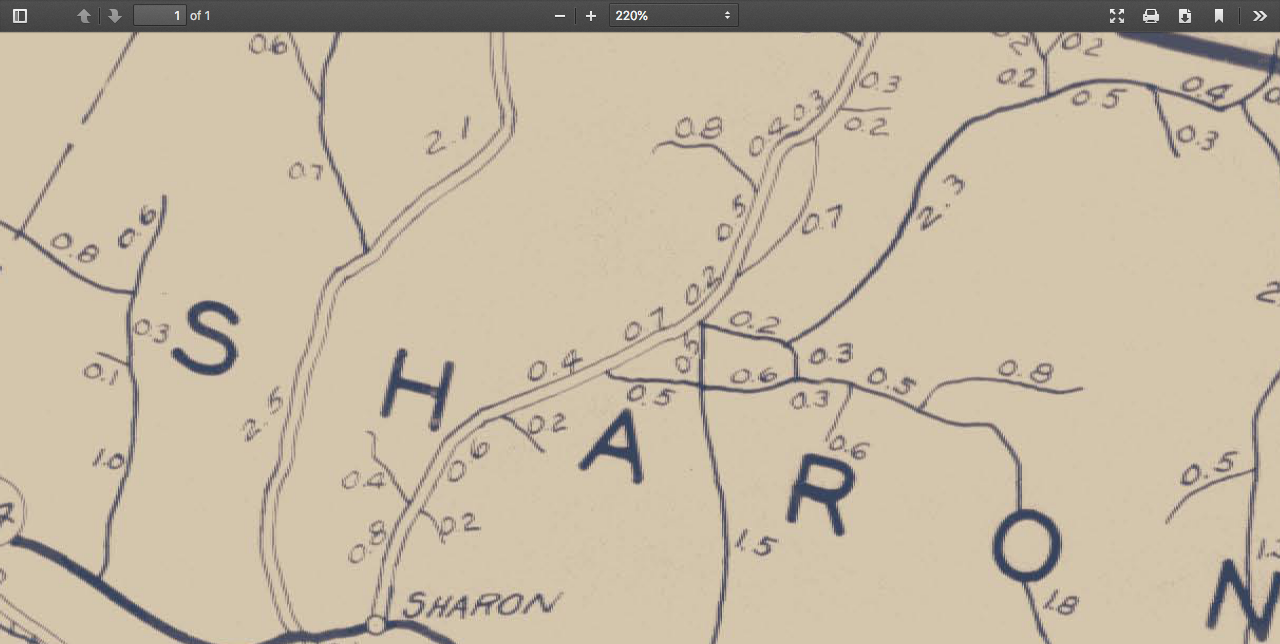 Agency of Transportation Map, 1931. Day District in Center 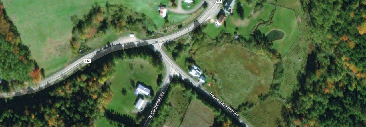 Image from Vermont Center for Geographic Information, thanks to Jason Hill for his comment. (see below for source.) 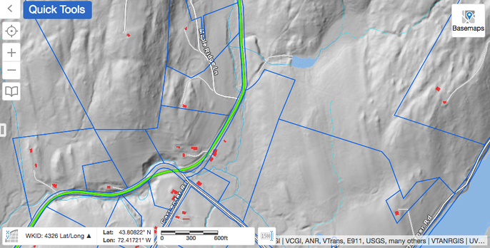 Lidar View of Same Area. Property Boundaries in Blue. Courtesy https://vcgi.vermont.gov/ Sources:
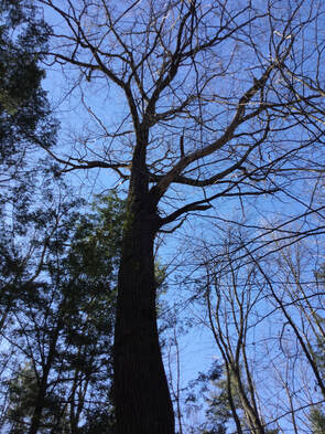
1968 Air Photo courtesy vintageaerial.com Vermont Agency of Transportation Maps: https://maps.vtrans.vermont.gov/Maps/TownMapSeries/WINDSOR_Co/SHARON/SHARON_1931.pdf Vermont Center for Geographic Information: https://vcgi.vermont.gov/ After doing my transfer station run on Wednesday, I parked the car outside the gate, near the small sand/wood chip shed. I wanted to get some exercise and fresh air before heading back home. 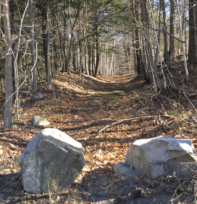 I'd seen those stones there before, blocking motor vehicle entrance, but I hadn't noticed any "No Trespassing" signs, so I thought I'd see where this trail might lead. I had a suspicion it might be a discontinued road. I headed up into the woods. 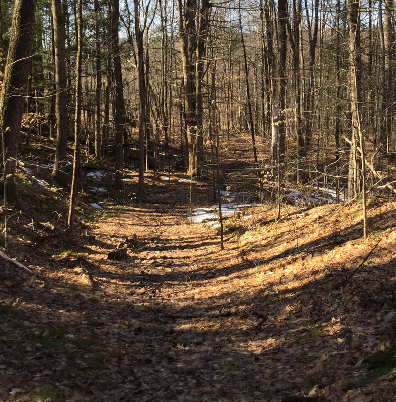 Not too long ago, a couple different people mentioned they thought there was a King's HIghway in Norwich, and that it ran up behind the Town Garage area. This was beginning to look like it could be an old town road, but I hadn't noticed it on a trail map before. 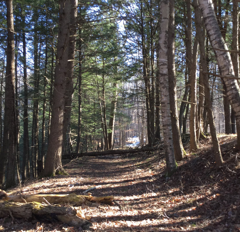 Old New England roads are often between stone walls, though sometimes the walls themselves are buried. 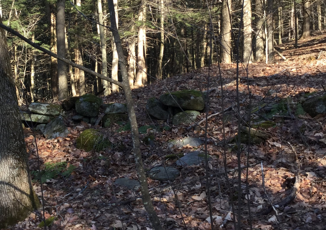 The old roadways also became depressions between the higher stone walls, from being tramped by on by people, animals, and carts and wagons of cargo, and water washing in the low points. 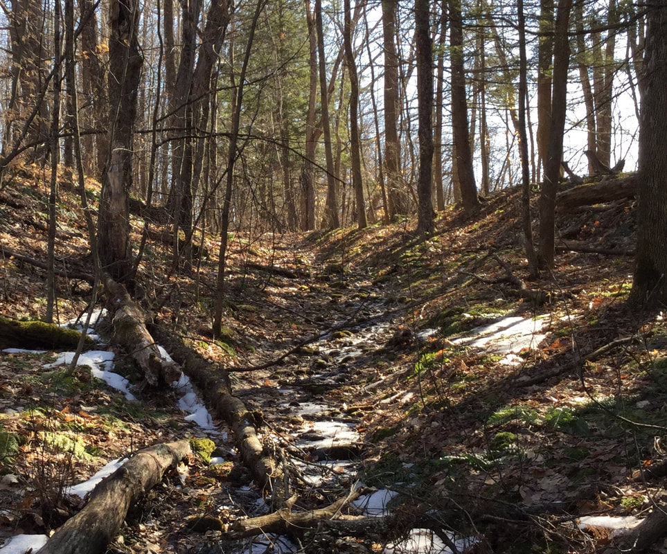 To the right I could start to see an open field. I wondered if maybe this road would lead to Olcott Road, near where the original Meetinghouse of Norwich first stood. 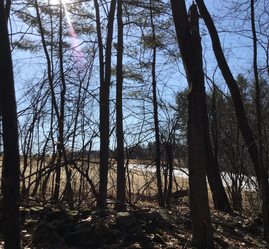 The high stone walls continued along both sides of the pathway. 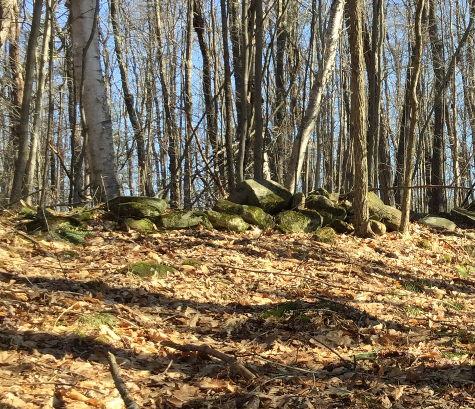 I wonder exactly when these walls were built. Maybe there's an early settler's diary at the Norwich Historical Society with an entry about working on the roadway, and moving rocks right here in this location. 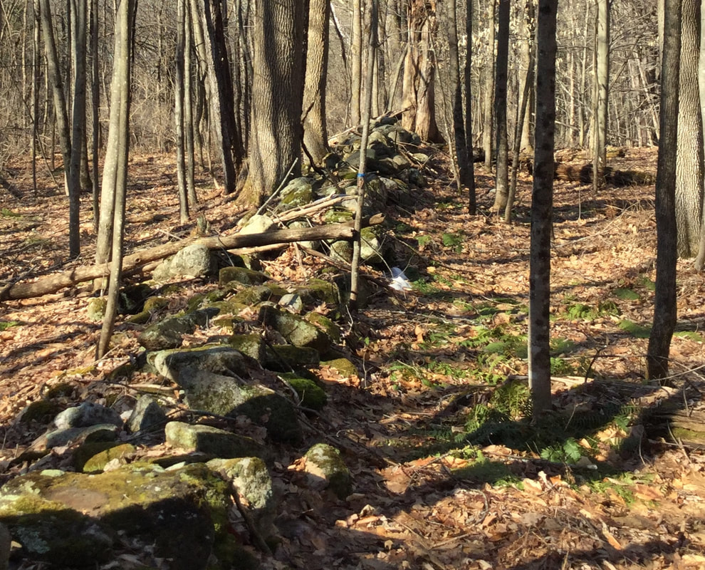 This has been a nice March for hiking. When I was out, it was mid-morning, and even though the snow was melting slowly, the ground was firm enough to walk without sloshing in slush or mud. That will be changing soon though. As I hiked around, following this old road, the ground leveled off a bit. There was a break in the wall. 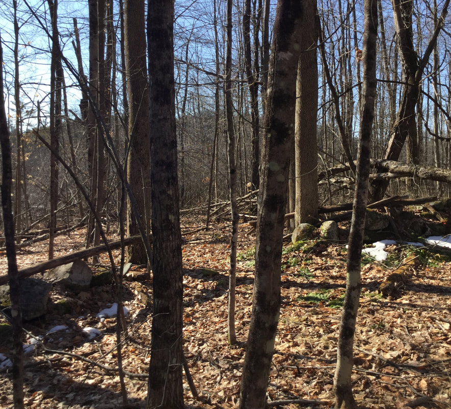 I found what looked like an old corner in the stone wall on the east side. There was an iron pin, most likely left from a survey... 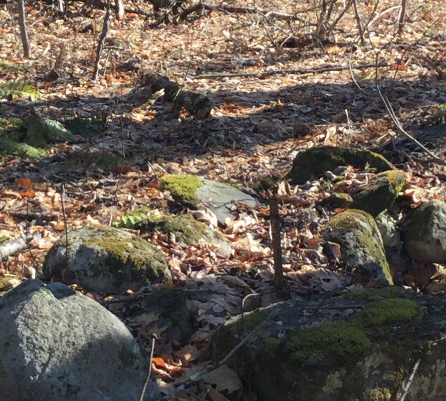 ..and what looked like a witness tree, a many trunked yellow birch giving witness to an old corner. 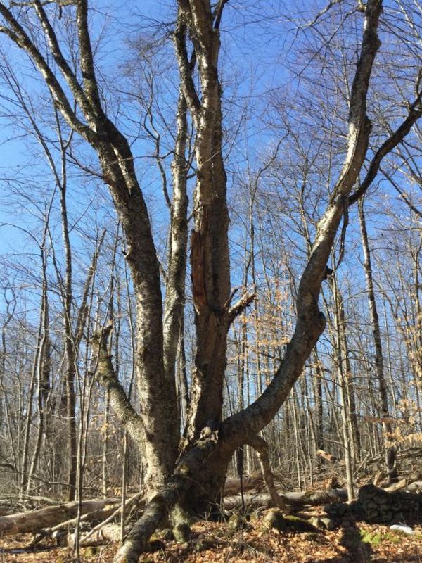 I looked around, and checked the time. I had a allotted myself a half hour for this walk, and it had already been 35 minutes, so I decided I'd better head back. 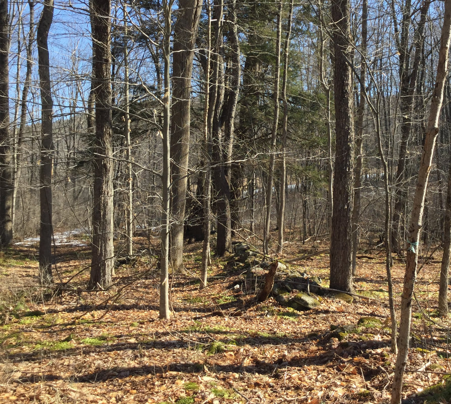 I admired the stone walls on the way back, and the wide swath of the roadway. 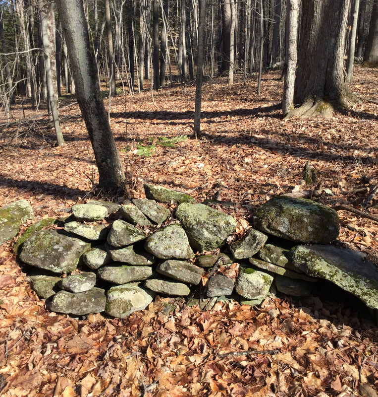 On my way back, I noticed a very large oak tree, by a turn in the road. It appeared to be the largest, oldest tree around, and it was right near a ravine, or seasonal streambed that dropped off, down to New Boston Road.
As I headed back down the last leg of the old road, toward the car, I could hear chicadees singing. When I got back home, I did a little research about this road. I don't know what it was called, but it looks like it was on the map in 1855, and was a way to get from the Meeting House to the starting point of New Boston Road, via Olcott Road. Here is a map from Google Earth: The dashed line shows the route of the road I was on. 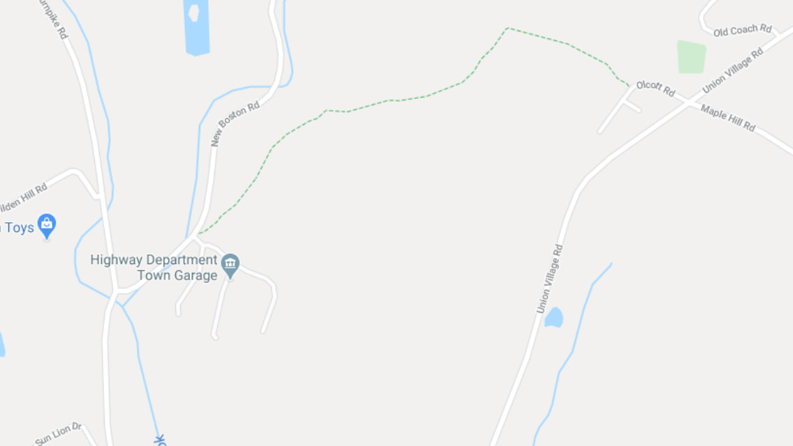 And here is the 1855 view: I circled the area in question. 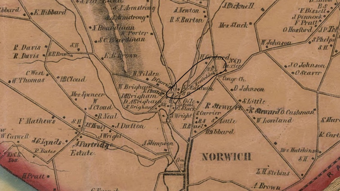 And here is the Google Earth imagery with the same area circled: 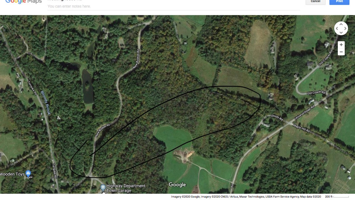 Fortunately, practicing social distancing doesn't have to mean staying out of the great outdoors. Getting excercise and fresh air is good for your body and your peace of mind, and it may even help you to sleep better at night! Thanks for hiking along Old Roads, Rivers and Rails of the Upper Valley. with me, Bob Totz If you haven't already done so, feel free to join the growing list of subscribers to this blog. Just send an email to [email protected] and we'll add you to the club. Sources: 1855 Windsor County VT map by Doton:
https://www.loc.gov/resource/g3753w.la001193/?r=0.305,0.282,0.928,0.392,0 Continued from Signs of Norwich Part One Having reached the divided highway just before the Interstate 91 entrance, I crossed Main street and headed back toward the Norwich village center. The first sign I encountered was this sign at the entrance of the town, "Centennial gift of The Norwich Women's Club". I think it's neat that Norwich, and some other nearby towns were chartered on July 4th. The royal governor who issued the charter at that time, had no idea what that date would mean, fifteen years later, when our Declaration of Independence was issued. 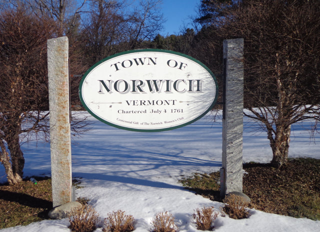 Sign at the entrance to Norwich from Route 10A. Upon taking the above photo I noticed an area that seemed to be graded uphill, toward the interstate on-ramp. 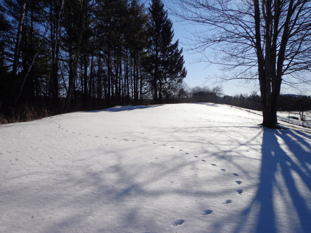 There were a few nice old maples flanking what might have been a roadway at one point, and I wondered if this might have been the old route of Lewiston Hill Road, before the interstate was built. 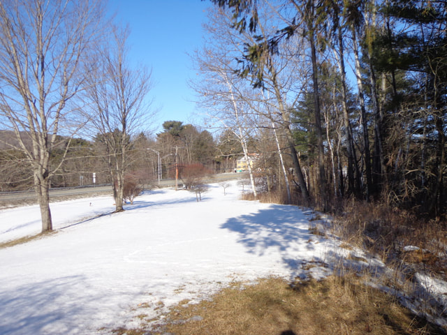 Looking toward town, from above the Norwich sign, near the I-91 entrance. Here is what this area looked like on a 1961 D.O.T. map: 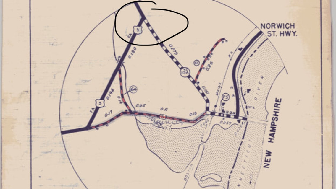 Here is a transition map, from the Vermont Department of Transportation, showing both pre-interstate, and post-interstate roads: 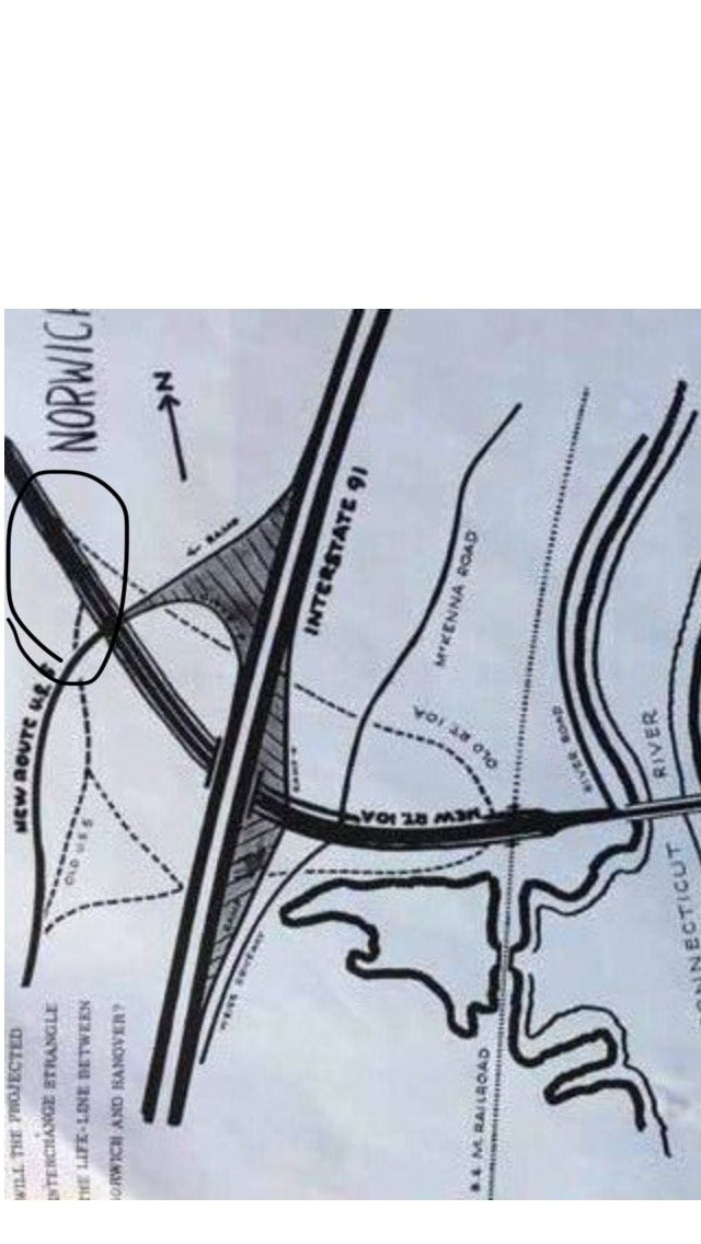 Above, in the lower left is an interesting question: "WILL THE PROJECTED INTERCHANGE STRANGLE THE LIFE-LINE BETWEEN NORWICH AND HANOVER?" The view below: Looking toward Lewiston, through the chain link fence above the Interstate entrance, I could imagine the days before the interstate. There must have been an awful lot of digging going on! 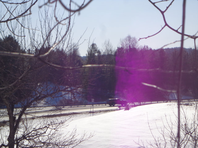 Looking across I-91 and entrance ramp toward Lewiston, from Norwich. But let's get back to the Signs of Norwich today: The following photo shows part of a sign: 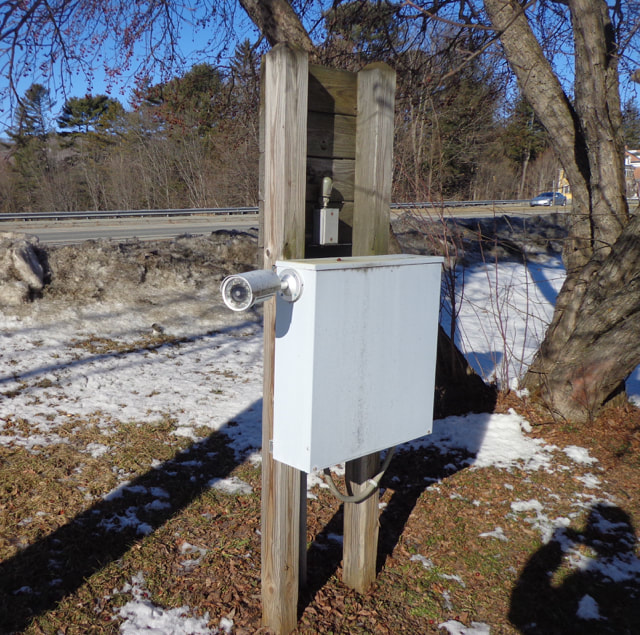 Here is the other part: 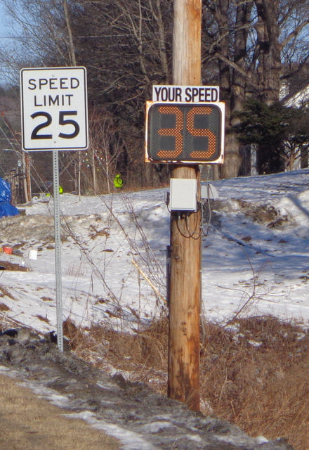 Uh-oh! The Lions are here in Norwich, and they are a very busy group of community minded folks, who's focus is to help others. This type of sign, for a benevolent association, is often seen at the entrance to a town: 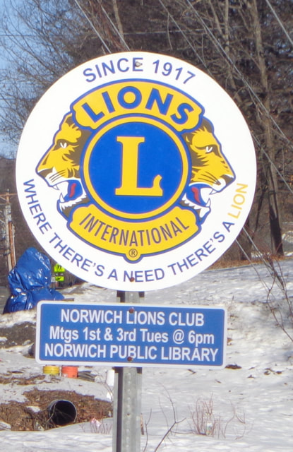 Lions Club is active in Norwich Here's our neckless friend again. This time he's letting us know we should be cautious, because there will be a crossing "AHEAD". 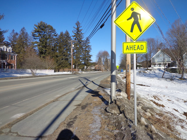 Pedestrian Crossing AHEAD Here's an interesting trio: Appalachian Trail, A Chinese (?) sticker, and an M.I.A. sticker. 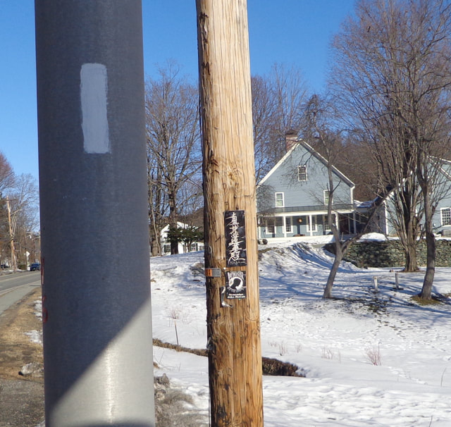 A closer look at the two on the utility pole: 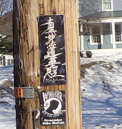 The next sign shows our footless friends, again. Do you know why this sign is shaped like home plate? 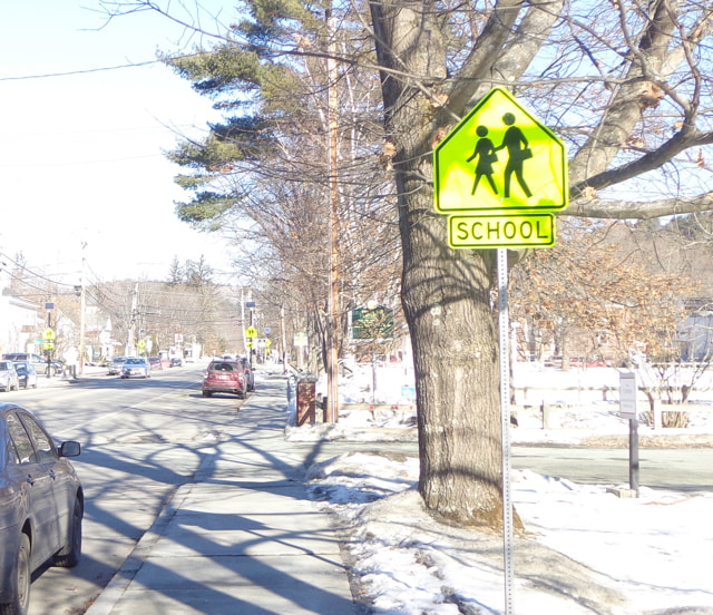 I like the way the following sign begins: "Welcome" 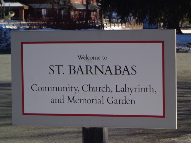 As we proceed to the school entrance, we can see a few safety related signs along the driveway: 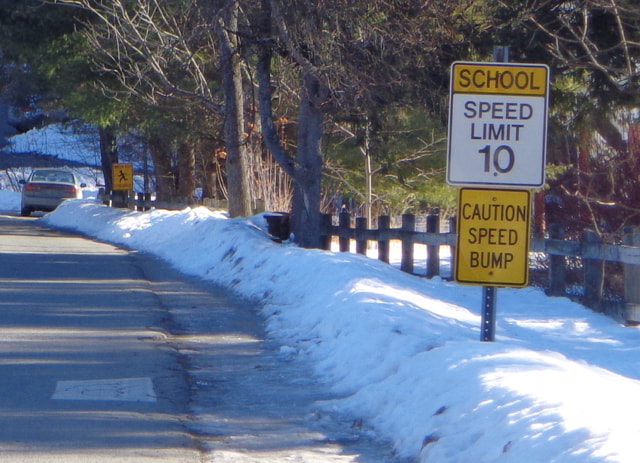 The next sign is a little blurry, but I think it may be one of the predecessors to today's neckless sign characters. This one looks like an older version: 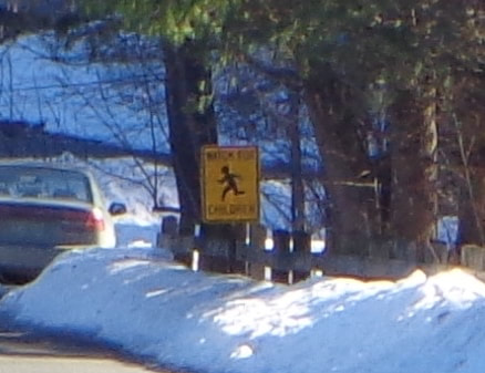 Here's one more, at the schoolyard: A sign of the times for someone like me, who grew up with a lot of second hand smoke in public places. 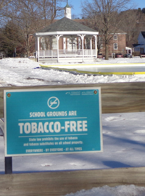 Meanwhile, back on Main Street: 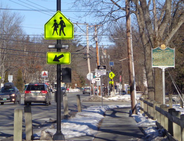 The Other Side of the Rapidly Flashing Bulb Pedestrian Crossing If you happen to amble on to the green, you'll see that we have a great little water fountain in town. 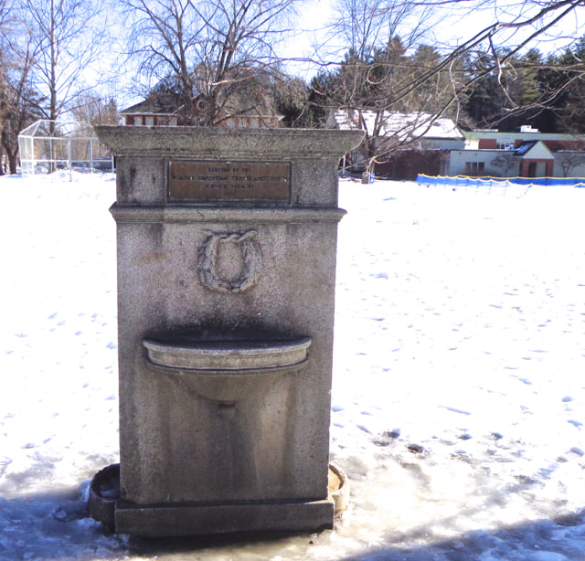 If you look closely, you can see a little sign on it: 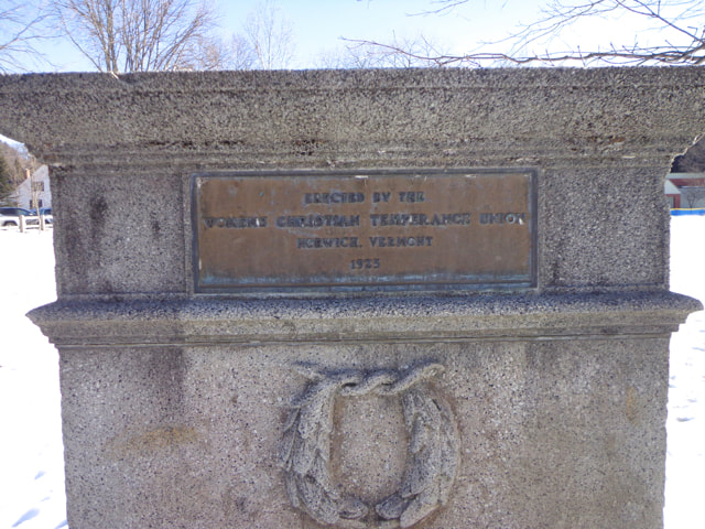 If you look really closely, you can read it. It's also a sign of the times. I find temperance to be an interesting term. Technically, it means moderation or restraint. 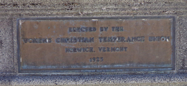 ERECTED BY THE WOMENS CHRISTIAN TEMPERANCE UNION NORWICH, VERMONT 1925 If front of the Bandstand there is a tribute to a local hero, Alden Partridge. 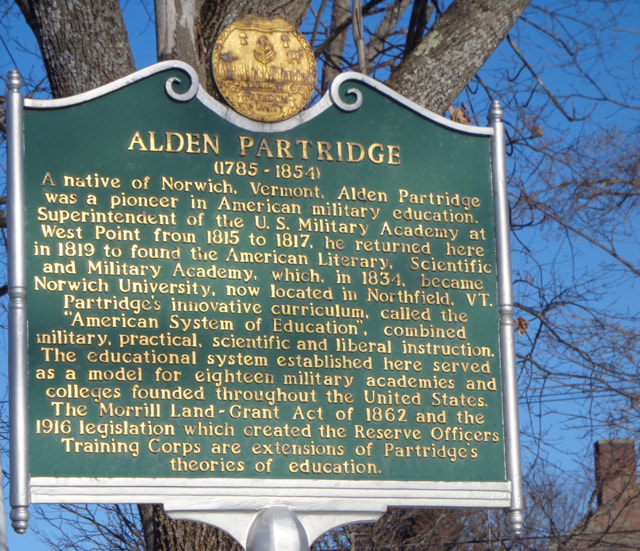 Historical Marker in Honor of Alden Partridge I am still amazed by the fact that Alden Partridge, as early as the 1820's, used to take groups of students on overnight trips, hiking up into the White Mountains, walking all the way from Norwich, bush-whacking up the great peaks, and sleeping under the stars. I guess he'd approve of the Appalachian Trail running through Norwich, and his plaque lying along the Trail. Thanks for walking down Old Roads, Rivers and Rails of the Upper Valley with me, Bob Totz. If you haven't subscribed yet, just send an email to [email protected], and we'll add you to the club. 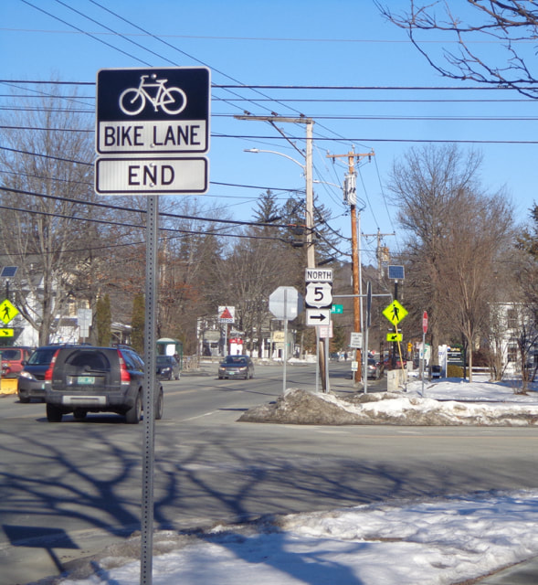 Norwich Vermont, Main Street. Photos taken January 29, 2020
There's a map that shows how many cases there are of COVID-19, deaths from the virus, recoveries, and other spatially related data, worldwide, and by country  COVID-19 Tracking Map. 3/17/2020, About 10:00 AM. The map is updated often, and gives you an idea of the exponential spread of the virus. You can go there anytime, and refresh the page, and see how and where the virus is spreading. (It may refresh itself, but I'm not sure at this point.) There is much more information than what is shown above. Here is a link to the map: https://www.arcgis.com/apps/opsdashboard/index.html#/bda7594740fd40299423467b48e9ecf6 There is also a table version of a COVID-19 Tracking Map that can be found here: https://ncov2019.live/ As many of us are dealing with severe change in our daily lives, I suggest getting out into the fresh air if/when you can, while still practicing "social distancing".
Stay safe everyone. - Bob Totz oldroadsuppervalley.weebly.com The place to go to find information on the Valley Quest program is vital communities, link here: https://vitalcommunities.org/valleyquest/ For those of you who aren't familiar, the Quest program is a great way to teach and learn local history. It's for children and adults, basically anyone who likes history and the outdoors 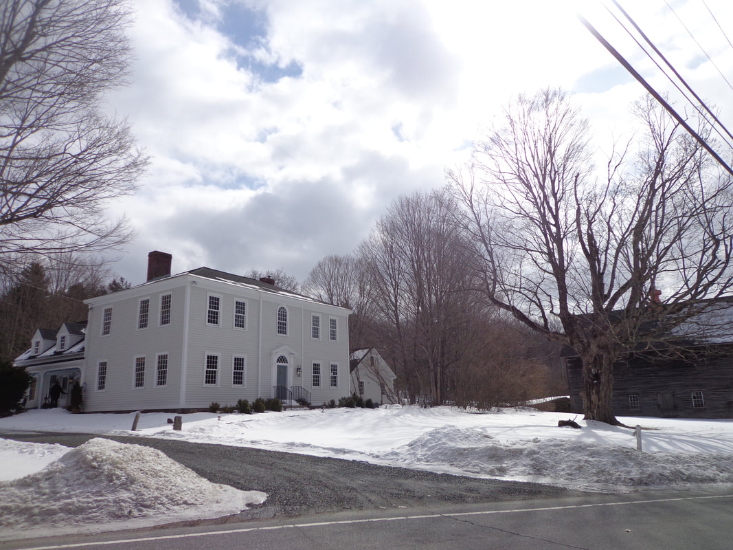 After the article on Centertown came out, I was contacted by the folks at Valley Quest, which is adminstered by Vital Communities. One of the quests is quite relevant, and I present just the beginning of the Quest Poem here. For the rest of the quest, go to this link to a pdf file of the Centertown Quest: www.vitalcommunities.org/valleyquest/wp-content/uploads/sites/4/2014/09/Center-of-Town-Quest-4-July-2018.pdf Here is the beginning of the Quest: "Clues: Many years ago, upon this green Hartford’s Center of Town was a bustling scene. So park your car and come on down Let’s explore this old ghost town! Start at something red, white, and blue And about old Hartford we will tell you. King George the 3rdwas no nerd On July 5th, 1761 he gave us his word By signing the charter to declare this town Hartford. Now gaze across the green And imagine this scene: Folks coming down from the hills To practice their drills, In preparation for fights To free up our rights. While imagining the beat of their marching feet Turn your body to look across the street. Note the tall trees, so scary and old They are *locust trees we are told..." For the rest of the quest, (and this great poem!), go to: You may also be interested in the 2020 "SuperQuest". Info at: https://vitalcommunities.org/valleyquest/superquest/ Thanks for traveling down Old Roads, Rivers and Rails of the Upper Valley, with me, Bob Totz Related articles: Historic Centertown King's Highway, Part 2: White River Jct VT King's Highway, Part 1: Lebanon NH 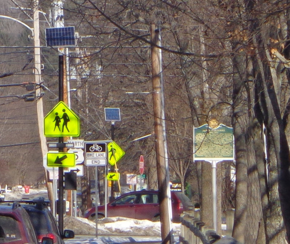 Have you ever looked carefully at the signs in your neighborhood? Most of us really don't, and can't, read all of them, especially if we're driving, and trying to concentrate on the road. We just sort of see them in the background. You don't actually have to read the letters "SPEED LIMIT" because you've seen that type of sign so often. You just focus on the big number "25". Other signs can just blend into the background, or are just too small to read anyway. However, if you walk, and pay attention, you will see that there is a lot of information directed toward you, as you stroll down the street, at least, that's how it is in Norwich Vermont these days. There are many different types of signs in Norwich. Let's explore: First, there are signs to attract potential customers to a business, such as this first one, as we head toward Hanover. 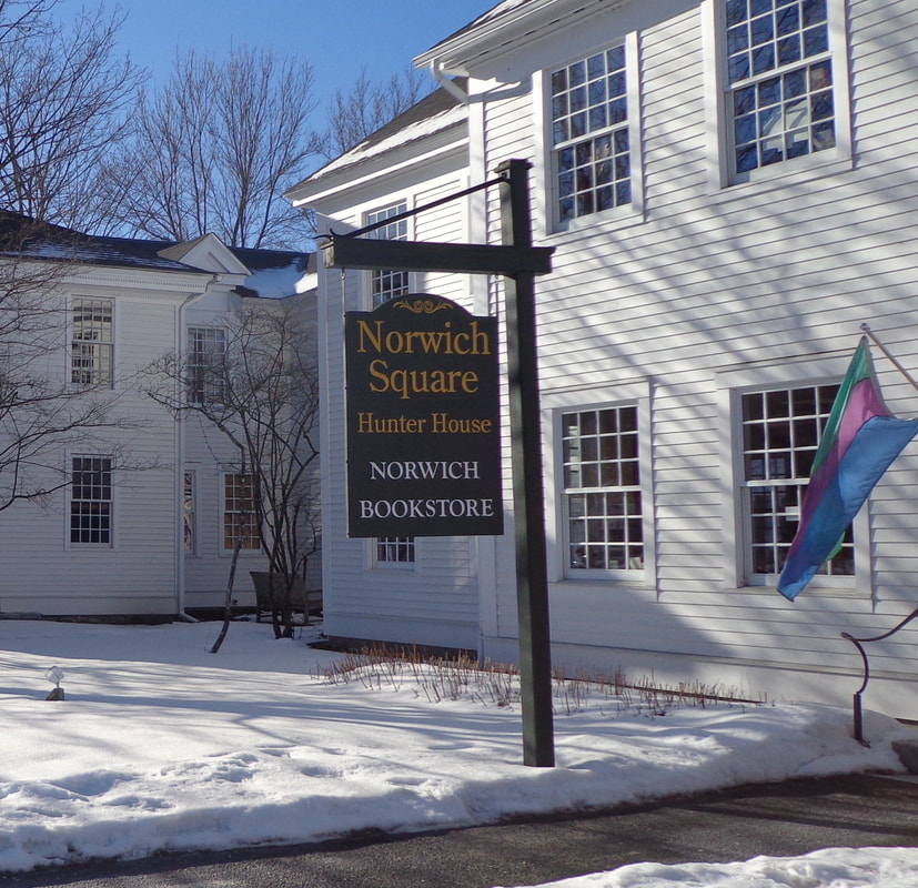 This one directs us to the bookstore, but it also let's us know that this is the Hunter House. Do you know who Hunter was? Another type of sign is the street sign, provided by our government, to help us figure out where we are, and how to get where we are going, or at least until GPS came out. At this corner, there's a common street sign, but also a granite post, in case the sign comes down. Although...the post sort of makes it look like it's the corner of Elm Street and Elm Street. 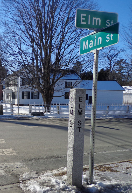 Continuing on our walk, we soon see another type of sign, also provided by our government, the safety related sign. The basic type of this particular sign came about years ago. I guess it's so that it doesn't matter what language you speak, if you can figure out the picture. But I wonder who came out with the neckless, handless and footless people-type of cartooning? It seems to have caught on well, but there's just something weird about these characters. Why don't they have hands, feet and necks?? Maybe their hands are those rectangular shaped things at the end of their left arms? Who are these people? 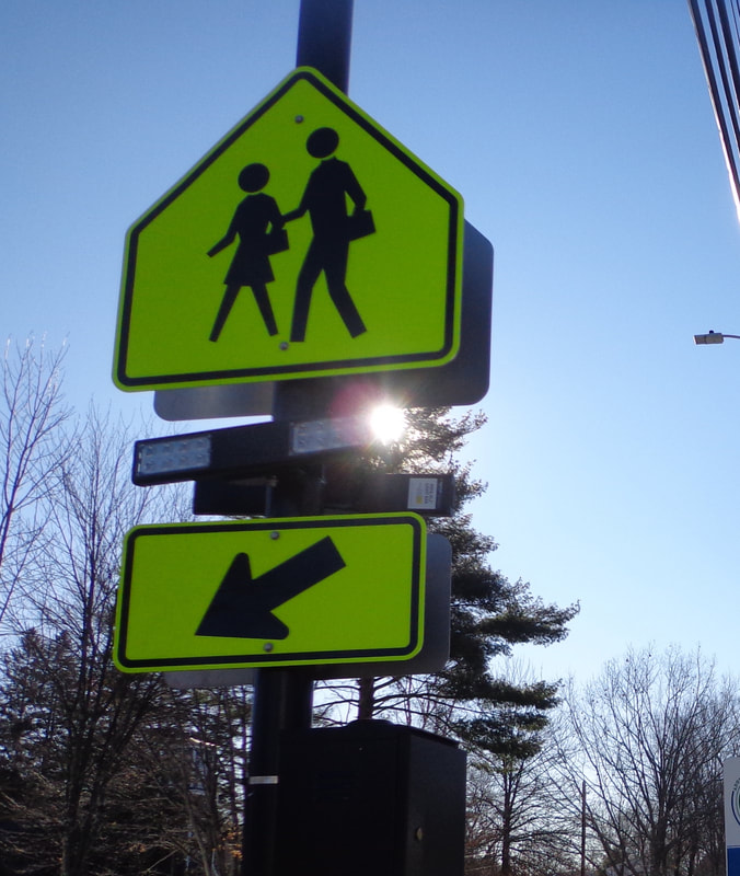 This pedestrian crossing sign has been modified with RRFBB's, a.k.a Rapidly Repeating Flashing Bright Bulbs, (or something like that). Here is also a sign provided by the government, though this one is for historical and informational purposes, as opposed to safety. I find it interesting that this one is "continued on other side"! So much to tell, so little space... 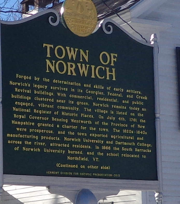 I have no idea what this "sign" (below), means, but I've been seeing a lot like them, on many utility poles these days. Can anyone interpret it, and tell us what it means in the comments section? >> 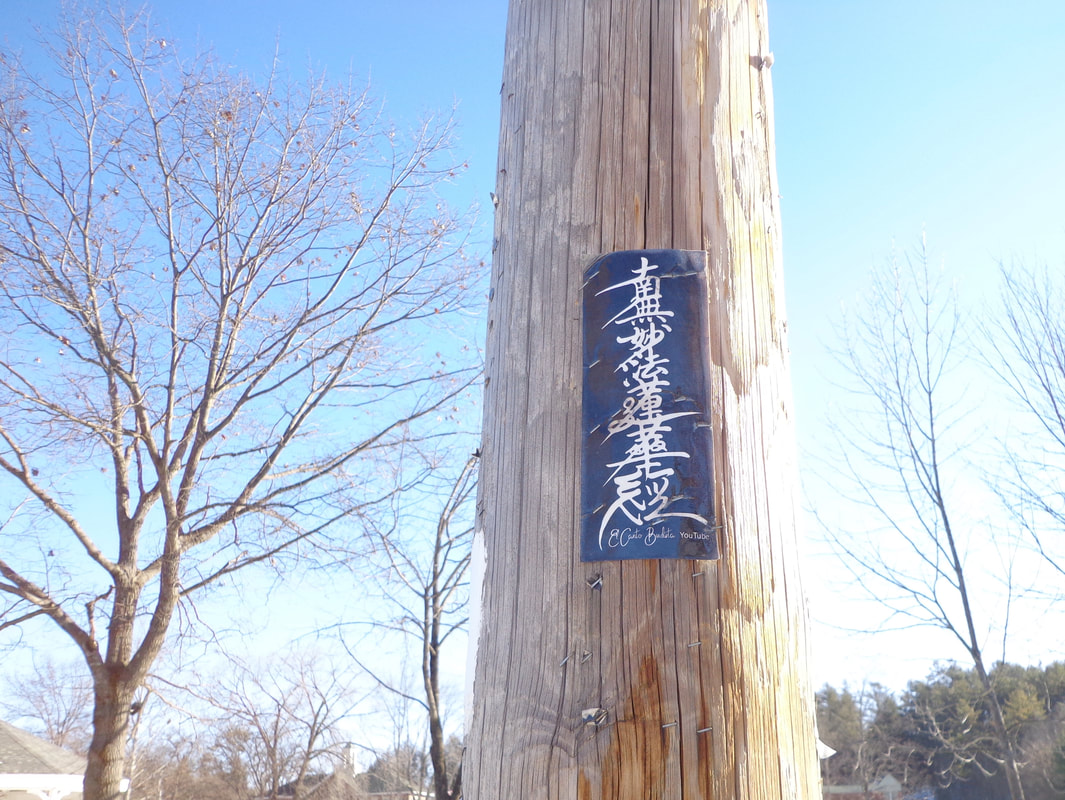 Interesting Notice on a Utility Pole in Norwich Vermont, US Route 5, Main Street. Here's one I particularly like: 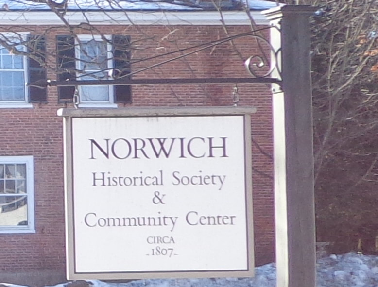 Norwich Historical Society & Community Center, CIRCA - 1807 - 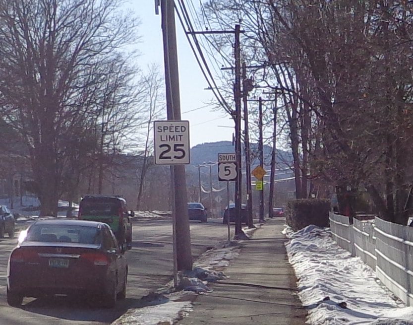 Safety: Speed Limit 25. Navigation: South US Route 5 Here's a sign for a local place of worship:  I was always taught that sharing is a good thing: 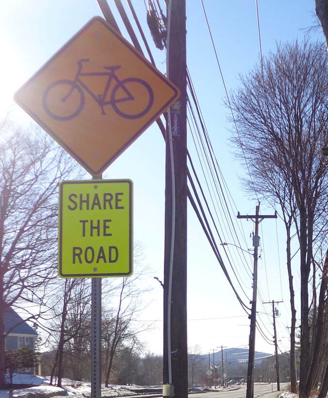 Share the Road" Signs Cropped up a Few Years Ago when Bicycle Lanes Were Introduced. A little further down the road, we come to another pedestrian crossing sign. This neckless, handless, and footless individual seems to be in a hurry, so look out!  Here's another sign I really like: " < TRAIL" The white rectangles remind us that US Route 5, and Main Street are also the Appalachian Trail. 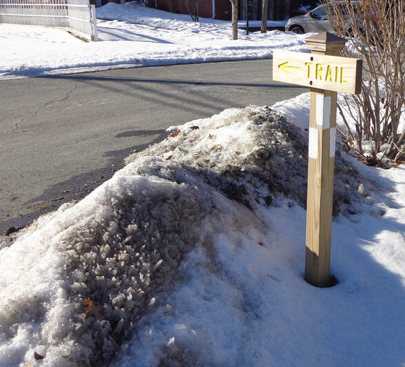 This Sign Lets You Know that You are on the Appalachian Trail. 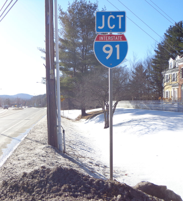 Where the Appalachian Trail and "The Dwight D. Eisenhower National System of Interstate and Defense Highways" Meet. Here's a couple safety type signs at the beginning of the median: The top one means stay to the right and don't run over the median. The lower one, a diamond shaped sign with reflectors most likely means the generic admonition: "Use Caution", which is always good advice. I have a feeling these signs weren't located here back in the 1950's. 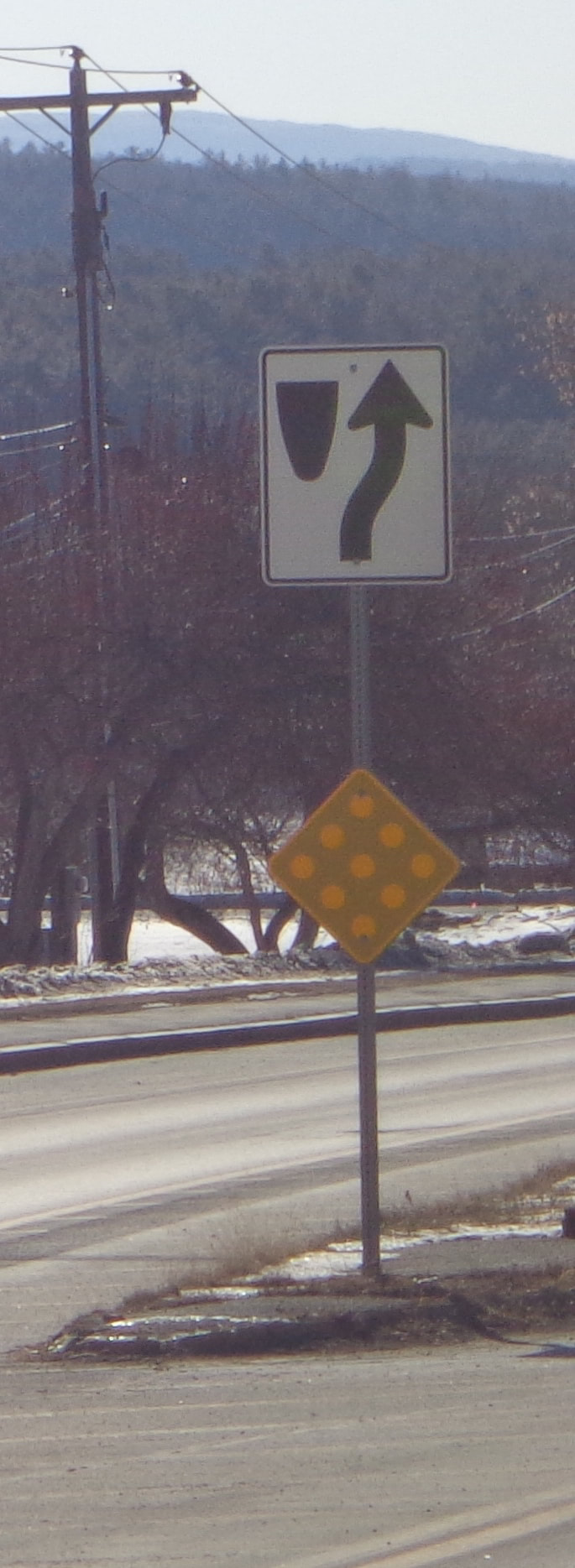 Divided Highway Begins. Use Caution Here's a safety related sign, letting you know that there will be a traffic control light up ahead. Does anyone agree with me that these lights should be flashing red on Sunday mornings, when traffic is really light? 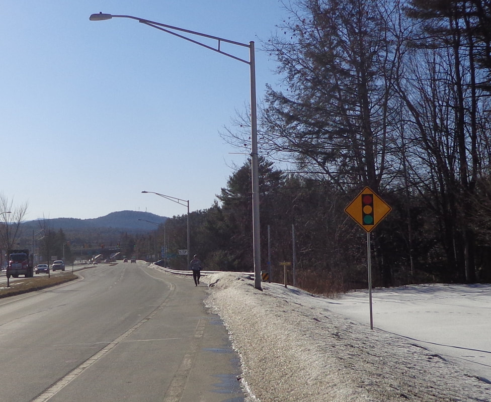 This sign is for another local trail, that heads down to the brook: 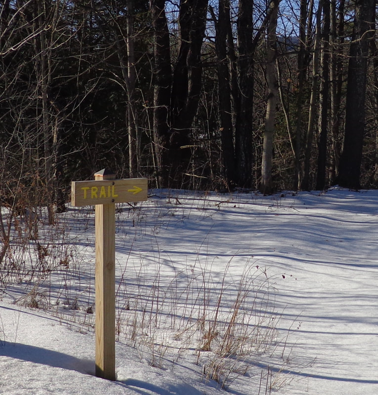 Uh oh....better check what lane you're in! 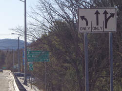 Here's one to let you know how far and in which direction to go. The small one underneath, appears to reference a "Bike Loop". 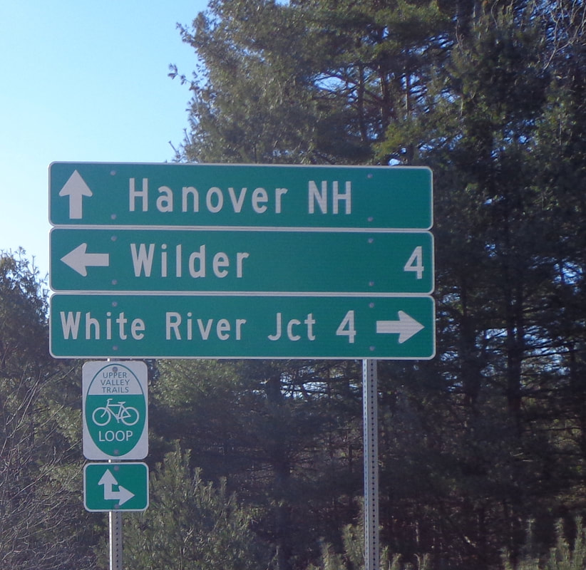 I chatted with a bicyclist a while back who spoke of the "5 and 10 Loop", with a ride to Thetford, and back through Lyme and Hanover. That sounded like a nice bicycle ride. Here's another sign I really like. How many people that live in Norwich have seen and read this memorial? I'm sure I noticed it in years past, but only subconsciously. I've lived in Norwich for thirty years, and I finally read it! I think it's really cool that this memorial was made from the bricks left in the ruins from the burned barracks in 1866. 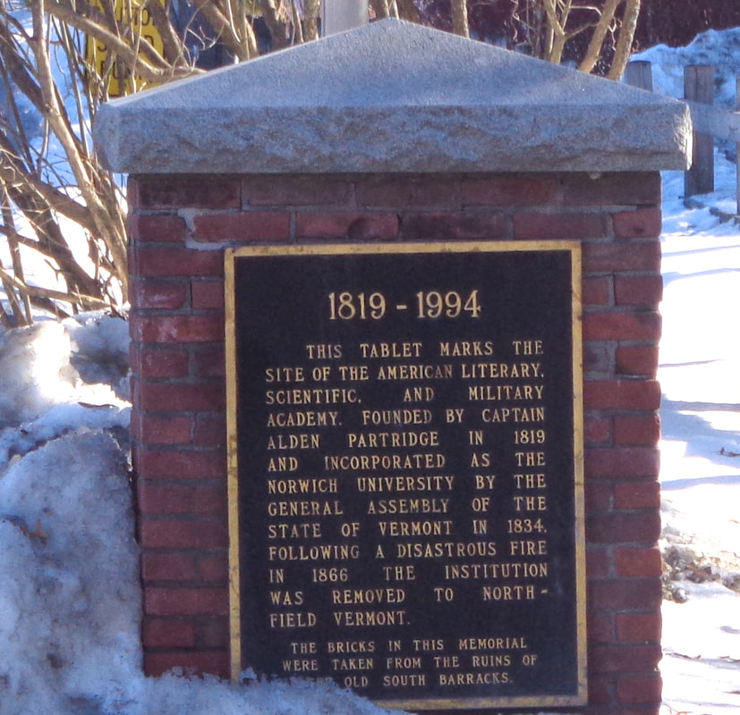 Memorial to Norwich University, on Route 5, Main Street, and the Appalachian Trail in Norwich Vermont. Thanks for walking down Old Roads, Rivers and Rails of the Upper Valley, with me, Bob Totz.
Have a comment on the post? Just click on comments and let us know what you think. NEW SUBSCRIBERS and SPONSORS are always welcome. Interested in subscribing to or sponsoring this website? Just send an email to [email protected] Thanks! 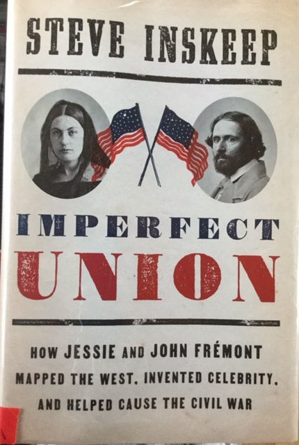 Book Review: IMPERFECT UNION by Steve Inskeep “How Jessie and John Fremont mapped the west, invented celebrity, and Helped cause the Civil War.” Penguin Press, 2020 Many remember that John Charles Fremont was an American explorer of the mid 19th century. In this book you will not only read about his explorations, but you’ll also learn much about politics, especially the 1856 presidential election, which was the first election for the new political party known as the Republicans. Although Fremont lost the 1856 presidential election, the campaign set the stage for the up and coming republican politician Abraham Lincoln to win the presidency in 1860. This book was sitting innocently enough, on a shelf at the Norwich Public Library, when I was there for another reason, a couple of weeks ago. When I happened to notice it, I immediately recognized the name “Fremont”, and the phrase “mapped the west”. I had to borrow this book. It was a brand new release, so I only had 2 weeks in which to read it. However, there was no one on waiting on a reserve list, so I was able to renew it and finish it a week later. Steve Inskeep is a familiar name to many of us. He has been on National Public Radio for years. He is an excellent writer, and has done in depth research for the book. Steve does a fascinating job of illuminating the relationship between John Fremont, and his wife Jessie, daughter of an influential senator. Jessie was a great force in John's life, helping to increase his popularity through her writing and tireless efforts in support of John Charles Fremont. One of the things I find fascinating is the similarities in politics with that of our age. Back then, the telegraph was brand new, and revolutionized the spread of “news”, allowing newspapers all over the country to obtain stories very quickly. Different newspapers were owned by different people, with a different spin on the same story, depending on their politics. Southern papers in general, supported slavery, and their stories reflected that, while many northern newspapers saw things differently, and their viewpoint reflected that in the way the news of the day was told. As an example, when representative Preston Brooks beat republican senator Charles Sumner with a cane until he was unconscious, the two sides of the slavery issue had very different spins on the story. It’s a fascinating book, and well worth the time reading, especially during this presidential election year. If you enjoy american history, geography, and politics, you’ll find this book is well worth picking up. I highly recommend this book to students of, and those interested in American History, and what we can learn from our past, in order to create a better future. - Bob Totz Old Roads, Rivers and Rails of the Upper Valley oldroadsuppervalley.weebly.com  A Portion of the Back Cover of Imperfect Union by Steve Inskeep
|
AuthorI'm Bob Totz, retired VT postmaster, and historical geographer ARCHIVES:
October 2021
EXPANDED ARCHIVES: AUGUST 2021 1858 Johnson Map of North America MAY 2021 1795 - "Road Over the Mountain" - Part Two Historic Toll House For Sale 1795 - "Road Over the Mountain" Part One OCTOBER 2020 Finding That Special Peaceful Place AUGUST 2020 Kayaking on the Pompy JULY 2020 Pt. 2: What the Heck Are These Things? JUNE 2020 Bob's Bio... What the Heck Are These Things? Pt. 1 MAY 2020 Stone Walls and Spirits The View APRIL 2020 Sunny Brook Farm Relics: Pt 2. Sunny Brook Farm Relics: Pt 1. MARCH 2020 Signs of Norwich Pt. 2 COVID-19 Tracking Map Centertown and Valleyquest Signs of Norwich Pt. 1 "Imperfect Union" - Book Review Historic Centertown FEBRUARY 2020 King's Hwy Pt. 2 WRJ Museum at Post Mills Airport Chatauguay Vermont The Independent Farmer poem Traveling Along the King's Highway - Lebanon NH JANUARY 2020 Finding Parkhurst Cemetery In Search of Parkhurst Cemetery Affordable Housing The Old Stone Grill Two Rivers Trail-Kmart License and Registration, Please! Prohibition, Murder and Dr. Seuss Peace, Paris, & P.O. DECEMBER 2019 BLOGGER'S LINKS Welcome to Old Roads Love-Quail Hollow fun Dartmouth Cemetery SEPTEMBER 2019 E. Thetford Cemetery JUNE 2019
Taps: Meetinghouse Cemetery 4-Corners Borders Quest Old Iron Gate Stumbling Upon History Sunrise Walk MAY 2019 4 Corners Cemetery Strafford's Abandoned Foundations Art in Old Stonework APRIL 2019 Strafford Tpke Pt 2 Strafford Tpke Pt 1 White River Valley FEBRUARY 2019 Learning from Historic Maps of the Upper Valley Change in Lewiston VT JANUARY 2019 A Vermont Ski Waltz John Ledyard 1773 What is the Upper Valley? DECEMBER 2018 Dartmouth Green Music Video: Sometimes Music Video: Montreal Express Railway Disaster of 1887 |
 RSS Feed
