|
Welcome! Scroll Down for Posts and Archives.
Other Menu Options at Top |
|
|
|
I write this with mixed feelings of relief, and dread. Twenty years ago, if you talked to me about global warming, and climate change, back around the turn of the millennium, you’d find that I wasn’t too concerned. Heck, I lived in Vermont, and the winters were long, cold, frosty and snowy. What would be wrong with a longer growing season, and a shorter winter? An earlier spring would certainly be a welcome thing, no?
I turned 40 in January 2000. My college years seemed like they were a long time ago, even back then. I was working as a rural postmaster, in the back of a General Store in a small Vermont village. I was pretty much a one-man show, doing everything from waiting on customers to doing the bookkeeping for the US Postal Service, headquartered in Washington, D.C. It was sort of a unique situation, in that, though it was a rural village scene, there was a great variety of folks that lived there. Some had been raised in the town, and some had family history had gone back many, many generations, even as far as the first european settlements here, in the 1760’s. Some folks even had Abenaki, first nation roots. Other people I served were relative new-comers, many connected with Dartmouth College and the medical center, commuting about 35 miles a day. In addition, from about Memorial Day to Labor Day, there were many “summer folks” and “camp people” who inundated the area due to the presence of Lake Fairlee, located less than a mile from the Post Office. Many of these folks came from all over the country, and foreign countries as well. Some of them had grown up going to the camps on Lake Fairlee back in the 1940’s, and loved it so much, they bought a summer place and returned every year for the glorious summer weather and cool lake waters. As you can imagine, the college has had a large impact on the area, providing jobs, and attracting intelligent, interesting people from all over the world. As postmaster, I interacted with all of them, and, as a hopelessly curious individual, with a little free time on my hands, I had seemingly endless conversations with many of the folks, from all walks of life, about many subjects, from history of the area, to current events, and much more. I learned a lot from these kind folks, and treasured my time there. To many people, my job seemed boring: “He’s stuck in that little room with a scale, rate charts, a file cabinet, sorting table, and a phone.” But to me, it was my own little window on a very real, vibrant village, and the world beyond. The winters were quiet and cold. All the summer folks had gone away, and many of the year-round residents worked and commuted during the day. During these times, I had plenty of time to chat with the retired, year-round residents. Eventually, politics came into the picture, and as an inquisitve individual, I listened to the various viewpoints, and learned from them, in an effort to form my own views. Two individuals stood out. The first man, we’ll call him Richard, or Rich, was a retired bank examiner, who had worked for a large insurance company. He was very intelligent and gregarious, and had grown up just down the road in another rural Vermont village. Rich had a grandfather who had run a general store, and who also had been a postmaster, so he knew very well, first-hand, what it was like there back in the mid twentieth century, and prior. I enjoyed hearing about life growing up there in the old days. The other fellow, Ed,was a World War II veteran, and I’m really not sure where he grew up, or how he was connected to the area, but he was a retired writer. Ed, like Rich lived with his wife a few miles up the road and came in daily for his po box mail. Rich and Ed would both come in, almost daily, and we might have a little chat across the p.o. service window. I got to know them, and enjoyed their company. A great ice-breaker for conversation was the weather. Like food, and the need to eat, weather was something that affected all of us, and often, the subject would lead to other matters of discussion, like, what the weather was like around there in the old days. It seemed that winters had been colder, longer, and snowier. My own, subjective experience of the weather in this geographic location began in February 1984, when I traveled north for a job interview in Lyme NH, at a small, up and coming digital mapping company. I remember distinctly a February morning when I parked my 1974 Plymouth Valiant on West Wheelock Street. I began a short walk to one of the college buildings, where I was to find the office of housing, which supplied a list of local housing possibilities. For some reason, I wasn’t considering how deep the snow was, and I inadvertently stepped into a thigh-deep snow bank, suddenly impressed with how much beautiful, dry, white fluffy snow I had almost got stuck in. Another step or two, and I was on the sidewalk, brushing snow off of my pant legs. I thought to myself, “Wow! Beautiful, white fluffy snow! Not slush!” And the weather was gorgeous: bright sunshine, clear blue sky, and the temperature was below freezing. I truly felt like I was moving to a place that I would love. I had grown up in Connecticut, and I’d had lots of experience with snow. As a child growing up, my birthdays in January, often included sledding parties. However, by this point in time, the mid nineteen-eighties, I was getting tired of the brownish slush of the Connecticut February scene, and was excited for crisp, cold nights and days, with lots of fresh, white snow. Of course, cold weather and snow is not for everyone, which is actually a good thing, or there would be a lot more people moving to the north country, and consequently, fewer forests and fields here, like in my hometown. By the time I graduated UConn, I had grown to dislike the crowds, wide paved roads and traffic lights, shopping malls, and suburban developments of the area of Connecticut where I had grown up, since 1960. As a part-time worker in the Wallingford post office, during the summers and Holiday periods from 1978-1983, while in college at UConn, I had seen a constant barrage of heavy equipment tearing down forests and fields for sewer lines, concrete, pavement, cul-de sacs, cookie-cutter houses and McMansions, and that had left a bad taste in my mouth. To me, it seemed like un-checked development, but people had to live somewhere, and be near to their jobs. Having moved to the north country, just after college in ‘84, I was delighted to be escaping all that development for a place where there was employment, interesting people, plenty of services, and most of all, open space, including hills and forested mountains, and the phenomenal Appalachian Trail. No one said it was going to be easy, or inexpensive to live here, but it was obvious there were folks who had been doing it, and were very happy. The air was fresh as can be, especially compared to from where I had come. In addition to the mountains, forests and streams, there were the lovely farmers’ fields along the Connecticut River, and the river itself, which was at the heart of the valley, clear and exciting, much narrower than down country. I looked forward to exploring the area, and learning all I could about it. But back to the general store post office, of the 1990’s and 2000’s. As I had gotten to know Rich and Ed, we talked about the weather and history, and eventually, the subject of global warming came up, as it had been a somewhat recent topic of the day. Rich and Ed were skeptics. “The weather has always been changing”, they would say. “It’s not man-made, and we really don’t have to worry about it, especially in Vermont, where the winters are too long and cold anyway!”. Hmmm. This made me think. In college, I had taken lots of geography courses. One course in particular that I enjoyed was called “Human Modifications of the Earth’s Environment”. I learned how we, as species had been, slowly at first, changing things. I also took courses in Urban Geography, and mapping courses in Air Photo Interpretaion and Satellite Imagery. I saw for myself, from the remote imagery, the difference in patterns on the earth’s surface as time evolved, and development expanded. Of course, there’s nothing like one’s own experiences, over the course of decades, to see, and hopefully understand what’s been happening all around us, at what used to be a slower pace. Fast forward to 2021. I’ve been retired for five years, and I have not taken another job. My wife advised me to do what interests me. What really interests me is geography and history, and how they relate to what is going on right now. Things are changing, and changing faster than ever. As I write this, I am recovering from an illness known as “babesiosis”. I got it from a very small, “black-legged tick”, or “deer tick”, scientific name: “Ixodes scapularis”. This illness has only been seen in our geographic region for about a year. Before that, folks who picked it up got it when they were on vacation, or visiting parts farther south. I never encountered ticks while growing up in Connecticut in the 60’s and 70’s. Back then we would lie on the grass, or roll around on the grass without a care in the world. In fact, the first time I'd ever even heard about a tick, I was in the Pine Barrens of New Jersey, in the summer of 1984. My girlfriend found one attached to her, and we had to drive all around to find something to take it off with. She said she needed a tweezers to pull it off, or vaseline to suffocate it. She was a Dartmouth grad, in environmental studies, and she knew something about them, while it was all new to me. Somehow we got it off of her, and then we went back to New Hampshire, and I was glad that those things didn’t live where we lived. But that was then. It was in the early 2000’s when I found the first one on me, dug in, and engorged. I had been cutting some weeds and cattails near the inlet of our pond, and didn’t realize the tick was crawling on me. In my case, I found it attached to my back while in the shower, and I just grapped the part that was outside, puffed up with my blood, and pulled what I could off of me. Of course, the head stayed in, and the site became red and took a week or two to heal. But there was no illness involved. It was easy to find, because it was big enough that I noticed it while showering. Over the next decade and a half or so, my wife and I, started finding ticks on our pets and on ourselves, more frequently, and we learned the proper way to remove them. Better than tweezers, we now use a small plastic “spoon” with a triangular shaped cut in it, which we use to spin the tick, and it usually “unscrews” right out, completely. They are gross. We learned to keep our pets well brushed, and check them at least daily. We’ve pulled countless ticks off of them, and ourselves. In the last couple years I started following the recommendations I’ve seen. I tuck my pant legs into my socks, so they can’t climb up my legs. I started using “Off” with Deet, to spray may shoes, clothes, and hat, in hopes of repelling them with the poison. When I come in from the grass or the woods, I throw my outer layers into the clothes dryer to kill any potential ticks, and I take a shower, being careful to check my body over for ticks, and hoping if there are any, that they havent’ dug in, and that they’ll go down the drain. With these new processes, I’ve done pretty well. I spend a lot of time outside, and I do my own landscaping, so I need to be cautious. This is especially true when trimming near the edges, where the mowed area meets the wild world of tall grasses, milkweeds, goldenrod, and borders of the pond. In 2020, I don’t think I found one tick on me, so I figured I was doing well. This year, 2021, I slacked a little. I still tucked my pant legs into my socks, put my clothes in the dryer, and took a shower. But I forgot the Deet. And, worse, once in a while, if I wasn’t too dirty or sweaty, and maybe tired, I’d postpone my shower to the next day. Bad idea. This past summer, near our northern property line border, I left an area unmowed for the summer. There’s a lot of sun out there, and the milkweeds love to grow. This year the Monarch Butterflies were plentiful, and glorious. I love watching them flutter around after they hatch, and I love to see them when they are in the caterpillar stage. They are colorful and beautiful. Also, the deer like to bed down there at night, leaving the tall grass matted down. We have Pine trees and Alders at that northern border that moved in when the field was broken up for two more houses, about 25 years ago, and I left that area to grow wild. Years ago the whole field had been hayed regularly, but since the field was split up, it just gets cut, and the cuttings are not used for hay. It’s a bit wet out there too, and I appreciate the border that has been made by the pines and alders. They act as a wind break from the strong north and northwesterly winds that blow here, especially during winter storms. We are on a 2 acre parcel, in the lower, southern part of the field. The whole field is about 20 acres, with a very wet, wild, wooded part at the far northern end, where the groundwater flow changes direction. The deer love this field, and years ago we saw a moose meander across. We also saw a bear come through one spring, but it’s been over twenty years since we’ve seen the big beautiful mammals. Deer still come through often, though, and we see their prints in the road and on our driveway and in the snow almost daily. The deer also like to chew on our hostas, coming right up to the front porch at times for a tasty treat. The deer and moose are currently being barraged by ticks. Around the end of September, I decided to mow up there in an effort to keep the area clear of trees. Don’t get me wrong. I LOVE trees! They are like the other half of our lungs, providing oxygen for us, while we provide carbon dioxide for them. What a great relationship! I could not live anywhere where people outnumber trees. And, remember, we only see half of a tree, as the roots spread out, and go deep, mingling with other trees’ roots, the soil, and especially the mycelium, the internet of the plant world. So I mowed with my little John Deere lawn tractor. It’s a good workout for the mower, as it’s a lot of cutting when the grass is over two feet tall, and filled with tall and short grasses and plants and many small quaking aspen, or “popple" trees. Try mowing a big patch of lawn that has gone wild all spring and summer, and see what happens. In this case, I generated a ton of “clippings”, which I wanted to clean up a bit so as not to create dead zones where the new grass has a hard time coming up. The next day, I got out a rake, and started raking the clippings onto a large tarp. I hauled the clippings over a couple banks that have been eroding, thinking that they would break down over the winter, and help to build up the soil. I’d seen old timers do that, and it made sense to me. Around September 22nd, I noticed a bulge in my right armpit, when showering. It wasn’t huge, and I thought it was strange. After a couple days it seemed to get bigger, and I had my wife take a look. She saw it too, and I started doing some research. It could be the result of an ingrown hair. Within a couple days, my wife noticed a faint red ring around the bulge, which had gotten bigger each day. There was no obvious bite mark. I called my doctor’s office and they said I should come in. They gave me an antibiotic, and after a week the bulge went down, the red ring went away, and I didn’t have any other symptoms. Another week or 10 days went by though, and I started noticing myself dragging. I was tired, but I wasn’t getting over that, and headaches were developing, followed by fever, especially at night. After a few days of this I thought I might have caught Covid. I’d had my shot, and my booster in May, but I figured I’d better get it checked out. I went back to my doctor’s office, and took two covid tests, both came back negative. My symptoms, which included fatigue, fever, chills, headache and muscle aches were consistent with a possible tick-borne illness, so I had a complete blood count test, and a test for tick-borne diseases. They also put me on doxycyline, which was pretty rough on my stomach. Four days later, I was still pretty sick, with the added problem of stomach cramps, and lack of appetite. Fortunately, at that point, my blood work came back and it was determined that I was suffering from Babesiosis, another tick-borne disease. Babesiosis wasn’t even seen in our geographic region until about 12 months ago, when the disease, along with the ticks that carry them, had migrated northward with the increasingly warmer temperatures of our summers, and lengthened growing season. It’s funny, that when I moved here back in 1984, I was really happy about long winters, and the fact that the cold and freezing temperatures kept certain species away. Back then, I was thinking more about things like alligators, and lizards, creatures like that. But also, what the cold used to do for us, was to keep things away, like ticks, and insects that carry disease too, but couldn’t survive in our area (back then). I’m only writing this because I care about folks, and until I had this happen to me, it was just something I had read about. Those deer ticks are really, really small and hard to detect when they are on your body. Please be careful out there, it really is a new reality, and it’s constantly changing. I used to think that any climate change was simply part of a natural process, and yes, partly that is true. It’s just that we humans are also a part of this natural process, and I believe we have unwittingly accelerated things greatly in the last two hundred years. It’s time to work together to find solutions. It won’t be easy. Many of us will have to lessen our expectations in terms of what we can, and should do. We just might not be able to live the lifestyles we had become accustomed to, in order to help out with the big picture, which is coming into clearer focus. But hopefully, we can survive, and thrive, and enjoy our lives and our families, like people have done for thousands of years.
7 Comments
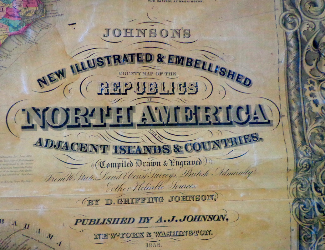 I acquired an interesting map a couple years ago. The map had been in an unused, upstairs room in an old Vermont farmhouse. I did not know what type of map it was, until we started unrolling it. You can imagine my excitement when it turned out to be a full color 1858 map of the USA at the height of westward expansion. 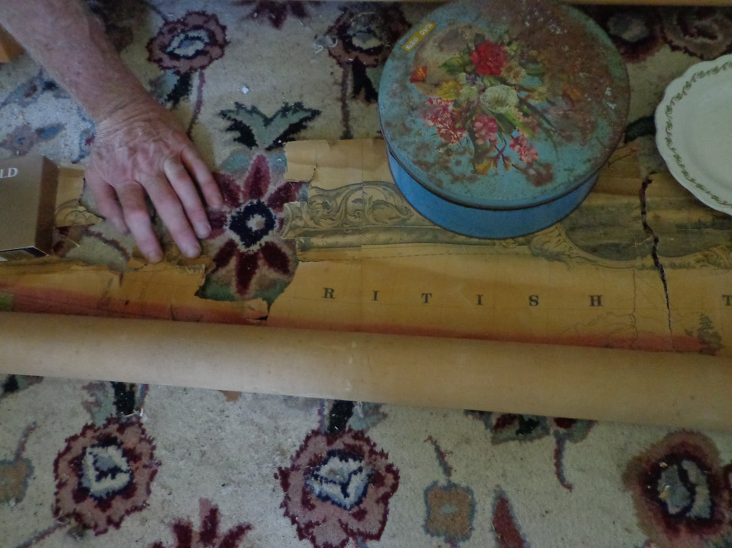 A friend and I took photos of the map, as we unrolled it on a carpet in an adjacent bedroom floor. As we started to unroll it from the top, my heart began to beat a little faster as the image began to appear. As we slowly and carefully unfurled the delicate, vintage map, we began to discern the outline of the west coast of the United States, though many of today's state boundary lines were clearly not yet in existence. 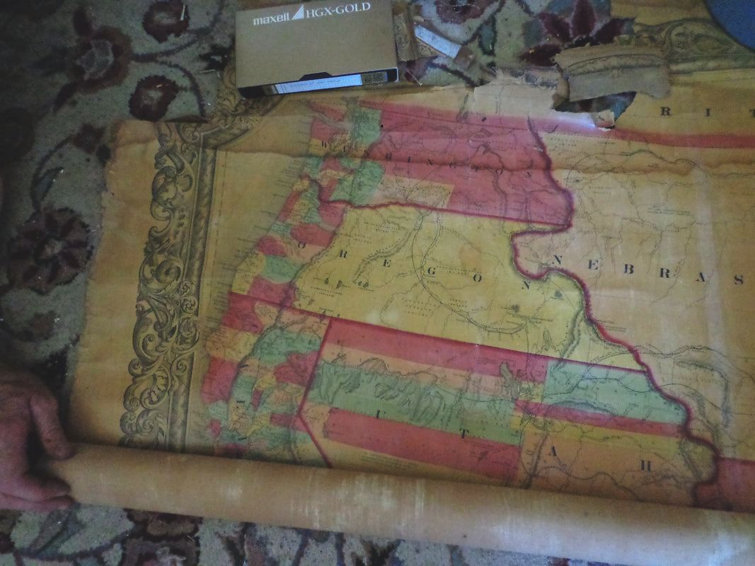 There were some rips along the top of the map, where a wooden roller had been attached, for hanging the map on a wall. The rips were in Canada, but did not continue below the border with the United States. 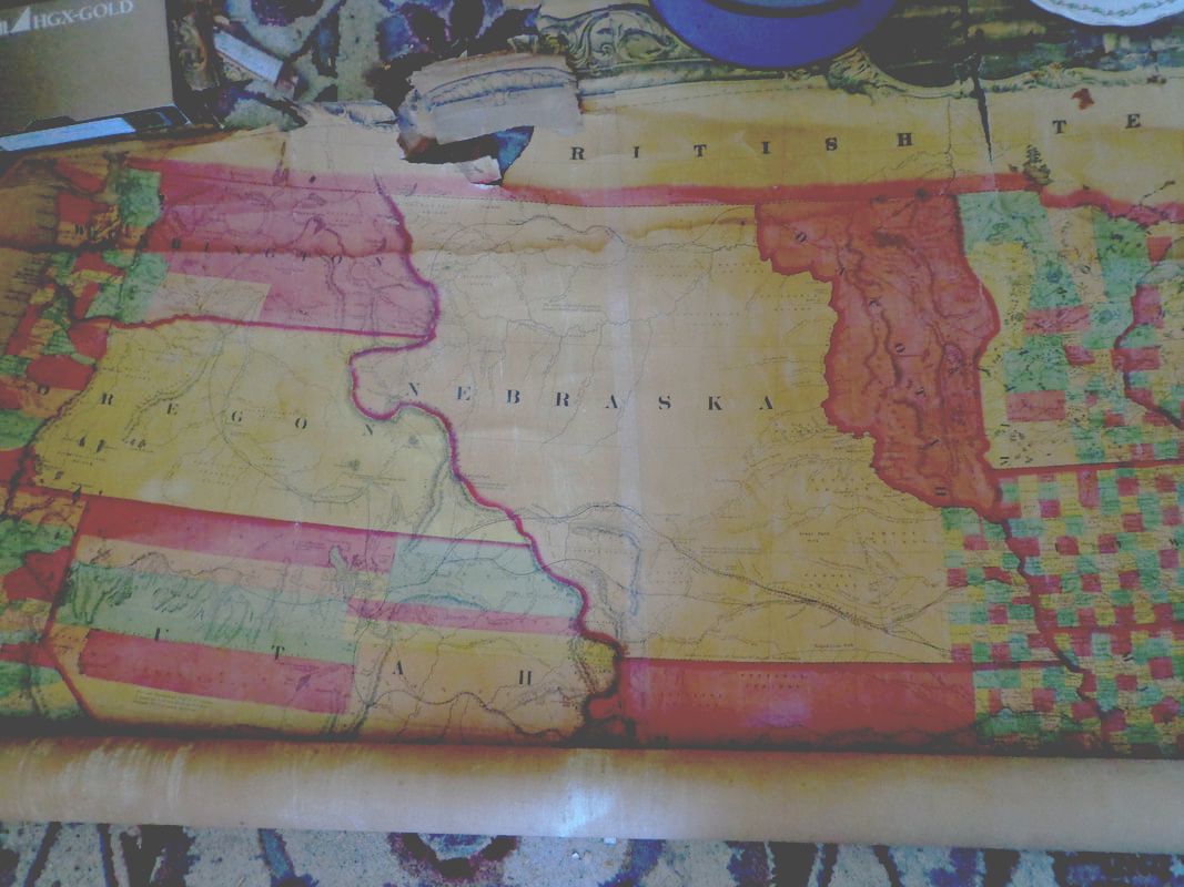 I did not want to damage the map, so we were very careful as we continued to unroll it. We used whatever happened to be handy to hold it down on top, and keep it from rolling back up on itself. Who knows how long it might have been rolled up since it was last looked at! 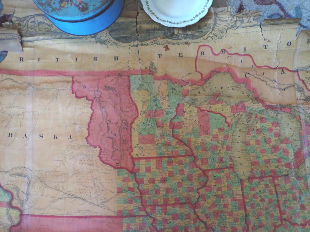 It soon became obvious that what we had here was a transition map, showing a snapshot of the state, county, and territorial boundaries as they existed around 1858, the year the map was published. Below is a shot of the upper right portion of the map, showing New England and eastern Canada. The counties are highlighted in contrasting colors. 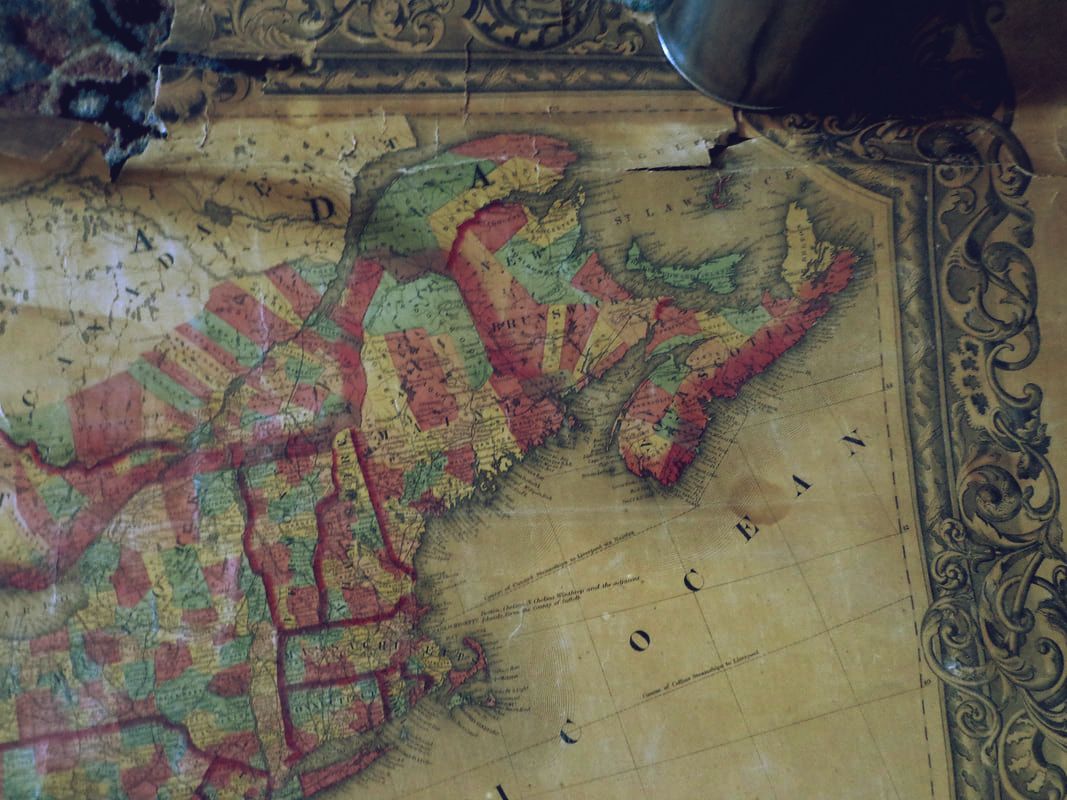 There are several vignettes arranged around the perimeter of the map. Here is one of the U.S. Capitol building, as it looked in the late 1850's: 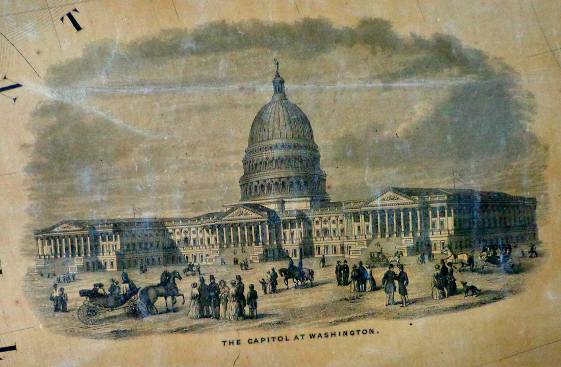 Here is a look at the northeast and what used to be called the Northwest Territory, or "The Old Northwest". Most of the state boundaries appear as the do today, with one notable exception. 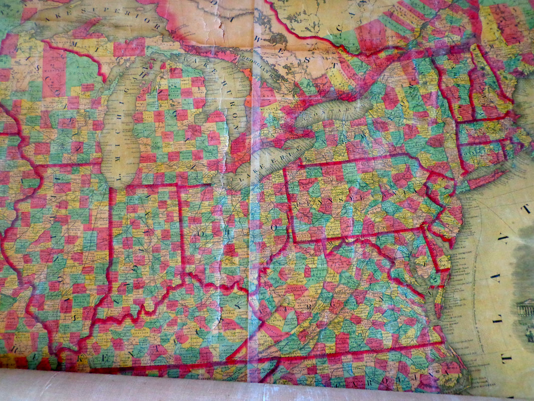 Can you see what state is missing in the close-up below? 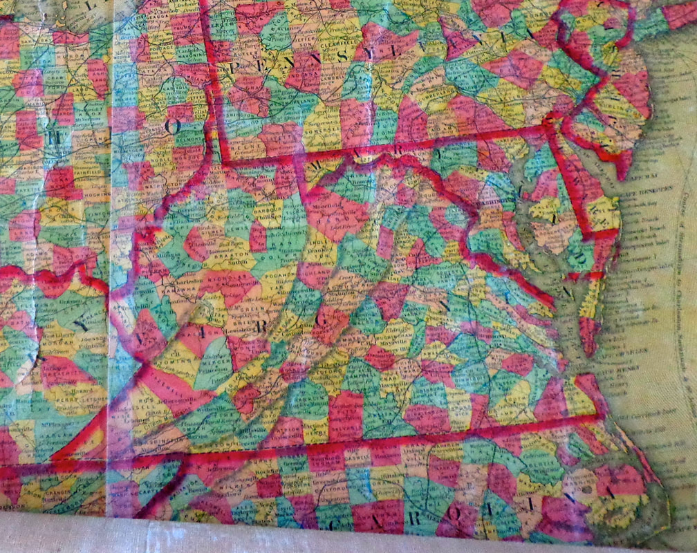 This map is from 1858, but West Virginia didn't gain statehood until 1863. The close-up below shows how much less settled was the area to the west of the Mississippi River. 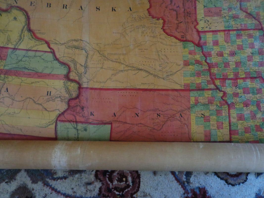 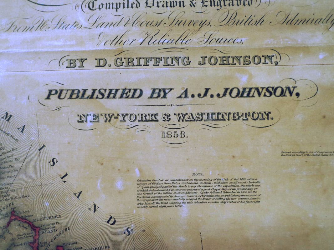 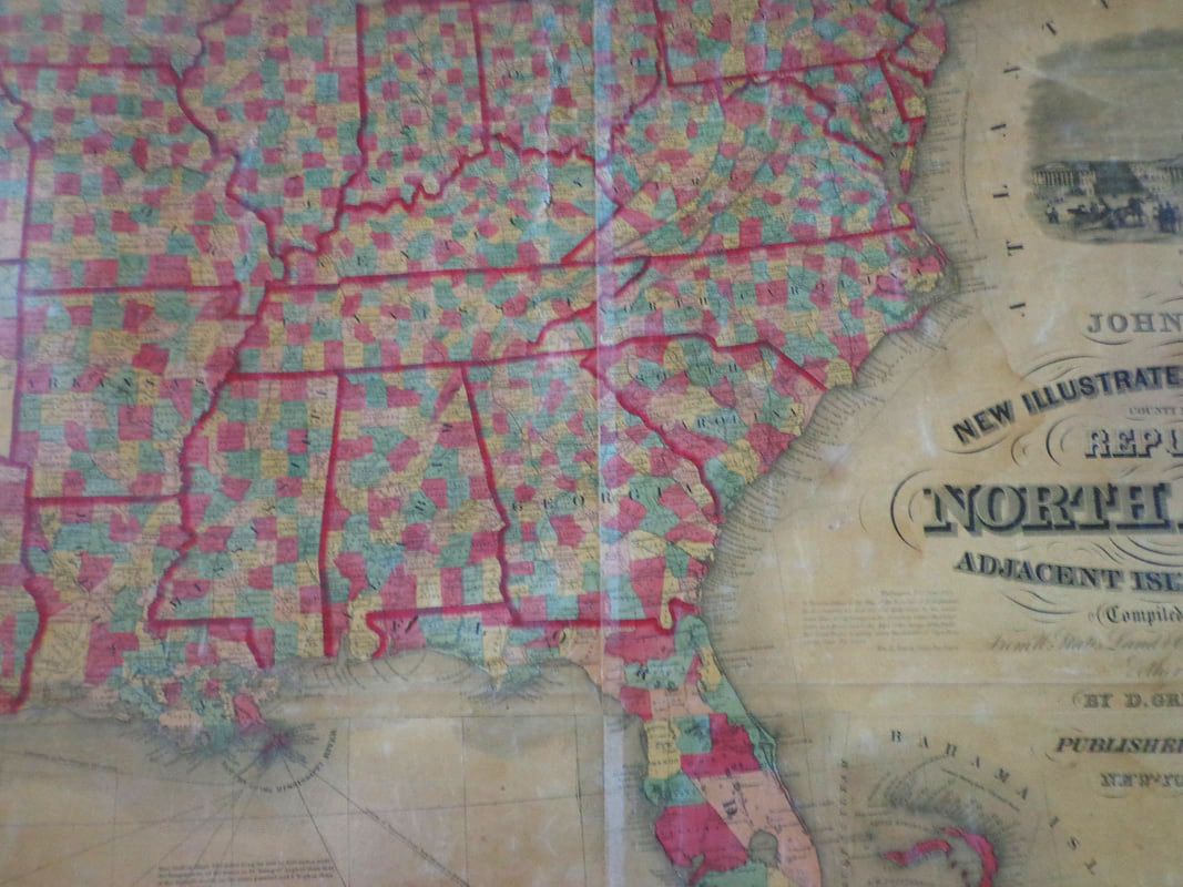 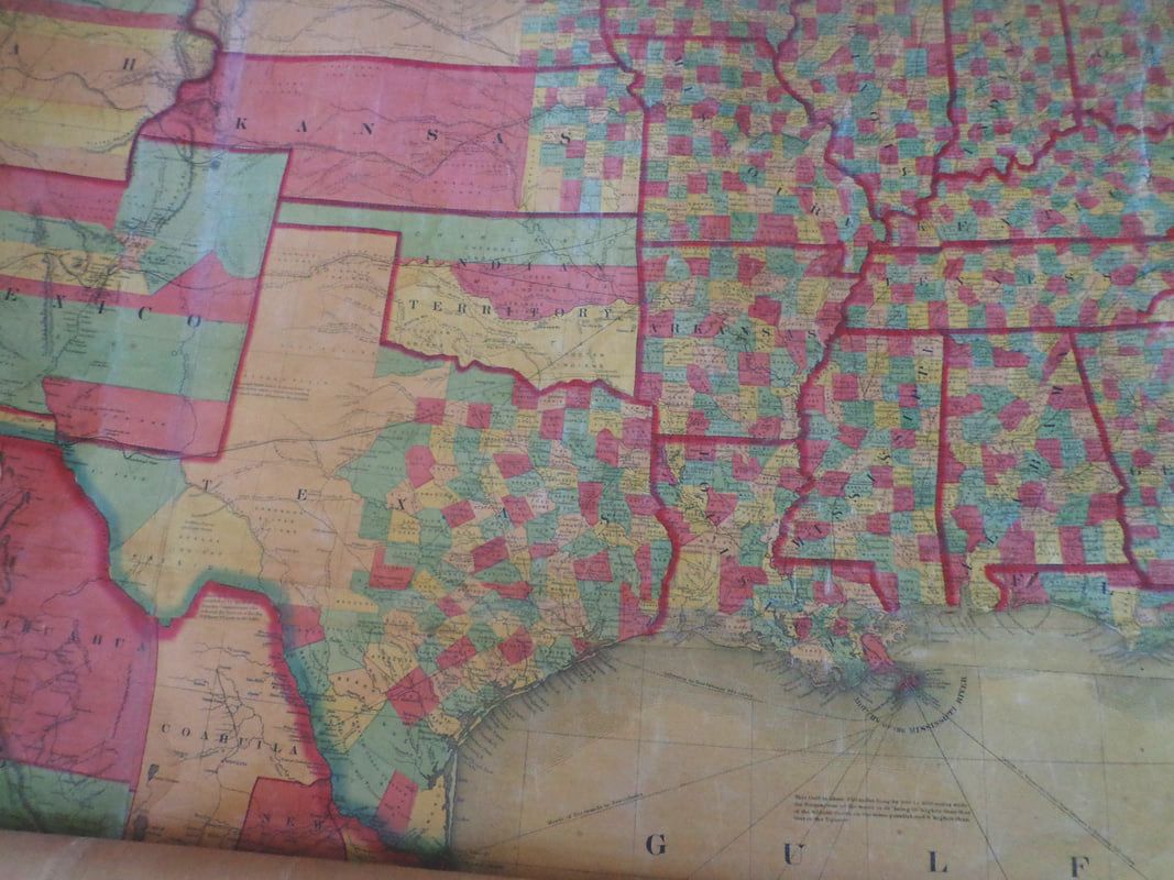 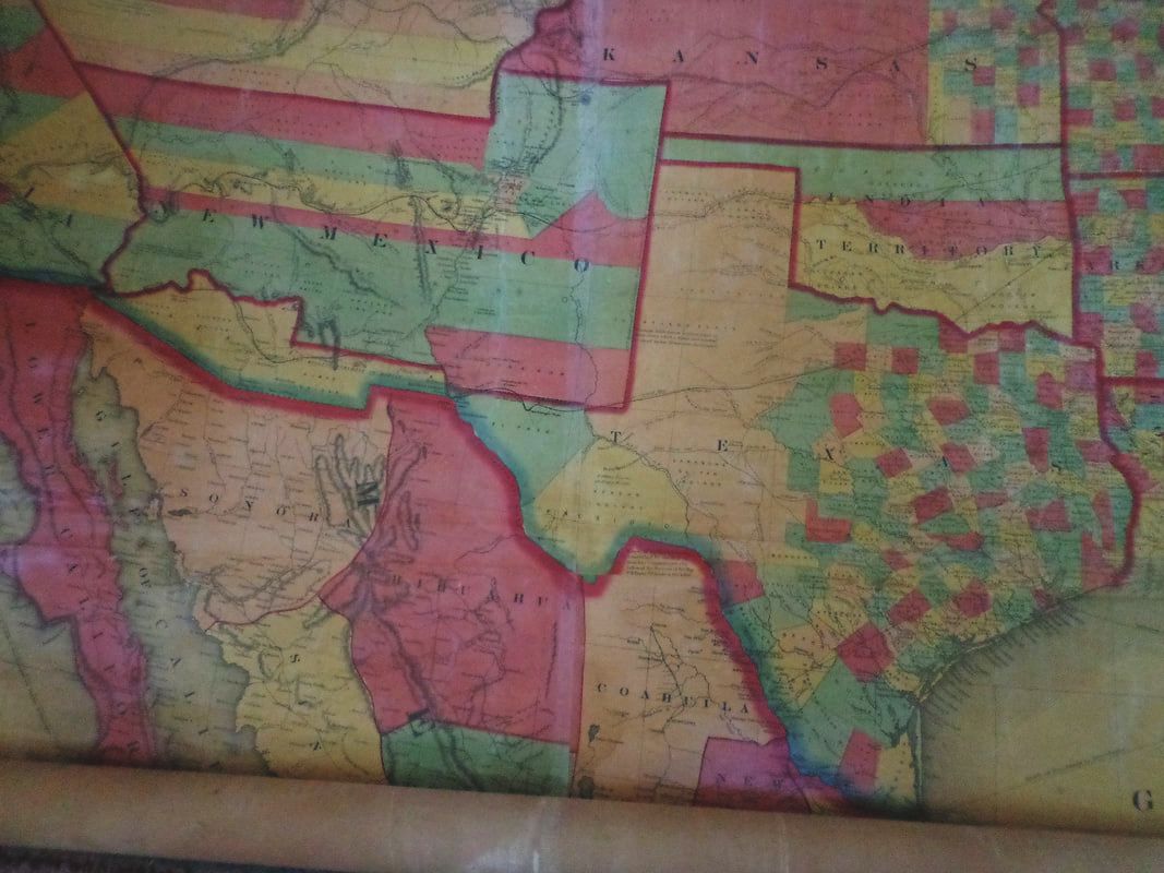 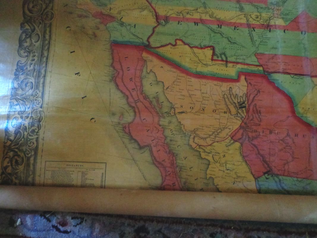 Below is a close-up of the lower left corner of the map. 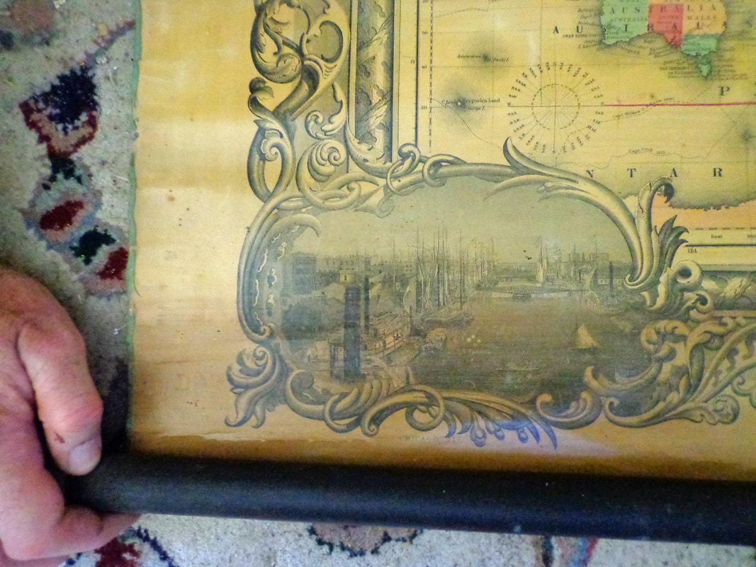 ....and an even closer look at the vignette, showing a river, bridges and ships. 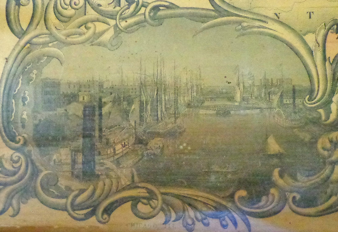 Continuing along the lower border, from left to right: 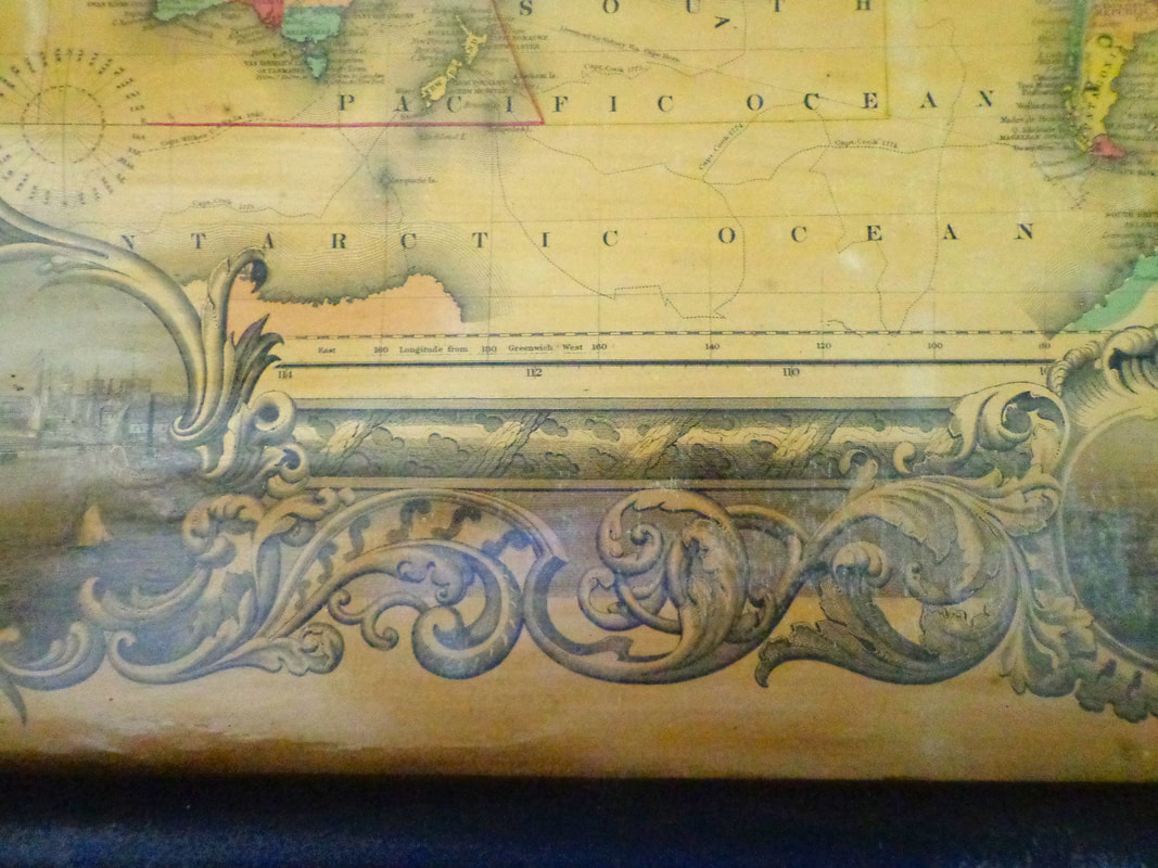 Along the bottom margin, is a vignette of the city of Cincinnatti Ohio, showing steamships on the Ohio River. 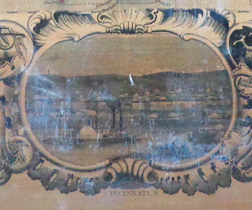 Belos is the lower right corner of the 1858 map, showing the northern part of South America, with a vignette of St. Louis in the margin. 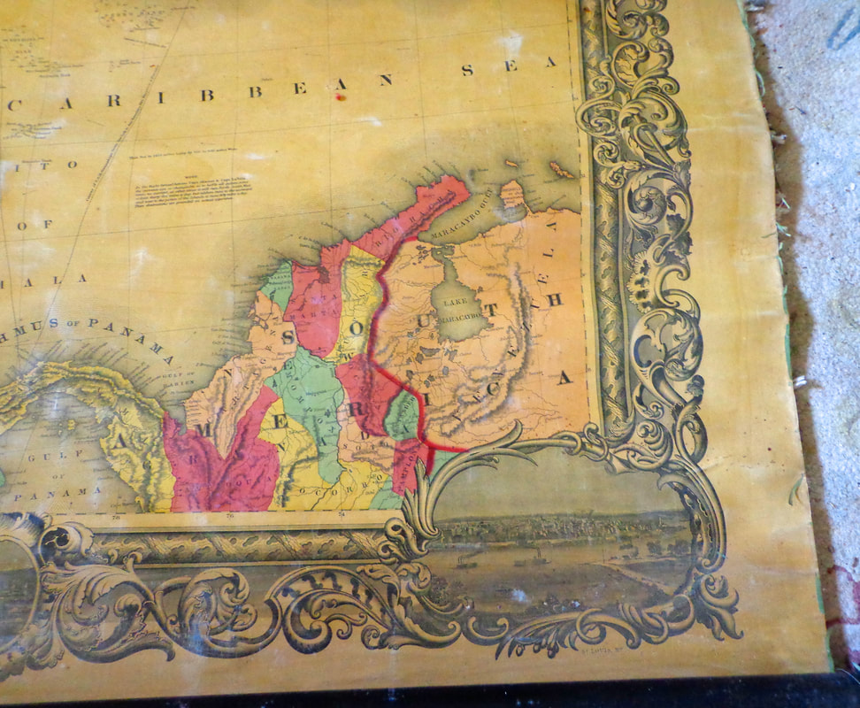 Below is a look at the vignette of Saint Louis in the lower right corner margin. 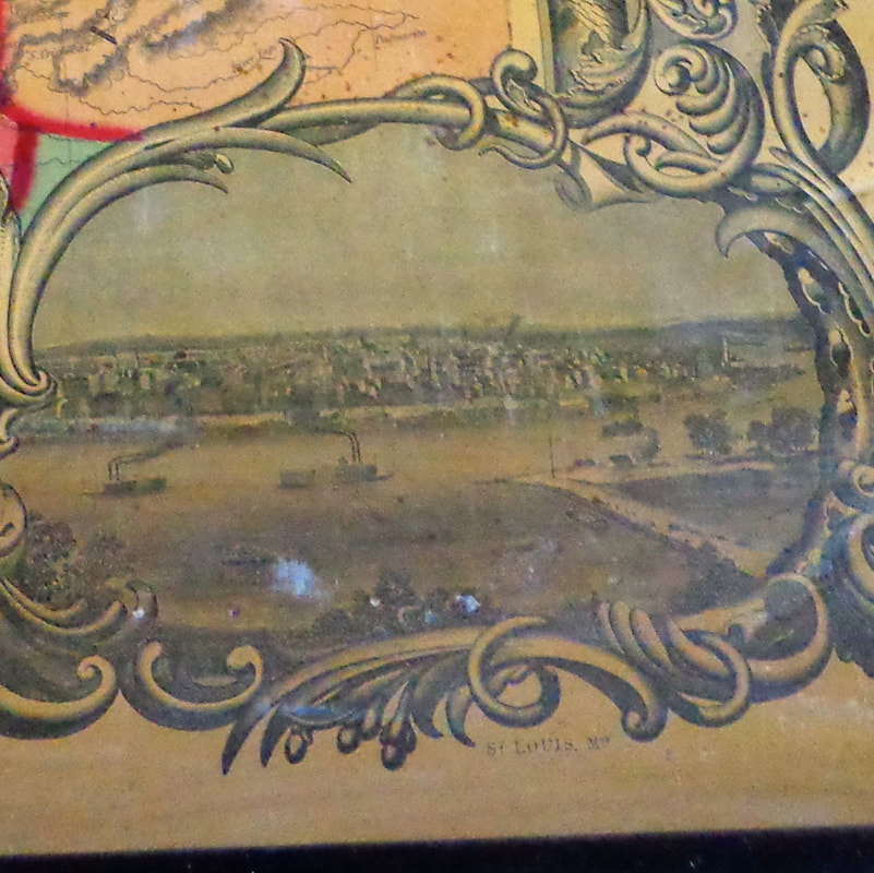 Below is a look at the lower part of Central America, including the "Isthmus of Panama". 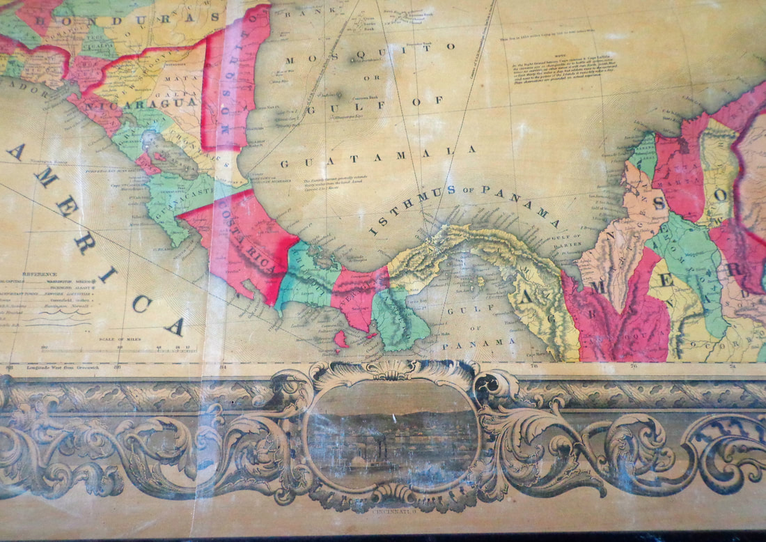 There is so much information on this one map! Below is a Reference Legend, showing the variety of fonts used for different features. 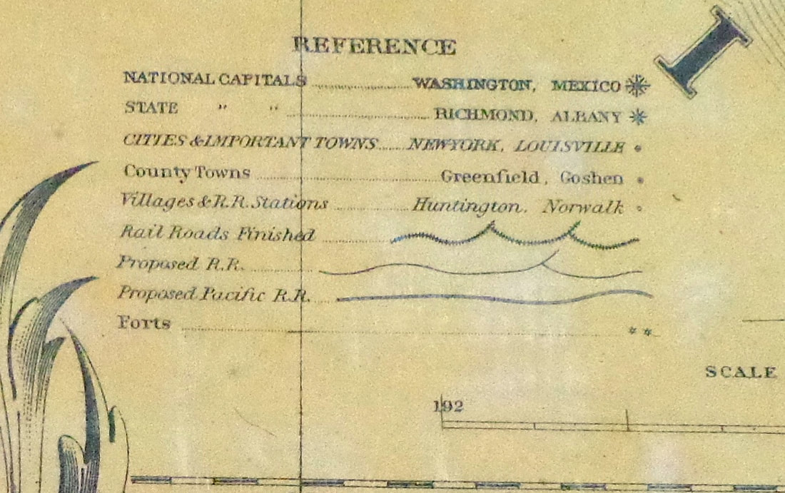 Below is another look at a portion of Central America. 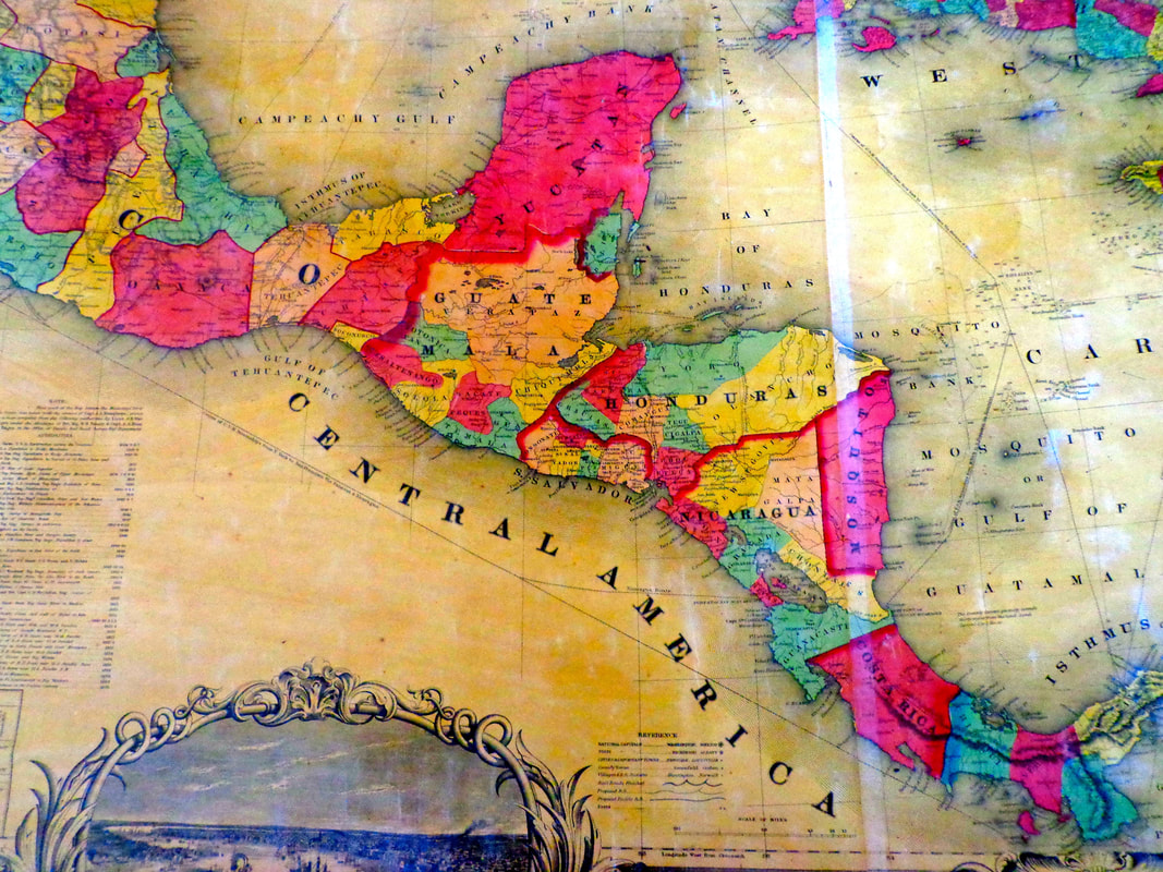 There is also an inset of a map of the world, showing ocean routes from popular coast cities. 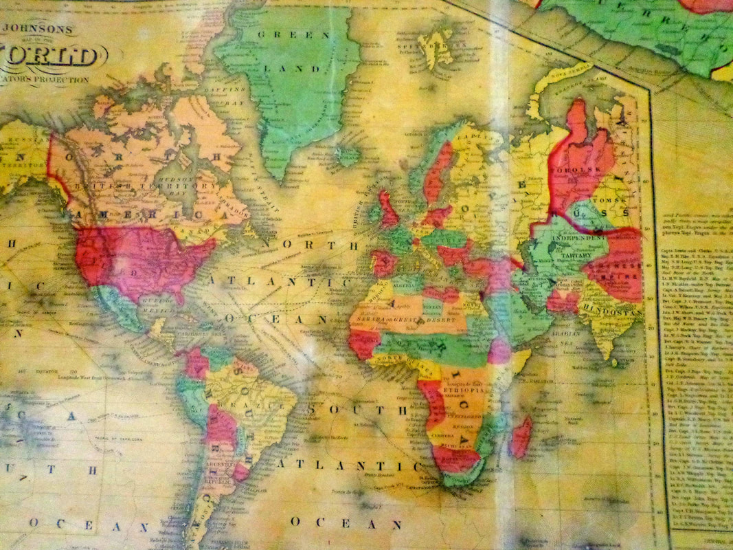 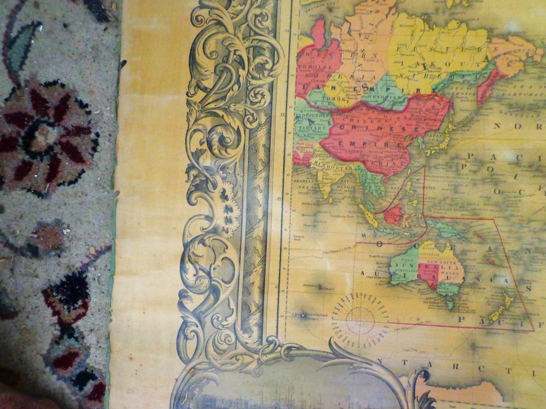 There's even a statistical table of the States' 1850 census. 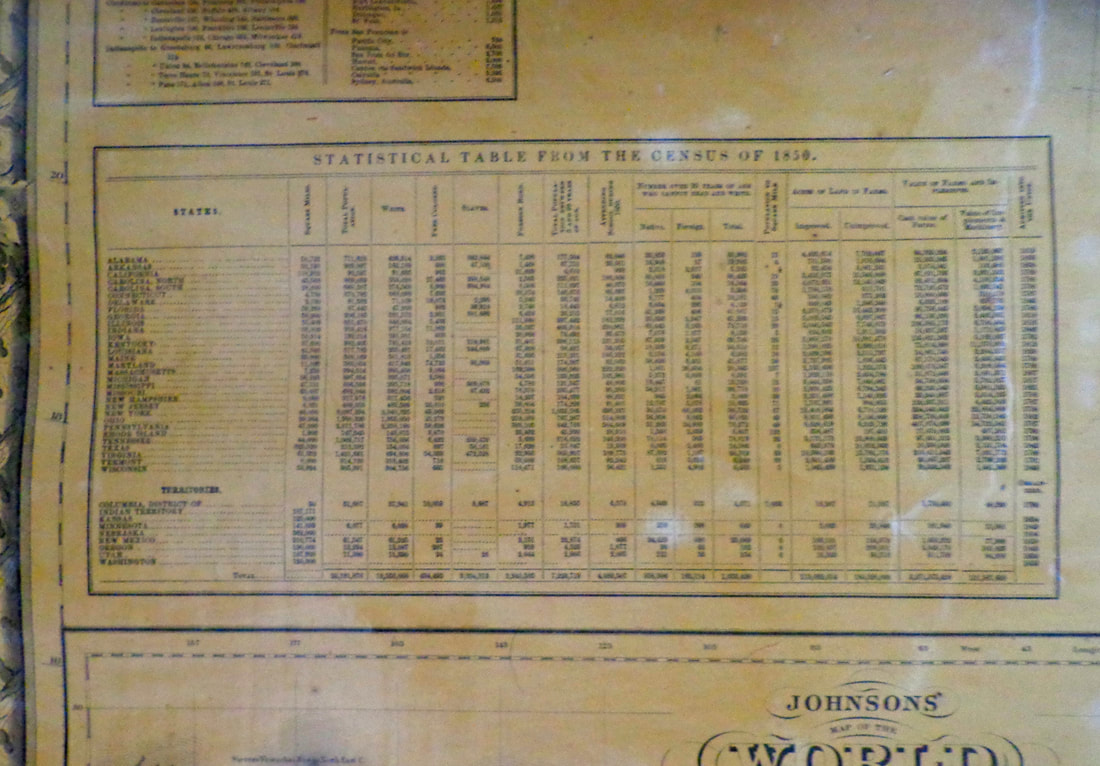 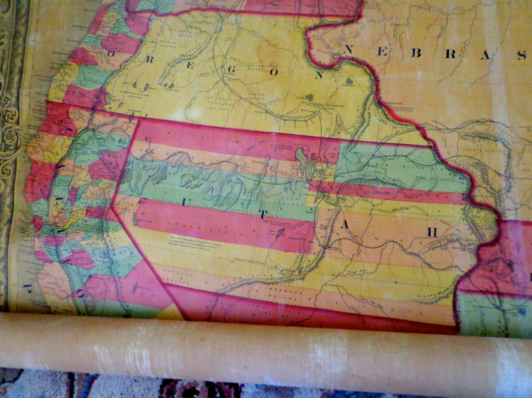 Close-up of Salt Lake City: 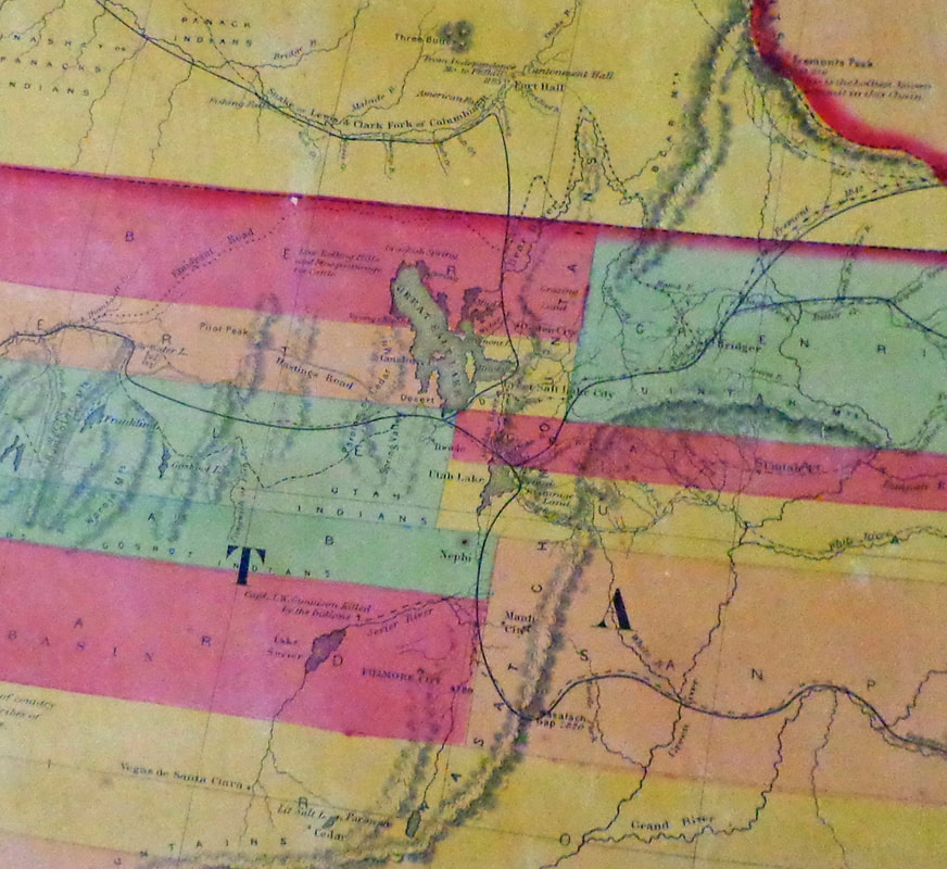 West Indies: 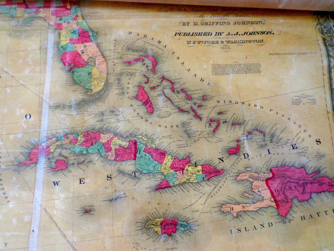 Florida Keys: 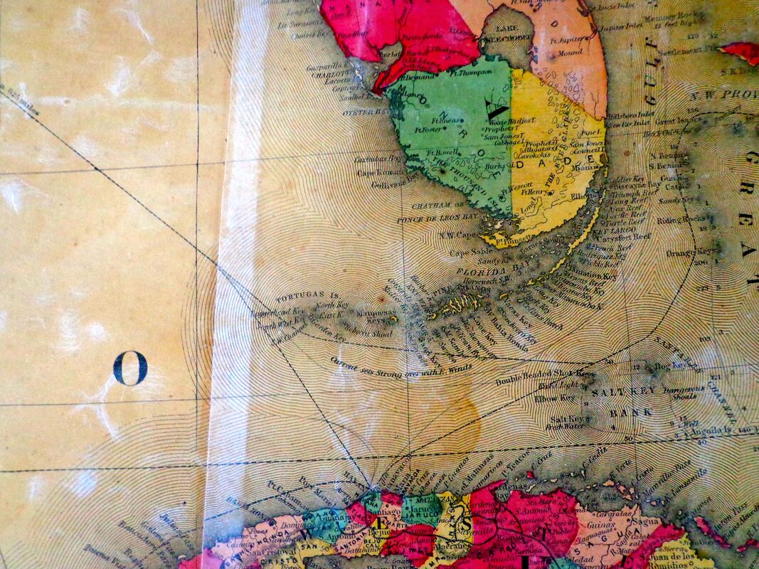 Florida: 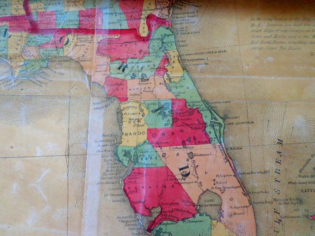 ...and the port city of New Orleans: 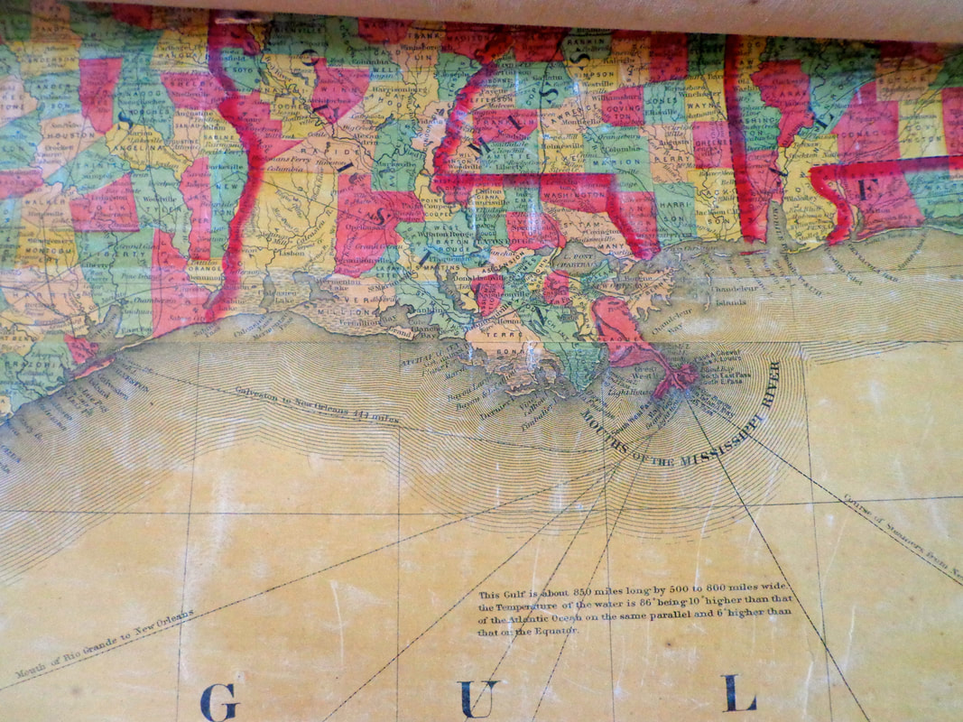 For a good look at the similar, 1859 version of this map, you can go to the David Rumsey map collection and magnify areas to see incredible detail, or pan back out to see the big picture. That map can be found here:
https://www.davidrumsey.com/luna/servlet/workspace/handleMediaPlayer?qvq=q%253A1859%2bjohnson%2bnorth%2bamerica%253Bsort%253APub_List_No_InitialSort%252CPub_Date%252CPub_List_No%252CSeries_No%253Blc%253ARUMSEY%257E8%257E1&trs=75&mi=2&lunaMediaId=RUMSEY~8~1~203535~3001689 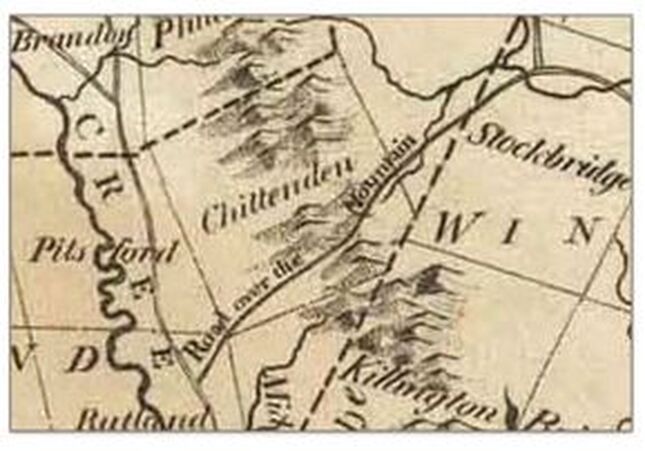 Inset from the 1795 map of Vermont by Carey In Part one of "The Road Over the Mountain" we explored the west end of this old 18th century route, shown in the above inset from the 1795 map of Vermont by Carey. In part one we traveled from Rutland to East Pittsford village. Now we'll continue, through Chittenden, and over the Green Mountains, to Stockbridge Vermont. Below is a modern Google Earth aerial view, which points to the village of East Pittsford, in the East Creek Valley, and shows the wilds of Chittenden Vermont, to the east. 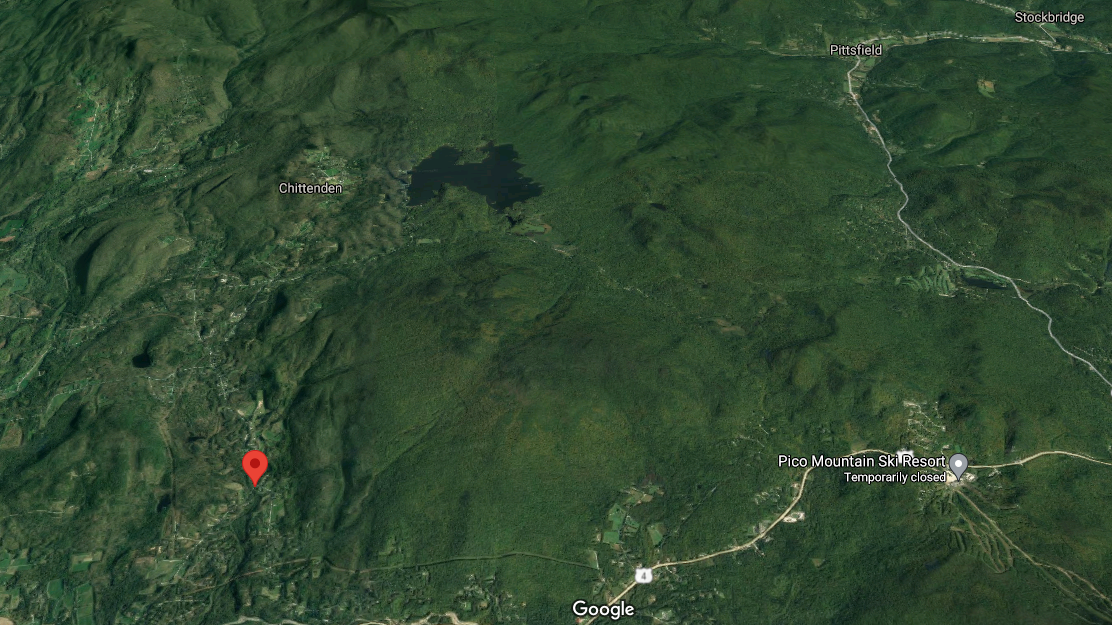 Village of East Pittsford, (at pointer). Chittenden Reservoir show above. image courtesy GoogleEarth The Chittenden reservoir can be seen in the upper central portion of the photo above. In this photo we can get an idea of the lay of the land, and we can see why the old Road over the Mountain probably wound around Blue Ridge Mountain, (elevation about 3250 feet), east of East Pittsford village, and south of Chittenden village. 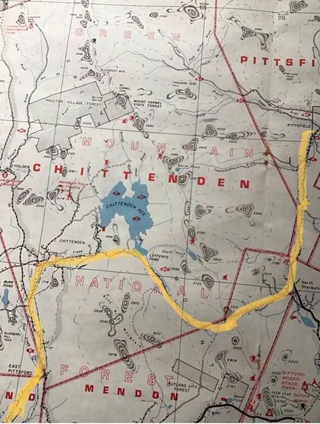 Inset from a Vermont Atlas published by DeLorme in the 20th century. Above, is a 20th century view showing the area, from a DeLorme Gazeteer I bought about 40 years ago. We can see what I believe is the Road over the Mountain, (highlighted by me). The Road Over the Mountain appears to go through the southeast tip of Pittsford, then northeast into Chittenden, followed by a turn east, then south. Then it heads south of Chittenden Pond (now Chittenden Reservoir), then east, then back north again, into North Sherburne, and then Pittsfield, (as opposed to Pittsford), before terminating in Stockbridge. Naming the Road(s) Today Identifying the route by today’s road or trail names is the next step. We started out by following East Pittsford Road from Rutland, through East Pittsford. In East Pittsford, the road name turned to “Chittenden Road”, and in Chittenden I’ve seen it labeled, “East Pittsford-Chittenden Road”. 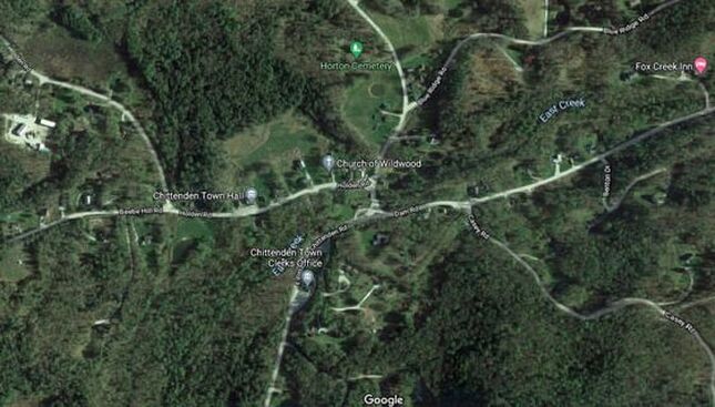 South Chittenden Vermont. Courtesy GoogleEarth. Continuing along the old route, after East Pittsford, we head to the village of South Chittenden. We pass by the Chittenden Post office on the right, followed by the Chittenden Town Clerk’s office, seen above. Below is a look at the South Chittenden in 1869. We see a busy village with at least two sawmills, a grist mill, a blacksmith shop, a store and a post office, and a "proposed railroad". 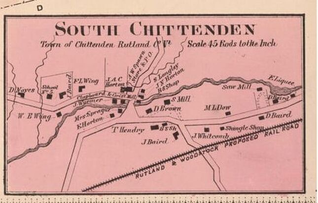 South Chittenden Village, 1869. Beer's Atlas Just past the Chittenden Town Clerk’s office, we continue on what is now known as “Dam Road”, no doubt named when the dam and reservoir were built. Here, be sure to avoid Mountain Top Road which goes to the left, and Casey Road, which is a right turn. In the photo below, the town clerk’s office in South Chittenden is in the lower left. We can see Dam Road leading east, over toward where Chittenden Pond was dammed to create the reservoir. The construction of the dam began in 1900. 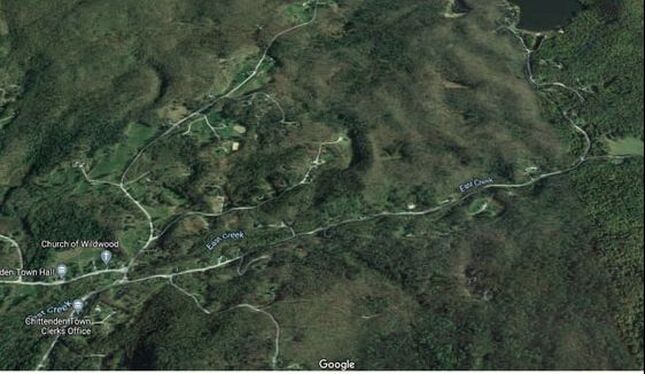 South Chittenden village, East Creek, and Dam Road. Courtesy GoogleEarth. Just before Dam Road heads north to the reservoir, there is a right turn. This right turn, I believe, is the continuance of our 1795 “Road over the Mountain”. Today, the next portion of the old road is known as “Wildcat Road”. I can only imagine why it was named that! Here is a look at that intersection, where we will bear right: 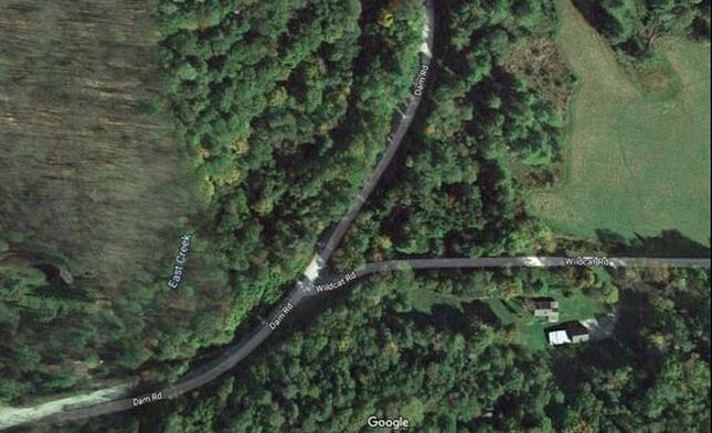 Turn onto Wildcat Road. Courtesy GoogleEarth. Outskirts of Town Have you ever noticed that many of the oldest roads, that have become discontinued and overgrown, are often located in the most remote regions of towns? Year after year, many of those forgotten roads are slowly returning back to their natural, forested state. Many of our township boundaries are located along the areas of least population density, on the outskirts of towns. Many of these areas, often farthest from town centers, had been populated by subsistence farmers in the early - mid 19th century. These farms were often in the higher elevations, as town centers were usually formed in valleys around rivers and streams, in the lowlands. In the mid-1800’s, almost three quarters of the land in Vermont, below 2000 feet elevation, had been cleared for crop raising, and sheep and cattle pasture. Many of the old roads, or portions of them, can still be found out there, in those formerly populated, remote highlands. Take a look at this area of outskirts below. Look at the township boundaries, and how they were delineated, where five townships meet: The boundaries of Chittenden, Mendon, Sherburne (now Killington), Pittsfield and Stockbridge all come close to one another in this rural region. Also, these boundaries were adjusted and modified over the years. (Compare the township boundaries on this 1869 map, to the boundaries on the highlighted DeLorme road map above.) 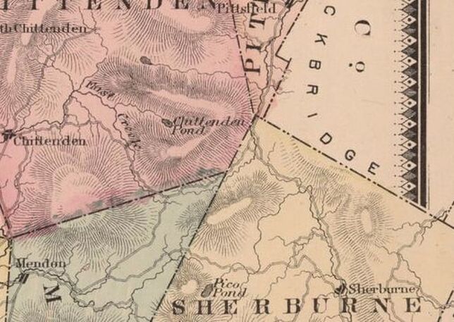 1869 view from Beers’ Rutland County Map, Showing Wildcat Road, Connecting with Old Turnpike Road, and Elbow Road Today, in Northern Mendon and Sherburne Townships. In the next view, we see our road climbing along East Creek to its source, just after crossing into extreme northeast Mendon township. From there, it eventually travels east, over the Green Mountains, through a gap now known as "The Elbow" As the road and creek climb, we'll pass camps and houses along the way. Eventually, the road seems to disappear into a wet area near the highest elevation. Just before the high, wet area, "Old Turnpike Road" comes in from the south, on the right, and joins Wildcat Road. Old Turnpike Road may be a remnant of the "Rutland and Stockbridge Turnpike" that was chartered in 1804. You can read a little about the Rutland and Stockbridge Turnpike in "Turnpikes of New England" by Frederic J. Wood, published in 1919, pg. 263. Here is a link to that page: https://archive.org/details/turnpikesofnewen00woodrich/page/262/mode/2up Here is an excerpt from a short history of Mendon VT, that relates to "Old Turnpike Road": "Mendon was located on the main road from Rutland to Woodstock. In 1807 a town meeting was held to lay out a turnpike and other roads. The result was the Rutland, Woodstock and Stockbridge Turnpike. It followed the present line of Woodstock Avenue to Mendon, went behind the present town office. At the present Old Turnpike or Elbow Road, it divided with one branch going left to Lefferts Pond and Chittenden and the other over the Sherburne pass through Bridgewater to Woodstock. The branch to Chittenden was used as the mail route as late as 1875." I suspect the Turnpike later became the preferred route to Stockbridge, as it appears to be a shorter distance. Both routes connect and cross the gap at the Elbow. 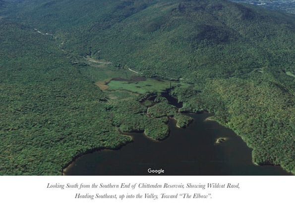 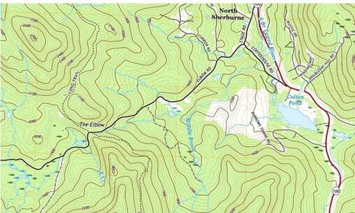 "The Elbow" is where the Road Over the Mountain now intersects with the Long Trail. Imagery courtesy USGS, 2018. "The Elbow" depicts a gap over and through the Green Mountains. The Long Trail intersects at this point. Above, Old Turnpike Road can be seen joining Wildcat Road, near the marshy area in the lower left, depicted as dashed line. Just beyond the junction with Old Turnpike, we find the source of East Creek, a wide, wet area that was probably difficult to maintain as a road. This is just before the height of the land. The 2018 US Geological Survey map view is shown above, Interestingly, on this modern map, Wildcat Road, (sometimes depicted as Old Turnpike Road after that junction), which becomes Elbow Road, is depicted as if it is a maintained road all the way through the gap. Below is a relief map from GoogleEarth, of the Elbow area, which shows elevation well, and does not show the road continuing through The Elbow, though I'm sure it still exists, for the most part, at least as a trail. 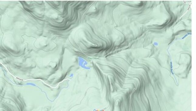 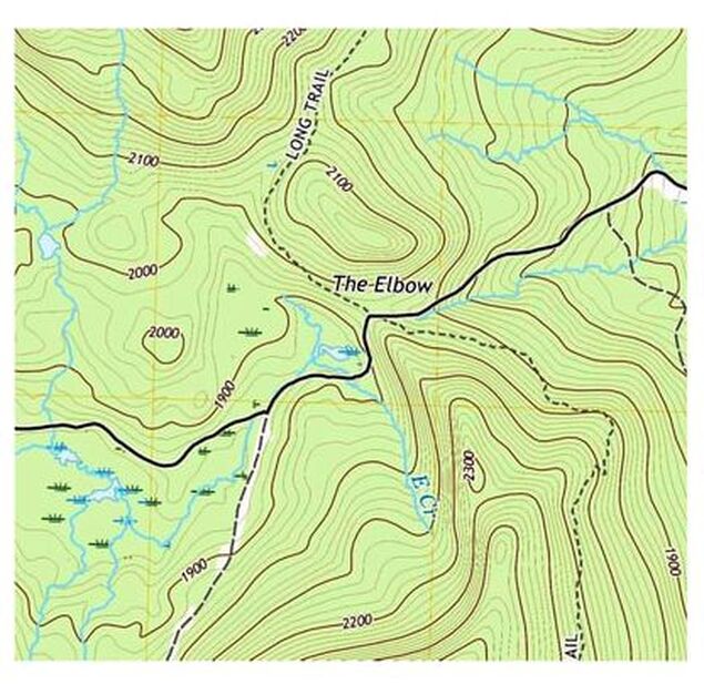 "The Elbow" 2018 USGS imagery "The Elbow" 2018 USGS imagery The Elbow is at the highest elevation, about 1950 feet. It is where the “Road Over the Mountain” actually went over the mountain, and then down the other side. The old Road Over the Mountain crosses the north-south route of Vermont’s “Long Trail”, which is the oldest long distance hiking trail in the United States. 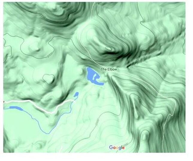 GoogleEarth relief map showing the high country as the Road Over the Mountain heads over the mountain at The Elbow. Today this old road intersects with The Long Trail. On the relief maps, it appears that the road is no longer maintained in the highest elevations, while on the 2018 USGS map, the road appears to be continuous. I’d really like to head out there and see for myself. It would be fun to hike in from the Long Trail, and then head west or east, and see what the old road looks like today. WATERSHEDS To the west of The Elbow, lie the headwaters of East Creek, which flows into Otter Creek, which flows from there into Lake Champlain, which flows north to the Ricelieu River, which empties into the St. Lawrence Seaway. To the east of The Elbow lie the tributaries of the Tweed River, which flows into the White River, which flows into the Connecticut River, which flows into Long Island Sound and the Atlantic Ocean. Below is a 3-D look at the area where the road crosses over the mountain. This GoogleEarth image, appears to show the old Road Over the Mountain snaking around the marsh. "The Elbow" is shown in fine print, upper right. 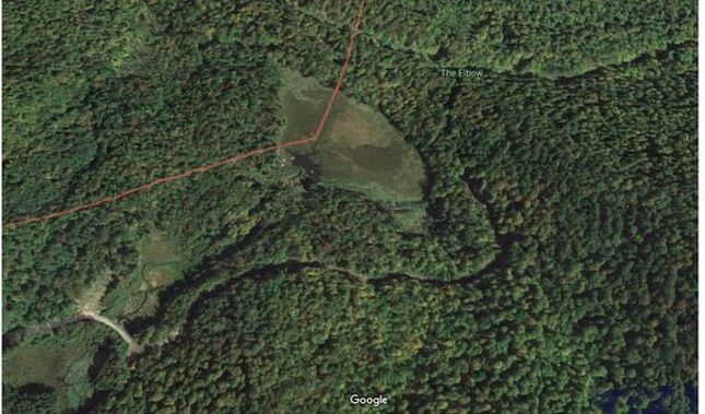 The Road Over the Mountain would have to go through, or around this wet area just before the gap at The Elbow. Courtesy GoogleEarth. Here is a closer look at that marsh, or wet area just before The Elbow: 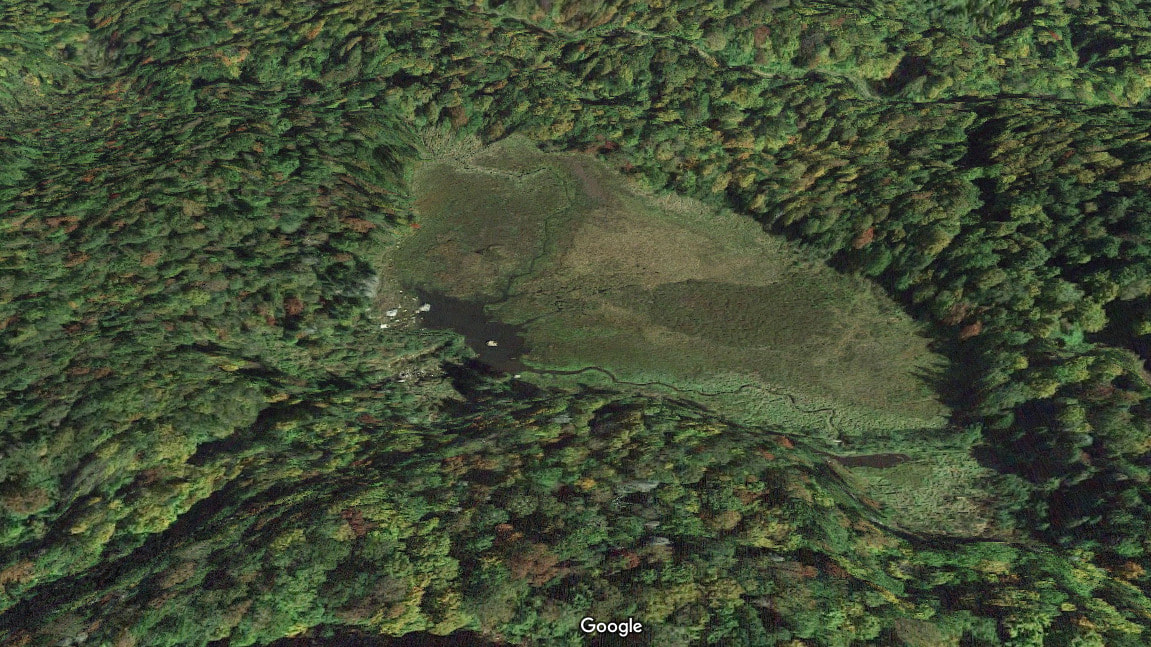 Wet area just before The Elbow. Courtesy GoogleEarth. Before we leave the top of the mountain, consider this: At The Elbow, the Long Trail continues for a short time, on an old railroad bed. 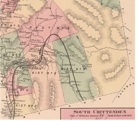 The Railroad bed had been prepared for an east-west, cross Vermont Railroad that was never completed. The proposed route is shown on the map above, from the 1869 Beers’ Atlas. The view shown below is LOOKING SOUTH. It shows the old railroad bed, that the Long Trail follows for a short distance. The Elbow is shown in upper right, and the high marshy area is a bit lower, to the right. 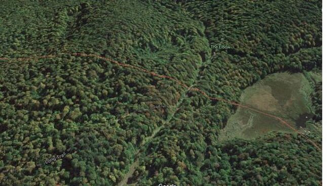 Photo courtesy GoogleEarth. After climbing and going through The Elbow, the road descends east, into the Tweed River Valley. The GoogleEarth photo below shows The Elbow in the far left, and we can make out a portion of the road that heads east, now known as Elbow Road. 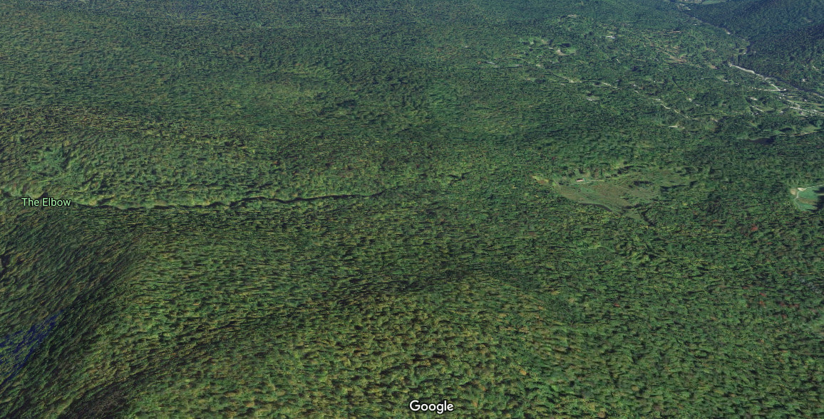 As the road descends from the Green Mountains into the Tweed River valley, civilization becomes more prevalent. 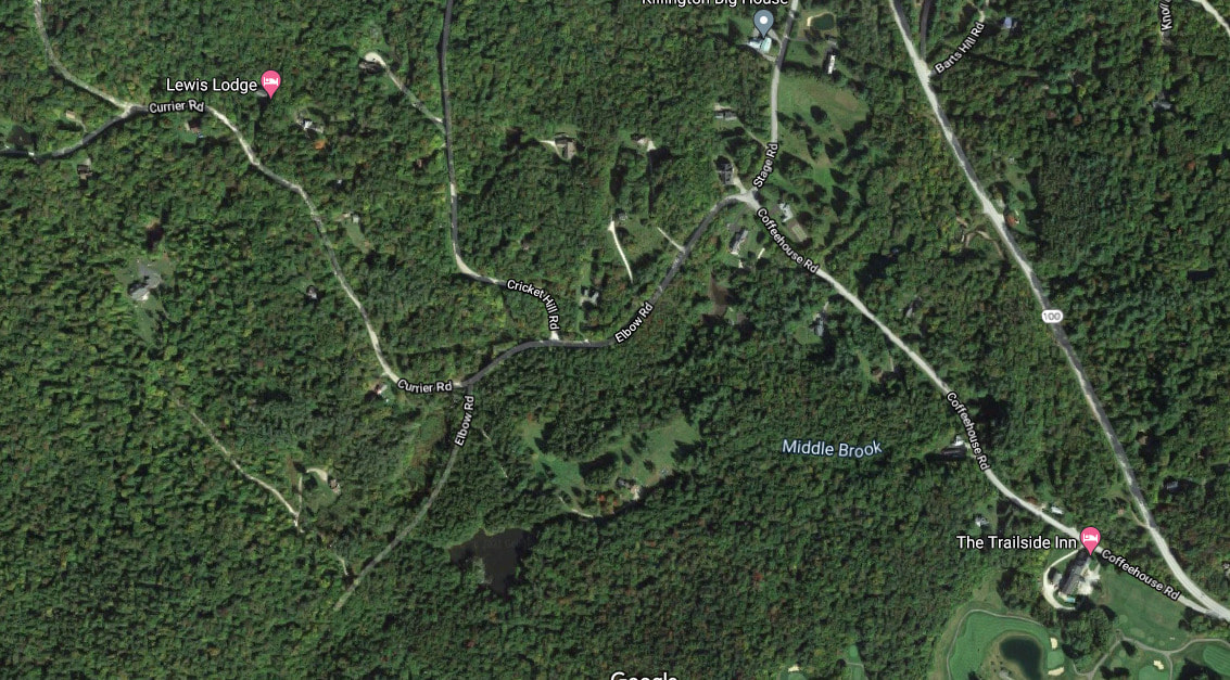 The photo above shows the area where Elbow Road comes down into North Sherburne. Here Elbow Road intersects with Stage Road and Coffeehouse Road in North Sherburne. I believe the Road Over the Mountain continued on Stage Road, and headed north to Stockbridge, along what is now Route 100. Just before the intersection of Elbow Road with Route 100, our road crosses the south branch of the Tweed River. From there, I suspect the old route was roughly the same as today's route 100, which heads up to the junction of the Tweed and White Rivers, and the western end of today's Route 107. The Road Over the Mountain must have paralleled the White River, on its way north to Stockbridge, though it may have run on the east side, near what is now Blackmer Boulevard, and/or Common road into the center of Stockbridge. 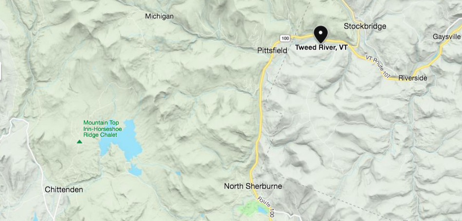 Area of Vermont showing Chittenden, North Sherburne, Pittsfield, and Stockbridge. Courtesy Microsoft Bing. Below is a modern look at the area near the confluence of the Tweed and White Rivers, including Stockbridge, to the north. 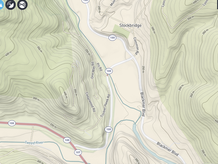 USGS Topographic Imagery. It's fun to look at routes on old maps, and try to figure out where they would be today. But can you imagine the amount of effort required to travel from Rutland To Stockbridge in 1795? It must have really been something! I expect the trip would have been made either on foot, or horseback at that time. I don't know if it would have been wide enough for wheeled traffic in 1795. Back in 1795, the road was probably no more than a bridle path, probably widened out from a trail made there by native americans. The native americans in turn, probably developed the trail based on animal trails that most likely went through The Elbow gap. The native americans may have found the trail while hunting game. The trail probably existed for hundreds of years before european settlers arrived. Still, I wonder if the "Road Over the Mountain" may have actually gone up and over Blue Ridge Mountain, and connected with Wildcat Road on the other side... There's a road in there called Stone Hollow Road....hmmm.....nahhh, couldn't be. Or could it? Maybe someone out there can enlighten me! Thanks for traveling down Old Roads, Rivers and Rails, with me, Bob Totz. If you like these kinds of stories, feel free to subscribe, by sending an email to [email protected] Portion of Railroad bed used for Long Trail: https://www.greenmountainclub.org/hiking/accessible-trails/ The Rutland and Stockbridge Turnpike, p. 263: https://archive.org/details/turnpikesofnewen00woodrich/page/264/mode/2up 1795 Map of VT by Carey: https://www.loc.gov/resource/g3750.ct000093/?r=0.072,0.596,0.722,0.32,0 Brief history of Mendon VT: https://www.mendonvt.org/community/history-mendon/#:~:text=Mendon%20was%20located%20on%20the%20main%20road%20from,to%20Mendon%2C%20went%20behind%20the%20present%20town%20office. Map of Stockbridge Vermont showing Blackmer Boulevard and Common Road: ngmdb.usgs.gov/topoview/viewer/#15/43.7793/-72.7573 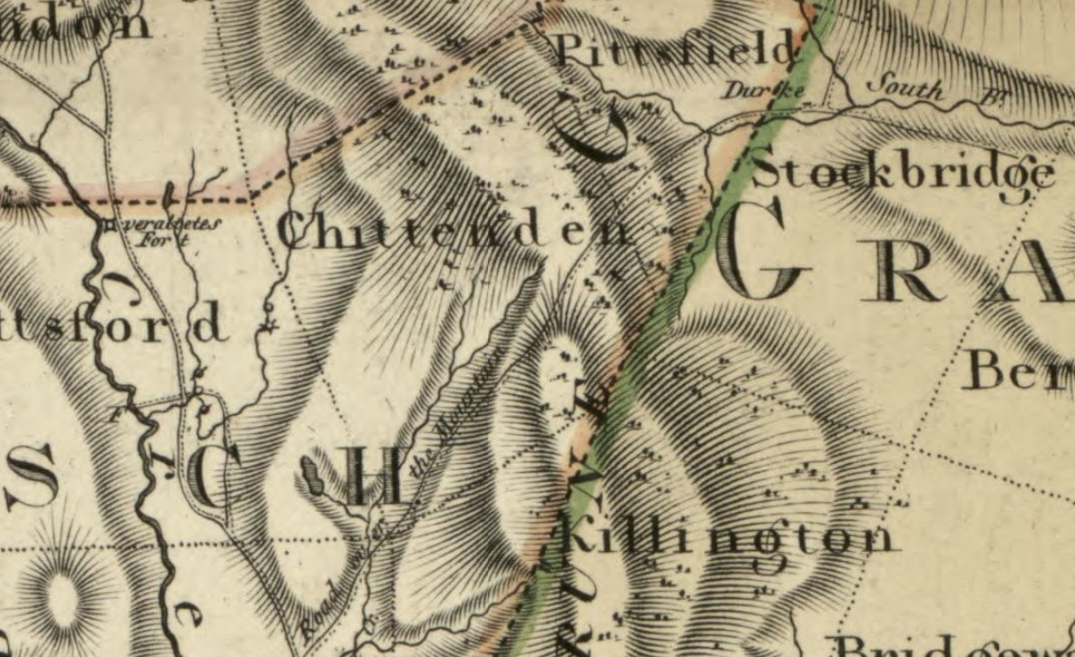 1796 View of Road Over the Mountain. From Vermont map by Bohn. found at: https://www.loc.gov/resource/g3750.tr000196/?r=0.205,0.744,0.265,0.117,0 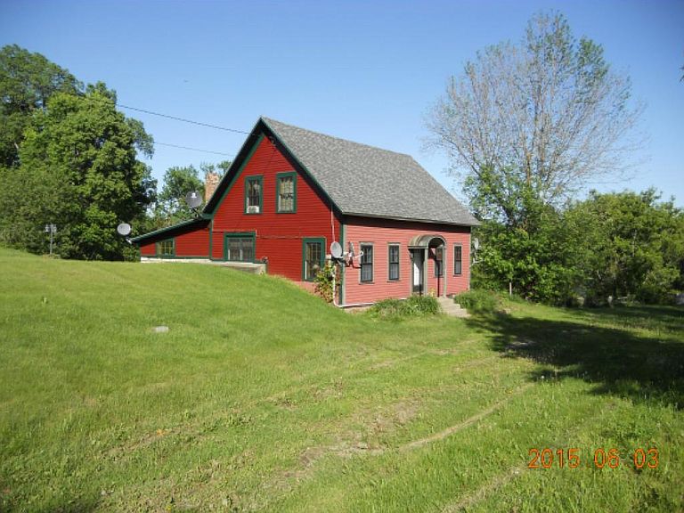 Historic Toll House for sale in Newbury Vermont 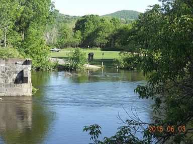 Looking across the River to Haverhill New Hampshire and Bedell Bridge State Park Looking across the River to Haverhill New Hampshire and Bedell Bridge State Park The old "Toll House" is for sale in Newbury VT. It's right on the Connecticut River. The old Bedell Bridge used to lead to it, from Haverhill NH. The bridge has been missing since the late 1970's, but traffic used to run right by this place for over a hundred years, via an old covered bridge. Now, the old place is at the end of a dead end road that leads to the Connecitcut River. The old stone bridge supports are still seen, standing in the river.  Across the Connecticut River is the Bedell Bridge State Park in Haverhill New Hampshire. 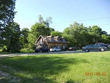 Second house is also part of the property. Second house is also part of the property. The place comes with a second house too, for guests, or maybe a B and B.  With 250 feet frontage on the Connecticut River, and a few acres of beautiful land, the toll house sits looking south or southwest, downstream. It looks like a beautiful place, and I am amazed it hasn't sold yet, especially in this tight market.
It looks like just a lovely spot to live! Many more photos and descriptions can be found at the listing in zillow: https://www.zillow.com/homedetails/139-Toll-House-Rd-Newbury-VT-05051/92008535_zpid/? Here is a link to the local listing agent's website: http://lymanrealtynow.com/search-mls Oh, and if you or anyone you know buys it, could you possibly let me know so we can come visit? I'd love to just walk around there sometime, and maybe run a metal detector around the old toll gate area! 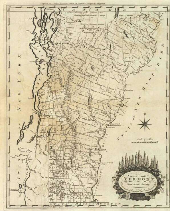 1795 Map of Vermont by Carey The oldest roads in Vermont are shown on the oldest maps of Vermont. However, some parts of the oldest roads have not been maintained in over a century, or more, though some of those portions can still be walked as a trail. Other old roads have been kept up, and some are main thoroughfares today. History and Geography have played important parts in deciding which roads remain. I like to look at the oldest maps, and see the lines that represent the earliest routes used by the first settlers in our region. I then compare them to other maps of varying vintage, and then try to see if I can find and name those old roads today. The best part comes later: walking along a route picked in advance, for its historical character, and looking for clues to history out there, such as features shown on old maps. If you like two hundred-plus year old stone walls, old foundations, cemeteries, ruins of old mills, and ancient witness trees, this can be a good way to find them. 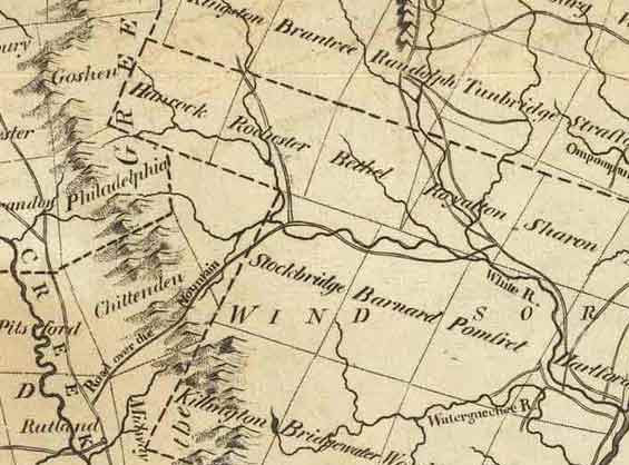 Central portion of 1795 Vermont map by Carey, showing "Road Over the Mountain" from Rutland to Stockbridge. 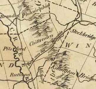 Above, and left, are two insets, from the 1795 map of Vermont by Carey, showing a portion of central Vermont. On the earliest maps, most roads were not identified by name, but occasionally I find one that does have a name, or description, such as: “Road over the Mountain”, seen above, running from Rutland, to Stockbridge. According to the 1795 map, the old road in question headed from Rutland, through the southeast corner of Pittsford, up into Chittenden, where it crossed the Green Mountains and descended into the Tweed and White River Valleys in Pittsfield and Stockbridge. Once in Stockbridge, the Road over the Mountain ended, but if you needed to, you could continue along the shore of the White River in Stockbridge, and follow the trail that would become “Center Turnpike” a few years later, which headed toward Royalton. Maps of the late 1700's are nowhere near as accurate as we are used to seeing. However, they tend to offer clues, including river crossings and township boundaries, that can help in ascertaining where these old routes were, or would be, today. They also offer clues to ruins found along abandoned stretches of old roadways. CAN WE FOLLOW THE OLD ROUTE TODAY? Sometimes, the names of today’s roads offer clues, such as “Mill Road” or “Stage Road”, or something like that, with a historically descriptive name. If you’re looking for an old route, and the road you suspect has a name like that, there’s a good chance you’re on the right road. 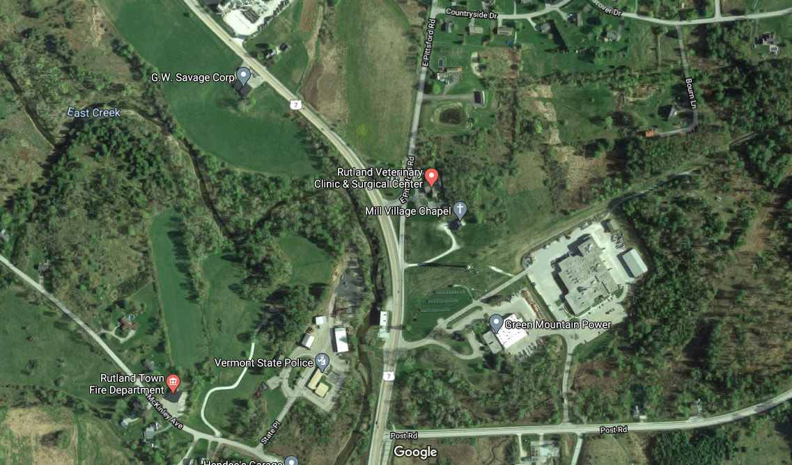 imagery courtesy Google Earth In this particular case, I figured the north-south route that our road jumped off from, was the precursor to today’s Route US 7, and the Road over the Mountain would head east off of that road, north of the city of Rutland, through extreme southeast Pittsford, into Chittenden. If you look on Google Earth, (above), you’ll see there is a road to the east of US Route 7, just north of Rutland, called East Pittsford Road. U.S. 7 North bears to the left. We'll bear right onto East Pittsford Road. There appears to be a veterinary clinic at this point. We'll follow E. Pittsford Road, which goes straight, past Countryside Drive and Russel Drive. The road then crosses East Creek, before turning to the right, to avoid Prospect Hill Road. According to GoogleEarth, there are polo fields on the left, just before that turn. The Google Maps photo below shows the turn at Prospect Hill Road. 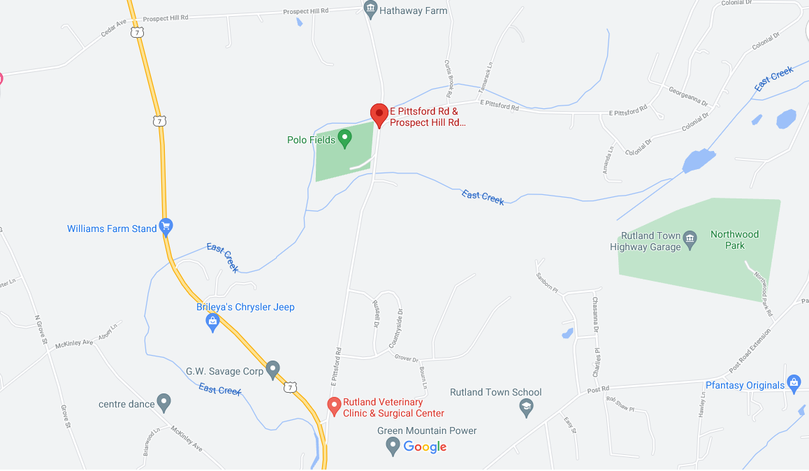 courtesy Google Earth Let’s take a look at this area on the 1869 Beers Atlas: 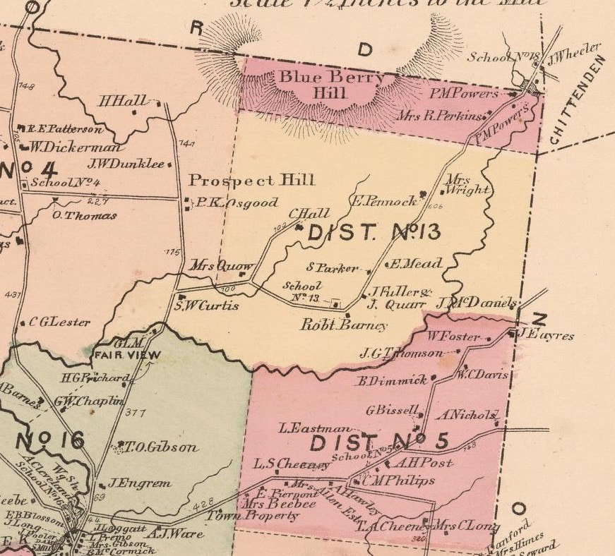 Seventy four years after the 1795 map of Vermont by Carey, the Beers Atlas showed the road network as it had advanced during the pre-motor vehicle era. The atlas shows the farms and homesteads along the route. Beginning in District 16, and crossing into District 13, J. Engram lived near the turn from Route 7 onto East Pittsford Road, and T. O. Gibson was not far, up on the right. At the turn near Prospect Hill Road, the farm was owned by S. W. Curtis. Not far from there, you would bear right at the home of Mrs. Quow. I really love how the mid-nineteenth century cartographers were able to incorporate the names of the property owners into their artwork. School number 13 would have been on your left, as you pass the place owned by Robert Barney. At Robert Barney’s place the road turns and heads northeast, past more farms, toward the village of East Pittsford, just after the Perkins’ and Powers’ places, in the extreme southeast corner of Pittsford township. School number 18 can also be seen in East Pittsford, just before heading into Chittenden, by J. Wheeler's place. Here is a look at the bigger picture, below, also from Beers’ 1869 Atlas: The road crosses the extreme southeast portion of Pittsford, before heading up into Chittenden village, in the southwest portion of Chittenden township. Notice Chittenden Pond in the southeast portion. 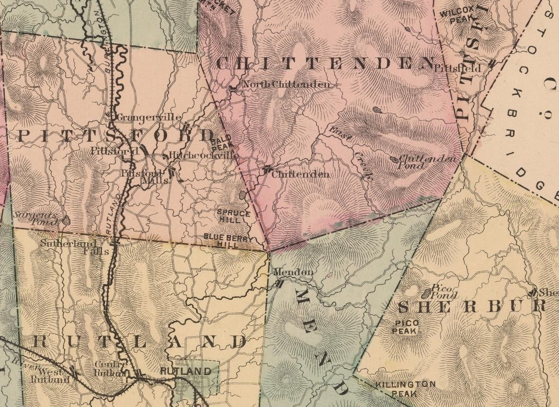 Chittenden pond was eventually dammed to create Chittenden Reservoir. Here is a link to an article with photos, about constructing the Chittenden Reservoir, from 1900 to 1909: https://www.vpr.org/post/historical-photos-show-arduous-construction-chittenden-reservoir#stream/0 Below is an inset from an 1817 map, from an Atlas by Samuel Lewis, which also shows the "Road Over the Mountain". 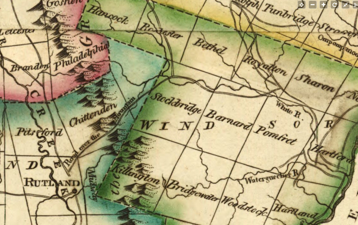 Inset from the 1817 Samuel Lewis Atlas Here is one more look at the area from Rutland to East Pittsford, from the 1854 map of Rutland County by Scott: 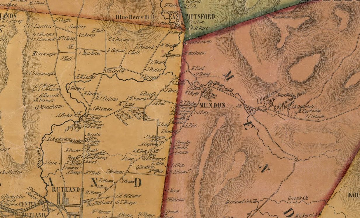 Inset from Scott's 1854 map of Rutland County, Vermont Inset from Scott's 1854 map of Rutland County, Vermont END of PART ONE In part two we'll continue our journey along "The Road Over the Mountain". SOURCES: 1795 Vermont Map by Carey: http://vtroads.com/downloads/vt_1795_CareyWEBdown.jpg GoogleEarth imagery Beers Atlas of Vermont, Rutland County, 1869. www.davidrumsey.com/luna/servlet/workspace/handleMediaPlayer;JSESSIONID=30728d37-3c5d-492e-a353-da3e61cd3115?lunaMediaId=RUMSEY~8~1~226869~5506969 1817 Samuel Lewis Atlas map of Vermont: www.loc.gov/resource/g3750.ct000097/?r=0.233,0.633,0.313,0.139,0 1854 Map of Rutland County by Scott: www.loc.gov/resource/g3753r.la001190/?r=0.523,0.48,0.242,0.107,0 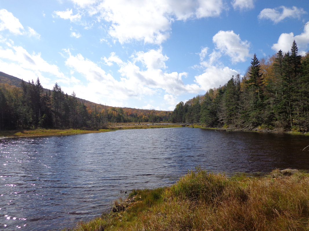 Large Beaver Pond Near the Base of Mount Moosilauke Do you have a favorite place? Is it somewhere public, or is it a "private" spot? Years ago, someone told me their favorite two places were Hampton Beach, NH, and Fenway Park in Boston, both public places. At that time, they were favorites of mine too. But times have changed. Places are important to me, as I'm sure they are to you too, and there are certain criteria for even being in the running for my list of favorites. These days, first and foremost, I like a peaceful place, where I can be alone with my thoughts and nature, or maybe read a good book. The presence of a river, stream or beach on a pond or lake, and/or a long-range view can help a lot too. Last spring, I found a really neat spot, not too far from where I live, near a local trail. I found it to be extremely peaceful, and beautiful, with views to the east, through the mature, twisted and bent hardwoods along the ridge. I could tell others had spent time there, many years ago. The old field had grown into forest, and the stonewalls were half-buried, but it had that sense of being a great place, known to others long ago. 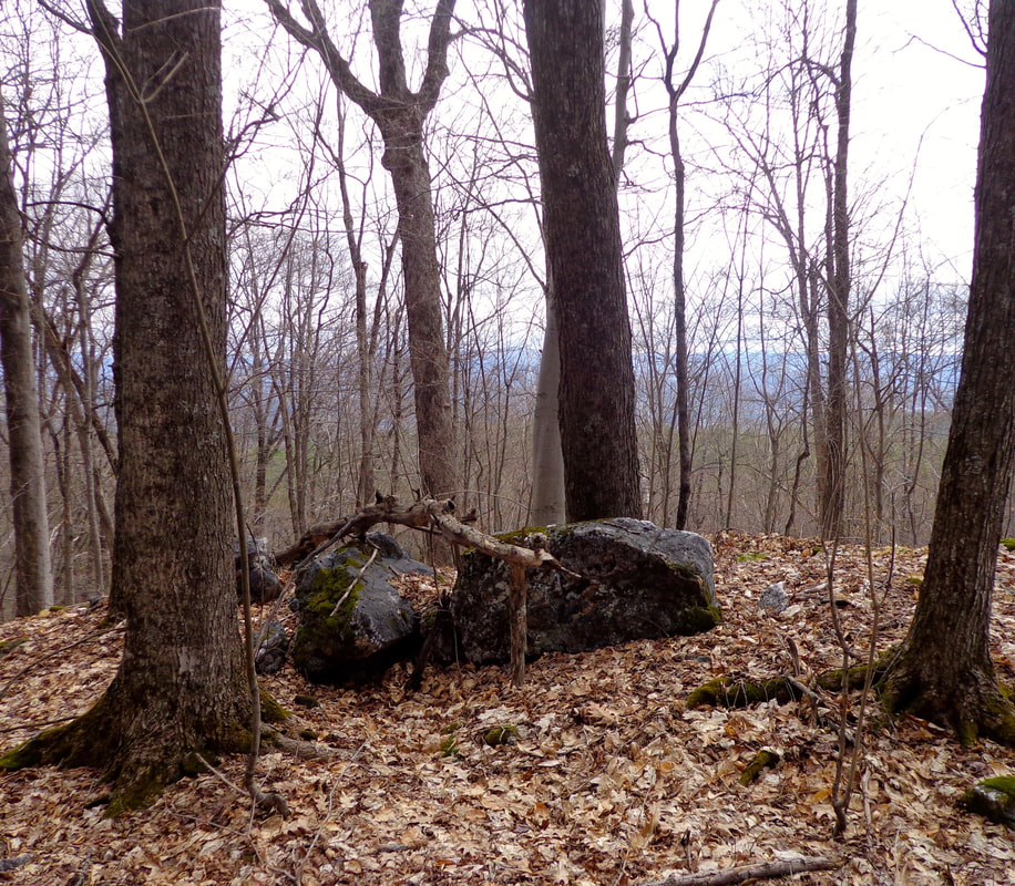 One of my recent favorite spots: A place to sit; quiet and peaceful, with long-range views. One of my recent favorite spots: A place to sit; quiet and peaceful, with long-range views. A week or so ago, thanks to a migraine headache, and a good friend, I found a quieter, more remote spot that I like even more, in the foothills of the White Mountains, though it takes a bit more effort to get there. 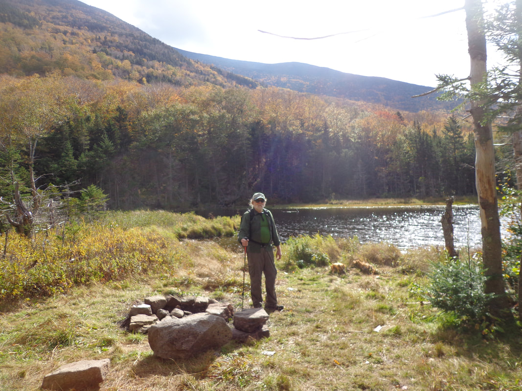 My friend Mike Z, at our destination. For many years, my backyard had been my favorite spot. We live on a small dirt road, off of another dirt road, and it's been a historically peaceful neighborhood. Sometimes, in the afternoon, I like to read in my backyard, by our small pond, and sometimes, I drift off to sleep. In recent years though, there has been a lot more sudden, unexpected noises. Do you remember when heavy trucks and equipment did NOT have backing-up beepers? While the traffic on the road has increased, the thing I've really been noticing is the AIR TRAFFIC. I've been noticing this increase during the last few years. It may have something to do with that funny looking thing with the fence around it down on Beaver Meadow Road. I've been told that the thing, (a transponder?), helps jets land at the Lebanon Airport, during cloudy weather. It's quite noticeable these days. It starts with a faint, high pitched sound, which quickly gets louder, until it's literally screaming, right over our heads. We are about 400 feet above the elevation of the Connecticut River, and I would guess the jets are barely a hundred feet or so above us, at times, as they descend into West Lebanon. A few weeks ago, I was enjoying some afternoon time outside, in our backyard, reading. I started to become conscious of a "wooshing" sound, like a jet was coming in from the southeast. Then the sound faded, and I forgot about it. A minute later, I started to hear that sound again, and thought, "Okay, a jet is coming....where is it, and when will it get out of here?" I looked around, didn't see a jet coming, and the sound faded again. A minute later, it came back again! I thought, okay, what's going on? The sound ebbed and flowed, cycling over and over for about ten minutes. it was strange, and disconcerting. The next day, I read that F-35 jets were practicing taking off and landing at Lebanon Airport. Hmmm....will this be happening often? I tend to notice these things because I spend most of my free time outside during the warmer months, and this summer had been extremely dry, so I was outside just about all day, every day. And, with the pandemic, I've been spending most of my time at home. I'm mentioning all this to point out how times have changed, at least in the last thirty years or so. There's just more going on, and more loud sounds being made. Period. ____ PEACE _____ This brings me back to the idea of a favorite spot; one that is inherently peaceful, by virtue of where it is, the setting involved, and what is going on around and above. Peaceful spots are out there, but they are getting harder to find, farther away, and generally more expensive. Back to my new favorite spot: I went for a hike with a friend on Thursday, October 1st. We left around 6:45 AM, and drove up into the foothills of the White Mountains, a drive that took about an hour. We were going to hike to the summit of Mt. Moosilauke, but I wasn't really sure if I was up for it, after a bout with a migraine the night before. After about fifteen minutes on the trail, my head was starting to pound, and the thought of continually hiking uphill another few thousand feet wasn't seeming like the greatest idea to me at that point. I appealed to my friend, and he and I decided to try to find something with less of an elevation change. I'm glad we changed our plan, because we ended up in a spot that was peaceful and beautiful, that I didn't know about previously. 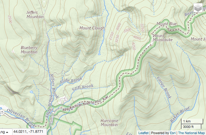 Map courtesy of: https://viewer.nationalmap.gov There's an old road not far from the Glencliff Home, that is now a trail, that begins along Slide Brook. I figure the stream is called Slide Brook because the stream begins at the base of one of Mount Moosilauke's ravines, where harsh weather causes rock slides. The brook is filled with large and small boulders. We headed out on the old road, which, as it turns out, has four major stream crossings. The day we headed out on the trail there had been a substantial rain storm recently, and the brook was flowing very well, making it a bit of a challenge at the crossings. 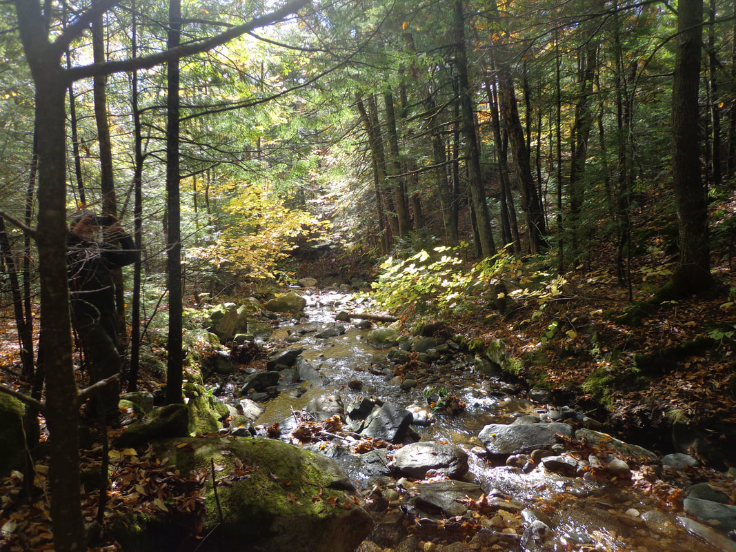 Slide Brook, Along the Tunnel Brook Trail. At one point, there were some beautiful ledges that jutted out over the brook. That was probably a great place to wait out a downpour. 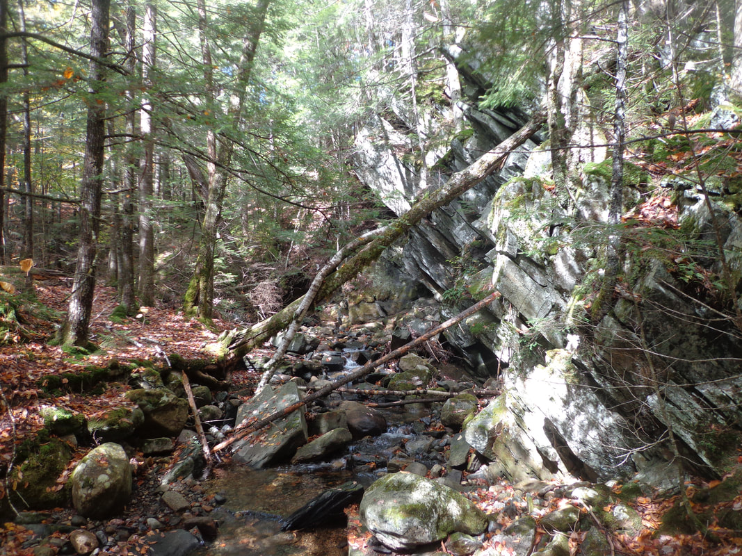 Ledges along Slide Brook Eventually we came to a very small reservoir that had been repaired since Tropical Storm Irene hit in 2011. It was a peaceful spot, with a bench at the shore, but it was not our destination. Our destination was the Beaver Ponds, which, on the map look to be the headwaters of Tunnel Brook, in the valley between Mt. Clough and Mt. Moosilauke. My friend had been there about ten years ago, and we were hoping to hike there again. 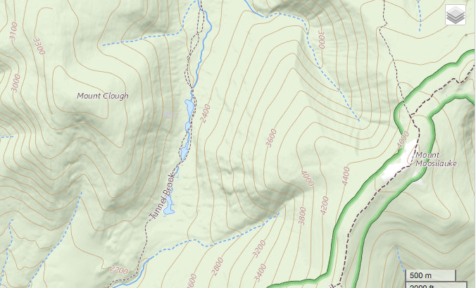 map courtesy of viewer.nationalmap.gov As we followed the trail, and criss-crossed the brook beyond the reservoir, the trail climbed more steeply, and eventually, Slide Brook headed to the east, away from us, toward the base of Mt. Moosilauke. After about a two mile hike in, we began to get views of the majestic mountain, one of the "4000 footers" in the White Mountains; a peak with a lot of history. Here are our first glimpses of Mount Moosilauke through the trees... 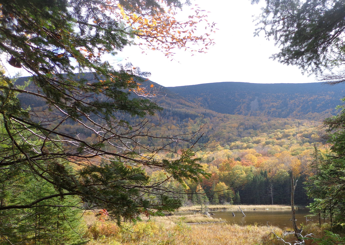 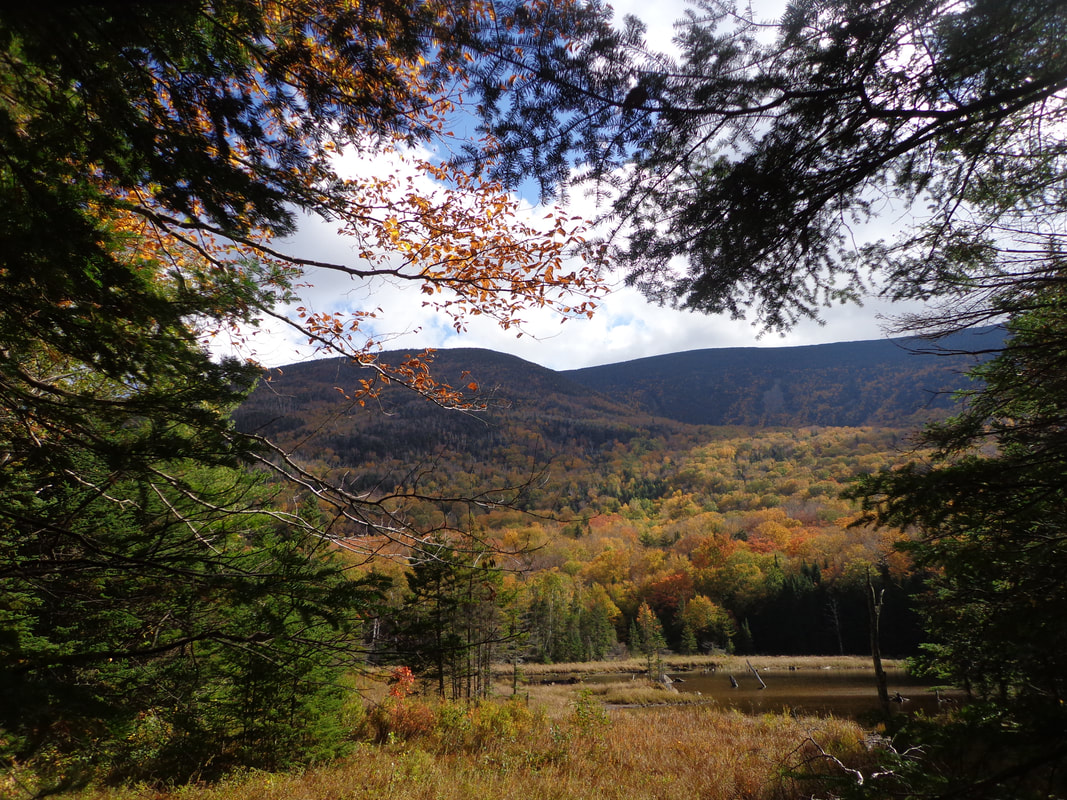 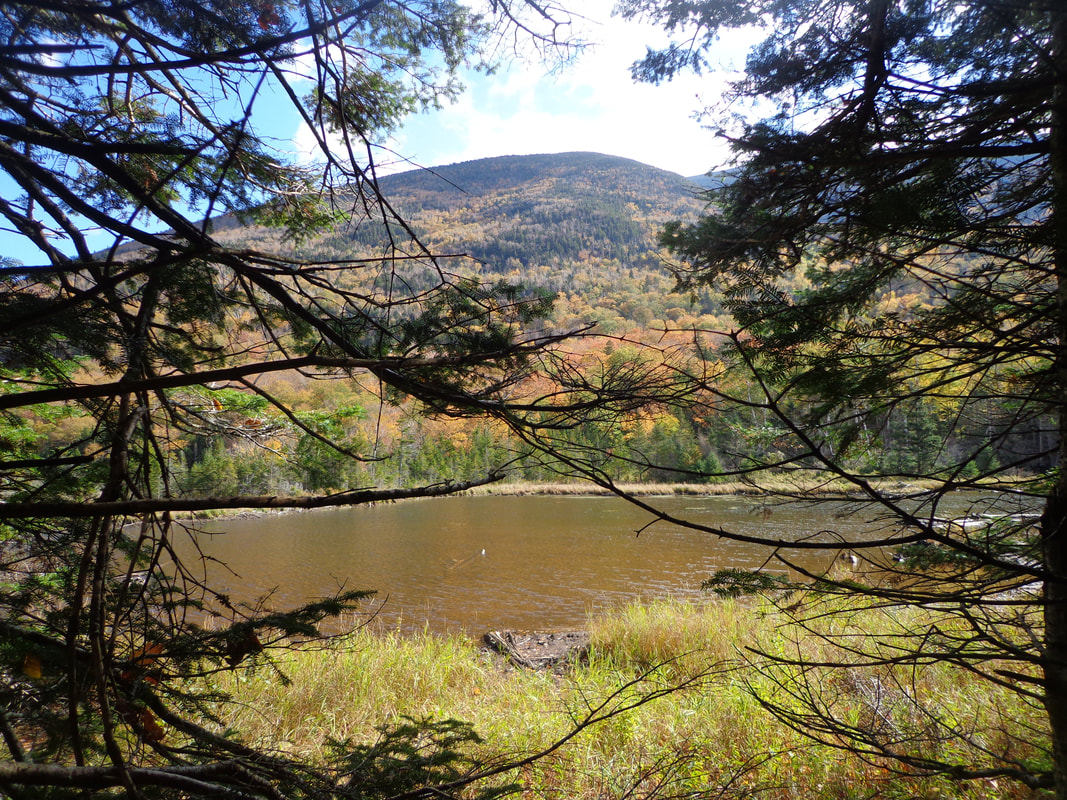 Beaver Ponds at the Base of Mount Moosilauke, NH. ...and we found the series of beaver ponds that represented the beginning of Tunnel Brook, which descended from the ponds, to the north. 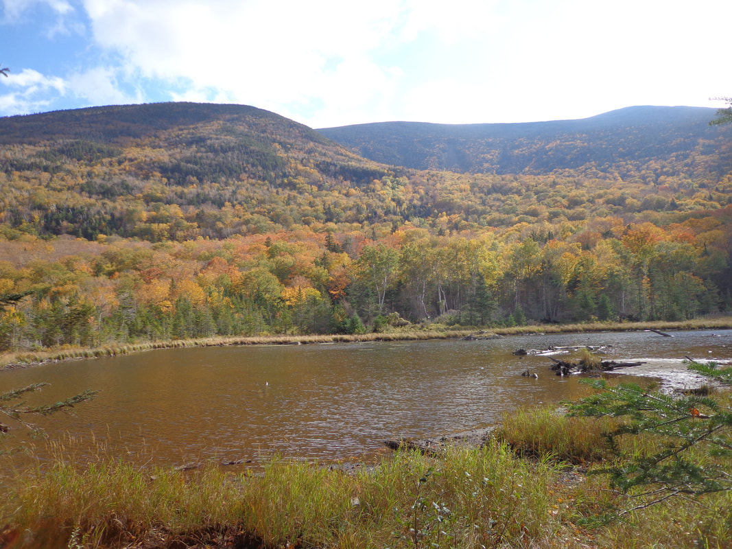 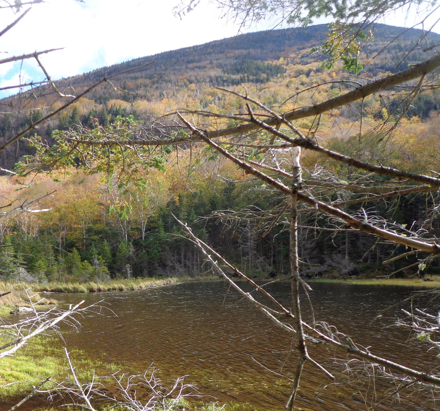 This was the spot we were hoping to find, but I had no idea how peaceful it would be there! It was as if there was no one, no vehicles, no air traffic, or machines within hundreds of miles. It was SO QUIET! In fact, the quiet kind of bothered me a little, as I thought there should at least be more insects and birds around. There was the occasional crow, chickadee or blue jay, but not many birds at all while we were there. At the north end of one of the ponds, we found a simple, small campsite with a stone firepit, stones for sitting, and a small beach. We found peace there. It was such a peaceful place! 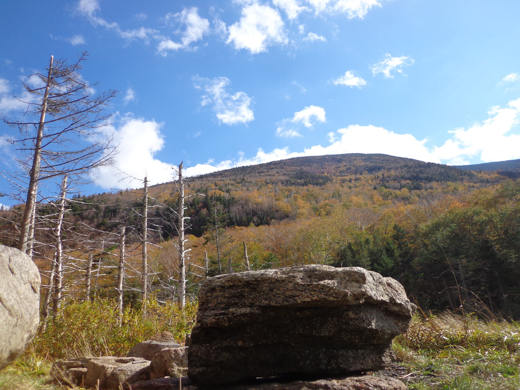 Stone Bench at Campsite... 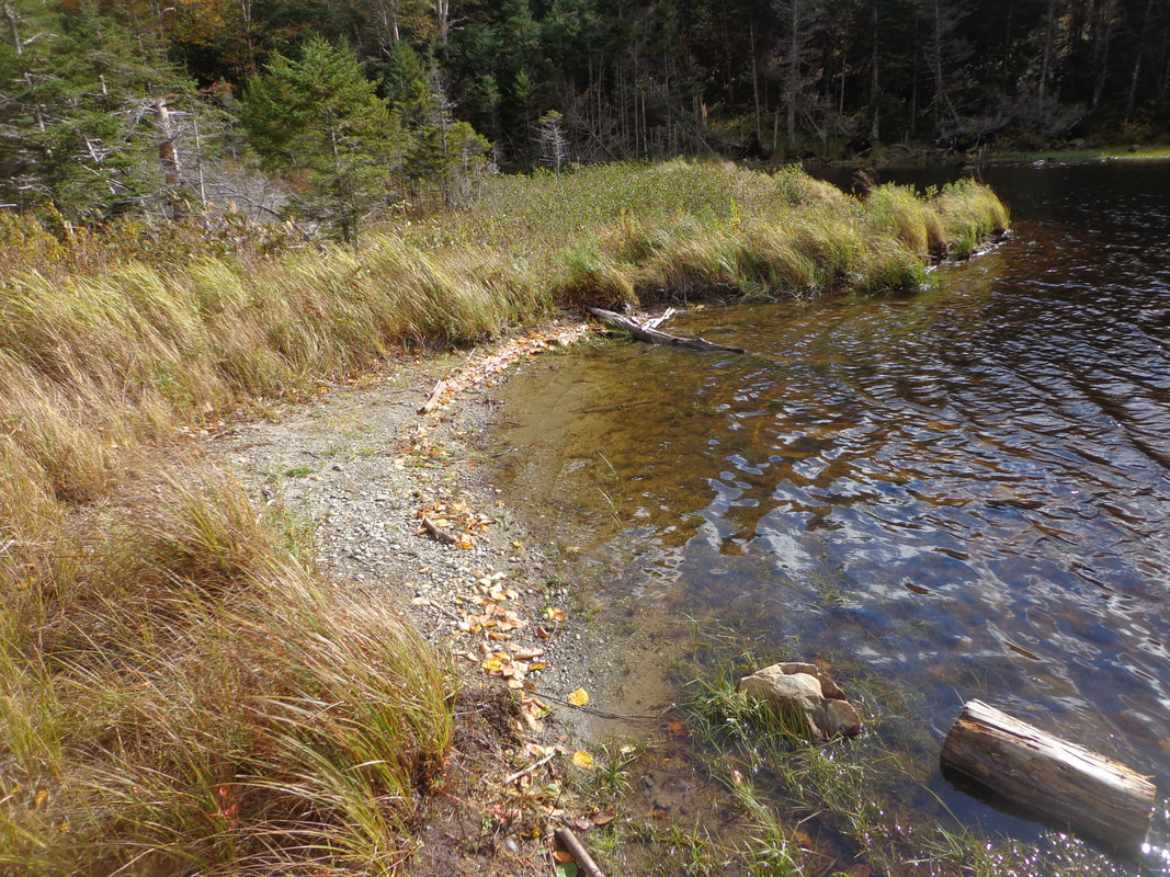 ...and a Small Beach. ...and a Small Beach. At the campsite we took off our day packs, and had a break for lunch. The views of the lake and the mountain were stunning, and well worth the four mile round trip hike, to experience them. As we sat there in the quiet, eating our lunch, I thought how this scene may not look all that different from how it looked here many years ago. It was probably more of a marsh before the beavers moved in, and if you go back about 400 years, there was old growth forest here, and probably more wildlife, but basically, it looks to me, as though not much has changed here in a couple hundred years. At least, there were no houses or camps to be seen, no power lines, no noise, nor any sign of human residence, other than the trail and the little campsite. 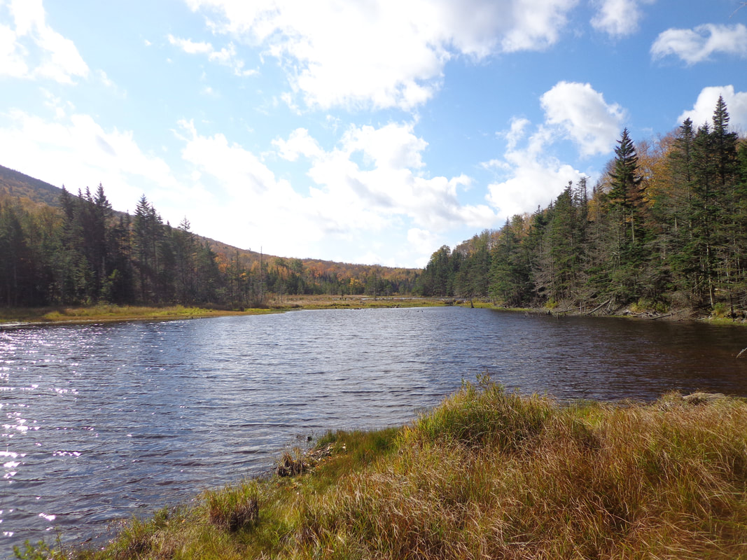 Is a two mile hike into the woods, with several challenging stream crossings worth it to find a beautiful, peaceful spot for lunch? 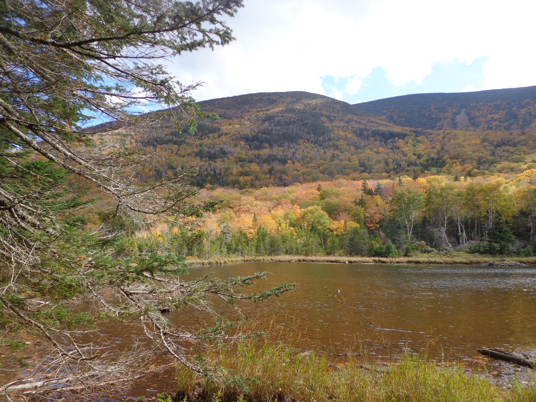 You bet it is! Thanks for hiking down Old Roads, Rivers and Rails! New subscribers are always welcome, feel free to share articles with your friends. Comments are welcome at the end of this article. Send any correspondence, or subscription requests to: [email protected] Sources and Suggested reading: From: http://www.cowhampshireblog.com "The Strange Haunting of Mount Moosilauke" Google Earth, Mt. Moosilauke https://viewer.nationalmap.gov/basic/ Wikimedia commons: (Open source photography) 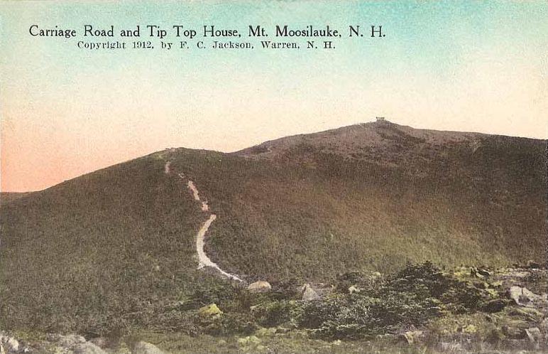 Early Postcard of Mount Moosilauke, Showing the Old Carriage Road. 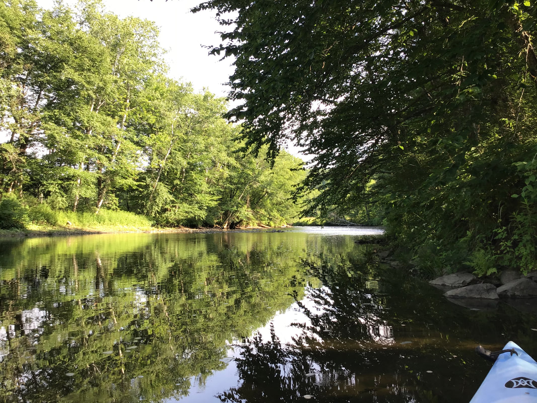 I didn't have to think for long, when my friend Mike Z asked me if I wanted to go kayaking on Tuesday morning, 7/7/2020. The last time I had gone with him we saw a moose at the McDaniels Marsh in Enfield New Hampshire. This time though, we decided to go exploring a little closer to home, on the Ompompanoosuc River, or "The Pompy". 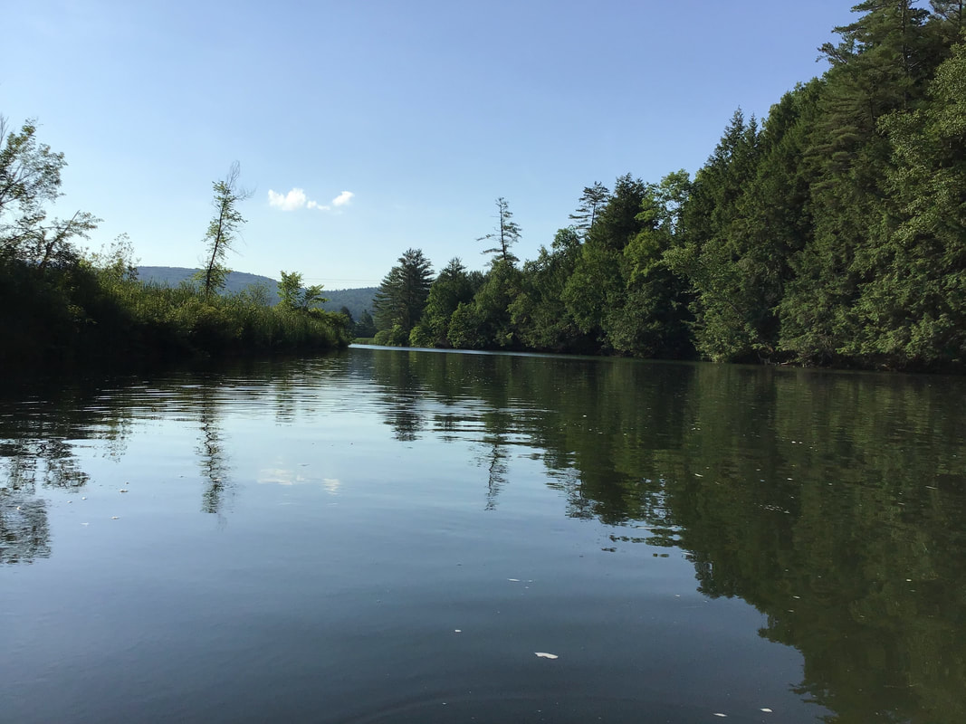 The Placid Pompy We drove up Rt 5 north a few miles from Norwich, took a left on the Old Bridge Road, just before Rt 132, and parked at the little boat ramp. It was about 8:00 AM. Within minutes, we were floating in kayaks on the Pompy, heading under the first bridge, Interstate 91.  Shortly after that, we were headed under the Rt 132 bridge, and began meandering up the Pompy, alongside of one of my favorite roads, Cambell Flat Road. 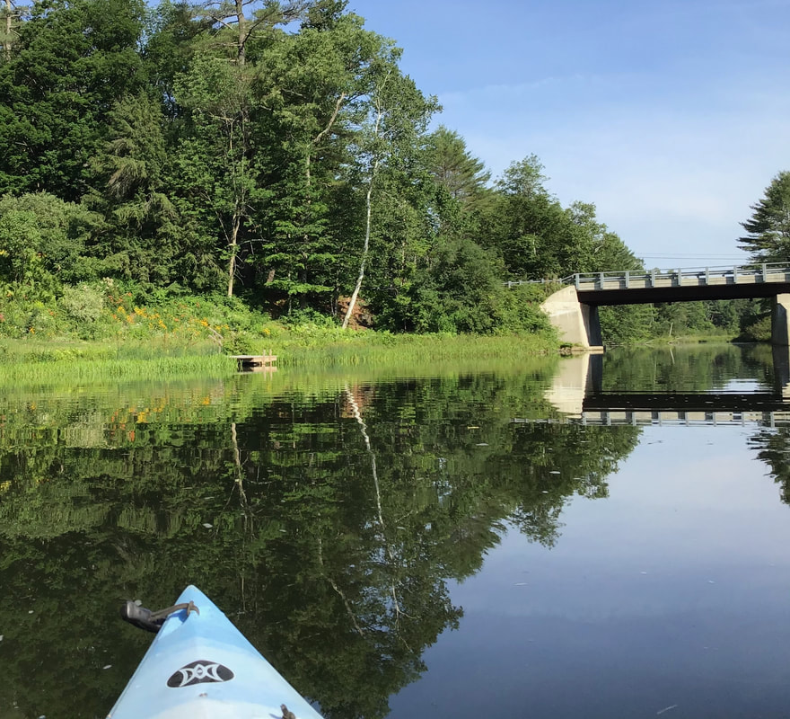 Back when I was commuting to and from Post Mills, Campbell Flat Road became one of my favorite routes; a meandering dirt road, flanked by fields. In the mornings I would drive by corn fields and cows. In the evening I enjoyed the rays of the setting sun as I turned into what used to be known as Pattersonville.  A Peaceful Perch on the Pompy. Suddenly, my eyes caught movement in the water, right in front of me. At first I thought it was a fish, but upon closer inspection, I saw a chipmunk doing the dog-paddle, or rather, the chipmunk-paddle, across the river, right in front of me! I could have reached out and grabbed it. The chipmunk looked at me for a second, and then swam about as hard and fast as it could and made it across the river. To me It looked like a cartoon character; something I had not expected. It all happened so fast, I wasn't able to get a photo or video. 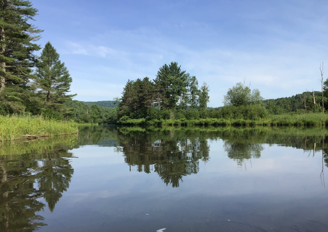 We came upon a spot in the river where a mother merganser and her brood were having a great time practicing fishing. I was able to get a short video of the cute youngsters during one of their first fishing expeditions. The 31 second video can be seen here: https://www.youtube.com/watch?v=Ut8q8g_-Pm8 While paddling along we were serenaded by many birds, including one of my favorites, the woodthrush. Here are some more photos from that glorious morning in July: 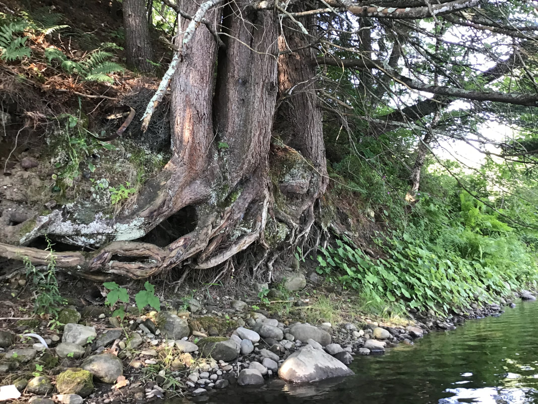 The resilience of trees. 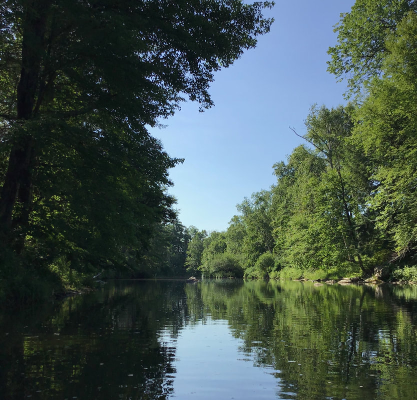 Contrasting light and shadows on a bright morning, about two weeks after the summer solstice. The western shore of the Pompy: 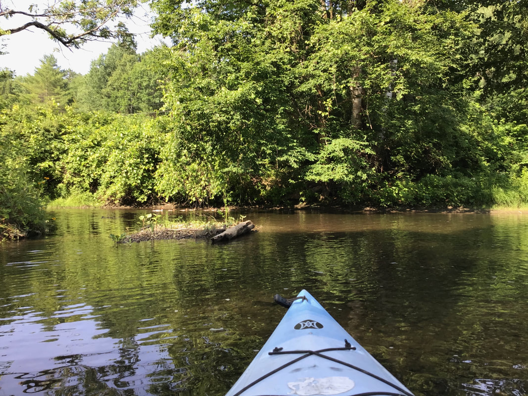 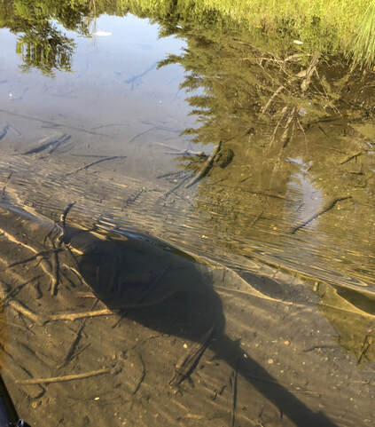 We turned around bellow Union Village, as the water level became increasingly shallow. Heading back toward the Connecticut River, the Pompy widens out. 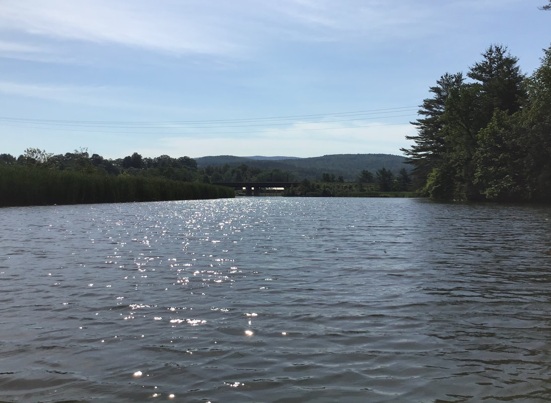 We detoured through the cattails, reeds, and lily pads behind the interstate bridge, before heading back to the boat ramp. 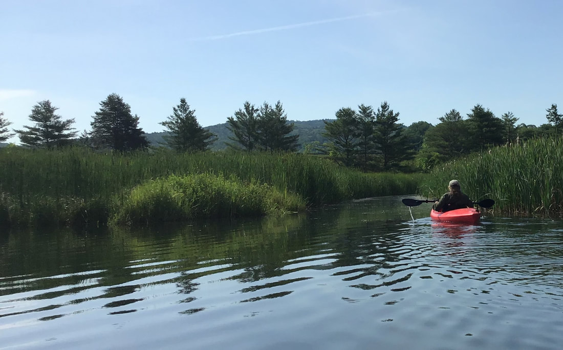 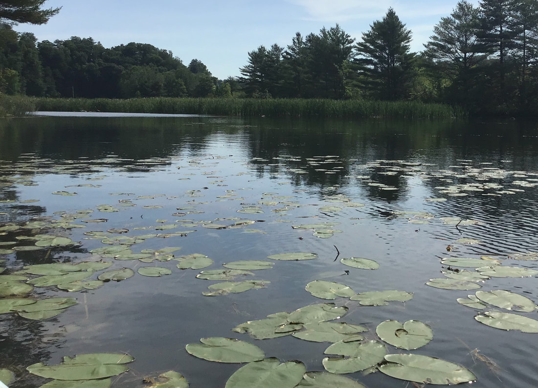 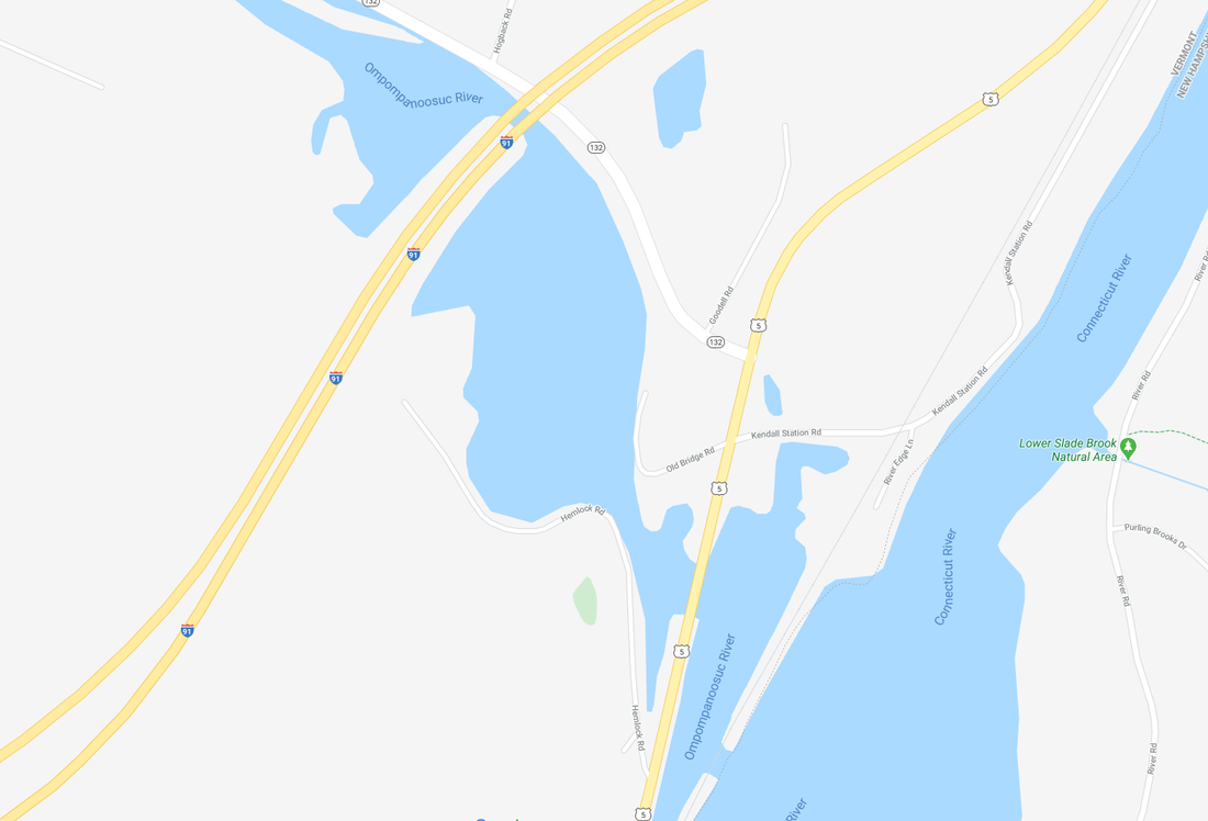 Map courtesy Google Earth Years ago, this area was known as Pattersonville, after the Patterson Chair Company, which was once a thriving business and employer in the area. I like to imagine what this area was like before european settlement. It was probably an ideal place for fishing, back before the interstate; before the Wilder Dam; before Route 5; before the railroad, when animal paths were followed by indigenous populations, and slowly widened by human feet. I've read that this area was found to be rich in arrowheads and spear points, found while excavating for the interstate highway. What is now the boat ramp on Old Bridge Road, was the site of the covered bridge that brought traffic over the Ompompanoosuc River on the former path of Route 5. 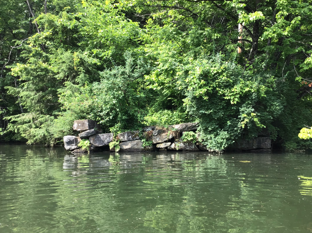 Remains of Former Bridge Abuttment Stones More information on the rich history of this area can be found at the Norwich Historical Society's website. There you can download an interesting podcast called "Rivers and Mills" that can be accessed here: norwichhistory.org/historic-driving-tour-podcast-rivers-and-mills/  Old covered bridge. Photo taken when Old Bridge Road was part of Route 5. Today, this is the site of the boat ramp. Photo courtesy Norwich VT HIstorical Society. Thanks for cruising down Old Roads, Rivers and Rails of the Upper Valley
with me, Bob Totz Good related article with photos: History of "Pompanoosuc" https://norwichhistory.org/wp-content/uploads/Pompanoosuc-Hamlet-History.pdf To be added to the list of subscribers, or to correspond, just send an email request to: [email protected] Subscriptions are free. Comments are appreciated, and can be entered below. In the previous post, “What The Heck Are These?”, we looked at some interesting features on a LiDAR map, in Sharon VT, just over the Norwich line, in the forested area between Sugarhouse Road and Chapel Hill Road North.  The LiDAR imagery for the area, (above), shows the Features in Question. By the dark shading, they appear to represent some features that jut up from the surface. Reconnaissance: A couple of weeks ago, I took a walk about two miles out Sugarhouse Road with Dave Phillips, his wife Chris, and their dog Betty. Our goal was to scout out the area, and also to try to walk as far as Krivak Road, which appears to connect with Sugarhouse Road, on old maps. The map below is from the USGS 15 min. series, from 1896. You can see that if you wanted to head from West Norwich, (bottom, center), to South Strafford, (top, center), or vice versa, this would have provided a fairly direct route. I wonder what they called the road back then? Today the route would be Sugarhouse Road, and Krivak Road, and then Downer Forest Road, but back in the 1800's, I suspect they all had several names, depending on who you asked. 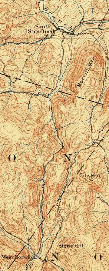 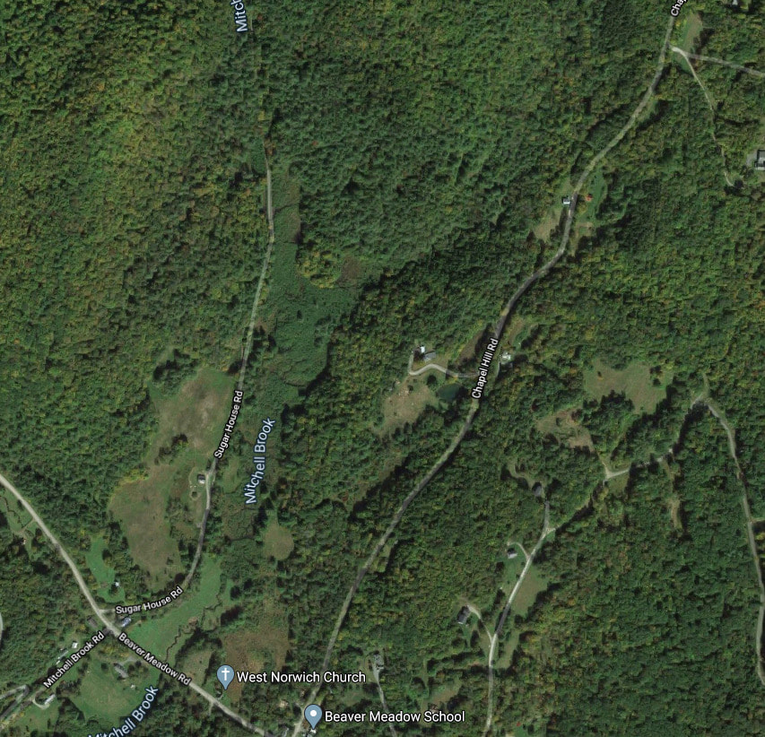 2020 Imagery courtesy Google Earth Dave, and Chris and I had a pleasant summer morning walk out Sugarhouse Road. The road had a mix of sun and shade, and Chris used a large fern as a fan to ward off the mosquitoes, blackflies, and other assorted flying pests. 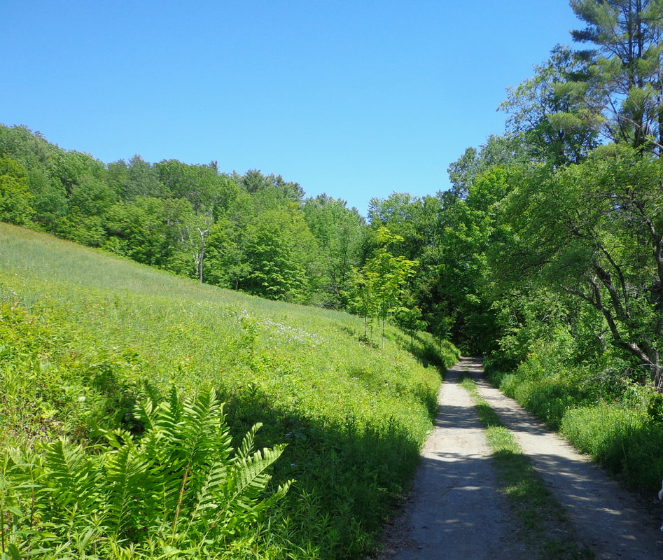 Sunlit Sugarhouse Road As we walked along, the beaver meadow was to our right, while sunlight and shade alternated.  Soon we came to a pond to our right, and a culvert, so that Mitchell Brook was now flowing on our left, as the meadow gave way to forest.  Not long after leaving the meadow, and entering a wooded area, we saw what may be the old sugarhouse for which the road is named. The sugarhouse seemed to be in a spot near a ravine shown on the LiDAR map, that could lead to those Features in Question. We made note of it for possible future treks, and continued north on Sugarhouse Road. The road was much shadier during this portion of the walk, and eventually, we noticed a clearing up ahead. As we approached, we found a beautiful old farmhouse with a sign on it.   Sign on the barn at the old farmhouse. The Hosea Doton 1855 map of Windsor County Vermont doesn't show this farmhouse, as it hadn't been built yet! Beyond the farmhouse, we again entered the woods. After another mile or so, we took a left fork, which led us past an old foundation we almost missed...  Our path opened up, but then looked like it came to an ambiguous fork. Below shows the area where we turned around.  Our time was running out, and we decided to walk back to our vehicles. By the time we got back to Beaver Meadow, we had walked over four miles. Reconnaissance 2: Hiking In From the Other Side A week or two went by, and I received an email from Old Roads subscriber, Doreen Guilette. Doreen had read the first article about these features, and decided to go out and search for them. She hiked into the woods from Chapel Hill Road North, where she found some beautiful ledges. She suggested they might be the Features in Question, and invited me to take a hike and check them out with her. Below is the photo she sent me.  Probable "Features in Question": Ledges photo by Doreen Guillette. When I saw the photo that Doreen had sent me (above), I was excited to see the large outcroppings she had found. Several days later, I met Doreen and she led me from Chapel Hill Road, through a meadow, then straight up a hill into the woods. There we found a narrow ridge trail, which we crossed. Then we descended downhill, deeper into the forest.  Soon she was showing me the beginning of a line of ledges, cliffs and outcroppings, that to me, were quite spectacular, in their own humble way. I immediately started snapping photos. 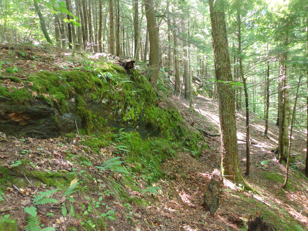 Looking east, I noticed the ledges increased in height, from west to east. 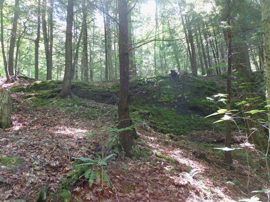 As we walked along and below the ledges, they increased in size and grandeur. 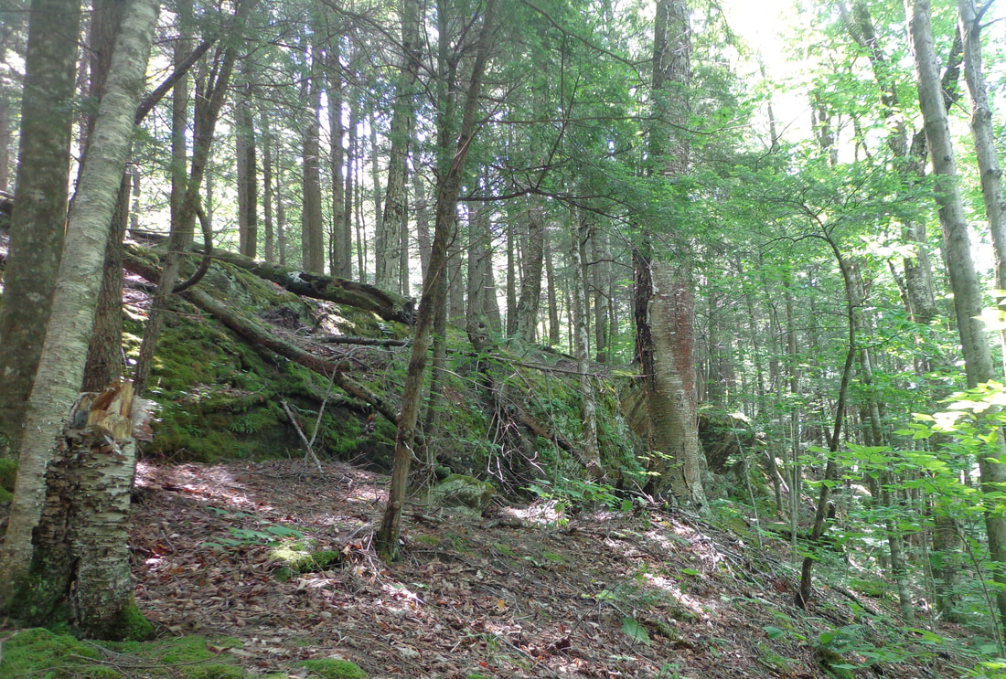 In person, the ledges appeared to be continuous, however on the LiDAR map, the features looked separate. Perhaps built-up vegetation between the ledges made them appear continuous in the forest. 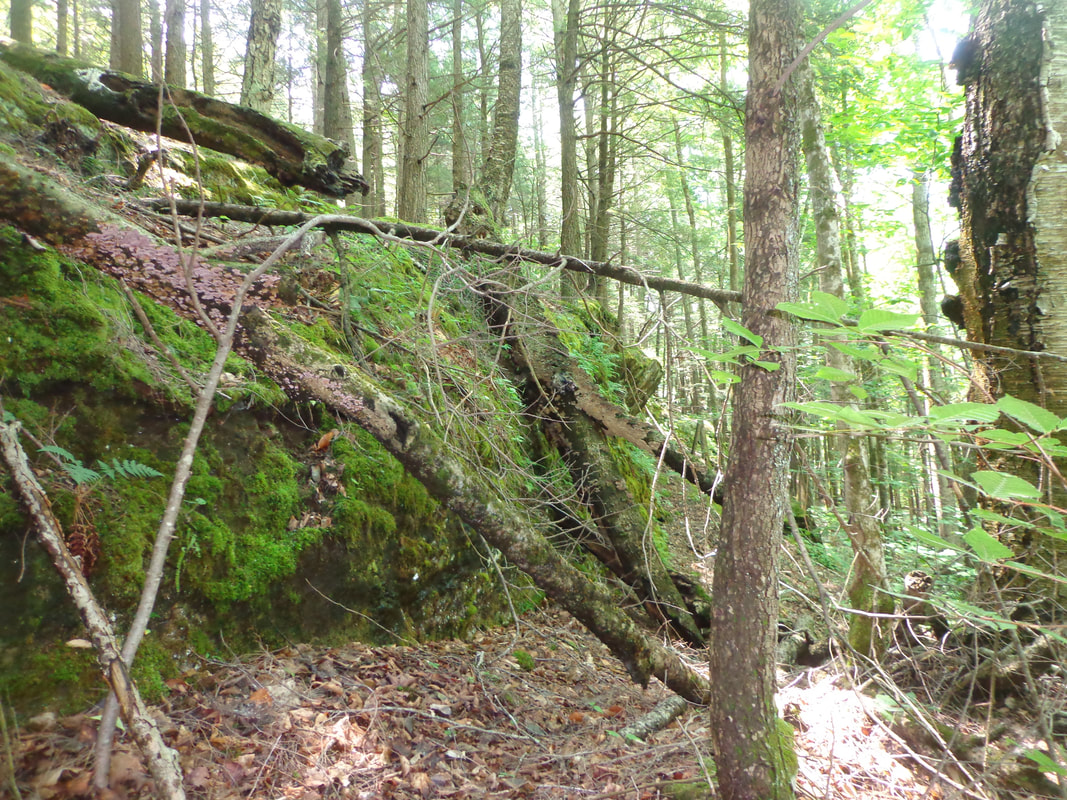 A very natural, moss-covered outcropping. 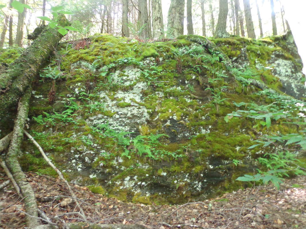  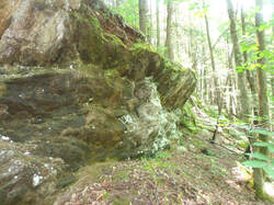 My favorite spot along the line of ledges 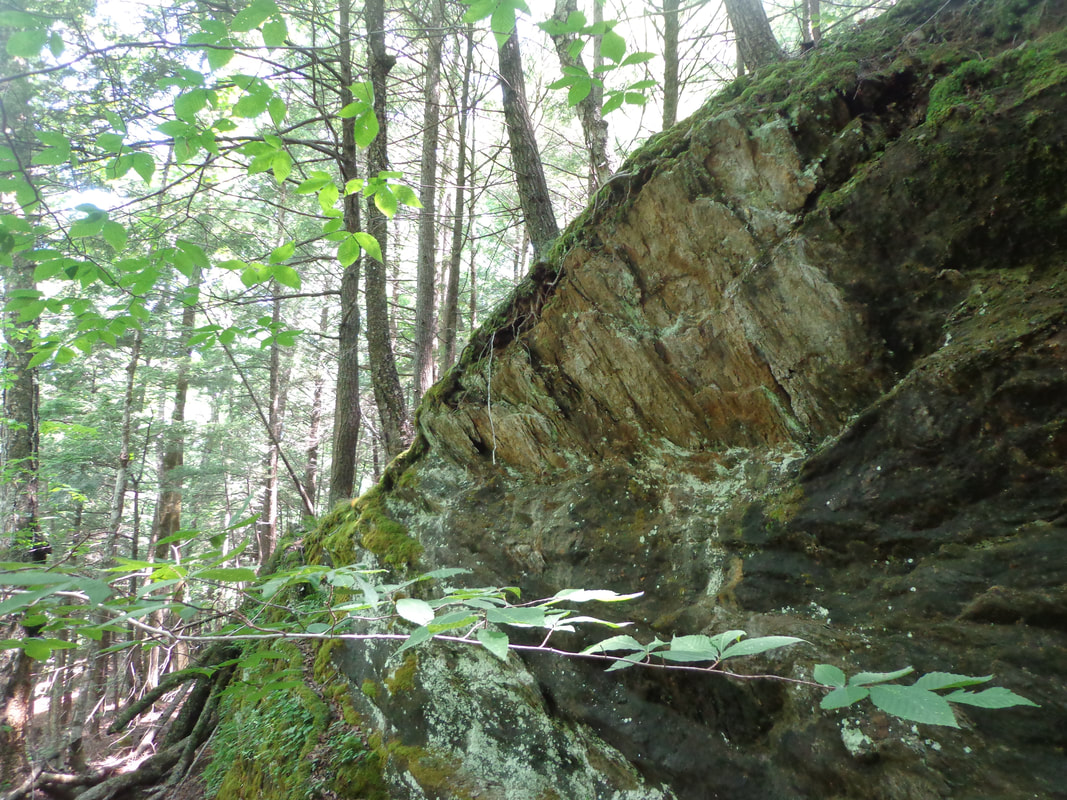 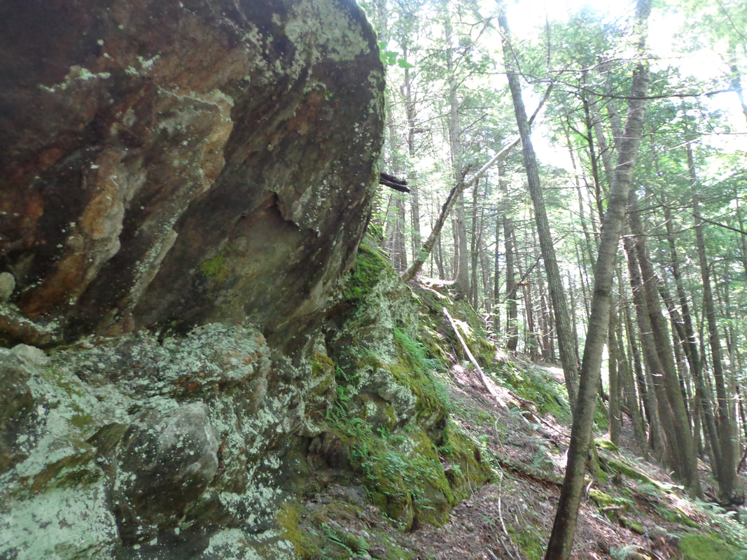 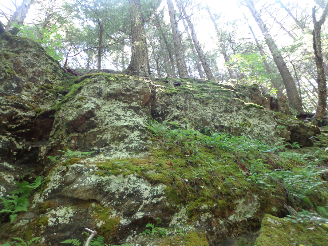 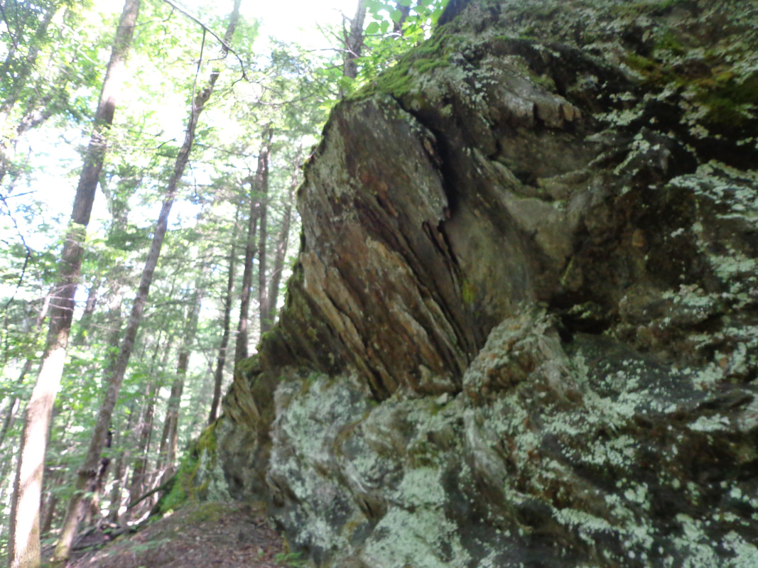 Having first seen those interesting features on the LiDAR map a few weeks earlier, I was thrilled to be seeing them in person. After investigating the ledges, we headed downhill, to the brook, and then upstream a short distance, before heading back uphill toward the ridge we had been on earlier. This time, we headed north along the ridge trail, and then came back down on the Chapel Hill side, where Doreen showed me this fine example of an old stone foundation. 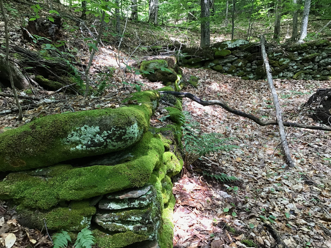 Sturdy, well-built stone foundation, still appearing straight. Upon returning home, I received an email with a map from Doreen, with the route we took outlined on it. Doreen had been using a GPS app on her phone to track our route. From the informaiton on Doreen's map, compared with the VCGI (LiDAR map), I thought there might be more ledges about 50 feet higher up, a bit further to the south. We may be heading back there to investigate sometime. 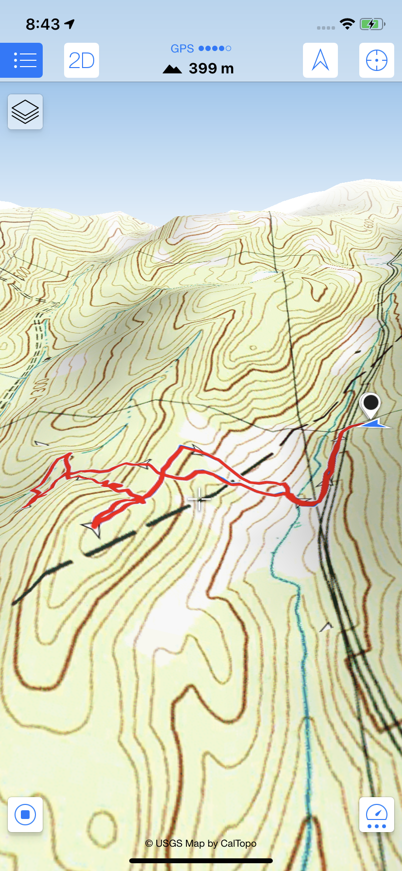 Map of our route, from the app: "Maps 3D" Shown below are the Features in Question, a.k.a Ledges, with a layer of topographic lines at one-foot intervals. The dot indicates the area w.here I believe we photographed the ledges. The highest ones, furthest to the south, are shown to be at about 1400 feet in elevation, which leads me to believe there are more out there that we haven't seen yet.  Even without the ledges, the forest was very beautiful! You never know what you may find!  This turned out to be one of my favorite explorations this year. I love seeing something interesting on a map, and then going out to see it for real, if it can be found. What makes that even better, is having someone to show me the way. Thanks, Doreen! Thanks for hiking down Old Roads, Rivers and Rails of the Upper Valley
- Bob Totz - July 12, 2020 Comments can be made at the end of each article. To subscribe to or correspond send an email to me at: [email protected] Sources: 1896 USGS Topo Map: https://ngmdb.usgs.gov/topoview/viewer/#13/43.8784/-72.4512 Vermont Center for Geographic Information Map Imagery: maps.vermont.gov/vcgi/html5viewer/?viewer=vtmapviewer Cell Phone app: "Maps 3D" 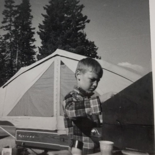 Cooking Breakfast at Cedar Breaks, Utah, 1968 Cooking Breakfast at Cedar Breaks, Utah, 1968 If you've ever been asked for a "Bio" of yourself, you'll find it to be an interesting project! Here is what I wrote today, at age 60, trying to be concise, yet complete: BIOGRAPHY of BOB TOTZ I was born 1n 1960 and grew up in Wallingford, Connecticut, about 15 miles north of Pepe's Pizzeria, I mean, New Haven. CAMPING AND MAPS Starting around 1964, my family used to go camping in the summers, first with a tent, and then with a tent-trailer, or pop-up camper. Ours was a Nimrod, Riviera model, which my father modified in order to add a bed and increased storage. At first, our camping trips were confined to the shore of Connecticut, and then in subsequent years we began to travel farther, first in New England, then Pennsylvania in 1966, Florida in ’67, and in 1968 we took a five week journey across the USA, to California and back, exploring the National Parks with a Golden Eagle Pass. A 1963 Dodge Dart was our key to adventure, and that little car never failed us. While traveling around the country, I often was in the front seat, in between my parents. While my sisters in the back seat reviewed the latest Archie comics, and other intellectual material of the day, I liked to look at the road maps, (which were given away for free at every service station), and see what interesting attractions might be ahead of us. Then I would watch, and compare what I saw from the car window, with what I had seen on the maps. I thought this was pretty cool! And that is where my love of maps, (Cartography), Geography and History began. UConn - 1978 - 1983 At the University of Connecticut I began my studies in the school of engineering, but soon transferred to the Geography department in the College of Liberal Arts and Sciences. There I took almost all the geography and cartography courses I could find, including Air Photo Interpretation, Satellite Imagery, Historical Geography, Map Interpretation, and many others. Move to Upper Valley - 1984 It seems like I have always loved to hike on trails and old roads in the woods. In 1984 I moved to the Upper Valley for a position in digital mapping. At that time, just out of college, I had been living outside of Washington DC, where I was waiting to hear from the Defense Mapping Agency about a position I was planning to take. However, a job offer in the Upper Valley, where hiking trails and fresh air abound, lured me away from the big city. The job in the Upper Valley paid a lot less than the job in DC, and it was a lot colder and snowier in the winter too, but the move was a decision I have never regretted. U. S. Postal Service, 1987 - 2016 After a few years in digital mapping and surveying, I took a job with the Postal Service in White River Junchtion. Within a year or so, I took a job in Quality Control, and later in Statistical Programs, in the Department of Finance. In Statistical Programs, I used to drive all over Vermont, visiting Post Offices large and small, conducting surveys on “live mail”. This gave me the opportunity to explore Vermont's hamlets, villages, towns and cities, mapping out my routes in advance. With this job I traveled from White River to Brattleboro, Bennington, Derby Line, Burlington, Fair Haven, and lots of little towns in between. While traveling around the state for the USPS Department of Finance, I found that I really liked the atmosphere in small town post offices, and that a postmaster’s position was something I might aspire to. In small town post offices, there seemed to always be a generally happy attitude among the postal workers, and among the regular customers who came to the window in the morning. In 1991 I married Jill, the love of my life, and we have lived in the same small cabin in Norwich for the past 30 years. In September 1991 I took an “Officer in Charge” assignment at the Tunbridge Vermont Post Office. What a great place! I really loved the job, and the community. Every morning, while I was sorting mail, Roger, the rural carrier would light his pipe and sort the mail to his route. At the same time, the “regulars” would come into the lobby and sit down and chat, while waiting for their mail. The door to the post office work area would be left open so that customers could chat with Roger, and me too, and we would be part of the conversation. I knew that technically the door to the lobby was supposed to be closed, (and locked), but I could see that this was an old tradition and that it was probably pretty safe to keep that door open in Tunbridge Vermont, at 9:00 in the morning, with all those good people there to help in the remote case of an emergency! The position of “OIC” or “Acting Postmaster” in Tunbridge Vermont lasted about four months, after which I returned to my position in the Finance Department in White River. This was January 1992, and soon the USPS was involved in an administrative reorganization, which resulted in my position being changed, and re-posted with different hours and days off, which did not appeal to me. I had decided I wanted to become a postmaster by this point anyway, and I transferred to the Norwich Vermont Post Office for more experience, less travel, and daytime work hours. After about a year and a half of working in the Norwich Post Office, I became Postmaster of Post Mills Vermont, where I worked as part of that unique community for over 19 years. I loved that job, and I still am in love with that community, and miss the great people I met there. The Post Office was, and still is, in the back of Baker’s general store, adjacent to the deli, and about a half mile from Lake Fairlee. I enjoyed learning about the history of the Post Mills area from local folks who grew up there, and had ancestors who had also grown up there. My golden retriever, Mickey used to help wait on customers, and at lunch we'd go for a walk and maybe a swim too. I could certainly write a book about my many experiences there over the years....hmmm...! In 2013, the Postmaster's job in Post Mills was eliminated however, and I was lucky to get the position of Postmaster of Sharon Vermont for my last three years with the Postal Service, before retiring in 2016. I met more great folks in Sharon, and have good memories of my three years there. Amateur Music Career I started playing harmonica at age seven, while camping. Both my father and grandfather were harmoonica players, so I had good teachers at a young age. At ten, I started taking trumpet lessons in school; actually it was a cornet. Also at age 10, I sang my first solo, "I'm getting nuttin' for Christmas" in a school concert. At about age fourteen I received a guitar for Christmas and learned how to play it from my best friend, Jamie Daly. From 1995 - 2013 I was a choir member at Saint Anthony’s catholic church in White River Junction, and from 2006 - 2013 I was director of the choir for the 10:30 AM Sunday mass. It was during this time that I began to compose music for choir, and in later years, for my own band. Highlights were our annual midnight mass at Christmas eve, which included brass instruments and organ. From 2005 - 2009 I was a member of the Upper Valley Community Band, and the Lyme NH Town Band, playing trumpet. In 2007, I had the honor of going to Joigny, France with the Hanover-Joigny Festival Band, where I played first trumpet for a five-nation, weekend band festival of “sister cities” from Britain, Germany, Italy, France and the USA. In 2012 I helped organize the acoustic band, “Out on a Limb”, which I left in 2017. The band still plays, and I occasionally “sit in” with them. 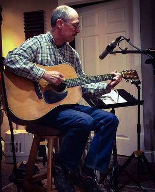 Recording Session May 2017 Recording Session May 2017 These days I play occasional musical engagements, with guitar, harmonica and vocals. I'm also a composer of folk songs, and my specialty is historical tales, such as “Morey Made the Magic” about Samuel Morey, resident of Fairlee, Vermont, inventor of the steamboat; and “Montreal Express” about the February 1887 Rail disaster over the White River in West Hartford Vermont. Old Roads, Rivers and Rails of the Upper Valley
In December 2018 I started my blog, “Old Roads, Rivers and Rails”, after publishing the music video / micro-documentary “Montreal Express”, where I combined my interests in History, Music, Photography, Geography, and Transportation. Shortly thereafter, I joined dailyUV.com as a paid blogger. Blogging was new to me, but writing was not, and I soon rekindled my love of maps, old roads, geography, hiking and history, as well as photography, applied to the Upper Valley of Vermont and New Hampshire. When the paid blogging platform went on hiatus in December 2019, I started the “Old Roads, Rivers and Rails of the Upper Valley" blog and website, for the fun of it. It can be found at: oldroadsuppervalley.weebly.com. Many of the stories I published in 2019 disappeared since the paid blogging site was discontinued. However, in ancticipation of that event, I spent a good portion of last December re-producing some of the more popular stories on the Old Roads, Rivers and Rails of the Upper Valley website archives. From looking at road maps on family summer trips in the 60's, to studying cartography at UConn in the 70's, to creating digital Zip Code boundary maps, and surveying in the 80's, to small town Postmaster in the 90's, and choir director in the 2000's, and now blogging about maps and geography, it's been a fun ride, which I'm thrilled to continue, and post about here at oldroadsuppervalley.weebly.com Thanks for joining me for the occasional hike along the old roads! - Bob Totz, Norwich VT June 27, 2020 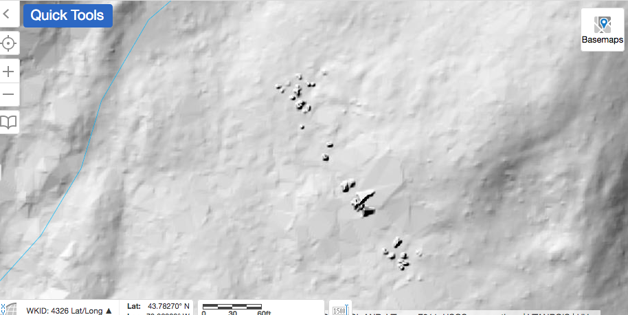 Do you see the features in the center of the LiDAR map above? I could use some help figuring out what they are! 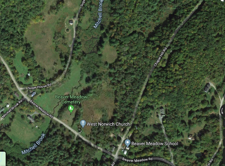 Courtesy Google Earth While preparing for a walk out Sugarhouse Road, in West Norwich, VT, I decided to look for anything interesting I might find out there, like ruins of old foundations, along the way, using LiDAR maps. That's when I found these interesting features, seen in the top photo above. My first guess is that they are very large boulders, or steep outcroppings, but I'm also wondering if they could have been made by humans. I have heard rumors of Native American ruins in that general area, though I've never been told exactly where, or what they may be. Researching with LiDAR maps is a good way to learn about an area you are about to explore. These maps can show geologic and man-made features, such as stone walls and foundations, mill sites, etc. Below is a much wider map of the area in question, showing only the LiDAR information; no overlays. You can see that you get a really good look at surface contours. 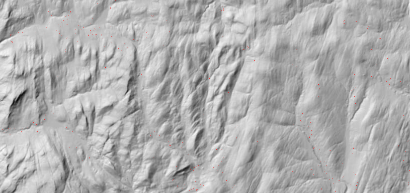 Now we'll add an overlay with some topographic lines and water features, below: 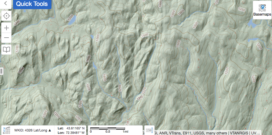 In the next shot, we pan out further, showing some major roads, (Route 132, I-89. etc), and some trails:  Below is the same area, but seen on the 1855 Windsor County map, showing Sugarhouse Road continuing through to Krivak Road, Sharon. In this view, we can see that families by the name of Wheeler, Hathaway, Smith, Hubbard, Pierce and Roberts had homes in the area where the road is no longer maintained today. I would expect to find remains of the old foundations out there. Some parts may be visible, and some buried.  PLANNING THE TRIP: Using the LiDAR maps available at https://maps.vermont.gov/vcgi/html5viewer/?viewer=vtmapviewer, I slowly followed Sugarhouse Road northward, from the start at Beaver Meadow Road, into Sharon. As seen below, starting out from Beaver Meadow Road, heading west towards Sharon, (lower right to upper left), Sugarhouse Road goes to the right (unmarked here). Just east of Sugarhouse Road, we can see the Beaver Meadow, with Mitchell Brook flowing southward, as a thin blue line. Thanks to LiDAR, we can also see an older channel of the brook, which flowed just to the west of today's channel. Beavers, weather, and humans have all participated to alter the flow of the brook here. In the lower right, we can see the mound that is the Beaver Meadow Cemetery. 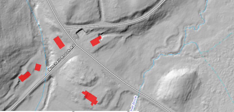 Heading north, up Sugarhouse Road, one would see the beaver meadow to the right. The following is a series of maps showing the progression along Sugarhouse Road: 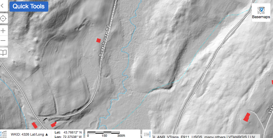 Below is a larger view, showing 2 ponds in the Beaver Meadow, to the east of Sugarhouse Road. 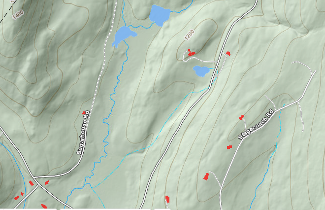 Beyond the ponds, Sugarhouse Road continues, and we see a 1400' hill to the west, while another hill begins to rise to the east. 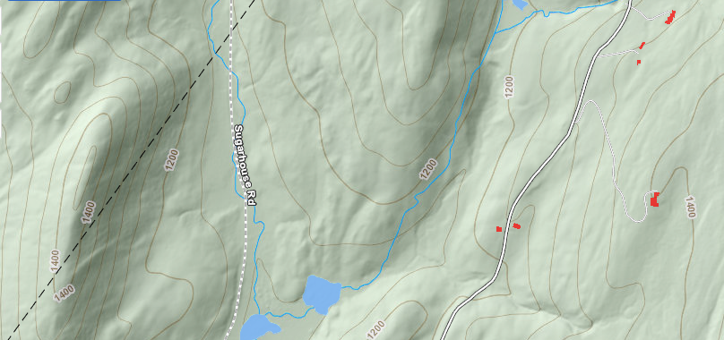 Continuing along Sugarhouse Road, we can see that the wide Beaver Meadow disappears above those two ponds, as the land to the east of Sugarhouse Road climbs to over 1300 feet in elevation. Sugarhouse Road continues, following the narrow valley of the main branch of Mitchell Brook. As seen below, a stream enters from the right, which is where things begin to get interesting. It's at this point that we begin to zoom closer in, and look for details. 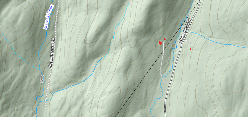 Below, getting closer, we begin to see the features in question, showing up as little shaded "dots'. 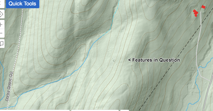 If we were to hike from Sugarhouse Road, inland to these features, we could veer to the east, and climb up, along the channel of the brook. Climbing uphill, and then to the right, we would hopefully find these features and investigate them. Please note, I would want to ask permission of the landowners before hiking up the stream bed. Below, looking more closely, we can see the features in question in the lower right. Also, "What is This?" refers to the interesting looking "half-square". I wonder if its origin might be related to the other features that brought our attention to this spot. Perhaps it represents what is left of some old walls, or could it possibly be of Native American origin? 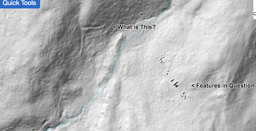 In the book, "A Guide to New England Stone Structures", by Mary Gage and James Gage, (Powwow River Books, Amesbury MA, 2006), reference is made to stone structures and enclosures built by Native Americans. These structures included stone cairns, enclosures, chambers, pedestal boulders, niches, manitou stones, and standing stones. Someone out there has probably visited this site, and knows what it's all about... and I'd love to hear from them! 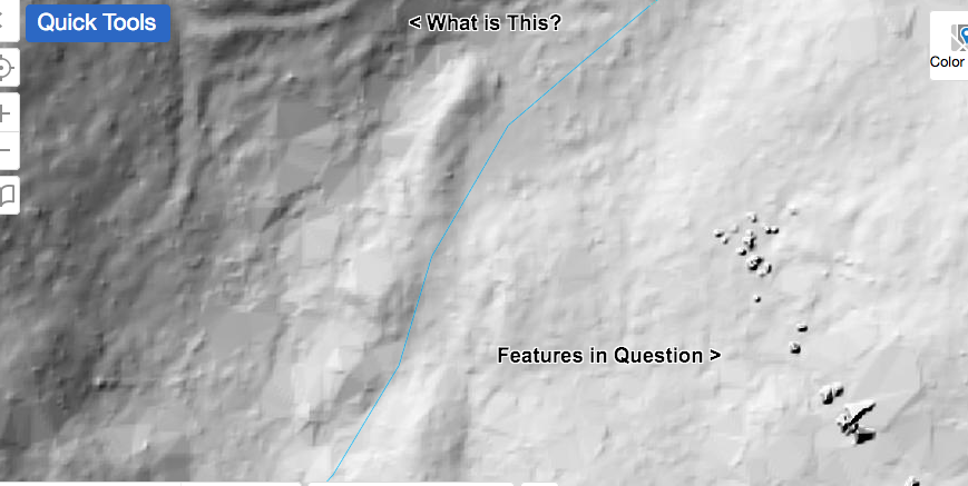 The map below shows the topography well. It appears that the features in question are near the top of a ridge, facing west. 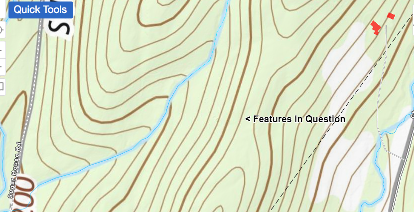 The map below is the same area, but it has an ESRI overlay. By viewing the same scene on different maps, you can sometimes discern patterns and new clues. In the view below, we can see that the features appear to be near the edge of a wooded area. 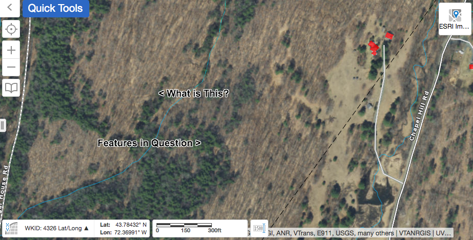 The map below is the same as the one above, except I used the LiDAR imagery slider bar only about half way, so we can see the features in question, along with the ESRI imagery. 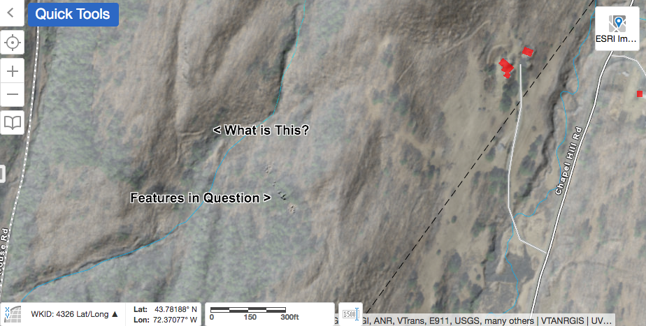 In the final map below, it appears there may be an old path, or logging road coming down on the right. 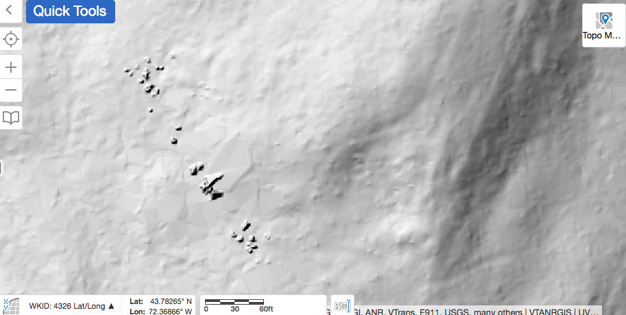 And so, I ask: Do you have any idea what these features are? I am interested in all possibilities, though it would be great to have a definitive answer! Thanks for meandering down Old Roads, Rivers and Rails of the Upper Valley with me, Bob Totz. Comments are always welcome and can be posted at the end of the article. Do you like maps and history of the Upper Valley? New Subscribers and emails are always welcome too. Simply email to: [email protected] Main page at: oldroadsuppervalley.weebly.com Sources: Vermont Center for Geographic Information, Interactive map viewer at: maps.vermont.gov/vcgi/html5viewer/?viewer=vtmapviewer A Guide to New England Stone Structures by Mary Gage and James Gage, 2006, Powwow River Books, Amesbury MA.
|
AuthorI'm Bob Totz, retired VT postmaster, and historical geographer ARCHIVES:
October 2021
EXPANDED ARCHIVES: AUGUST 2021 1858 Johnson Map of North America MAY 2021 1795 - "Road Over the Mountain" - Part Two Historic Toll House For Sale 1795 - "Road Over the Mountain" Part One OCTOBER 2020 Finding That Special Peaceful Place AUGUST 2020 Kayaking on the Pompy JULY 2020 Pt. 2: What the Heck Are These Things? JUNE 2020 Bob's Bio... What the Heck Are These Things? Pt. 1 MAY 2020 Stone Walls and Spirits The View APRIL 2020 Sunny Brook Farm Relics: Pt 2. Sunny Brook Farm Relics: Pt 1. MARCH 2020 Signs of Norwich Pt. 2 COVID-19 Tracking Map Centertown and Valleyquest Signs of Norwich Pt. 1 "Imperfect Union" - Book Review Historic Centertown FEBRUARY 2020 King's Hwy Pt. 2 WRJ Museum at Post Mills Airport Chatauguay Vermont The Independent Farmer poem Traveling Along the King's Highway - Lebanon NH JANUARY 2020 Finding Parkhurst Cemetery In Search of Parkhurst Cemetery Affordable Housing The Old Stone Grill Two Rivers Trail-Kmart License and Registration, Please! Prohibition, Murder and Dr. Seuss Peace, Paris, & P.O. DECEMBER 2019 BLOGGER'S LINKS Welcome to Old Roads Love-Quail Hollow fun Dartmouth Cemetery SEPTEMBER 2019 E. Thetford Cemetery JUNE 2019
Taps: Meetinghouse Cemetery 4-Corners Borders Quest Old Iron Gate Stumbling Upon History Sunrise Walk MAY 2019 4 Corners Cemetery Strafford's Abandoned Foundations Art in Old Stonework APRIL 2019 Strafford Tpke Pt 2 Strafford Tpke Pt 1 White River Valley FEBRUARY 2019 Learning from Historic Maps of the Upper Valley Change in Lewiston VT JANUARY 2019 A Vermont Ski Waltz John Ledyard 1773 What is the Upper Valley? DECEMBER 2018 Dartmouth Green Music Video: Sometimes Music Video: Montreal Express Railway Disaster of 1887 |
 RSS Feed
