|
Welcome! Scroll Down for Posts and Archives.
Other Menu Options at Top |
|
|
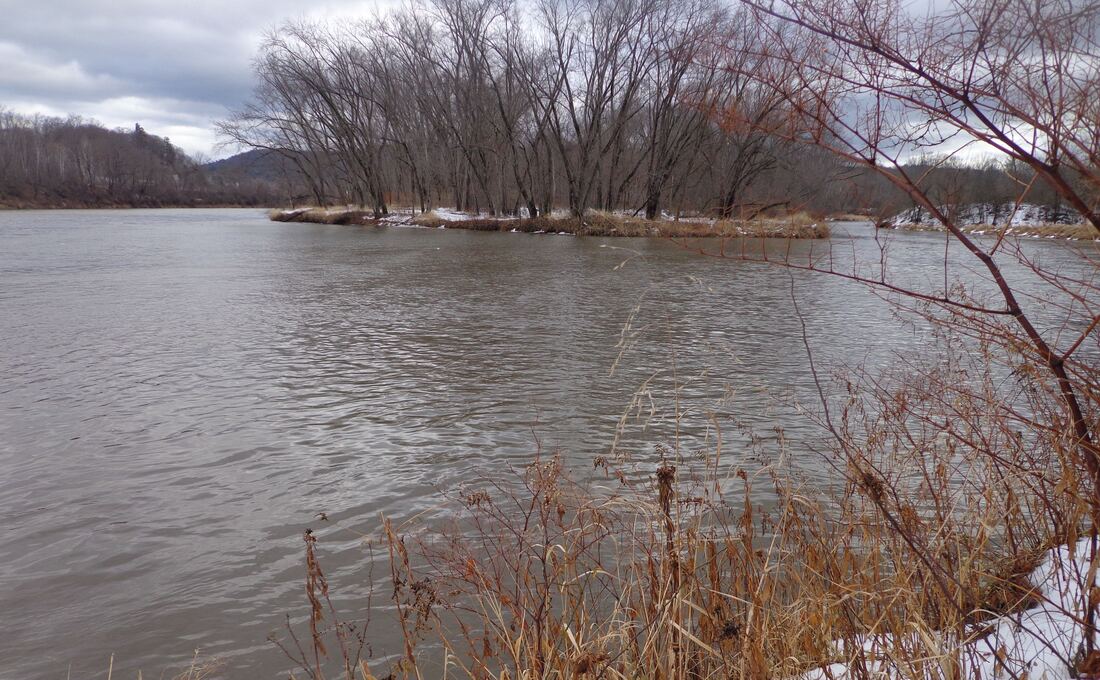 Confluence of the Mascoma River, on right, and the Connecticut River, on left at the Two Rivers Trail. A hiking trail is the last thing I expected to find behind K-Mart, but not far from the exit 20 northbound on-ramp, lies the Two Rivers Trail, that leads to the confluence of the Mascoma and the Connecticut River. It's a beautiful spot, really. I found out about it the other day, when I was doing some research for the new "Hiking Trails" section of this website. 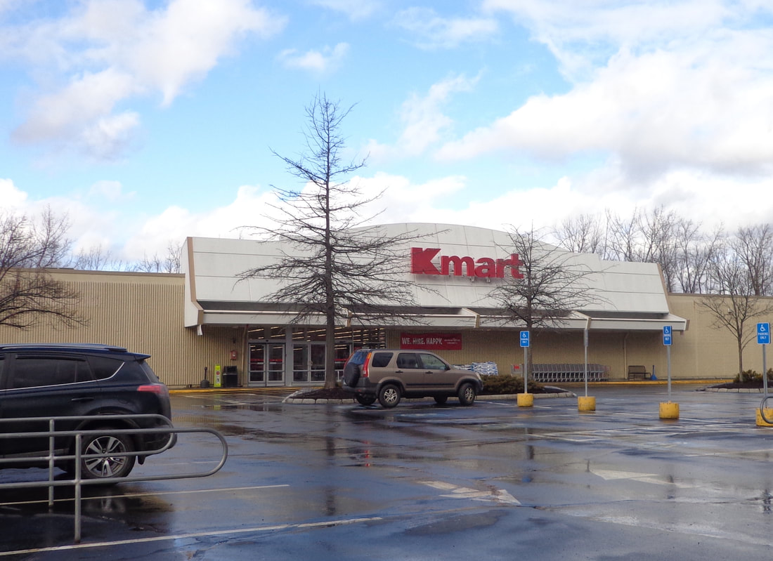 Kmart, and the Kmart Plaza, Route 12A, West Lebanon, New Hampshire On Sunday morning, January 12, 2020, around 10:00 AM, my wife and I decided to head out to West Lebanon to check out Two Rivers trail. The rain had stopped earlier in the morning, and although the sun had been out, it started to cloud up again, with a balmy breeze. As we left home, the temperature was 47 degrees, but when we pulled around to the left side of the Kmart building, the temperature had risen up to 58, not bad for a mid-January day! And probably a rare opportunity to hike around back there without skis or snowshoes. 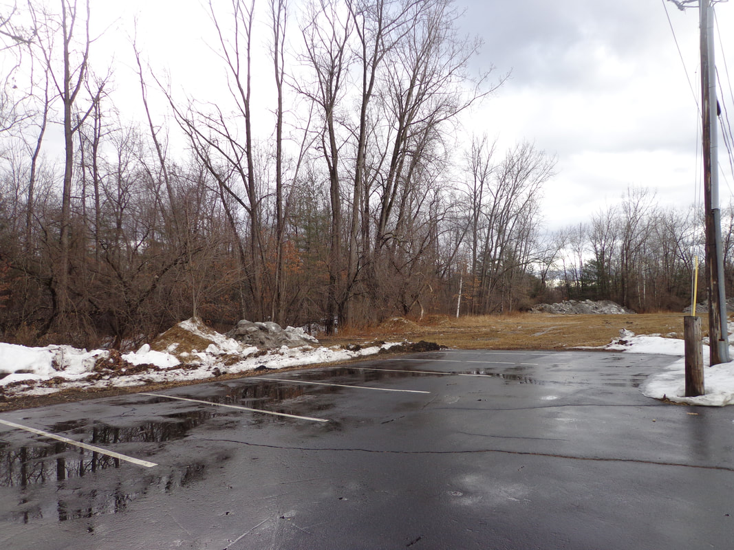 Parking lot to the left of, and to the rear of, Kmart. We walked across the lot behind K-Mart, not really seeing any sign of a trail at first. The ground behind the rear access lot was very wet, with some snow left on it. There was a huge pile of snow and rocks or debris at the end of the lot. As we got closer, I could see a couple concrete blocks, and then I sighted a kiosk not far from the edge of the woods. 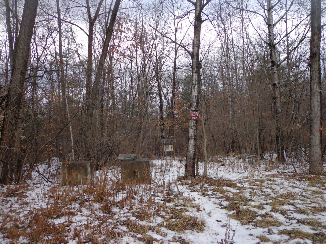 Concrete Blocks, a narrow Footpath, and a kiosk in the Distance The kiosk had a photo / map of the trail, and a nice bird’s nest on top, under the roof! 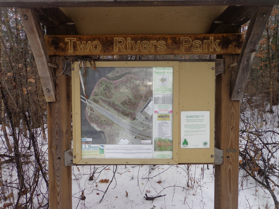 Two River Park Kiosk 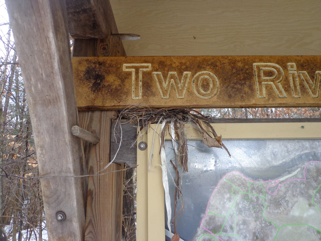 Bird's Nest on the Kiosk It appeared there were no blazes indicating the way, but it was clear where there was a trail, although it looked like no one had walked it since the last snowfall. 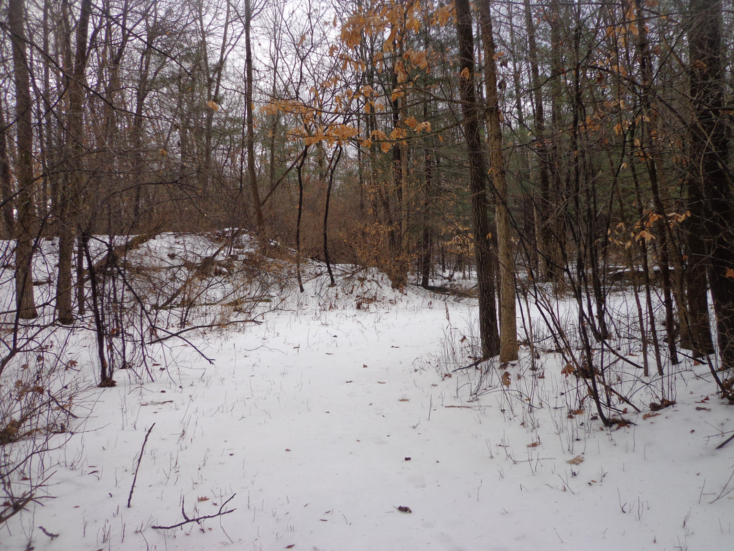 Two Rivers Trail 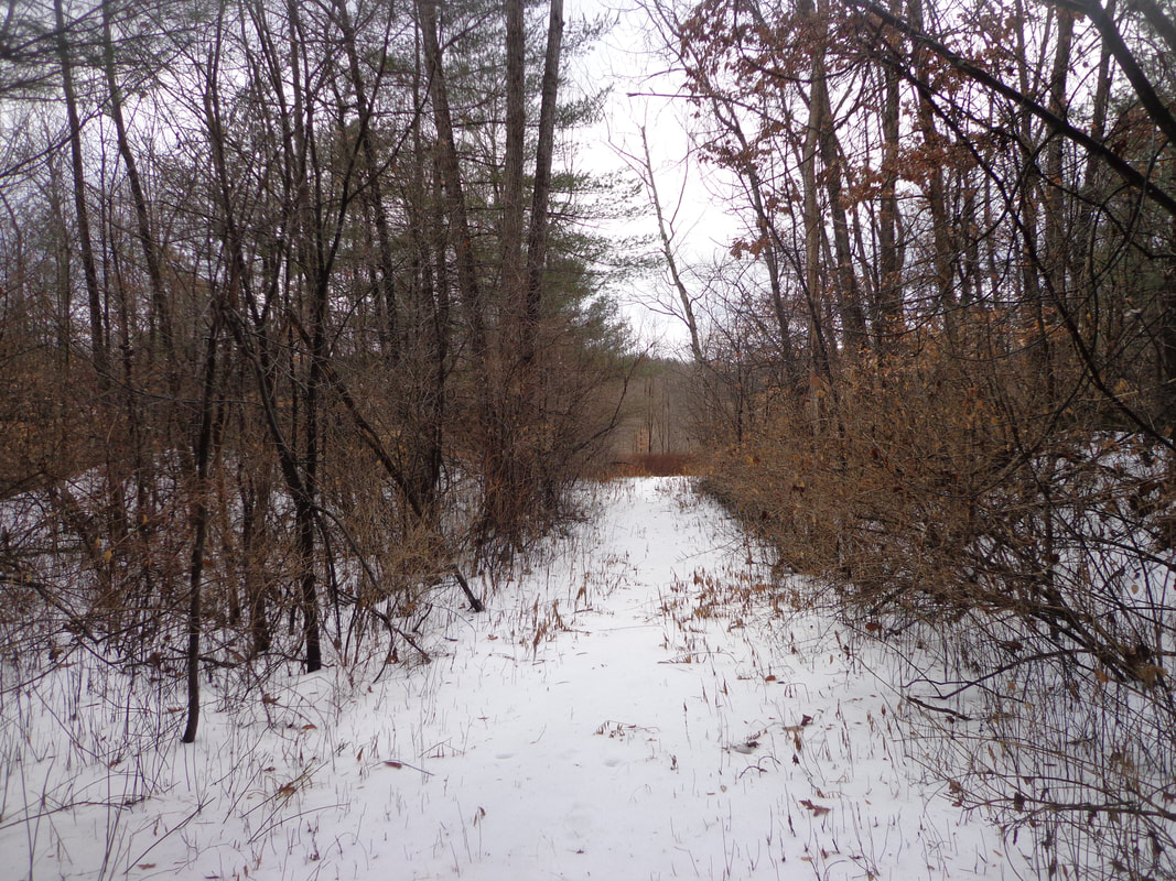 At first it was wooded, but soon we were walking through a more open zone. Wiith the temperature so high, I was hoping no ticks would be waking up! The trail was hard to find at times, but we seemed to find a path. According to the map at the kiosk, there were several trails to choose from. 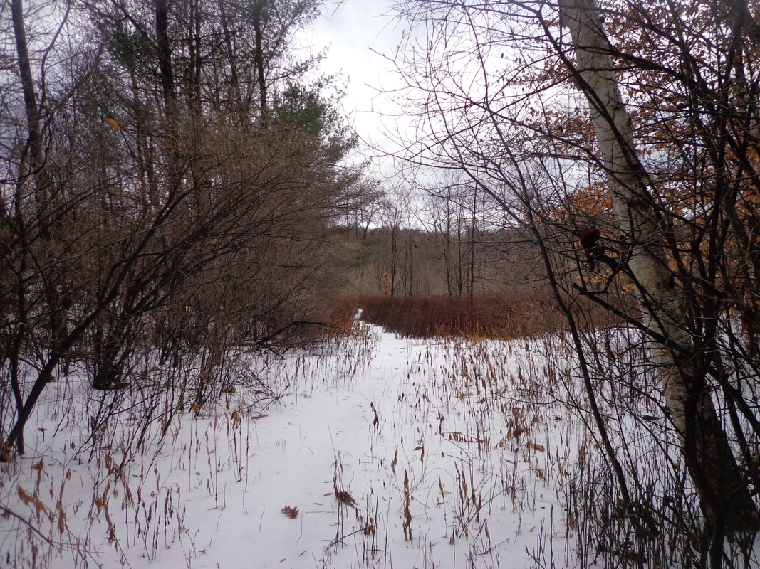 There was a knoll to our right, that we walked around, with a large tree on top. I wondered if there was any historical significance to the knoll. What looked like a pile of stones peeking out from the top seemed somewhat suspicious. 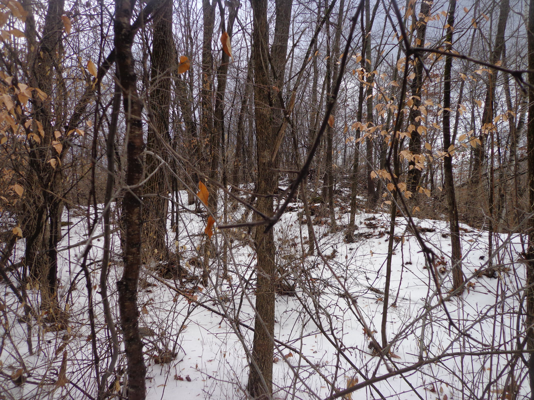 The path meandered a bit and eventually I could see one of the rivers in the distance, through the trees. There were brambles, and thorny weeds in the way, even though it was clear that the weeds had been cut back at one point, not too long ago. 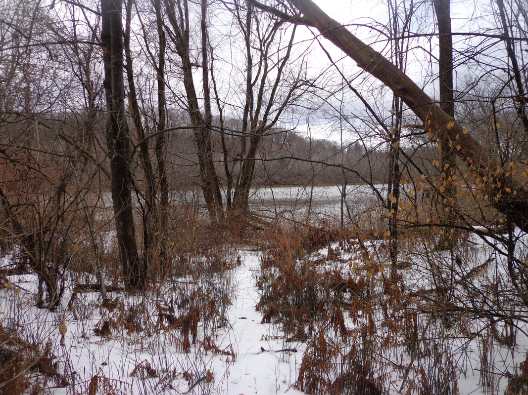 View of the Connecticut River from Two Rivers Trail. We emerged from the brambles at the point where the Mascoma River, on the right, could be seen flowing into the Connecticut River, on our left. 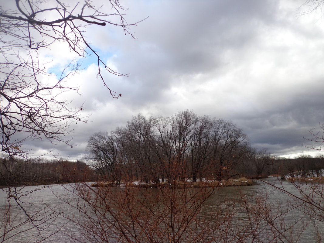 Confluence of the Mascoma and Connecticut Rivers The rivers were flowing strongly, as there was a flood watch in effect at the time. Fortunately, we didn’t get as much rain as had been predicted, but the warm temperature did quite a number on any snow cover in the lowlands. 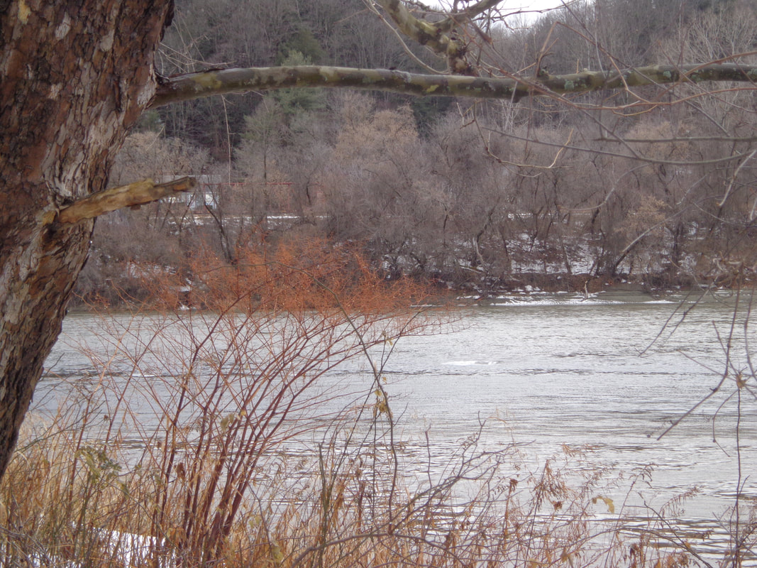 The Mighty Connecticut River Even with the cloud cover, it was a beautiful spot, and with the warm temperatures, it felt a little bit like a dream, being January. 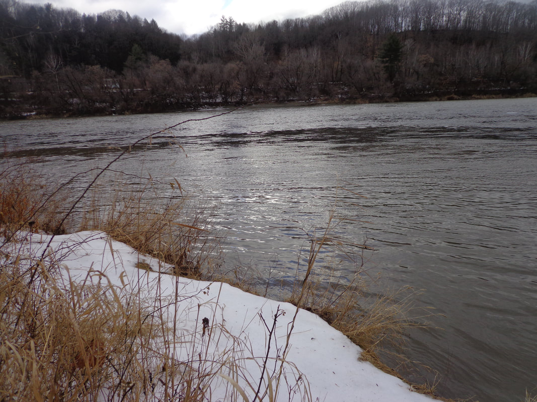 Waters of the Mascoma River Flowing into the Connecticut As we headed back, I took a quick side trip up the little knoll, to look for any clues to the past. All I found was what looked like an old railroad tie, or fencepost, and some cable that looked like part of an old-style guardrail. 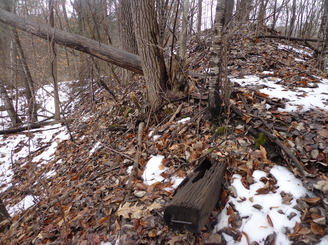 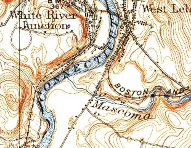 1942 USGS Imagery, Mascoma River flowing into Connecticut River, in the Pre-plaza Era Above is a 1942 image of the area showing where the Two Rivers Trail is now. I believe this was farmland back then. Here is a look at the same area in 1959. Not much going on here in 1959, but just upriver along the Mascoma, we see a power plant. 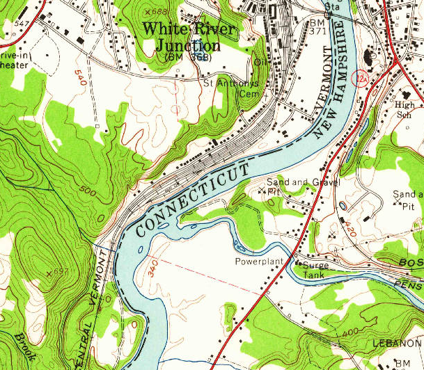 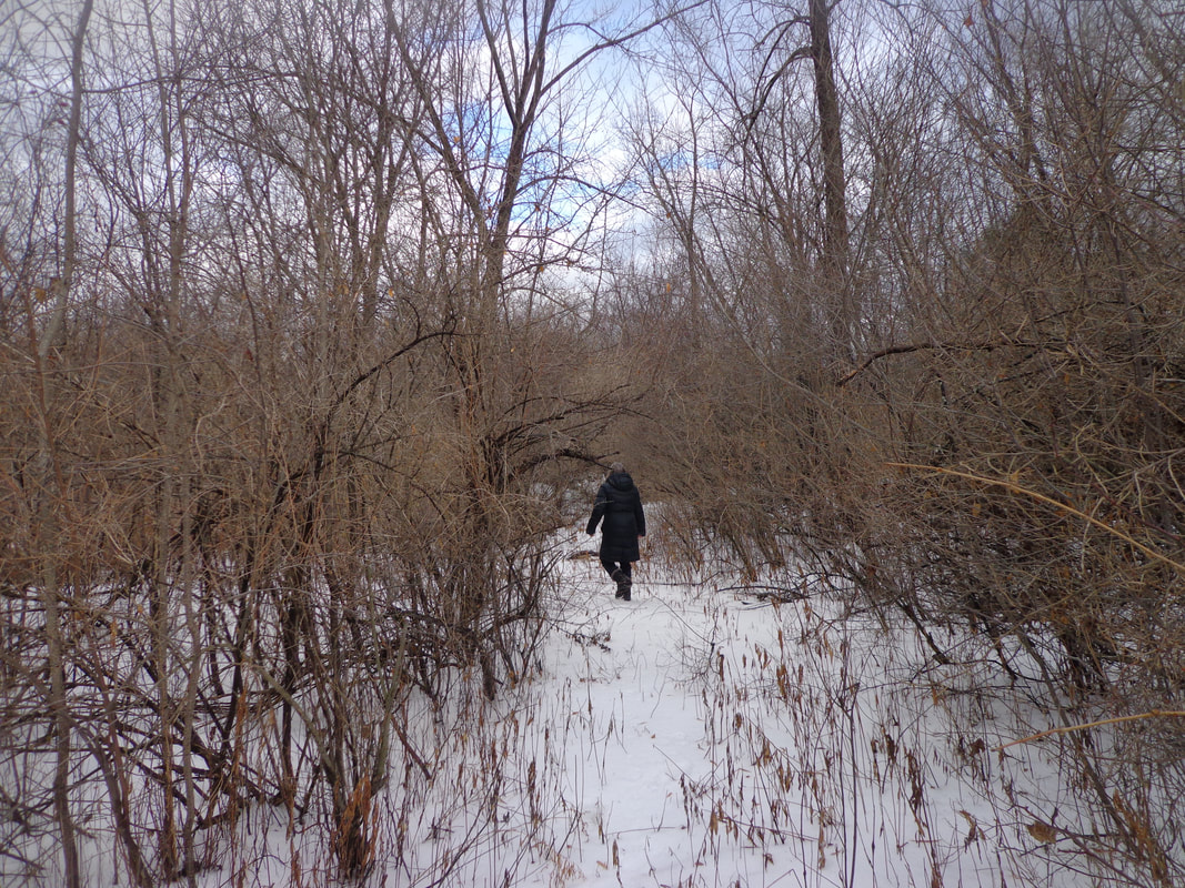 We took a left at a fork, and took a slightly different trail back to Kmart. There were plenty of wild vines and honeysuckles along the way. As we neared the back of K-Mart again, we ended up right behind that huge snow pile, which seemed to be right in our way! 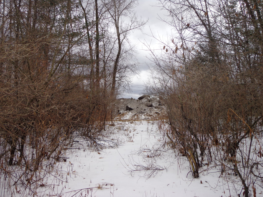 We figured we could either go over it, to the left of it, or to the right, but neither direction looked like the trail. 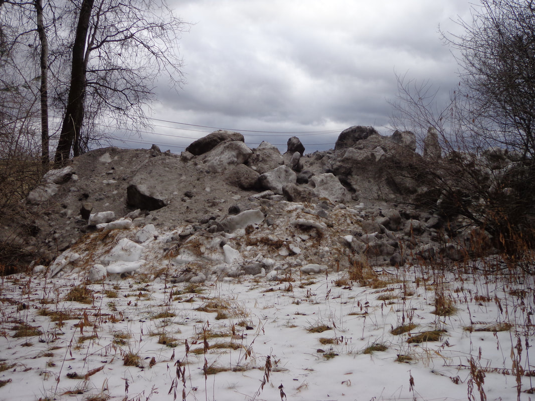 Trail is....where? 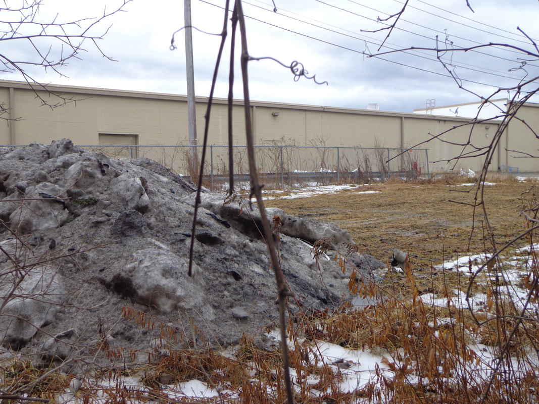 We bushwacked a short distance and were soon in back of Kmart. All in all, we felt quite lucky to have taken the hike out there on a January morning, when it wasn’t cold, and there wasn’t much snow. And, it was quite thrilling to be so close to the Mascoma River, and the Connecticut, wild and free, away from the constraints of the Wilder Dam, after some rain and a bunch of melting snow cranked them up. Finally, it was certainly different to be so close to I-89, K-Mart, and Route 12A, yet to be on a hiking trail. It certainly looks like a very nice place to visit on a warm sunny day! 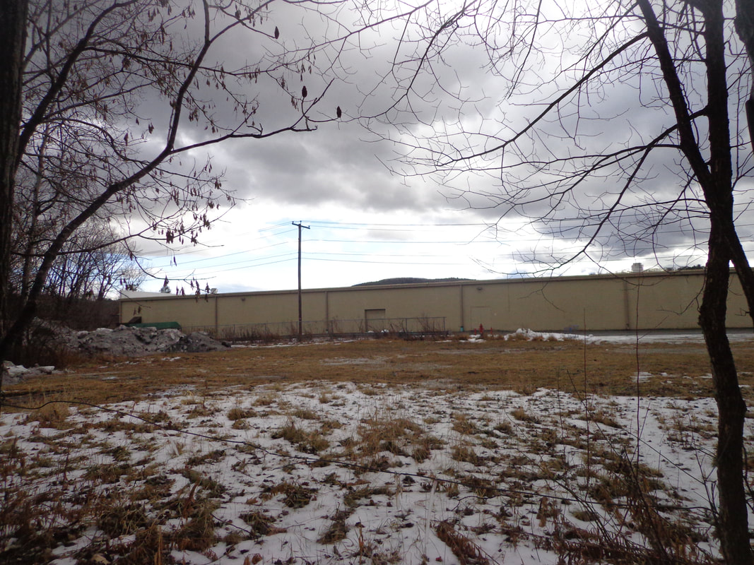 Two Rivers Trail HIdes, Silently, Behind Kmart 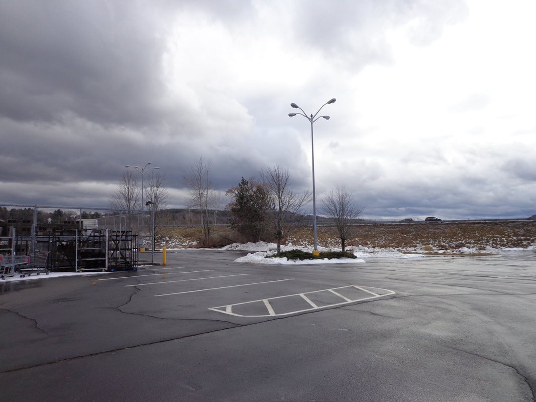 Interstate 89 Northbound On-ramp in the Distance Thanks once again, for hiking along on Old Roads, Rivers and Rails. To subscribe, simply send an email to: [email protected] See you out there on the trail! Sources: https://lebanonnh.gov/Facilities/Facility/Details/Two-Rivers-Conservation-Area-32 US Geological Survey "Topoview" The following map is the USGS imagery from 1981. It shows the Kmart building, and the I-89 interchange, more familiar to us today. 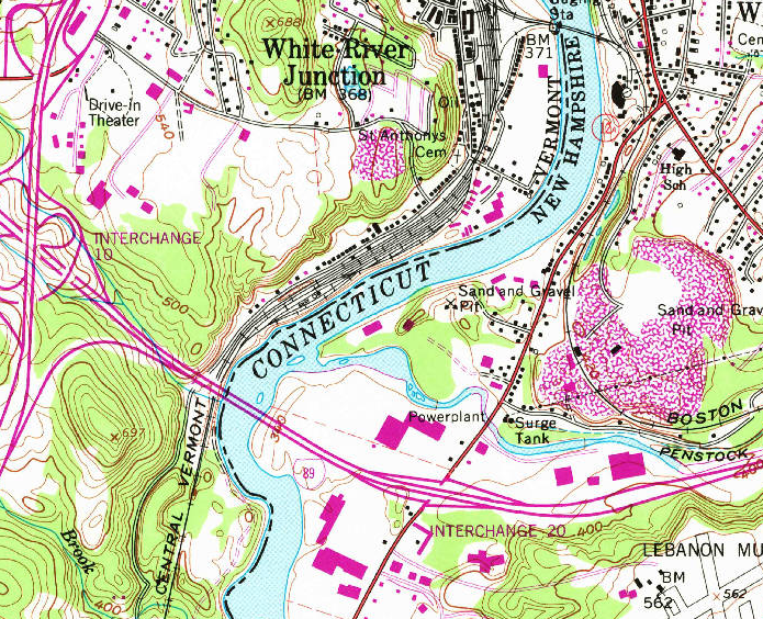 1981 USGS Imagery Below is a current photo; courtesy of google earth 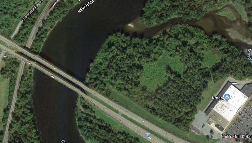
22 Comments
During a lively discussion on facebook, I found this interesting information from Patrick Putnam: "The gravel stockpiles on the upper right side of this picture were remnants of the last gravel mined from the CT. River by Lebanon Sand & Gravel. Lebanon S & G became Lebanon Crushed Stone and moved 2 miles south on 12-A. It was accompanied by the photo I added at the end of the story, showing the I-89 On-ramp, and the adjacent Two Rivers Park as it looked around 1970.
George A Chapman
1/18/2020 12:24:11 pm
I remember skiing in that gravel pit with my late friend Richard Kimball.
bob totz
1/18/2020 12:55:24 pm
Sounds like some great memories, George! What years might that have been that you were skiing down there? I'd love to see photos, but I doubt there were many taken in the "old days". Thanks.
suzi r
1/18/2020 10:43:14 am
Thanks for a great story, Bob, and for putting in those helpful maps. Lovely photos, too.
Bob Totz
1/19/2020 07:20:04 am
No ticks, Sue! A nice time of year for a hike!
Coralie Mitchell
1/18/2020 11:50:24 am
Is the power plant on the Mascoma River on the 1959 map the one that the Powerhouse Mall is named after? Doesn't part of it still exist as part of the Mall, or maybe one of those smaller buildings near the mall?
George A Chapman
1/18/2020 12:07:46 pm
Yes.
George A Chapman
1/18/2020 01:30:18 pm
Probably sometime between 1945 and 1950. Accessed it off from Waterman Avenue.
Bob Totz
1/19/2020 07:21:53 am
Thanks, George, for all your great information, and for sharing your memories of former upper valley days!
Leslie Berger
1/18/2020 01:51:54 pm
Your article is a good reminder that even forsaken places like shopping plazas have real histories. They were built in once pristine natural locales -- in this case an actual confluence. And though we don't see them with our Route 12A blinders on, the land is very much there, in need of our guardianship and protection.
Bob Totz
1/18/2020 01:55:52 pm
Well said, Leslie!
Bev Chapin
1/18/2020 09:58:37 pm
Once upon a time in the long ago - about the early 1950's when I remember - those fields now covered by plazas were covered in summer by fields of beautiful corn. Flooding over the centuries before the building of major power dams had left behind deposits of good topsoil that made an enriched base all along rivers like the Connecticut that were ideal for farmers to grow the corn to fill the multiple silos with winter feed for the large herds of dairy cows. From those farms came the milk for cities to the south, milk that was picked up by trains making stops along the route south that became known as "milk trains." The stops were frequent so trips were slower if you had to ride one to make connections further down the line.
Bob Totz
1/19/2020 07:24:46 am
Bev, Thank you for your insight, and for sharing your memories. History is what we learn from those who lived it. You have a wonderful way of expressing and sharing your memories, and it's greatly appreciated! Addendum, Jan 20, 2020: Since posting this, I learned that this location was farm fields, and then later, part of a gravel and sand mining corporation. I heard that some folks used to fish down there, and cross-country ski, before the plazas were built. Also, I heard about a story where a plane landed back there at one point, and the occupants got out and went shopping at the plazas! 3/3/2024 12:50:29 am
Remarkable article, it is particularly useful! I quietly began in this, and I'm becoming more acquainted with it better! Delights, keep doing more and extra impressive! Your comment will be posted after it is approved.
Leave a Reply. |
AuthorI'm Bob Totz, retired VT postmaster, and historical geographer ARCHIVES:
October 2021
EXPANDED ARCHIVES: AUGUST 2021 1858 Johnson Map of North America MAY 2021 1795 - "Road Over the Mountain" - Part Two Historic Toll House For Sale 1795 - "Road Over the Mountain" Part One OCTOBER 2020 Finding That Special Peaceful Place AUGUST 2020 Kayaking on the Pompy JULY 2020 Pt. 2: What the Heck Are These Things? JUNE 2020 Bob's Bio... What the Heck Are These Things? Pt. 1 MAY 2020 Stone Walls and Spirits The View APRIL 2020 Sunny Brook Farm Relics: Pt 2. Sunny Brook Farm Relics: Pt 1. MARCH 2020 Signs of Norwich Pt. 2 COVID-19 Tracking Map Centertown and Valleyquest Signs of Norwich Pt. 1 "Imperfect Union" - Book Review Historic Centertown FEBRUARY 2020 King's Hwy Pt. 2 WRJ Museum at Post Mills Airport Chatauguay Vermont The Independent Farmer poem Traveling Along the King's Highway - Lebanon NH JANUARY 2020 Finding Parkhurst Cemetery In Search of Parkhurst Cemetery Affordable Housing The Old Stone Grill Two Rivers Trail-Kmart License and Registration, Please! Prohibition, Murder and Dr. Seuss Peace, Paris, & P.O. DECEMBER 2019 BLOGGER'S LINKS Welcome to Old Roads Love-Quail Hollow fun Dartmouth Cemetery SEPTEMBER 2019 E. Thetford Cemetery JUNE 2019
Taps: Meetinghouse Cemetery 4-Corners Borders Quest Old Iron Gate Stumbling Upon History Sunrise Walk MAY 2019 4 Corners Cemetery Strafford's Abandoned Foundations Art in Old Stonework APRIL 2019 Strafford Tpke Pt 2 Strafford Tpke Pt 1 White River Valley FEBRUARY 2019 Learning from Historic Maps of the Upper Valley Change in Lewiston VT JANUARY 2019 A Vermont Ski Waltz John Ledyard 1773 What is the Upper Valley? DECEMBER 2018 Dartmouth Green Music Video: Sometimes Music Video: Montreal Express Railway Disaster of 1887 |
 RSS Feed
