|
Welcome! Scroll Down for Posts and Archives.
Other Menu Options at Top |
|
|
|
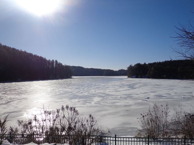
Originally published in January 2019. 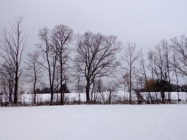 We have nice neighbors that let us ski in their fields. Well with the "big storm" coming this weekend, and temperatures up near 30 degrees, I figured I'd do a little skiing out in the fields while the time seemed right. I had enough of carrying and stacking firewood the last couple days and needed a break. Actually, I was a bit blocked about what to write about, and my father suggested I "walk away" for awhile. So I decided to ski away instead! 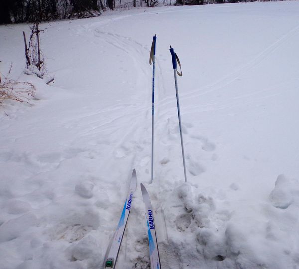 I headed out to a couple of maple trees I transplanted back around 2001. Hard to believe I carried them there in a bucket! 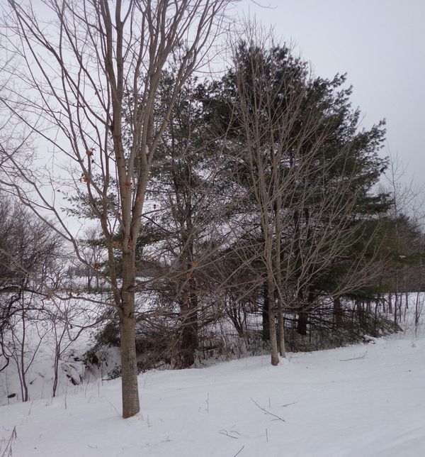 I took a right, near the bat house, or bat condominium I put up a few years ago... 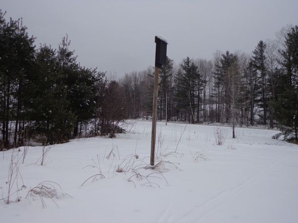 And I headed out into the fields. There were nice views, and downed trees, small ponds, and even a nice train whistle in the distance. Here's the video. I hope you like it Once I got back home, I realized I knew what I wanted to write about today, or better yet, make a video about: Today's skiing session! Sometimes you just need to take a walk, or a ski, if you can. Thanks for checking out "Old Roads, Rivers and Rails", by Bob Totz Comments 4
0 Comments
 The Ledyard Bridge between Hanover NH and Norwich VT was named in his honor. John Ledyard, the explorer, led a life of unbelievable adventure. In his brief 37 years he traveled many thousands of miles. His story begins in 1751, in Connecticut. He was born in Groton, near New London, on the Thames River. 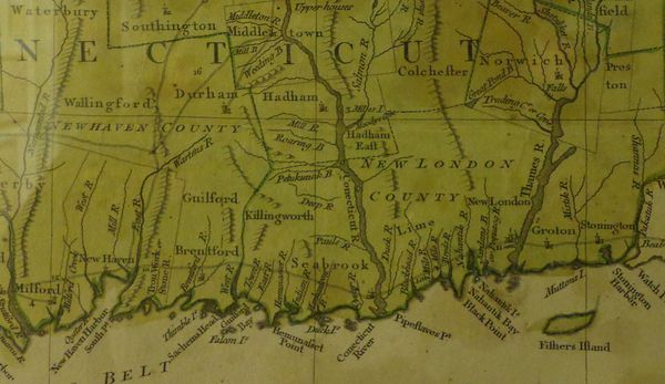 Mid-late 1700's Connecticut. Thames River to right, Connecticut River to left. His father, with the same name, was a sea captain who died at the age of 35, leaving a widow and four children. John Ledyard was the oldest. After his father died, the Ledyard family moved to Southold NY on Long Island, to the home of John's mother's father. After a few years, John's mother remarried, and John moved to Hartford Conn. to live with his paternal grandfather. 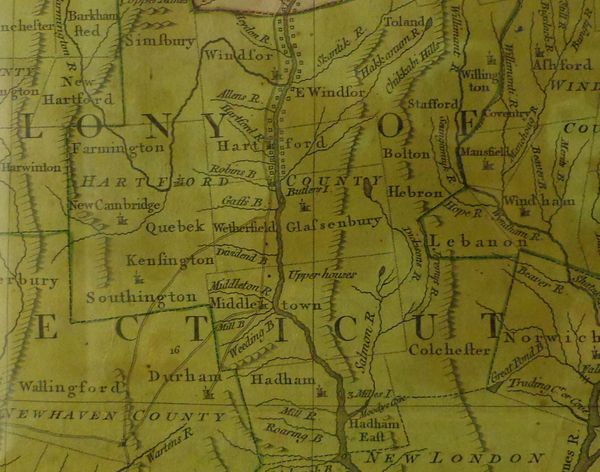 The Connecticut River in Connecticut, showing Hartford Connecticut on both sides of the River John’s grandfather happened to be good friends wth Eleazar Wheelock, who had founded Dartmouth College a couple years earlier. In the Spring of 1772, John Ledyard accepted an offer to study at Dartmouth, to prepare for a life as a christian missionary among the Indians. 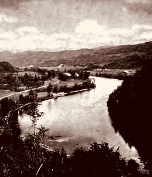 The Bend" Two miles above the Ledyard Bridge. Photo courtesy of Edwin Bacon's "The Connecticut River and the Valley of the Connecticut" He was intelligent enough, but it seems he was impatient for adventure. The tedium of the daily routine of college was probably too much for his restless soul. About four months after he started at Dartmouth, and without permission, or giving advance notice, he traipsed off to the north, into the wilderness for three and a half months. He wandered to the Canadian border to learn about the “Six Nations” of Indians and learn their ways. Since he was thinking of becoming a missionary to the Indians, he was probably deciding if it was what he really wanted to do with his life. When Ledyard returned to Dartmouth, he resumed his studies, but it was probably at this time that he realized college, and missionary work were not suited for him. However he did realize his love of travel and adventure. 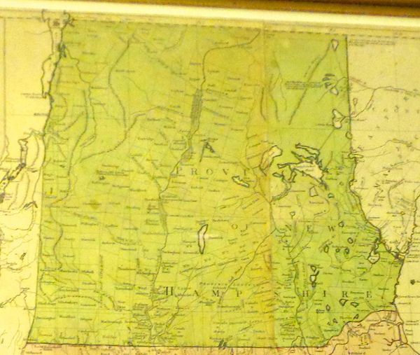 Upper Connecticut River Valley, Mid-late 1700's: Notice no mention of "Vermont" Soon John Ledyard began planning a new adventure, an escape from Dartmouth! With the help of some classmates, he started to manufacture a dugout canoe. He had no training in this, but he figured that wouldn’t stop him. They felled a large tree, down by the river, and they eventually turned that log into a 50 foot long dugout canoe. 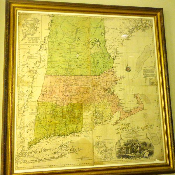 Early map of New England in History Room at Baker Library, Hanover NH. Courtesy of Dartmouth Libraries One day in Spring 1773, John Ledyard put his canoe into the Connecticut River at the spot where the bridge that bears his name stands today. Wearing a bearskin, and floating in a canoe filled with provisions, John Ledyard started on a 140 mile journey down river to Hartford Connecticut, ill-prepared for the falls and rapids that lie ahead, and unaware of the many other adventures that soon awaited him. Connecticut River, looking south from the Ledyard Bridge. As John Ledyard headed south in his homemade canoe, he had no idea that one day a bridge at that spot would bear his name. 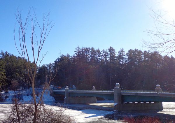 The Ledyard Bridge today
Old Roads, Rivers and Rails is brought to you by me, Bob Totz. I'm a retired Postmaster of Post Mills and Sharon, Vermont, graduate in Geography from University of Connecticut, former choir director, and composer and performer of folk songs on guitar and harmonica. I write articles about local History, Geography, and occasionally include music videos, such as "The Montreal Express" Railway disaster of 1887 at https://www.youtube.com/watch?v=IaSscBeK7So&t=17swww.youtube.com/watch?v=IaSscBeK7So&t=17s 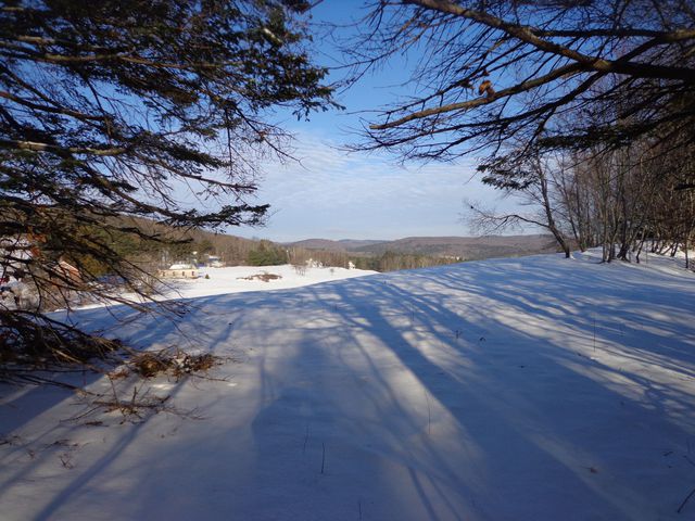 A geographical region? An idea? Where is it? A little history too... (NOTE: This was originally published in Dec. 2018) I moved to the Upper Valley from Connecticut in February 1984, and found out I was a "Flatlander". Upon arriving here I was almost immediately made aware of the term, "Upper Valley". It seemed like it had a lot to do with Hanover and Lebanon NH, and Norwich and Hartford VT, (or White River Junction). As a recent graduate in geography, I was intrigued by the idea of the Upper Valley, as well as the geographic region that it seemed to encompass. It was apparent, or at least seemed to be, that the valley referred to was the Connecticut River Valley. So I wondered, shouldn't the Upper Valley really be north of here? Isn't the Connecticut River the boundary between the states of Vermont and New Hampshire, and doesn't that extend to the Canadian border? Shouldn't we be in the Middle Valley, or Upper Middle Valley, or Lower Upper Valley? Somewhere along the line, someone coined the term "Upper Valley" to define this area where we live, basically a community that spans the Connecticut River, and includes parts of both New Hampshire and Vermont. 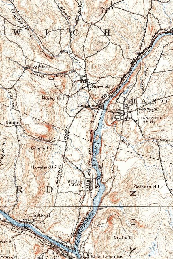 1927 US Geological Survey map. Note the lack of Interstates, the bridge from Wilder to West Lebanon NH, and the old road from Lewiston to Norwich. This whole area, along both sides of the Connecticut River, was settled by many people from Connecticut. Look at some of the township names, which share place names with Connecticut, such as Norwich, Hartford, Windsor and Lebanon. In fact, in the late 1700's there was a movement to create a state called New Connecticut since residents on both sides of the river felt more connected to each other, and the local area, than either Vermont or New Hampshire. There was also a movement to annex the NH towns on the river to be part of Vermont. Eventually around 1782, the CT River was deemed to be the official border between the states of NH and VT. Technically the border is the west bank of the CT River. 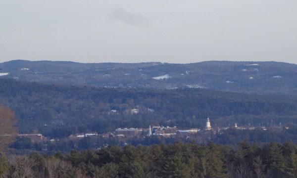 Baker Library Tower, Dartmouth College, Hanover NH seen from Norwich VT, 3 PM, Jan 4, 2019 In the early days, The Connecticut River was the most important route in the area for trade and transportation. More trade was done with Springfield MA than with Boston, until roads and turnpikes were eventually cleared and built in the late 1700's into the 1800's, that created links with places like Concord NH and beyond. In the 1840's the railroads finally came and changed the face of transportation and commerce for our area as well as other parts of our nation. Similarly, in the mid-twentieth century, the Interstate Highways were developed. The introduction of quick travel on I-89 and I-91 may have added to the perceived size of the Upper Valley, as people became more mobile, and connected to the area by commuting from farther away. 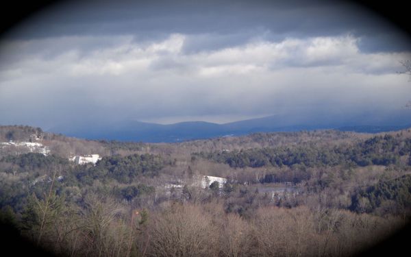 View to NH from Norwich VT But it was the Connecticut River that originally brought them here, with it's beauty and usefulness. There were places along the river though, that could not be navigated due to the falls, and quick drops in elevation. Eventually locks were built to get boats past the falls. Locally, the White River Falls, or Olcott Falls as it was later named after Mills Olcott, was a source of frustration until locks could be built. Today those falls can't be seen due to the river being sixteen feet higher, on average, above the Wilder Dam, which was built in the late 1940's. The log drives of the 1800's must have been something to see. The last log drive on the Connecticut River was in 1915. 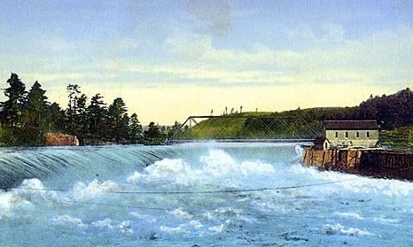 The White River or Oclott Falls at Wilder The river valley was an incredibly important place, and many people born here in the 18th and 19th century never ventured more than twenty miles or so from their place of birth and their home. They had family and friends on both sides of the river and it was commonplace then, as today, that folks spent much of their time in both states. I came here 35 years ago for a job in digital mapping, and fell in love with the place and the people. I've lived on both sides of the river, from Plainfield to Lyme to North Haverhill NH, and Sharon, Wilder and finally settled in Norwich VT by chance, or by the grace of God, almost thirty years ago. This all brings me to this question: Where does the Upper Valley begin and end? Should it include Bradford, Wells River, Monroe and points north? Should it include Claremont and Windsor, Springfield, Bellows Falls, Brattleboro? I suppose it doesn't really matter. Actually, I am glad there is no one, official definition. If you live in Bethel, and work and shop in Lebanon, then you probably consider Bethel to be part of the Upper Valley. If you live in Bethel, but work and shop in Randolph, you may not feel like you live in the Upper Valley. Either opinion is perfectly valid, because the Upper Valley is as much a concept as a geographical region, even though the geography of the area, (physical, cultural, and historical), has to do with the coining of the term. In 1985 I moved from Meriden NH to North Haverhill NH, about 50 miles north. I worked in Littleton for a few months and definitely felt that I was NOT connected to the Upper Valley, (and I missed that!) My housemates and I even called North Haverhill "North Hinterland" because we were so far away from what we considered to be the Upper Valley. After a few months, I found myself working in White River Junction, and even though it was about a 45 mile commute, I again felt I was part of the Upper Valley. Shortly after that I moved to Lebanon to be closer to work, and I felt even more ensconced in "Upper Valleyness". 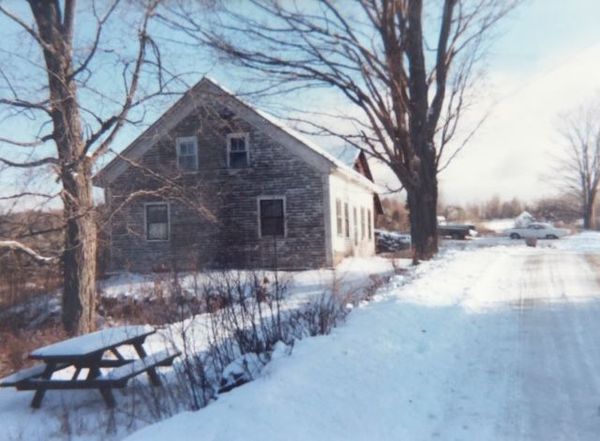 The old farmhouse where I lived in North Haverhill NH back in 1985-87. It was built around 1830, but was torn down, unfortunately, a few years ago. A beautiful old post and beam home. At some point I was told that to be a "native" Vermonter, you had to be at least third generation born in Vermont. I guess it takes three generations to get most of the flatlanderness out of the genes. My favorite quip was from an elderly gentleman that said If you were born in Vermont, that doesn't make you a Vermonter because: "If the cat has kittens in the oven, that doesn't make them biscuits!".I also fell in love with the local humor
Comments 11
|
AuthorI'm Bob Totz, retired VT postmaster, and historical geographer ARCHIVES:
October 2021
EXPANDED ARCHIVES: AUGUST 2021 1858 Johnson Map of North America MAY 2021 1795 - "Road Over the Mountain" - Part Two Historic Toll House For Sale 1795 - "Road Over the Mountain" Part One OCTOBER 2020 Finding That Special Peaceful Place AUGUST 2020 Kayaking on the Pompy JULY 2020 Pt. 2: What the Heck Are These Things? JUNE 2020 Bob's Bio... What the Heck Are These Things? Pt. 1 MAY 2020 Stone Walls and Spirits The View APRIL 2020 Sunny Brook Farm Relics: Pt 2. Sunny Brook Farm Relics: Pt 1. MARCH 2020 Signs of Norwich Pt. 2 COVID-19 Tracking Map Centertown and Valleyquest Signs of Norwich Pt. 1 "Imperfect Union" - Book Review Historic Centertown FEBRUARY 2020 King's Hwy Pt. 2 WRJ Museum at Post Mills Airport Chatauguay Vermont The Independent Farmer poem Traveling Along the King's Highway - Lebanon NH JANUARY 2020 Finding Parkhurst Cemetery In Search of Parkhurst Cemetery Affordable Housing The Old Stone Grill Two Rivers Trail-Kmart License and Registration, Please! Prohibition, Murder and Dr. Seuss Peace, Paris, & P.O. DECEMBER 2019 BLOGGER'S LINKS Welcome to Old Roads Love-Quail Hollow fun Dartmouth Cemetery SEPTEMBER 2019 E. Thetford Cemetery JUNE 2019
Taps: Meetinghouse Cemetery 4-Corners Borders Quest Old Iron Gate Stumbling Upon History Sunrise Walk MAY 2019 4 Corners Cemetery Strafford's Abandoned Foundations Art in Old Stonework APRIL 2019 Strafford Tpke Pt 2 Strafford Tpke Pt 1 White River Valley FEBRUARY 2019 Learning from Historic Maps of the Upper Valley Change in Lewiston VT JANUARY 2019 A Vermont Ski Waltz John Ledyard 1773 What is the Upper Valley? DECEMBER 2018 Dartmouth Green Music Video: Sometimes Music Video: Montreal Express Railway Disaster of 1887 |
 RSS Feed
