|
Welcome! Scroll Down for Posts and Archives.
Other Menu Options at Top |
|
|
|
The Old King's Highway shows up in Lebanon, NH, and Hartford and Pomfret Vermont, among other places. I was told by an old timer once, that "The King's Highway ran to Montreal via Montpelier". I'm not quite sure that was true, but in any case, I decided to attempt to locate the mythical road, or at least map out a route on some of Vermont's oldest roads that are still in use today. 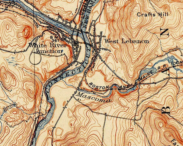 Map Image from 1908 USGS 15 minute Series Hanover Quadrangle. The view above, and inset below, show Nutt Lane in White River Junction, Vermont, where it heads down to the shore of the Connecticut River, circa 1908. 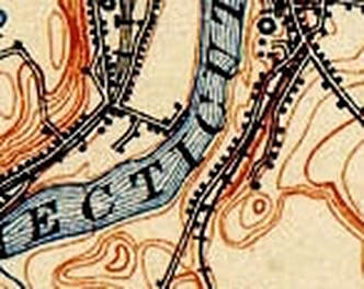 In the first post on this subject, we explored the Old King's Highway in Lebanon, which wound around Farnum Hill, and appeared to end up by the Connecticut River, about where Airport Road comes down to Route 12A today. I had a nice chat with an older gentleman who grew up in West Lebanon, New Hampshire, about what route folks would take, to get from the King's Highway in Lebanon to the King's Highway in White River Junction. He suggested folks forded the Connecticut River a bit south of Lyman Point, which is where we cross into White River Junction on US Route 4 today. The first bridge over the Connecticut River from West Lebanon was opened around 1804. It was a toll bridge owned by Elias Lyman III. For a time, before the bridge existed, there could have been a ferry available. The gentleman I was talking to mentioned there was a depression between two houses along the Connecticut River on Route 12A, that may have been where folks used to cross the river, before the toll bridge opened. The spot happened to be directly across the Connecticut River from what is now the end of Nutt Lane in White River Junction. "S. Nutt" is shown at the end of the road by the shore. 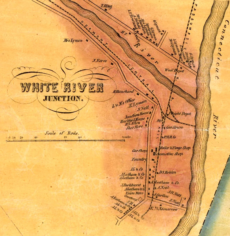 White River Junction, circa 1855, During the Railroad Boom. Nutt Lane, St. Anthony's Cemetery, and the Railroad tracks are all still there today. The intersection with what is today, Sykes Mountain Ave appears to be shown, at the very bottom, just below the last "A. L. & Co." buildings. Close up below. 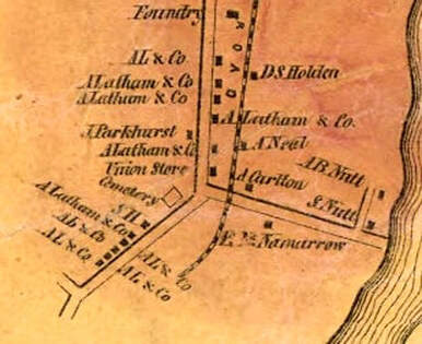 Nutt Lane was probably named after Samuel Nutt. He owned the Junction House Hotel, which opened in 1850. Samuel Nutt was an entrepreneur, who took advantage of the new railroad industry in White River Junction, and who also had a boating business, beginning around 1830. Samuel Nutt was also the first Postmaster of White River Junction. I'm guessing Sykes Mountain Ave would have been the route the earliest travelers would have hiked or rode up from the Nutt Lane area to King's HIghway. In the map below, from 1855, you can see a road running from the lower right, diagonally, northwest. This road appears to be "Sykes Moutain Ave" of today, or an earlier road in approximately that area. Climbing up that hill, in 1855, one would come to a schoolhouse at a four corners. Here is a closer look. The four corners is circled in light pencil, near the Pinneo Farm, which is approximately where the V.A. Hospital stands today. 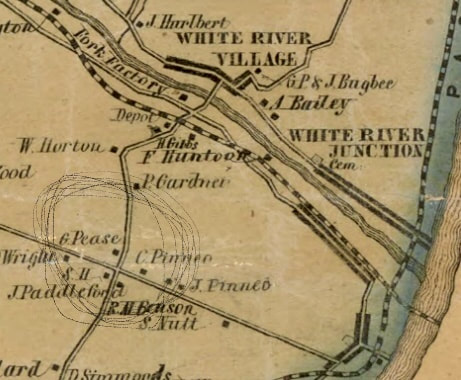 This appears to me to be the corner of what we now call the V.A. Cutoff Road, Route 5, and where King's Highway used to connect. The V.A. Cutoff Road is seen running north, and leads down across the train tracks, to the (old) depot, River Road, and the bridge to Hartford Village, known in 1855 as "White River Village". North Hartland Road comes in from the south, and is shown taking a hard right, which I believe is the predecessor to Sykes Mountain Avenue, as it heads down to White River Junction. King's Highway heads northwest, past Wright's place. ______________________________________ Here is a quote from David Brown recorded by the Hartford Agricultural Oral History Project, June 12, 2012: "This farm actually bordered the road that was in town’s history as King’s Highway that ran from Boston to Montreal. It was a stagecoach road. And it went up over part of our farm – Hurricane Hill – to the center of town, which was the original center of the Town of Hartford and then on to Quechee and Woodstock and headed to Montreal... ...The Veteran’s Hospital, which is adjacent to us to the north, when it was built in 1938, there was discussion that it was built on the Pinneo Farm... ...The area I’m referring to is [Beers Map] – okay, right here you’re coming up from White River and there is what used to be Four Corners right behind the food stop. Now it’s referred to as the VA Cutoff that runs down here to the village of Hartford. But in those days it was the Four Corners. And there was also a district school, District 14 I think, the Wright school. " _________________________ Below is a view of the same area, 53 years later, from 1908. Climbing up Sykes Mountain Avenue in 1908 would bring you up the hill, and into the Vermont State Fairgrounds, where the racetrack is visible. The Vermont State Fair was an annual event held in that area from the mid-1800's until 1928. The Twin State Airport occupied the area from 1929 - 1950, and was visited by Amelia Earhart in 1933. 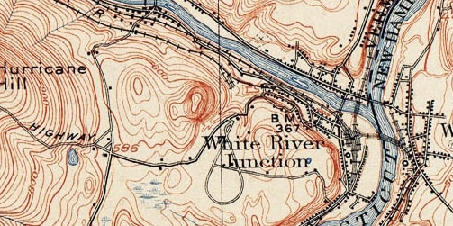 1908 View of White River Junction, Showing the Fairgrounds. On the 1908 map above, on the left, center, we can still see the schoolhouse at the Four Corners of the VA Cutoff Road, and North Hartland Road. And King's Highway is still connected, about where the Carriage Shed is today, perhaps. At this point in time, there was no road called Route 5. Below is a VTrans map of the same area from 1931. At this point the King's Highway still went through, from the looks of this map. I recently read that there was a train spur that went up to the Fairgrounds from the White River Junction and that the route they used is today the section of Route 5, that leads up to Sykes Avenue from the Junction.  In the 1931 Vtrans map above, you can also see the soon to be dismantled Woodstock Railroad line, heading toward Quechee, through Dewey's Mills. The route of the Woodstock Railroad was soon to become the new pathway of US Route 4. Today you cannot drive the King's Highway from Route 5, a.k.a. North Hartland Road. However, you can get to the King's Highway by heading out Route 4 west, then take a left on Center of Town Road. You'll find the King's Highway up there. The 1959 map below offers a great slice in time. By then, the Vermont State Fair had ended, and the Drive-In Theater had opened, but there was no interstate 89 or 91. Here is a good look at this area from 1959: 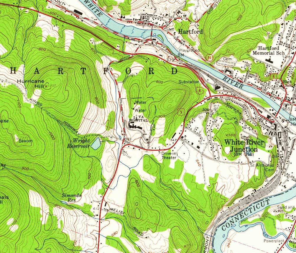 1959 USGS Map Showing White River Junction, and Hartford villages, and Sykes Avenue Area. Above, King's Highway is shown as an umimproved road. The intersection with US Route 5, (North Hartland Road), and the V.A. Cutoff Road is shown in the center, just east of Wright Reservoir, and just below the V.A. Hospital. Below is another look at the same area, from 2018. Note the addition of the interstate Highways. On the far left "KINGS HWY" can be read, and it looks like the eastern end of it either sort of vanished or was rerouted to accomodate the Interstate and then became Wright Reservoir Road. I suspect that if you drive up Wright Reservoir Road to the end, you'll probably find vestiges of the old King's Highway in the woods. 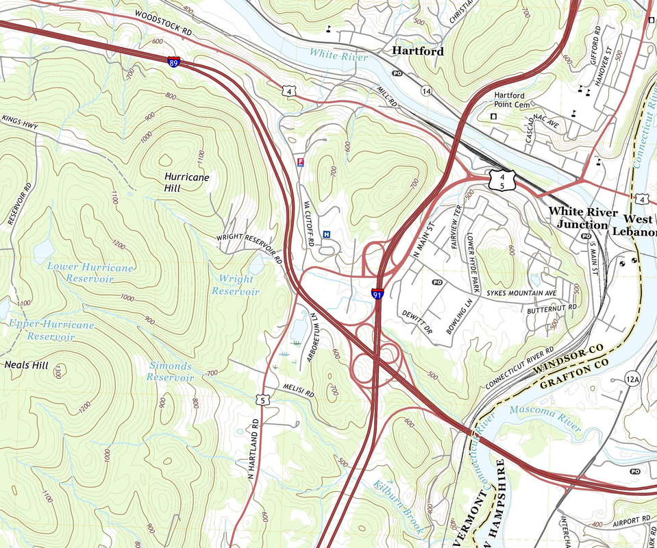 2018 View. King's HIghway, labeled "KINGS HWY" in upper left. Below, also a 2018 view, (just to the west of the previous map), it appears that KINGS HWY goes across Center of Town Road, and then right through the on and off ramps of Exit 1, I-89 in Quechee! We'll look into that further in the next episode of... THE KING'S HIGHWAY 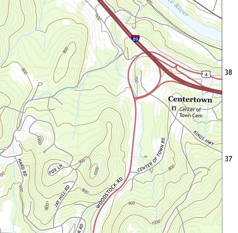 Thanks for traveling down Old Roads, Rivers and Rails of the Upper Valley with me, Bob Totz. If you'd like to subscribe to these articles, posts, blogs, what have you, just send an email to me at [email protected] and I'll add you to the growing list of subscribers who get timely notices of published posts. I extend my warmest thanks to all who have subscribed! Do you have an interesting story to tell, related to this article? We'd love to hear it! Just click on comments and add your thoughts. Thanks! 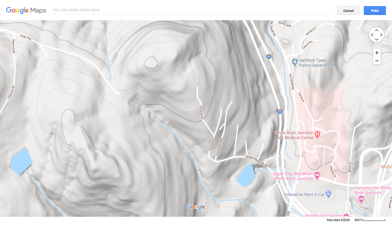 2020 Google Earth Imagery, White River Junction, Vermont. Many early roads followed ridge lines, as well as river valleys. In the history of American highways, we find that many of the early Indian trails ran along the ridge lines for protection purposes. Staying to the ridgelines and high points also provided some relief from the mud and mire of lower elevation routes. The routes of early settlers often started by following these Indian "High-Ways", which were later widened, straightened, detoured, discontinued, or improved, and so on. The "High-Ways" were some of the greatest of the 19th century roads. Some still exist and can be driven on today. We'll see if we can take the old "High-way" to Montpelier by following the old roads of yesterday, that were fit for a King! Sources: 1855 Map of Windsor County Vermont, by Hosea Doton: https://www.loc.gov/resource/g3753w.la001193/?r=0.662,0.518,0.133,0.056,0 Interview with David Brown, Hartford Agricultural Oral History Project: www.hartford-vt.org/DocumentCenter/View/276/HOHP_Brown_Transcript1?bidId= US Geological Survey, Topoview: https://ngmdb.usgs.gov/topoview/viewer/#15/43.6368/-72.4095 History of Hartford Vermont by William Howard Tucker, published in 1889: https://ia802609.us.archive.org/22/items/historyofhartfor00tuck/historyofhartfor00tuck.pdf 1931 VTrans Map of Hartford VT: https://maps.vtrans.vermont.gov/Maps/TownMapSeries/WINDSOR_Co/HARTFORD/HARTFORD_1931.pdf Hartford by Frank Barrett, p. 98 Vermont State Fairgrounds Hartford VT Historical Society: http://www.hartfordhistory.org/12103.html Google Earth: https://www.google.com/maps/place/White+River+Junction,+Hartford,+VT/@43.6480418,-72.3365708,2220m/data=!3m1!1e3!4m5!3m4!1s0x4cb4cb9cfdff35bd:0xe460379aa54a2b52!8m2!3d43.6489596!4d-72.3192579 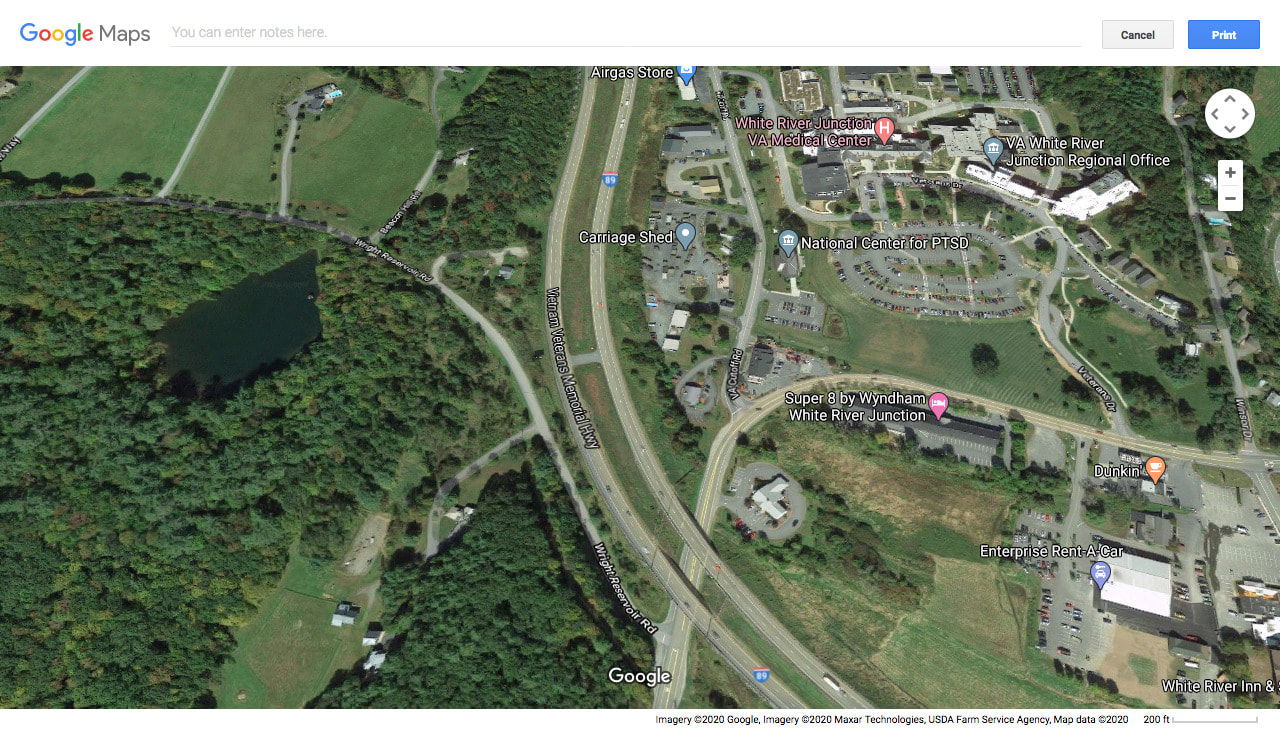 The old Four Corners Ain't What She Used to Be!
4 Comments
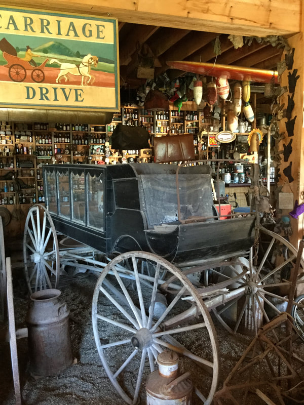 Antique Hearse at the Post Mills Vermont Airport Have you visited the Museum at the Post Mills Airport? It's a unique treasure in the Upper Valley. In addition to the airport being used by pilots of small planes and experimental aircraft, hot air balloons and gliders, the airport houses a varied and unique collection of interesting items acquired and/or built by airport owner Brian Boland, over the years. Some of my family's "heirlooms" were donated to the collection during my time as postmaster in that village, knowing that I could probably see them again, anytime I visit the museum. 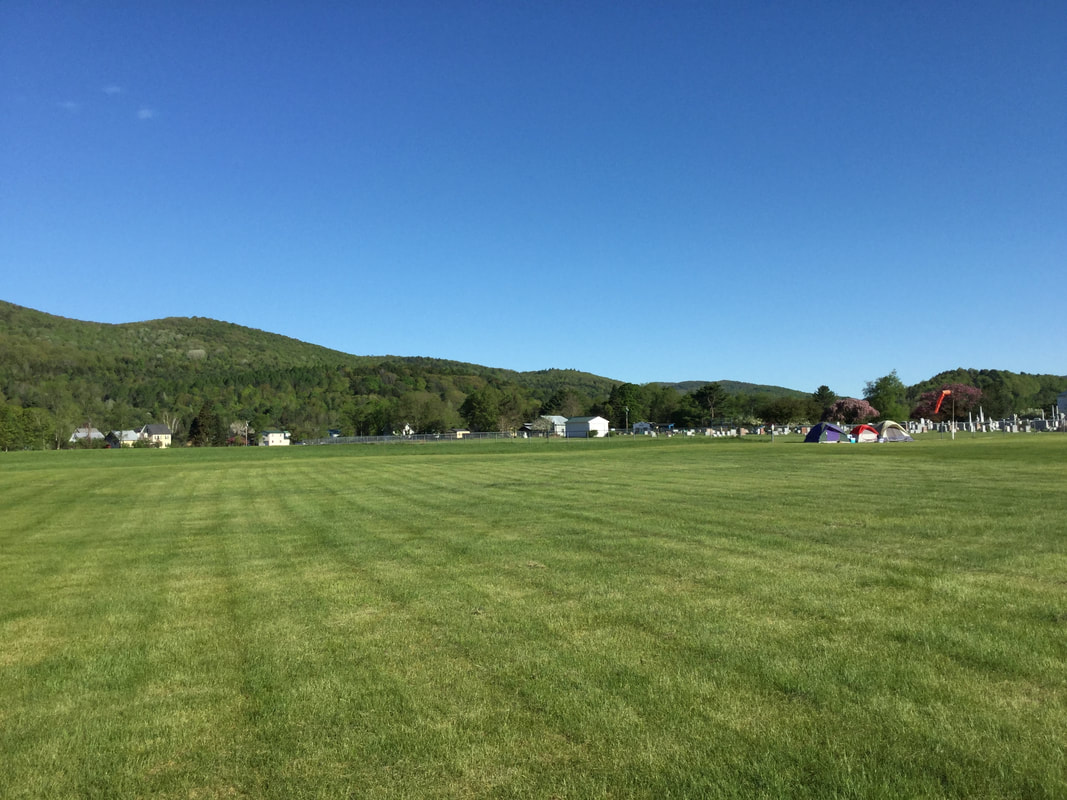 Post Mills Airport Field The location couldn't be nicer. Less than a mile from Lake Fairlee, and on level ground, the airport sits next to a cemetery, and across from the Post Mills Congregational Church, just off Route 244, on Robinson Hill Road. Post Mills is one of the villages of the town of Thetford, not far from West Fairlee. I could go on and on about the history of Post Mills, and include maps and all, but I'll save that for another time. Today I just want to share with you some of the interesting things you might find at the Post Mills airport, in and around the museum "wing". Here's a one-man submarine, sitting under an old canoe, that happened to be outside on display when I took most of these photos, back in May of 2017. 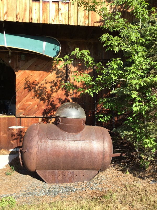 Early One-man Submarine Here's what looks to me to be either an early model rowing machine: 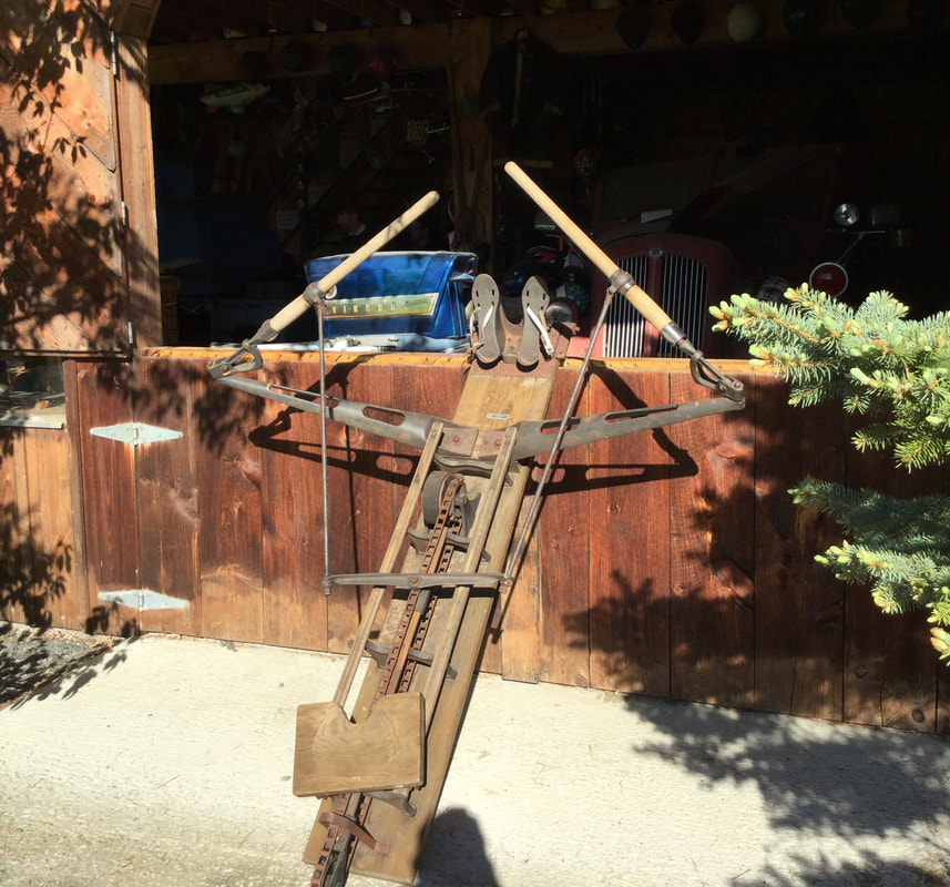 Or maybe it's a human catapult? Somewhere around 2005 or so, Brian acquired a bunch of inexpensive Chinese motorcycles, and used them to create some very unique vehicles. One of them was a double decker bus, with an open top level. We formed a dixieland band and played from the top level of the bus during the Labor Day parade that year. On the spring day that I took these photos, Brian had many of those unique vehicles on display in some very cute little garages that face the museum wing of the airport. The first interesting motor vehicle is a bed! 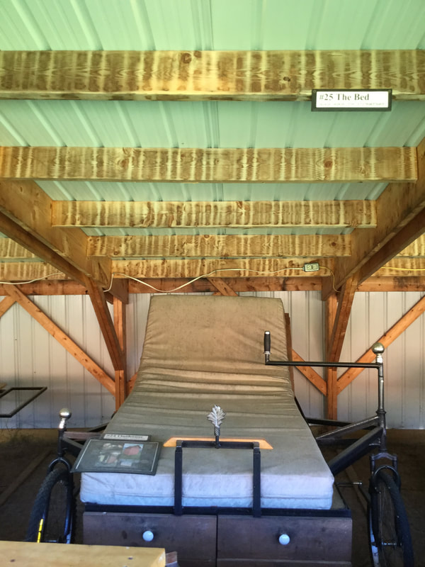 Motorized Bed, Complete with Tiller for Steering, Bicycle Wheels, and a Motorcycle Engine. And Drawers for Storage! Below is one of my favorites. A mobile picnic table! 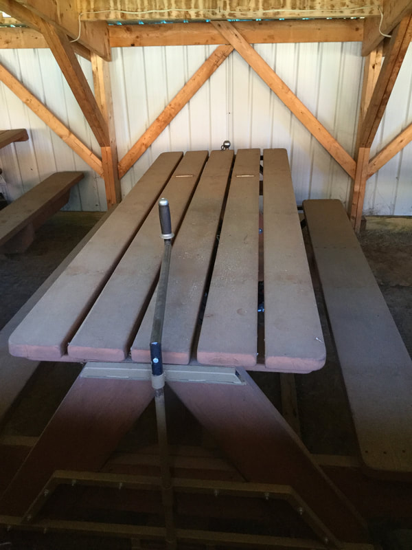 Motorized Picnic Table, Steering Tiller at Front Here's one last piece from the outdoor collection. Brian Boland is a world famous balloon builder and flyer. Here's his combination balloon basket/motorcycle: 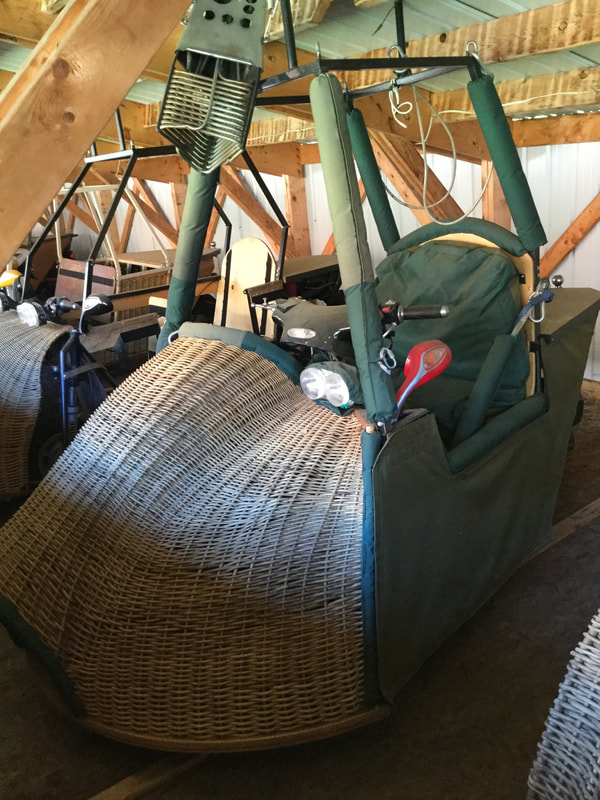 Balloon Basket / Motorcycle Okay, now let's head inside the museum wing and see what's in there... There are a few vehicles on the first floor of the museum wing. Here's a VW Bug with an interesting paint scheme. I think there's two soft top options on this one? 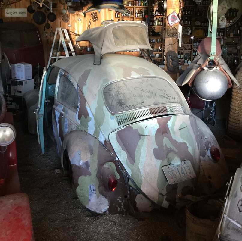 Volkswagen Beetle on first floor of museum. Here's a Subaru you don't see everyday: 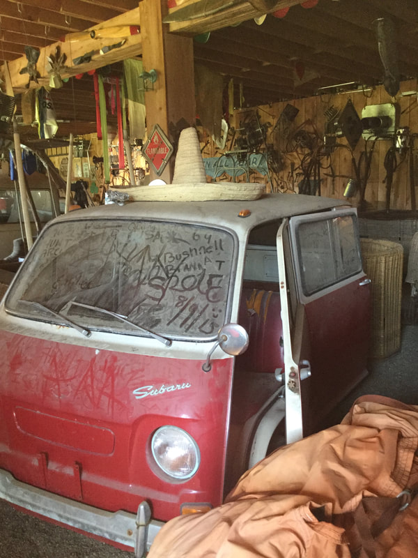 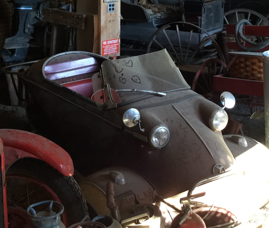 There are many booths upstairs, in the museum wing, housing specific collections. Here is the old vacuum cleaner booth: 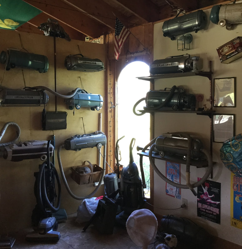 Years ago, I donated my old electrolux canister vacuum that used to belong to my grandparents. It's nicely displayed on the wall along with several others. I think ours is the one on the top shelf on the right. It's fun to go back and see it, now mounted on a wall. I used that vacuum all through college, and beyond, for years. It still worked fine when I gave it to Brian, and I bet it still works fine! 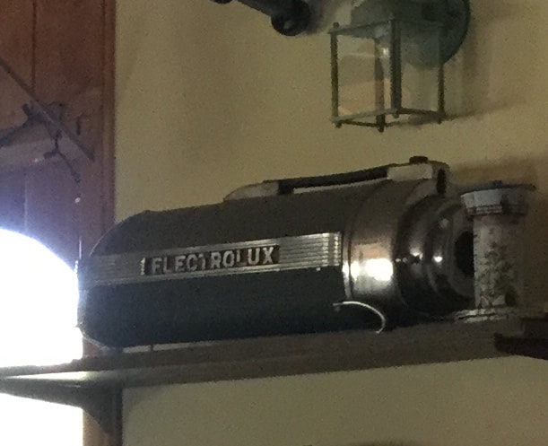 My Old Electrolux Vacuum Cleaner: Timeless Design! There's also a booth dedicated to circus posters... 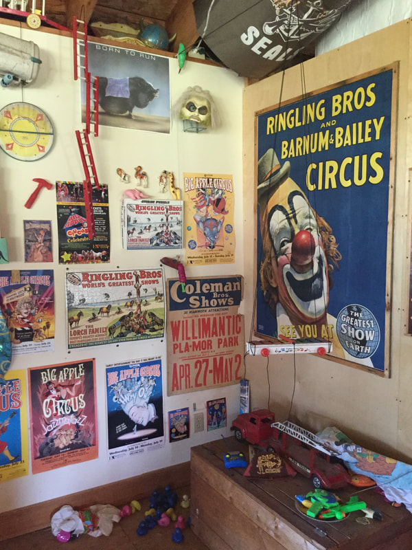 and fans... 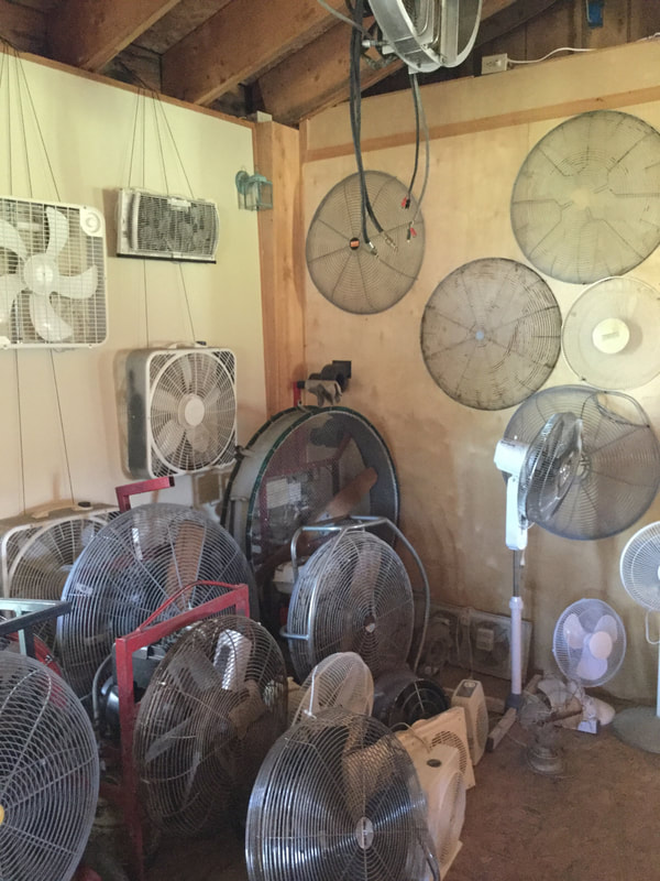 ...and historical military hats and helmets... 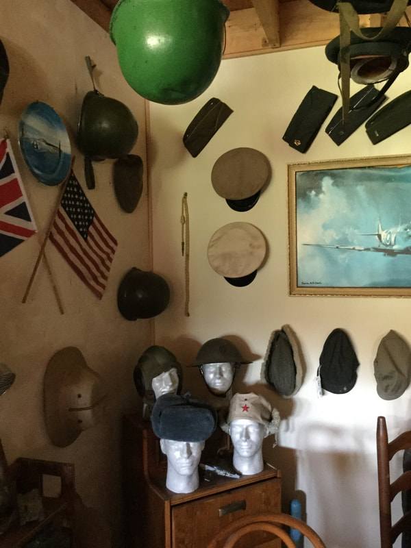 Among the typewriters sits a classic grey Smith-Corona, that I used back in college, and my mother used back in High School! I also used it for a few years in the Post Mills Post Office, before donating it to Brian when the personal computer became part of my job. 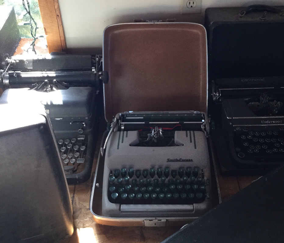 Smith-Corona Typewriter, Mid-twentieth Century Downstairs in the museum, the walls are covered with a wide variety of items, including what appears to be a souvenir from the Titanic. 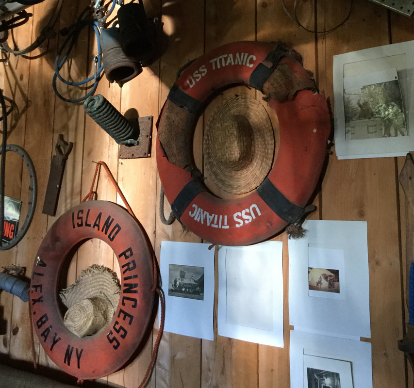 There is a good portion of the lower back wall dedicated to beer bottles and cans, with an assortment of other interesting things placed among them. The wall itself has a grid-like shelving unit built in, facilitating the display of all the treasures. 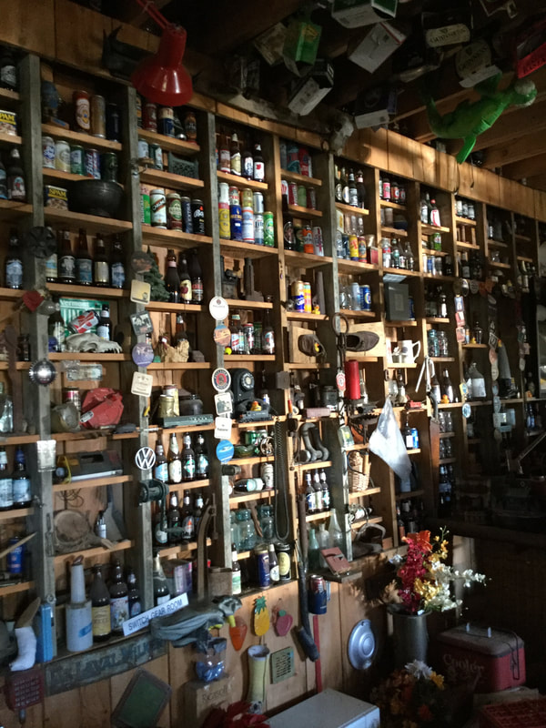 Beer Bottle and Can Collection at the Post Mills Airport 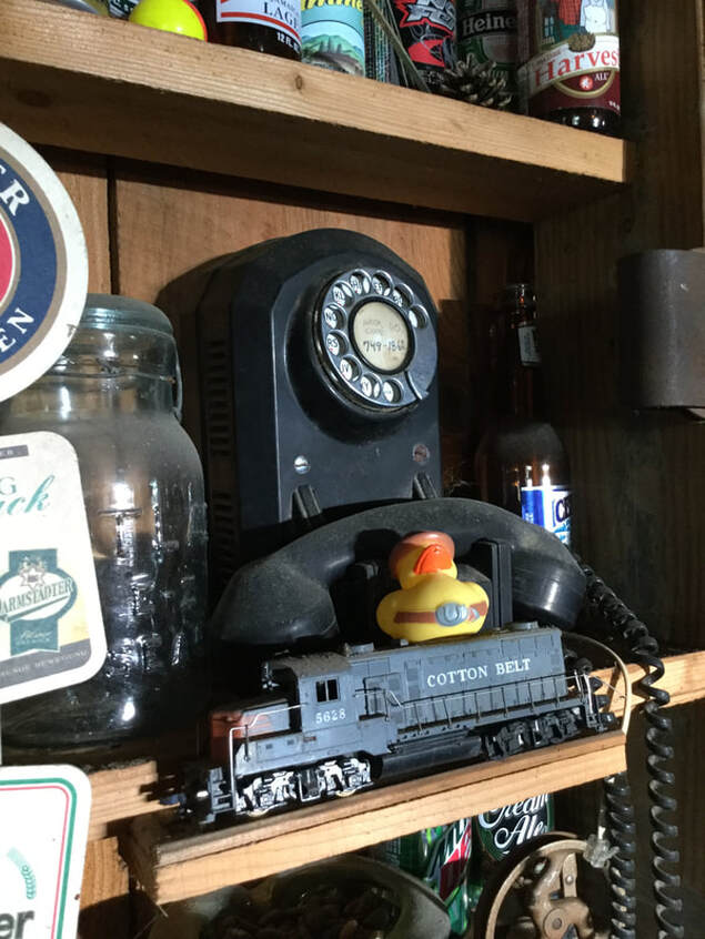 And if you need to make a phone call... Do you collect old and/or interesting things? Many people do, but few have collections of the scale seen at the Post Mills Airport. With plenty of space to display his wide array of twentieth century items, Brian Boland has created a unique museum in the quiet village of Post Mills Vermont. The museum is open by chance. If you happen by the airport, knock on the door, and if Brian is home, I suspect he'll let you walk through and admire his collections. And don't forget to ask about the Vermontasaurus! 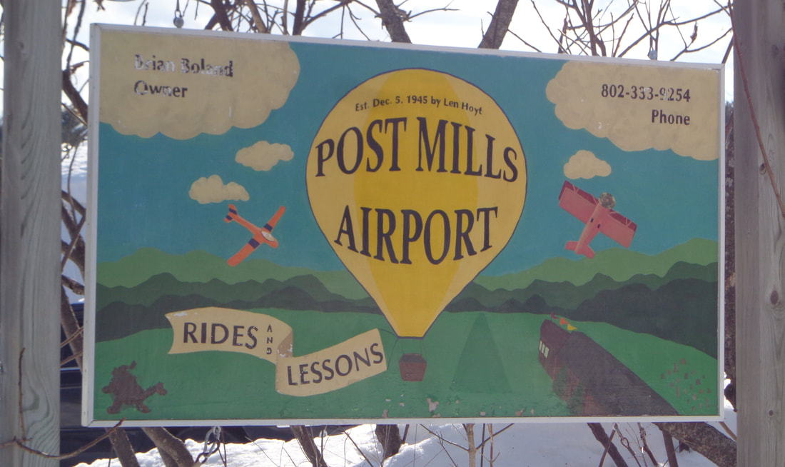 Sign at Entrance to the Post Mills Vermont Airport  Post Mills Vermont Airport. Museum wing Not Visible, to the Left. Thanks for meandering down Old Roads, Rivers and Rails of the Upper Valley with me, Bob Totz To subscribe and receive free updates from Old Roads, simply send an email to: [email protected] Old Roads, Rivers and Rails explores the Upper Valley of the Connecticut River, it's history, geography, and intersting aspects that make the area a special place to live and thrive. 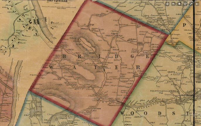 Bridgewater Vermont, 1855 Windsor County wall map by Hosea Doton. Have you heard of, or been to Chatauguay? Chatauguay is an old settlement in the northwest corner of Bridgewater Vermont. Bridgewater lies just west of Woodstock, Vermont and can be found on the way to Killington and Rutland on U.S. Route 4, although the Chatauguay area is closer to Barnard. Below is a close-up from the 1855 map. The name Briggs appears, along with a schoolhouse and Saw Mill at the confluence of two streams in Chatauguay. In this early view, we can clearly see two roads, one leading west, into Sherburne, (and Rutland County), and the other leading north and northeast, into Barnard. As you can see, above the Briggs Family, the road crossed the brook many times, on the way to the next neighbor, Thompson, and there was even another schoolhouse, up near the township boundary with Barnard. 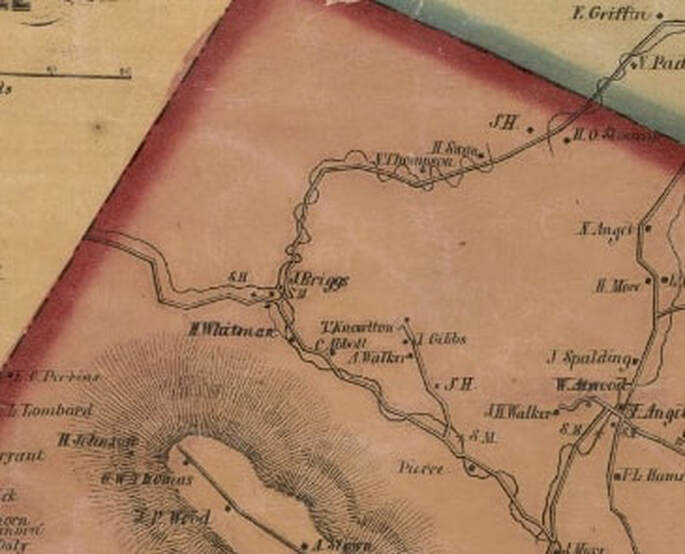 Below is a topographic map view from the 1930's. By then there were three roads leaving the area labeled Chatauguay, and they were all unmaintained roads at this point. 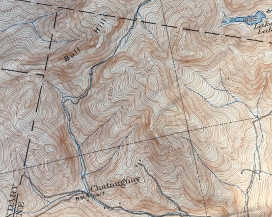 Below is a 1943 view; USGS imagery, which shows even more unimproved roads in the area, and a few dwellings or camps near the base of Bull Hill, in the nort-central area of this photo: 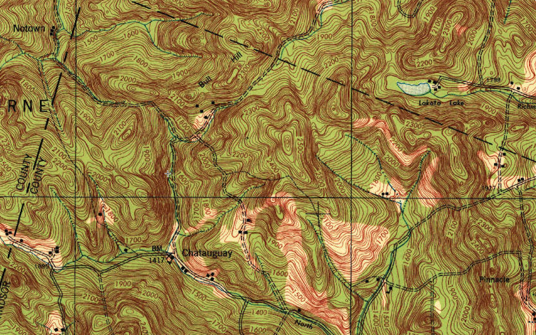 The above map is from the 1:62,500 or "15 Minute" series USGS map. Below is a similar view, but from the 7.5 minute series map, from 1966. On this map we see the unimproved road turned into a single dashed line, or "Jeep Trail". Also, a portion of the Appalachian Trail has appeared. 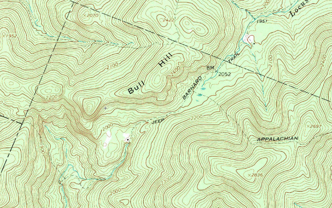 There's a spot on the map above, just above the word "Jeep" where the terrain narrows, with sloping sides, at an elevation of about 2100 feet. Just beyond that, to the northeast, there's a marshy area, before descending on the north side. This looks like an interesting area to do some field checking in the future. It was recently suggested I look into the history of the roads of Bridgewater, particularly the roads that became discontinued sometime in the last couple hundred years. Often those roads provide clues to early settlement along the way. Stone walls and old foundations can often be found. Farm houses, barns, mills, and outbuildings that once served the humble settlers of these townships, in many instances fell into disrepair and disuse, and simply decomposed back into the earth, leaving only the stones upon which they were built. 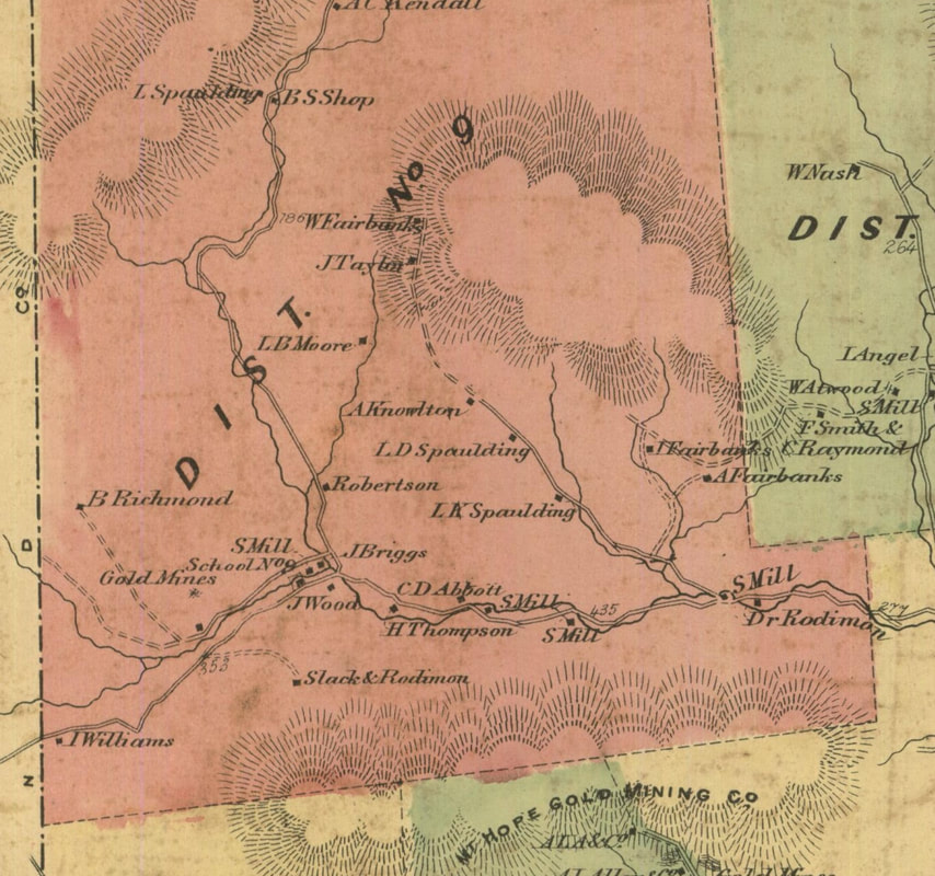 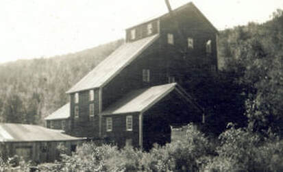 The above map is from the Beers Atlas, around 1869. By this time gold had been found, and the northwest region of Bridgewater was quite active. The gold mini-boom provided a romantic period in the history of Bridgewater Vermont. "Goldcrusher" Building, circa 1902 While doing some internet research for this post, I came upon the following great video posted by Kristina Stykos. It features a road trip in the Chatauguay, using their "trusty gazetteer" for navigation. If you want to get a good feel for what it's like to travel in that remote area, by car, in the 21st century, click on this link:
I'ts Just a Mile Down the Road Following is another video, which gives an idea what it would be like to travel out the old Chatauguay Road today in a caravan of modern Jeeps! It's an interesting video to watch, especially after studying the topography and map images of the area. 2016 Killington Jeep Jamboree - Friday, Chatauguay There are some other interesting areas in Bridgewater that I'd like to explore in the near future. Places with names like "Grandmadam Hill", "Dailey Hollow", and "Bridgewater Hollow" For now, I'm just looking forward to a nice hike up into Chatauguay, but I don't think I'll take my Jeep too far up in there! Thanks for traveling down Old Roads, Rivers and Rails of the Upper Valley. - Bob Totz Map Sources: 1855 Windsor County Map by Hosea Doton: https://www.loc.gov/resource/g3753w.la001193/?r=0.28,0.423,0.138,0.053,0 USGS maps: https://ngmdb.usgs.gov/topoview/viewer/#4/40.00/-100.00 "Goldcrusher" Building courtesy Bridgewater Historical Society: http://www.bridgewaterhistory.org/projects/gold-crusher/  The Independent Farmer The following poem, by Thomas Green Fessenden, was published in the book: Poets and Poetry of Vermont, in 1858, by Abby Maria Hemenway. Abby Maria Hemenway was a 19th century Vermont historian and schoolteacher. She was born in Ludlow, Vermont in 1828, and graduated from Black River Academy. She is best known for her Vermont history series: The Vermont Historical Gazeteer. Thomas Green Fessenden was born in Walpole, New Hampshire, on April 22nd, 1771. He graduated from Dartmouth College in 1796, and went on to study law in Rutland, Vermont. He practiced law for a number of years in Brattleboro and Bellows Falls, and then became a newspaper editor, eventually starting the publication: The New England Farmer. He died in November 1827 at the age of 56 the year before Abby Maria Hemenway was born. It may very truly be said, That his is a noble vocation, Where industry leaves him to spread, Around him a little creation. He lives independent of all Except the omnipotent donor; He's always enough at his call, And more is a plague to its owner. He works with his hands it is true, But happiness dwells with employment; And he who has nothing to do, Has nothing by way of enjoyment. His labors are mere exercise, Which saves him from pains and physicians; Then farmers you truly may prize Your own as best of conditions. From competence shared with content, Since all true felicity springs, The life of the farmer is blent With more real bliss than a king's. 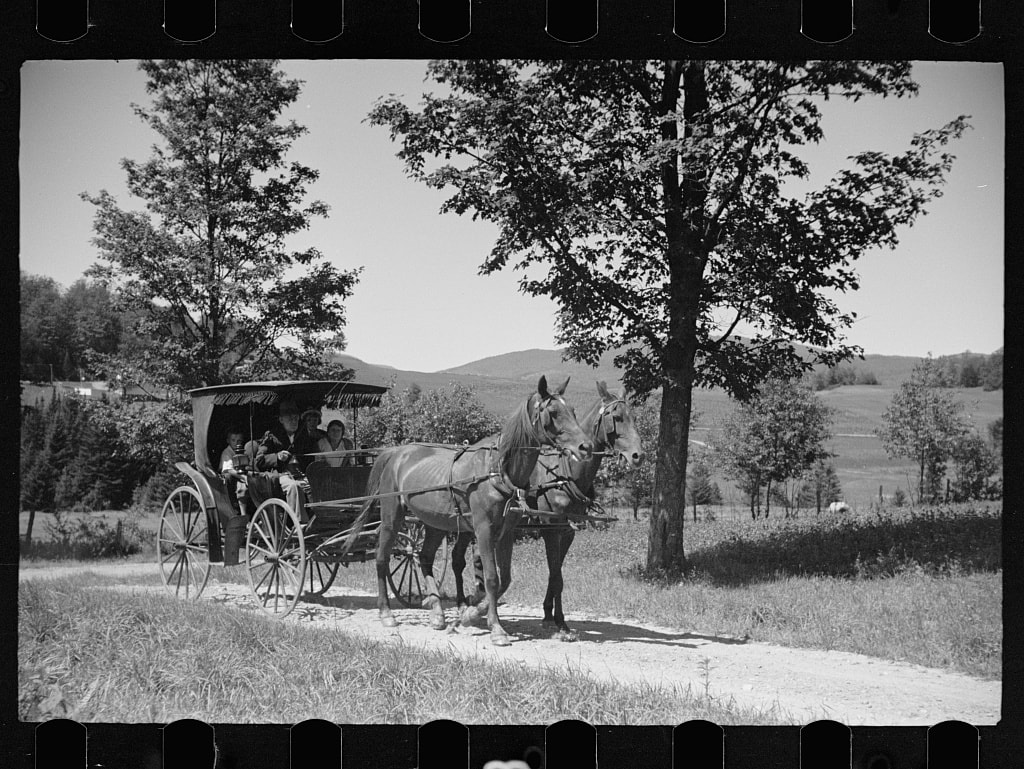 Sources: Poets and Poetry of Vermont, 1858, by Abby Maria Hemenway, p. 12: https://ia800701.us.archive.org/30/items/poetsvermont00hemerich/poetsvermont00hemerich.pdf Old carriage and Farm Family, 1936, Hyde Park VT Photos by Carl Mydans, Library of Congress, found at: http://photogrammar.yale.edu/records/index.php?record=fsa1997002583/PP 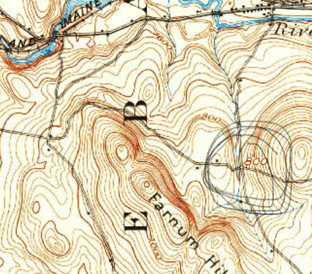 A Portion of The Old King's Highway, Lebanon. NH, winding north and west around Farnum Hill. 1932 USGS 15 min. series, Hanover Quadrangle. Circled is Intersection with Slayton Hill Road. Portions of The "King's Highway", or "The Old King's Highway" show up in various places in New Hampshire and Vermont. I first noticed it when looking at older maps of the Poverty Lane area of New Hampshire, from before the Lebanon Airport was built. I found it interesting that there was a King's HIghway in both Lebanon, NH, and also just across the Connecticut River in Hartford, Vermont. In Lebanon, the "Old King's Highway" came in from the east, from the Storrs Hill area, crossing Slayton Hill Road, heading up hill going west into Farnum Hill. 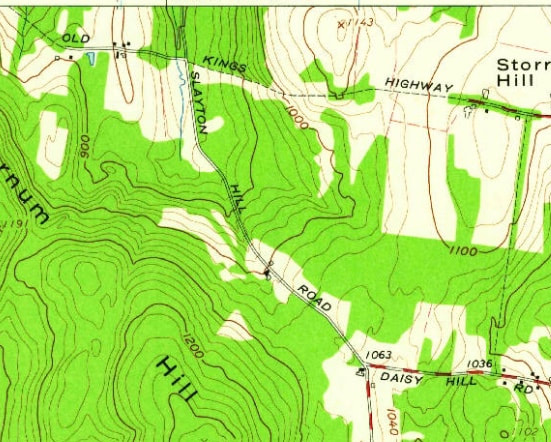 Old King's Highway in Lebanon, shown at top. While Mostly a Trail, One portion is maintained, just west of the Intersection with Slayton Hill Road. Eastern Portion Heads Toward Storrs Hill. From the 1959 USGS 7.5 Minute Series North Hartland Map. Awhile back, I took a trip east on the Miracle Mile, to investigate the Old King's Highway. Just before the center of Lebanon, I took a right up Slayton Hill Road, a road I'd passed by many times, but had only traveled on once or twice before. 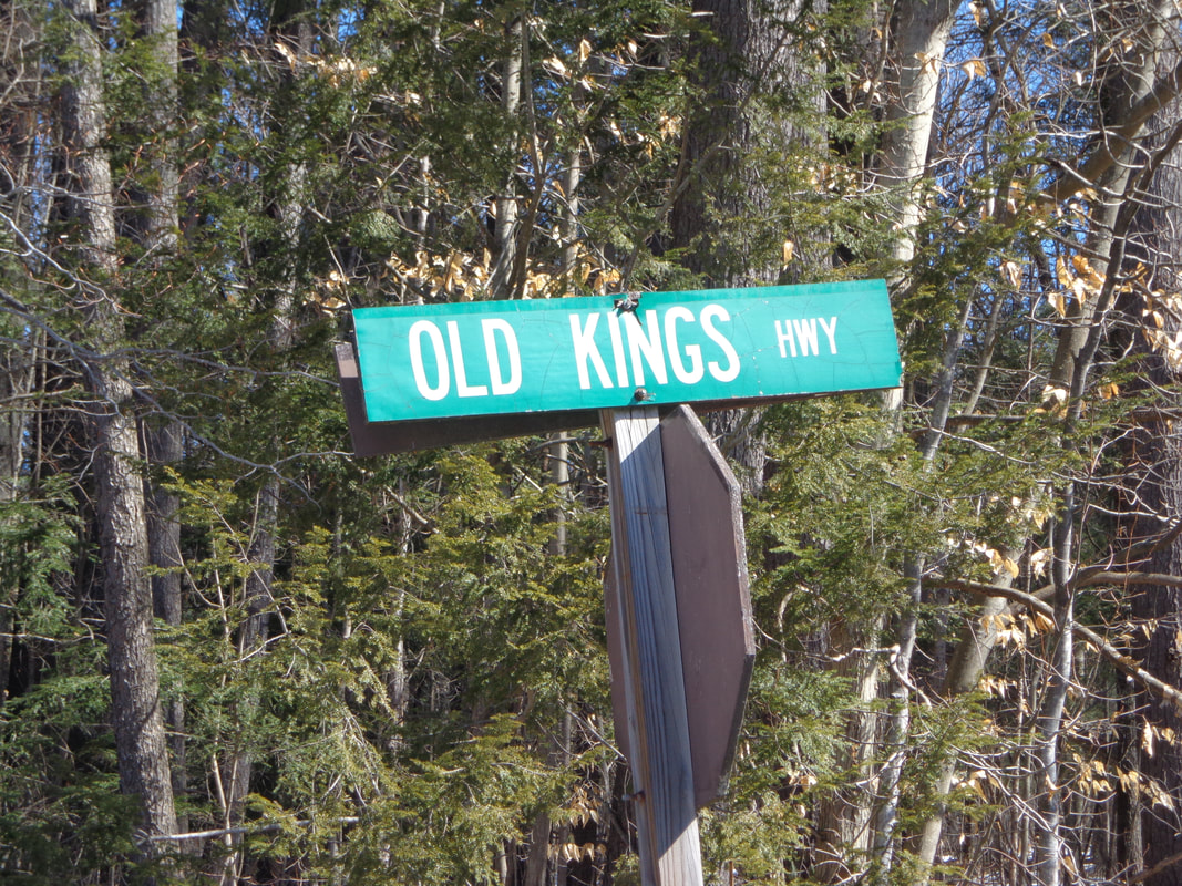 Sign at the corner of Slayton Hill Road, Storrs Hill Road, and Old King's Highway, (a.k.a. Farnum Hill Road). After winding my way up Slayton Hill for a while, I came to the intersection with Storrs Hill Road, which was to my left. To the right, uphill, was "Old King's Highway" However, if you look at the area on google maps, that section of the road is labeled Farnum Hill Road. I headed up Old King's Highway, and found a beautiful stately old home situated on a knoll. The home was in the process of receiving new windows, and probably siding too. It was a beautiful spot, and spoke of a simpler time, long ago. Just beyond where the maintained portion of the old road ends, the Old King's Highway becomes a trail in the woods, with massive stone walls on either side of a wide roadway. There's a kiosk located there, where the modern road ends, but the Old King's Highway continues on, around the northern boundary of the Farnum Reserve. 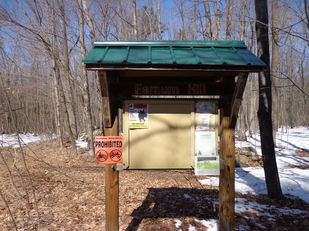 Kiosk at the Beginning of the Old King's Highway Trail in Lebanon NH I headed down the Old King's Highway for a walk. It was quiet and calm, and I could imagine the old horse drawn wagons clip-clopping down the wide lane. 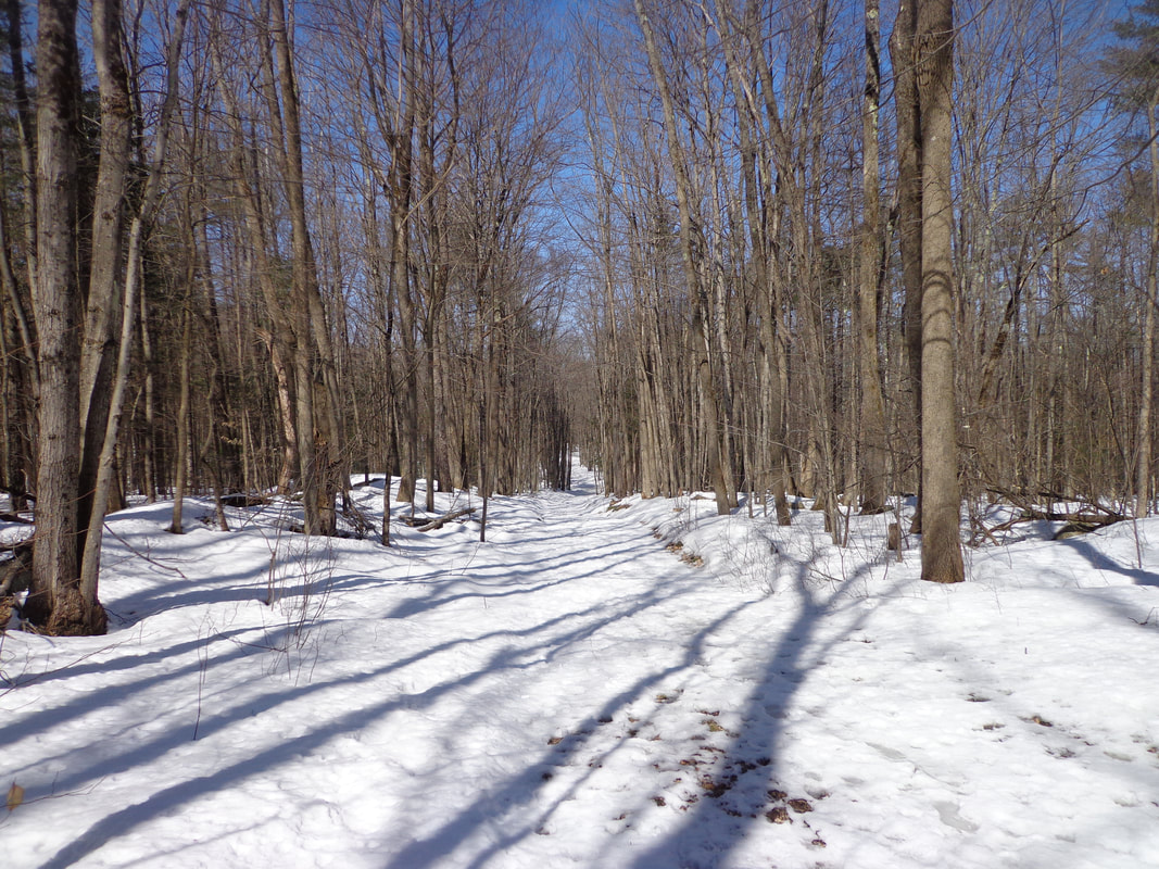 The Old King's Highway, at Farnum Hill, in Lebanon. Here is a quote from the official Lebanon New Hampshire website: "The area around Farnum Hill is rich in early Lebanon History. King's Highway, the first planned colonial road in Lebanon is now a class VI road running along the north boundary of the reserve. Original planners proposed that the first village in Lebanon be built in the north slopes of Farnum Hill. However, early settlers chose other sites for their first villages" As I headed back out of the woods, and returned to Slayton Hill Road, I eventually came to a fork, took a right, and found myself on Poverty Lane, a road I'd been on before, though many years ago. As I continued driving along Poverty Lane, I eventually came to a spot where the King's Highway Trail came out of the woods on the other end of the Farnum Hill Reserve, not far from Poverty Lane Orchards. It's great that this section of Lebanon's oldest colonial road is available for hiking today. While searching for old maps of Lebanon with the Old King's Highway on them, I found an interesting 1884 "Bird's Eye View" map of the center of Lebanon, from the Library of Congress website. I place it here, though it does not show the King's Highway area, which would have been a bit to the south. 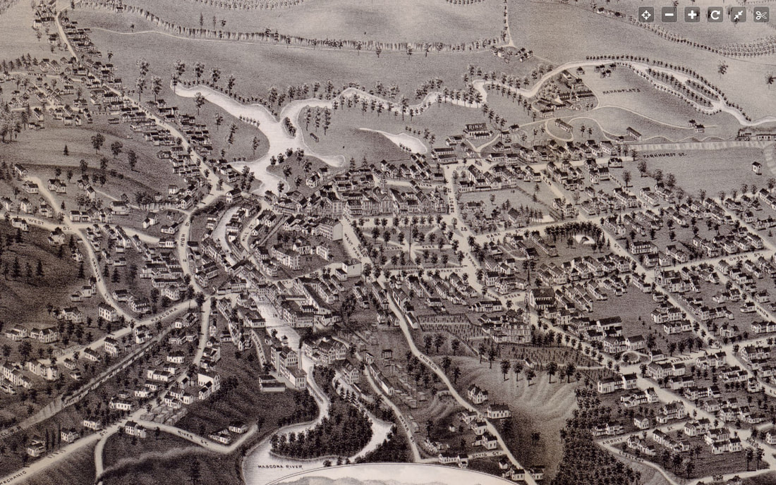 Bird's Eye View of Lebanon New Hampshire, 1884. found at: https://www.loc.gov/resource/g3744l.pm011600/?r=0.017,0.229,0.949,0.381,0 Below is the imagery from the 1860 Grafton County, NH map by Walling: 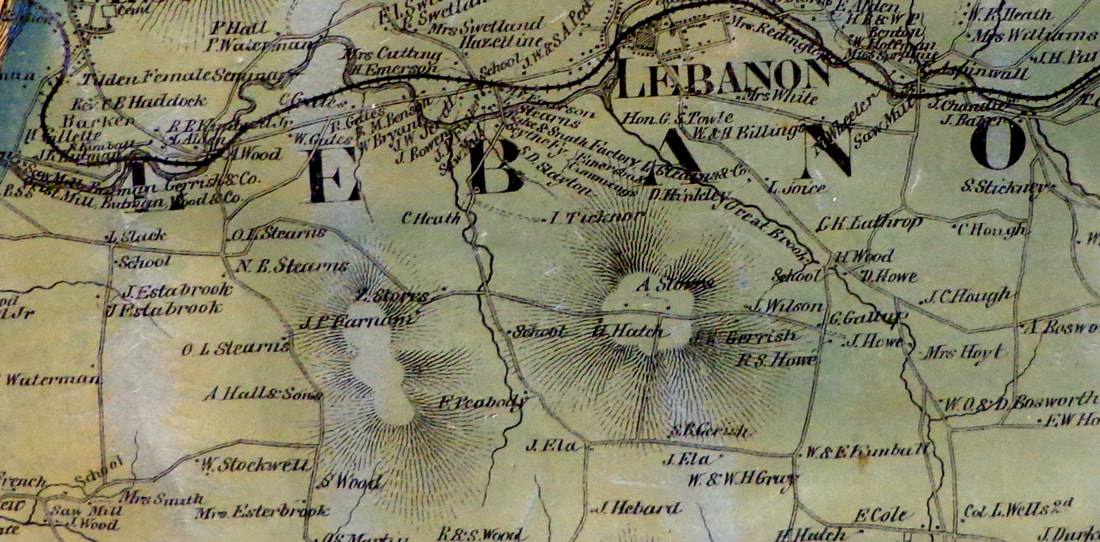 In the 1860 view above, we can see where the name "Farnum Hill" came from. Farnum lived along the Old King's Highway, along wih Z. Storrs, near the area that I walked, not far from Slayton Hill Road. If you followed the Old King's Highway in 1860, you'd get to an intersection near O.L. and N. B. Stearns, where Old King's Highway meets Poverty Lane on the west side of Farnum Hill. Continuing west, towards where the airport stands today, there was a school near L. Slack's place. The road continued west, down towards what is now Route 12A. Below is a similar view, almost one hundred years later, from 1959, with the Old King's Highway still in view as a trail. 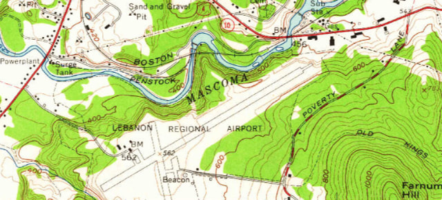 Farnum Hill, Old King's Highway, and the Lebanon Airtport. 1959 7.5 Minute Series USGS Hanover Quadrant. In researching online about the King's Highway, you'll find a few real estate ads, and some history about the original King's Highway that King Charles II ordered built in 1650, from Charleston. South Carolina to Boston Mass. The original highway was extended through Hampton and Portsmouth, New Hampshire, to Portland, Maine. Apparently there were many King's Highways, King's Ways, and King's Roads in the colonial era. One was built from Keene, New Hampshire to the seacoast, starting in 1747, through Merrimack, NH. There is an interesting "Church Map" available, courtesy Dartmouth College Libraries. Here is the top of the map. I haven't found much out about this map yet, but it appears that the bold lines were sections known as "King's Highways", Which could be used as a route to get to church. Strangely enough, the Old King's Highway in Lebanon is not shown boldly, presumably because it was more of a trail than a road at that point in time, around 1925. 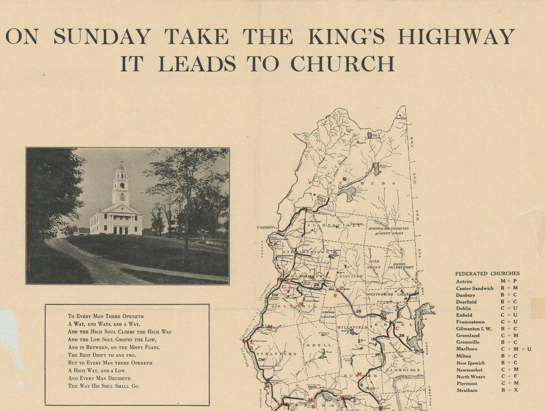 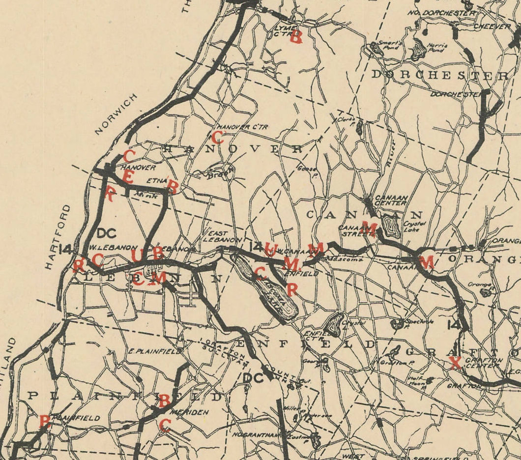 Close-up View Showing Lebanon, Hanover, Plainfield, Enfield and Canaan NH. "Church Map" Prepared by the Interdenominational Commission of New Hampshire, 1925 Courtesy Dartmouth College Libraries An old timer once told me that a King's Highway went from Boston to Montreal, via Lebanon and White River Junction, and Montpelier. I suppose travelers in the earliest days did well to get a ferry across the Connecticut River, either at Lyman Point, or maybe a little further south. I also read that back in Colonial Times, a road might be reviewed by a royal committee, and if found to be good enough, it was deemed "The King's Highway". The following is an excerpt from The Road North of Boston, New Hampshire Taverns and Turnpikes, 1700-1900: "In 1743, for example, the legislature sent a committee 'to goe up to Chester and Londonderry to View a high way formerly laid out.' Only after the committee reported the road to be 'the most conveniente way for Accomodation of Both Towns and Travellers in General' did the committee proclaim it "the King's Highway and...a Publick road' " By being proclaimed "The King's Highway" the road was available to be maintained at town expense. I guess if the road passed the review, then it was good enough for the king to travel on. There's a small section of a King's Highway in Hartland, VT too. Here's a 1959 view of the King's Highway in Hartford Vermont, in the Hurricane Hill area, as seen below: 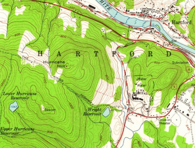 King's Highway in White River Junction, or Hartford, Vermont, Heading Northwest from Wright Reservoir Area. 1959 USGS 7.5 Minute Series, Hanover NH Quadrant There's also a section of King's Highway in Pomfret, VT, not far from the Bunker Hill Cemetery and the Appalachian Trail. 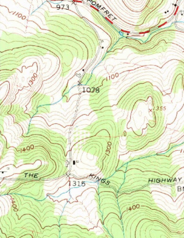 King's Highway in Pomfret, Vermont 1959 7.5 Minute Series, USGS Quechee Quadrangle I recently spent some time trying to find what would have been the most likely route to Montpelier from White River Junction around 1820 or so, while searching for segments of the old King's Highway. I mapped out an interesting trip, that would be fun to try to travel today. There are some beautiful old roads along the ridges and valleys of Vermont, awaiting exploration.
Thanks for traveling along on Old Roads, Rivers and Rails of the Upper Valley. - Bob Totz USGS Map Source: ngmdb.usgs.gov/topoview/viewer/#4/39.98/-100.06 King's Highway through Merrimack, NH: www.merrimacknh.gov/highway-maintenance/pages/old-kings-highway Interesting "Church" map of King's Highways: http://libarchive.dartmouth.edu/cdm/singleitem/collection/gsmaps/id/1243/rec/1 Lebanon NH Official Website on Farnum Hill Reserve: https://lebanonnh.gov/Facilities/Facility/Details/Farnum-Hill-Reserve-26 Book: The Road North of Boston: New Hampshire Taverns and Turnpikes 1700-1900. authors: Donna-Belle Garvin and James L. Garvin. published by University Press of New England, Hanover and London. 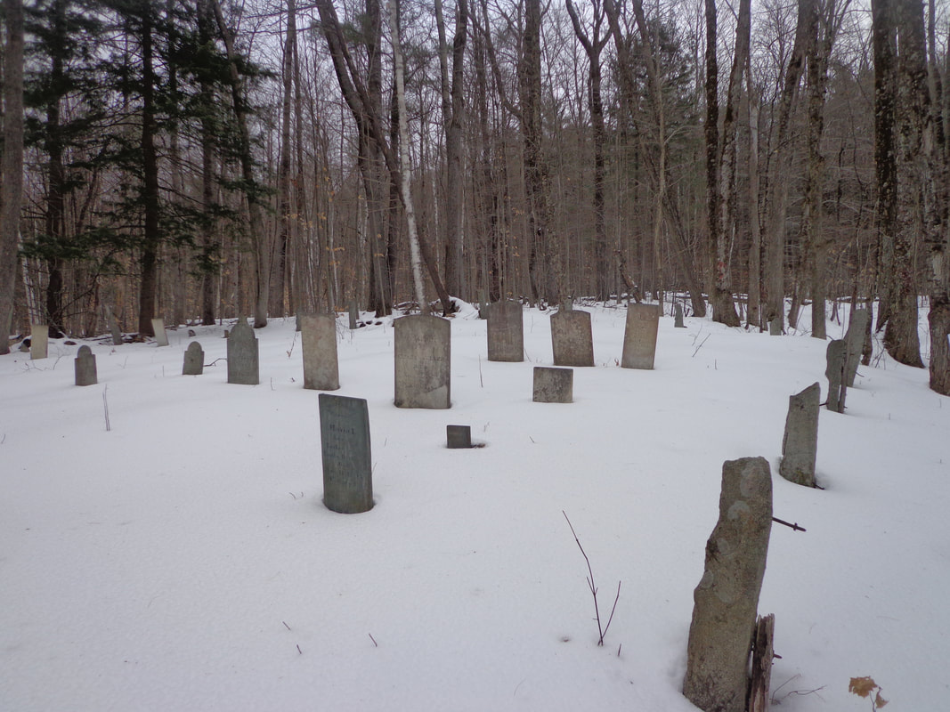 Parkhurst Cemetery, Norwich Vermont. 4 PM, Tuesday, Jan 28, 2020 We were so-o-o close to turning around without finding it ! We'd been hiking longer than Mike and I expected, almost two hours since 2:30 PM, and we knew we'd be losing daylight soon. Of course, when you've got to stop, take off gloves, and get out a camera and take a photo every other minute, like I do, it can take a while to make any real progress! Plus, we didn't know exactly where the cemetery was, so at one point we went off on a tangent, and then doubled back, and then took the correct turn downhill, near an old camp. 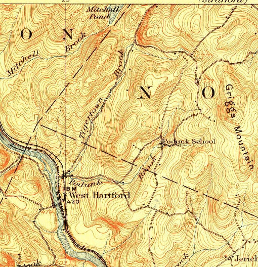 We Headed Out on Sue Spaulding Road, in Search of the Parkhurst Cemetery . On the Map Above, That's the Right Turn After the Words "Tigertown Brook", Heading Towards Griggs Mountain. 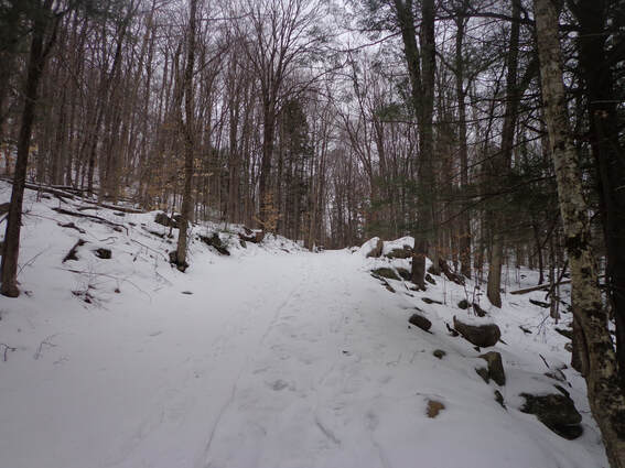 If you haven't read part one of this adventure, you might want to read it first. It shows vintage maps and preliminary information used to help locate the old cemetery. Here is a link to Part One: In Search of Parkhurst Cemetery We parked the Jeep on the side of Tigertown road, and started walking up Sue Spaulding Road. It's steeper at the first part, then it levels off. The snow surface was sort of a loose crust, deep enough to make walking a little tough, but there were snowshoe and ski tracks, so walking on them was pretty easy, as long as we watched our traction, and walked in the snow in icy spots. On our left was a rocky hill. 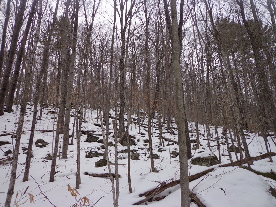 And to our right, we could see the other side of a valley. 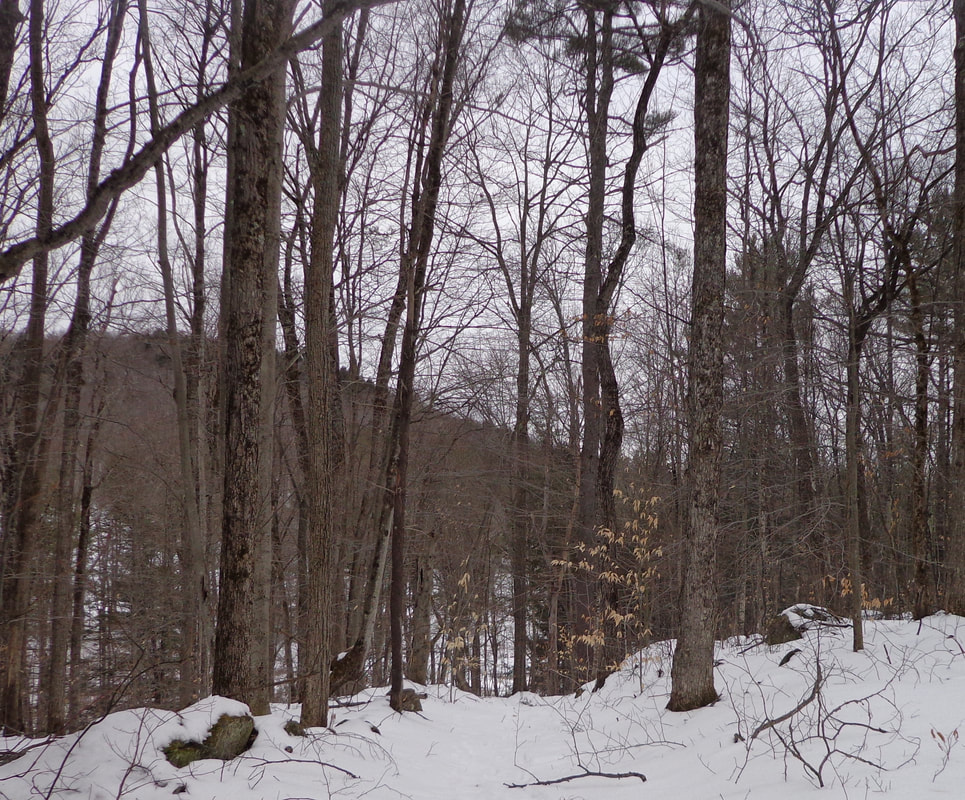 As we continued on, we noticed nice old stone walls on either side of the wide old road. Long ago, this was just another town road, traveled by folks and their animals, on foot, horseback, and in wagons. Today, it's a vestige of the past, a road that no longer warrants continual maintenance by the town. 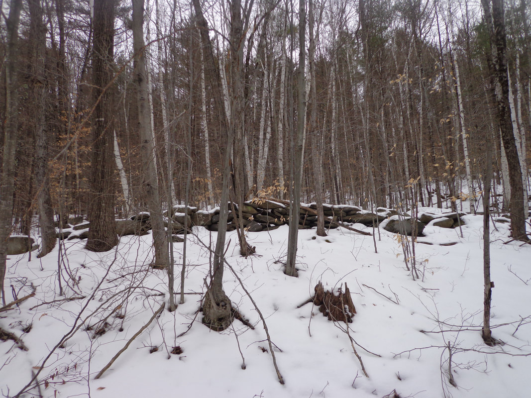 The temperature was near freezing, so there was a bit of melting going on underfoot 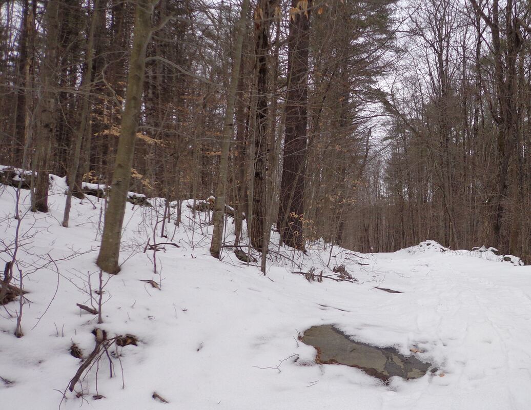 We soon passed a camp and came upon a wide clearing. Mike recognized an old trail to the left that he had taken years ago. 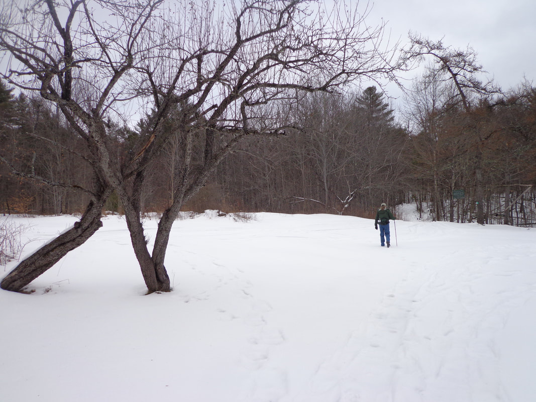 Back in the woods, we came upon a small waterfall on our right. 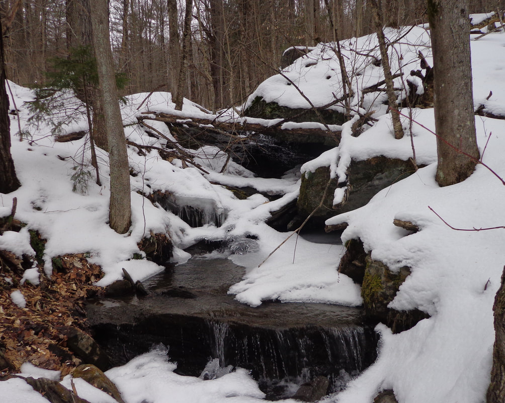 The road was wide and clear in spots, and had recently been packed down by snowmobiles in this section. 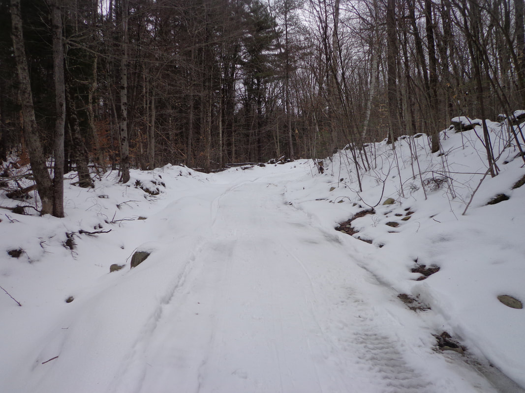 Soon we came upon another clearing, and another camp up ahead. 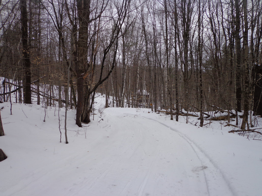 I'd walked to this spot before, but via the Burton Woods Road. We were now faced with a decision: head down, to the right, and follow the snowmobile path, or continue straight, toward the second camp, where Burton Woods Road came down from the left. A fork in the road: 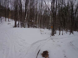 A fork in the Trail, and a Decision to be Made. 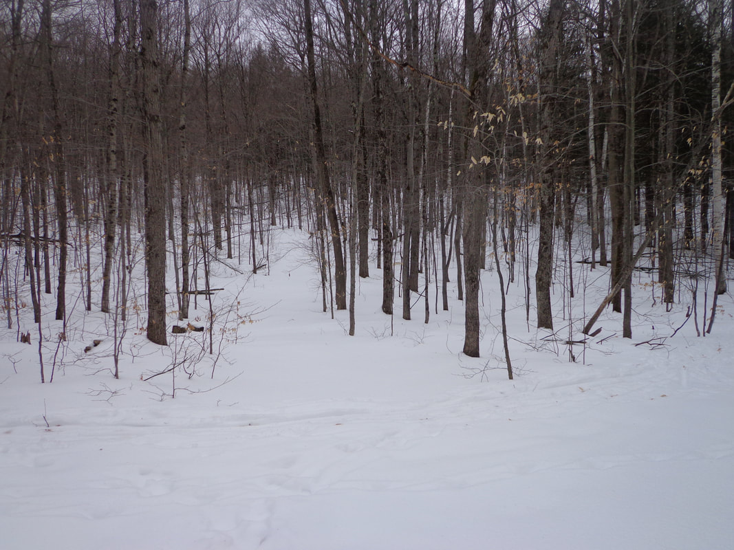 We decided to go straight, toward another camp where it looked like the road continued past. We post-holed uphill past this third camp, to a point where another trail crossed, that had well worn cross-country ski marks, (see above). It looked like a great place to ski, but we turned around, and went back to the turn and followed the snowmobile trail. Before we got back to the turn, I took a few photos of an old stone foundation. It must have been a beautiful location for a farm, in its day. 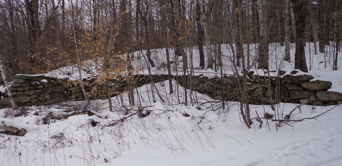 Antique Stone Wall Foundation, Possibly from a Barn. 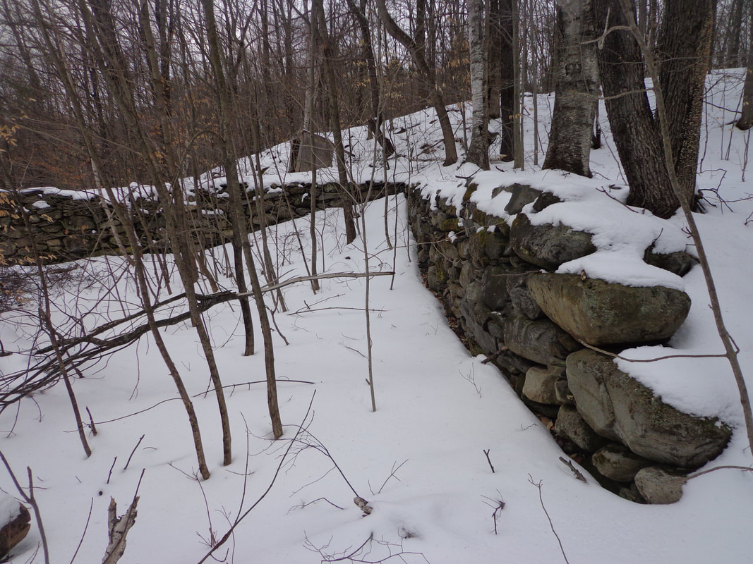 It amazes me that after so many years, possibly 200 or more, these stone foundations still appear level, and straight with clear cut corners. 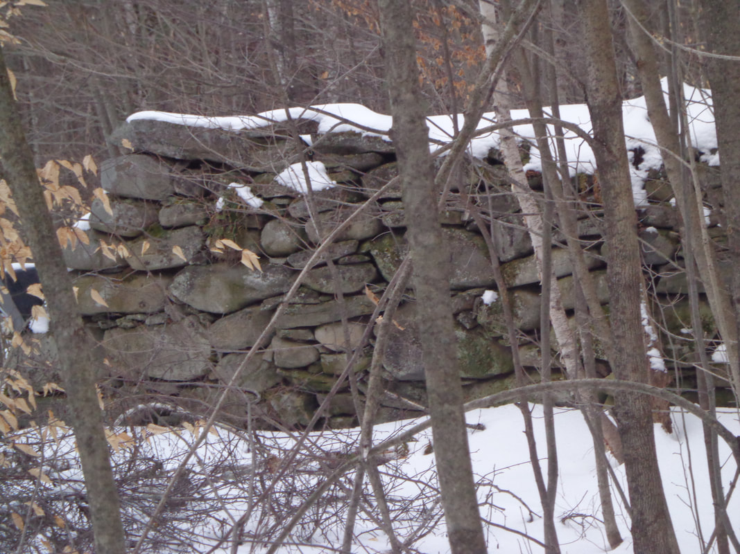 Soon we were heading downhill, hopefully on Burton Woods Road, heading toward Parkhurst Cemetery. 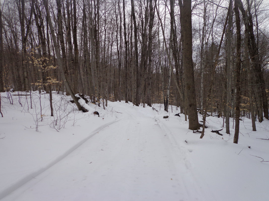 Burton Woods Road, also a snowmobile trail this time of year. Burton Woods Road had come in from the North, and now we were going down what I was hoping was the southern section of that road. It looked like a good bet, considering how wide it was. We didn't bring any maps with us, but I had brought along an iPod with a couple map close-up screenshots I had taken. Every once in a while I checked those maps, but since returning, I've found other maps with more information that would have been more help. We wandered along Burton Woods Road, descending a little at first, followed by a pleasant, fairly level walk. I kept thinking, "It's getting late, we should probably turn around soon." There were some wet spots to negotiate and we had to bushwack a bit, in a few spots. 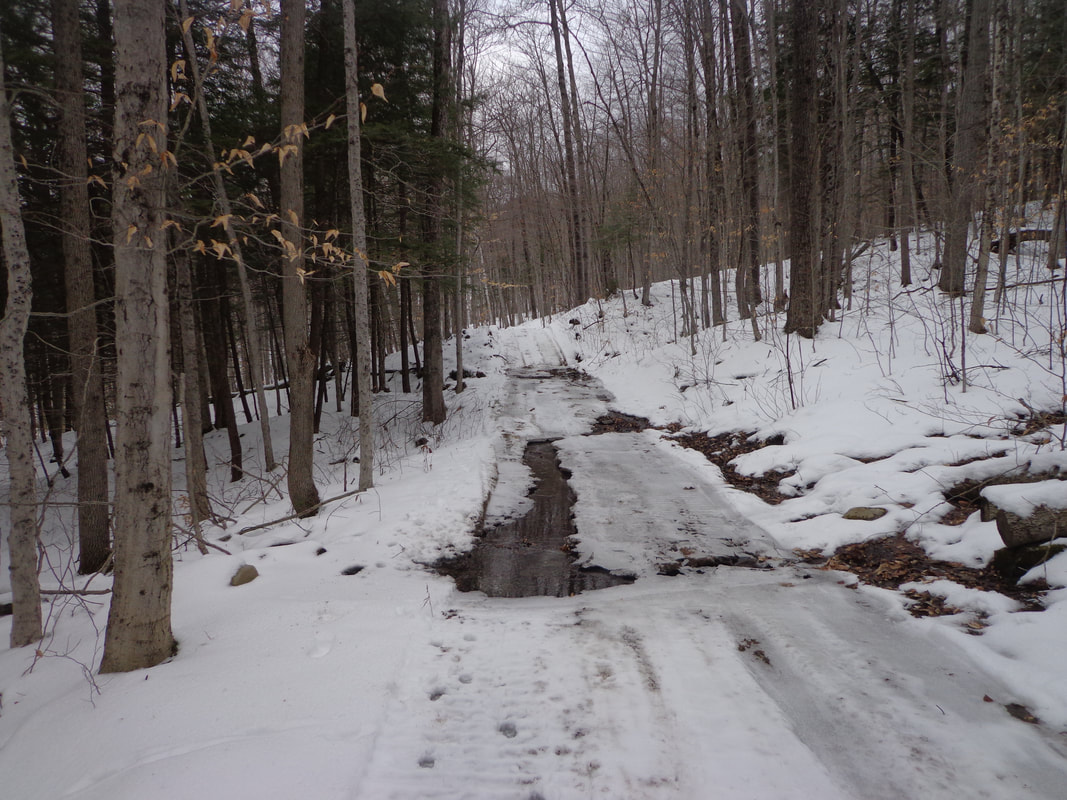 Along the way, we could see that there was a nice view to the southwest beyond the nearby trees. 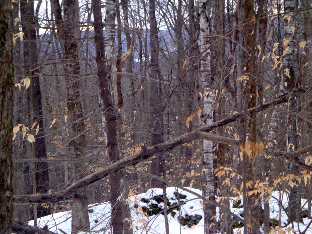 In a little while, we came upon this interesting sign in the woods, which verified we were on the right road. 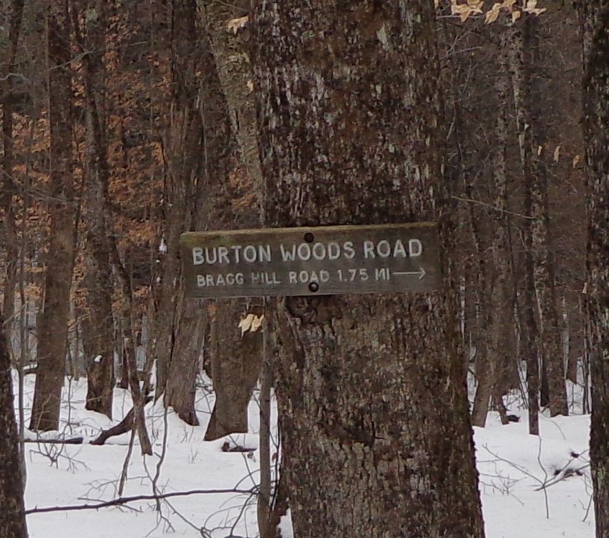 Eventually, we found another wet area, followed by the road rising, and turning toward the left. Thinking that we may need to turn back, I took out the iPod, and looked at the map I had. I was just saying to Mike that we were probably pretty close to the graveyard, when suddenly he yelled, "There it is!" 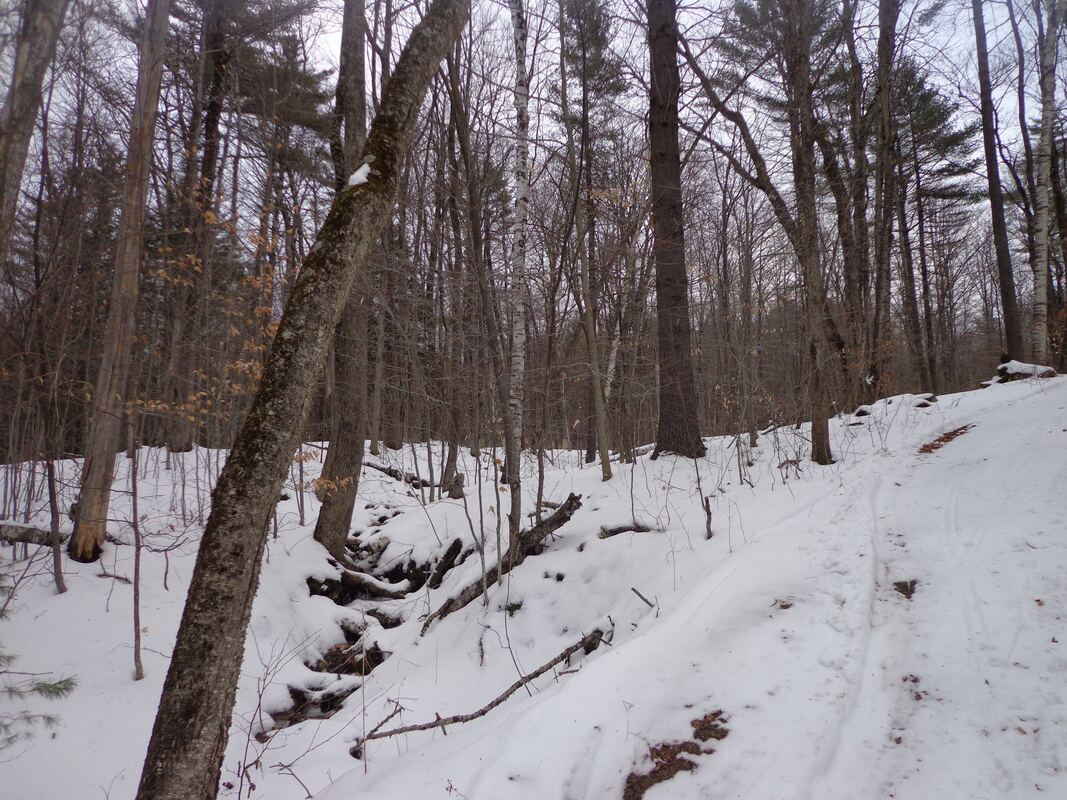 Above, is what it looked like to me. Below, is a close-up from the exact same photo, and somehow Mike saw the gravestones, just sticking out of the snow, in the distance: 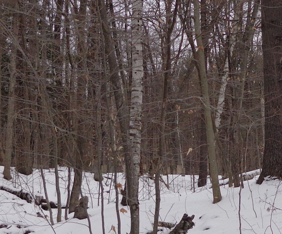 Parkhurst Cemetery in the distance, in the forest. Can YOU see the gravestones poking out of the snow? There's something about finding an old cemetery out in the woods. First, there's the sense of accomplishment, from doing research, then exploring, and finally finding the historical feature that you've been searching for. Second, I feel a sense of profound, serene peace in these old rural graveyards. However... 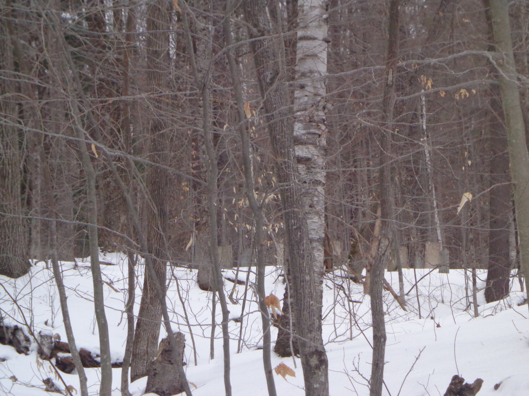 Parkhurst Cemetery, in the Distance. I suddenly realized, that I only had a little time to take photos, as it was getting late, and we needed to turn back. The view below gives an idea of the distance from the cemetery to the road: 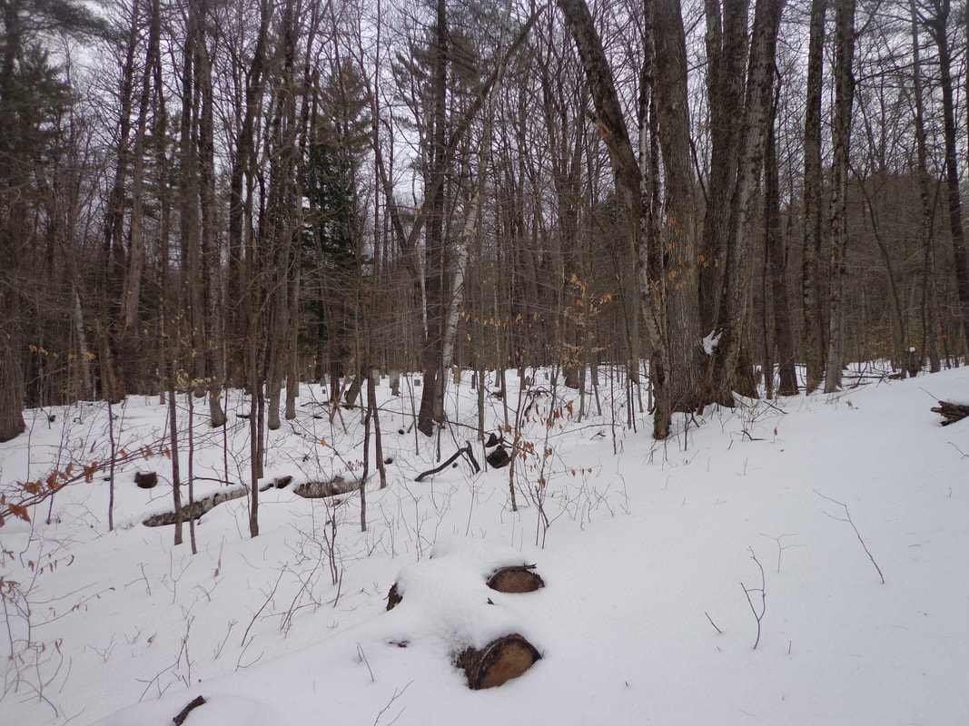 I quickly scrambled across a small brook, and headed toward the old resting place. 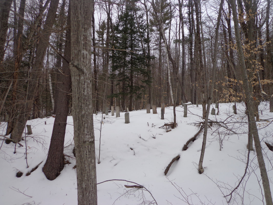 As I approached, I got a better idea of the size of the cemetery. 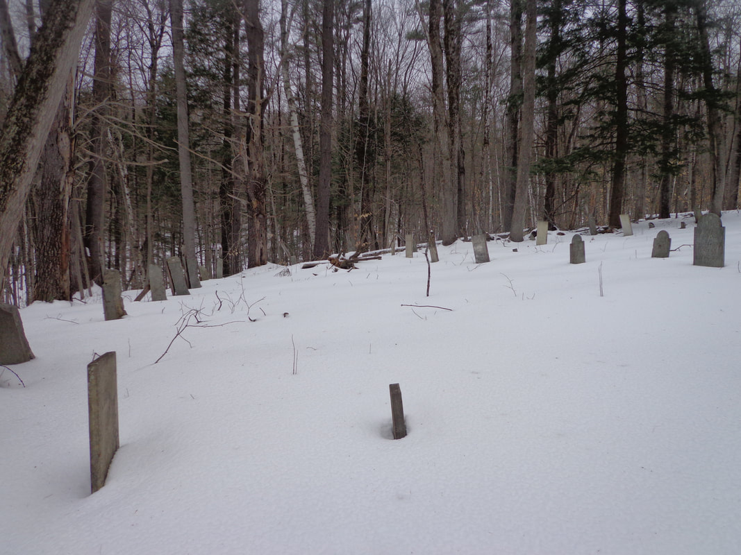 As I hurried toward the cemetery, I took more photos. 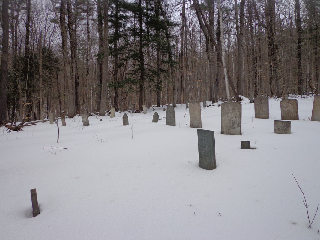 To me, it was like finding a priceless antique in the forest. There isn't a lot of information available on this graveyard, at least not on the internet. 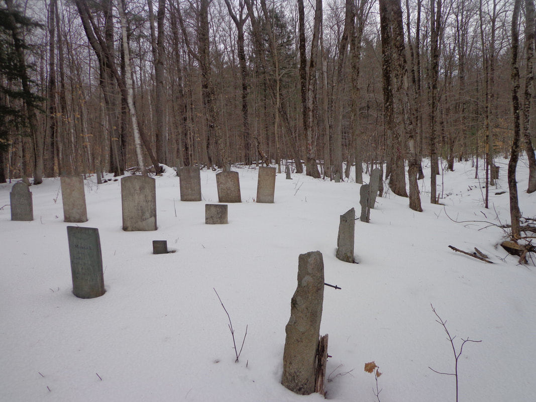 I had become fascinated by this graveyard since I first saw it on an old map over a year ago, and it was quite satisfying to finally find it. The hike back was peaceful, and uneventful, as the daylight began to fade. Here's are a few gravestones that I photographed, in the few minutes we were there: The first stone I photographed was for a child, only six weeks old when she died. How sad it must have been for the family. 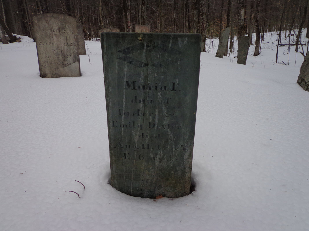 Murial Daughter of Parker and Emily Dexter died Aug. 11, 1847 AE 6 weeks At the other end of the spectrum, there's the headstone of a nonagenarian, Marguret Culver. If a person could survive their early childhood, they had a chance of living a long life. 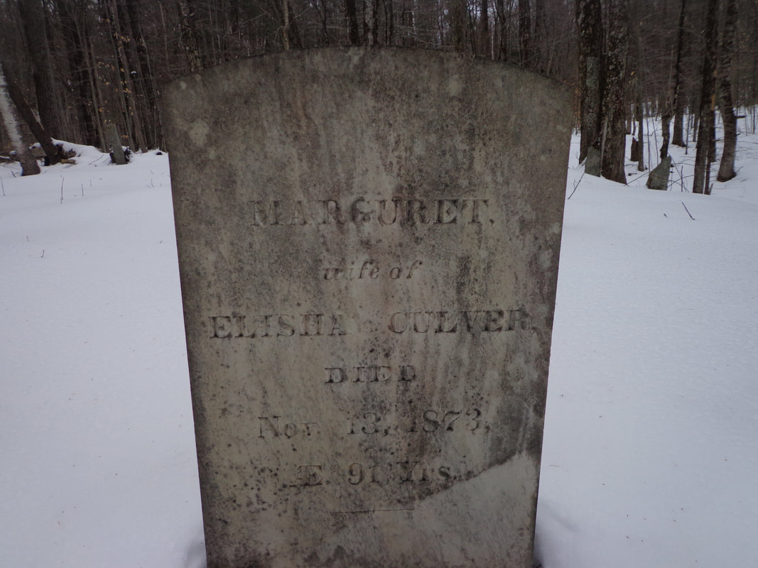 MARGURET wife of ELISHA CULVER Died Nov. 13, 1873 AE 91 Yrs. These folks lived lives of hard work. Without modern conveniences, such as electricity, and all the labor saving devices electricity would power, everything required effort. Simple things we take for granted, like turning on a water faucet, could have involved a walk to the river or well, and carrying full buckets uphill, back to the farmhouse. 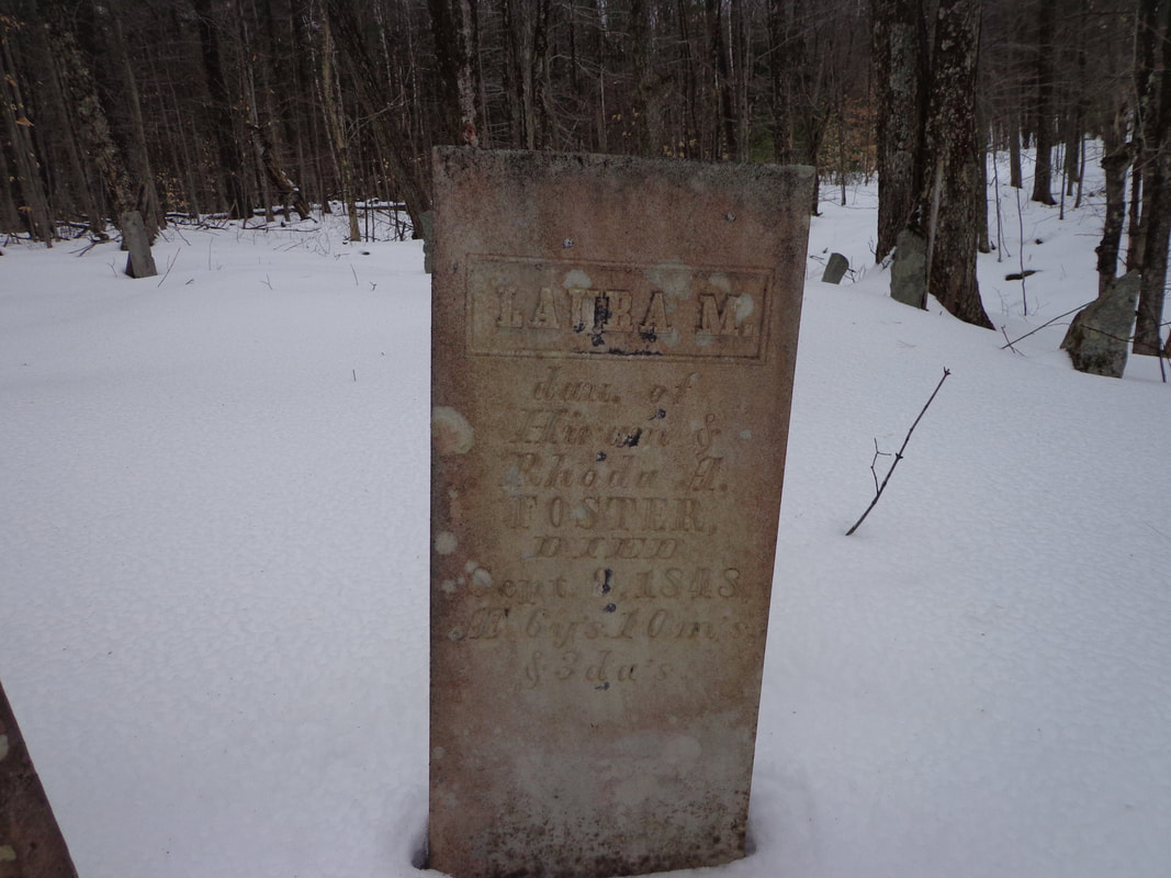 LAURA M. dau. of Hiram & Rhoda A. Foster Died Sept. 8, 1848 AE 6 yrs. 10 m's & 3 da's 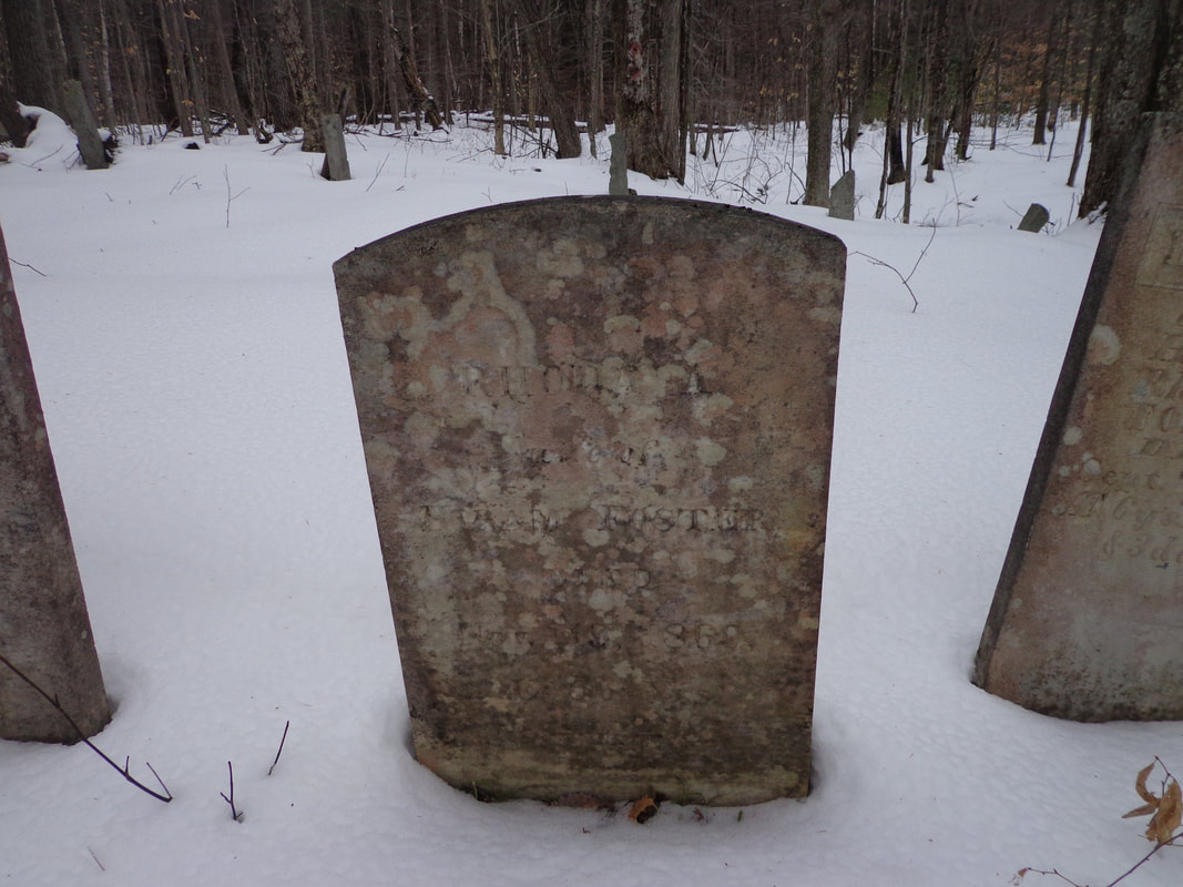 RHONDA Wife of HIRAM FOSTER DIED Nov 19, 1869 AE 66 years 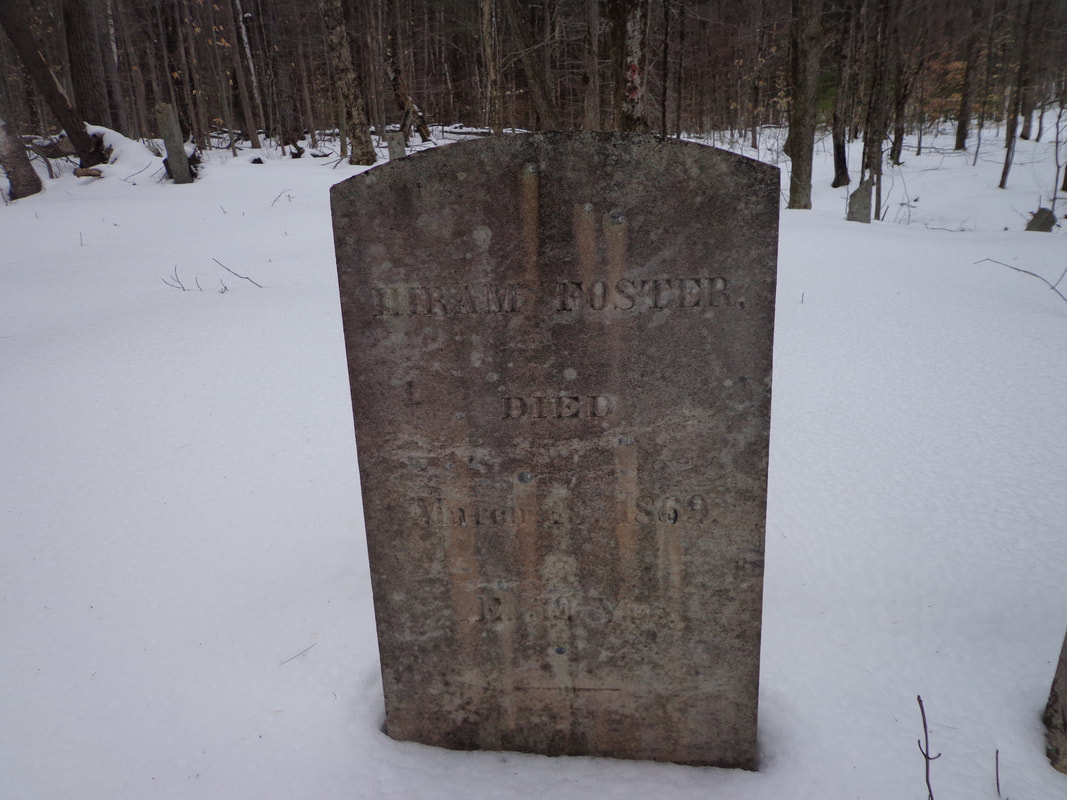 HIRAM FOSTER DIED March 18th, 1869 AE 59 yrs. 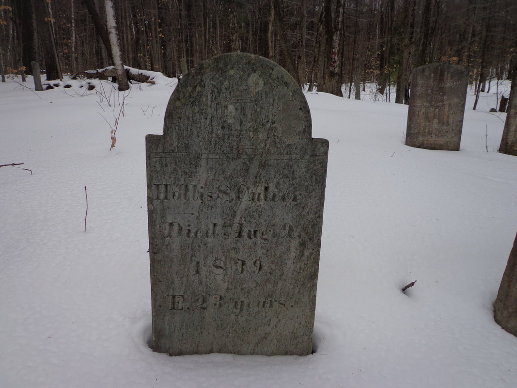 HOLLIS S. CULVER DIED Aug. 9th, 1839 (19th?) AE 23 years 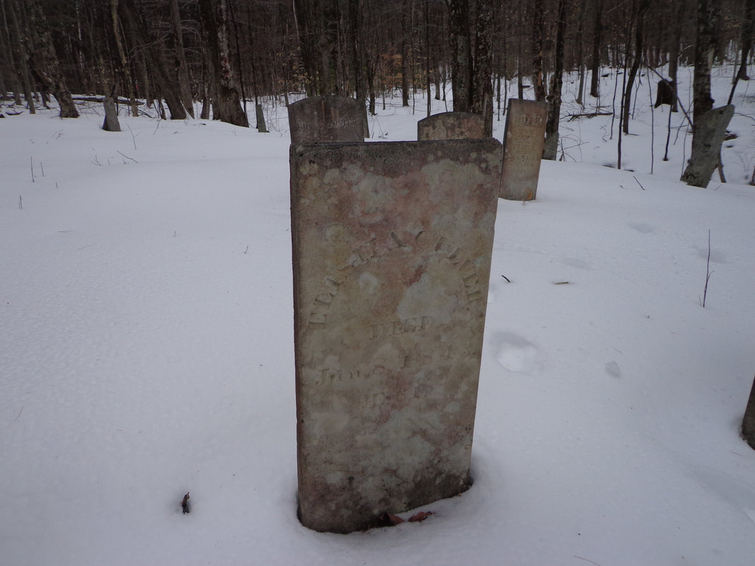 ELISHA CULVER DIED Jun, 8, 1843 AE 61 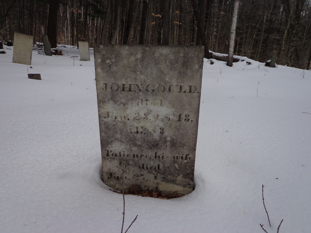 JOHN GOULD died Jan, 23, 1843 AE 83 Patience, his wife died Jun 27, 1832 (age) 74 Such a peaceful place. It was great to finally get out there and see what it was like, and think about these folks that lived and died there, and were buried out there in what is now Forest. The cemetery remains as a quiet reminder of our heritage, our past.
Thanks for traveling along, on Old Roads, Rivers and Rails of the Upper Valley If you haven't already subscribed, feel free to send an email to [email protected] and I'll add you to our group, and send updates whenever there's a new post. As always, comments are welcome. Thanks, - Bob Totz, Feb 2, 2020 |
AuthorI'm Bob Totz, retired VT postmaster, and historical geographer ARCHIVES:
October 2021
EXPANDED ARCHIVES: AUGUST 2021 1858 Johnson Map of North America MAY 2021 1795 - "Road Over the Mountain" - Part Two Historic Toll House For Sale 1795 - "Road Over the Mountain" Part One OCTOBER 2020 Finding That Special Peaceful Place AUGUST 2020 Kayaking on the Pompy JULY 2020 Pt. 2: What the Heck Are These Things? JUNE 2020 Bob's Bio... What the Heck Are These Things? Pt. 1 MAY 2020 Stone Walls and Spirits The View APRIL 2020 Sunny Brook Farm Relics: Pt 2. Sunny Brook Farm Relics: Pt 1. MARCH 2020 Signs of Norwich Pt. 2 COVID-19 Tracking Map Centertown and Valleyquest Signs of Norwich Pt. 1 "Imperfect Union" - Book Review Historic Centertown FEBRUARY 2020 King's Hwy Pt. 2 WRJ Museum at Post Mills Airport Chatauguay Vermont The Independent Farmer poem Traveling Along the King's Highway - Lebanon NH JANUARY 2020 Finding Parkhurst Cemetery In Search of Parkhurst Cemetery Affordable Housing The Old Stone Grill Two Rivers Trail-Kmart License and Registration, Please! Prohibition, Murder and Dr. Seuss Peace, Paris, & P.O. DECEMBER 2019 BLOGGER'S LINKS Welcome to Old Roads Love-Quail Hollow fun Dartmouth Cemetery SEPTEMBER 2019 E. Thetford Cemetery JUNE 2019
Taps: Meetinghouse Cemetery 4-Corners Borders Quest Old Iron Gate Stumbling Upon History Sunrise Walk MAY 2019 4 Corners Cemetery Strafford's Abandoned Foundations Art in Old Stonework APRIL 2019 Strafford Tpke Pt 2 Strafford Tpke Pt 1 White River Valley FEBRUARY 2019 Learning from Historic Maps of the Upper Valley Change in Lewiston VT JANUARY 2019 A Vermont Ski Waltz John Ledyard 1773 What is the Upper Valley? DECEMBER 2018 Dartmouth Green Music Video: Sometimes Music Video: Montreal Express Railway Disaster of 1887 |
 RSS Feed
