|
Welcome! Scroll Down for Posts and Archives.
Other Menu Options at Top |
|
|
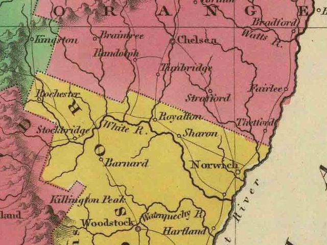 Vintage Cartography: Art and Science. In doing research on early Upper Valley settlement, I came across some great early maps that have been digitized and made available on-line. The inset below represents northern Windsor County, and southern Orange County VT, from the 1779 map by Sauthier. The map is titled: "A Chorographical Map of the Province of New York in North America Divided into Counties, Manors, Patents and Townships Exhibiting Likewise All the Private Grants of Land Made and Located in that Province. Compiled from Actual Surveys Deposited in the Patent Office at New York. By Order of his Excellency Major General William Tryon, by Claude Joseph Sauthier Esquire, London." 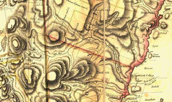 1779 Sauthier Map Inset, depicting the White River Valley and surrounding townships. The 1779 Sauthier map was created before Vermont became a state, and during the time both New York and New Hampshire claimed the land that is now Vermont If you look closely, you can see that there were certainly some errors in the surveys that generated this map. A fair amount of conjecture probably went into the drafting of the map in the less explored wilderness areas. The general pattern of the White River is recognizable, however it is listed as what we know today as the Ompompanoosuc River to the east, (flowing through Norwich), and as the White River flowing into it from the west, sort of the two rivers combined. Also, some township names will seem odd to those of us today. The town of Hartford is where Hartland is today. Hartford is instead, named "Ware". Above Norwich, and below Thetford is a town called "Pagnell" (I think). Chelsea is "Charlotte", Vershire looks like "Gageborough" and Bradford is called "Mooretown". Places like Rochester, Hancock, and Granville, near the headwaters of the White River hadn't even been granted or settled at this point. The full 1779 Sauthier map can be seen at Library of Congress website: https://tile.loc.gov/image-services/iiif/service:gmd:gmd380:g3800:g3800:ar107003/full/pct:12.5/0/default.jpg 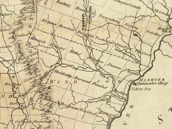 1795 "Carey" Map The above Carey map was drafted sixteen years later, in 1795 On this map we see major pathways drawn in. Rochester and Hancock are also now drawn in. Gaysville is also settled, but during this time it was known as "Kingston". Chelsea is now "Turnersburg". And one name I like, is the Waterquechee River, which is now spelled Ottaquechee. 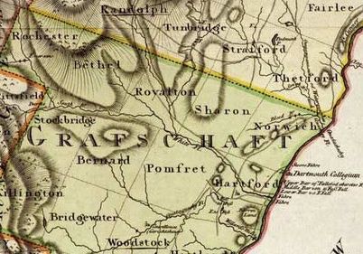 1797 Sotzman Map The above map inset, from a 1797 map by Sotzman, was drafted in Hamburg, Germany, and seems a bit more accurate than the 1795 Sauthier map, though it's the first map I've seen with the county name "Grafschaft" (similar to Grafton, in NH). Schaft can be translated from German as "community". 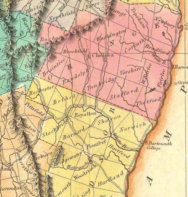 Close-up of Carey's 1822 Map By 1822, plenty of settlement, surveying, and migration inland had taken place. Carey's upgraded 1822 map was in color and more accurate. We can see all three branches of the White River, plus the Main branch reaching up into Hancock and Kingston (Granville VT). Pathways are also drawn in to approximate major routes. Some of theses routes we still use today, such as the scenic Vermont Route 110, which travels along the First Branch of the White River through Tunbridge and Chelsea into Washington VT. Many of these pathways began as Native American foot trails, following certain streams and tributaries to their sources and then going through a gap in the mountains. Finally they would descend down another river valley to the lowlands on the other side of the mountains. 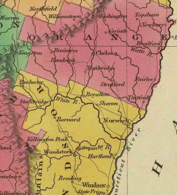 Inset of 1831 Finley Map One of my favorite early maps of Vermont, for pure visual appeal, is the Finley map above, from 1831. River routes are becoming much more accurate, and the town names are starting to appear as we know them today. The White River and Ompompanoosuc riverways are nicely drawn in. 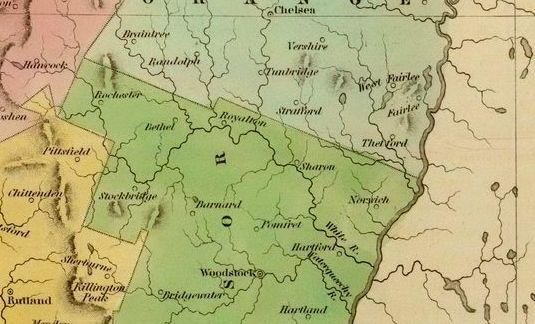 1838 Map by Bradford This 1838 map by Bradford is also visually appealing and probably more accurate than previous versions. Visual appeal is created by color and shading. Simplicity and ease of viewing is created by removing Township boundary lines, allowing one to focus on the major rivers, their branches and tributaries, and mountain peaks and ranges. This map shows how important waterways were in the north country in 1838, at a time when railroad transportation was about to move in to Vermont. 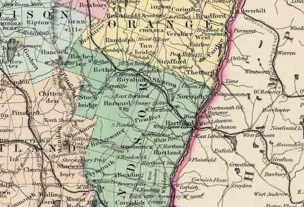 Inset from 1856 Colton Map As you can see, things have gotten a lot busier by 1856, both in terms of commerce and transportation, and the map itself is much busier. In addition to the riverways, place names, and mountain peaks, we see Township boundaries, railroad lines and roadways. We also have the names of the counties in large print, and each county has its own color. Townships are in smaller bold print, and small place names, such as villages, are in small italic print. Examples of villages now on the map include Post Mills, White River Junction, and Cornish Flats. Even some stores are listed. Just east of the word "Barnard" is "Snows Store". As transportation improved, and more and more information was to be displayed on maps, the maps tended to become more complicated and difficult to read. A nice feature of the 1856 Colton map is that it also includes major features in adjacent New Hampshire. We see the Boston, Concord and Maine Railroad running from above Haverhill NH, through Warren and Wentworth and on toward W. Rumney. Also depicted is the Northern Railroad, from West Lebanon, through Canaan, Grafton, Danbury, West Andover, NH. Roadways in New Hampshire that were part of the New Hampshire Turnpike system show up nicely without all the extra lines, as on the Vermont side of the map. 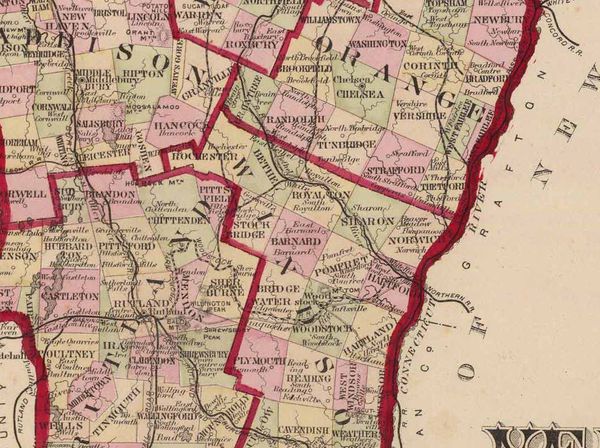 Inset from Burgett Map of 1876 Burgett's map from 1876 shows us another variation in style. This map has bold county lines, and different colors for adjacent townships. In the twenty years since Colton's map, there has been an increase in roads and railroad lines. The roads are becoming more prominent as well, with thicker lines used to denote them. In 1879 the United States Geological Survey, (USGS) was created. Maps of the United States would become much more accurate and comprehensive. USGS Maps show topographic lines which are lines of equal elevation. They can be quite dramatic and closely drawn when the land is steep. In a wide river valley or coastline, the lines are spread out, indicating relatively flat terrain. 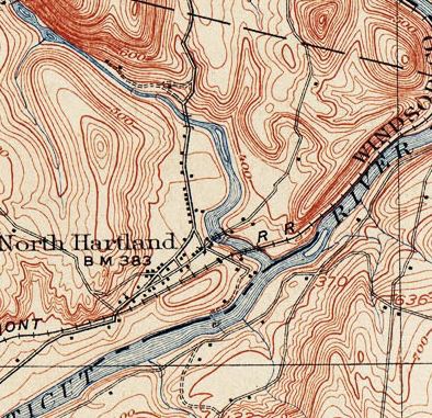 The confluence of the Ottaquechee and Connecticut Rivers in North Hartland VT. USGS 1908 15 Minute Series Map  The confluence of the White River and Connecticut River at White River Junction, Vermont and West Lebanon NH. 1908 USGS Map Also depicted on the 1908 map close-up above are: The Mascoma River, The Boston and Maine Railroad, Crafts Hill, Wilder Village, and many buildings shown as small dark squares. Some streets are named too, such as Christian Street just west of Wilder village. The bridge connecting Vermont to New Hampshire at Wilder also shows up nicely. We can learn many things from exploring and examining the details found in maps, especially a group of maps of the same area over time. We can use historical maps as aides to study settlement patterns over time. Many features in old maps not only give us clues to the way things used to be, but also show us the ways in which generations before us viewed and interpreted their world, what was important to them in that world, and how they used that world. Some settlements changed their names. Some disappeared altogether. Some were logging camps and mill sites long ago. Clues about these settlements exist on historic maps and in the back country areas that those maps represent. Rivers change courses due to severe weather events, and coastlines and shorelines change over time. I really enjoy old maps because of the clues they hold to the past, and the ways in which they are depicted. They are artistic expressions of geographic facts and sometimes, conjecture. 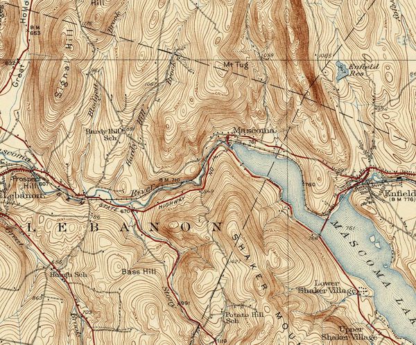 USGS Map 1932 Most of the maps for this article are courtesy of VTRoads.com which is a great website. The USGS map images came from the University of Texas at http://legacy.lib.utexas.edu/maps/topo/vermont/ Thanks for reading and subscribing to "Old Roads, Rivers and Rails" blog. I'm Bob Totz, retired Vermont Postmaster, Geographer, former choir director and composer and performer of folk songs. Follow Bob Totz Norwich, VT - 123 Followers 'm Bob Totz, retired Vermont Postmaster. I have a love of Local History, Geography and Music. I have a bachelor's degree in Geography, with a specialization in Cartography. I ... Have something you'd like to Post? Get started today.Comments 9
0 Comments
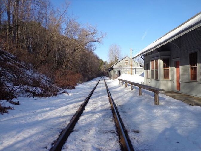 A lot of History down in the old village. I stopped by old Lewiston Vermont the other day. Lewiston is the "lost village" of Norwich. It was a booming place back in the heyday of the railroads, and up into the 20th century. 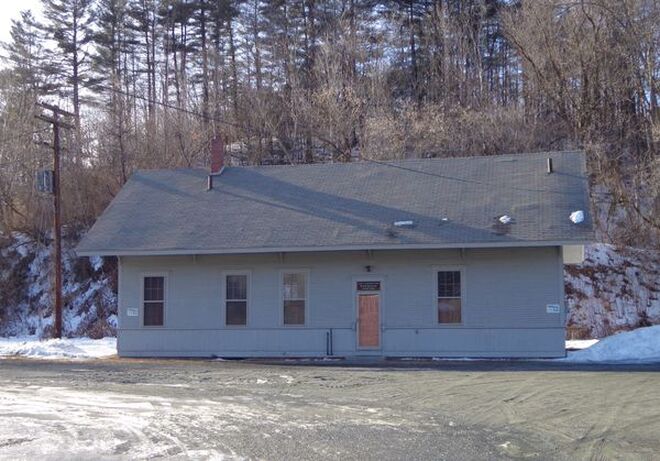 The Lewiston, or Hanover-Norwich Train Station, built in 1884, as it looks in 2019. 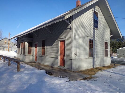 The Lewiston, or Hanover-Norwich Train Station as Seen from the Tracks. 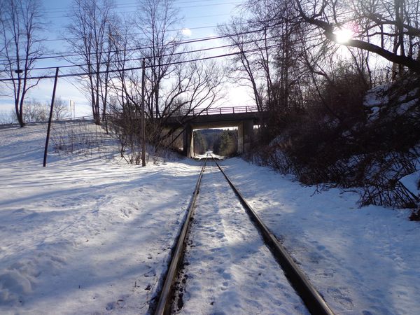 Looking south from the station, toward Wilder and White River Junction. 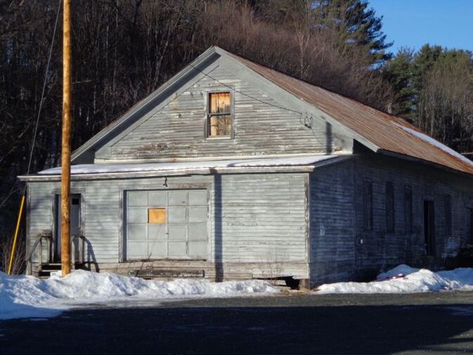 Old Freight Building next to the Lewiston Train Station. 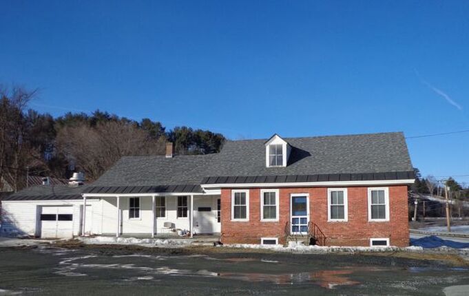 The Pottery Studio. A former home, and an historic remnant of old Lewiston. The downfall of Lewiston was the result of three factors. The first factor contributing to the fall of Lewistion was the decline of the railroad industry, and the closing of the railroad station in Lewiston when White River Jct took over as the main stop for Hanover and Norwich, in the 1920's. A bustiing village became a lot quieter when the railroad stop was discontinued at Lewiston.  The White River Jct. Railroad Depot Area in it's heyday. The second factor was the construction of the Wilder Dam in the late 1940's, which raised the level of the river by about sixteen feet, causing the destruction of several buildings along the waterfront, just north of the Ledyard Bridge. Wilder Lake was born, and several buildings disappeared. 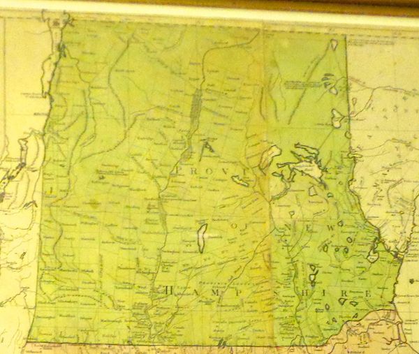 Old Postcard Showing the "New" Wilder Dam The third and final factor affecting the decline of Lewiston Vermont was the building of Interstate 91, the northbound on-ramp, and the approach from the Ledyard Bridge. All this expansion necessitated the destruction of several buildings along Lewiston Hill Road, which went from Norwich to Hanover via Lewiston village and the Ledyard Bridge. 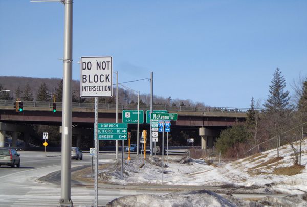 Entrance to I-91 North, in Norwich, just beyond McKenna Rd. Looking toward Norwich from Lewiston, 2019. 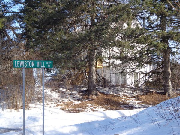 Lewiston Hill Rd. The only section that exists today, off McKenna Rd. 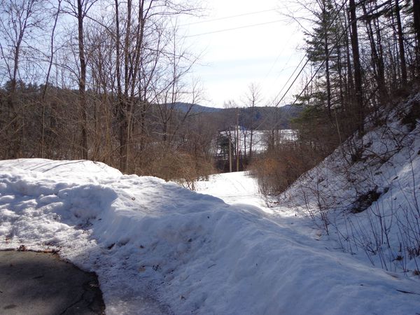 The view from the bottom of Lewiston Hill Rd in 2019, showing the approximate location where the road used to continue on, toward the Ledyard Bridge. Connecticut River is seen in the background. 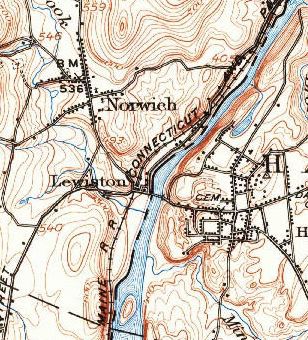 Close-up view of a USGS map showing Lewiston before the arrival of the Interstate. This map shows the former route from Norwich to the Ledyard Bridge and Hanover. These days, much of what was Lewiston is owned by Dartmouth College. Dartmouth College has just built a new parking lot on River Road in Lewiston. 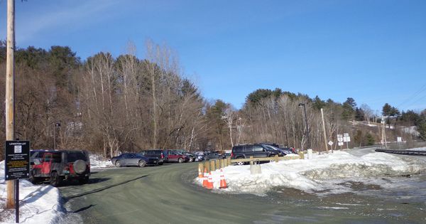 The new Lewiston Parking Lot, recently built by Dartmouth College 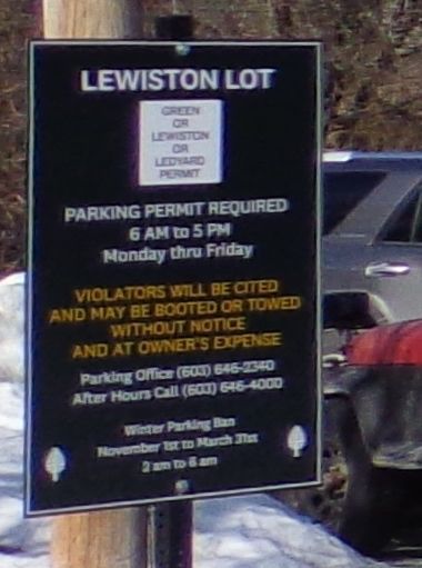 Sign at the new Lewiston Parking Lot on River Road On this particular day, the weather was clear and sunny, and cold, with temperatures in the low twenties. This winter, the Connecticut River has been frozen over nicely, and it brought back visions of the old ice harvesting days, when there was an ice-house on the shore, that is now inundated by the Connecticut River. 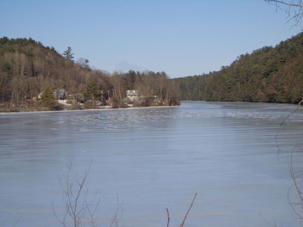 Shoreline, now sixteen feet higher than before the Wilder Dam was built. Plenty of ice could be harvested this year! I walked carefully out on the frozen river, a short distance, looking north. I may have been standing on the site where the old ice-house had once stood. 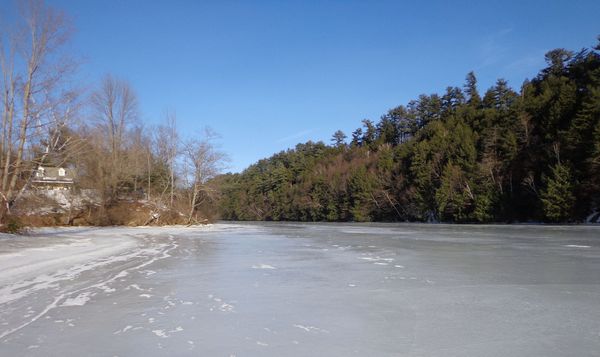 This photo was taken while standing on the ice, looking north, possibly at the site of the old Lewiston Ice House. I paused and listened, and imagined I could hear the sounds of people harvesting ice out on the lake, and the sounds of steam engines braking and pulling in to the old train station, and tons of coal being offloaded for heating Dartmouth College. 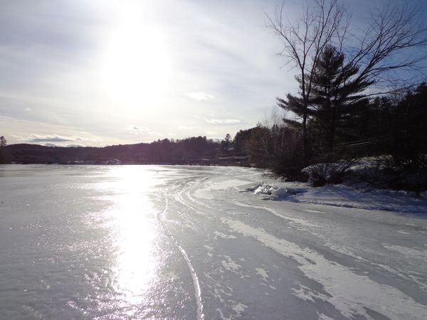 Looking south from Lewiston VT, from the ice February 2019 What is next in store for old Lewiston village? Affordable housing? A Bird sanctuary? A beautiful beach and dock for the residents of both Hanover and Norwich? We'll just have to see. Today, where Lewiston once thrived, stand vestiges of days gone by. They are few, but they are there....and the turkeys don't seem to care! 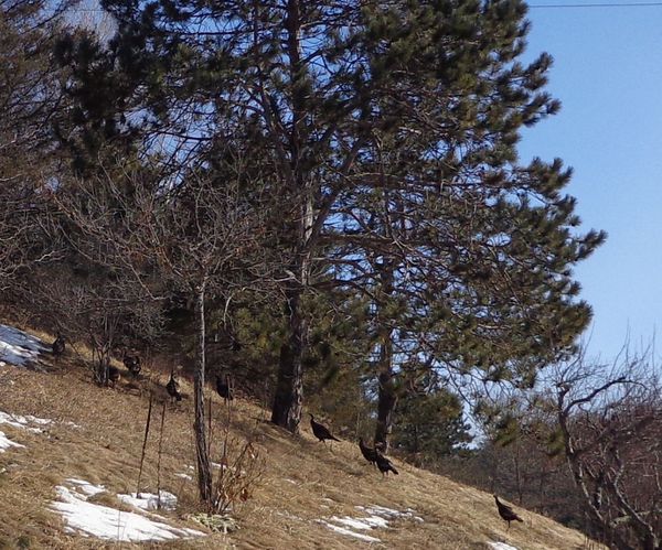 One of the Norwich Turkey Flocks enjoying the lack of snow on the south side of Lewiston Hill, in preparation for an upcoming snowstorm.
I hope you enjoyed another episode of "Old Roads Upper Valley". Thanks for your interest. If you'd like to subscribe send an email to [email protected] and you'll receive email updates whenever we post. |
AuthorI'm Bob Totz, retired VT postmaster, and historical geographer ARCHIVES:
October 2021
EXPANDED ARCHIVES: AUGUST 2021 1858 Johnson Map of North America MAY 2021 1795 - "Road Over the Mountain" - Part Two Historic Toll House For Sale 1795 - "Road Over the Mountain" Part One OCTOBER 2020 Finding That Special Peaceful Place AUGUST 2020 Kayaking on the Pompy JULY 2020 Pt. 2: What the Heck Are These Things? JUNE 2020 Bob's Bio... What the Heck Are These Things? Pt. 1 MAY 2020 Stone Walls and Spirits The View APRIL 2020 Sunny Brook Farm Relics: Pt 2. Sunny Brook Farm Relics: Pt 1. MARCH 2020 Signs of Norwich Pt. 2 COVID-19 Tracking Map Centertown and Valleyquest Signs of Norwich Pt. 1 "Imperfect Union" - Book Review Historic Centertown FEBRUARY 2020 King's Hwy Pt. 2 WRJ Museum at Post Mills Airport Chatauguay Vermont The Independent Farmer poem Traveling Along the King's Highway - Lebanon NH JANUARY 2020 Finding Parkhurst Cemetery In Search of Parkhurst Cemetery Affordable Housing The Old Stone Grill Two Rivers Trail-Kmart License and Registration, Please! Prohibition, Murder and Dr. Seuss Peace, Paris, & P.O. DECEMBER 2019 BLOGGER'S LINKS Welcome to Old Roads Love-Quail Hollow fun Dartmouth Cemetery SEPTEMBER 2019 E. Thetford Cemetery JUNE 2019
Taps: Meetinghouse Cemetery 4-Corners Borders Quest Old Iron Gate Stumbling Upon History Sunrise Walk MAY 2019 4 Corners Cemetery Strafford's Abandoned Foundations Art in Old Stonework APRIL 2019 Strafford Tpke Pt 2 Strafford Tpke Pt 1 White River Valley FEBRUARY 2019 Learning from Historic Maps of the Upper Valley Change in Lewiston VT JANUARY 2019 A Vermont Ski Waltz John Ledyard 1773 What is the Upper Valley? DECEMBER 2018 Dartmouth Green Music Video: Sometimes Music Video: Montreal Express Railway Disaster of 1887 |
 RSS Feed
