|
Welcome! Scroll Down for Posts and Archives.
Other Menu Options at Top |
|
|
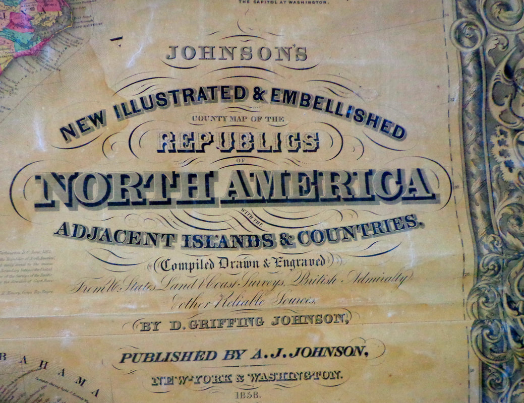 I acquired an interesting map a couple years ago. The map had been in an unused, upstairs room in an old Vermont farmhouse. I did not know what type of map it was, until we started unrolling it. You can imagine my excitement when it turned out to be a full color 1858 map of the USA at the height of westward expansion. 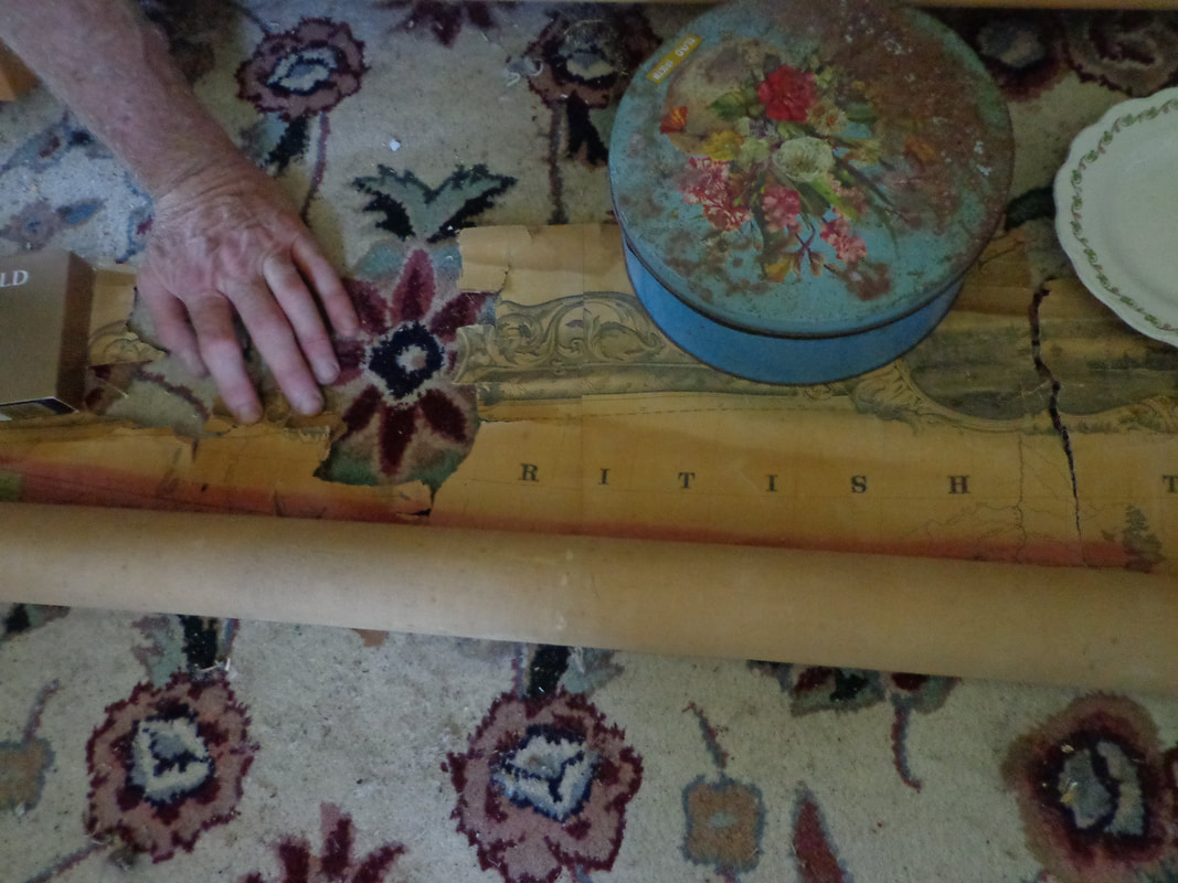 A friend and I took photos of the map, as we unrolled it on a carpet in an adjacent bedroom floor. As we started to unroll it from the top, my heart began to beat a little faster as the image began to appear. As we slowly and carefully unfurled the delicate, vintage map, we began to discern the outline of the west coast of the United States, though many of today's state boundary lines were clearly not yet in existence. 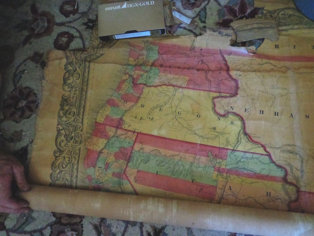 There were some rips along the top of the map, where a wooden roller had been attached, for hanging the map on a wall. The rips were in Canada, but did not continue below the border with the United States. 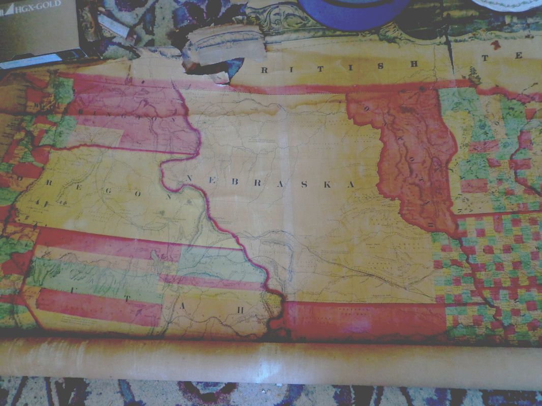 I did not want to damage the map, so we were very careful as we continued to unroll it. We used whatever happened to be handy to hold it down on top, and keep it from rolling back up on itself. Who knows how long it might have been rolled up since it was last looked at! 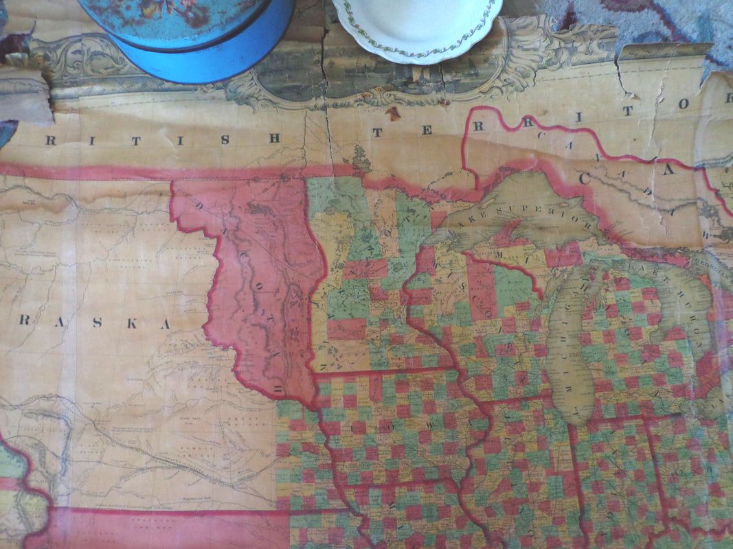 It soon became obvious that what we had here was a transition map, showing a snapshot of the state, county, and territorial boundaries as they existed around 1858, the year the map was published. Below is a shot of the upper right portion of the map, showing New England and eastern Canada. The counties are highlighted in contrasting colors. 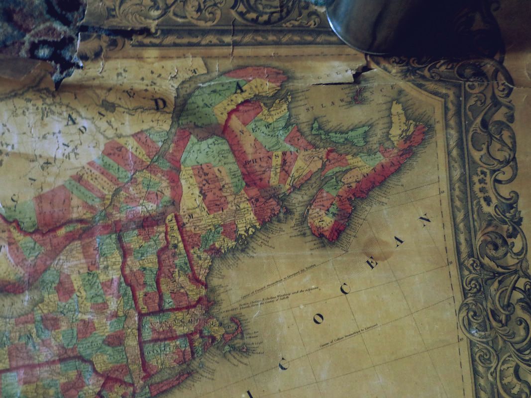 There are several vignettes arranged around the perimeter of the map. Here is one of the U.S. Capitol building, as it looked in the late 1850's: 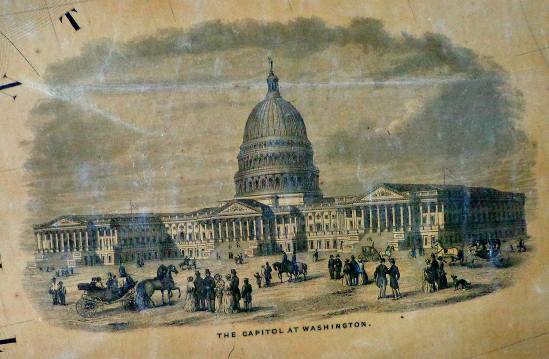 Here is a look at the northeast and what used to be called the Northwest Territory, or "The Old Northwest". Most of the state boundaries appear as the do today, with one notable exception. 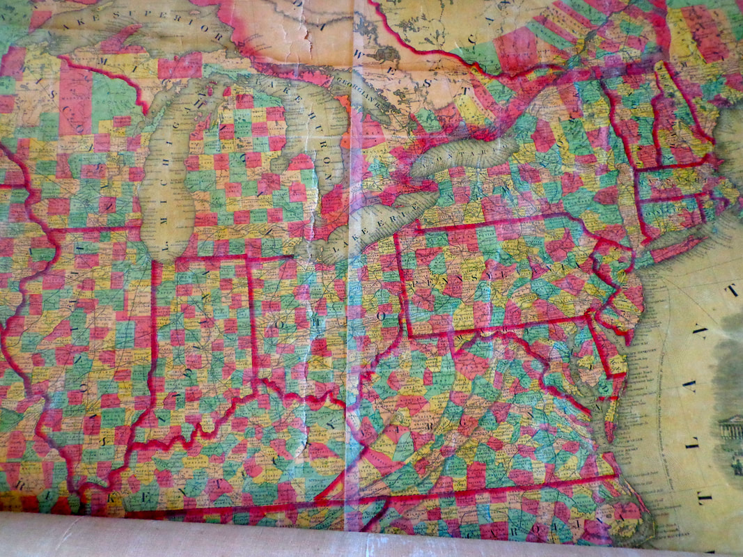 Can you see what state is missing in the close-up below? 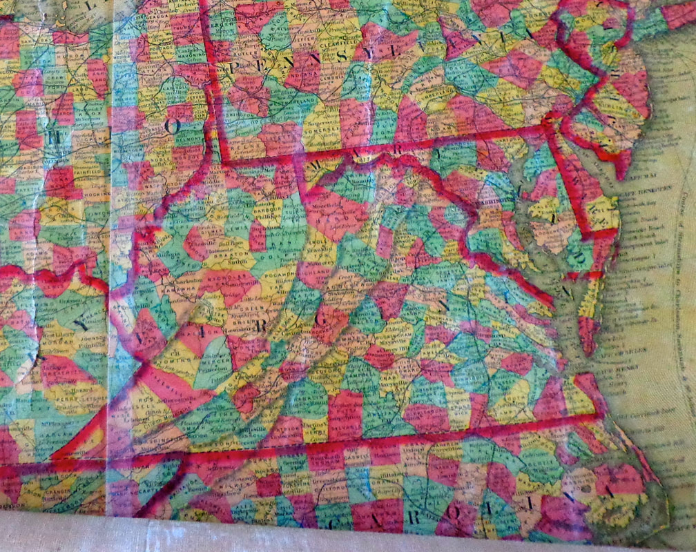 This map is from 1858, but West Virginia didn't gain statehood until 1863. The close-up below shows how much less settled was the area to the west of the Mississippi River. 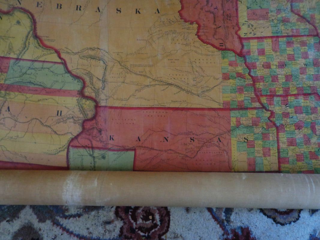 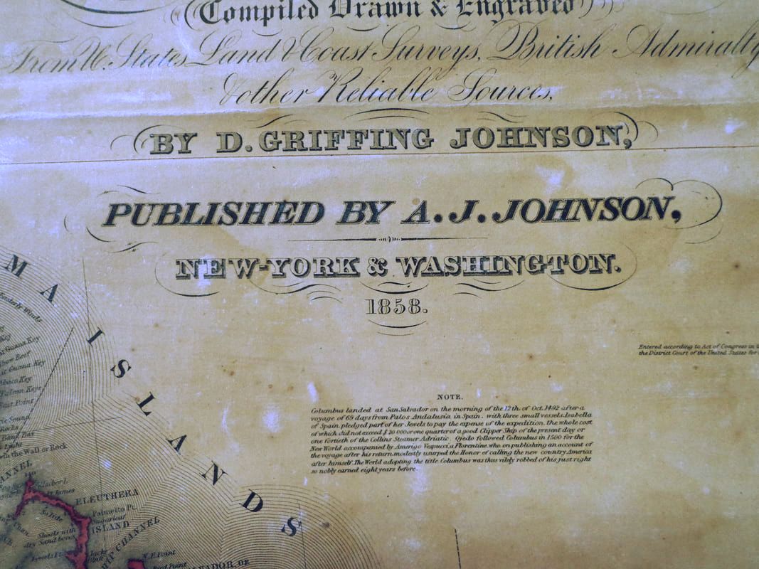 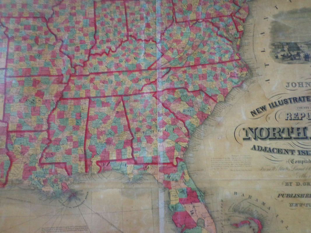 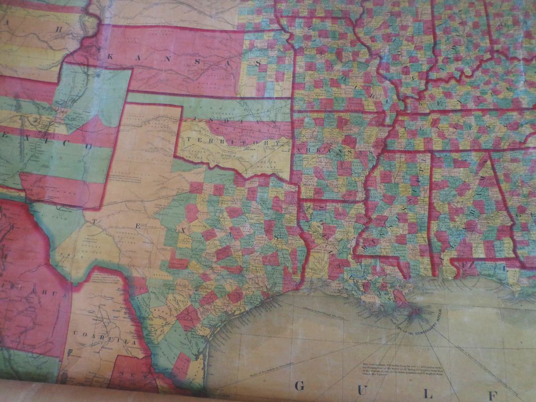 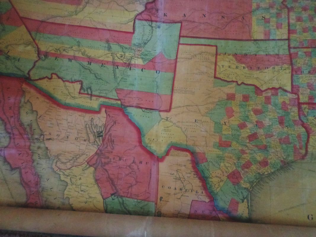 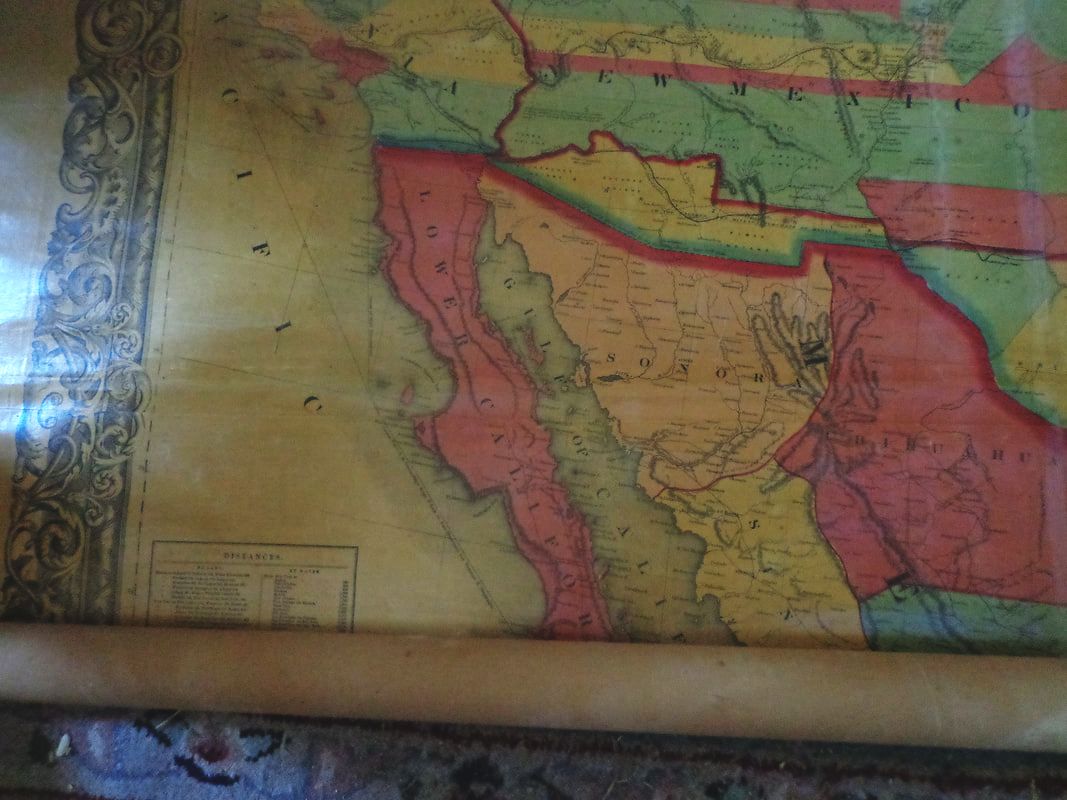 Below is a close-up of the lower left corner of the map. 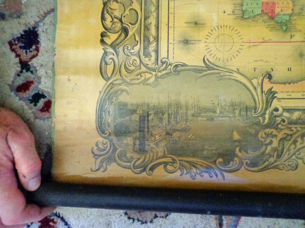 ....and an even closer look at the vignette, showing a river, bridges and ships. 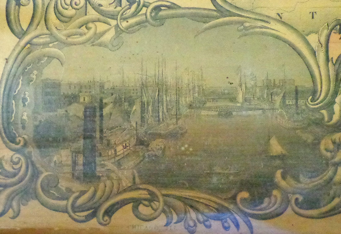 Continuing along the lower border, from left to right: 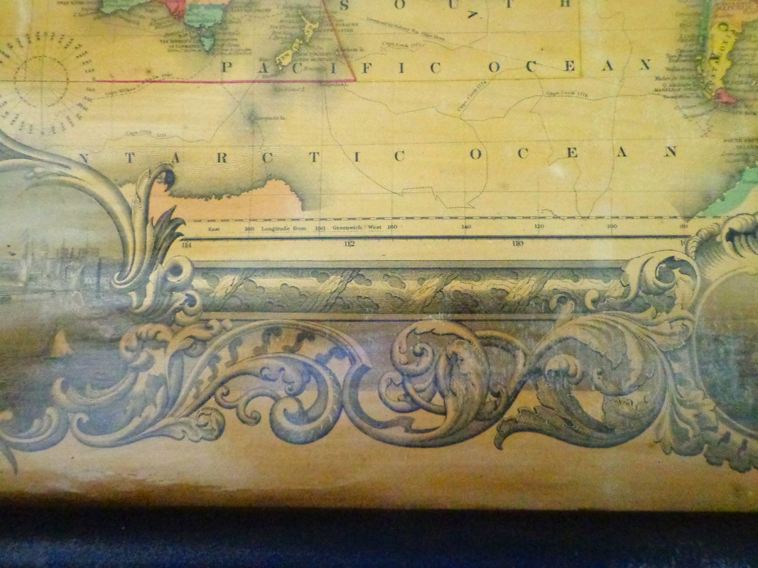 Along the bottom margin, is a vignette of the city of Cincinnatti Ohio, showing steamships on the Ohio River. 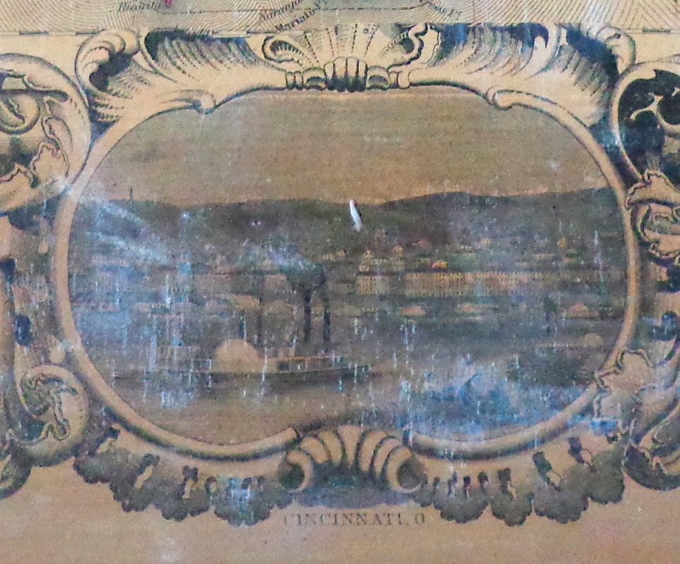 Belos is the lower right corner of the 1858 map, showing the northern part of South America, with a vignette of St. Louis in the margin. 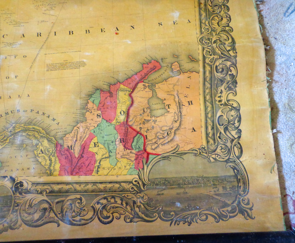 Below is a look at the vignette of Saint Louis in the lower right corner margin. 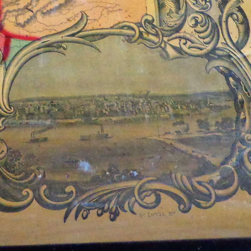 Below is a look at the lower part of Central America, including the "Isthmus of Panama". 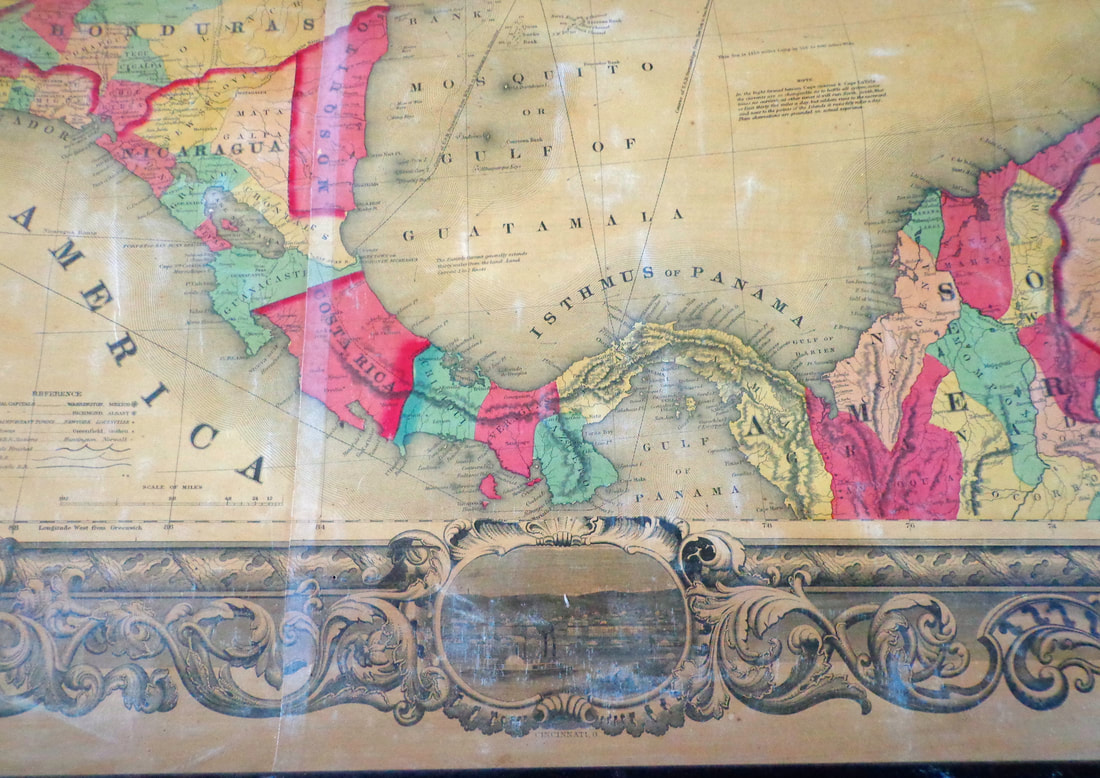 There is so much information on this one map! Below is a Reference Legend, showing the variety of fonts used for different features. 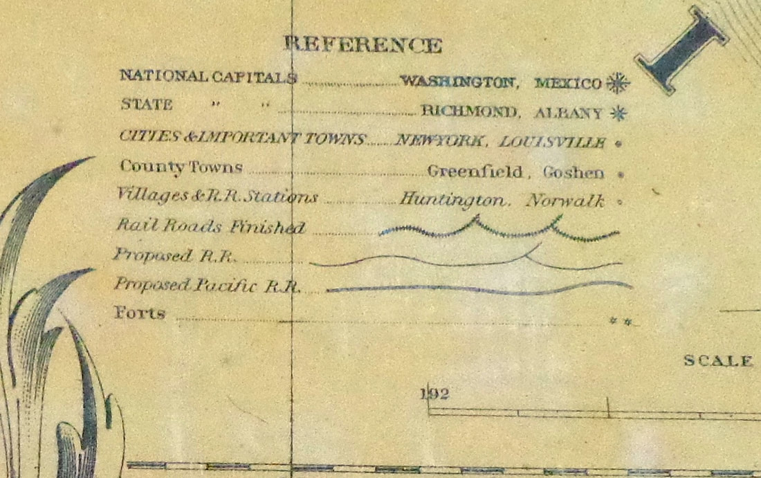 Below is another look at a portion of Central America. 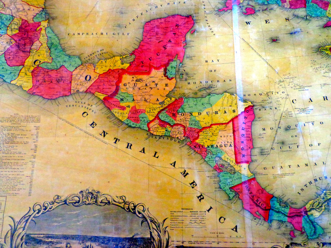 There is also an inset of a map of the world, showing ocean routes from popular coast cities. 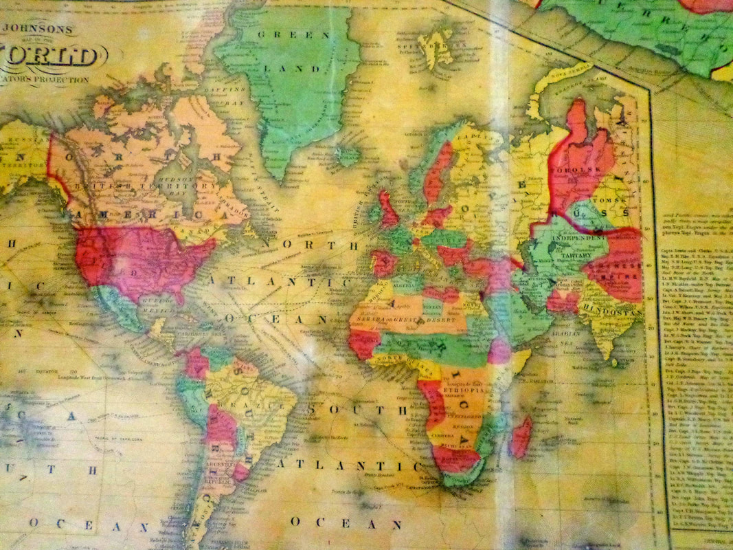 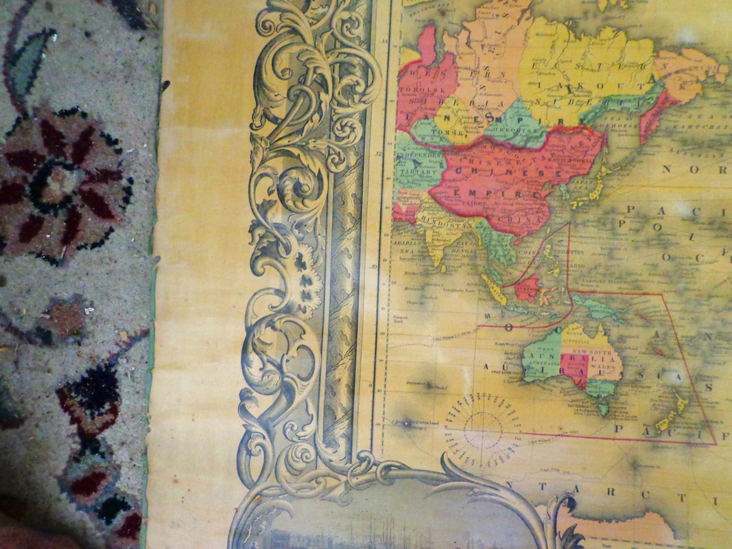 There's even a statistical table of the States' 1850 census. 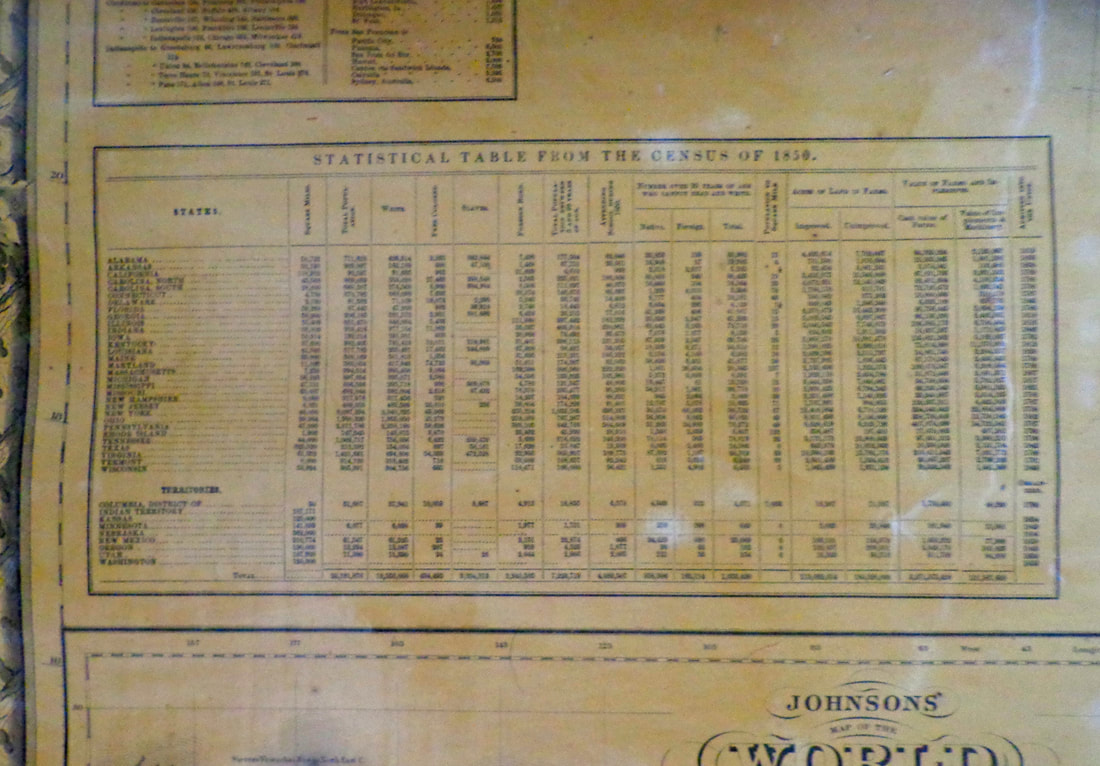 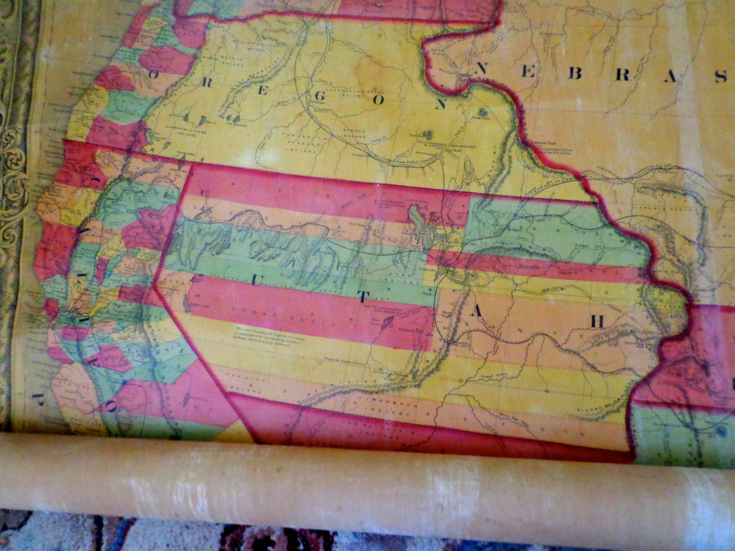 Close-up of Salt Lake City: 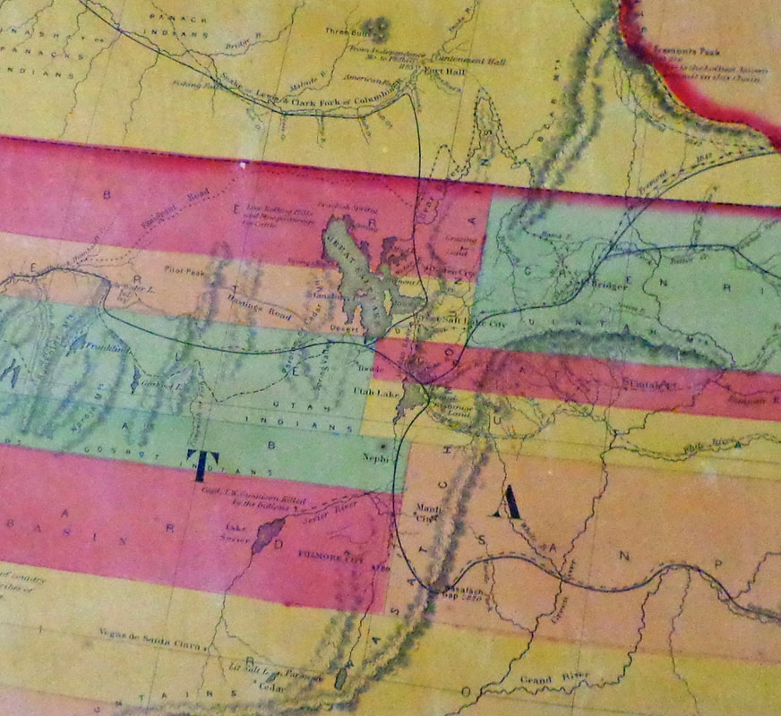 West Indies: 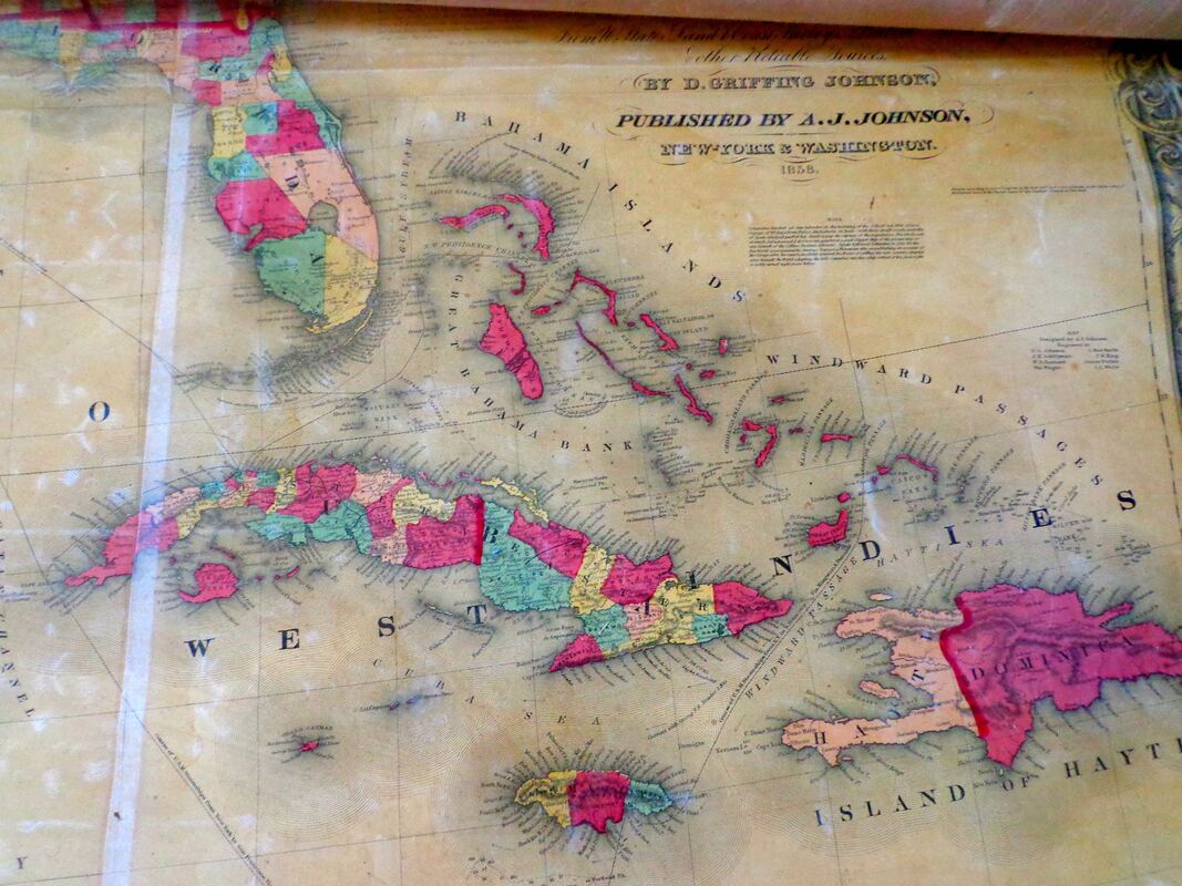 Florida Keys: 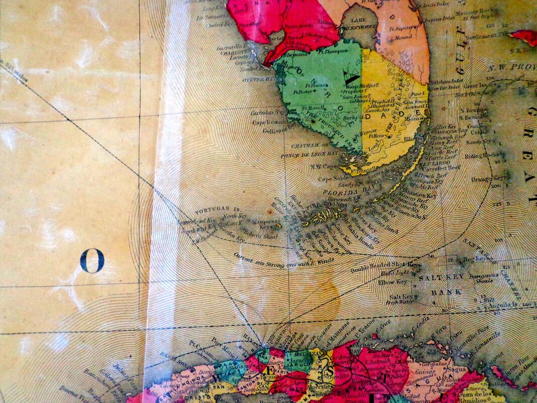 Florida: 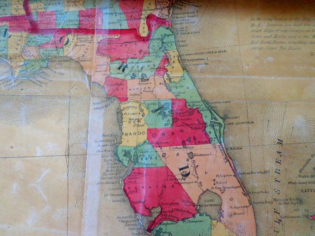 ...and the port city of New Orleans: 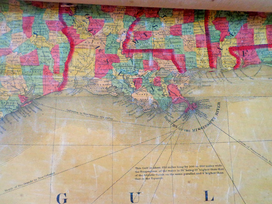 For a good look at the similar, 1859 version of this map, you can go to the David Rumsey map collection and magnify areas to see incredible detail, or pan back out to see the big picture. That map can be found here:
https://www.davidrumsey.com/luna/servlet/workspace/handleMediaPlayer?qvq=q%253A1859%2bjohnson%2bnorth%2bamerica%253Bsort%253APub_List_No_InitialSort%252CPub_Date%252CPub_List_No%252CSeries_No%253Blc%253ARUMSEY%257E8%257E1&trs=75&mi=2&lunaMediaId=RUMSEY~8~1~203535~3001689
6 Comments
sally lambert
8/15/2021 08:59:42 am
Maybe I missed it Bob, what are the dimensions of this map...??
Bob Totz
8/16/2021 08:31:48 am
The map is about six feet by six feet, with a wooden roller at the top and bottom, like a big scroll.
John Procidano
8/15/2021 09:41:28 am
Hi Bob, This information for sure ought to be taught in schools across the entire country. all the great American history that is within this one document/map would be so exciting for children to learn.
Leslie Berger
8/15/2021 11:54:29 pm
I'd love to see this map in person. Is it viewable? I too am curious about the dimensions.
Bob Totz
8/16/2021 08:36:44 am
Unfortunately, each time it's unrolled, it's apt to rip or deteriorate just a little bit more, so its something I don't want to do very often. 8/1/2022 11:15:34 pm
Instagram kaliteli takipçi satın almak için adresimiz 7/24 aktif olarak çalışmaktadır. Bu durum dahilindeki hizmetler ve daha fazlası için adresimizi ziyaret edebilirsiniz. Your comment will be posted after it is approved.
Leave a Reply. |
AuthorI'm Bob Totz, retired VT postmaster, and historical geographer ARCHIVES:
October 2021
EXPANDED ARCHIVES: AUGUST 2021 1858 Johnson Map of North America MAY 2021 1795 - "Road Over the Mountain" - Part Two Historic Toll House For Sale 1795 - "Road Over the Mountain" Part One OCTOBER 2020 Finding That Special Peaceful Place AUGUST 2020 Kayaking on the Pompy JULY 2020 Pt. 2: What the Heck Are These Things? JUNE 2020 Bob's Bio... What the Heck Are These Things? Pt. 1 MAY 2020 Stone Walls and Spirits The View APRIL 2020 Sunny Brook Farm Relics: Pt 2. Sunny Brook Farm Relics: Pt 1. MARCH 2020 Signs of Norwich Pt. 2 COVID-19 Tracking Map Centertown and Valleyquest Signs of Norwich Pt. 1 "Imperfect Union" - Book Review Historic Centertown FEBRUARY 2020 King's Hwy Pt. 2 WRJ Museum at Post Mills Airport Chatauguay Vermont The Independent Farmer poem Traveling Along the King's Highway - Lebanon NH JANUARY 2020 Finding Parkhurst Cemetery In Search of Parkhurst Cemetery Affordable Housing The Old Stone Grill Two Rivers Trail-Kmart License and Registration, Please! Prohibition, Murder and Dr. Seuss Peace, Paris, & P.O. DECEMBER 2019 BLOGGER'S LINKS Welcome to Old Roads Love-Quail Hollow fun Dartmouth Cemetery SEPTEMBER 2019 E. Thetford Cemetery JUNE 2019
Taps: Meetinghouse Cemetery 4-Corners Borders Quest Old Iron Gate Stumbling Upon History Sunrise Walk MAY 2019 4 Corners Cemetery Strafford's Abandoned Foundations Art in Old Stonework APRIL 2019 Strafford Tpke Pt 2 Strafford Tpke Pt 1 White River Valley FEBRUARY 2019 Learning from Historic Maps of the Upper Valley Change in Lewiston VT JANUARY 2019 A Vermont Ski Waltz John Ledyard 1773 What is the Upper Valley? DECEMBER 2018 Dartmouth Green Music Video: Sometimes Music Video: Montreal Express Railway Disaster of 1887 |
 RSS Feed
