|
Welcome! Scroll Down for Posts and Archives.
Other Menu Options at Top |
|
|
|
In the previous post, “What The Heck Are These?”, we looked at some interesting features on a LiDAR map, in Sharon VT, just over the Norwich line, in the forested area between Sugarhouse Road and Chapel Hill Road North. 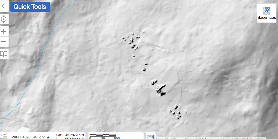 The LiDAR imagery for the area, (above), shows the Features in Question. By the dark shading, they appear to represent some features that jut up from the surface. Reconnaissance: A couple of weeks ago, I took a walk about two miles out Sugarhouse Road with Dave Phillips, his wife Chris, and their dog Betty. Our goal was to scout out the area, and also to try to walk as far as Krivak Road, which appears to connect with Sugarhouse Road, on old maps. The map below is from the USGS 15 min. series, from 1896. You can see that if you wanted to head from West Norwich, (bottom, center), to South Strafford, (top, center), or vice versa, this would have provided a fairly direct route. I wonder what they called the road back then? Today the route would be Sugarhouse Road, and Krivak Road, and then Downer Forest Road, but back in the 1800's, I suspect they all had several names, depending on who you asked. 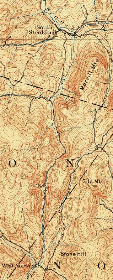 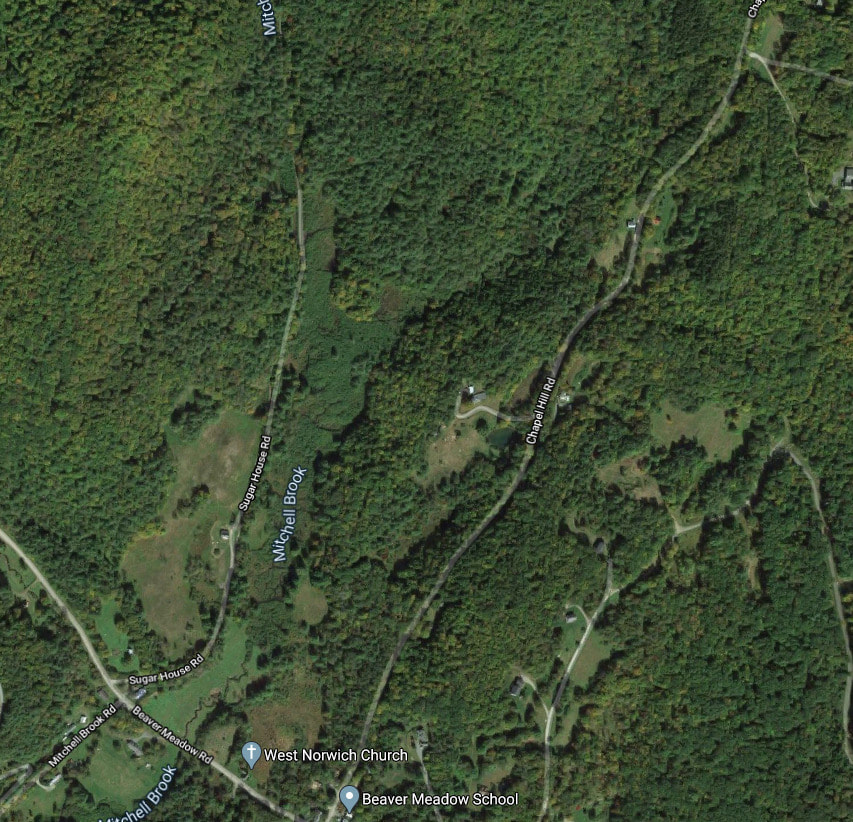 2020 Imagery courtesy Google Earth Dave, and Chris and I had a pleasant summer morning walk out Sugarhouse Road. The road had a mix of sun and shade, and Chris used a large fern as a fan to ward off the mosquitoes, blackflies, and other assorted flying pests. 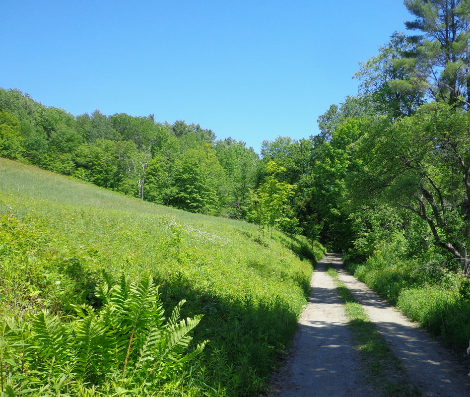 Sunlit Sugarhouse Road As we walked along, the beaver meadow was to our right, while sunlight and shade alternated. 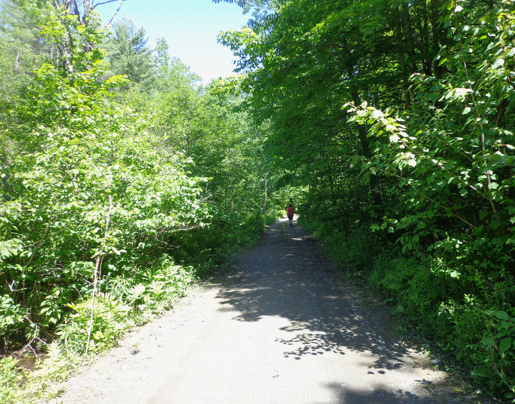 Soon we came to a pond to our right, and a culvert, so that Mitchell Brook was now flowing on our left, as the meadow gave way to forest. 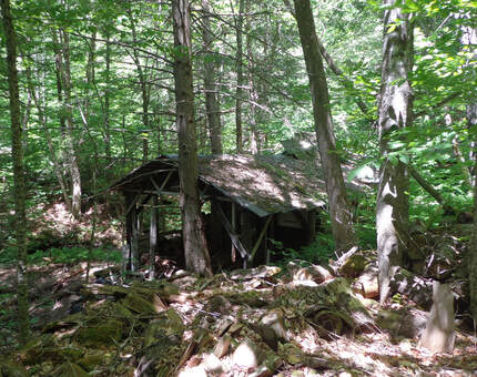 Not long after leaving the meadow, and entering a wooded area, we saw what may be the old sugarhouse for which the road is named. The sugarhouse seemed to be in a spot near a ravine shown on the LiDAR map, that could lead to those Features in Question. We made note of it for possible future treks, and continued north on Sugarhouse Road. The road was much shadier during this portion of the walk, and eventually, we noticed a clearing up ahead. As we approached, we found a beautiful old farmhouse with a sign on it. 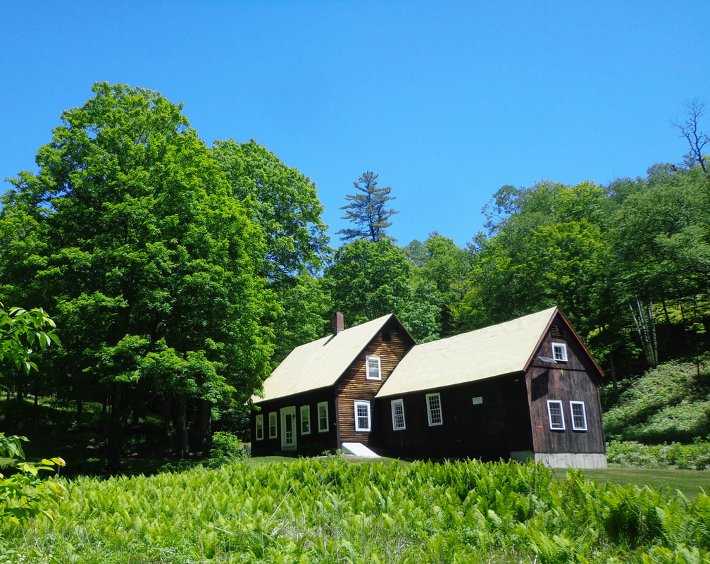 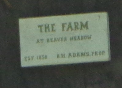 Sign on the barn at the old farmhouse. The Hosea Doton 1855 map of Windsor County Vermont doesn't show this farmhouse, as it hadn't been built yet! Beyond the farmhouse, we again entered the woods. After another mile or so, we took a left fork, which led us past an old foundation we almost missed... 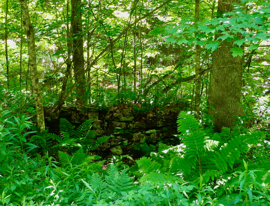 Our path opened up, but then looked like it came to an ambiguous fork. Below shows the area where we turned around. 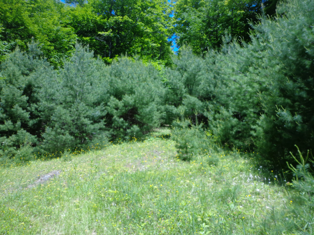 Our time was running out, and we decided to walk back to our vehicles. By the time we got back to Beaver Meadow, we had walked over four miles. Reconnaissance 2: Hiking In From the Other Side A week or two went by, and I received an email from Old Roads subscriber, Doreen Guilette. Doreen had read the first article about these features, and decided to go out and search for them. She hiked into the woods from Chapel Hill Road North, where she found some beautiful ledges. She suggested they might be the Features in Question, and invited me to take a hike and check them out with her. Below is the photo she sent me. 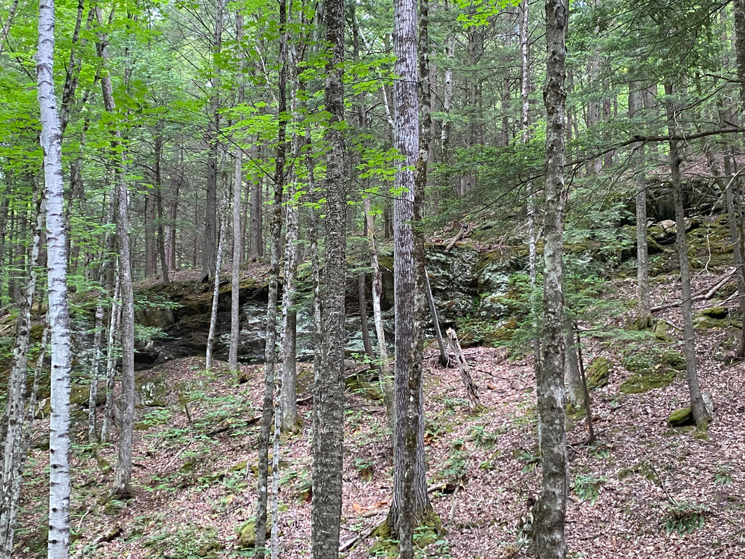 Probable "Features in Question": Ledges photo by Doreen Guillette. When I saw the photo that Doreen had sent me (above), I was excited to see the large outcroppings she had found. Several days later, I met Doreen and she led me from Chapel Hill Road, through a meadow, then straight up a hill into the woods. There we found a narrow ridge trail, which we crossed. Then we descended downhill, deeper into the forest. 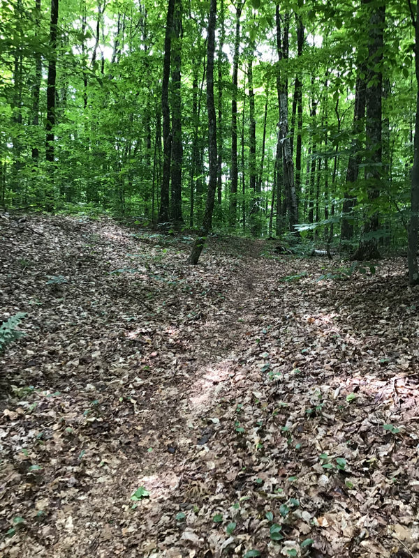 Soon she was showing me the beginning of a line of ledges, cliffs and outcroppings, that to me, were quite spectacular, in their own humble way. I immediately started snapping photos. 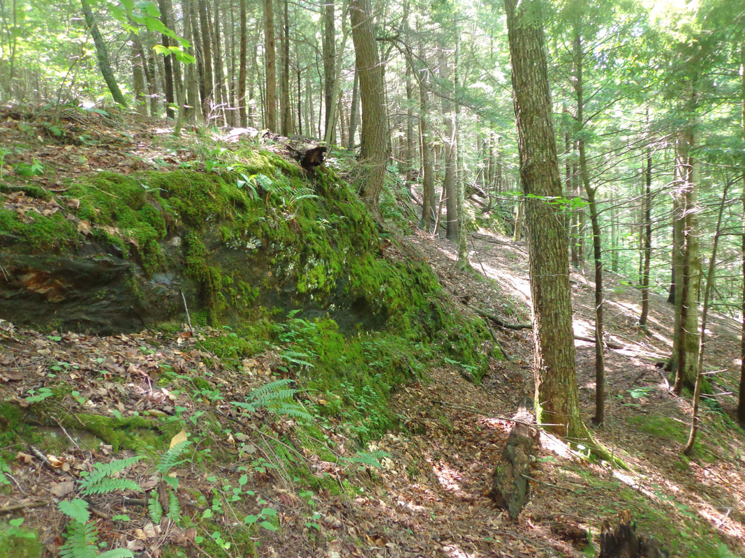 Looking east, I noticed the ledges increased in height, from west to east. 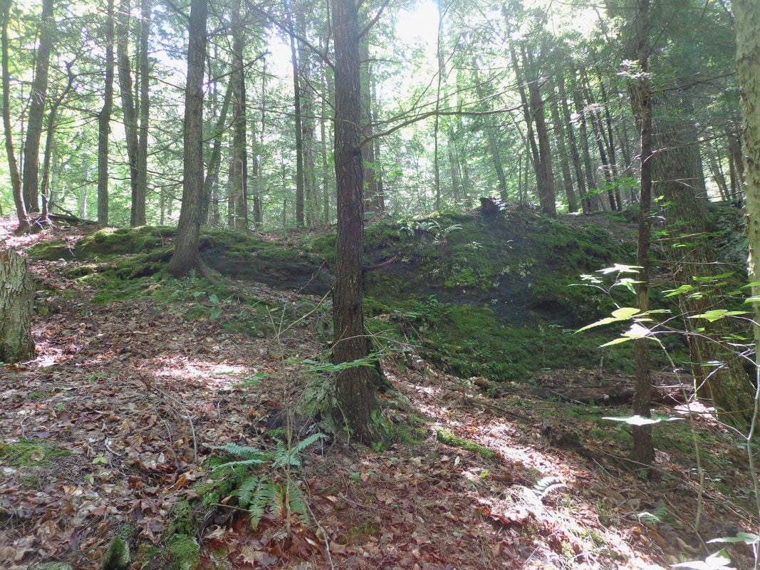 As we walked along and below the ledges, they increased in size and grandeur. 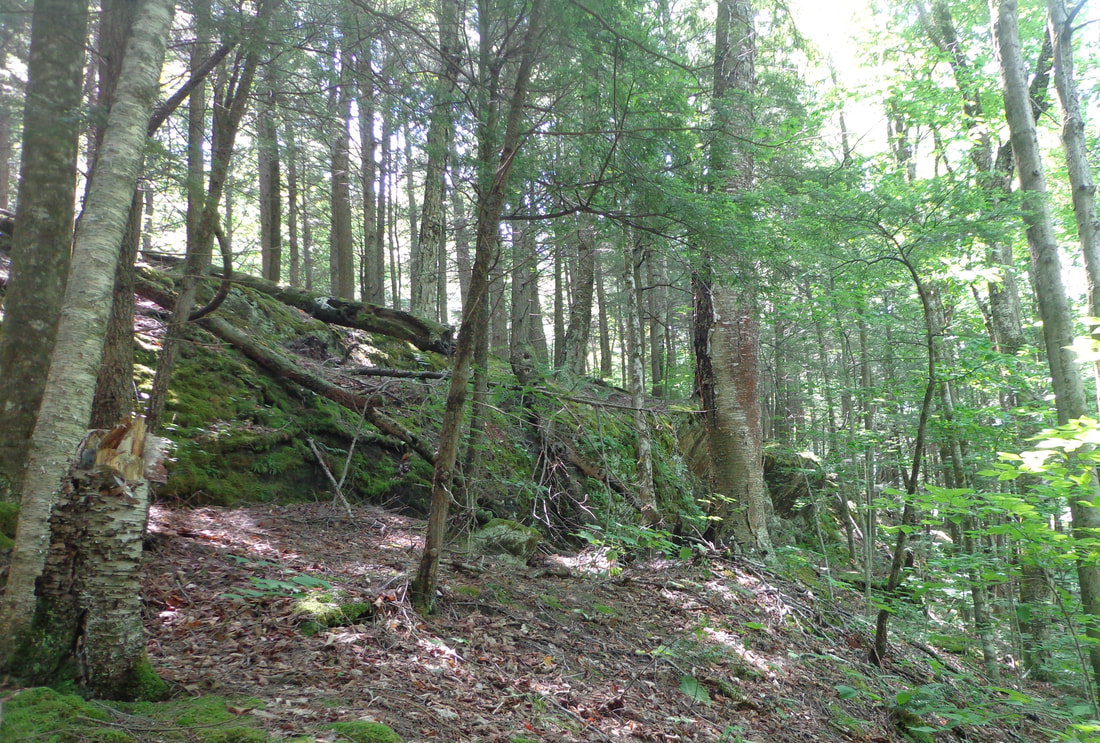 In person, the ledges appeared to be continuous, however on the LiDAR map, the features looked separate. Perhaps built-up vegetation between the ledges made them appear continuous in the forest. 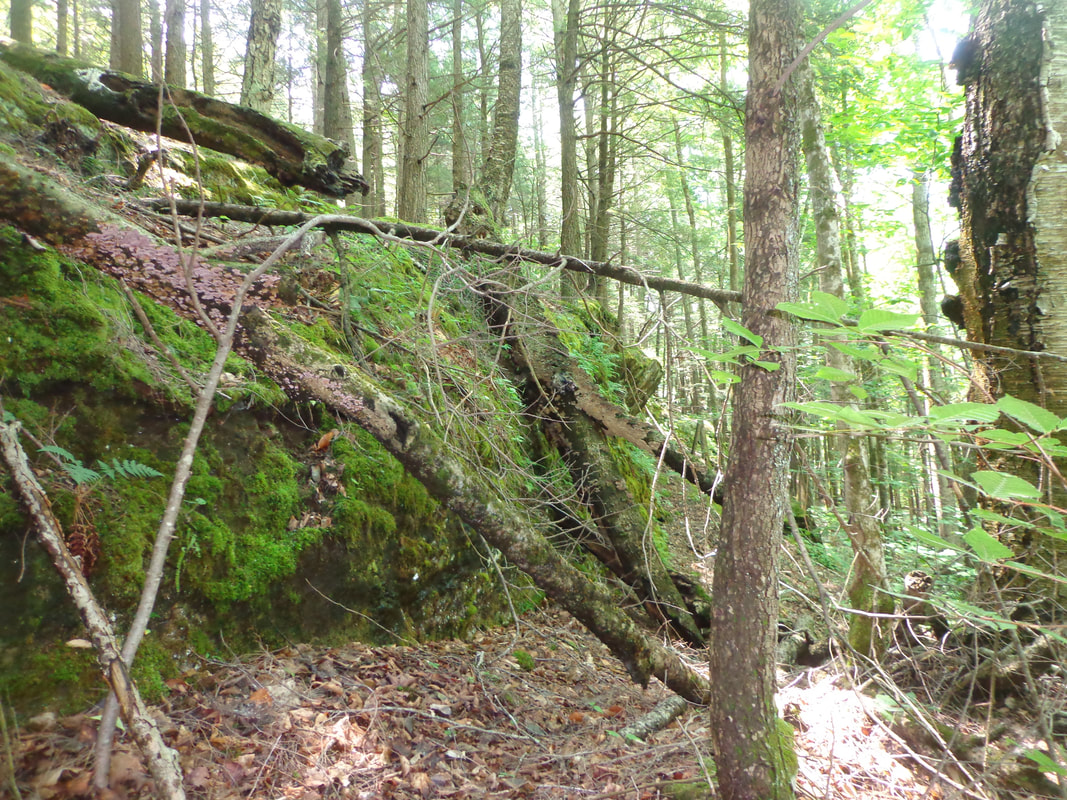 A very natural, moss-covered outcropping. 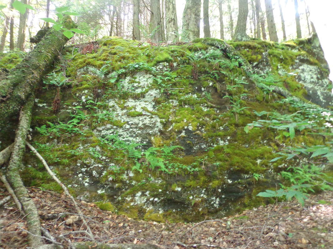  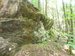 My favorite spot along the line of ledges 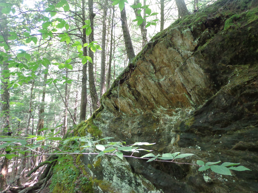 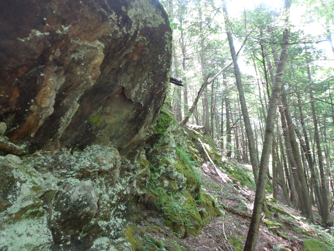 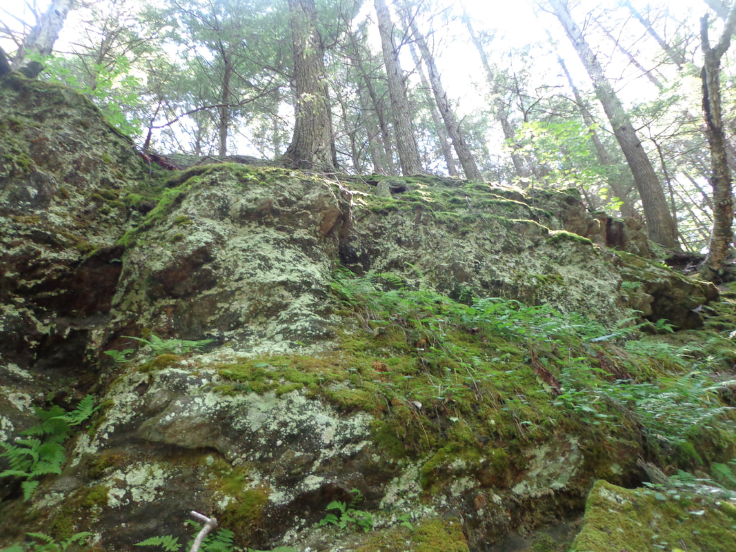 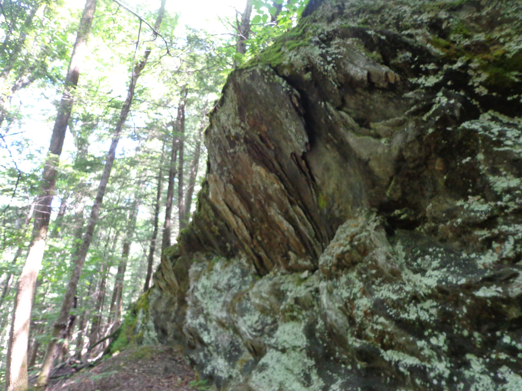 Having first seen those interesting features on the LiDAR map a few weeks earlier, I was thrilled to be seeing them in person. After investigating the ledges, we headed downhill, to the brook, and then upstream a short distance, before heading back uphill toward the ridge we had been on earlier. This time, we headed north along the ridge trail, and then came back down on the Chapel Hill side, where Doreen showed me this fine example of an old stone foundation. 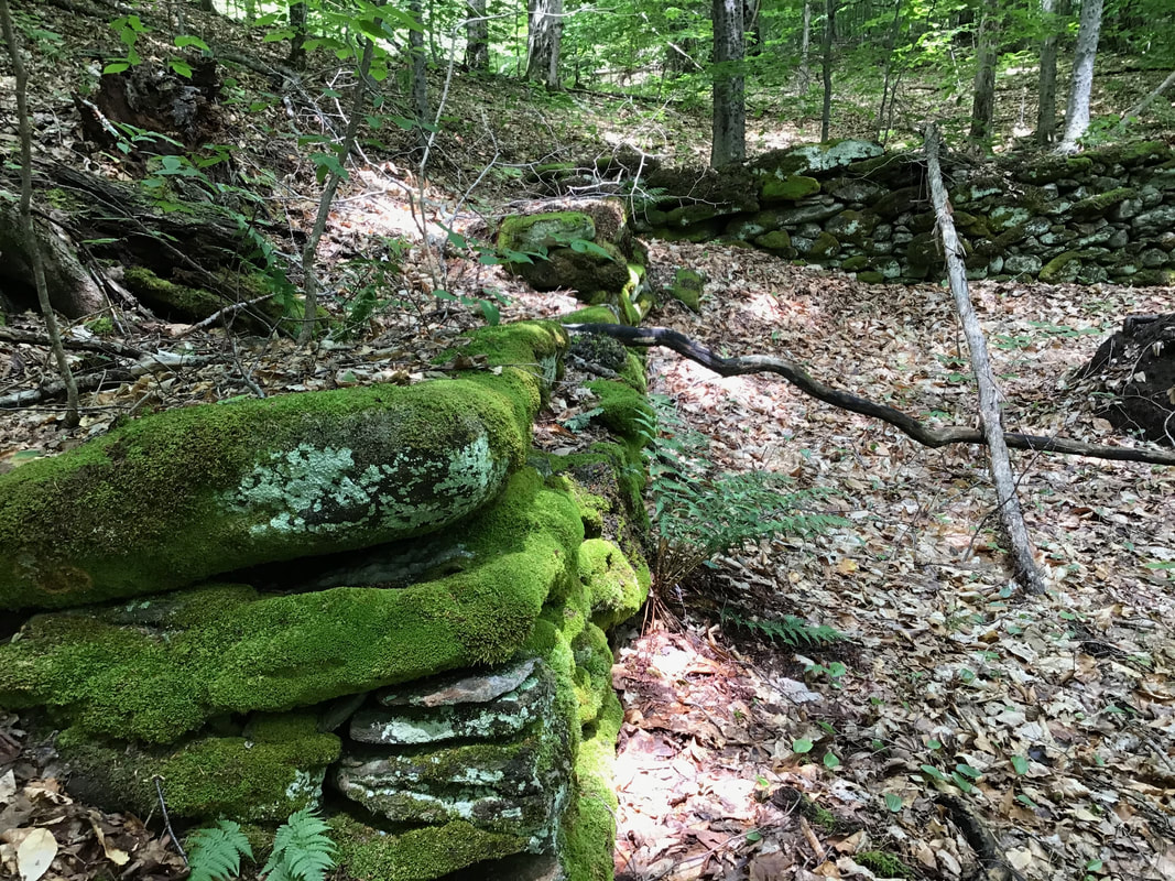 Sturdy, well-built stone foundation, still appearing straight. Upon returning home, I received an email with a map from Doreen, with the route we took outlined on it. Doreen had been using a GPS app on her phone to track our route. From the informaiton on Doreen's map, compared with the VCGI (LiDAR map), I thought there might be more ledges about 50 feet higher up, a bit further to the south. We may be heading back there to investigate sometime. 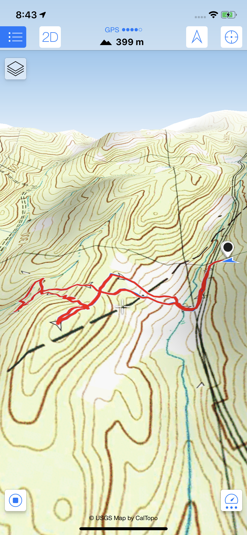 Map of our route, from the app: "Maps 3D" Shown below are the Features in Question, a.k.a Ledges, with a layer of topographic lines at one-foot intervals. The dot indicates the area w.here I believe we photographed the ledges. The highest ones, furthest to the south, are shown to be at about 1400 feet in elevation, which leads me to believe there are more out there that we haven't seen yet. 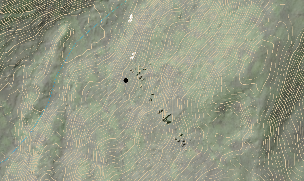 Even without the ledges, the forest was very beautiful! You never know what you may find!  This turned out to be one of my favorite explorations this year. I love seeing something interesting on a map, and then going out to see it for real, if it can be found. What makes that even better, is having someone to show me the way. Thanks, Doreen! Thanks for hiking down Old Roads, Rivers and Rails of the Upper Valley
- Bob Totz - July 12, 2020 Comments can be made at the end of each article. To subscribe to or correspond send an email to me at: [email protected] Sources: 1896 USGS Topo Map: https://ngmdb.usgs.gov/topoview/viewer/#13/43.8784/-72.4512 Vermont Center for Geographic Information Map Imagery: maps.vermont.gov/vcgi/html5viewer/?viewer=vtmapviewer Cell Phone app: "Maps 3D"
10 Comments
|
AuthorI'm Bob Totz, retired VT postmaster, and historical geographer ARCHIVES:
October 2021
EXPANDED ARCHIVES: AUGUST 2021 1858 Johnson Map of North America MAY 2021 1795 - "Road Over the Mountain" - Part Two Historic Toll House For Sale 1795 - "Road Over the Mountain" Part One OCTOBER 2020 Finding That Special Peaceful Place AUGUST 2020 Kayaking on the Pompy JULY 2020 Pt. 2: What the Heck Are These Things? JUNE 2020 Bob's Bio... What the Heck Are These Things? Pt. 1 MAY 2020 Stone Walls and Spirits The View APRIL 2020 Sunny Brook Farm Relics: Pt 2. Sunny Brook Farm Relics: Pt 1. MARCH 2020 Signs of Norwich Pt. 2 COVID-19 Tracking Map Centertown and Valleyquest Signs of Norwich Pt. 1 "Imperfect Union" - Book Review Historic Centertown FEBRUARY 2020 King's Hwy Pt. 2 WRJ Museum at Post Mills Airport Chatauguay Vermont The Independent Farmer poem Traveling Along the King's Highway - Lebanon NH JANUARY 2020 Finding Parkhurst Cemetery In Search of Parkhurst Cemetery Affordable Housing The Old Stone Grill Two Rivers Trail-Kmart License and Registration, Please! Prohibition, Murder and Dr. Seuss Peace, Paris, & P.O. DECEMBER 2019 BLOGGER'S LINKS Welcome to Old Roads Love-Quail Hollow fun Dartmouth Cemetery SEPTEMBER 2019 E. Thetford Cemetery JUNE 2019
Taps: Meetinghouse Cemetery 4-Corners Borders Quest Old Iron Gate Stumbling Upon History Sunrise Walk MAY 2019 4 Corners Cemetery Strafford's Abandoned Foundations Art in Old Stonework APRIL 2019 Strafford Tpke Pt 2 Strafford Tpke Pt 1 White River Valley FEBRUARY 2019 Learning from Historic Maps of the Upper Valley Change in Lewiston VT JANUARY 2019 A Vermont Ski Waltz John Ledyard 1773 What is the Upper Valley? DECEMBER 2018 Dartmouth Green Music Video: Sometimes Music Video: Montreal Express Railway Disaster of 1887 |
 RSS Feed
