|
Welcome! Scroll Down for Posts and Archives.
Other Menu Options at Top |
|
|
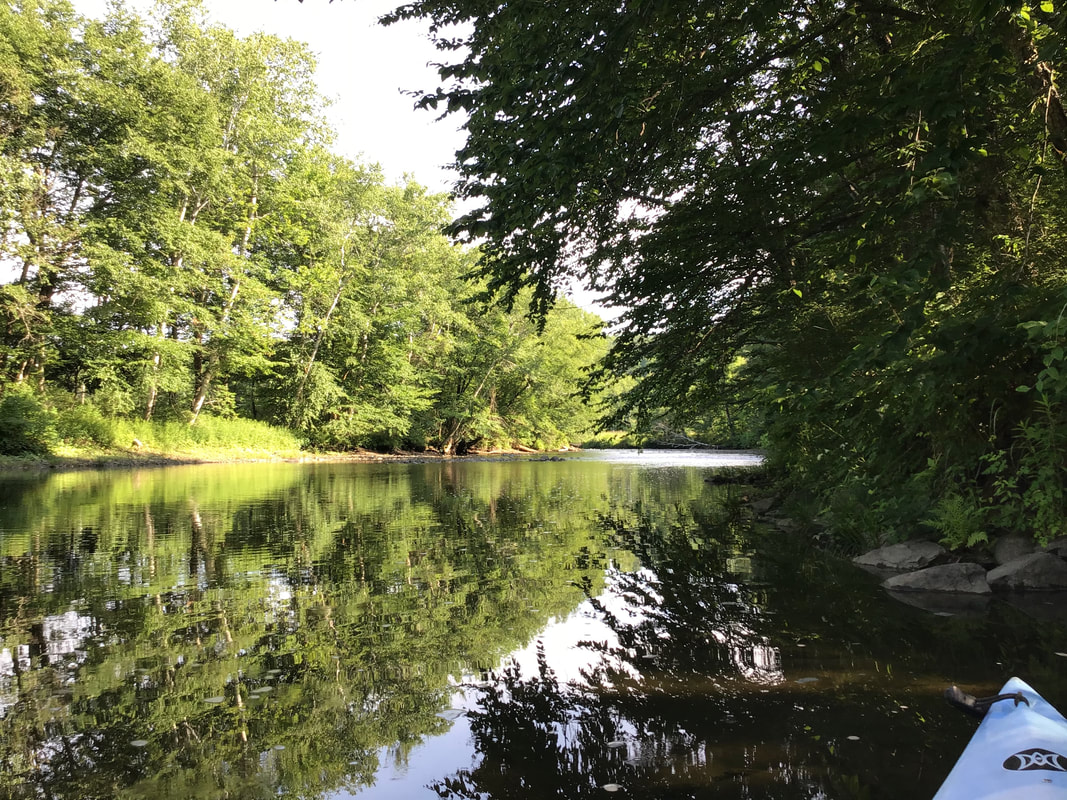 I didn't have to think for long, when my friend Mike Z asked me if I wanted to go kayaking on Tuesday morning, 7/7/2020. The last time I had gone with him we saw a moose at the McDaniels Marsh in Enfield New Hampshire. This time though, we decided to go exploring a little closer to home, on the Ompompanoosuc River, or "The Pompy". 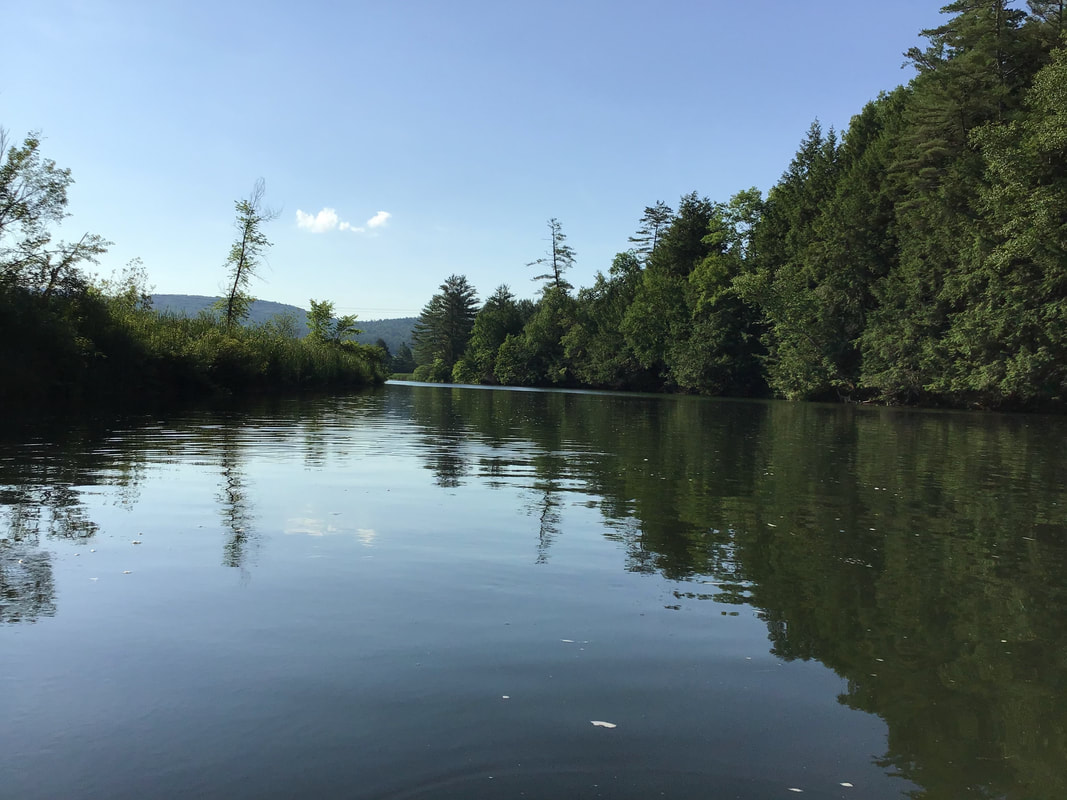 The Placid Pompy We drove up Rt 5 north a few miles from Norwich, took a left on the Old Bridge Road, just before Rt 132, and parked at the little boat ramp. It was about 8:00 AM. Within minutes, we were floating in kayaks on the Pompy, heading under the first bridge, Interstate 91. 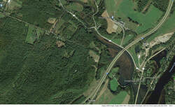 Shortly after that, we were headed under the Rt 132 bridge, and began meandering up the Pompy, alongside of one of my favorite roads, Cambell Flat Road. 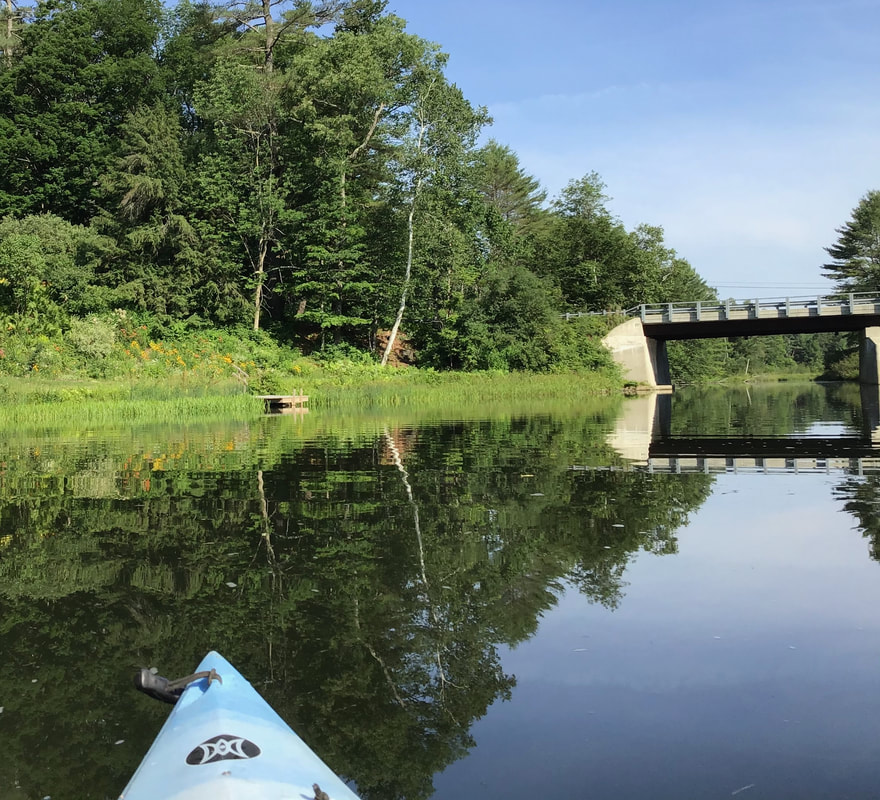 Back when I was commuting to and from Post Mills, Campbell Flat Road became one of my favorite routes; a meandering dirt road, flanked by fields. In the mornings I would drive by corn fields and cows. In the evening I enjoyed the rays of the setting sun as I turned into what used to be known as Pattersonville.  A Peaceful Perch on the Pompy. Suddenly, my eyes caught movement in the water, right in front of me. At first I thought it was a fish, but upon closer inspection, I saw a chipmunk doing the dog-paddle, or rather, the chipmunk-paddle, across the river, right in front of me! I could have reached out and grabbed it. The chipmunk looked at me for a second, and then swam about as hard and fast as it could and made it across the river. To me It looked like a cartoon character; something I had not expected. It all happened so fast, I wasn't able to get a photo or video. 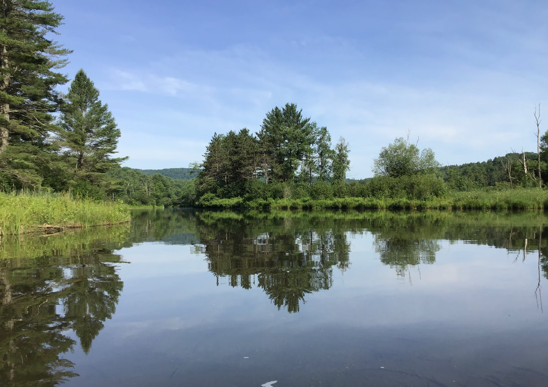 We came upon a spot in the river where a mother merganser and her brood were having a great time practicing fishing. I was able to get a short video of the cute youngsters during one of their first fishing expeditions. The 31 second video can be seen here: https://www.youtube.com/watch?v=Ut8q8g_-Pm8 While paddling along we were serenaded by many birds, including one of my favorites, the woodthrush. Here are some more photos from that glorious morning in July: 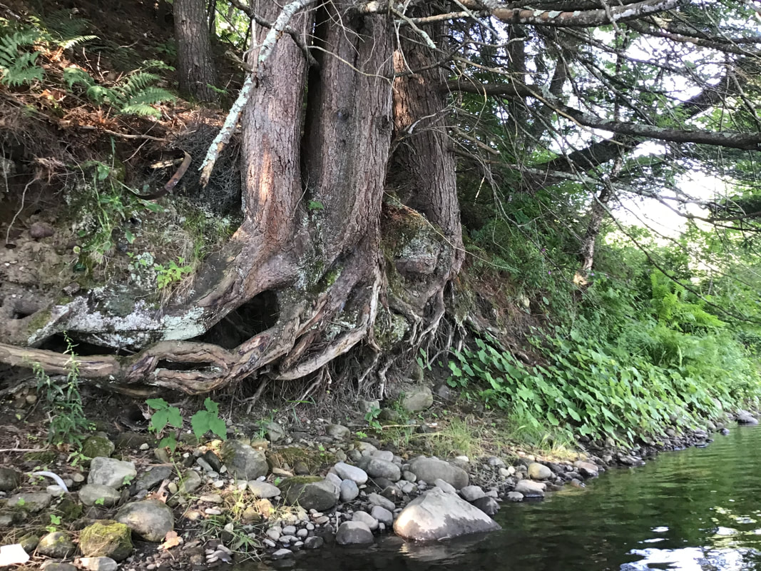 The resilience of trees. 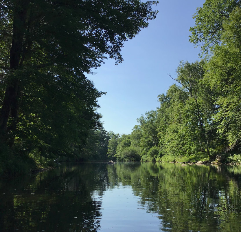 Contrasting light and shadows on a bright morning, about two weeks after the summer solstice. The western shore of the Pompy: 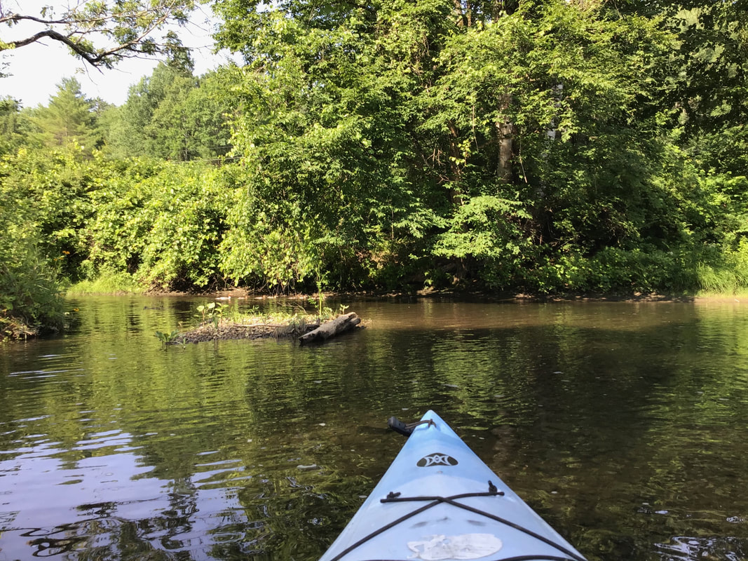 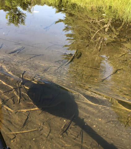 We turned around bellow Union Village, as the water level became increasingly shallow. Heading back toward the Connecticut River, the Pompy widens out. 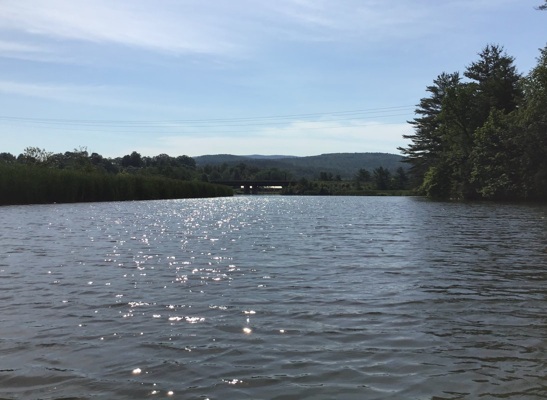 We detoured through the cattails, reeds, and lily pads behind the interstate bridge, before heading back to the boat ramp. 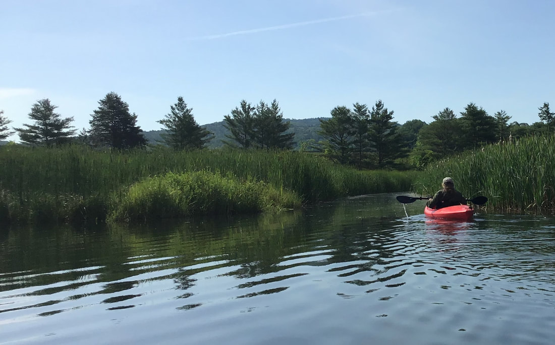 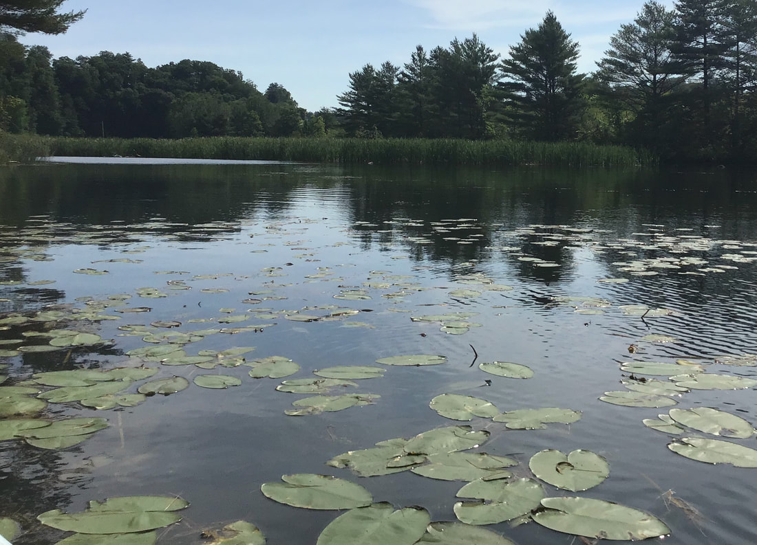 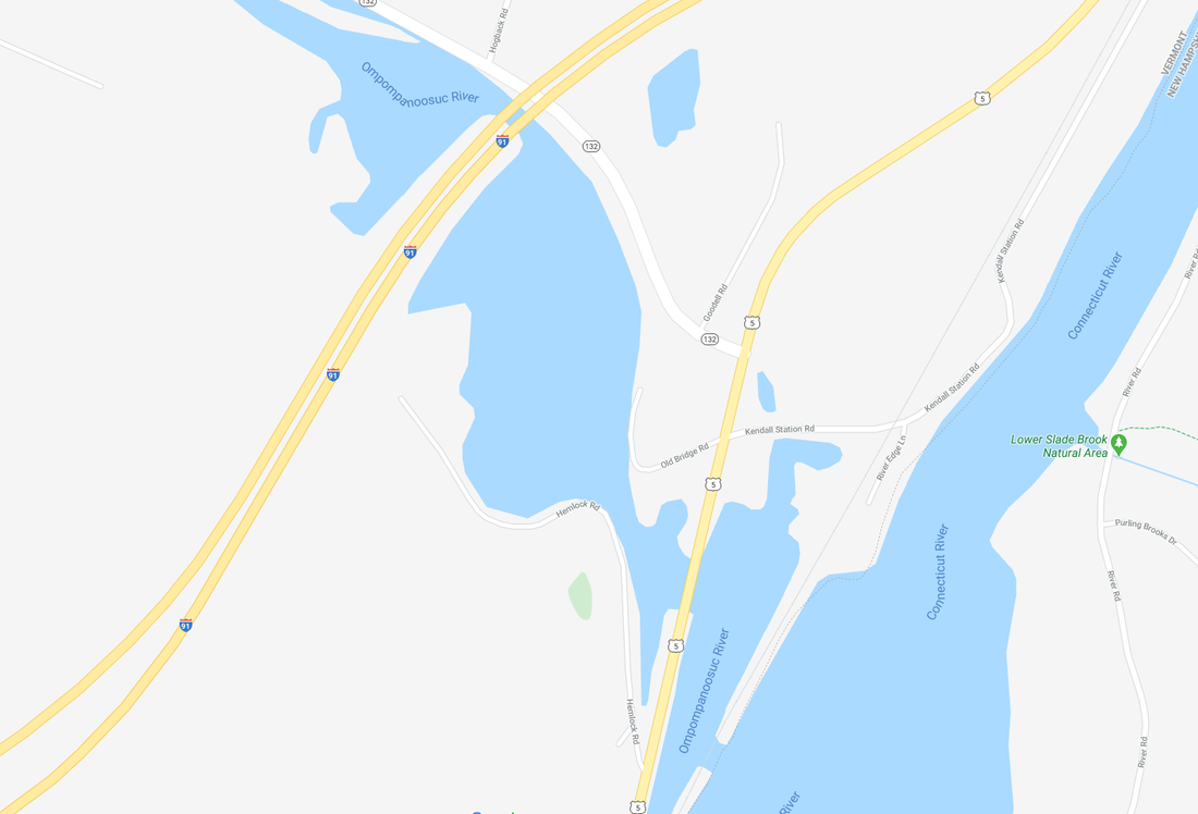 Map courtesy Google Earth Years ago, this area was known as Pattersonville, after the Patterson Chair Company, which was once a thriving business and employer in the area. I like to imagine what this area was like before european settlement. It was probably an ideal place for fishing, back before the interstate; before the Wilder Dam; before Route 5; before the railroad, when animal paths were followed by indigenous populations, and slowly widened by human feet. I've read that this area was found to be rich in arrowheads and spear points, found while excavating for the interstate highway. What is now the boat ramp on Old Bridge Road, was the site of the covered bridge that brought traffic over the Ompompanoosuc River on the former path of Route 5. 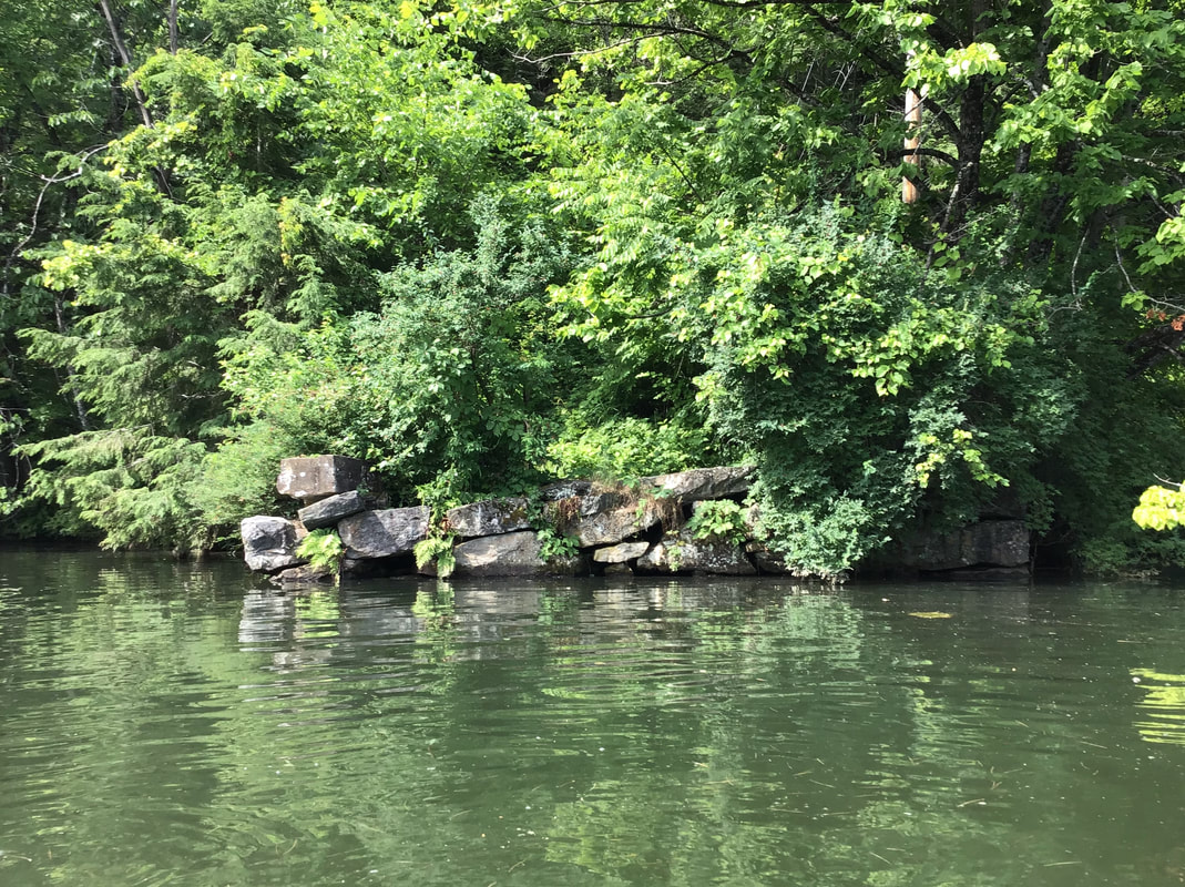 Remains of Former Bridge Abuttment Stones More information on the rich history of this area can be found at the Norwich Historical Society's website. There you can download an interesting podcast called "Rivers and Mills" that can be accessed here: norwichhistory.org/historic-driving-tour-podcast-rivers-and-mills/ 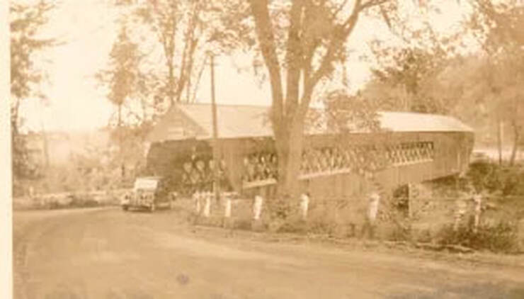 Old covered bridge. Photo taken when Old Bridge Road was part of Route 5. Today, this is the site of the boat ramp. Photo courtesy Norwich VT HIstorical Society. Thanks for cruising down Old Roads, Rivers and Rails of the Upper Valley
with me, Bob Totz Good related article with photos: History of "Pompanoosuc" https://norwichhistory.org/wp-content/uploads/Pompanoosuc-Hamlet-History.pdf To be added to the list of subscribers, or to correspond, just send an email request to: [email protected] Subscriptions are free. Comments are appreciated, and can be entered below.
8 Comments
|
AuthorI'm Bob Totz, retired VT postmaster, and historical geographer ARCHIVES:
October 2021
EXPANDED ARCHIVES: AUGUST 2021 1858 Johnson Map of North America MAY 2021 1795 - "Road Over the Mountain" - Part Two Historic Toll House For Sale 1795 - "Road Over the Mountain" Part One OCTOBER 2020 Finding That Special Peaceful Place AUGUST 2020 Kayaking on the Pompy JULY 2020 Pt. 2: What the Heck Are These Things? JUNE 2020 Bob's Bio... What the Heck Are These Things? Pt. 1 MAY 2020 Stone Walls and Spirits The View APRIL 2020 Sunny Brook Farm Relics: Pt 2. Sunny Brook Farm Relics: Pt 1. MARCH 2020 Signs of Norwich Pt. 2 COVID-19 Tracking Map Centertown and Valleyquest Signs of Norwich Pt. 1 "Imperfect Union" - Book Review Historic Centertown FEBRUARY 2020 King's Hwy Pt. 2 WRJ Museum at Post Mills Airport Chatauguay Vermont The Independent Farmer poem Traveling Along the King's Highway - Lebanon NH JANUARY 2020 Finding Parkhurst Cemetery In Search of Parkhurst Cemetery Affordable Housing The Old Stone Grill Two Rivers Trail-Kmart License and Registration, Please! Prohibition, Murder and Dr. Seuss Peace, Paris, & P.O. DECEMBER 2019 BLOGGER'S LINKS Welcome to Old Roads Love-Quail Hollow fun Dartmouth Cemetery SEPTEMBER 2019 E. Thetford Cemetery JUNE 2019
Taps: Meetinghouse Cemetery 4-Corners Borders Quest Old Iron Gate Stumbling Upon History Sunrise Walk MAY 2019 4 Corners Cemetery Strafford's Abandoned Foundations Art in Old Stonework APRIL 2019 Strafford Tpke Pt 2 Strafford Tpke Pt 1 White River Valley FEBRUARY 2019 Learning from Historic Maps of the Upper Valley Change in Lewiston VT JANUARY 2019 A Vermont Ski Waltz John Ledyard 1773 What is the Upper Valley? DECEMBER 2018 Dartmouth Green Music Video: Sometimes Music Video: Montreal Express Railway Disaster of 1887 |
 RSS Feed
