|
Welcome! Scroll Down for Posts and Archives.
Other Menu Options at Top |
|
|
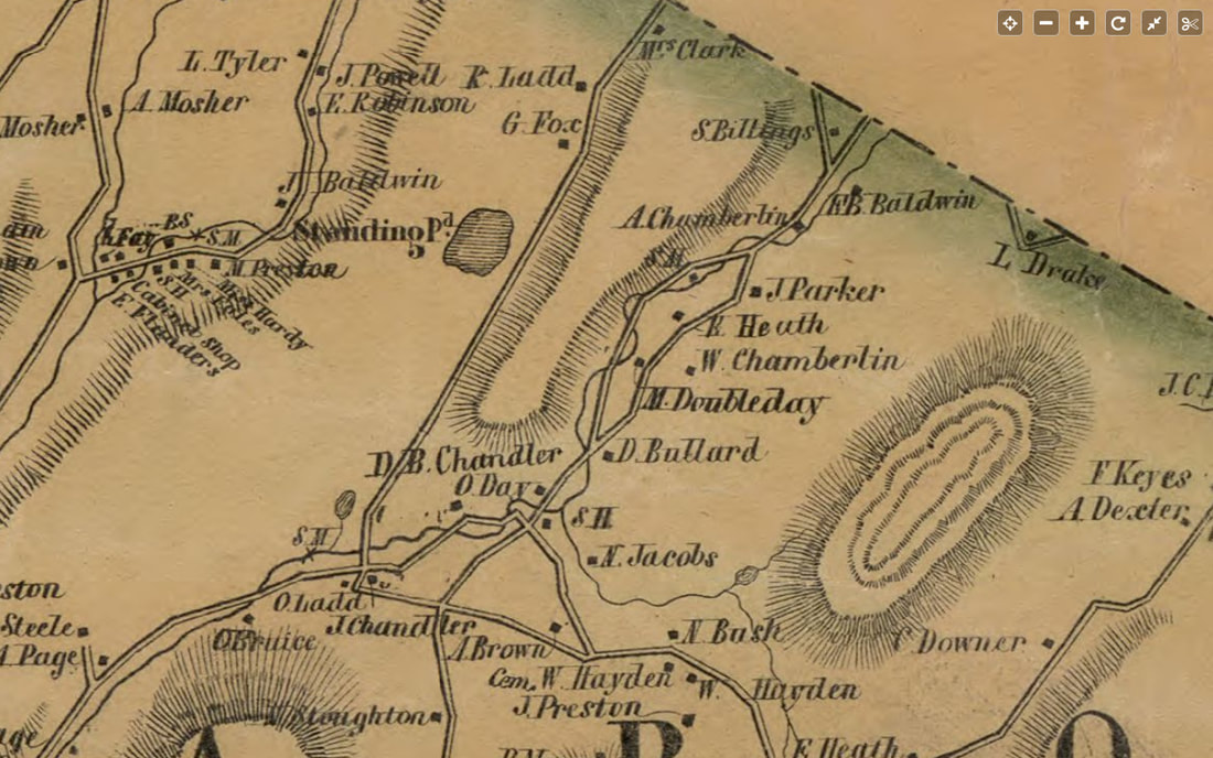 Day District of Sharon Vermont. 1855. In part one of this article, we focused on our spring hike out to the old man-made reservoir that was a source of water for the Sunny Brook Trout Farm. As we left the reservoir, we headed uphill and into the woods on an old road. 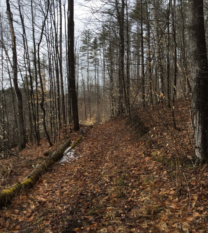 Heading Out on the Old Woods Road. The road led us uphill, and soon we were approaching an old stone foundation. 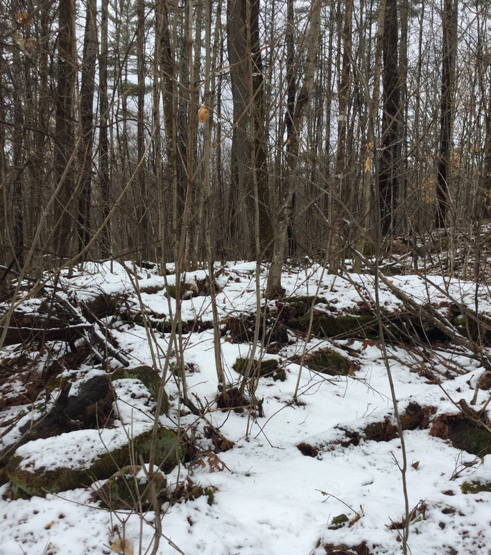 As we approached, I could make out the shape of an old stone wall poking out of the snow. 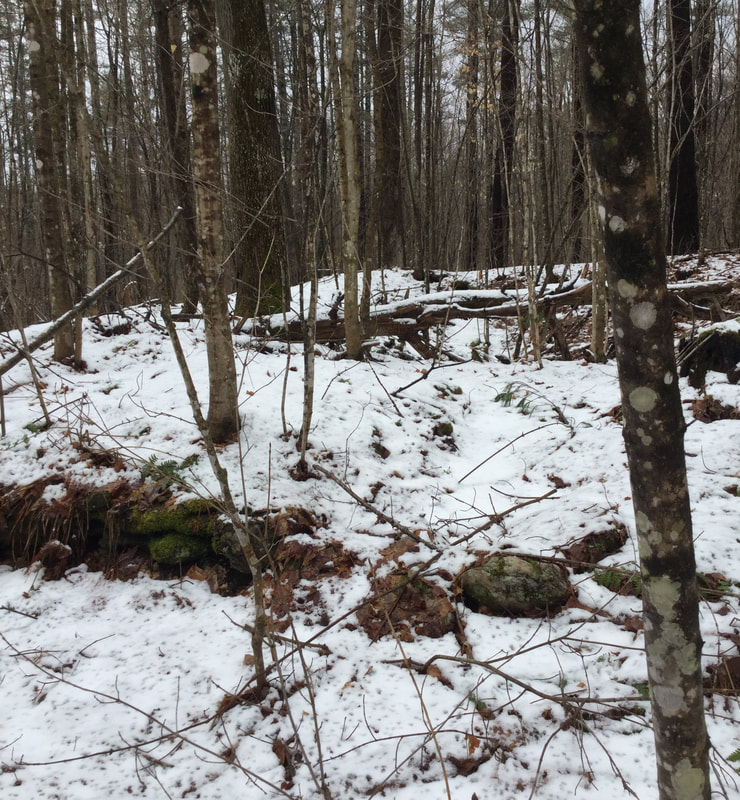 Though difficult to see with the old crusty snow, we could tell there was some serious history half-hidden here. 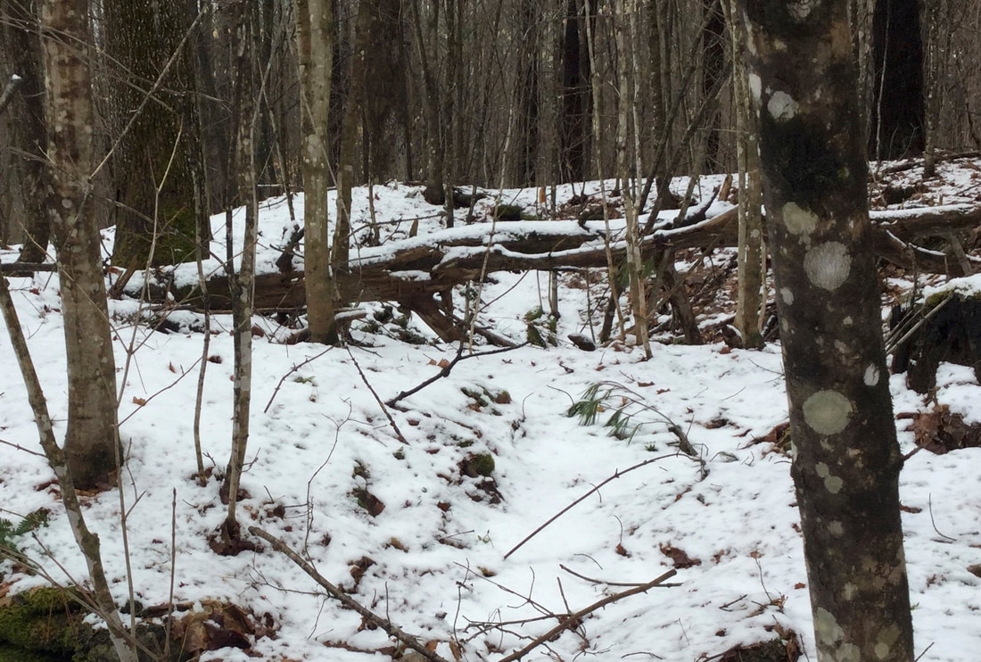 A Closer View of the Old Foundation. Dead Trees Have Fallen into the Hole. With snow, fallen trees and debris all around the area, we had to use our imagination a bit, to try and see an old homestead in what is now forest. The forest around us was fairly young, but the presence of an ancient majestic maple, just above the foundation called to mind days of sugaring and farming here, in the `19th century. 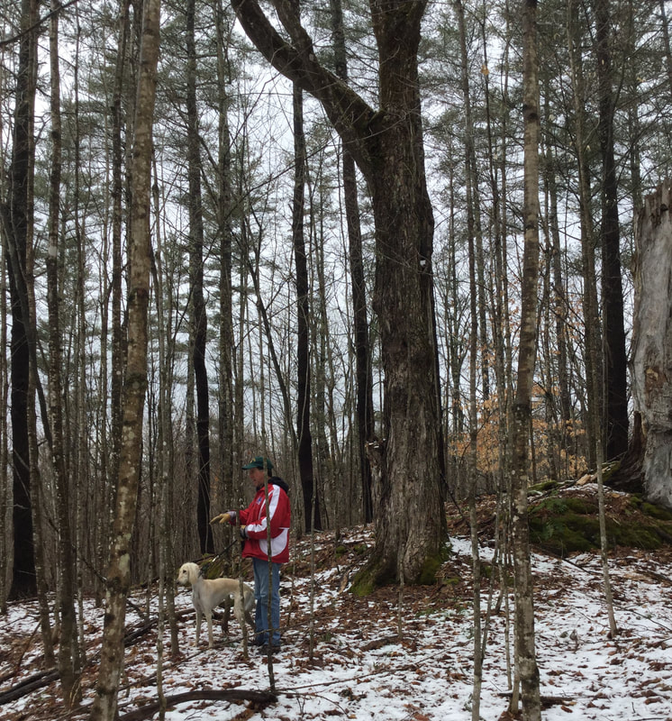 Dave Phillips Stands in Front of the Majestic Old Maple Tree, Just above the Stone Foundation. Here is another look at the foundation, looking down from the big maple tree: 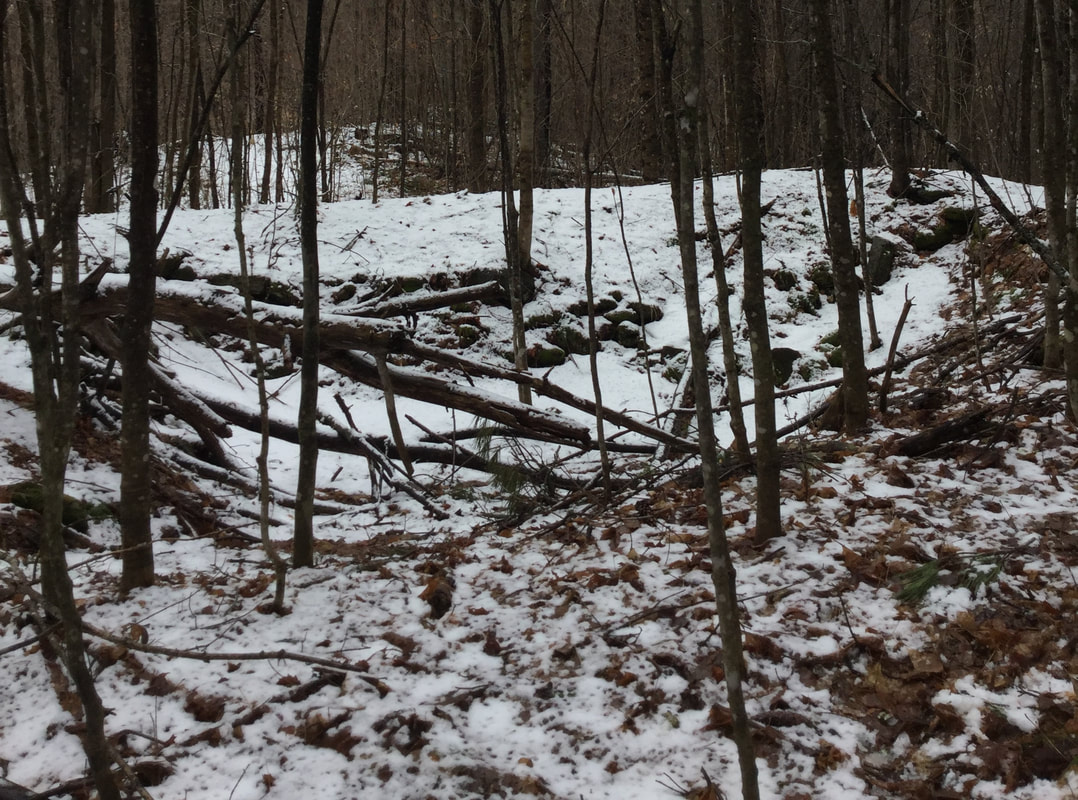 To the left of the old cellar hole, was another low wall that may have been the foundation of an ell, or other living space that did not have a cellar hole underneath: 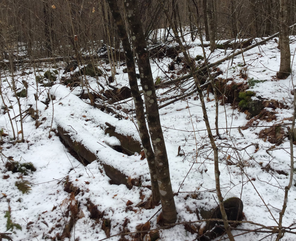 Foundation Stones Adjacent to Main Cellar Hole. Soon we were heading uphill again, in the forest, along an old road, where we came upon the most... AMAZING STONE WALL! 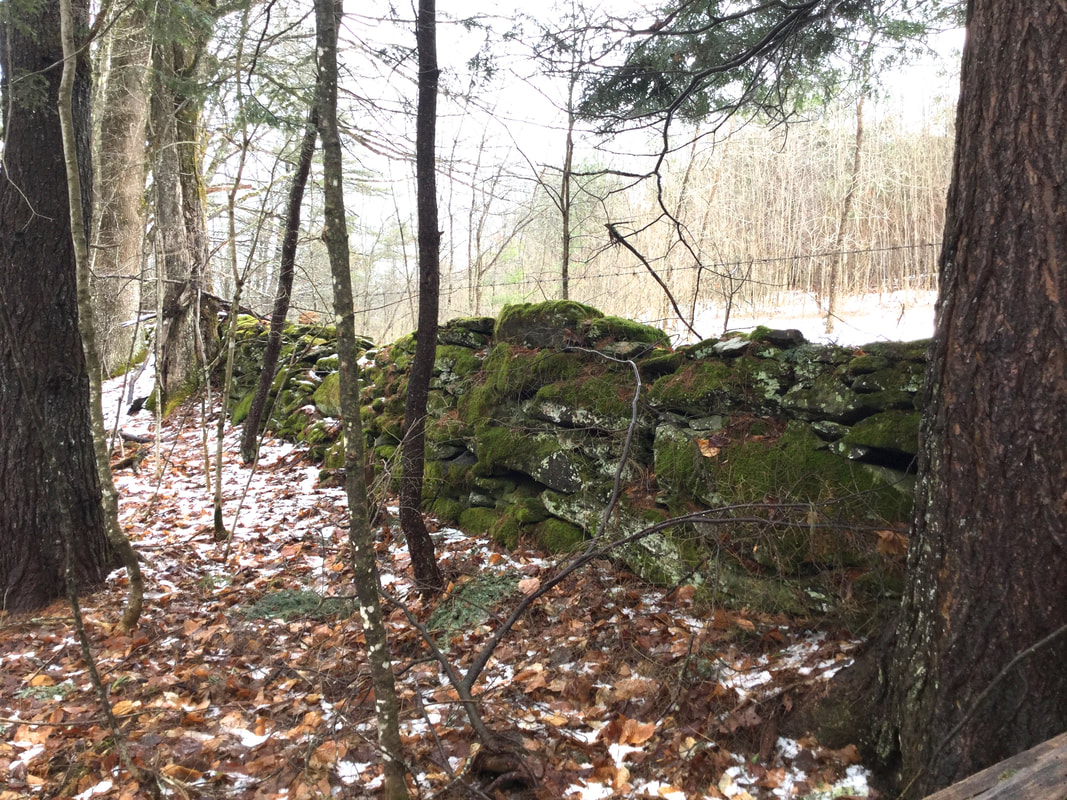 Dave had told me about this wall earlier, and I had been looking forward to seeing it. To me, old stone walls are, to some degree, works of art. Even though they were built for a variety of functional reasons, I can't help thinking that sometimes the builders had a desire to create something that would be visually pleasing, as well as durable and functional. 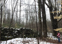 Dave Phillips Stands to the Right, Admiring the Large Old Stone Wall. In the photo above, Dave and his pup stand to the right, giving an idea as to the size of the wall. By the looks of this wall, I could see that something very durable was built many years ago. And it is visually pleasing as well. Large old trees line the wall. They may have been planted there, or possibly they grew close to the wall by chance. Though some of them were ancient and dying, some of the old trees still had plenty of life left in them. 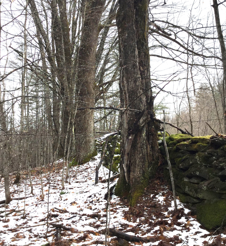 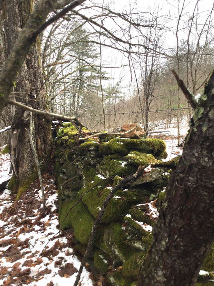 As we investigated the old stone wall, we pondered why it had been built here, so tall and sturdy. It almost seemed like it said "Here is the estate of someone who is wealthy and wanted a beautiful wall to show the boundary of their property on this side." One interesting feature, attesting to the intelligence of the builder(s) of this wall: There appears to be a culvert that was built right into the stone wall at the low spot, to allow water to pass under it without undercutting the integrity of the wall. It seems to have worked well for probably well over a hundred years, maybe two hundred? 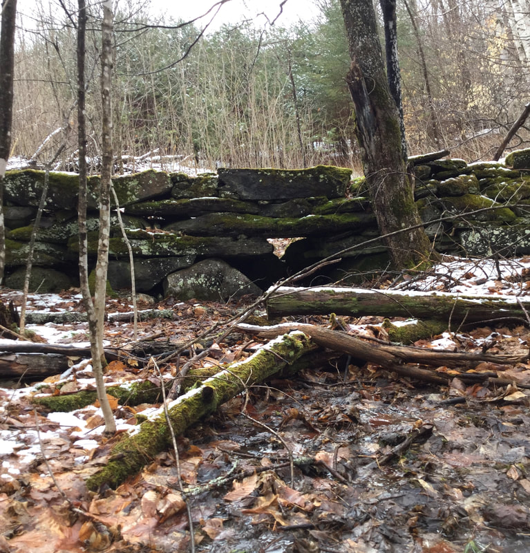 Clever Stone Culvert Built into the Wall Here is a good look at the workmanship displayed in this wall: 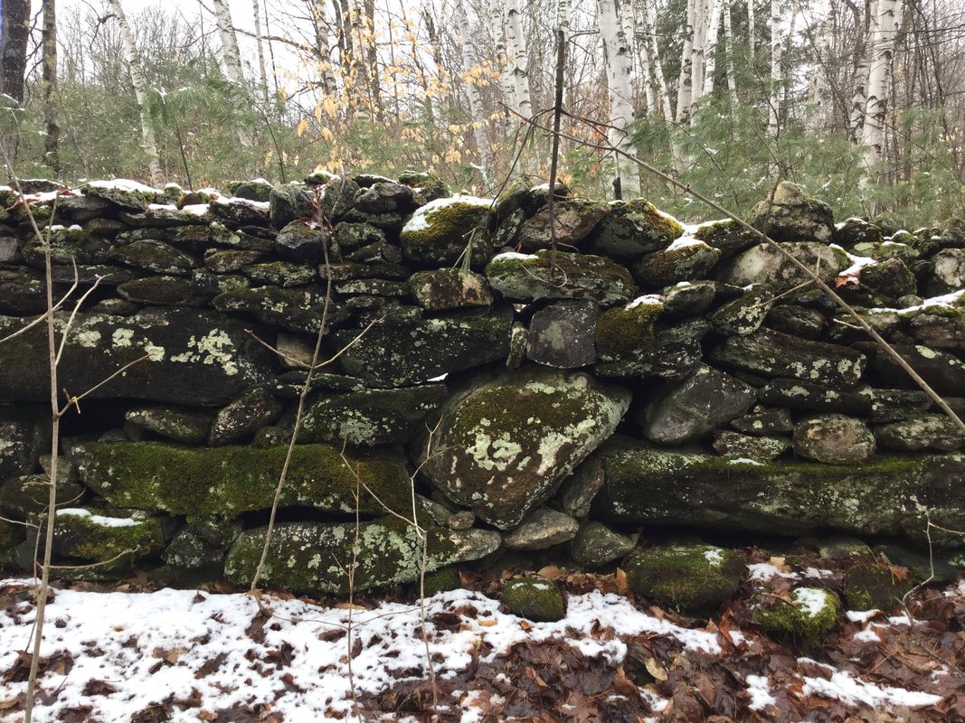 And here is a look at a corner of the wall: 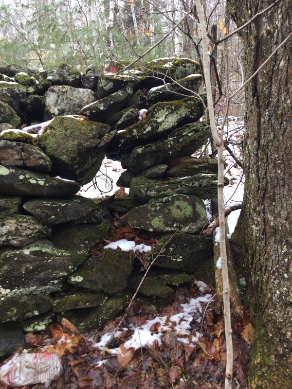 Below is a look at the same corner, just to the right, showing the remains of an old gate. 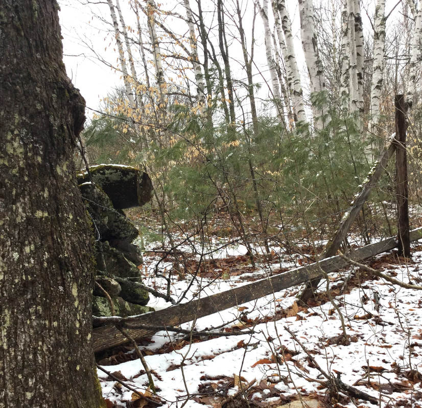 As Dave and I headed back towards the old reservoir, we discussed the origin and use of the road, and the tall wall. Perhaps the road was used as a shortcut to upper pastures, or possibly for visiting the neighbors' farm(s). There is a road that connects with Route 132 above the Sunny Brook Farm, called Muir Road. Today, it is a dead end road. However, back in 1855, and up until the early 20th century, it appeared that Muir Road also connected with Route 132, or Quation Brook Road, as it was probably called in earlier days. I wonder where the name "Quation" came from? Here is a close up of that area from the 1855 Windsor County map: It appears to me that the road to the right, (east) would be Muir Road, and Quation Brook Road would be the western path. 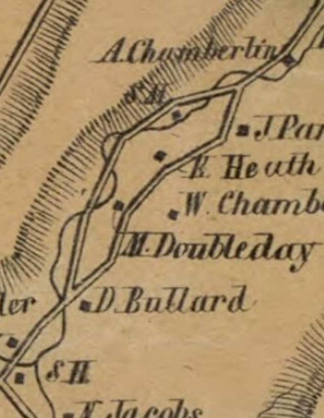 Close-up of Road Behind Sunny Brook Farm. This May Be Muir Road Today. In the close-up above, from 1855, we can see that there were homesteads of D. Bullard, M. Doubleday, W. Chamberlain, Heath, and Parker. It's possible that the old stone foundation we visisted belonged to one of those families. 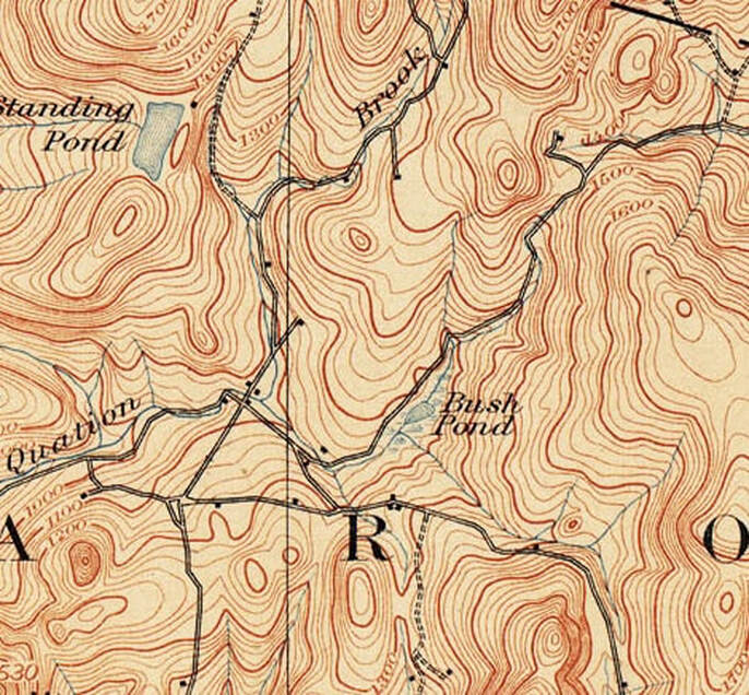 Day District, Sharon Vermont, 1896, Showing Two Ends of Muir Road, Not Connected.  Day District, Sharon Vermont, 1949. The Double Dashed Line above the Day School Indicates Muir Road. LIDAR technology uses laser technology to map the surface of the earth from the air, without being obscured by vegetation. The following are a series of screenshots from the Vermont Center for Geographic Information, using LIDAR technology, each one a bit closer to the area where we found the great stone wall. LIDAR can show where fields used to be, and where stone walls can be found, even when partially or totally buried, by the subtle changes in elevation shown on the images. 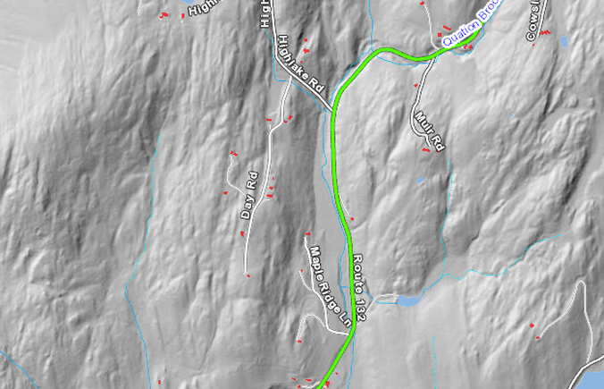 The image above shows the area in question to the right of Route 132. 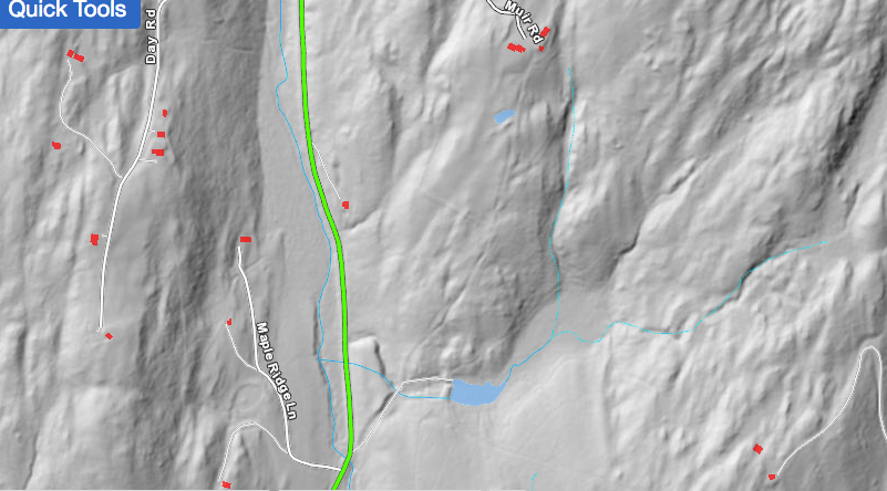 Here is a closer look. 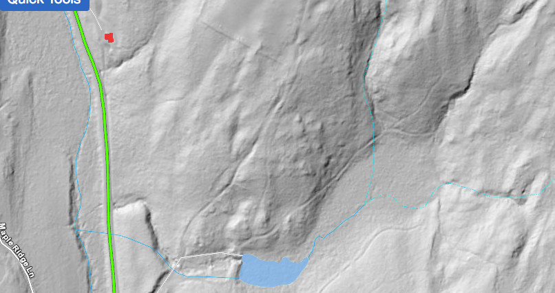 In the image above, the old reservoir is shown in blue at the bottom. We had turned away from the old reservoir dam and up into the woods, where a road can be seen leading northeast. It appears to me that Muir Road was to the west of where we were walking. It's possible we were on a path or old road that connects to what is now Cowslip Road, which is the next right turn off Rt 132 after Muir Road, heading north. 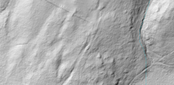 In the close-up image above, notice a very straight line running diagonal, lower right to upper left. I believe this may represent the tall stone wall that we found. Here's one last view, from Google Earth, showing Sunny Brook Farm, Muir Road, and Coswlip Road: 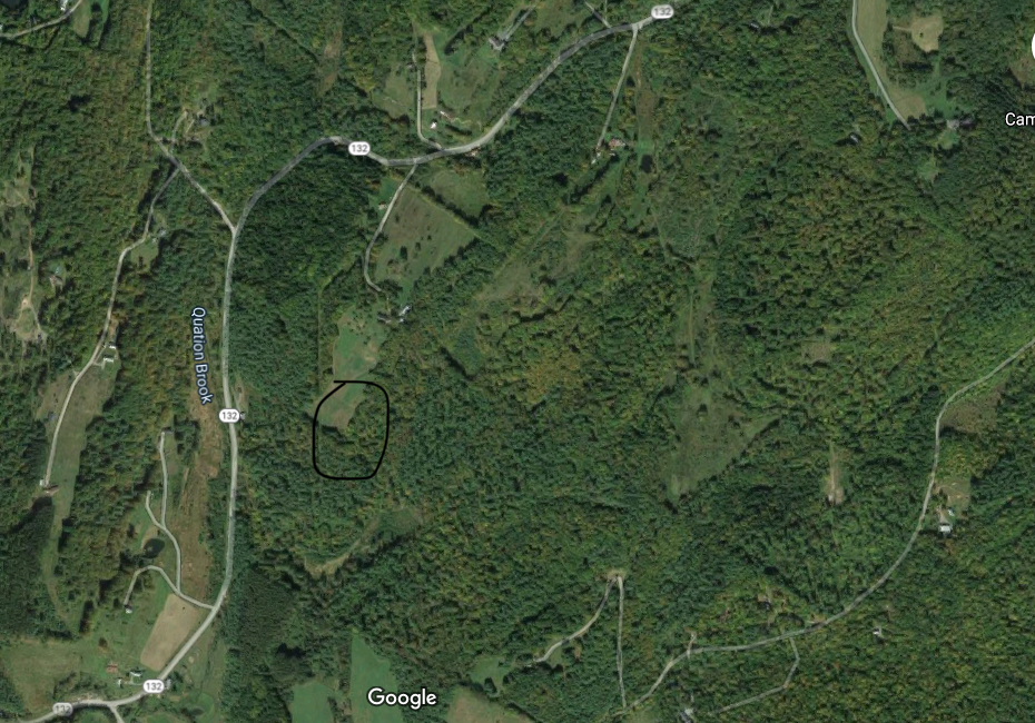 Circled above is the general location where I believe the tall wall was found, just below a field. This is a very interesting area, as are so many old back woods areas in Vermont, where farms used to thrive. Emigration in the mid-1800's often left old farmsteads to decay and return to the forest along with their pastures and fields. Today, we look for signs of the past, and the largest clues are the stone walls, and stone foundations, often along the older roads that are no longer in use, yet still exist out back. Thanks for hiking down Old Roads, Rivers and Rails of the Upper Valley with me, Bob Totz Comments and New Subscribers are always welcome! To subscribe, simply send an email to [email protected] SOURCES:
USGS Topographic Maps: https://ngmdb.usgs.gov/topoview/viewer/#12/43.7799/-72.4312 LIDAR Map: https://maps.vermont.gov/vcgi/html5viewer/?viewer=vtmapviewer Satellite View: Courtesy Google Maps https://www.google.com/maps
0 Comments
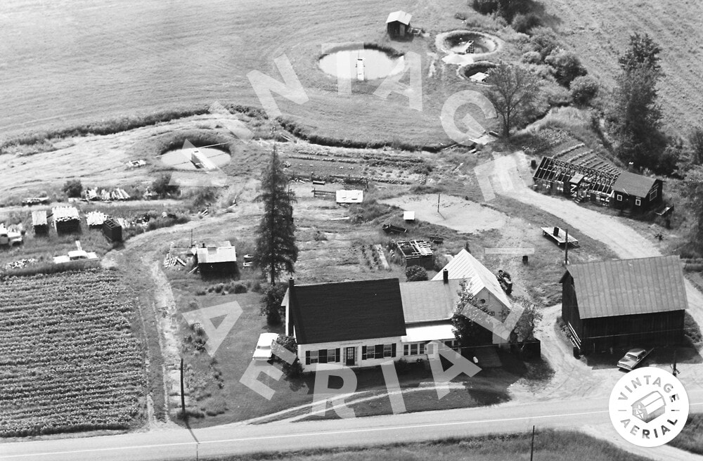 Sunny Brook Trout Farm in 1968. Aerial view by vintageaerial.com An invitation to hike on an old, long unused Vermont road, to see some old relics in the woods was something I did not expect on a Tuesday morning. Happily, I called up Dave Phillips and accepted his offer. Both Dave and I have a love of old roads, foundations, stone walls, history and relics. 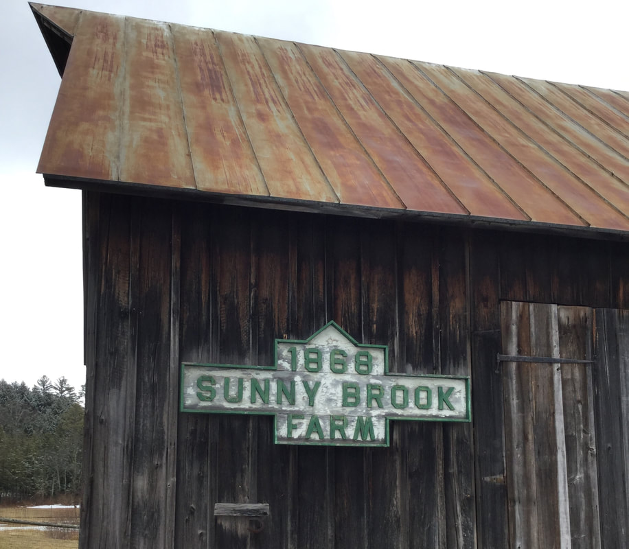 Maybe you can't go to work, but that doesn't mean you can't go for a walk. I usually walk daily, locally, in my neighborhood, but Dave's offer was a welcome one, and I headed west on Beaver Meadow Road, for a springtime walk at the old Sunny Brook Trout Farm. 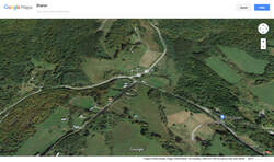 The Day District, and Sunny Brook Farm, in Sharon Vermont near the intersection of Beaver Meadow Road, Route 132, and Carpenter Street. 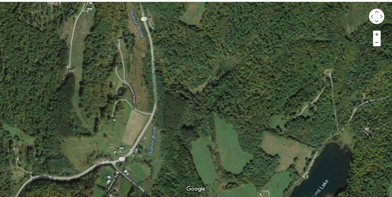 Since 1988, when I lived in Sharon, for a couple of years, I've been fascinated with this area, which is known as the "Day District", after the Day family who farmed here years ago. I've often wondered how Beaver Meadow Road, Downer Forest Road, and Route 132, looked 100 or 200 years ago. I'm thinking there were different pathways between farmsteads, that were used as roads back then, and eventually, some became public, and got the maintenance they required, while others settled back into the hills and woods. 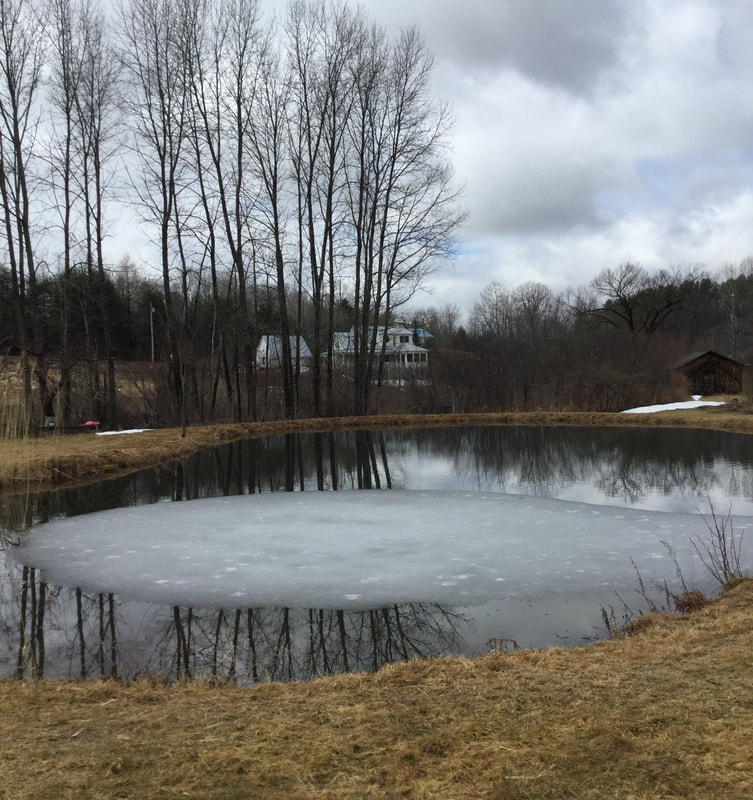 The one pond remaining from the Sunnybrook Trout Farm Days. Dave met me at his back door, with his dog, who was along for the walk. As we strolled across the back field, Dave gave me some history of the Trout Farm that was active on this property, for fifty years, from 1930-1980. The gentleman who ran the trout farm, Harold Day, must have been very busy, and must have loved his work. Dave thought Harold Day's father had started the trout farm back in 1930. There is only one pond remaining on the property today, but as you can see from the air photo at the top of this article, there were several ponds back in the day. 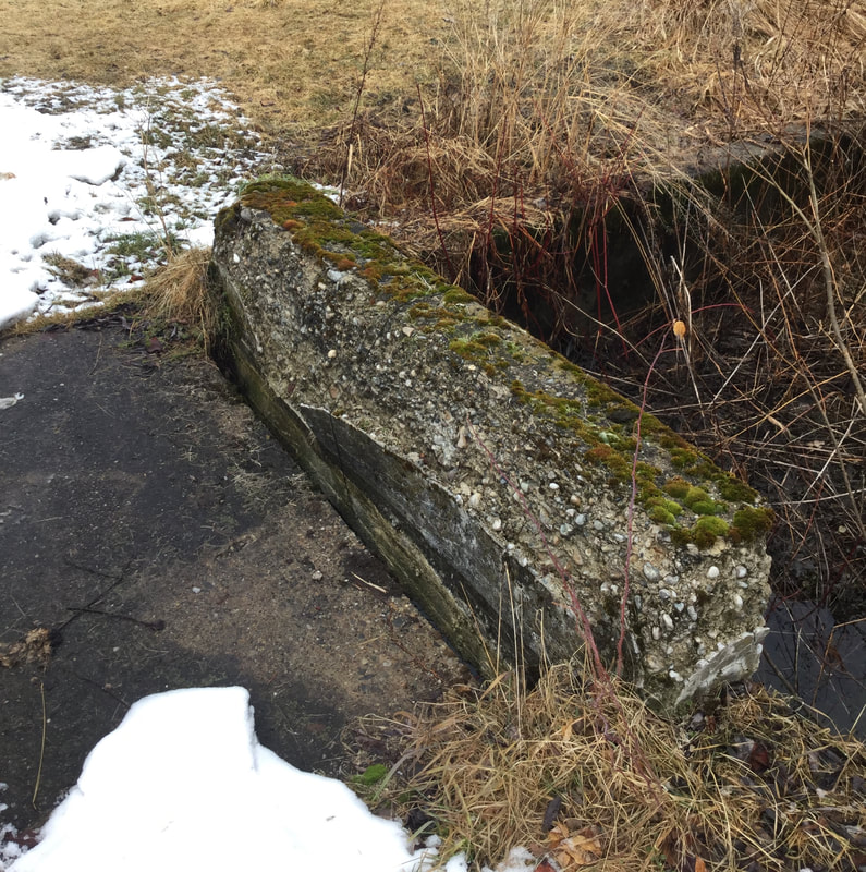 Cement Bridge over Quation Brook on the Former Trout Farm. The ponds were all fed by Quation Brook, which runs through this property. There are several small, old cement bridges spanning the brook on the farm. From there, the stream continues down alongside of Route 132 from the intersection with Beaver Meadow Road, to the White River. 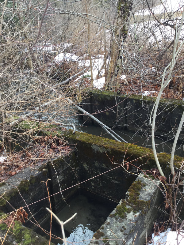 Cement Structure along the Brook, Formerly Used for Trapping Fish. Along the river, Mr. Day had installed concrete gates for trapping the fish. There are several concrete bridges and gates scattered about the brook, that are no longer used, but slowly deteriorating as ninety year old cement tends to do. Stones fall out, year after year, returning back to the stream bed. 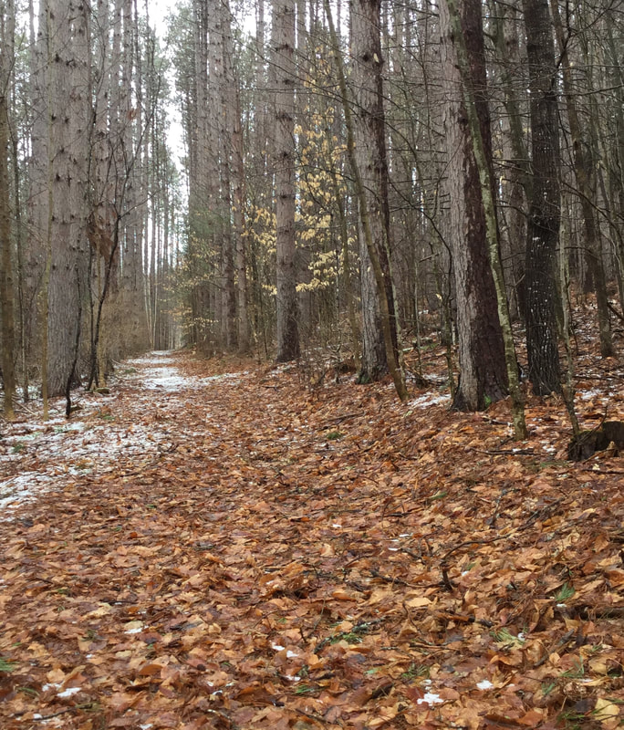 The Old Woods Road Soon, we headed out of the field, and into the woods. As we walked along, we pondered the origin of the road on which we were walking. 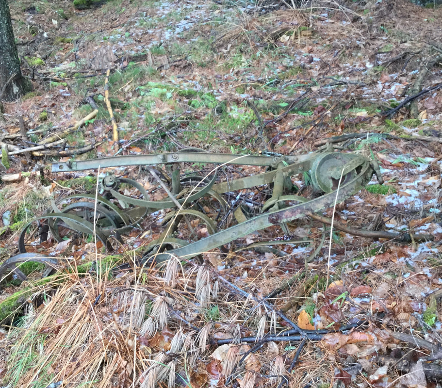 Old Relics Remain, Rusting by the Roadside. This road had been used by the trout farm, for there was some old, rusting equipment lying around. There were also some pipes poking out of the ground, formerly used to direct water flow to the ponds. After having walked uphill for a while, we came upon a clearing in the forest, with a large, prominent pine tree. 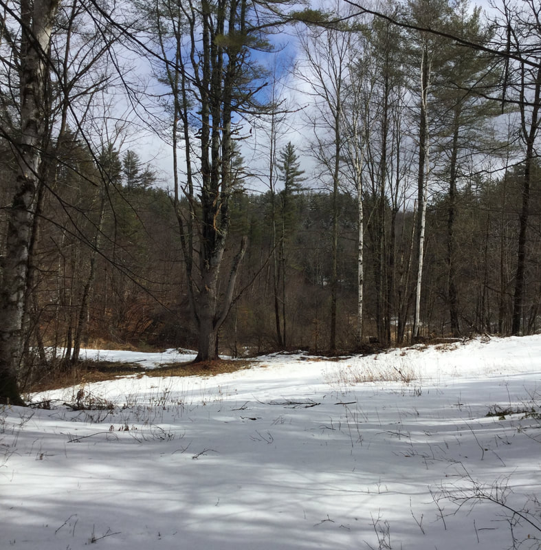 An Interesting Clearing To the right was a road that ascended, but we took the left. 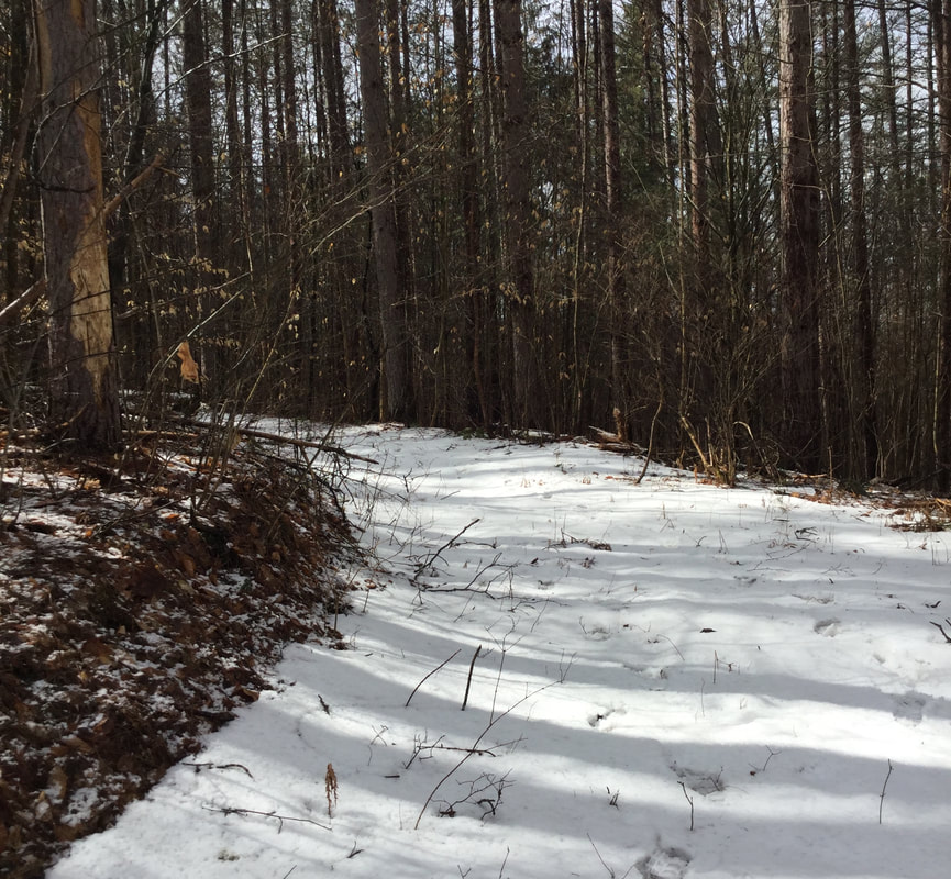 Roadway Leading to the Former Reservoir THE FORMER RESERVOIR FOR THE SUNNY BROOK TROUT POND We headed downhill, past the big pine tree, and over a berm that traversed above a low marshy, wet area. 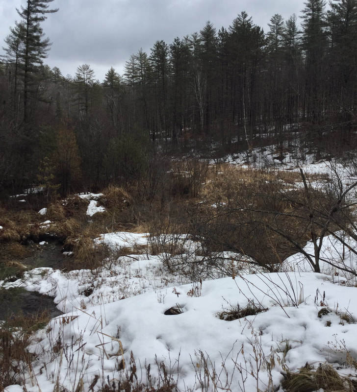 It turns out, this berm was part of a dam, back in the days of the Trout Farm. The dam held back a LOT of water! It must have been something to see when there was a pond or reservoir here. There are a fair amount of large man-made ponds around this area, such as Lake Mitchell, and the C.C.C. pond, and the big "Lonely" pond on Beaver Meadow Road, below the old barn, in Sharon. Unfortunately, this one blew out, big time. 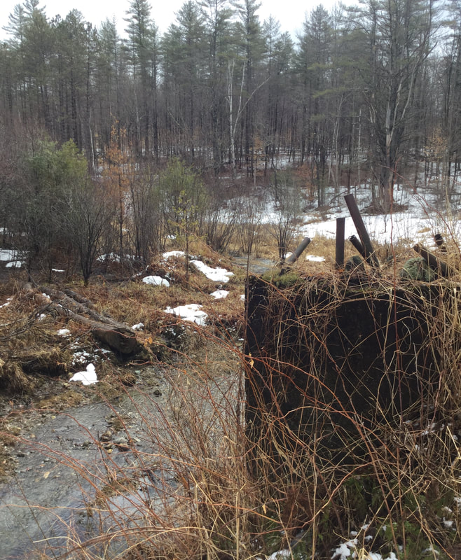 Site of the Former Dam, at the Sunny Brook Trout Farm Reservoir Dave told me that back when the dam broke, it devastated a portion of Route 132. I think that was in the 1980's, so I'm sure there are folks around here that remember the event. 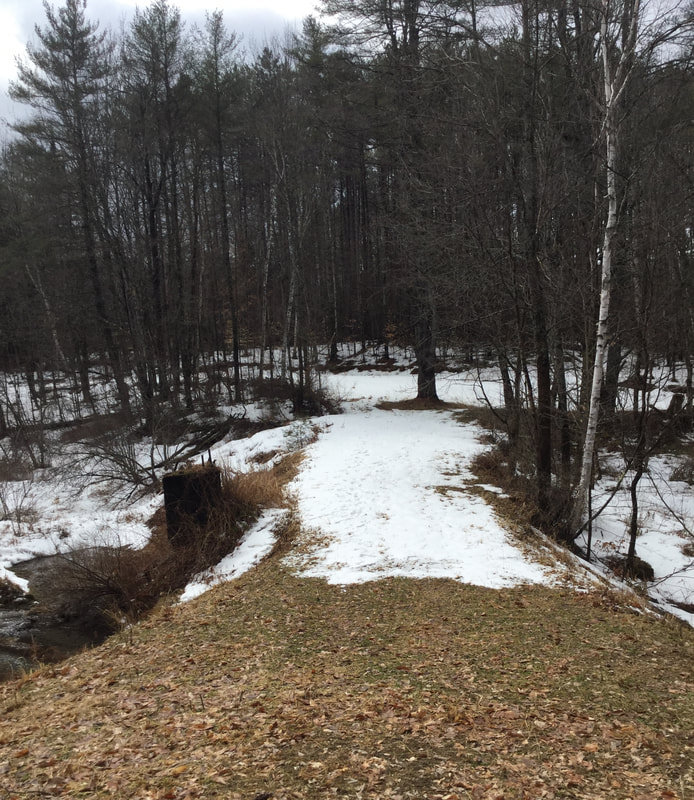 Looking Back at the Berm We headed around the west edge of the former pond, and continued back into the woods. 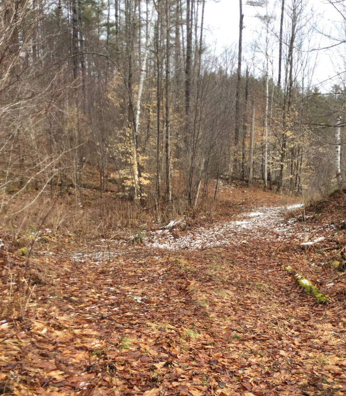 We Continued Uphill, Back into the Forest. 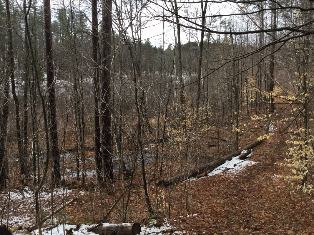 Looking Back, at What Used to Be a Reservoir 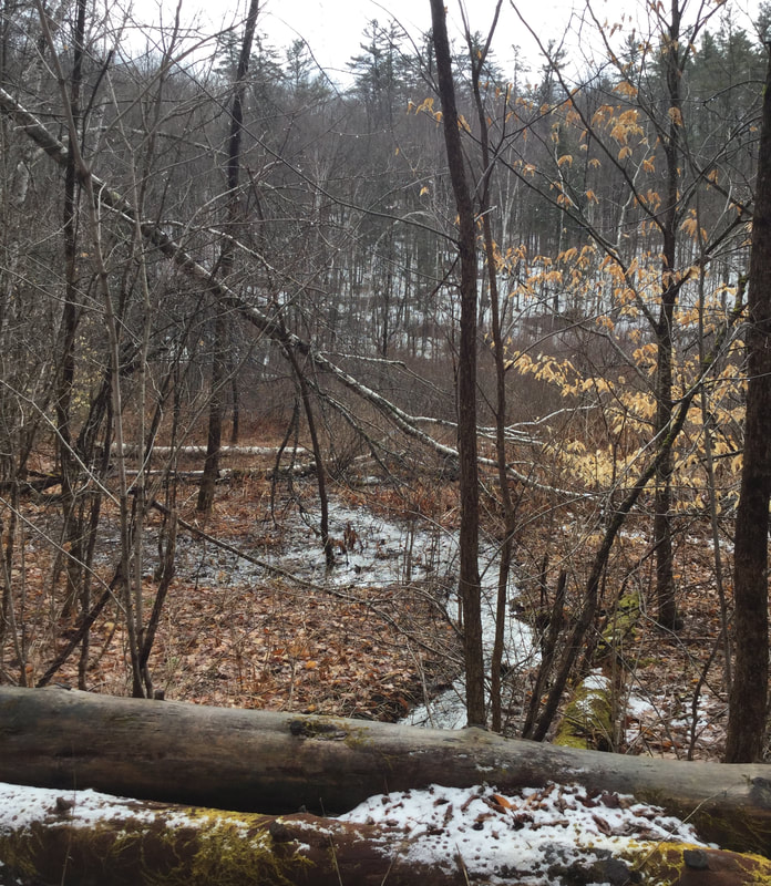 Looking East, Toward the Former Lake/Pond/Reservoir We began to hike westward, uphill, toward some more clues to the past that Dave had recently noticed during a hike in the woods. END OF PART ONE In part two, we'll explore the rest of this hike, and see what else we might find in this interesting, historic part of the Day District in Sharon Vermont. Please feel free to comment on this post, especially if you have any first hand knowledge of the Trout Farm and the time that the dam burst. 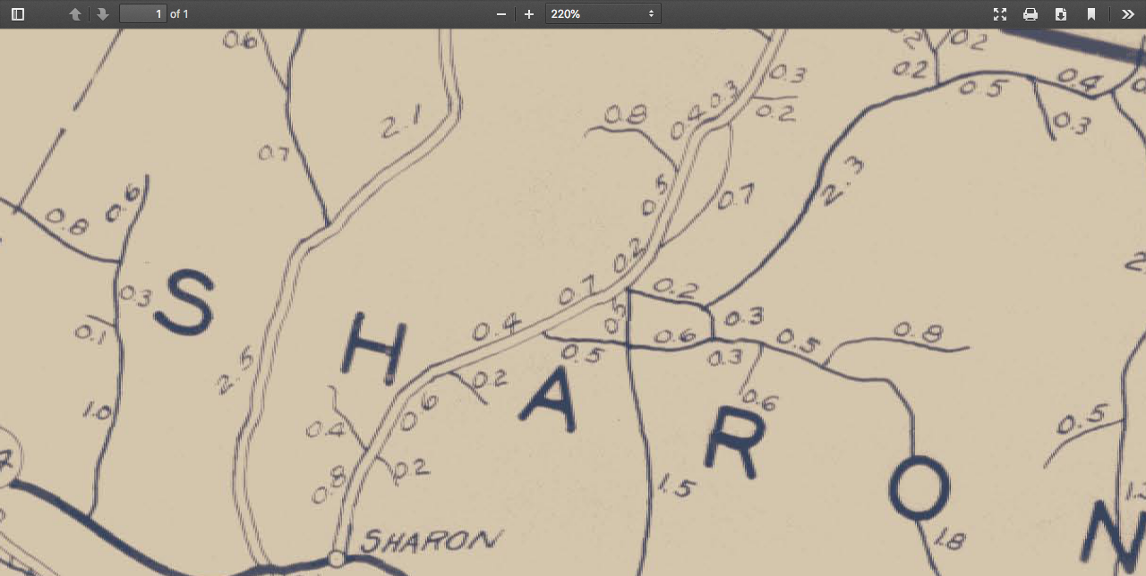 Agency of Transportation Map, 1931. Day District in Center 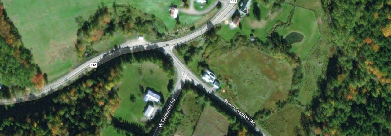 Image from Vermont Center for Geographic Information, thanks to Jason Hill for his comment. (see below for source.) 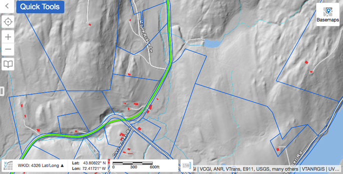 Lidar View of Same Area. Property Boundaries in Blue. Courtesy https://vcgi.vermont.gov/ Sources:
1968 Air Photo courtesy vintageaerial.com Vermont Agency of Transportation Maps: https://maps.vtrans.vermont.gov/Maps/TownMapSeries/WINDSOR_Co/SHARON/SHARON_1931.pdf Vermont Center for Geographic Information: https://vcgi.vermont.gov/ |
AuthorI'm Bob Totz, retired VT postmaster, and historical geographer ARCHIVES:
October 2021
EXPANDED ARCHIVES: AUGUST 2021 1858 Johnson Map of North America MAY 2021 1795 - "Road Over the Mountain" - Part Two Historic Toll House For Sale 1795 - "Road Over the Mountain" Part One OCTOBER 2020 Finding That Special Peaceful Place AUGUST 2020 Kayaking on the Pompy JULY 2020 Pt. 2: What the Heck Are These Things? JUNE 2020 Bob's Bio... What the Heck Are These Things? Pt. 1 MAY 2020 Stone Walls and Spirits The View APRIL 2020 Sunny Brook Farm Relics: Pt 2. Sunny Brook Farm Relics: Pt 1. MARCH 2020 Signs of Norwich Pt. 2 COVID-19 Tracking Map Centertown and Valleyquest Signs of Norwich Pt. 1 "Imperfect Union" - Book Review Historic Centertown FEBRUARY 2020 King's Hwy Pt. 2 WRJ Museum at Post Mills Airport Chatauguay Vermont The Independent Farmer poem Traveling Along the King's Highway - Lebanon NH JANUARY 2020 Finding Parkhurst Cemetery In Search of Parkhurst Cemetery Affordable Housing The Old Stone Grill Two Rivers Trail-Kmart License and Registration, Please! Prohibition, Murder and Dr. Seuss Peace, Paris, & P.O. DECEMBER 2019 BLOGGER'S LINKS Welcome to Old Roads Love-Quail Hollow fun Dartmouth Cemetery SEPTEMBER 2019 E. Thetford Cemetery JUNE 2019
Taps: Meetinghouse Cemetery 4-Corners Borders Quest Old Iron Gate Stumbling Upon History Sunrise Walk MAY 2019 4 Corners Cemetery Strafford's Abandoned Foundations Art in Old Stonework APRIL 2019 Strafford Tpke Pt 2 Strafford Tpke Pt 1 White River Valley FEBRUARY 2019 Learning from Historic Maps of the Upper Valley Change in Lewiston VT JANUARY 2019 A Vermont Ski Waltz John Ledyard 1773 What is the Upper Valley? DECEMBER 2018 Dartmouth Green Music Video: Sometimes Music Video: Montreal Express Railway Disaster of 1887 |
 RSS Feed
