|
Welcome! Scroll Down for Posts and Archives.
Other Menu Options at Top |
|
|
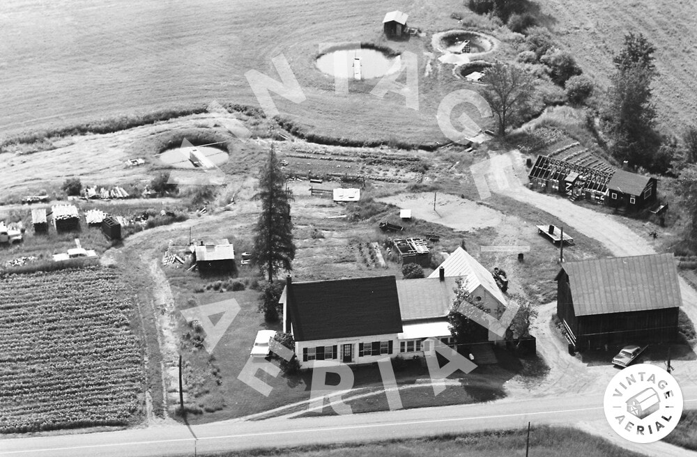 Sunny Brook Trout Farm in 1968. Aerial view by vintageaerial.com An invitation to hike on an old, long unused Vermont road, to see some old relics in the woods was something I did not expect on a Tuesday morning. Happily, I called up Dave Phillips and accepted his offer. Both Dave and I have a love of old roads, foundations, stone walls, history and relics. 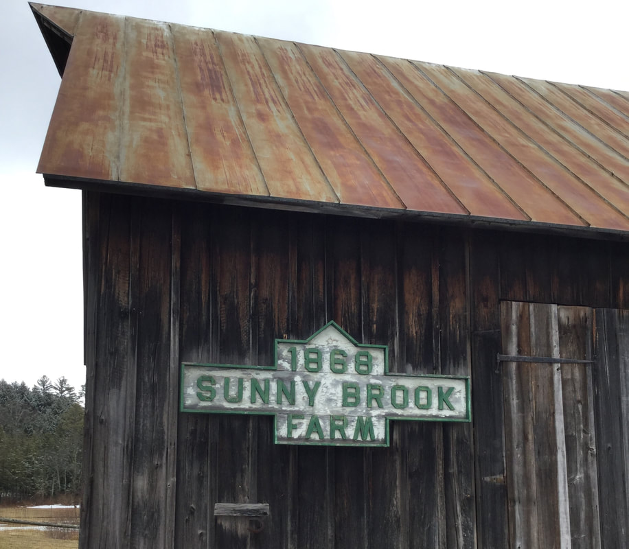 Maybe you can't go to work, but that doesn't mean you can't go for a walk. I usually walk daily, locally, in my neighborhood, but Dave's offer was a welcome one, and I headed west on Beaver Meadow Road, for a springtime walk at the old Sunny Brook Trout Farm.  The Day District, and Sunny Brook Farm, in Sharon Vermont near the intersection of Beaver Meadow Road, Route 132, and Carpenter Street. 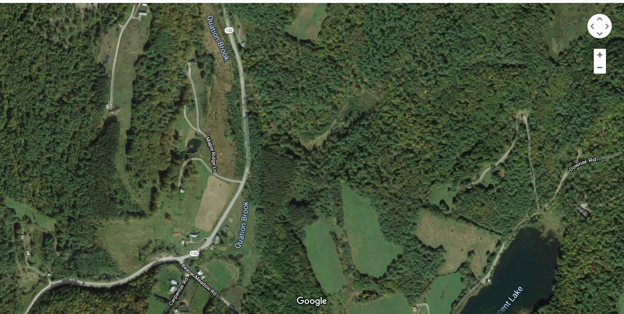 Since 1988, when I lived in Sharon, for a couple of years, I've been fascinated with this area, which is known as the "Day District", after the Day family who farmed here years ago. I've often wondered how Beaver Meadow Road, Downer Forest Road, and Route 132, looked 100 or 200 years ago. I'm thinking there were different pathways between farmsteads, that were used as roads back then, and eventually, some became public, and got the maintenance they required, while others settled back into the hills and woods. 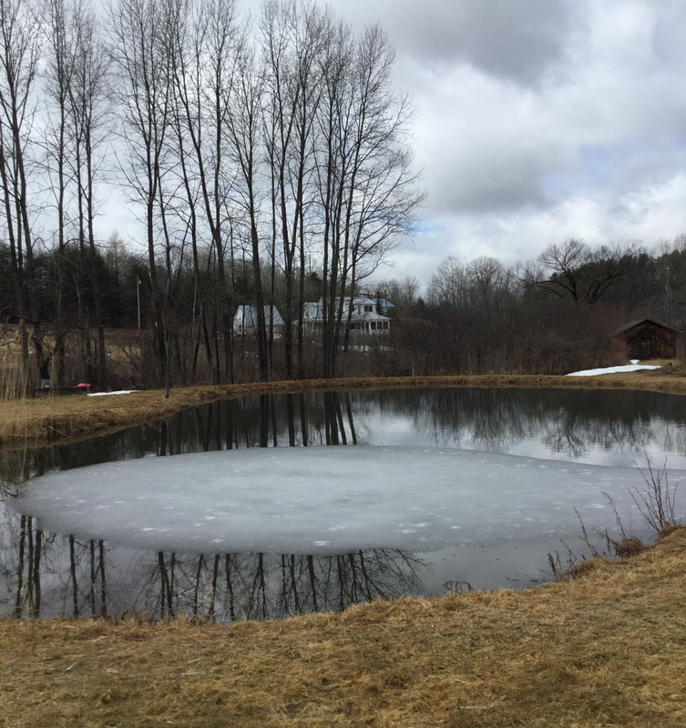 The one pond remaining from the Sunnybrook Trout Farm Days. Dave met me at his back door, with his dog, who was along for the walk. As we strolled across the back field, Dave gave me some history of the Trout Farm that was active on this property, for fifty years, from 1930-1980. The gentleman who ran the trout farm, Harold Day, must have been very busy, and must have loved his work. Dave thought Harold Day's father had started the trout farm back in 1930. There is only one pond remaining on the property today, but as you can see from the air photo at the top of this article, there were several ponds back in the day. 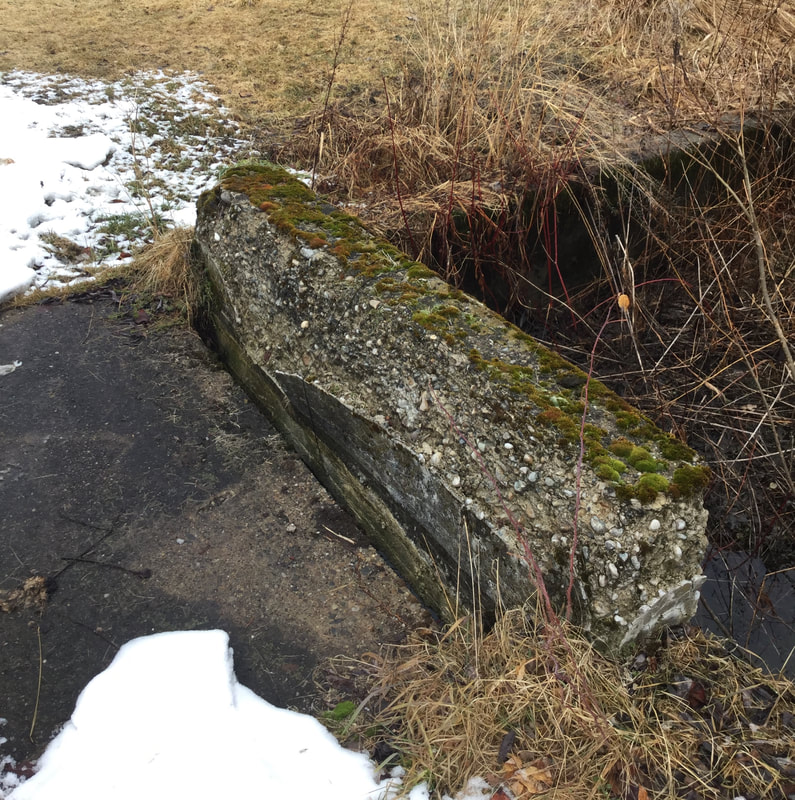 Cement Bridge over Quation Brook on the Former Trout Farm. The ponds were all fed by Quation Brook, which runs through this property. There are several small, old cement bridges spanning the brook on the farm. From there, the stream continues down alongside of Route 132 from the intersection with Beaver Meadow Road, to the White River. 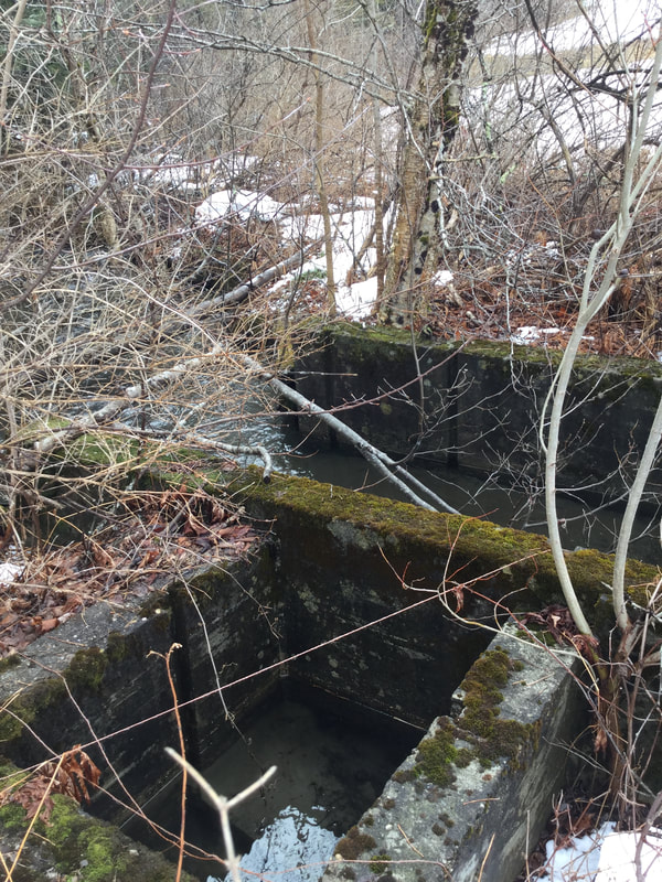 Cement Structure along the Brook, Formerly Used for Trapping Fish. Along the river, Mr. Day had installed concrete gates for trapping the fish. There are several concrete bridges and gates scattered about the brook, that are no longer used, but slowly deteriorating as ninety year old cement tends to do. Stones fall out, year after year, returning back to the stream bed. 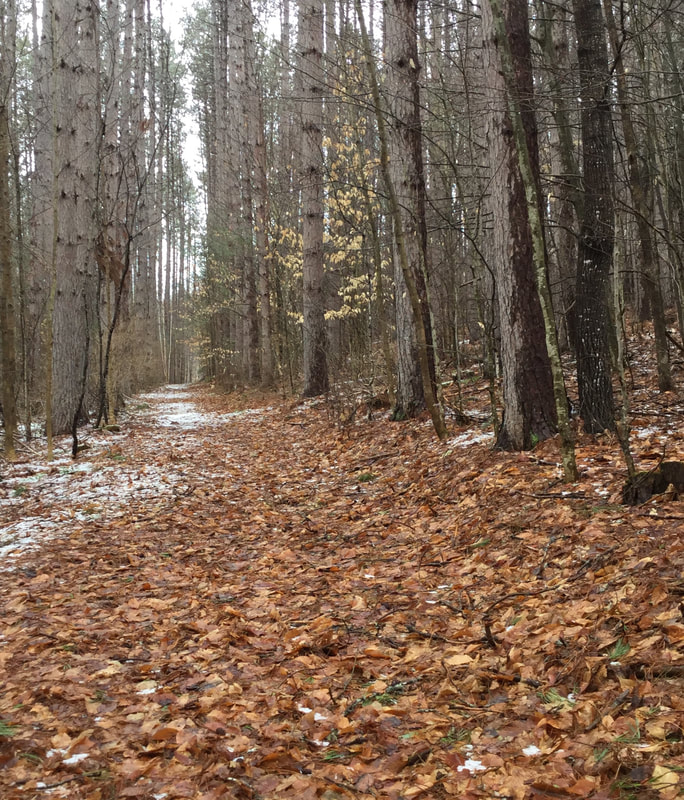 The Old Woods Road Soon, we headed out of the field, and into the woods. As we walked along, we pondered the origin of the road on which we were walking. 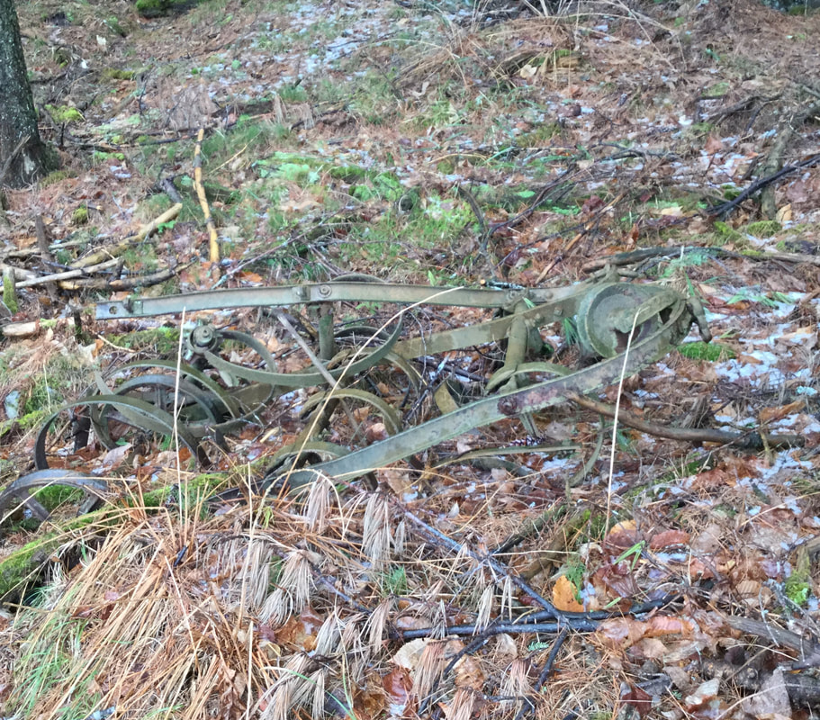 Old Relics Remain, Rusting by the Roadside. This road had been used by the trout farm, for there was some old, rusting equipment lying around. There were also some pipes poking out of the ground, formerly used to direct water flow to the ponds. After having walked uphill for a while, we came upon a clearing in the forest, with a large, prominent pine tree. 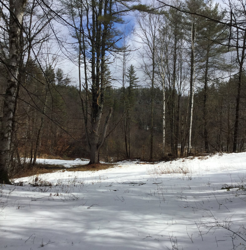 An Interesting Clearing To the right was a road that ascended, but we took the left. 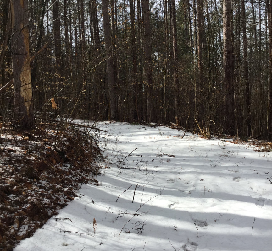 Roadway Leading to the Former Reservoir THE FORMER RESERVOIR FOR THE SUNNY BROOK TROUT POND We headed downhill, past the big pine tree, and over a berm that traversed above a low marshy, wet area. 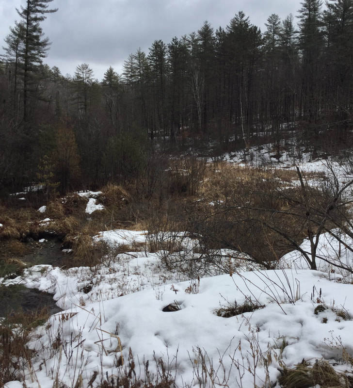 It turns out, this berm was part of a dam, back in the days of the Trout Farm. The dam held back a LOT of water! It must have been something to see when there was a pond or reservoir here. There are a fair amount of large man-made ponds around this area, such as Lake Mitchell, and the C.C.C. pond, and the big "Lonely" pond on Beaver Meadow Road, below the old barn, in Sharon. Unfortunately, this one blew out, big time. 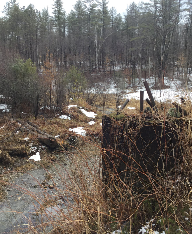 Site of the Former Dam, at the Sunny Brook Trout Farm Reservoir Dave told me that back when the dam broke, it devastated a portion of Route 132. I think that was in the 1980's, so I'm sure there are folks around here that remember the event. 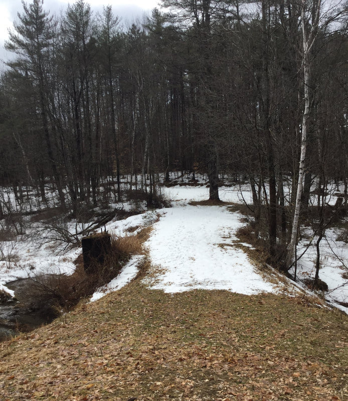 Looking Back at the Berm We headed around the west edge of the former pond, and continued back into the woods. 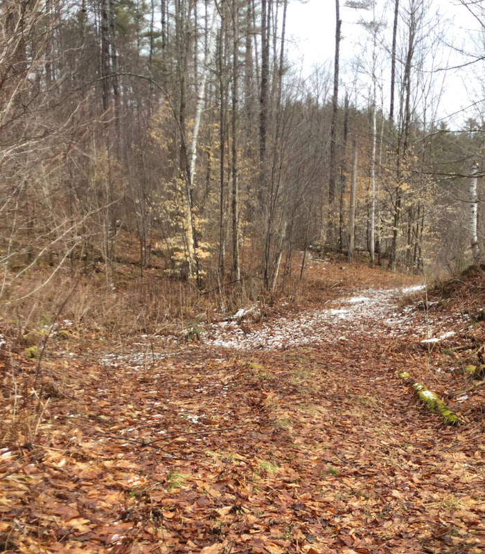 We Continued Uphill, Back into the Forest. 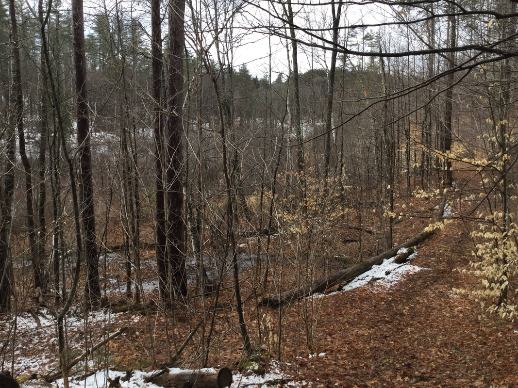 Looking Back, at What Used to Be a Reservoir 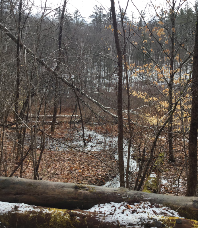 Looking East, Toward the Former Lake/Pond/Reservoir We began to hike westward, uphill, toward some more clues to the past that Dave had recently noticed during a hike in the woods. END OF PART ONE In part two, we'll explore the rest of this hike, and see what else we might find in this interesting, historic part of the Day District in Sharon Vermont. Please feel free to comment on this post, especially if you have any first hand knowledge of the Trout Farm and the time that the dam burst. 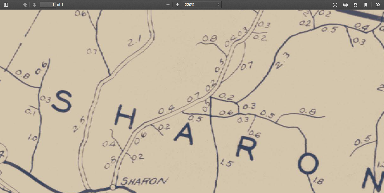 Agency of Transportation Map, 1931. Day District in Center 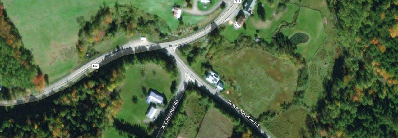 Image from Vermont Center for Geographic Information, thanks to Jason Hill for his comment. (see below for source.) 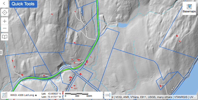 Lidar View of Same Area. Property Boundaries in Blue. Courtesy https://vcgi.vermont.gov/ Sources:
1968 Air Photo courtesy vintageaerial.com Vermont Agency of Transportation Maps: https://maps.vtrans.vermont.gov/Maps/TownMapSeries/WINDSOR_Co/SHARON/SHARON_1931.pdf Vermont Center for Geographic Information: https://vcgi.vermont.gov/
6 Comments
Martha Walke
4/5/2020 07:31:34 am
Bob, I so remember when this was a working trout farm and your pix brought back memories. But, the reason I'm writing is because, a few years ago, I bought a handmade fishing net from a woman selling them at the Strafford Xmas sale. She was a Day, the granddaughter of the last family to farm there. Currently married to Tom Stickney, the net maker, and they live in Thetford Cntr. Thought you might like to get in touch with her for more background.
Bob Totz
4/5/2020 07:48:51 am
Interesting story!
judy m
4/5/2020 11:11:32 am
I look down on that property from my house,,thanks for pics
Jason Hill
4/6/2020 11:02:56 am
Another great post Bob. I just wanted to point you to Vermont's online GIS viewer: https://maps.vermont.gov/vcgi/html5viewer/?viewer=vtmapviewer You can turn on and view the state's lidar imagery at this link, which I think you'll find really useful. I use this imagery for my wildlife research. Lidar is a laser mapping approach that is used to map the ground surface. Long story short, the lasers can see right through the trees to the ground, so you can 'see' the ground even in dense forests with centimeter accuracy. With lidar imagery, you can see subtleties in the ground terrain that you can't see in regular aerial imagery. So you can identify sites of former buildings, abandoned forest-covered roads, old property boundaries where the cattle walked the fence line (making the ground a few inches lower there)...or where the old trout ponds used to be...even if they have been filled in. It's an amazing tool. Hope this is useful in your discoveries, and I look forward to future posts. Cheers. Jason
Bob Totz
4/7/2020 11:21:29 am
Thanks for the info and link, Jason! I've looked at Lidar before,
Jonathan Sewall
5/9/2023 05:37:10 am
I bought 200 brook and rainbow trout from Harold Day in 1968. Before he delivered them to our pond in Fletcher, Vermont he had us spend a day at the farm in Sharon touring the facility and the rearing ponds. He also had a small lake stocked with very large trout. For $100 one could buy a ticket good for 35 lbs of trout that could be takin all at once or spread over many trips. The many "bull heads" were free.I will never forget Harold Day. Your comment will be posted after it is approved.
Leave a Reply. |
AuthorI'm Bob Totz, retired VT postmaster, and historical geographer ARCHIVES:
October 2021
EXPANDED ARCHIVES: AUGUST 2021 1858 Johnson Map of North America MAY 2021 1795 - "Road Over the Mountain" - Part Two Historic Toll House For Sale 1795 - "Road Over the Mountain" Part One OCTOBER 2020 Finding That Special Peaceful Place AUGUST 2020 Kayaking on the Pompy JULY 2020 Pt. 2: What the Heck Are These Things? JUNE 2020 Bob's Bio... What the Heck Are These Things? Pt. 1 MAY 2020 Stone Walls and Spirits The View APRIL 2020 Sunny Brook Farm Relics: Pt 2. Sunny Brook Farm Relics: Pt 1. MARCH 2020 Signs of Norwich Pt. 2 COVID-19 Tracking Map Centertown and Valleyquest Signs of Norwich Pt. 1 "Imperfect Union" - Book Review Historic Centertown FEBRUARY 2020 King's Hwy Pt. 2 WRJ Museum at Post Mills Airport Chatauguay Vermont The Independent Farmer poem Traveling Along the King's Highway - Lebanon NH JANUARY 2020 Finding Parkhurst Cemetery In Search of Parkhurst Cemetery Affordable Housing The Old Stone Grill Two Rivers Trail-Kmart License and Registration, Please! Prohibition, Murder and Dr. Seuss Peace, Paris, & P.O. DECEMBER 2019 BLOGGER'S LINKS Welcome to Old Roads Love-Quail Hollow fun Dartmouth Cemetery SEPTEMBER 2019 E. Thetford Cemetery JUNE 2019
Taps: Meetinghouse Cemetery 4-Corners Borders Quest Old Iron Gate Stumbling Upon History Sunrise Walk MAY 2019 4 Corners Cemetery Strafford's Abandoned Foundations Art in Old Stonework APRIL 2019 Strafford Tpke Pt 2 Strafford Tpke Pt 1 White River Valley FEBRUARY 2019 Learning from Historic Maps of the Upper Valley Change in Lewiston VT JANUARY 2019 A Vermont Ski Waltz John Ledyard 1773 What is the Upper Valley? DECEMBER 2018 Dartmouth Green Music Video: Sometimes Music Video: Montreal Express Railway Disaster of 1887 |
 RSS Feed
