|
Welcome! Scroll Down for Posts and Archives.
Other Menu Options at Top |
|
|
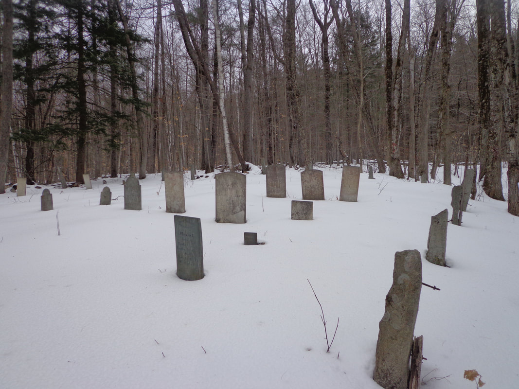 Parkhurst Cemetery, Norwich Vermont. 4 PM, Tuesday, Jan 28, 2020 We were so-o-o close to turning around without finding it ! We'd been hiking longer than Mike and I expected, almost two hours since 2:30 PM, and we knew we'd be losing daylight soon. Of course, when you've got to stop, take off gloves, and get out a camera and take a photo every other minute, like I do, it can take a while to make any real progress! Plus, we didn't know exactly where the cemetery was, so at one point we went off on a tangent, and then doubled back, and then took the correct turn downhill, near an old camp. 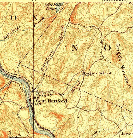 We Headed Out on Sue Spaulding Road, in Search of the Parkhurst Cemetery . On the Map Above, That's the Right Turn After the Words "Tigertown Brook", Heading Towards Griggs Mountain. 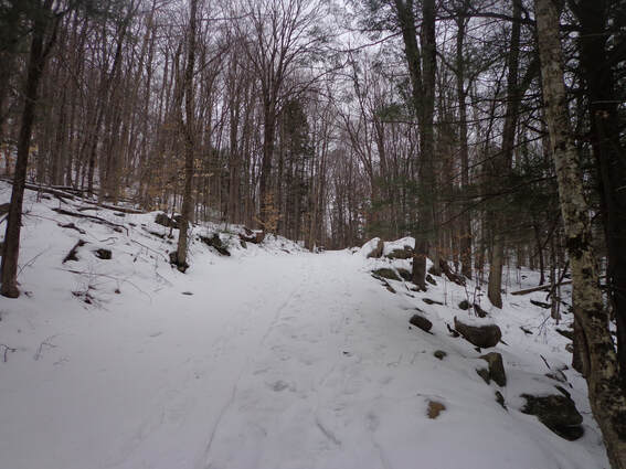 If you haven't read part one of this adventure, you might want to read it first. It shows vintage maps and preliminary information used to help locate the old cemetery. Here is a link to Part One: In Search of Parkhurst Cemetery We parked the Jeep on the side of Tigertown road, and started walking up Sue Spaulding Road. It's steeper at the first part, then it levels off. The snow surface was sort of a loose crust, deep enough to make walking a little tough, but there were snowshoe and ski tracks, so walking on them was pretty easy, as long as we watched our traction, and walked in the snow in icy spots. On our left was a rocky hill. 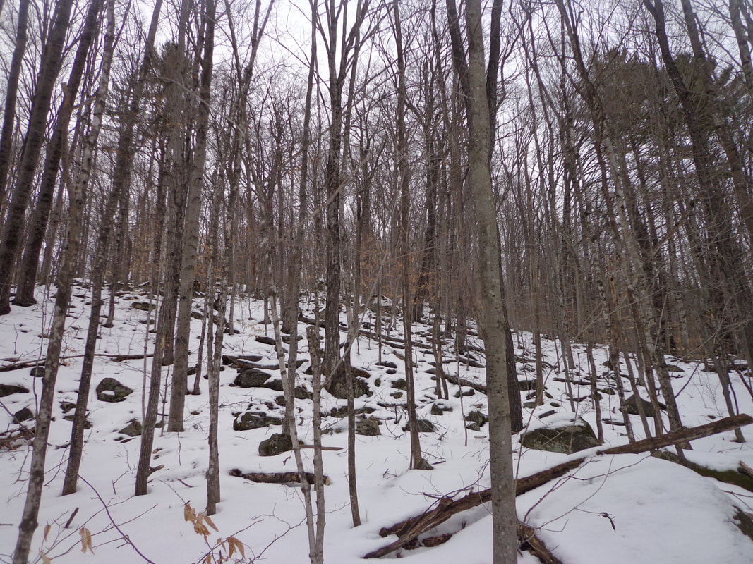 And to our right, we could see the other side of a valley. 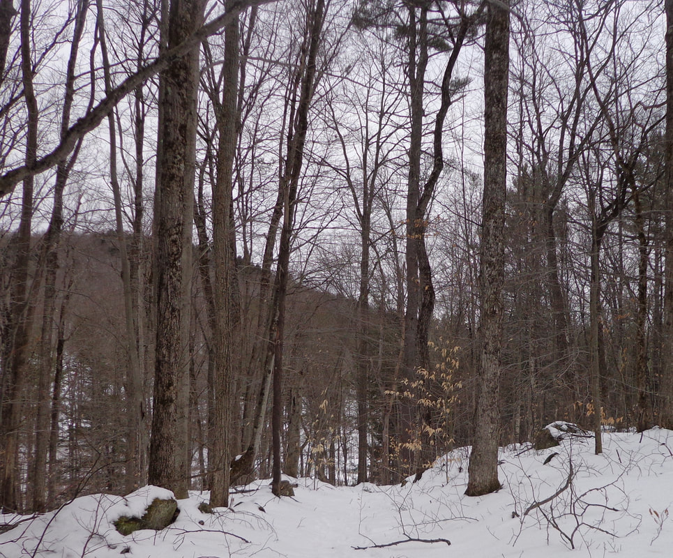 As we continued on, we noticed nice old stone walls on either side of the wide old road. Long ago, this was just another town road, traveled by folks and their animals, on foot, horseback, and in wagons. Today, it's a vestige of the past, a road that no longer warrants continual maintenance by the town. 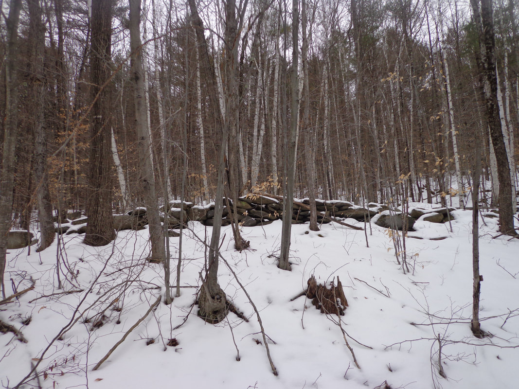 The temperature was near freezing, so there was a bit of melting going on underfoot 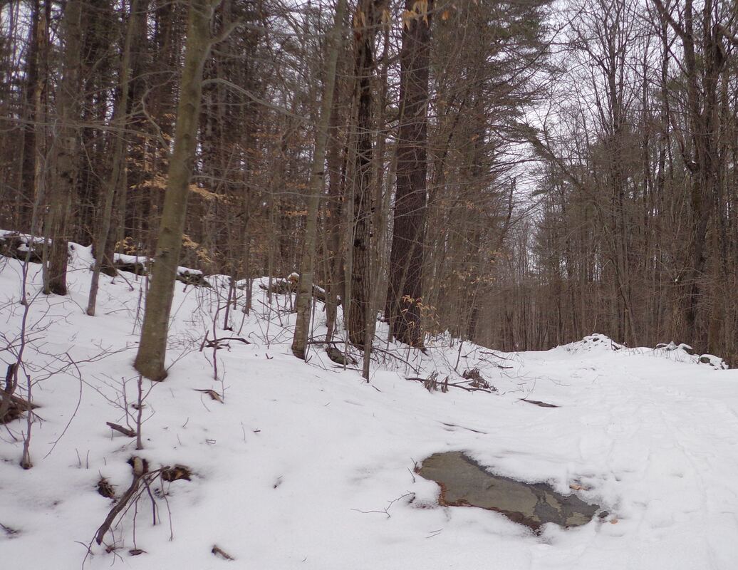 We soon passed a camp and came upon a wide clearing. Mike recognized an old trail to the left that he had taken years ago.  Back in the woods, we came upon a small waterfall on our right. 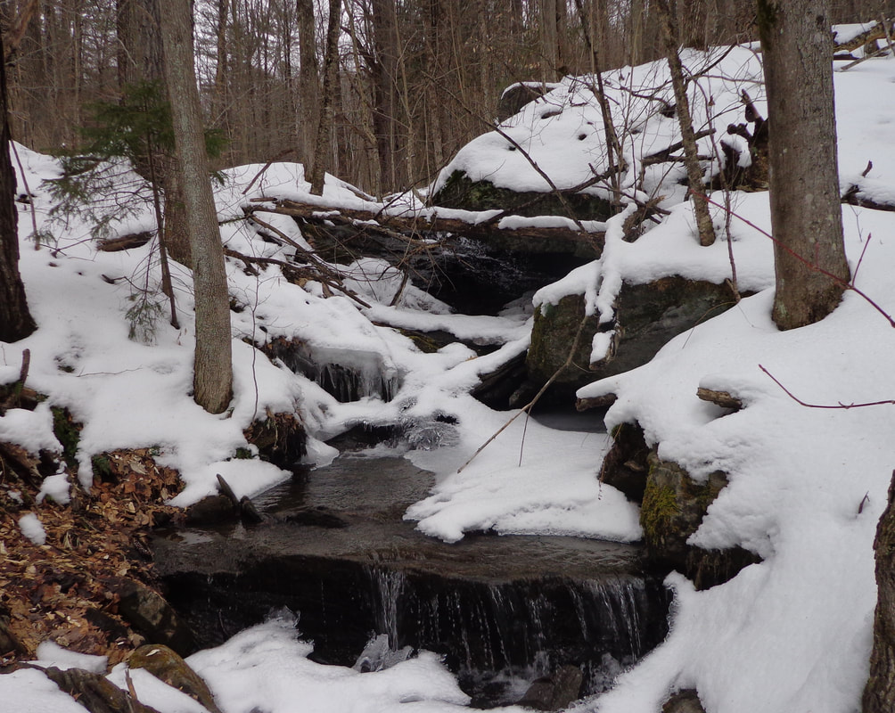 The road was wide and clear in spots, and had recently been packed down by snowmobiles in this section. 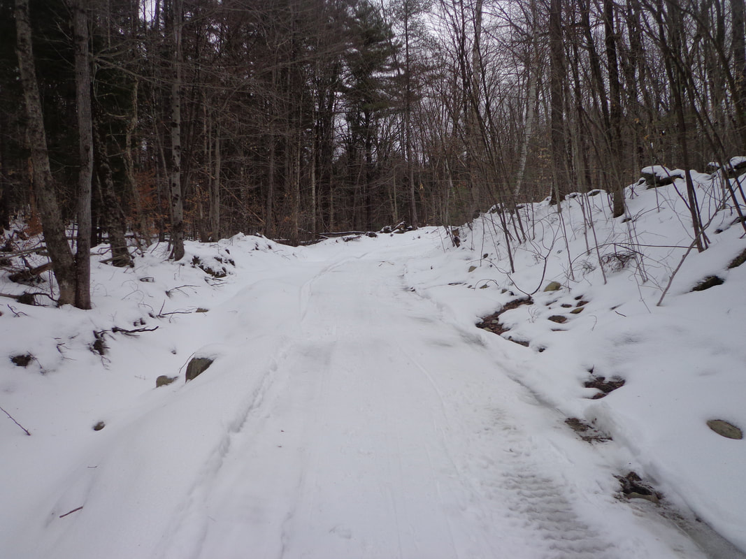 Soon we came upon another clearing, and another camp up ahead. 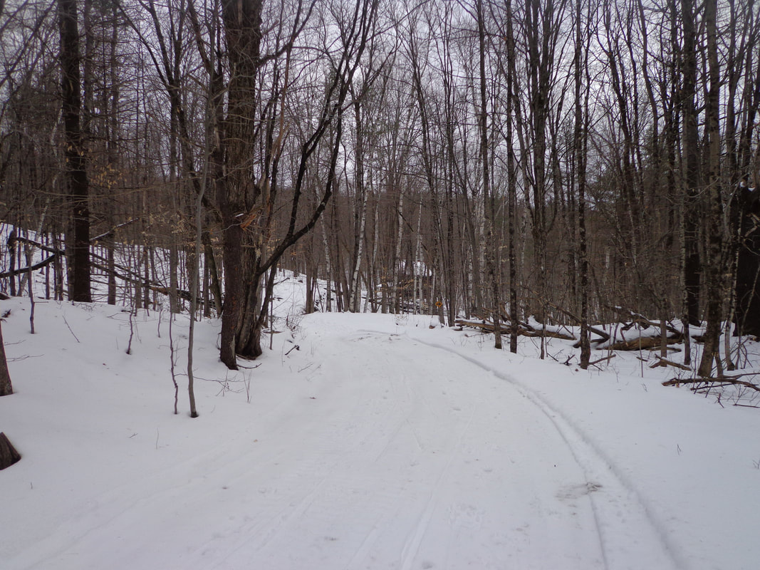 I'd walked to this spot before, but via the Burton Woods Road. We were now faced with a decision: head down, to the right, and follow the snowmobile path, or continue straight, toward the second camp, where Burton Woods Road came down from the left. A fork in the road: 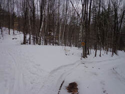 A fork in the Trail, and a Decision to be Made. 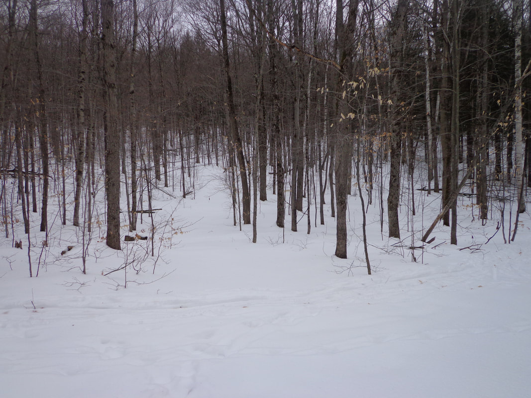 We decided to go straight, toward another camp where it looked like the road continued past. We post-holed uphill past this third camp, to a point where another trail crossed, that had well worn cross-country ski marks, (see above). It looked like a great place to ski, but we turned around, and went back to the turn and followed the snowmobile trail. Before we got back to the turn, I took a few photos of an old stone foundation. It must have been a beautiful location for a farm, in its day. 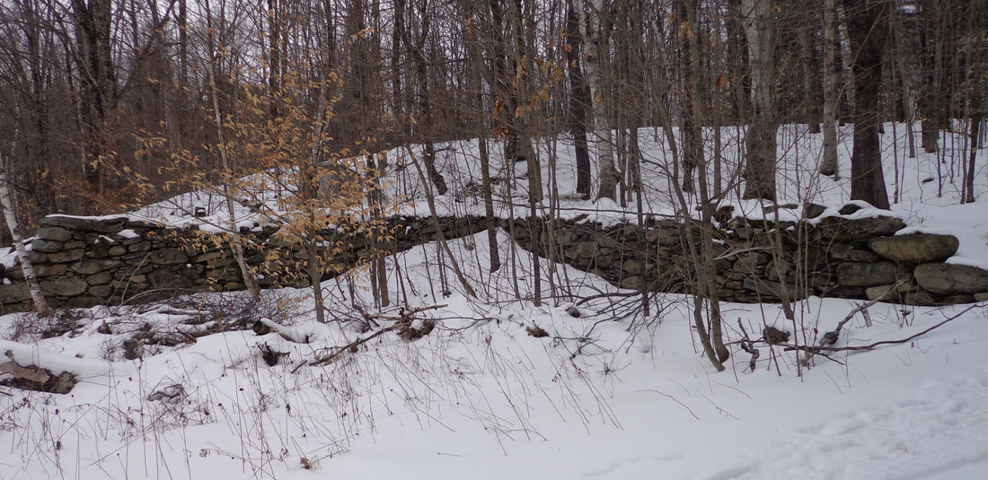 Antique Stone Wall Foundation, Possibly from a Barn. 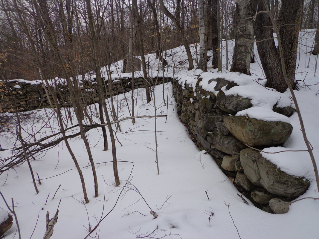 It amazes me that after so many years, possibly 200 or more, these stone foundations still appear level, and straight with clear cut corners. 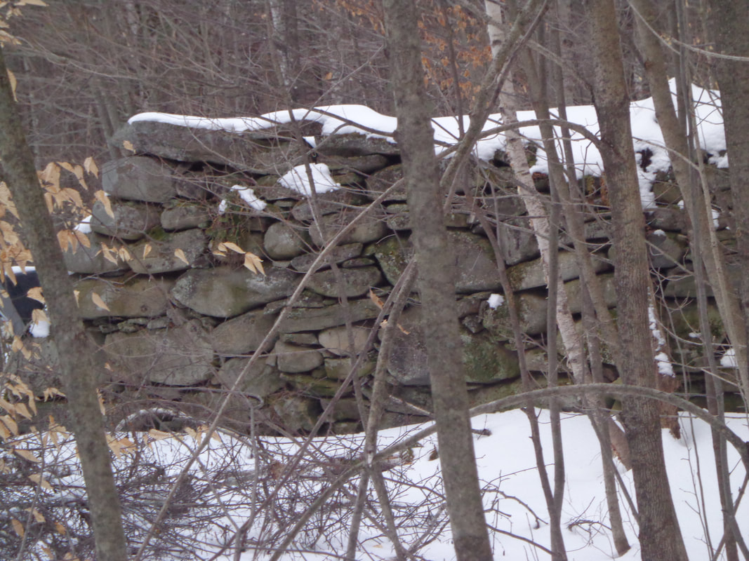 Soon we were heading downhill, hopefully on Burton Woods Road, heading toward Parkhurst Cemetery. 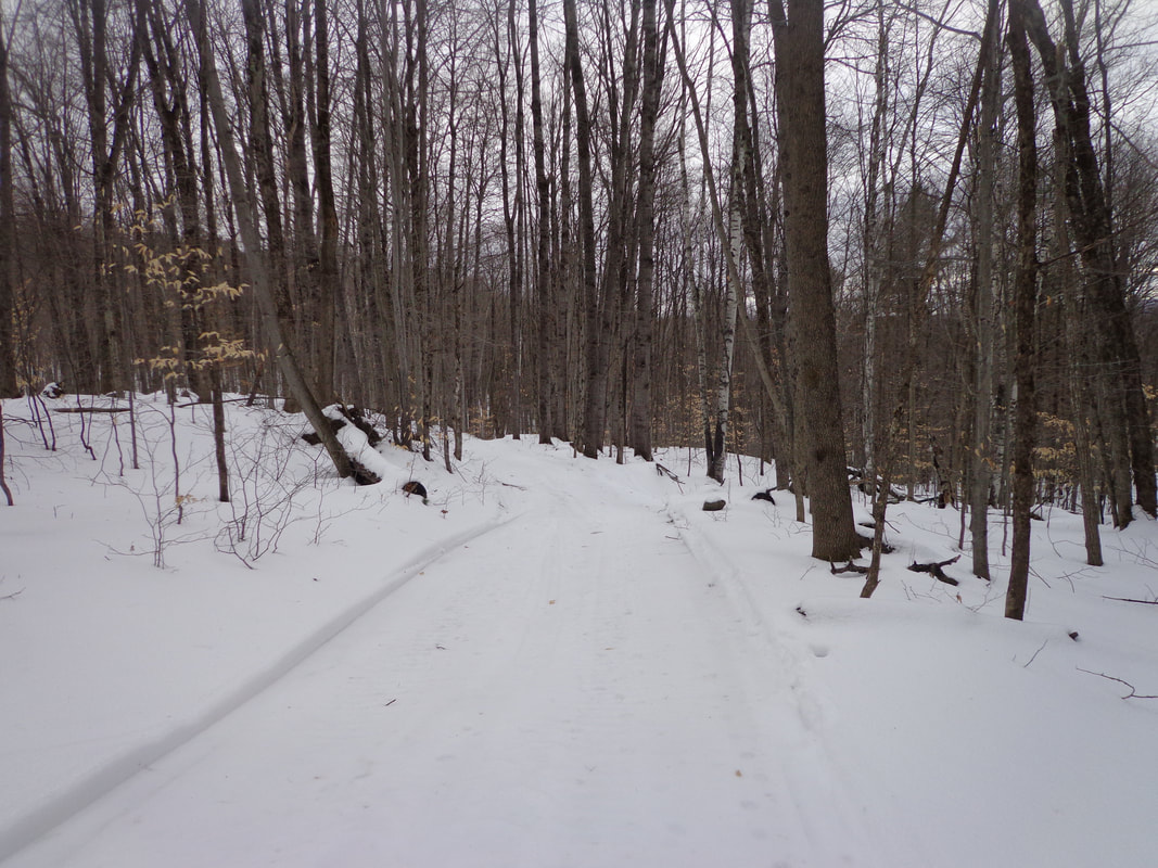 Burton Woods Road, also a snowmobile trail this time of year. Burton Woods Road had come in from the North, and now we were going down what I was hoping was the southern section of that road. It looked like a good bet, considering how wide it was. We didn't bring any maps with us, but I had brought along an iPod with a couple map close-up screenshots I had taken. Every once in a while I checked those maps, but since returning, I've found other maps with more information that would have been more help. We wandered along Burton Woods Road, descending a little at first, followed by a pleasant, fairly level walk. I kept thinking, "It's getting late, we should probably turn around soon." There were some wet spots to negotiate and we had to bushwack a bit, in a few spots. 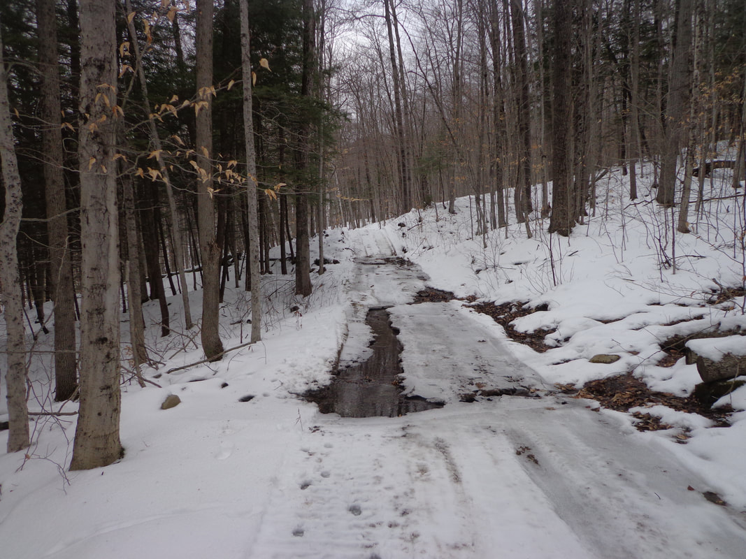 Along the way, we could see that there was a nice view to the southwest beyond the nearby trees. 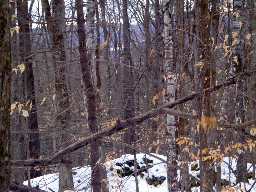 In a little while, we came upon this interesting sign in the woods, which verified we were on the right road. 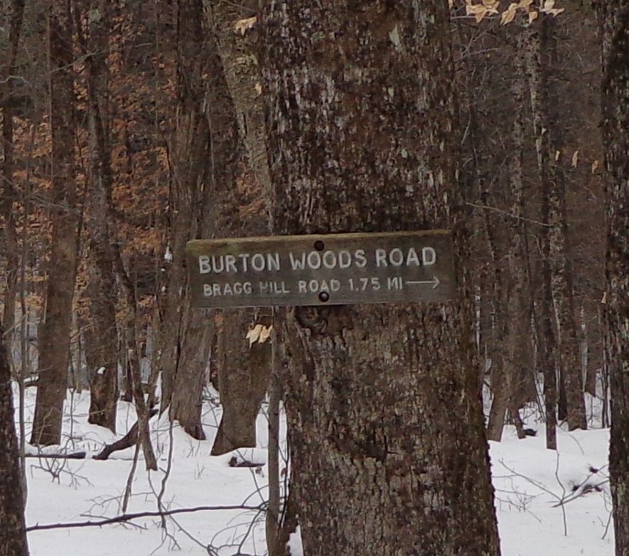 Eventually, we found another wet area, followed by the road rising, and turning toward the left. Thinking that we may need to turn back, I took out the iPod, and looked at the map I had. I was just saying to Mike that we were probably pretty close to the graveyard, when suddenly he yelled, "There it is!" 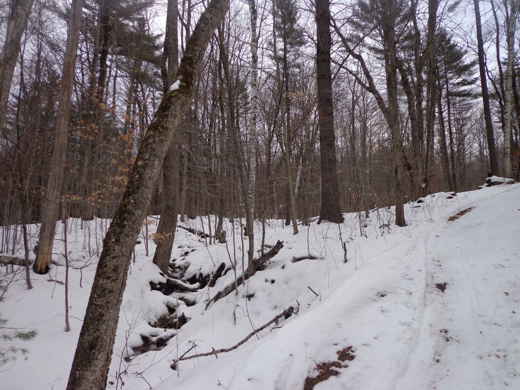 Above, is what it looked like to me. Below, is a close-up from the exact same photo, and somehow Mike saw the gravestones, just sticking out of the snow, in the distance: 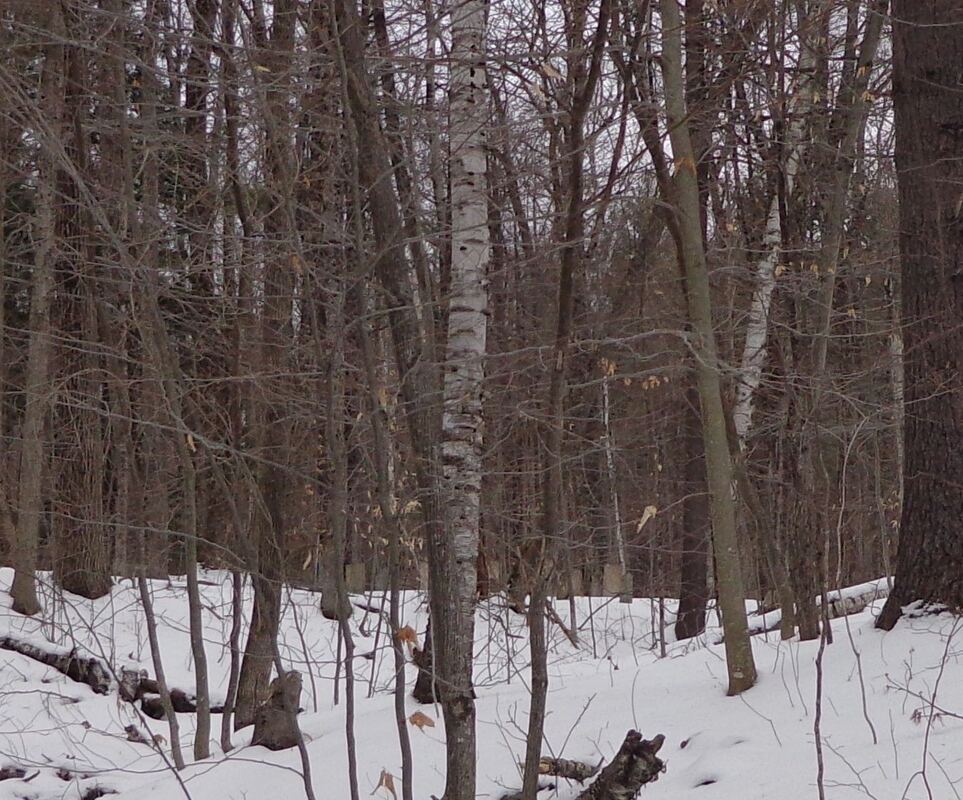 Parkhurst Cemetery in the distance, in the forest. Can YOU see the gravestones poking out of the snow? There's something about finding an old cemetery out in the woods. First, there's the sense of accomplishment, from doing research, then exploring, and finally finding the historical feature that you've been searching for. Second, I feel a sense of profound, serene peace in these old rural graveyards. However... 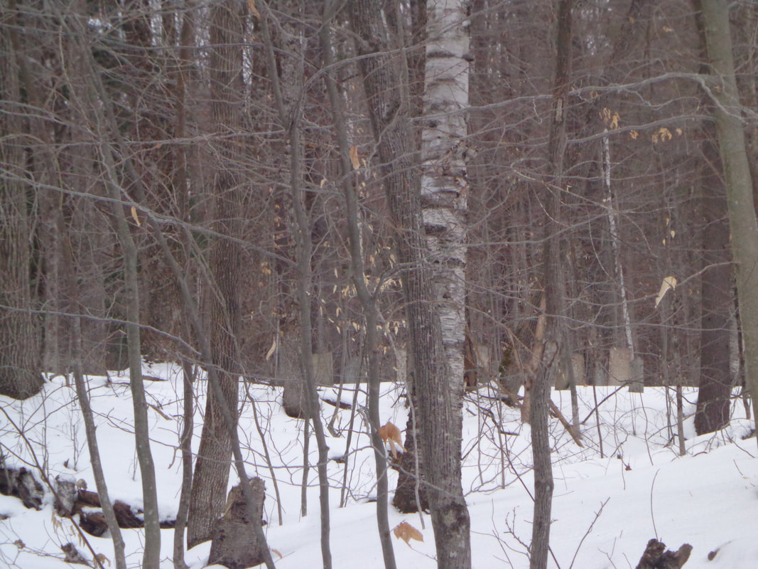 Parkhurst Cemetery, in the Distance. I suddenly realized, that I only had a little time to take photos, as it was getting late, and we needed to turn back. The view below gives an idea of the distance from the cemetery to the road: 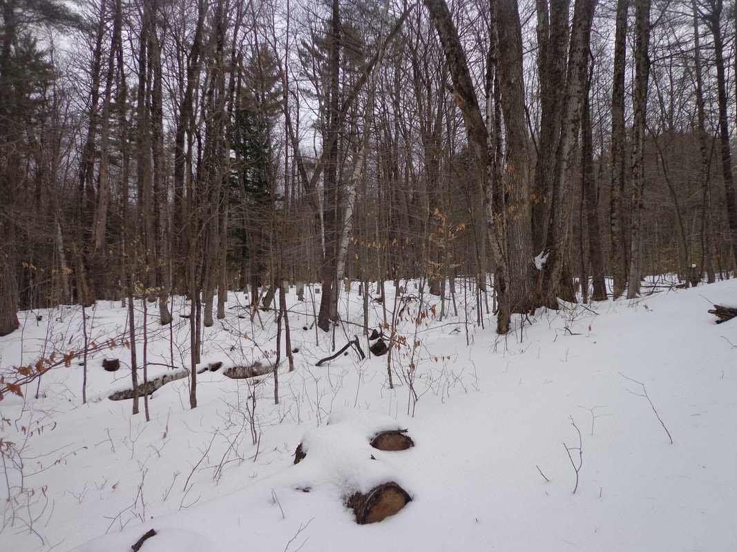 I quickly scrambled across a small brook, and headed toward the old resting place. 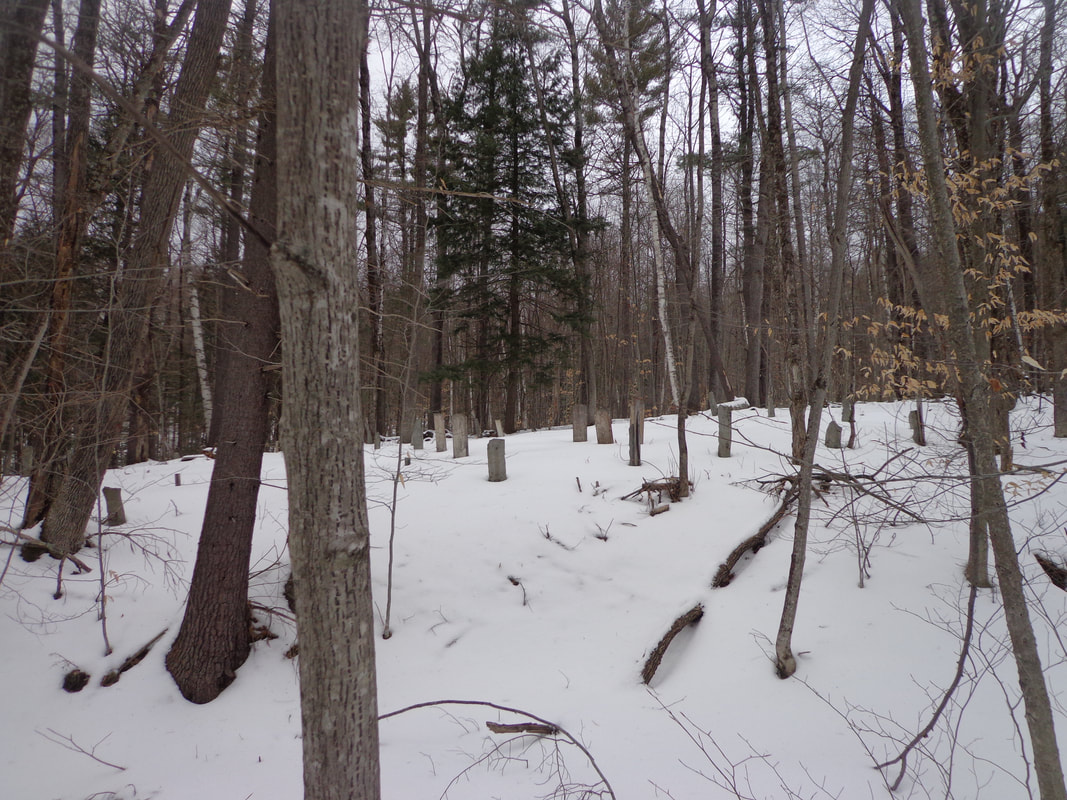 As I approached, I got a better idea of the size of the cemetery. 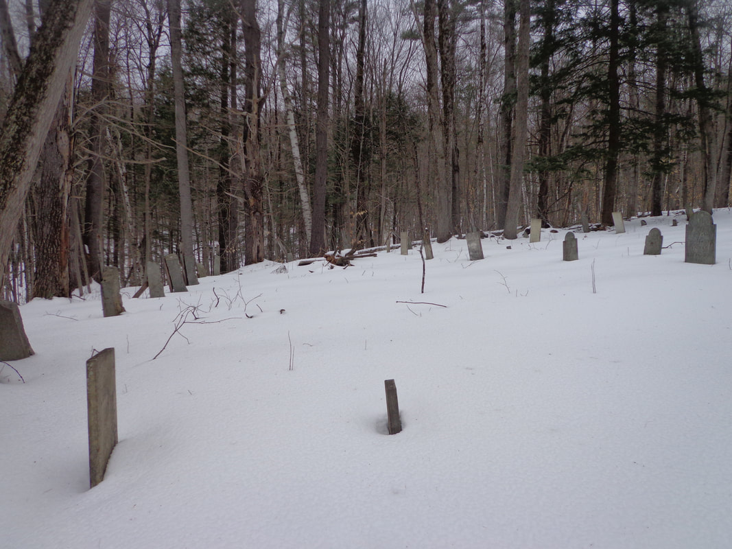 As I hurried toward the cemetery, I took more photos. 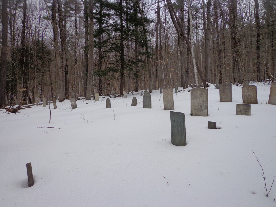 To me, it was like finding a priceless antique in the forest. There isn't a lot of information available on this graveyard, at least not on the internet. 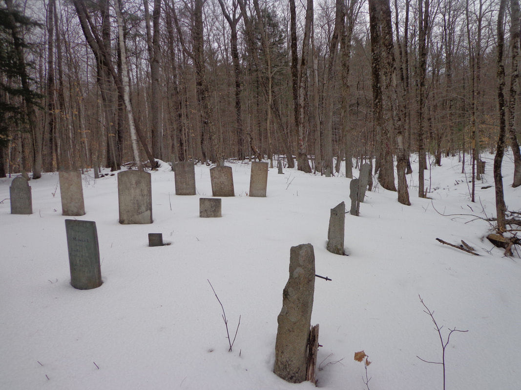 I had become fascinated by this graveyard since I first saw it on an old map over a year ago, and it was quite satisfying to finally find it. The hike back was peaceful, and uneventful, as the daylight began to fade. Here's are a few gravestones that I photographed, in the few minutes we were there: The first stone I photographed was for a child, only six weeks old when she died. How sad it must have been for the family. 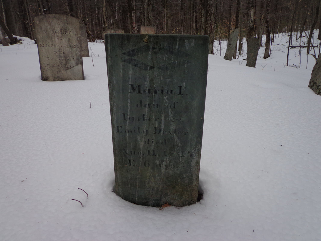 Murial Daughter of Parker and Emily Dexter died Aug. 11, 1847 AE 6 weeks At the other end of the spectrum, there's the headstone of a nonagenarian, Marguret Culver. If a person could survive their early childhood, they had a chance of living a long life. 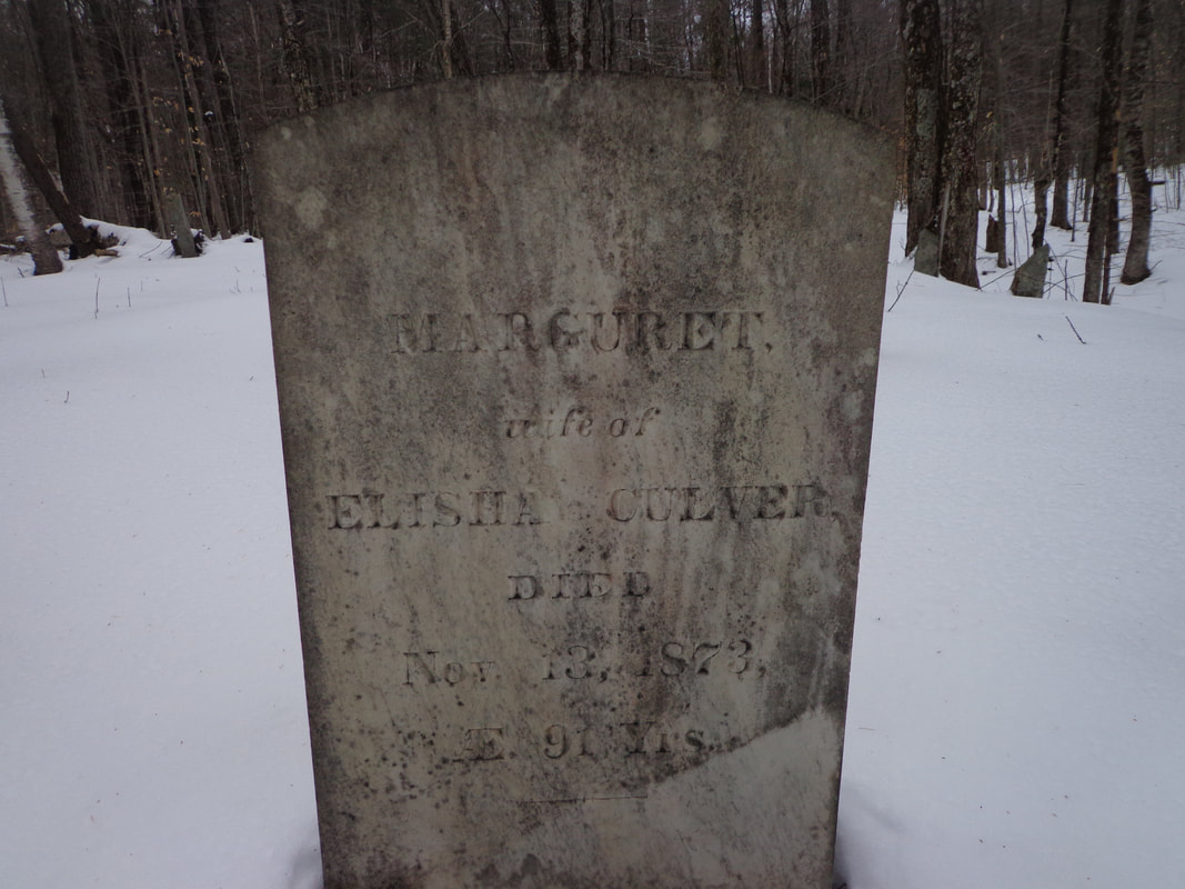 MARGURET wife of ELISHA CULVER Died Nov. 13, 1873 AE 91 Yrs. These folks lived lives of hard work. Without modern conveniences, such as electricity, and all the labor saving devices electricity would power, everything required effort. Simple things we take for granted, like turning on a water faucet, could have involved a walk to the river or well, and carrying full buckets uphill, back to the farmhouse. 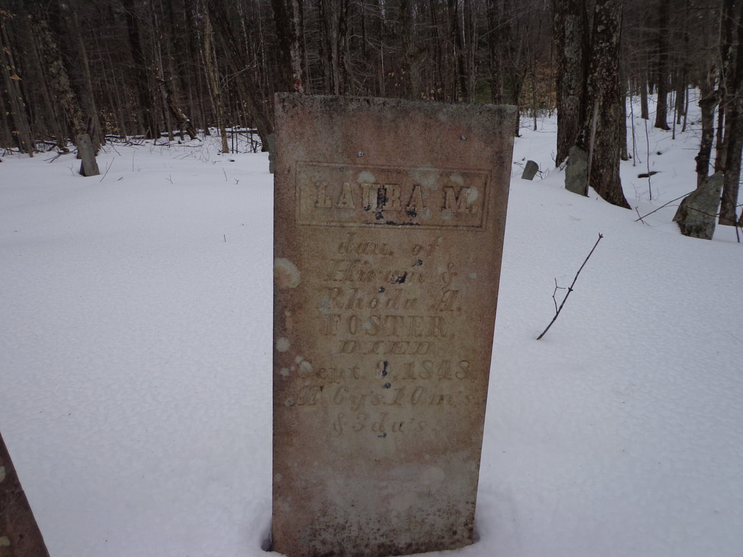 LAURA M. dau. of Hiram & Rhoda A. Foster Died Sept. 8, 1848 AE 6 yrs. 10 m's & 3 da's 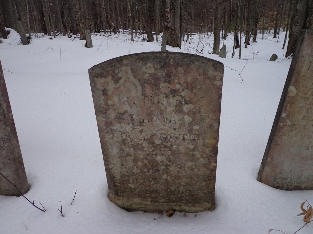 RHONDA Wife of HIRAM FOSTER DIED Nov 19, 1869 AE 66 years 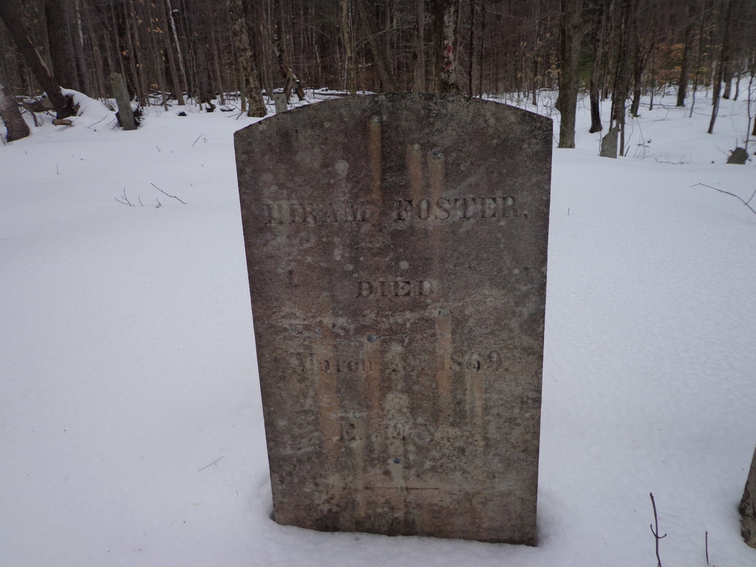 HIRAM FOSTER DIED March 18th, 1869 AE 59 yrs. 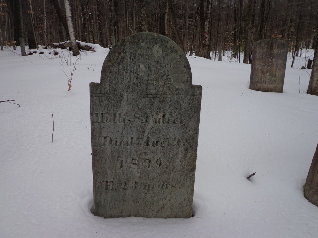 HOLLIS S. CULVER DIED Aug. 9th, 1839 (19th?) AE 23 years 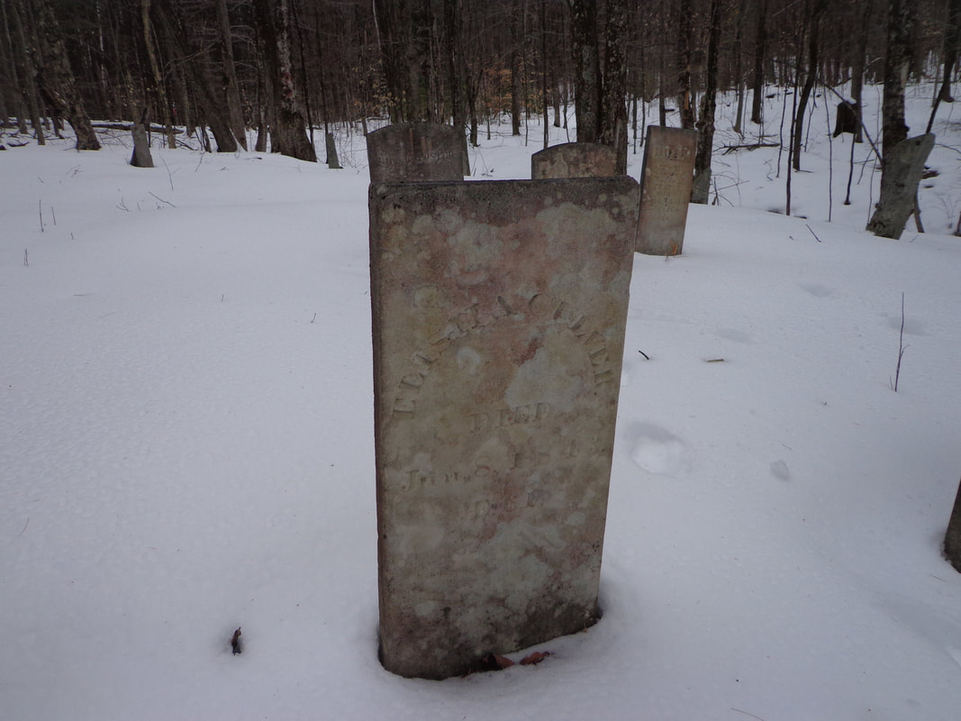 ELISHA CULVER DIED Jun, 8, 1843 AE 61 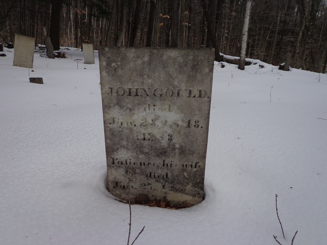 JOHN GOULD died Jan, 23, 1843 AE 83 Patience, his wife died Jun 27, 1832 (age) 74 Such a peaceful place. It was great to finally get out there and see what it was like, and think about these folks that lived and died there, and were buried out there in what is now Forest. The cemetery remains as a quiet reminder of our heritage, our past.
Thanks for traveling along, on Old Roads, Rivers and Rails of the Upper Valley If you haven't already subscribed, feel free to send an email to [email protected] and I'll add you to our group, and send updates whenever there's a new post. As always, comments are welcome. Thanks, - Bob Totz, Feb 2, 2020
6 Comments
B A
2/12/2020 09:52:34 am
Wow, such a sense of peaceful repose, and shielded from the crazy busy world. Really neat to see, thanks for sharing.
Bob Totz
2/12/2020 12:16:08 pm
You're welcome, BA.
Tom Williamson
10/21/2022 09:37:42 am
Bob, my daughter and I have searched for Parkhurst Cemetery for a while and so far no luck.
Bob Totz
10/23/2022 07:46:06 am
Hi Tom - You were probably very close. It's off of Burton Woods Rd, a very short walk in the woods, up hill, across a very small brook. The first time I was there I didn't see it, but my friend who has great vision and directional sense spotted a gravestone. Depending on the time of day, time of year, and the weather, it might be very hard to discern. But it's there! It will be worth finding if you go back and hunt around. It's not far from the sign pointing to Bragg Hill, etc. I'd love to take a hike out there with you sometime.
Tom Williamson
10/23/2022 10:16:42 am
Bob, my daughter Jenny and I would love to connect with you and find Parkhurst, do you have time sometime this week?
Bob Totz
10/23/2022 01:08:35 pm
Tom, I can't see your email. Your comment will be posted after it is approved.
Leave a Reply. |
AuthorI'm Bob Totz, retired VT postmaster, and historical geographer ARCHIVES:
October 2021
EXPANDED ARCHIVES: AUGUST 2021 1858 Johnson Map of North America MAY 2021 1795 - "Road Over the Mountain" - Part Two Historic Toll House For Sale 1795 - "Road Over the Mountain" Part One OCTOBER 2020 Finding That Special Peaceful Place AUGUST 2020 Kayaking on the Pompy JULY 2020 Pt. 2: What the Heck Are These Things? JUNE 2020 Bob's Bio... What the Heck Are These Things? Pt. 1 MAY 2020 Stone Walls and Spirits The View APRIL 2020 Sunny Brook Farm Relics: Pt 2. Sunny Brook Farm Relics: Pt 1. MARCH 2020 Signs of Norwich Pt. 2 COVID-19 Tracking Map Centertown and Valleyquest Signs of Norwich Pt. 1 "Imperfect Union" - Book Review Historic Centertown FEBRUARY 2020 King's Hwy Pt. 2 WRJ Museum at Post Mills Airport Chatauguay Vermont The Independent Farmer poem Traveling Along the King's Highway - Lebanon NH JANUARY 2020 Finding Parkhurst Cemetery In Search of Parkhurst Cemetery Affordable Housing The Old Stone Grill Two Rivers Trail-Kmart License and Registration, Please! Prohibition, Murder and Dr. Seuss Peace, Paris, & P.O. DECEMBER 2019 BLOGGER'S LINKS Welcome to Old Roads Love-Quail Hollow fun Dartmouth Cemetery SEPTEMBER 2019 E. Thetford Cemetery JUNE 2019
Taps: Meetinghouse Cemetery 4-Corners Borders Quest Old Iron Gate Stumbling Upon History Sunrise Walk MAY 2019 4 Corners Cemetery Strafford's Abandoned Foundations Art in Old Stonework APRIL 2019 Strafford Tpke Pt 2 Strafford Tpke Pt 1 White River Valley FEBRUARY 2019 Learning from Historic Maps of the Upper Valley Change in Lewiston VT JANUARY 2019 A Vermont Ski Waltz John Ledyard 1773 What is the Upper Valley? DECEMBER 2018 Dartmouth Green Music Video: Sometimes Music Video: Montreal Express Railway Disaster of 1887 |
 RSS Feed
