|
Welcome! Scroll Down for Posts and Archives.
Other Menu Options at Top |
|
|
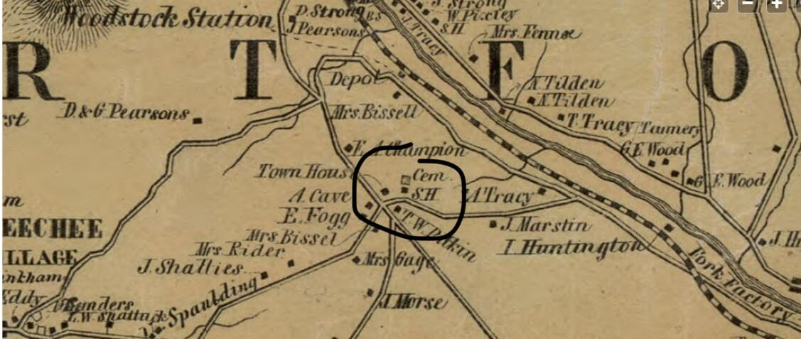 1855 view from the Windsor County map by Walling. Center of Town Road in Hartford Vermont is one of the oldest roads in the town of Hartford Vermont. King's HIghway connects with it, and at that intersection, formerly stood the original Town Meeting House. There is an old cemetery still there too, and the site of a former schoolhouse as well. 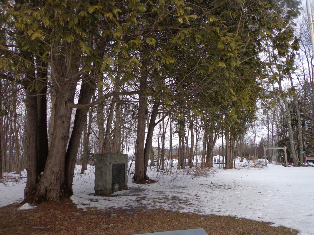 Also at the intersection of King's Highway and Center of Town Road, is a large stone monument with a plaque, that was laid there in 1911 by the Daughters of the American Revolution, or D.A.R., 1911. It is flanked by two beautiful, mature cedar tree clusters. 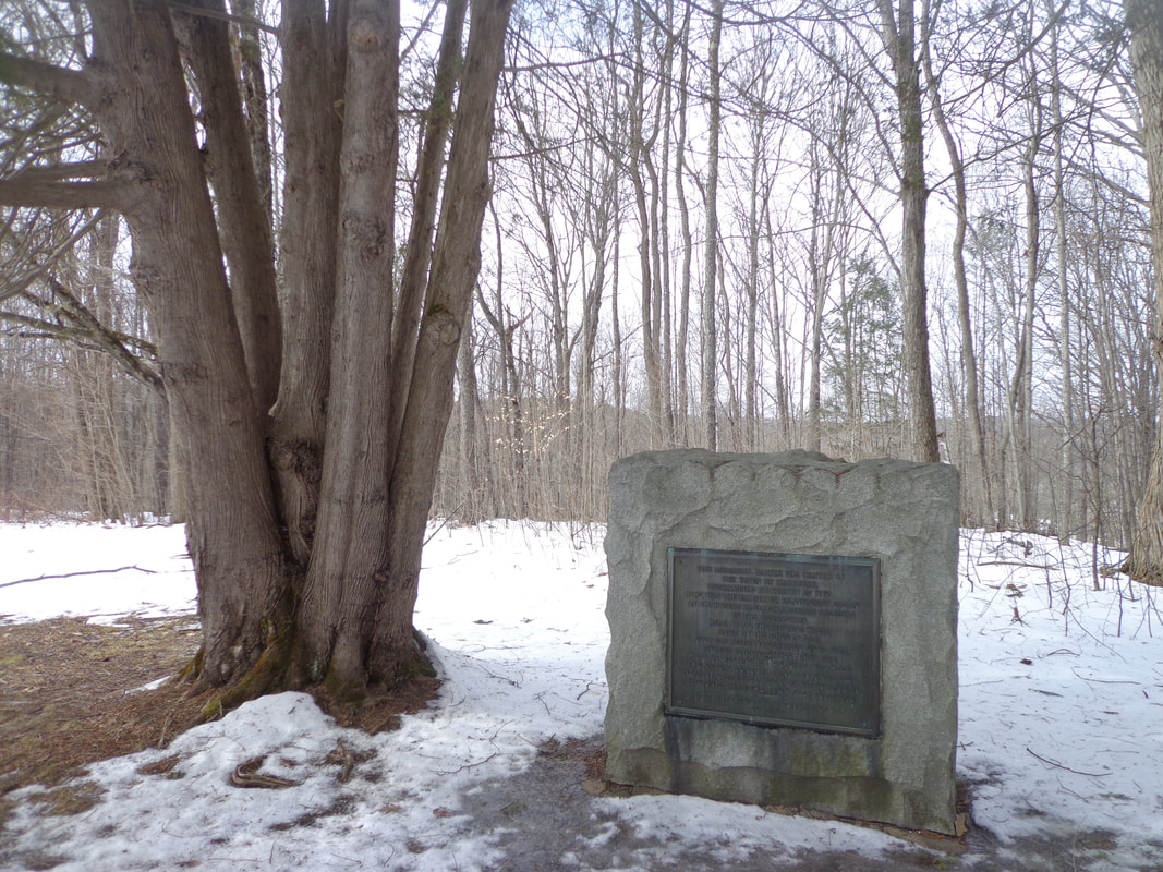 The plaque reads: THIS MEMORIAL MARKS THE CENTER OF THE TOWN OF HARTFORD, DETERMINED BY SURVEY IN 1774. HERE WAS THE PARADE OR CONVENIENT GREEN ON WHICH WERE DRILLED HARTFORD'S SOLDIERS IN THE REVOLUTION. HERE STOOD THE MEETING HOUSE BUILT BY THE TOWN IN 1784, USED FOR RELIGIOUS SERVICES UNTIL 1828, AND FOR TOWN MEETINGS UNTIL 1872. HERE ON MEETING HOUSE SQUARE WAS HELD THE ANNUAL JUNE TRAINING DAY UNTIL 1844. NEARBY STOOD FREEGRACE LEAVITT'S TAVERN AND UNTIL 1840 THE TOWN CLERK'S OFFICE. -------------------------------- ERECETED BY THOMAS CHITTENDEN CHAPTER D.A.R. JULY 4, 1911 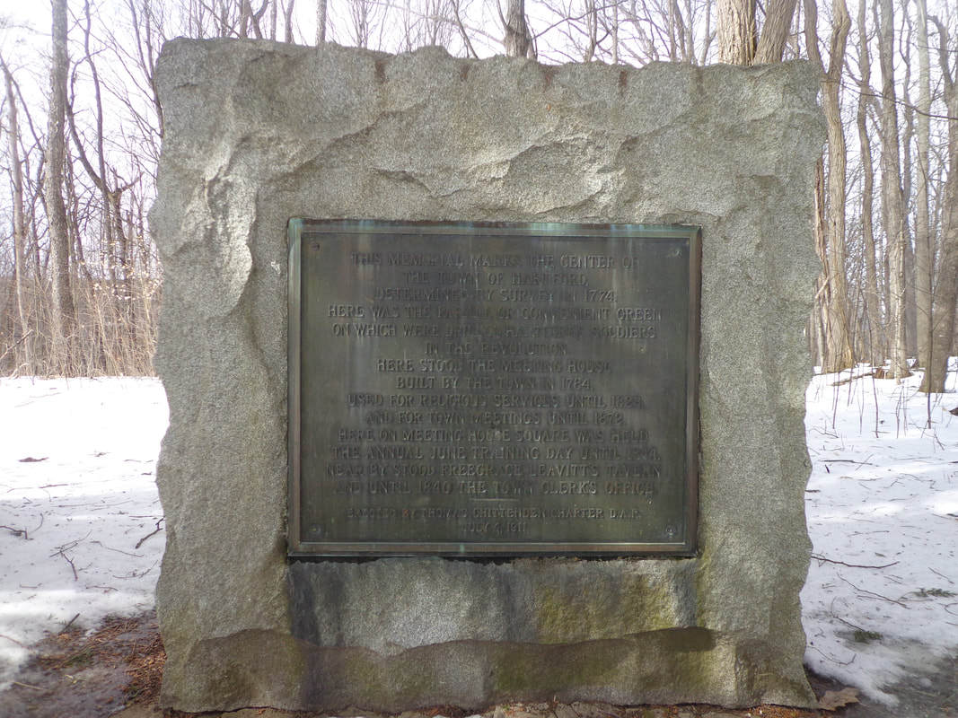 D.A.R. Memorial Plaque in Centertown, Hartford Vermont, Placed July 4, 1911 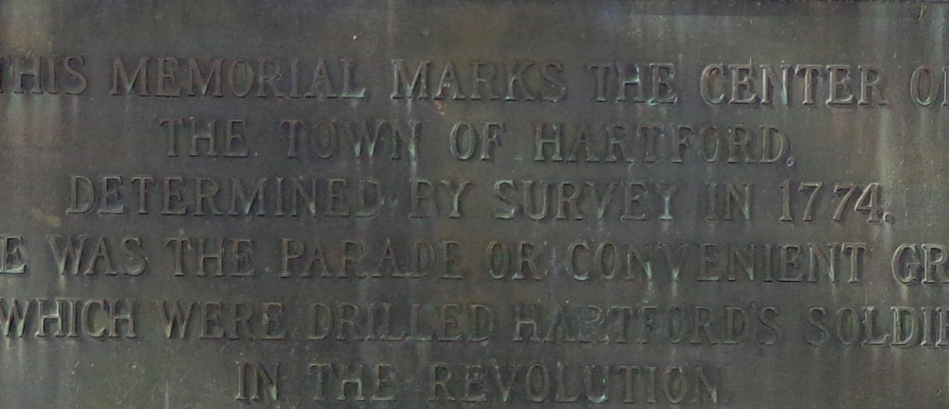 Close-Up Look at the Lettering on the Plaque. A Schoolhouse was also located at this spot, and an old cemetery. 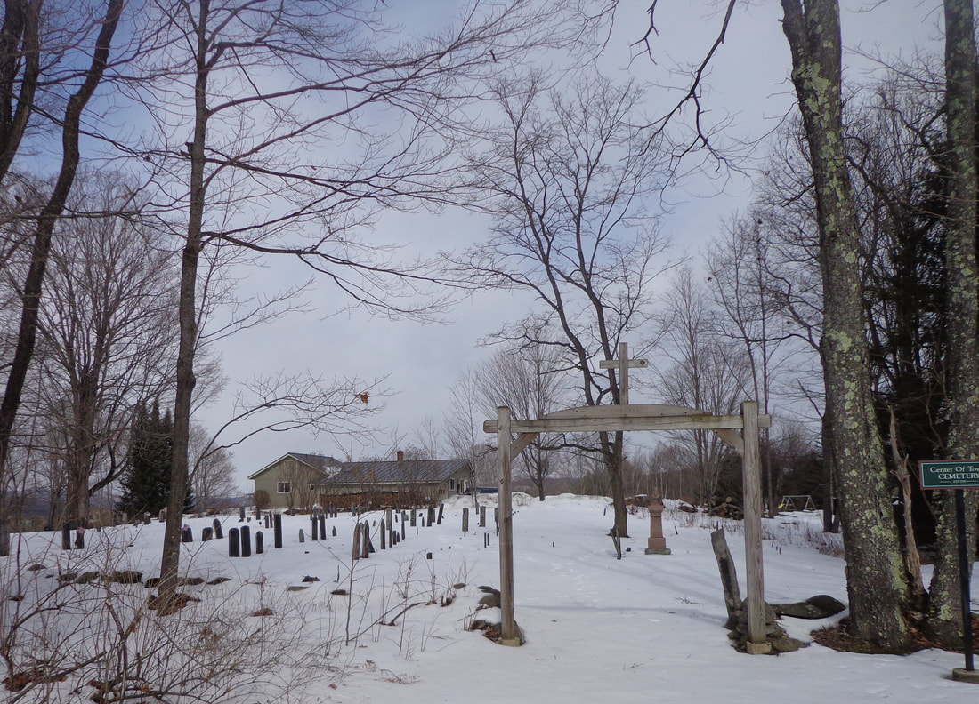 Center Of Town Cemetery, Hartford VT 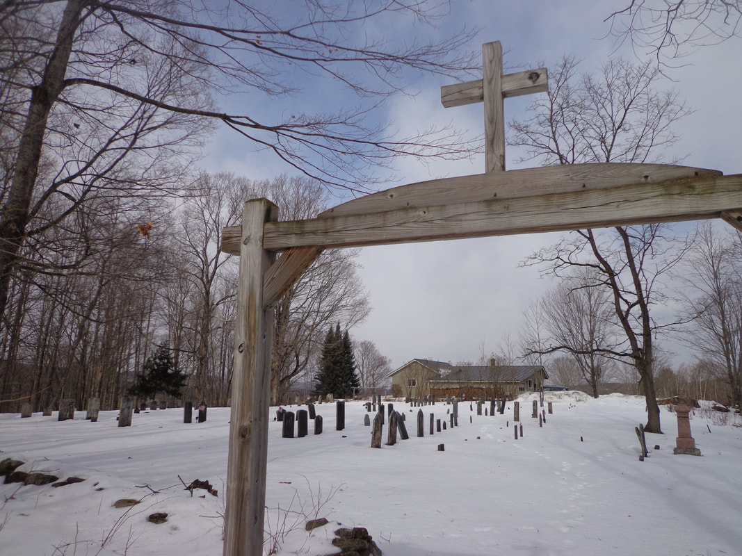 Below is a topographic image from the U.S. Geological Survey in 1908, showing the Centertown area, which has been circled. As you can see, the spot is located on a knoll, with northwestern exposure. The King's Highway appears to continue past the cemetery, downhill, across the Woodstock Railroad tracks (today's US Route 4), to today's Old Quechee Road. 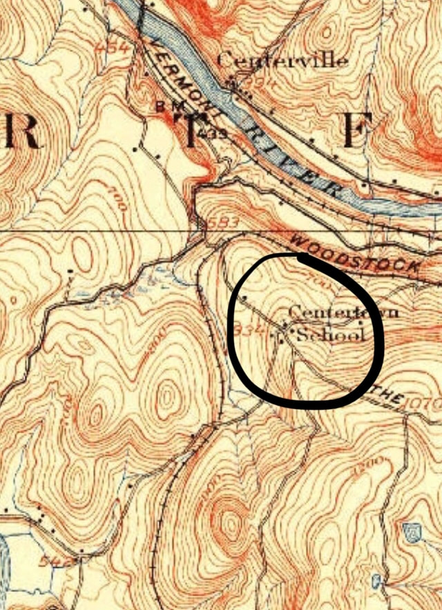 Centertown in 1908. USGS 15 minute Series, Hanover Quadrangle. By 1996, this area looked a little different, below the old parade ground at the Center of Town. As seen below, the King's Highway was shown as a double dashed line, an unimproved road, on both sides of Center of Town Road. The parade ground can be seen as a small triangular shaped area where Center of Town Road and King's Highway meet. 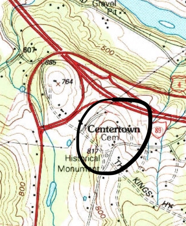 USGS Representation of Center of Town in 1996. 7.5 Minute Series, Quechee Quadrangle. Note above, that US Route 4 follows the former path of the Woodstock Railroad. In the map image below, from 2012, we get yet another, more recent look at the Centertown area, without topographic lines. 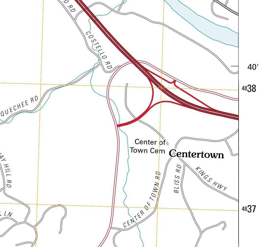 Last week my wife and I took a ride up to Centertown. I had been up that way only once before, for an event on Bliss Road, about 20 years ago. On the old maps, it appears that Center of Town Road connected to River Road, on the south side of the White River, and then crossed the King's Highway, and continued to Quechee, on what is today Quechee Main Street. (See the 1855 map at the top of this article.) Today Center of Town Road appears to have been split into three sections, thanks to the Woodstock Railroad, and later, US Route 4 construction. 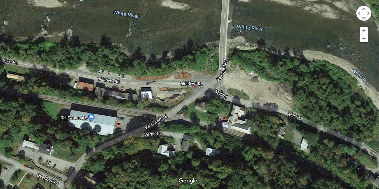 Mill Road, River Road, VA Cutoff Road, and Bridge to Hartford Village. Courtesy Google Earth. The eastern section starts on Smith Road, from River Road. 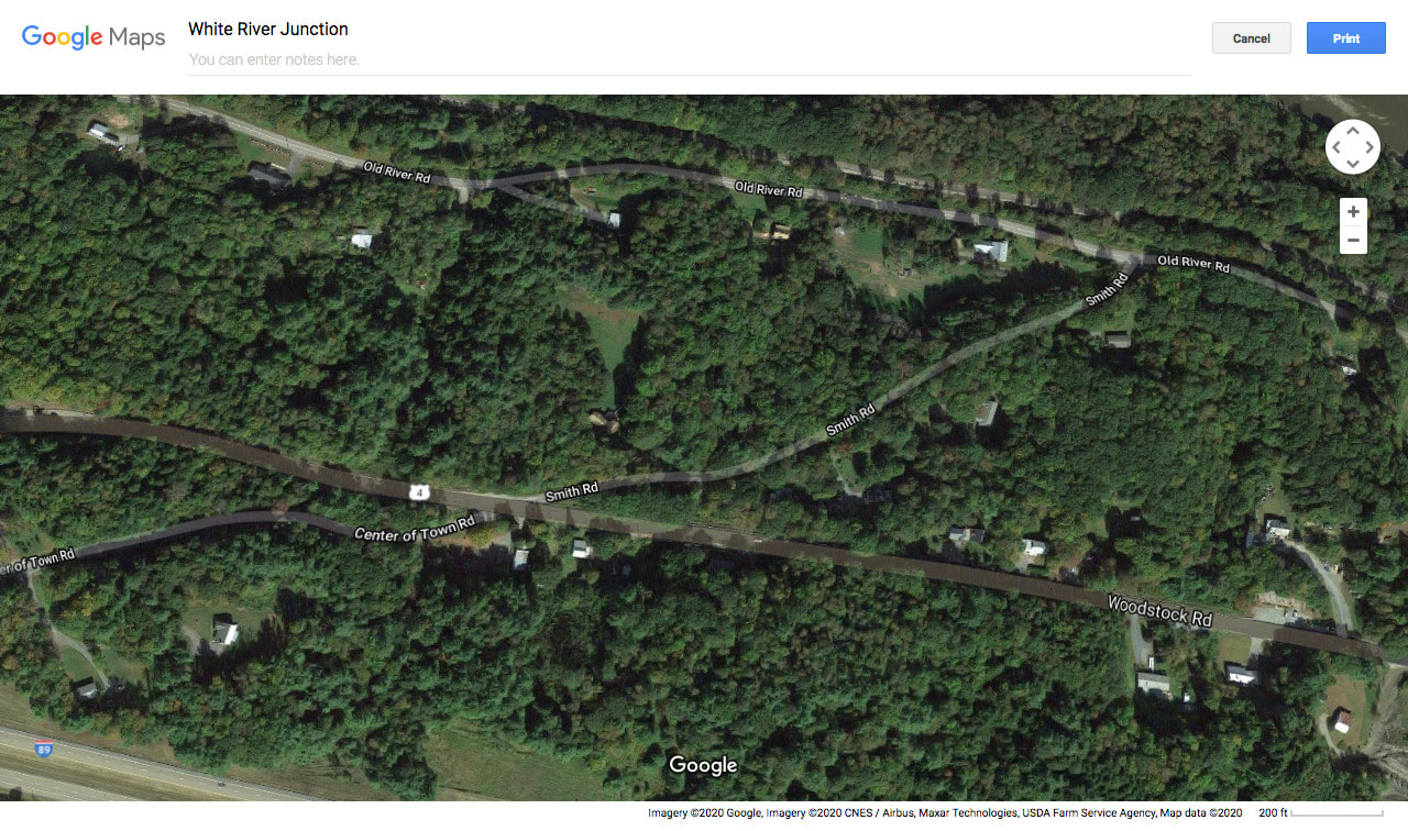 Smith Road is shown leaving River Road in upper right. Once it crosses Route 4, it is called Center of Town Road. I wonder why they named that end Smith Road? We drove up Smith Road, and it was a very interesting little paved portion of an old road. It looked like the road could use some work, as the cracks and frost heaves were pretty serious. When we climbed to Route 4, we simply crossed and continued up Center of Town Road, to the top, where the old parade ground is located. 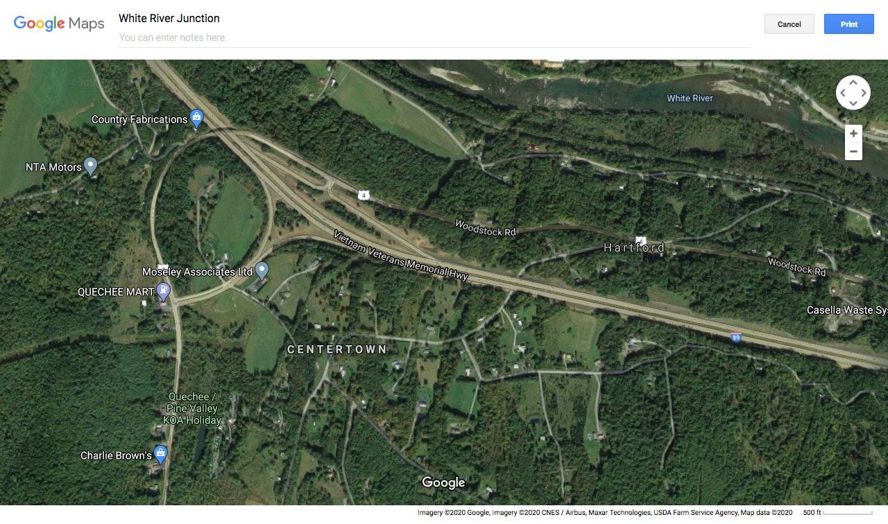 Current Google Earth image of Centertown, with US Route 4 and I-89 Shown. Center of Town Road leads back down to Route 4 on the south side, and then a quick right puts you on Quechee Main Street. There was a time though, when there was no route 4 to cross, or railroad, before that, and you simply just continued down into Quechee. The USGS map below, from 1908 shows the old route, though the Woodstock Railroad was in existence then, and it looks like there was a railroad crossing about where Center of Town Road meets Route 4 on its southern end today. 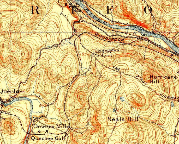 1908 view, showing the route of Center of Town Road from the White River, up to Centertown, and down to Quechee. 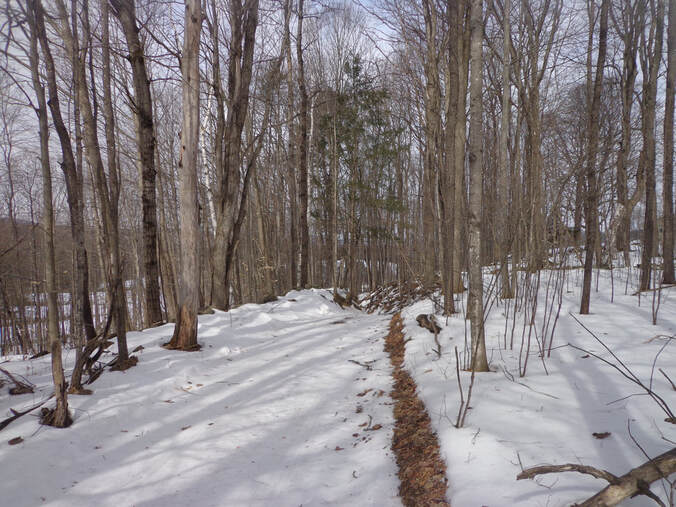 Extension of King's Highway heading downhill toward I-89. Today, straight across from the paved King's Highway, just below the Center of Town Cemetery, the King's Highway appears to continue as a trail, downhill toward Interstate 89, (seen above). Just beyond the Center of Town Cemetery, on the far corner of King's Highway and Center of Town Road, sits the former "Freegrace Leavitt's Inn". A formal colonial home and tavern, it has sat as a silent witness to two hundred-plus years of history. 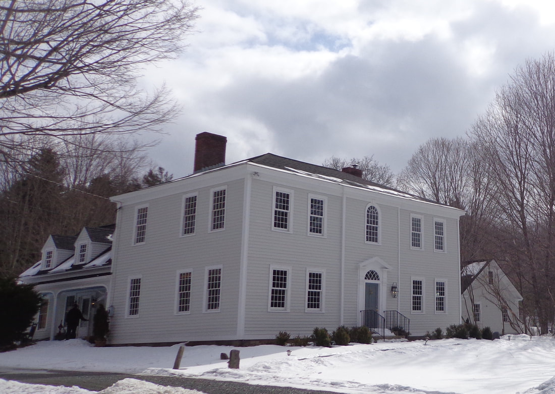 Former Freegrace Leavitt's Tavern and Hartford Town Clerk's Office, at Centertown. The Center of Town area in Hartford Vermont is a historic place that saw much activity in the past. Revolutionary soldiers drilled there. The Town Clerk worked there. The Meetinghouse was there, and the Tavern too. It was a major crossroads in it's day, but today it is a "Back Road". Thanks for riding along on Old Roads, Rivers and Rails of the Upper Valley, with me, Bob Totz.
If you haven't already subscribed, feel free to send an email to [email protected] and we'll add you to the growing list of members who receive email updates whenever there's a new Old Roads, Rivers and Rails of the Upper Valley post. Sources: 1855 Windsor County Wall Map by Walling: www.loc.gov/resource/g3753w.la001193/?r=0.659,0.503,0.092,0.039,0 USGS Topographic Maps available at "Topoview": ngmdb.usgs.gov/topoview/viewer/#13/43.6488/-72.3650 Aerial View Images from Google Earth and Google Maps. Other Photos by Bob Totz
6 Comments
Barbara
3/8/2020 12:25:21 pm
I discovered Centertown when I lived in Killington and was looking for the absolutely shortest drive to WRJ. Loved driving through there, it's like a little corner that time forgot.
Bob Totz
3/8/2020 01:04:12 pm
That's a great story, Barbara! It's one of those shortcuts where you go up and over, instead of around.
Douglas Shane
5/10/2020 09:14:08 am
There's a great "over the Green Mountains" 4th class road connecting Arlington and Wardsboro that I traveled in a Pathfinder automobile back in the 1990's.
Douglas Shane
5/10/2020 09:17:19 am
You can copy and paste the address of the Webster story if the link doesn't work with a click.
Dave Phillips
3/8/2020 09:27:45 pm
Bob, I did some work helping to set a stone in that cemetery a handful of years ago. Prior to that I had no idea that that beautiful area existed! Dave
B A
3/9/2020 08:48:29 am
My old stomping grounds! Thank you for posting about this. So true, it used to be a major crossroads of activity, but it now considered out in the country. So much history interesting history there. Your comment will be posted after it is approved.
Leave a Reply. |
AuthorI'm Bob Totz, retired VT postmaster, and historical geographer ARCHIVES:
October 2021
EXPANDED ARCHIVES: AUGUST 2021 1858 Johnson Map of North America MAY 2021 1795 - "Road Over the Mountain" - Part Two Historic Toll House For Sale 1795 - "Road Over the Mountain" Part One OCTOBER 2020 Finding That Special Peaceful Place AUGUST 2020 Kayaking on the Pompy JULY 2020 Pt. 2: What the Heck Are These Things? JUNE 2020 Bob's Bio... What the Heck Are These Things? Pt. 1 MAY 2020 Stone Walls and Spirits The View APRIL 2020 Sunny Brook Farm Relics: Pt 2. Sunny Brook Farm Relics: Pt 1. MARCH 2020 Signs of Norwich Pt. 2 COVID-19 Tracking Map Centertown and Valleyquest Signs of Norwich Pt. 1 "Imperfect Union" - Book Review Historic Centertown FEBRUARY 2020 King's Hwy Pt. 2 WRJ Museum at Post Mills Airport Chatauguay Vermont The Independent Farmer poem Traveling Along the King's Highway - Lebanon NH JANUARY 2020 Finding Parkhurst Cemetery In Search of Parkhurst Cemetery Affordable Housing The Old Stone Grill Two Rivers Trail-Kmart License and Registration, Please! Prohibition, Murder and Dr. Seuss Peace, Paris, & P.O. DECEMBER 2019 BLOGGER'S LINKS Welcome to Old Roads Love-Quail Hollow fun Dartmouth Cemetery SEPTEMBER 2019 E. Thetford Cemetery JUNE 2019
Taps: Meetinghouse Cemetery 4-Corners Borders Quest Old Iron Gate Stumbling Upon History Sunrise Walk MAY 2019 4 Corners Cemetery Strafford's Abandoned Foundations Art in Old Stonework APRIL 2019 Strafford Tpke Pt 2 Strafford Tpke Pt 1 White River Valley FEBRUARY 2019 Learning from Historic Maps of the Upper Valley Change in Lewiston VT JANUARY 2019 A Vermont Ski Waltz John Ledyard 1773 What is the Upper Valley? DECEMBER 2018 Dartmouth Green Music Video: Sometimes Music Video: Montreal Express Railway Disaster of 1887 |
 RSS Feed
