|
Welcome! Scroll Down for Posts and Archives.
Other Menu Options at Top |
|
|
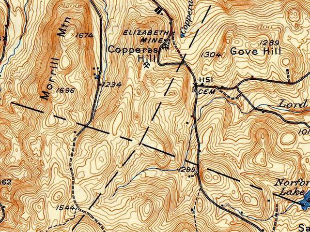 A Nice June Day for a History Hike. After pondering that old, straight stonewall on New Boston Road, at the Thetford and Norwich border, I was invited by a friend to explore the area with him. We were hoping to find some evidence of the old border lines, that I thought must have been surveyed, or marked at some point. My friend lives near to that area, and is familiar with the lay of the land. 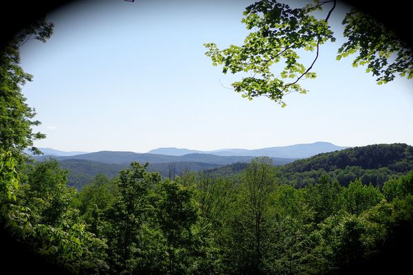 I was greeted with the above view, as I got out of my Jeep to meet my host, Mike Hebb. It was Wednesday morning, June 12th, 2019, A beautiful sunny day was forecast. I had a feeling this would be a fun hike. We headed out along an old footpath, and eventually were on an old road that was used by the workers on Copperas Hill, many years ago. Early in our walk we passed by a run down shed, leftover from the mine. 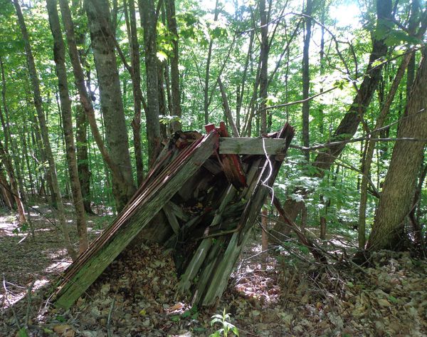 The township boundaries of the four towns in question all meet at a point, or seem to, by the looks of the older USGS, and other maps I have been looking at. The point we're interested in, is the intersection of the four dashed straight lines seen in the map below. The line that goes from left to right, is also the boundary between Orange county and Windsor county, Vermont, so we hoped we might find some type of clues to old survey markings out there. We were not far from Copperas road, which runs from Copperas Hill to the intersection with the old Strafford Turnpike, and Chapel Hill Road, at the northern base of Gile Mountain, in Sharon. 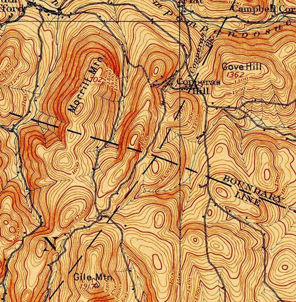 1896 USGS Map showing Copperas Road and Topography, and Town and County Boundary Lines We started our hike by climbing up into the forest, above and away from the Elizabeth Mine, away from the area where the Environmental Protection Agency has been working for years. We soon came upon an interesting old abandoned foundation. This was turning out to be my kind of hike. If I'm going to battle blackflies, mosquitoes, and ticks, then I prefer to see some neat old artifacts, or some interesting natural features! I was delighted to find a very nice example of one of Strafford's historic stone foundations, left here from some of the early settlers 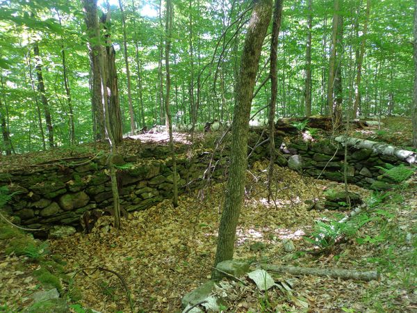 19th century foundation Rear the road Mike pointed out that an interesting characteristic of the stone foundation was the offset top layers of stones, most likely to help support floor joists 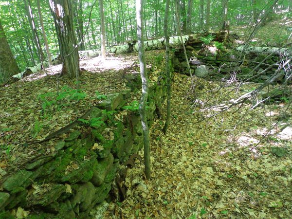 Foundation walls still straight after perhaps two centuries. After some walking there was an opportunity to get to the edge of the woods for a photo of the scarred landscape of the old copper miine. 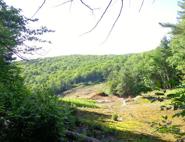 Remains of Elizabeth Mine Back in the forest, we alternated between the Strafford Cross Town Trail... 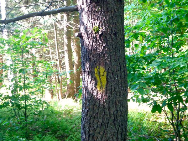 Yellow blaze of the Strafford Cross Town Trail and bushwacking... 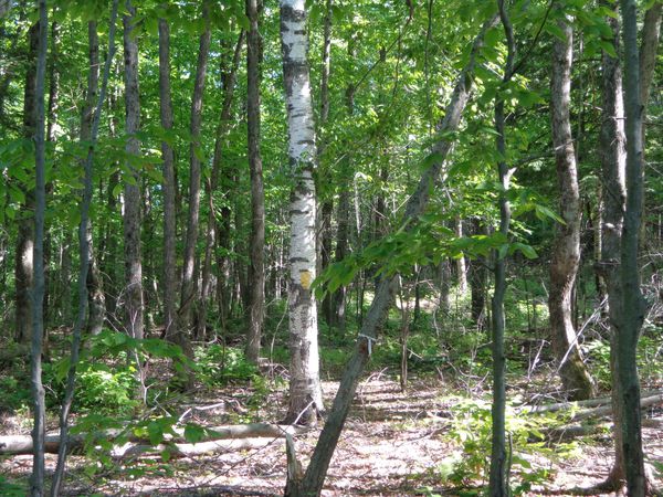 Bushwacking through the woods. Basically, we were west of the mine, traipsing generally southward. 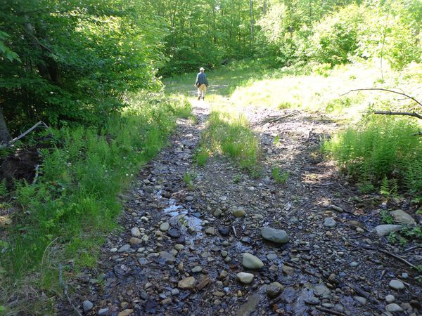 Walking along an old mine road Soon we were under the forest canopy, enjoying the warmth of the day, in the cool of the shade, and walking along a ridge between The old Strafford Turnpike and Copperas Road. 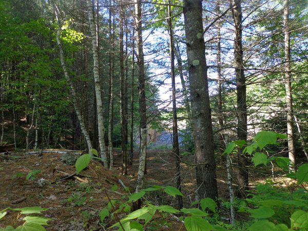 The Forest in Strafford Along the trail, Mike showed me where bears had clawed an old beech tree, leaving claw marks years ago, still seen today. 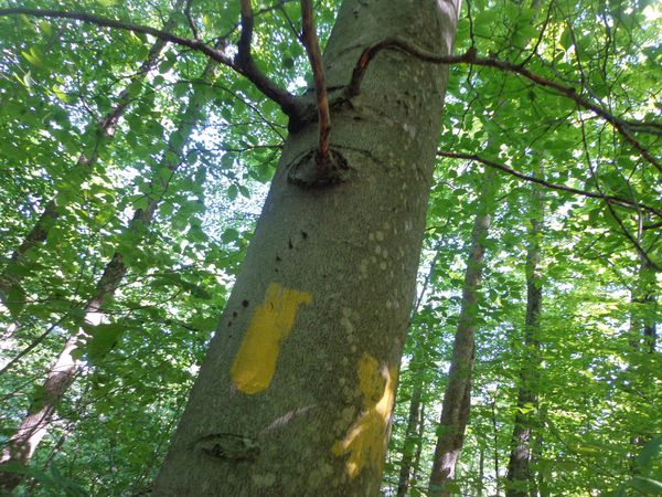 Beech tree with bear claw markings, to the left and above the blaze. Eventually, we came down out of the woods to the southern border of the south cut of the old mine... 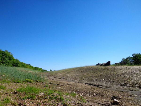 Southern end of the south cut, near Strafford's boundary with Sharon. As we walked down and out of the woods, we crossed the old road that led back to Gile Mountain. The sky was blue and clear, a very welcome weather event most times, but especially this Spring. ************************************************* I had been to this spot about a month ago, when another friend, also named Mike accompanied me from the opposite direction, from Sharon. That was the day we found the Roberts - Sharon cemetery, and we had begun to look for clues to the town boundary lines. Further north from the cemetery, just before that south mine cut, we had come to this spot, and noticed that to the west of the road was a very straight stone wall, which I think may represent the Windsor - Orange boundary, and also the Sharon-Strafford boundary at that spot. I surmised that this could be part of the same straight stone wall I saw at the county and town line on New Boston Road, that started me thinking about all this. Here is what that boundary wall looked like about a month ago. You can see it pretty well, in the photo below, as the trees hadn't leafed out yet at that point. 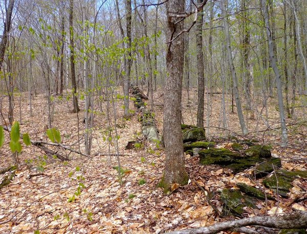 Possible Orange - Windsor County Line, looking west. The problem with these old stone walls is that ,even if left undisturbed by human activity, many segments end up underground centuries later. Sometimes you can see a little moss on top of a rock, just sticking out of the ground, and maybe some tops of a few rocks, but unless you go poking around, it can be hard to see an old wall that is mostly buried. Trees die and fall on them, and rot, and return to the earth. Leaves and plants die and compost. New trees grow up and their roots push rocks out and away. ****************************************************************************************** But back to our most recent reconnaissance trip: Mike Hebb had brought along a portable Garmin GPS unit, and had pre-programmed the four corners point into it, as best he could. The unit displayed both the point where we were, and the point we were looking for, with topography, on a small screen. I followed near Mike as he periodically checked his device to compare our current position to the point on the map, as we descended away from the road, back into the woods, heading south and east. 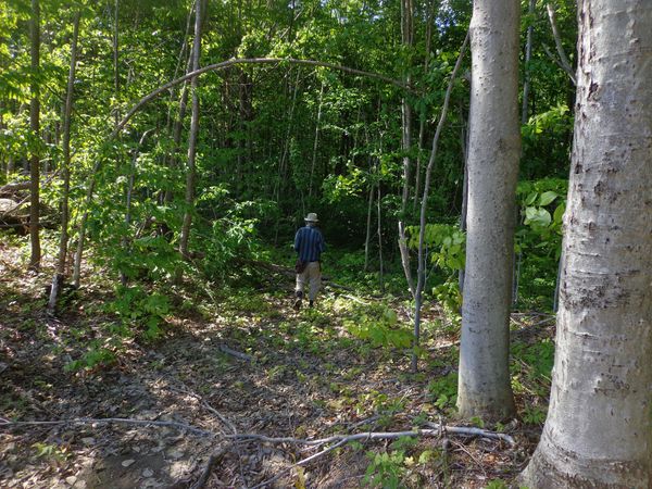 We bushwacked around, getting closer to the point on the map, all the while looking for signs of the boundaries, like very old witness trees, stone walls, and corners, or anything that might still be seen, left by surveyors of many years ago. Soon we were in the right location, given the margin of error, and some discrepancies in source data, so we walked around observing, looking for stone walls, piles of stones, iron pipes, flagging, anything that might look like it was put there by someone to tell a story. We soon came upon a large boulder, with several good sized rocks on top of it, placed in a circle, with a hole in the middle. 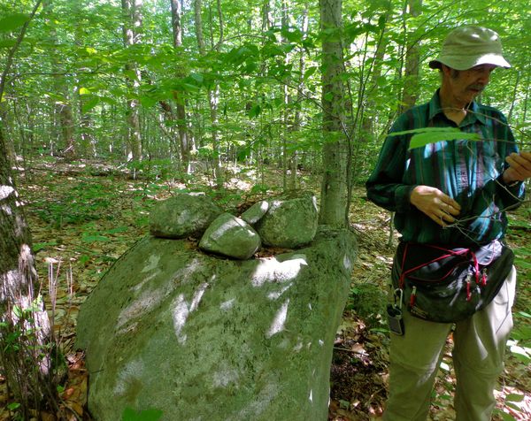 I doubt anyone moved the big boulder to this spot, but maybe they used it as a "witness" to let folks know that they were near the corner of the four towns, by placing the rocks on top of it. It certainly would stand the test of time. And there may have been a stake in the middle of those stones, at one point. Or, maybe they decided to make the boulder the corner, since it was a prominent, locatable feature in the general area. Some of these county and town boundaries have been changed over time too. There was also another large pile of stones nearby. I don't know if that meant anything or not, but it seemed out of the ordinary. 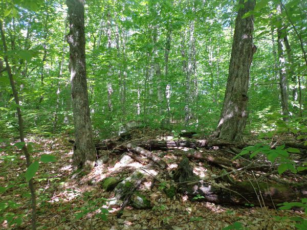 A large pile of rocks nearby There were a couple of small trees chopped down with an axe.. 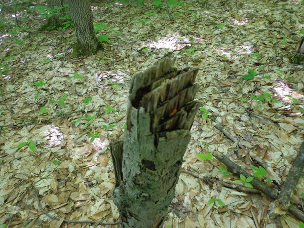 Stake cut with an axe There were a few trees nearby with some modern-type flagging, but I soon spotted something I really had to check out: an old looking tree in the middle of a straight stone wall... 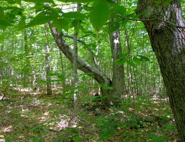 Suspicious Looking Tree and Stone Wall I moved closer to get a look at the tree and found that it was in the middle of a stone wall that seemed to possibly run in a line with the wall up above and to the west of Copperas road, which I had surmised might be the county boundary. 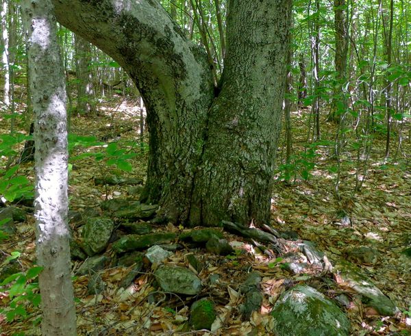 A Closer Look On that tree, was a neatly fused branch that grew out, and came back into the trunk! What do you suppose caused that? 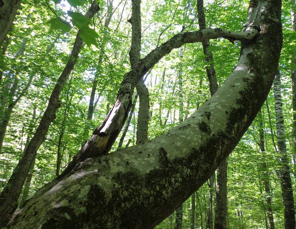 Following this stone wall, from the old fused tree to the east, the wall settled into the ground a bit, then came back out, and eventually formed a corner with another, perpendicular stone wall, in a low spot, beneath a small ledge. The perpendicular wall could be seen heading in a southerly direction. It looked like there was some significant settling here, as both walls were sometimes underground. The lay of the land matched the topography seen on my old USGS map too, so that was also a good sign that we were in the correct area. 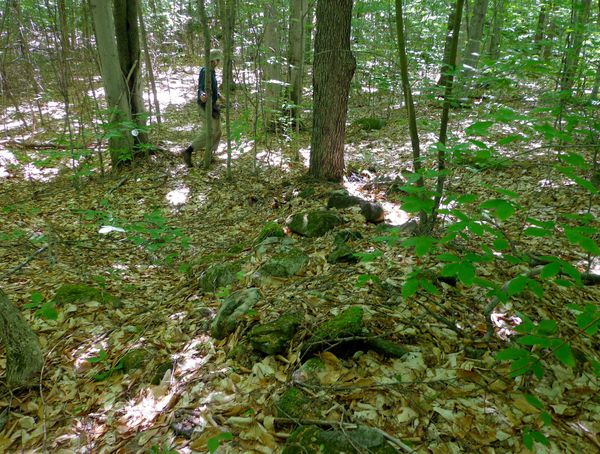 Stone Wall, heading east, from the Old Fused Tree. The photo above shows the west - east stone wall, heading to the corner. Here is the corner that we found. It appears to be in the proper location. We did not move leaves or try to dig out the stone wall. It's not a great photograph, however I think you can get the idea. I think it would look a lot more dramatic if we had taken the time to remove leaves and debris and did some digging and cleaning. 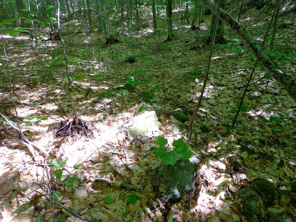 Looking at the corner of the stone walls. At this point I think we found the Point of the Four Corners of the four towns; Thetford and Strafford, in Orange County, and Norwich and Sharon in Windsor County. I think we found the south and west wall, which would represent the border of Sharon with both Strafford and Norwich. But, I'll have to come back, and try to find the east and north walls. Cleaning of debris in order to get better photos would be a good idea too. Maybe we'll come in from New Boston road this time...If it leads us to this spot, then I would say we found the corner. But I wonder...maybe the actual boundary line of the four towns was never marked at all? Maybe these are just stone walls from when the farmers of old cleared their fields? No, I don't think so, though they may have had that dual purpose, both as a political boundary, and the border of a field or property. That wall from New Boston Road was too straight and important looking, and not far away, as the crow flies. We'll need to go back and check just east and north of here, as I suspect that those other boundary segments are represented by two other walls that could be just below the surface, just beyond that corner. 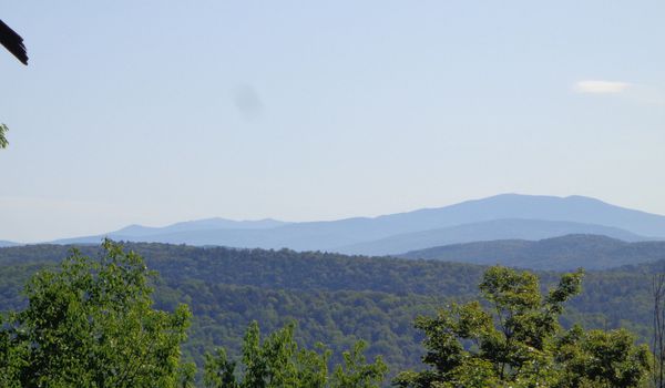 View from above the mine. Mt. Moosilauke, and the White Mountains beyond. Storms, blow-downs, low, wet spots, frost heaves, animal activity, and the ravages of time have all conspired to bury parts of these old walls. But the vestiges and remains are still there, though they may be buried. My wife says that when we are certain that we found the point, we should mark it with a big granite post, on which will be placed an orange and a Windsor chair! Thanks for bushwacking along on "Old Roads, River and Rails" < Click on this link, and scroll down for more adventures. A heartfelt thanks to Mike Hebb for help in researching and investigating the boundaries, and for showing me a beautiful region of our Upper Valley. New Subscribers and Comments are always welcome! 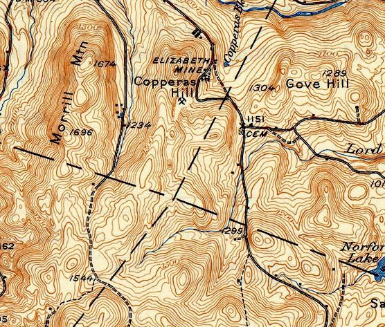 1944 USGS Topography, Close-up of the 4 Corners area
- Bob Totz, June 14, 2019 Strafford Trails: http://straffordtrails.yolasite.com/cross-town-trail.php map source: https://ngmdb.usgs.gov/topoview/viewer/#9/43.7552/-72.0744
0 Comments
Your comment will be posted after it is approved.
Leave a Reply. |
AuthorI'm Bob Totz, retired VT postmaster, and historical geographer ARCHIVES:
October 2021
EXPANDED ARCHIVES: AUGUST 2021 1858 Johnson Map of North America MAY 2021 1795 - "Road Over the Mountain" - Part Two Historic Toll House For Sale 1795 - "Road Over the Mountain" Part One OCTOBER 2020 Finding That Special Peaceful Place AUGUST 2020 Kayaking on the Pompy JULY 2020 Pt. 2: What the Heck Are These Things? JUNE 2020 Bob's Bio... What the Heck Are These Things? Pt. 1 MAY 2020 Stone Walls and Spirits The View APRIL 2020 Sunny Brook Farm Relics: Pt 2. Sunny Brook Farm Relics: Pt 1. MARCH 2020 Signs of Norwich Pt. 2 COVID-19 Tracking Map Centertown and Valleyquest Signs of Norwich Pt. 1 "Imperfect Union" - Book Review Historic Centertown FEBRUARY 2020 King's Hwy Pt. 2 WRJ Museum at Post Mills Airport Chatauguay Vermont The Independent Farmer poem Traveling Along the King's Highway - Lebanon NH JANUARY 2020 Finding Parkhurst Cemetery In Search of Parkhurst Cemetery Affordable Housing The Old Stone Grill Two Rivers Trail-Kmart License and Registration, Please! Prohibition, Murder and Dr. Seuss Peace, Paris, & P.O. DECEMBER 2019 BLOGGER'S LINKS Welcome to Old Roads Love-Quail Hollow fun Dartmouth Cemetery SEPTEMBER 2019 E. Thetford Cemetery JUNE 2019
Taps: Meetinghouse Cemetery 4-Corners Borders Quest Old Iron Gate Stumbling Upon History Sunrise Walk MAY 2019 4 Corners Cemetery Strafford's Abandoned Foundations Art in Old Stonework APRIL 2019 Strafford Tpke Pt 2 Strafford Tpke Pt 1 White River Valley FEBRUARY 2019 Learning from Historic Maps of the Upper Valley Change in Lewiston VT JANUARY 2019 A Vermont Ski Waltz John Ledyard 1773 What is the Upper Valley? DECEMBER 2018 Dartmouth Green Music Video: Sometimes Music Video: Montreal Express Railway Disaster of 1887 |
 RSS Feed
