|
Welcome! Scroll Down for Posts and Archives.
Other Menu Options at Top |
|
|
|
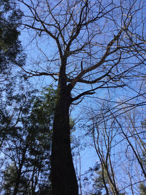
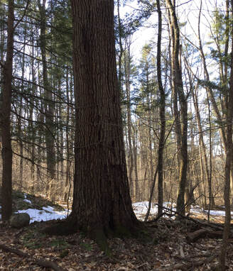
After doing my transfer station run on Wednesday, I parked the car outside the gate, near the small sand/wood chip shed. I wanted to get some exercise and fresh air before heading back home. 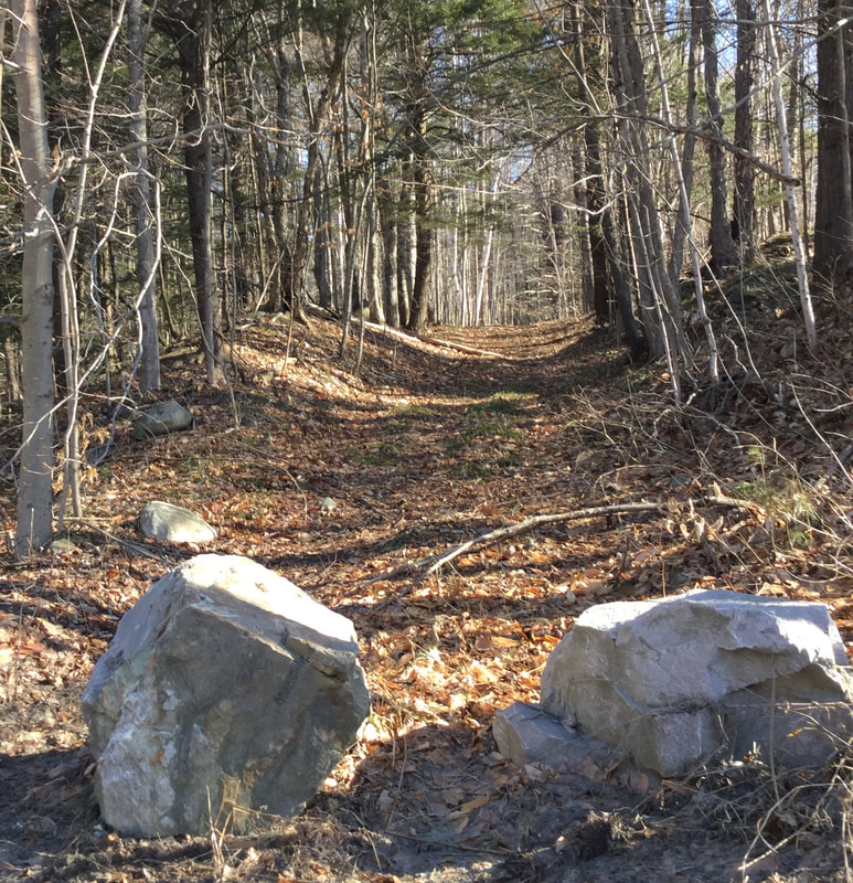 I'd seen those stones there before, blocking motor vehicle entrance, but I hadn't noticed any "No Trespassing" signs, so I thought I'd see where this trail might lead. I had a suspicion it might be a discontinued road. I headed up into the woods. 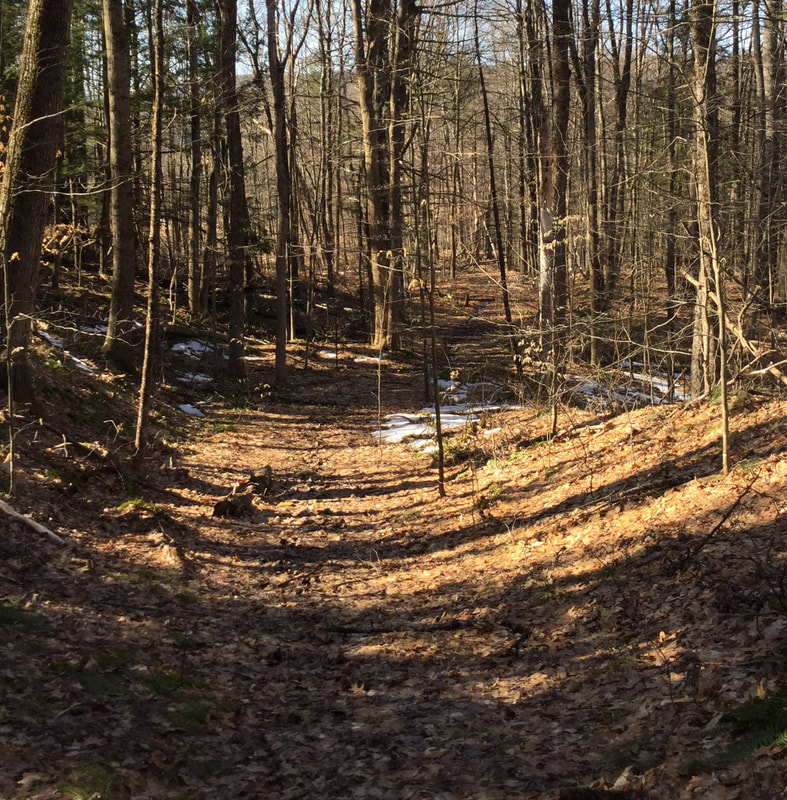 Not too long ago, a couple different people mentioned they thought there was a King's HIghway in Norwich, and that it ran up behind the Town Garage area. This was beginning to look like it could be an old town road, but I hadn't noticed it on a trail map before. 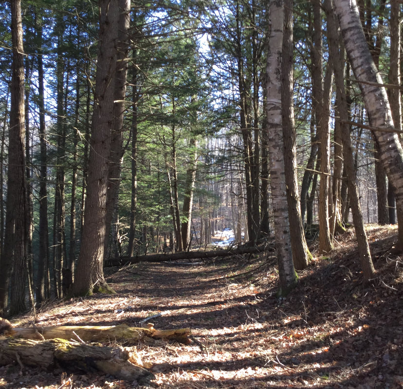 Old New England roads are often between stone walls, though sometimes the walls themselves are buried. 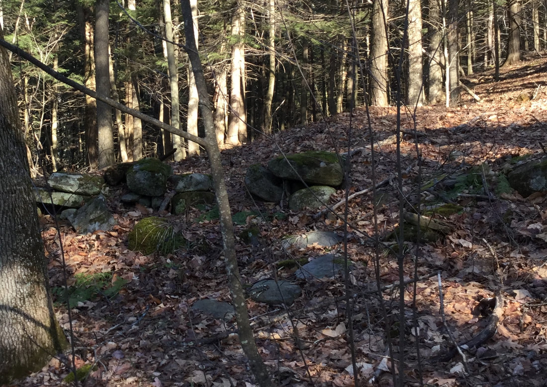 The old roadways also became depressions between the higher stone walls, from being tramped by on by people, animals, and carts and wagons of cargo, and water washing in the low points. 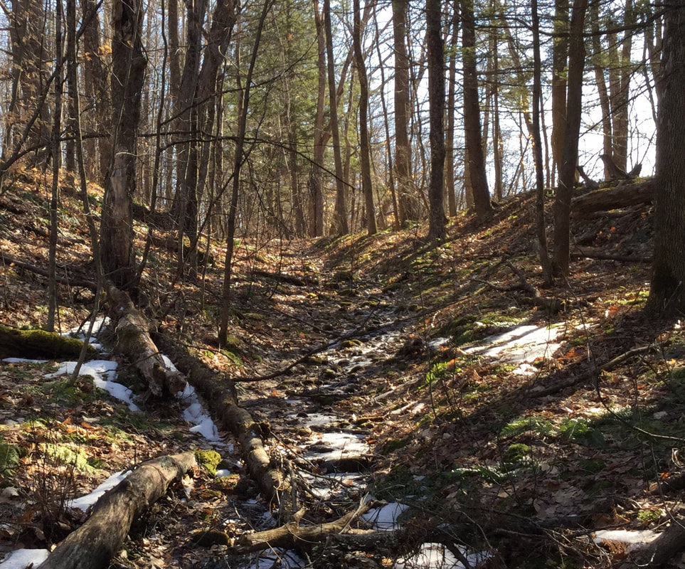 To the right I could start to see an open field. I wondered if maybe this road would lead to Olcott Road, near where the original Meetinghouse of Norwich first stood. 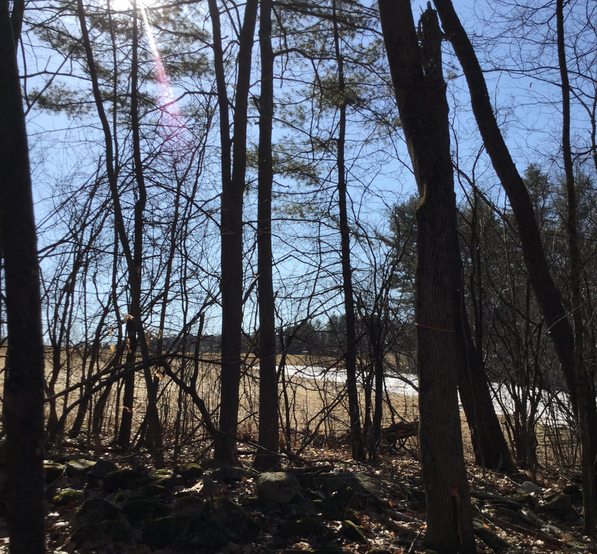 The high stone walls continued along both sides of the pathway. 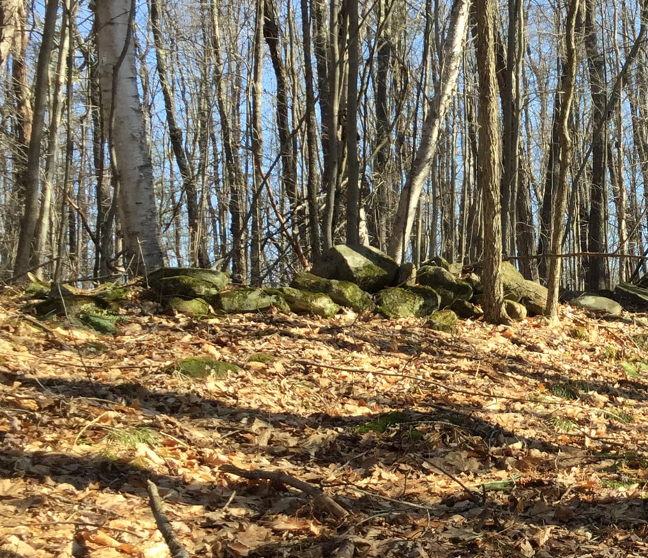 I wonder exactly when these walls were built. Maybe there's an early settler's diary at the Norwich Historical Society with an entry about working on the roadway, and moving rocks right here in this location. 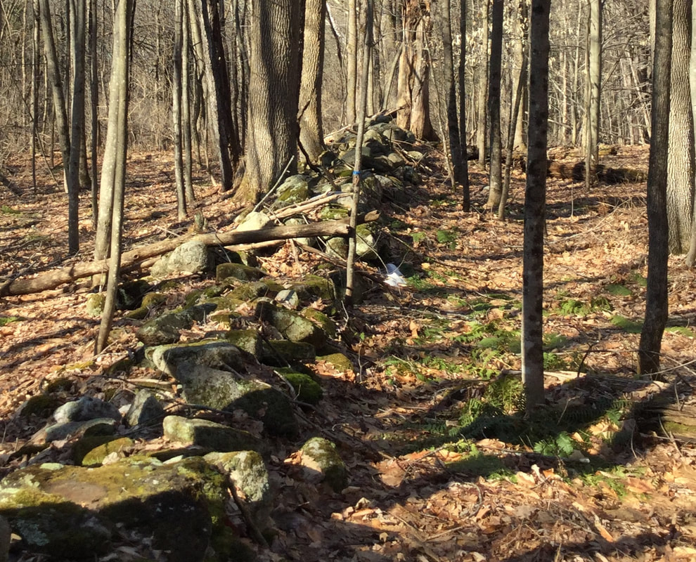 This has been a nice March for hiking. When I was out, it was mid-morning, and even though the snow was melting slowly, the ground was firm enough to walk without sloshing in slush or mud. That will be changing soon though. As I hiked around, following this old road, the ground leveled off a bit. There was a break in the wall. 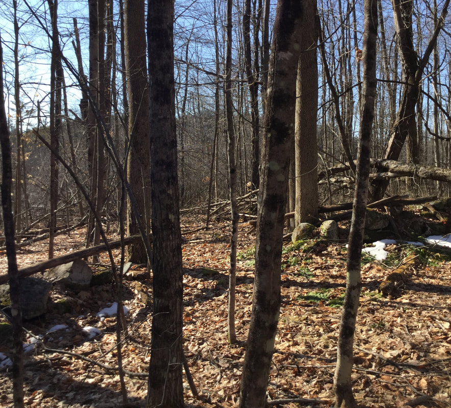 I found what looked like an old corner in the stone wall on the east side. There was an iron pin, most likely left from a survey... 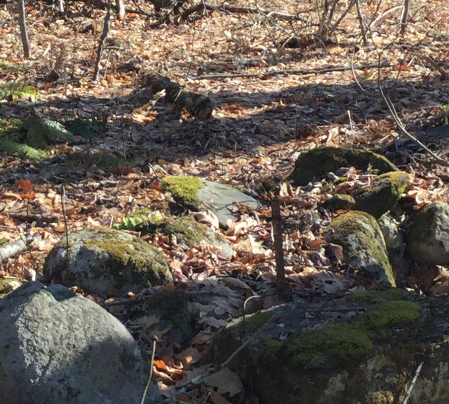 ..and what looked like a witness tree, a many trunked yellow birch giving witness to an old corner. 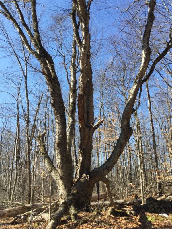 I looked around, and checked the time. I had a allotted myself a half hour for this walk, and it had already been 35 minutes, so I decided I'd better head back. 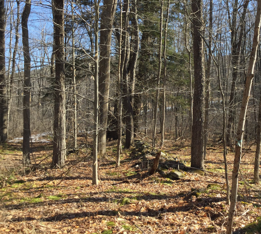 I admired the stone walls on the way back, and the wide swath of the roadway. 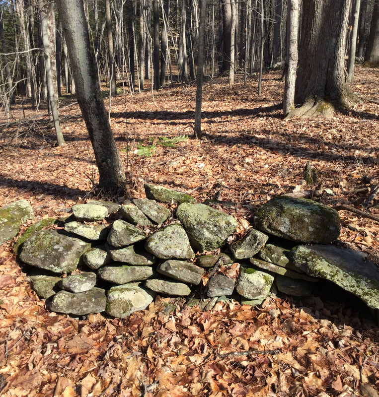 On my way back, I noticed a very large oak tree, by a turn in the road. It appeared to be the largest, oldest tree around, and it was right near a ravine, or seasonal streambed that dropped off, down to New Boston Road.
As I headed back down the last leg of the old road, toward the car, I could hear chicadees singing. When I got back home, I did a little research about this road. I don't know what it was called, but it looks like it was on the map in 1855, and was a way to get from the Meeting House to the starting point of New Boston Road, via Olcott Road. Here is a map from Google Earth: The dashed line shows the route of the road I was on. 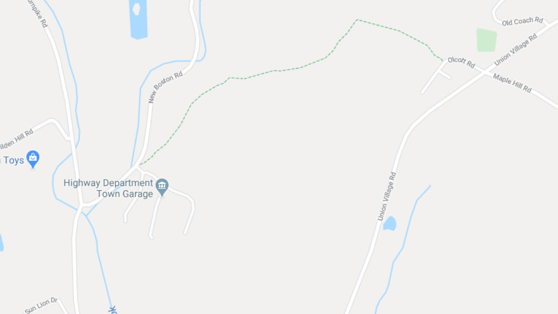 And here is the 1855 view: I circled the area in question. 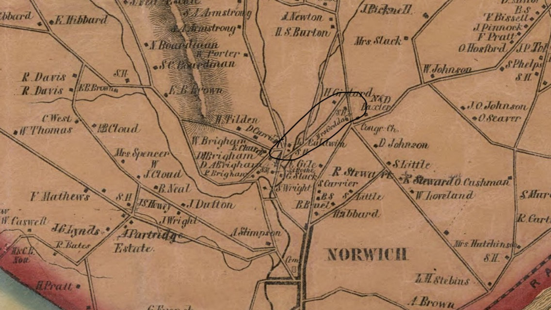 And here is the Google Earth imagery with the same area circled: 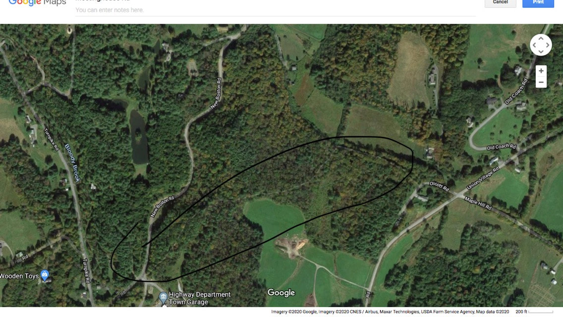 Fortunately, practicing social distancing doesn't have to mean staying out of the great outdoors. Getting excercise and fresh air is good for your body and your peace of mind, and it may even help you to sleep better at night! Thanks for hiking along Old Roads, Rivers and Rails of the Upper Valley. with me, Bob Totz If you haven't already done so, feel free to join the growing list of subscribers to this blog. Just send an email to [email protected] and we'll add you to the club. Sources: 1855 Windsor County VT map by Doton:
https://www.loc.gov/resource/g3753w.la001193/?r=0.305,0.282,0.928,0.392,0
4 Comments
Continued from Signs of Norwich Part One Having reached the divided highway just before the Interstate 91 entrance, I crossed Main street and headed back toward the Norwich village center. The first sign I encountered was this sign at the entrance of the town, "Centennial gift of The Norwich Women's Club". I think it's neat that Norwich, and some other nearby towns were chartered on July 4th. The royal governor who issued the charter at that time, had no idea what that date would mean, fifteen years later, when our Declaration of Independence was issued. 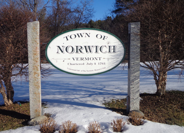 Sign at the entrance to Norwich from Route 10A. Upon taking the above photo I noticed an area that seemed to be graded uphill, toward the interstate on-ramp.  There were a few nice old maples flanking what might have been a roadway at one point, and I wondered if this might have been the old route of Lewiston Hill Road, before the interstate was built.  Looking toward town, from above the Norwich sign, near the I-91 entrance. Here is what this area looked like on a 1961 D.O.T. map: 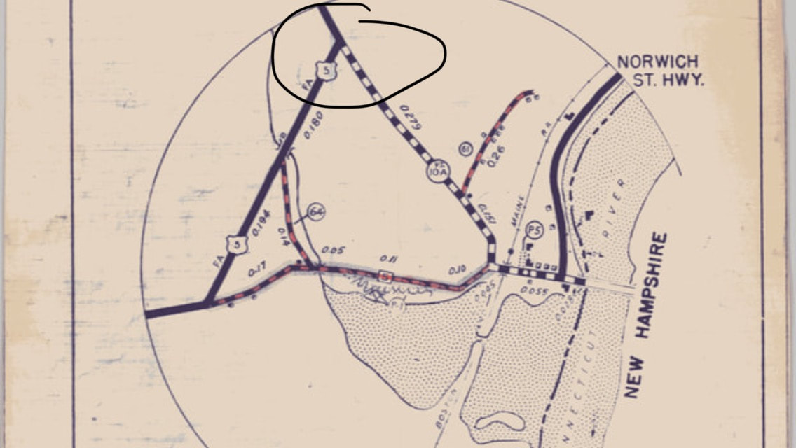 Here is a transition map, from the Vermont Department of Transportation, showing both pre-interstate, and post-interstate roads: 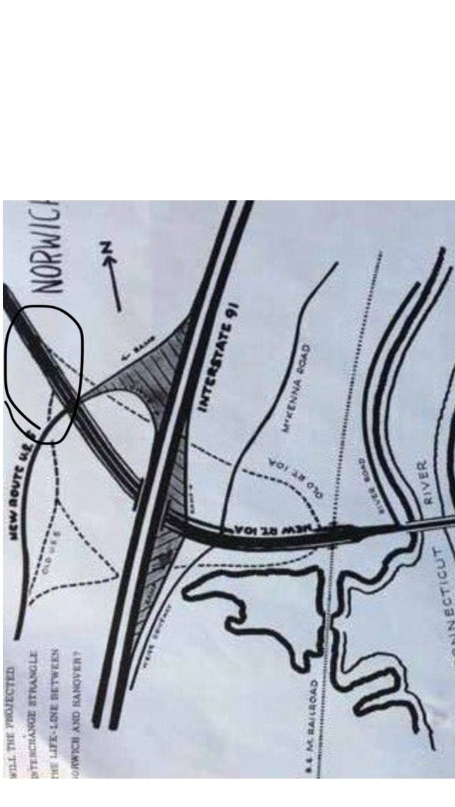 Above, in the lower left is an interesting question: "WILL THE PROJECTED INTERCHANGE STRANGLE THE LIFE-LINE BETWEEN NORWICH AND HANOVER?" The view below: Looking toward Lewiston, through the chain link fence above the Interstate entrance, I could imagine the days before the interstate. There must have been an awful lot of digging going on!  Looking across I-91 and entrance ramp toward Lewiston, from Norwich. But let's get back to the Signs of Norwich today: The following photo shows part of a sign:  Here is the other part: 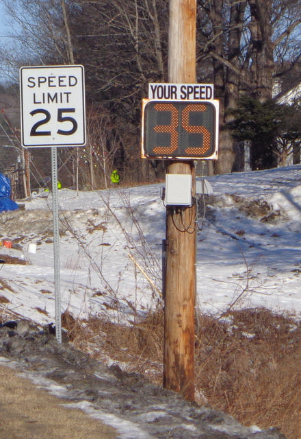 Uh-oh! The Lions are here in Norwich, and they are a very busy group of community minded folks, who's focus is to help others. This type of sign, for a benevolent association, is often seen at the entrance to a town: 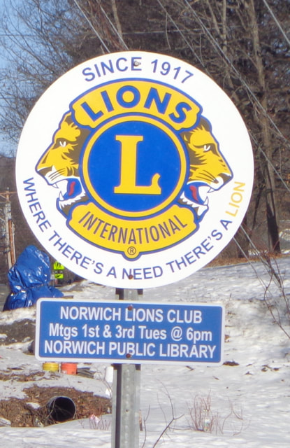 Lions Club is active in Norwich Here's our neckless friend again. This time he's letting us know we should be cautious, because there will be a crossing "AHEAD". 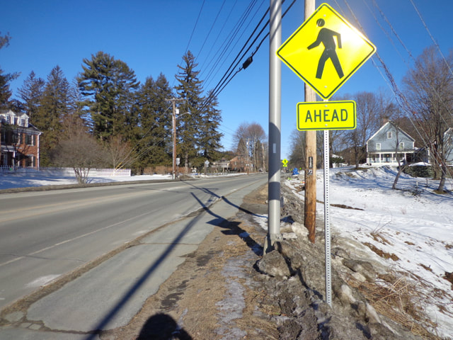 Pedestrian Crossing AHEAD Here's an interesting trio: Appalachian Trail, A Chinese (?) sticker, and an M.I.A. sticker. 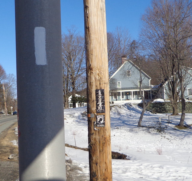 A closer look at the two on the utility pole: 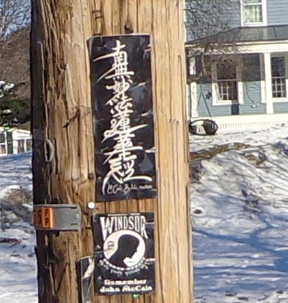 The next sign shows our footless friends, again. Do you know why this sign is shaped like home plate? 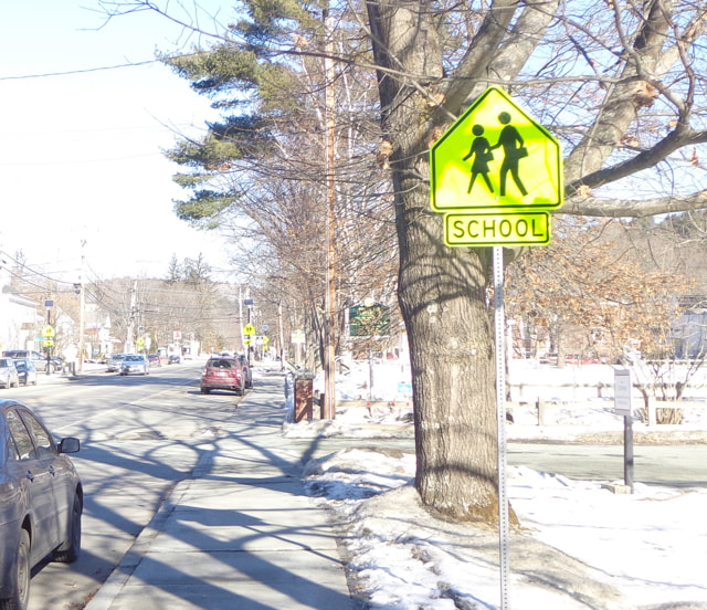 I like the way the following sign begins: "Welcome"  As we proceed to the school entrance, we can see a few safety related signs along the driveway: 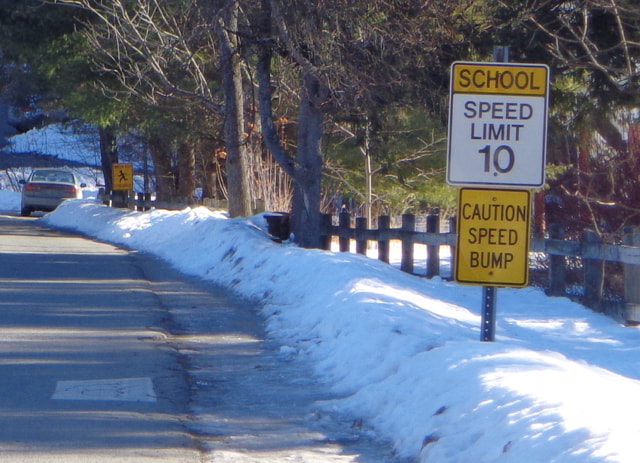 The next sign is a little blurry, but I think it may be one of the predecessors to today's neckless sign characters. This one looks like an older version: 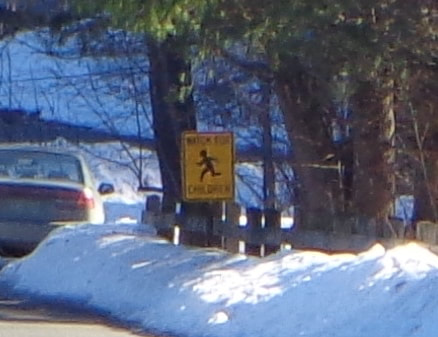 Here's one more, at the schoolyard: A sign of the times for someone like me, who grew up with a lot of second hand smoke in public places. 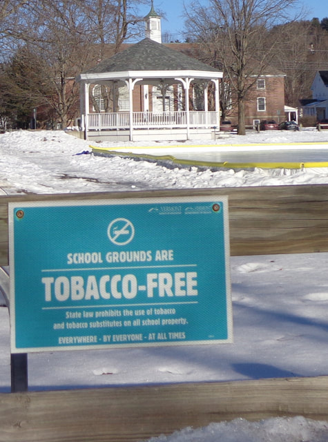 Meanwhile, back on Main Street: 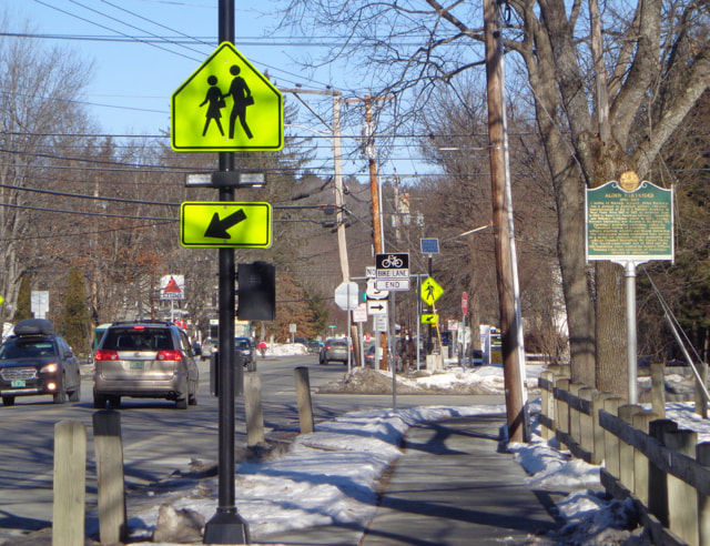 The Other Side of the Rapidly Flashing Bulb Pedestrian Crossing If you happen to amble on to the green, you'll see that we have a great little water fountain in town. 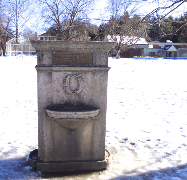 If you look closely, you can see a little sign on it: 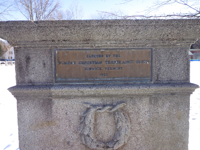 If you look really closely, you can read it. It's also a sign of the times. I find temperance to be an interesting term. Technically, it means moderation or restraint. 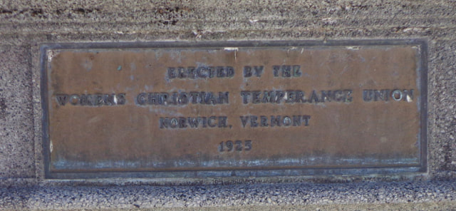 ERECTED BY THE WOMENS CHRISTIAN TEMPERANCE UNION NORWICH, VERMONT 1925 If front of the Bandstand there is a tribute to a local hero, Alden Partridge. 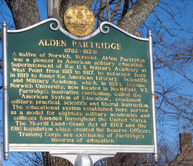 Historical Marker in Honor of Alden Partridge I am still amazed by the fact that Alden Partridge, as early as the 1820's, used to take groups of students on overnight trips, hiking up into the White Mountains, walking all the way from Norwich, bush-whacking up the great peaks, and sleeping under the stars. I guess he'd approve of the Appalachian Trail running through Norwich, and his plaque lying along the Trail. Thanks for walking down Old Roads, Rivers and Rails of the Upper Valley with me, Bob Totz. If you haven't subscribed yet, just send an email to [email protected], and we'll add you to the club. 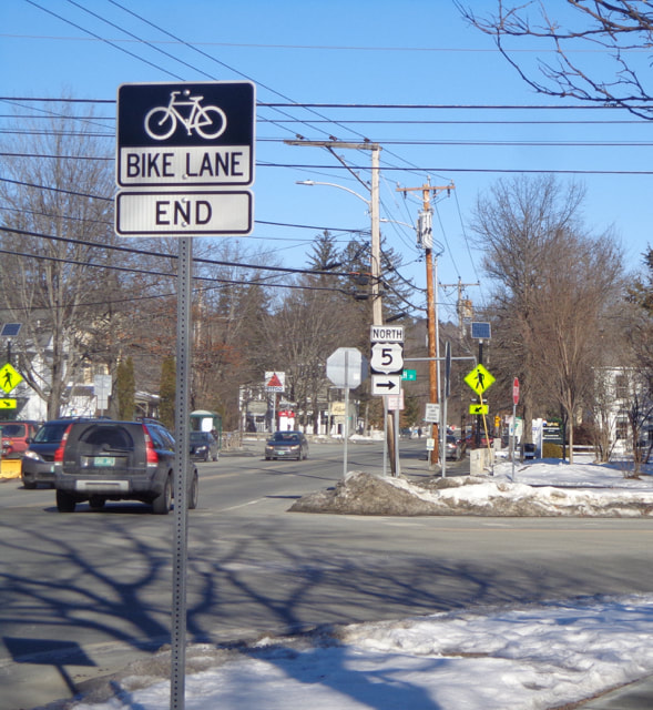 Norwich Vermont, Main Street. Photos taken January 29, 2020
There's a map that shows how many cases there are of COVID-19, deaths from the virus, recoveries, and other spatially related data, worldwide, and by country  COVID-19 Tracking Map. 3/17/2020, About 10:00 AM. The map is updated often, and gives you an idea of the exponential spread of the virus. You can go there anytime, and refresh the page, and see how and where the virus is spreading. (It may refresh itself, but I'm not sure at this point.) There is much more information than what is shown above. Here is a link to the map: https://www.arcgis.com/apps/opsdashboard/index.html#/bda7594740fd40299423467b48e9ecf6 There is also a table version of a COVID-19 Tracking Map that can be found here: https://ncov2019.live/ As many of us are dealing with severe change in our daily lives, I suggest getting out into the fresh air if/when you can, while still practicing "social distancing".
Stay safe everyone. - Bob Totz oldroadsuppervalley.weebly.com The place to go to find information on the Valley Quest program is vital communities, link here: https://vitalcommunities.org/valleyquest/ For those of you who aren't familiar, the Quest program is a great way to teach and learn local history. It's for children and adults, basically anyone who likes history and the outdoors  After the article on Centertown came out, I was contacted by the folks at Valley Quest, which is adminstered by Vital Communities. One of the quests is quite relevant, and I present just the beginning of the Quest Poem here. For the rest of the quest, go to this link to a pdf file of the Centertown Quest: www.vitalcommunities.org/valleyquest/wp-content/uploads/sites/4/2014/09/Center-of-Town-Quest-4-July-2018.pdf Here is the beginning of the Quest: "Clues: Many years ago, upon this green Hartford’s Center of Town was a bustling scene. So park your car and come on down Let’s explore this old ghost town! Start at something red, white, and blue And about old Hartford we will tell you. King George the 3rdwas no nerd On July 5th, 1761 he gave us his word By signing the charter to declare this town Hartford. Now gaze across the green And imagine this scene: Folks coming down from the hills To practice their drills, In preparation for fights To free up our rights. While imagining the beat of their marching feet Turn your body to look across the street. Note the tall trees, so scary and old They are *locust trees we are told..." For the rest of the quest, (and this great poem!), go to: You may also be interested in the 2020 "SuperQuest". Info at: https://vitalcommunities.org/valleyquest/superquest/ Thanks for traveling down Old Roads, Rivers and Rails of the Upper Valley, with me, Bob Totz Related articles: Historic Centertown King's Highway, Part 2: White River Jct VT King's Highway, Part 1: Lebanon NH 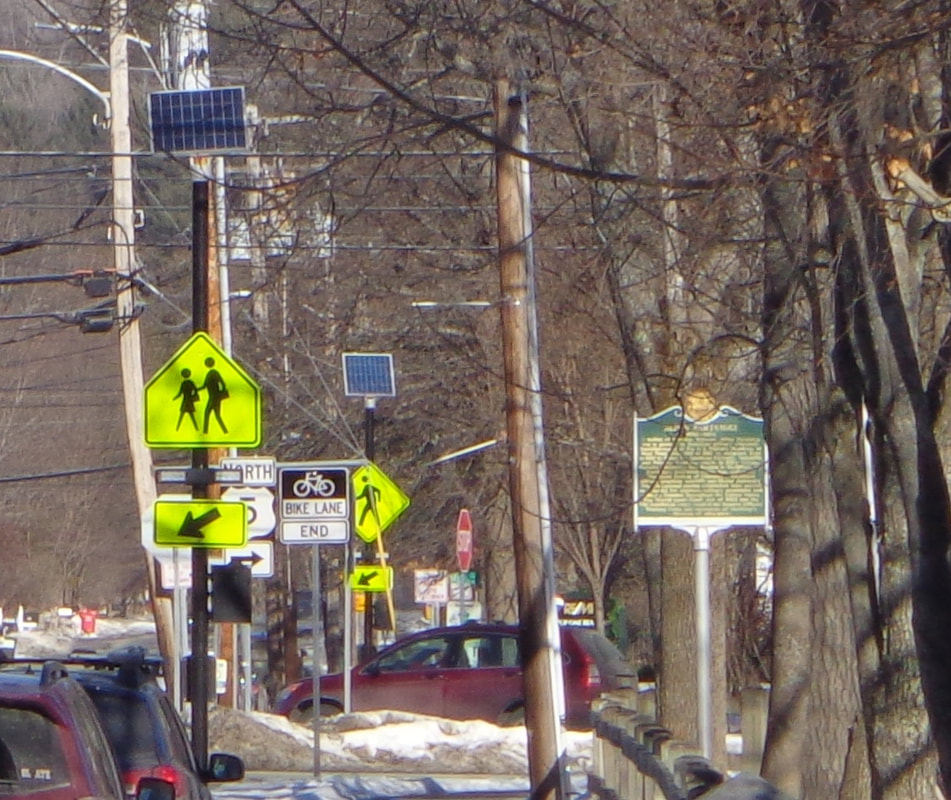 Have you ever looked carefully at the signs in your neighborhood? Most of us really don't, and can't, read all of them, especially if we're driving, and trying to concentrate on the road. We just sort of see them in the background. You don't actually have to read the letters "SPEED LIMIT" because you've seen that type of sign so often. You just focus on the big number "25". Other signs can just blend into the background, or are just too small to read anyway. However, if you walk, and pay attention, you will see that there is a lot of information directed toward you, as you stroll down the street, at least, that's how it is in Norwich Vermont these days. There are many different types of signs in Norwich. Let's explore: First, there are signs to attract potential customers to a business, such as this first one, as we head toward Hanover. 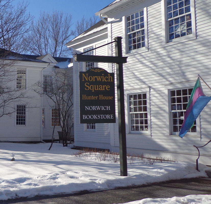 This one directs us to the bookstore, but it also let's us know that this is the Hunter House. Do you know who Hunter was? Another type of sign is the street sign, provided by our government, to help us figure out where we are, and how to get where we are going, or at least until GPS came out. At this corner, there's a common street sign, but also a granite post, in case the sign comes down. Although...the post sort of makes it look like it's the corner of Elm Street and Elm Street. 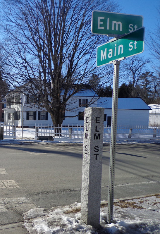 Continuing on our walk, we soon see another type of sign, also provided by our government, the safety related sign. The basic type of this particular sign came about years ago. I guess it's so that it doesn't matter what language you speak, if you can figure out the picture. But I wonder who came out with the neckless, handless and footless people-type of cartooning? It seems to have caught on well, but there's just something weird about these characters. Why don't they have hands, feet and necks?? Maybe their hands are those rectangular shaped things at the end of their left arms? Who are these people? 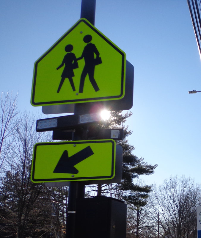 This pedestrian crossing sign has been modified with RRFBB's, a.k.a Rapidly Repeating Flashing Bright Bulbs, (or something like that). Here is also a sign provided by the government, though this one is for historical and informational purposes, as opposed to safety. I find it interesting that this one is "continued on other side"! So much to tell, so little space... 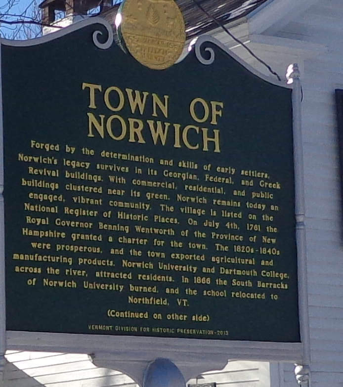 I have no idea what this "sign" (below), means, but I've been seeing a lot like them, on many utility poles these days. Can anyone interpret it, and tell us what it means in the comments section? >> 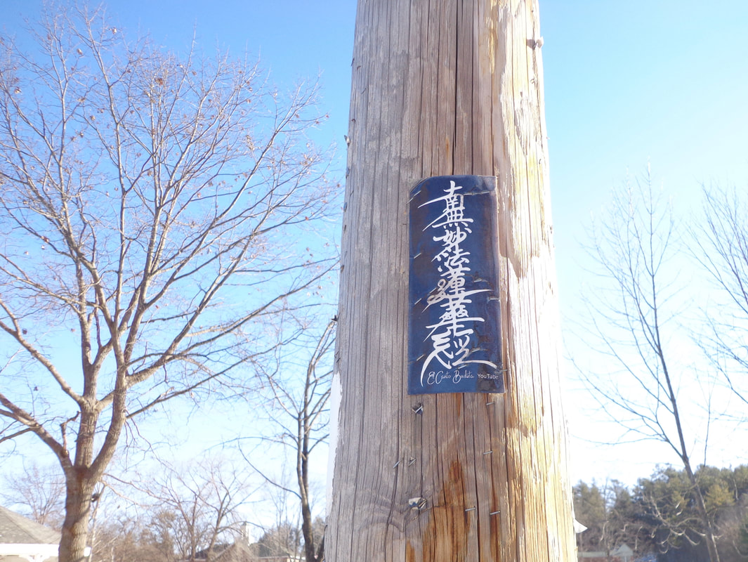 Interesting Notice on a Utility Pole in Norwich Vermont, US Route 5, Main Street. Here's one I particularly like: 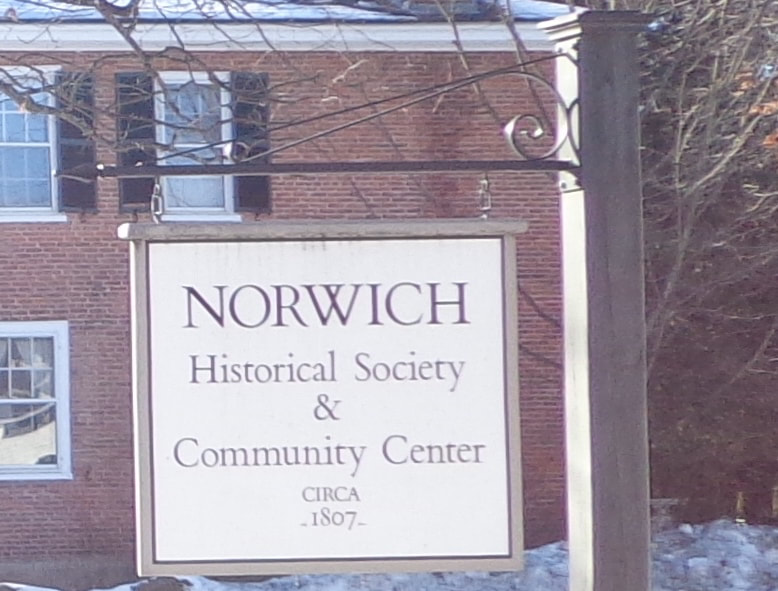 Norwich Historical Society & Community Center, CIRCA - 1807 - 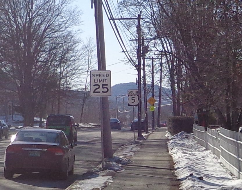 Safety: Speed Limit 25. Navigation: South US Route 5 Here's a sign for a local place of worship:  I was always taught that sharing is a good thing: 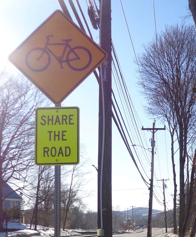 Share the Road" Signs Cropped up a Few Years Ago when Bicycle Lanes Were Introduced. A little further down the road, we come to another pedestrian crossing sign. This neckless, handless, and footless individual seems to be in a hurry, so look out!  Here's another sign I really like: " < TRAIL" The white rectangles remind us that US Route 5, and Main Street are also the Appalachian Trail. 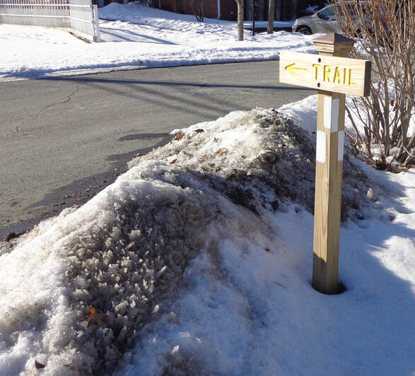 This Sign Lets You Know that You are on the Appalachian Trail. 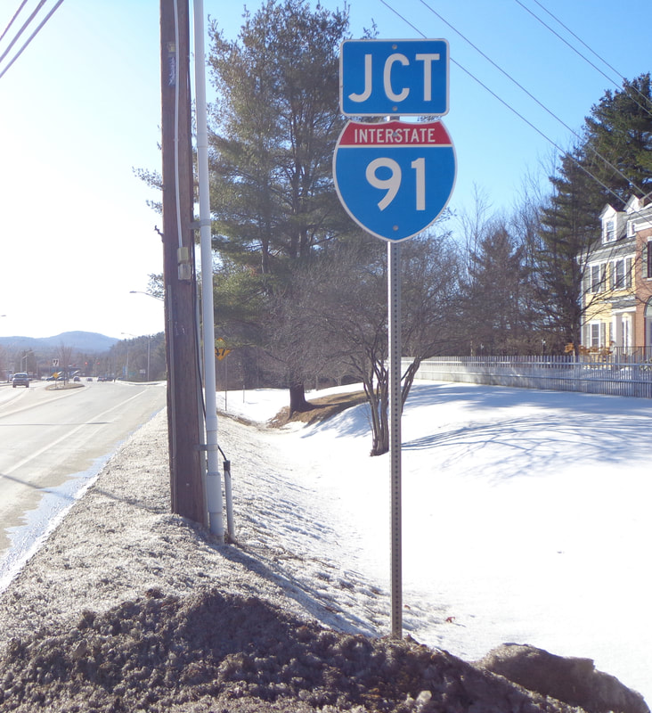 Where the Appalachian Trail and "The Dwight D. Eisenhower National System of Interstate and Defense Highways" Meet. Here's a couple safety type signs at the beginning of the median: The top one means stay to the right and don't run over the median. The lower one, a diamond shaped sign with reflectors most likely means the generic admonition: "Use Caution", which is always good advice. I have a feeling these signs weren't located here back in the 1950's. 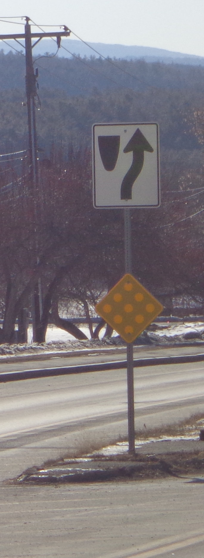 Divided Highway Begins. Use Caution Here's a safety related sign, letting you know that there will be a traffic control light up ahead. Does anyone agree with me that these lights should be flashing red on Sunday mornings, when traffic is really light? 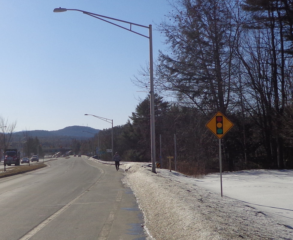 This sign is for another local trail, that heads down to the brook: 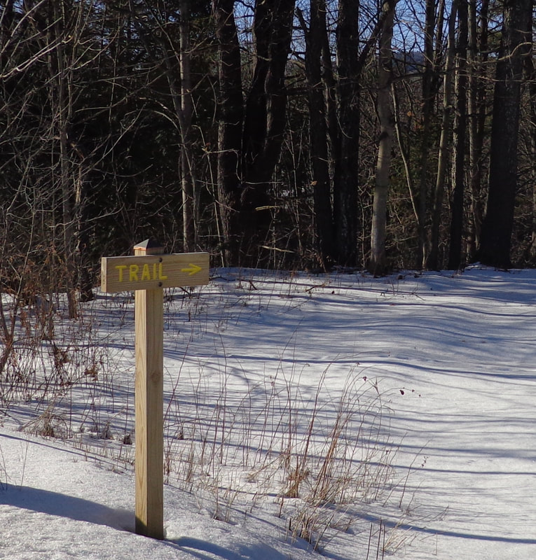 Uh oh....better check what lane you're in! 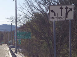 Here's one to let you know how far and in which direction to go. The small one underneath, appears to reference a "Bike Loop". 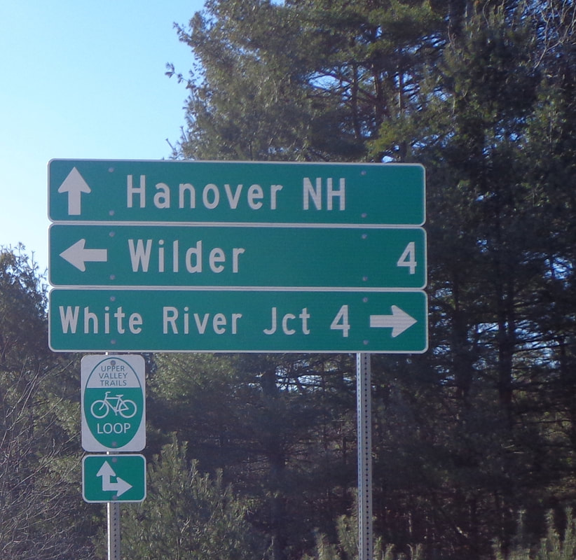 I chatted with a bicyclist a while back who spoke of the "5 and 10 Loop", with a ride to Thetford, and back through Lyme and Hanover. That sounded like a nice bicycle ride. Here's another sign I really like. How many people that live in Norwich have seen and read this memorial? I'm sure I noticed it in years past, but only subconsciously. I've lived in Norwich for thirty years, and I finally read it! I think it's really cool that this memorial was made from the bricks left in the ruins from the burned barracks in 1866. 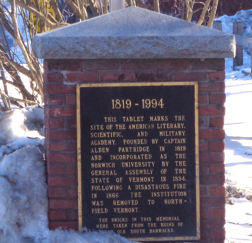 Memorial to Norwich University, on Route 5, Main Street, and the Appalachian Trail in Norwich Vermont. Thanks for walking down Old Roads, Rivers and Rails of the Upper Valley, with me, Bob Totz.
Have a comment on the post? Just click on comments and let us know what you think. NEW SUBSCRIBERS and SPONSORS are always welcome. Interested in subscribing to or sponsoring this website? Just send an email to [email protected] Thanks! 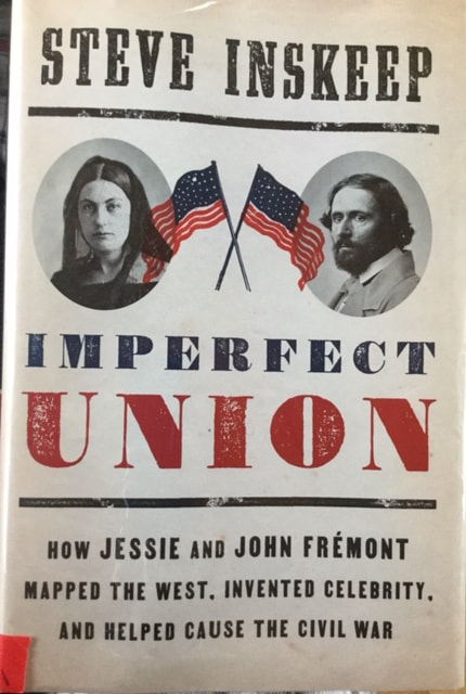 Book Review: IMPERFECT UNION by Steve Inskeep “How Jessie and John Fremont mapped the west, invented celebrity, and Helped cause the Civil War.” Penguin Press, 2020 Many remember that John Charles Fremont was an American explorer of the mid 19th century. In this book you will not only read about his explorations, but you’ll also learn much about politics, especially the 1856 presidential election, which was the first election for the new political party known as the Republicans. Although Fremont lost the 1856 presidential election, the campaign set the stage for the up and coming republican politician Abraham Lincoln to win the presidency in 1860. This book was sitting innocently enough, on a shelf at the Norwich Public Library, when I was there for another reason, a couple of weeks ago. When I happened to notice it, I immediately recognized the name “Fremont”, and the phrase “mapped the west”. I had to borrow this book. It was a brand new release, so I only had 2 weeks in which to read it. However, there was no one on waiting on a reserve list, so I was able to renew it and finish it a week later. Steve Inskeep is a familiar name to many of us. He has been on National Public Radio for years. He is an excellent writer, and has done in depth research for the book. Steve does a fascinating job of illuminating the relationship between John Fremont, and his wife Jessie, daughter of an influential senator. Jessie was a great force in John's life, helping to increase his popularity through her writing and tireless efforts in support of John Charles Fremont. One of the things I find fascinating is the similarities in politics with that of our age. Back then, the telegraph was brand new, and revolutionized the spread of “news”, allowing newspapers all over the country to obtain stories very quickly. Different newspapers were owned by different people, with a different spin on the same story, depending on their politics. Southern papers in general, supported slavery, and their stories reflected that, while many northern newspapers saw things differently, and their viewpoint reflected that in the way the news of the day was told. As an example, when representative Preston Brooks beat republican senator Charles Sumner with a cane until he was unconscious, the two sides of the slavery issue had very different spins on the story. It’s a fascinating book, and well worth the time reading, especially during this presidential election year. If you enjoy american history, geography, and politics, you’ll find this book is well worth picking up. I highly recommend this book to students of, and those interested in American History, and what we can learn from our past, in order to create a better future. - Bob Totz Old Roads, Rivers and Rails of the Upper Valley oldroadsuppervalley.weebly.com 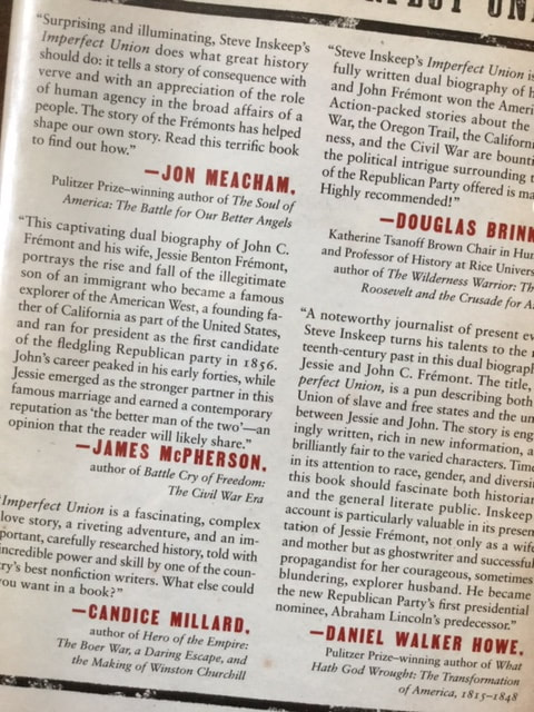 A Portion of the Back Cover of Imperfect Union by Steve Inskeep
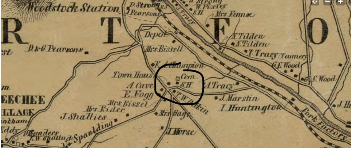 1855 view from the Windsor County map by Walling. Center of Town Road in Hartford Vermont is one of the oldest roads in the town of Hartford Vermont. King's HIghway connects with it, and at that intersection, formerly stood the original Town Meeting House. There is an old cemetery still there too, and the site of a former schoolhouse as well. 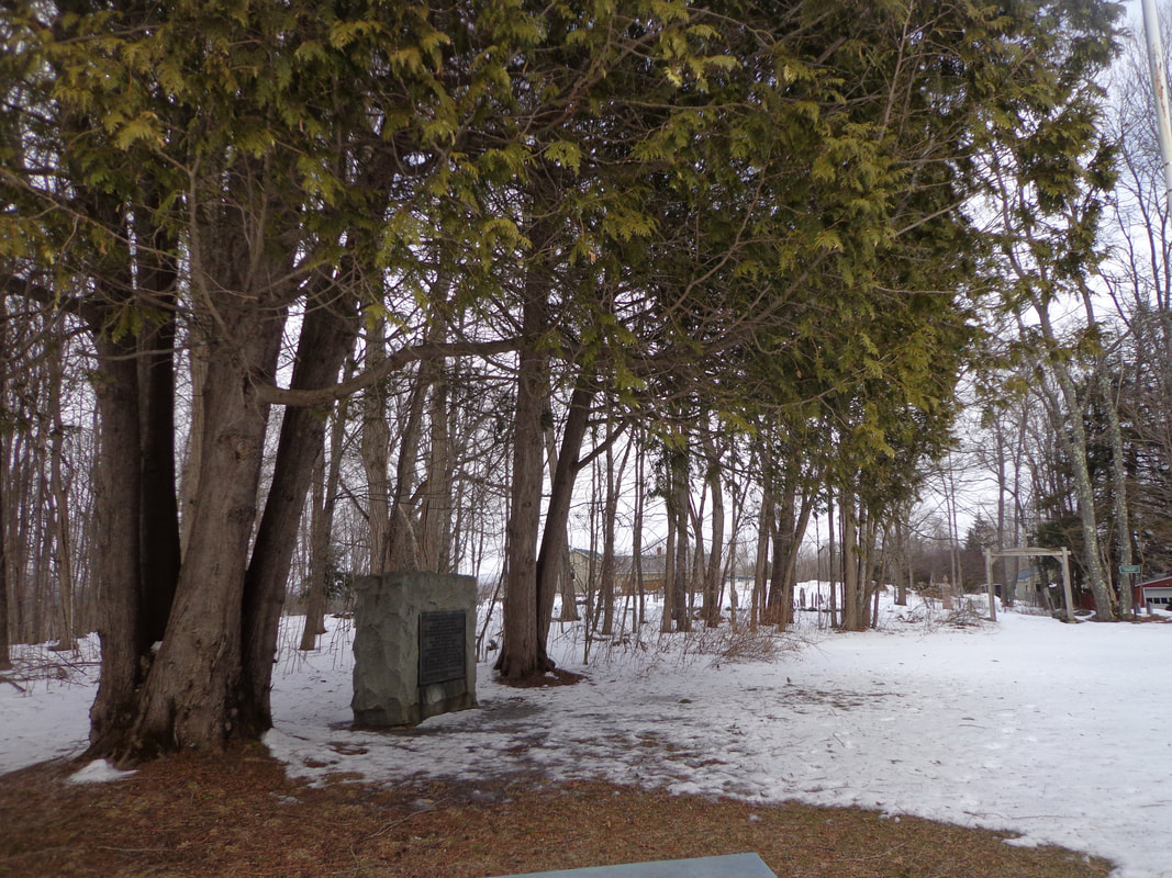 Also at the intersection of King's Highway and Center of Town Road, is a large stone monument with a plaque, that was laid there in 1911 by the Daughters of the American Revolution, or D.A.R., 1911. It is flanked by two beautiful, mature cedar tree clusters. 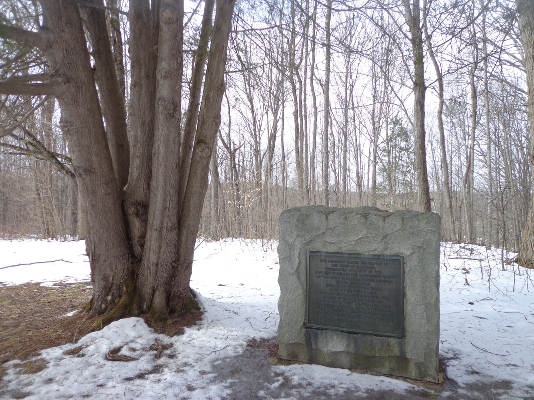 The plaque reads: THIS MEMORIAL MARKS THE CENTER OF THE TOWN OF HARTFORD, DETERMINED BY SURVEY IN 1774. HERE WAS THE PARADE OR CONVENIENT GREEN ON WHICH WERE DRILLED HARTFORD'S SOLDIERS IN THE REVOLUTION. HERE STOOD THE MEETING HOUSE BUILT BY THE TOWN IN 1784, USED FOR RELIGIOUS SERVICES UNTIL 1828, AND FOR TOWN MEETINGS UNTIL 1872. HERE ON MEETING HOUSE SQUARE WAS HELD THE ANNUAL JUNE TRAINING DAY UNTIL 1844. NEARBY STOOD FREEGRACE LEAVITT'S TAVERN AND UNTIL 1840 THE TOWN CLERK'S OFFICE. -------------------------------- ERECETED BY THOMAS CHITTENDEN CHAPTER D.A.R. JULY 4, 1911 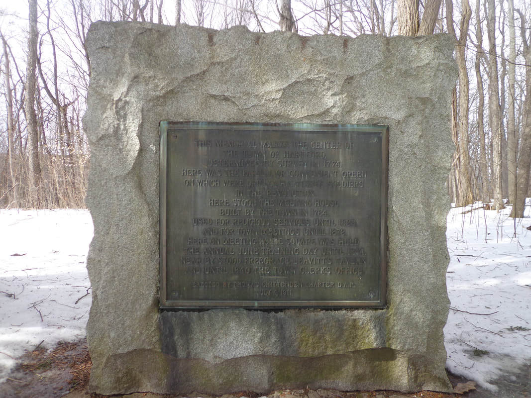 D.A.R. Memorial Plaque in Centertown, Hartford Vermont, Placed July 4, 1911 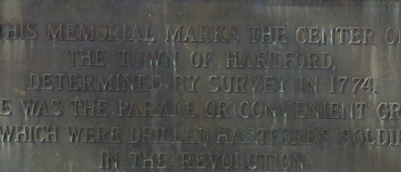 Close-Up Look at the Lettering on the Plaque. A Schoolhouse was also located at this spot, and an old cemetery. 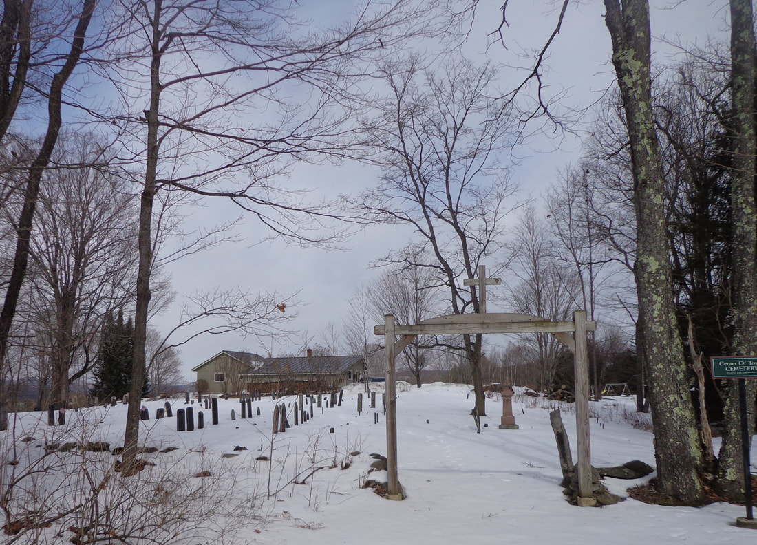 Center Of Town Cemetery, Hartford VT 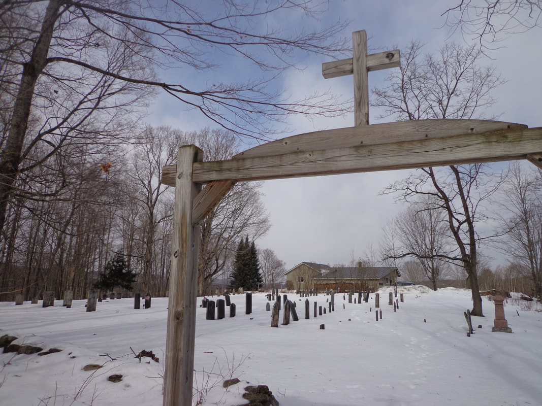 Below is a topographic image from the U.S. Geological Survey in 1908, showing the Centertown area, which has been circled. As you can see, the spot is located on a knoll, with northwestern exposure. The King's Highway appears to continue past the cemetery, downhill, across the Woodstock Railroad tracks (today's US Route 4), to today's Old Quechee Road. 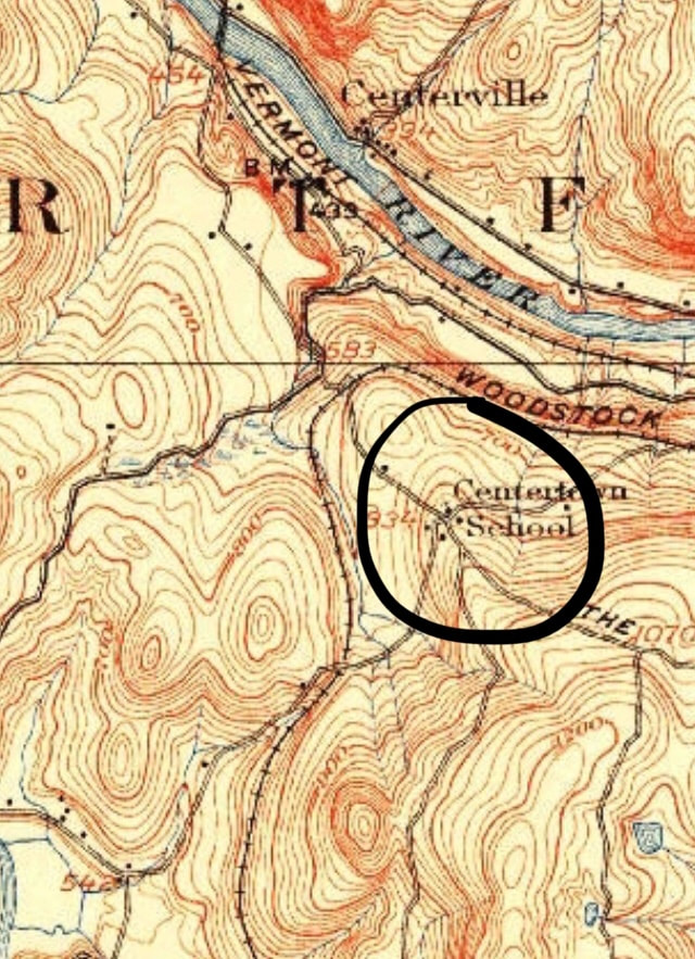 Centertown in 1908. USGS 15 minute Series, Hanover Quadrangle. By 1996, this area looked a little different, below the old parade ground at the Center of Town. As seen below, the King's Highway was shown as a double dashed line, an unimproved road, on both sides of Center of Town Road. The parade ground can be seen as a small triangular shaped area where Center of Town Road and King's Highway meet. 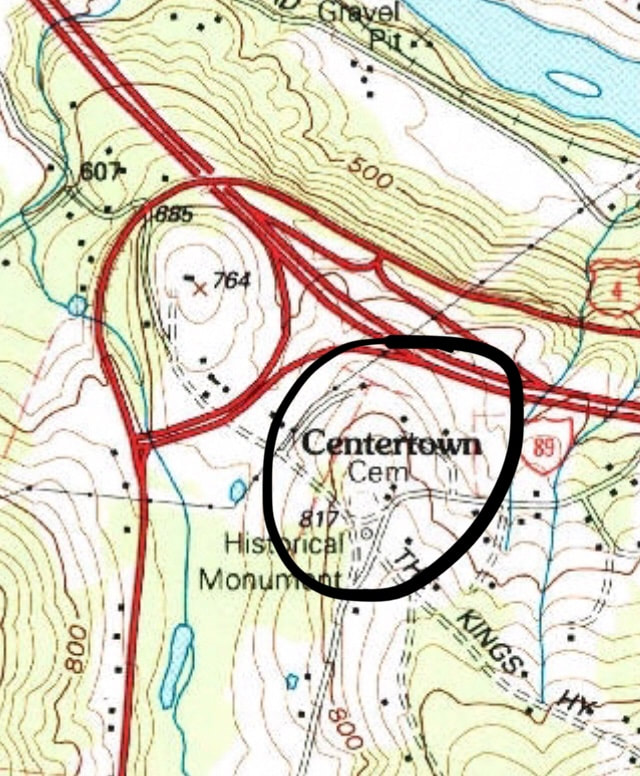 USGS Representation of Center of Town in 1996. 7.5 Minute Series, Quechee Quadrangle. Note above, that US Route 4 follows the former path of the Woodstock Railroad. In the map image below, from 2012, we get yet another, more recent look at the Centertown area, without topographic lines. 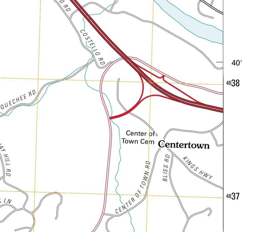 Last week my wife and I took a ride up to Centertown. I had been up that way only once before, for an event on Bliss Road, about 20 years ago. On the old maps, it appears that Center of Town Road connected to River Road, on the south side of the White River, and then crossed the King's Highway, and continued to Quechee, on what is today Quechee Main Street. (See the 1855 map at the top of this article.) Today Center of Town Road appears to have been split into three sections, thanks to the Woodstock Railroad, and later, US Route 4 construction. 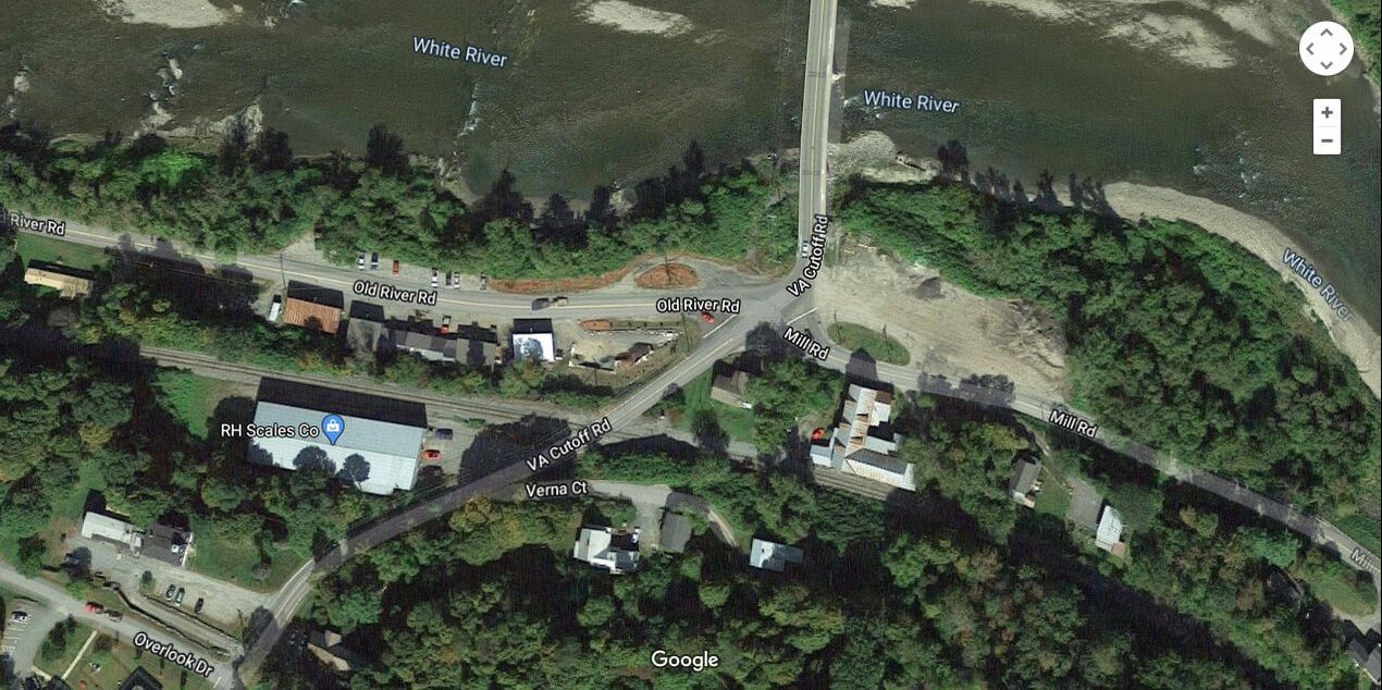 Mill Road, River Road, VA Cutoff Road, and Bridge to Hartford Village. Courtesy Google Earth. The eastern section starts on Smith Road, from River Road. 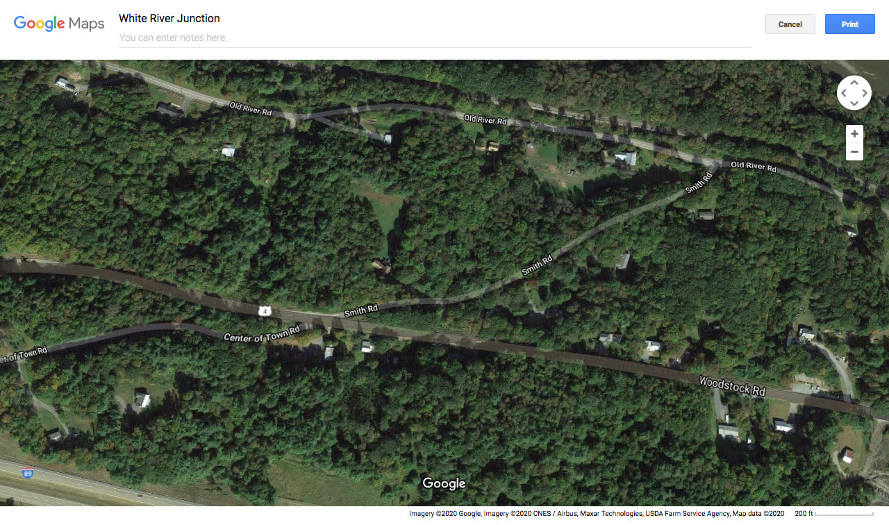 Smith Road is shown leaving River Road in upper right. Once it crosses Route 4, it is called Center of Town Road. I wonder why they named that end Smith Road? We drove up Smith Road, and it was a very interesting little paved portion of an old road. It looked like the road could use some work, as the cracks and frost heaves were pretty serious. When we climbed to Route 4, we simply crossed and continued up Center of Town Road, to the top, where the old parade ground is located. 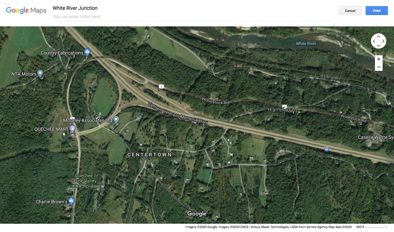 Current Google Earth image of Centertown, with US Route 4 and I-89 Shown. Center of Town Road leads back down to Route 4 on the south side, and then a quick right puts you on Quechee Main Street. There was a time though, when there was no route 4 to cross, or railroad, before that, and you simply just continued down into Quechee. The USGS map below, from 1908 shows the old route, though the Woodstock Railroad was in existence then, and it looks like there was a railroad crossing about where Center of Town Road meets Route 4 on its southern end today. 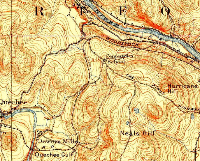 1908 view, showing the route of Center of Town Road from the White River, up to Centertown, and down to Quechee. 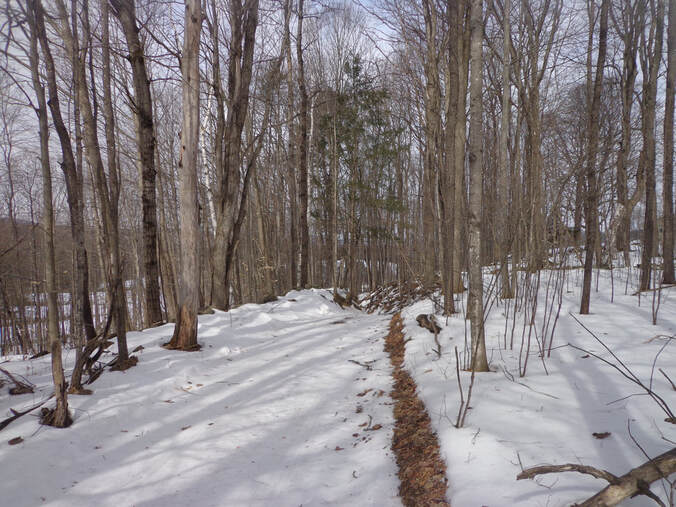 Extension of King's Highway heading downhill toward I-89. Today, straight across from the paved King's Highway, just below the Center of Town Cemetery, the King's Highway appears to continue as a trail, downhill toward Interstate 89, (seen above). Just beyond the Center of Town Cemetery, on the far corner of King's Highway and Center of Town Road, sits the former "Freegrace Leavitt's Inn". A formal colonial home and tavern, it has sat as a silent witness to two hundred-plus years of history. 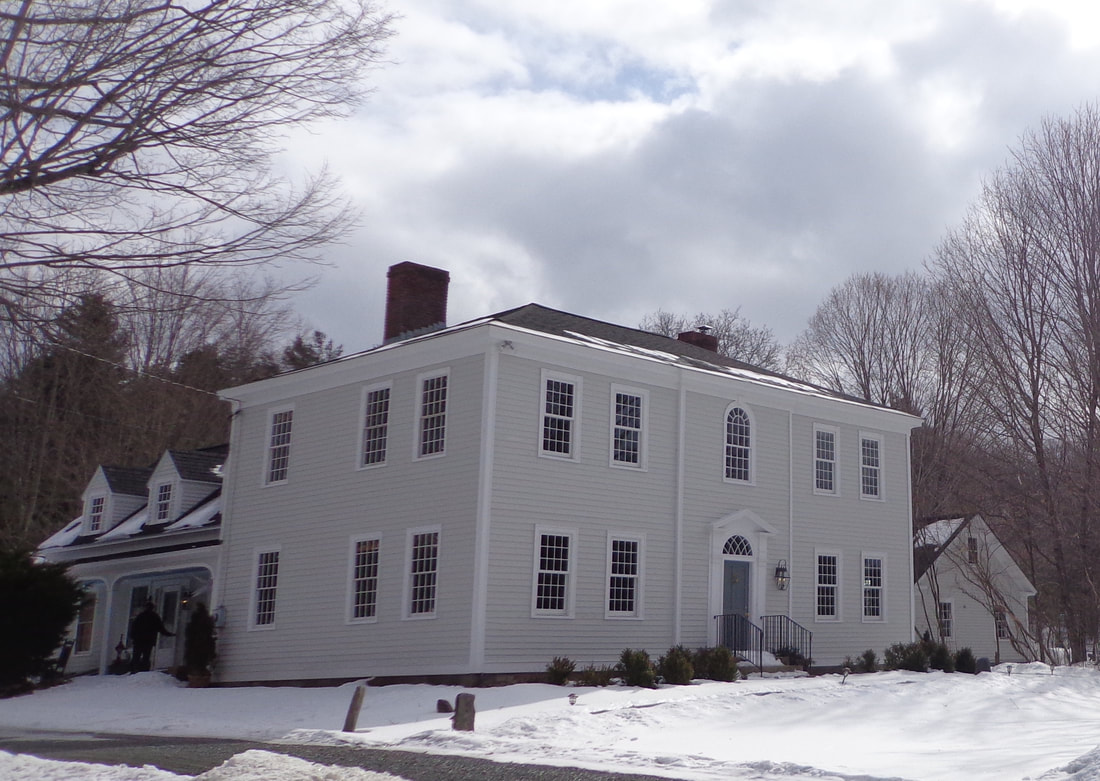 Former Freegrace Leavitt's Tavern and Hartford Town Clerk's Office, at Centertown. The Center of Town area in Hartford Vermont is a historic place that saw much activity in the past. Revolutionary soldiers drilled there. The Town Clerk worked there. The Meetinghouse was there, and the Tavern too. It was a major crossroads in it's day, but today it is a "Back Road". Thanks for riding along on Old Roads, Rivers and Rails of the Upper Valley, with me, Bob Totz.
If you haven't already subscribed, feel free to send an email to [email protected] and we'll add you to the growing list of members who receive email updates whenever there's a new Old Roads, Rivers and Rails of the Upper Valley post. Sources: 1855 Windsor County Wall Map by Walling: www.loc.gov/resource/g3753w.la001193/?r=0.659,0.503,0.092,0.039,0 USGS Topographic Maps available at "Topoview": ngmdb.usgs.gov/topoview/viewer/#13/43.6488/-72.3650 Aerial View Images from Google Earth and Google Maps. Other Photos by Bob Totz |
AuthorI'm Bob Totz, retired VT postmaster, and historical geographer ARCHIVES:
October 2021
EXPANDED ARCHIVES: AUGUST 2021 1858 Johnson Map of North America MAY 2021 1795 - "Road Over the Mountain" - Part Two Historic Toll House For Sale 1795 - "Road Over the Mountain" Part One OCTOBER 2020 Finding That Special Peaceful Place AUGUST 2020 Kayaking on the Pompy JULY 2020 Pt. 2: What the Heck Are These Things? JUNE 2020 Bob's Bio... What the Heck Are These Things? Pt. 1 MAY 2020 Stone Walls and Spirits The View APRIL 2020 Sunny Brook Farm Relics: Pt 2. Sunny Brook Farm Relics: Pt 1. MARCH 2020 Signs of Norwich Pt. 2 COVID-19 Tracking Map Centertown and Valleyquest Signs of Norwich Pt. 1 "Imperfect Union" - Book Review Historic Centertown FEBRUARY 2020 King's Hwy Pt. 2 WRJ Museum at Post Mills Airport Chatauguay Vermont The Independent Farmer poem Traveling Along the King's Highway - Lebanon NH JANUARY 2020 Finding Parkhurst Cemetery In Search of Parkhurst Cemetery Affordable Housing The Old Stone Grill Two Rivers Trail-Kmart License and Registration, Please! Prohibition, Murder and Dr. Seuss Peace, Paris, & P.O. DECEMBER 2019 BLOGGER'S LINKS Welcome to Old Roads Love-Quail Hollow fun Dartmouth Cemetery SEPTEMBER 2019 E. Thetford Cemetery JUNE 2019
Taps: Meetinghouse Cemetery 4-Corners Borders Quest Old Iron Gate Stumbling Upon History Sunrise Walk MAY 2019 4 Corners Cemetery Strafford's Abandoned Foundations Art in Old Stonework APRIL 2019 Strafford Tpke Pt 2 Strafford Tpke Pt 1 White River Valley FEBRUARY 2019 Learning from Historic Maps of the Upper Valley Change in Lewiston VT JANUARY 2019 A Vermont Ski Waltz John Ledyard 1773 What is the Upper Valley? DECEMBER 2018 Dartmouth Green Music Video: Sometimes Music Video: Montreal Express Railway Disaster of 1887 |
 RSS Feed
