|
Welcome! Scroll Down for Posts and Archives.
Other Menu Options at Top |
|
|
|
Today I am entering one of my favorite Old Roads posts. This one is from May, 2019. This is one of my favorite hikes, especially with my buddy Mike Z. ----->  A Trip Down an Old Road to Find an 1800's Graveyard. The Roberts-Sharon Cemetery is also known as Four Corners Cemetery. It is located in the northeast corner of Sharon, Vermont and is near the four corners area, where Chapel Hill Road crosses the old Strafford Turnpike. After that intersection, I think Chapel Hill becomes Copperas Road, or at least it does, once it crosses the Strafford town line. 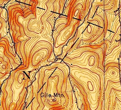 Chapel Hill Road, Sharon, running from lower left to upper right. Turnpike Road coming in from lower right to upper left. Four Corners area is the intersection of the two roads. We met at the Beaver Meadow schoolhouse. My friend Mike jumped in the jeep and we drove out Chapel Hill Road North. 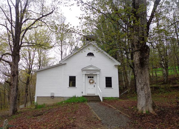 Beaver Meadow Schoolhouse, Norwich, Vermont We crossed into Sharon and parked about two and a half miles out, where the old town road ceased to be maintained. 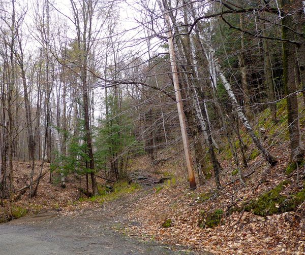 Chapel Hill Road, where it becomes a trail. We started hiking up what is now more of a trail than a road, but once brought travelers and their livestock to and from their farms and homes. 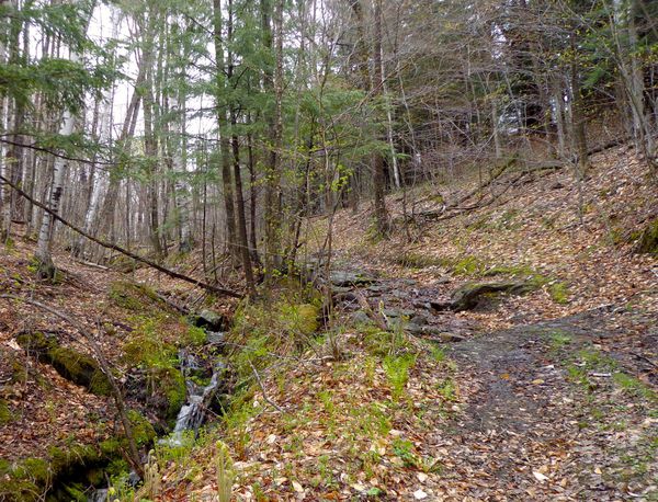 There was a small stream running nearby, but soon it was part of the trail, as it has been so wet this spring. 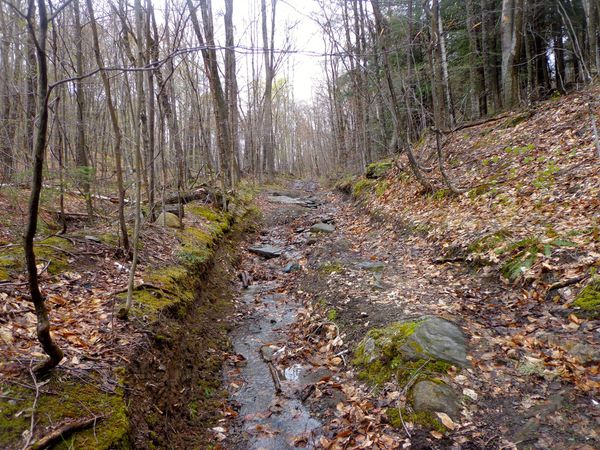 Chapel Hill Road heading north There were parts we had to walk around to avoid getting too wet, or sinking in some soft muck. 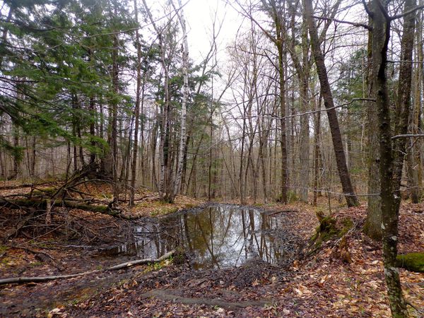 We hiked to the height of the land, an especially muddy area, and then began walking downhill. After a while things opened up, and leveled off, and we came upon what I like to call, the "New and Improved Power Line Thruway" 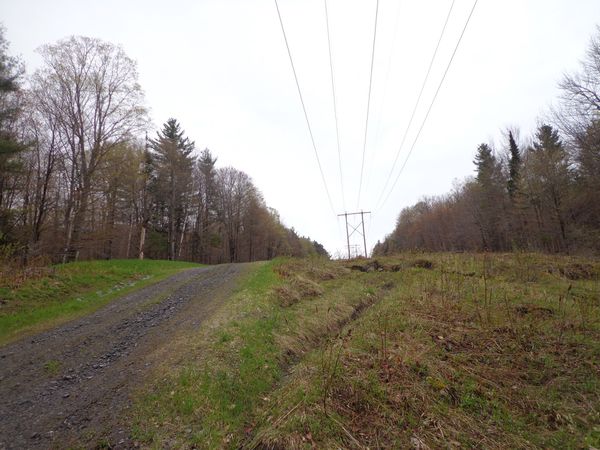 Back into the woods, we continued on, in search of the old Four Corners cemetery. 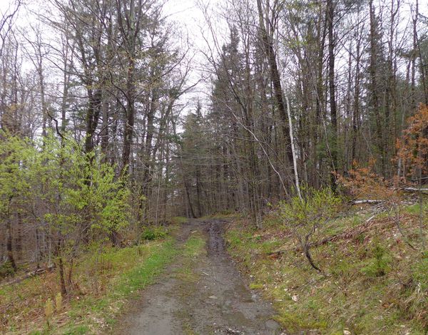 Chapel Hill Road, north of the power lines. The Four Corners cemetery is also known as the Roberts-Sharon cemetery, and as the John Burnham Farm cemetery. The Four Corners cemetery contains graves of people buried between the years 1815-1869. After then, population continued to decline and the roads fell into disrepair and disuse. In the map below, from 1855, we can see at least four Roberts family homes in and around the four corners area, and also W. Burnham near the Strafford border at the top, on Turnpike Road. The cemetery in question is shown on the right as "Cem." Note also, the "S.H." for Schoolhouse, near the four corners intersection, which is not a perfect 4 corners, as can be seen below. 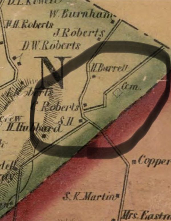 Four Corners area, on the 1855 Windsor County map by Hosea Doton. On the day we hiked we saw tire tracks in the road from bicycles, and possibly ATV's or off-road vehicles. 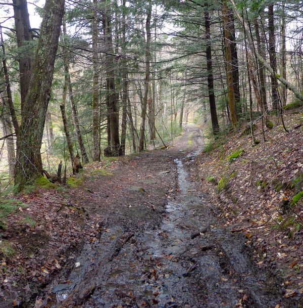 Soon we were heading downhill again, and could see some more daylight coming in from the left, and then we beheld a beautiful, beaver pond, with a large beaver dam on the side facing the road. 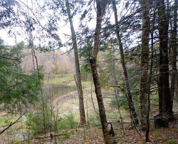 Beaver Pond at the Four Corners Area 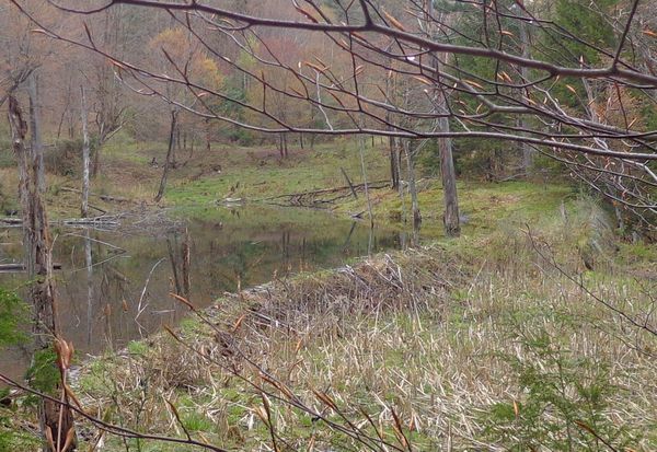 Close-up View of the Beaver Pond After gawking at the pond, I realized we had arrived at the four corners area, and were about to cross the old Strafford Turnpike, known as Turnpike Road today. Having reached the Four Corners, where we noted the headwaters of Lord's Brook, we crossed over the Strafford Turnpike, and headed northeast on Chapel Hill/Copperas Road. 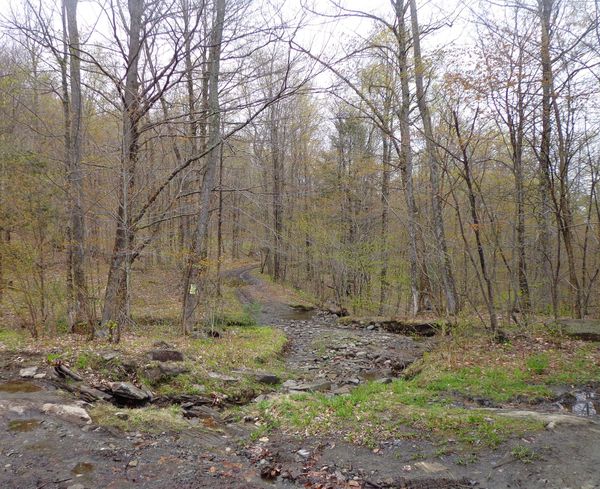 Crossing the Strafford Turnpike, and the Headwaters of Lord's Brook 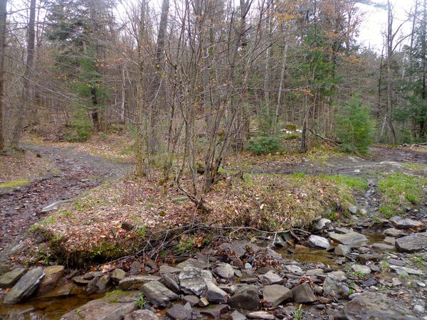 Strafford Turnpike to the left, Chapel Hill Road/Copperas Road, to the right, and a little island in the middle. Looking north from the four corners. The intersection of the two old roads is a very wet area. It was obvious that it would have been a very difficult area to keep passable, back in the early 1800's, for traffic on the Strafford Turnpike. The view to the east/northeast had become obscured by growing trees, since I had last walked out here, years ago. But being spring, and the leaves not fully out, I could see where there used to be a gorgeous view, especially back in the 1800's when more land was cleared. 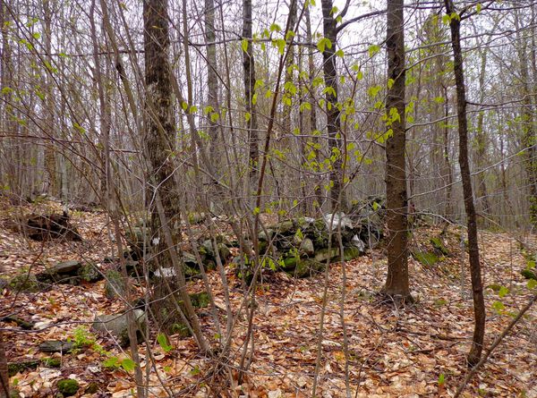 Suddenly I heard Mike telling me that he found the cemetery. I looked ahead, and as the road curved to the right, I could just make out one of the stone walls surrounding the old resting place. 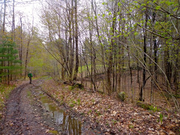 Mike discovering the cemetery I jogged ahead, dodging puddles, and found the old Roberts-Sharon Four Corners cemetery, looking pretty much like I had remembered it, appearing simple, humble, and peaceful, out here in the middle of the woods. 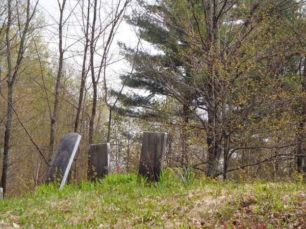 About the time we reached the cemetery, the sun started trying to come out, and it warmed up a bit. We were amazed at how peaceful it was out there. There are many cemeteries in urban areas, or near major roads, but this was truly a resting place! 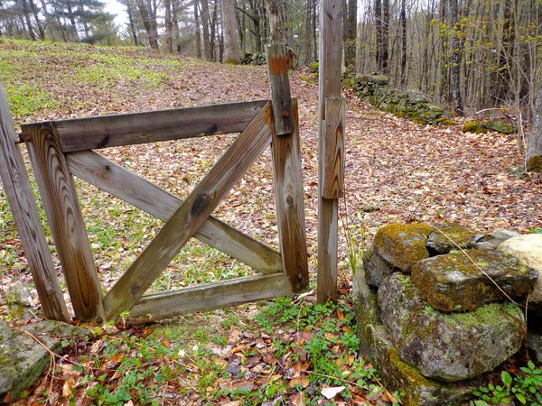 Gate at Cemetery Entrance 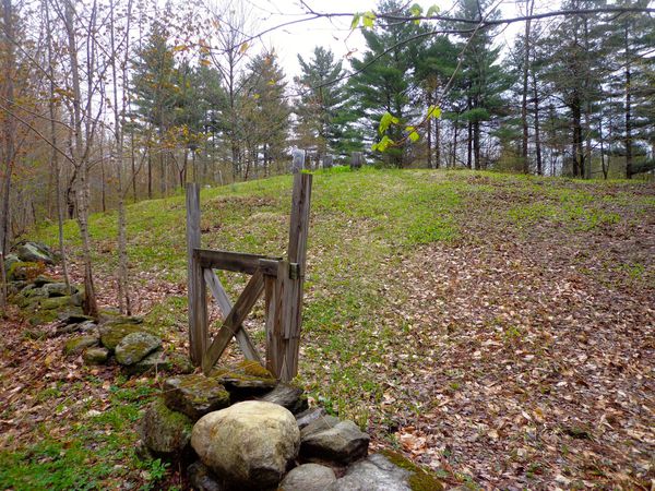 A stone wall and barbed wire surrounds it, with mature old trees, and a simple gate with a wooden latch. 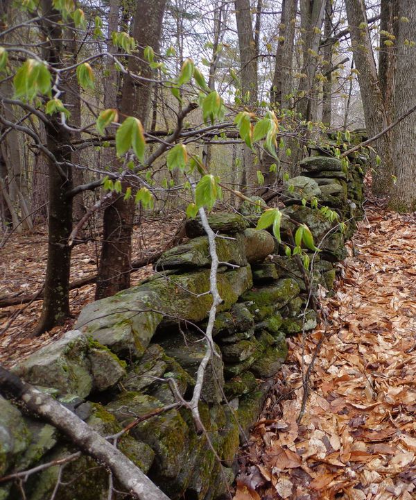 Stonewall Bordering the Cemetery There is no sign to identify the cemetery. Some of the stones appeared to be simple fieldstones with no engravings. Here are a few photos of some of the memorial headstones at the cemetery:  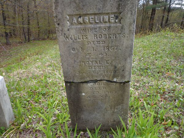 The stone above was repaired at least once. 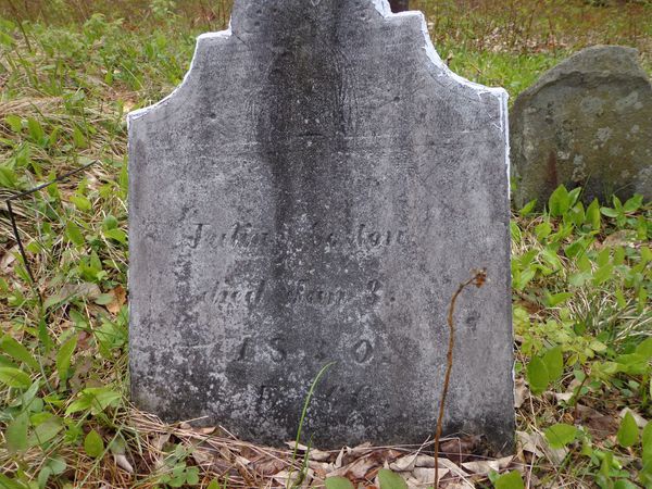 I counted about twenty-eight gravestones, including the fieldstone graves poking up from the earth. 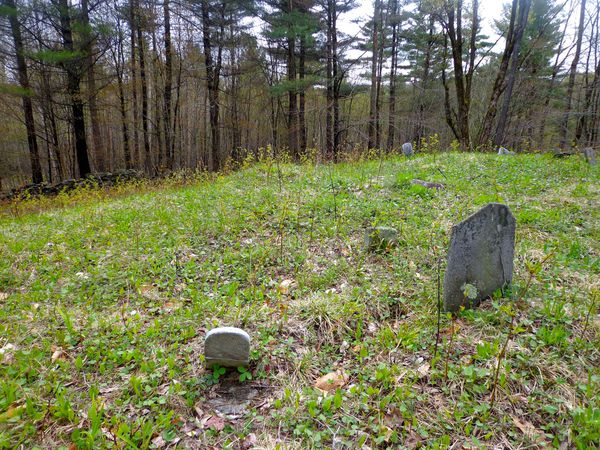 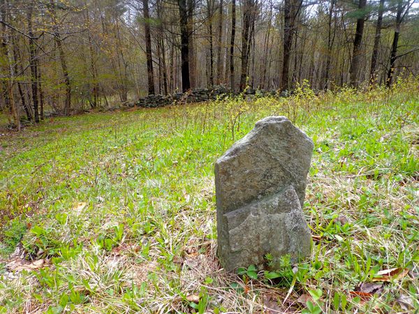 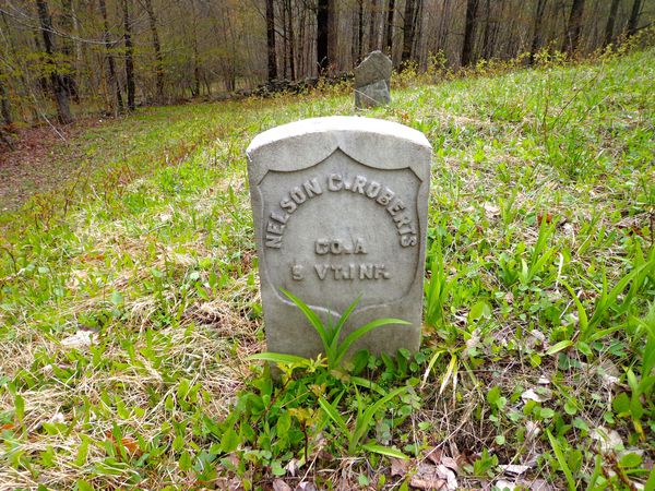 Following the Civil War, this busy farming community began to disappear. We said a prayer for the souls that reposed in the small clearing. We then headed on our way down the old road, pondering the past, and walking into the future.  The Road Thanks for journeying along on Old Roads, Rivers and Rails. Sources for this post:
USGS topographic maps: https://ngmdb.usgs.gov/topoview sharonvt.net/cemetery-associations/ Map of Windsor County published by Hosea Doton, Pomfret, Vermont circa 1855: loc.gov/resource/g3753w.la001193/?r=0.63,0.286,0.275,0.114,0 Comments 7
0 Comments
Your comment will be posted after it is approved.
Leave a Reply. |
AuthorI'm Bob Totz, retired VT postmaster, and historical geographer ARCHIVES:
October 2021
EXPANDED ARCHIVES: AUGUST 2021 1858 Johnson Map of North America MAY 2021 1795 - "Road Over the Mountain" - Part Two Historic Toll House For Sale 1795 - "Road Over the Mountain" Part One OCTOBER 2020 Finding That Special Peaceful Place AUGUST 2020 Kayaking on the Pompy JULY 2020 Pt. 2: What the Heck Are These Things? JUNE 2020 Bob's Bio... What the Heck Are These Things? Pt. 1 MAY 2020 Stone Walls and Spirits The View APRIL 2020 Sunny Brook Farm Relics: Pt 2. Sunny Brook Farm Relics: Pt 1. MARCH 2020 Signs of Norwich Pt. 2 COVID-19 Tracking Map Centertown and Valleyquest Signs of Norwich Pt. 1 "Imperfect Union" - Book Review Historic Centertown FEBRUARY 2020 King's Hwy Pt. 2 WRJ Museum at Post Mills Airport Chatauguay Vermont The Independent Farmer poem Traveling Along the King's Highway - Lebanon NH JANUARY 2020 Finding Parkhurst Cemetery In Search of Parkhurst Cemetery Affordable Housing The Old Stone Grill Two Rivers Trail-Kmart License and Registration, Please! Prohibition, Murder and Dr. Seuss Peace, Paris, & P.O. DECEMBER 2019 BLOGGER'S LINKS Welcome to Old Roads Love-Quail Hollow fun Dartmouth Cemetery SEPTEMBER 2019 E. Thetford Cemetery JUNE 2019
Taps: Meetinghouse Cemetery 4-Corners Borders Quest Old Iron Gate Stumbling Upon History Sunrise Walk MAY 2019 4 Corners Cemetery Strafford's Abandoned Foundations Art in Old Stonework APRIL 2019 Strafford Tpke Pt 2 Strafford Tpke Pt 1 White River Valley FEBRUARY 2019 Learning from Historic Maps of the Upper Valley Change in Lewiston VT JANUARY 2019 A Vermont Ski Waltz John Ledyard 1773 What is the Upper Valley? DECEMBER 2018 Dartmouth Green Music Video: Sometimes Music Video: Montreal Express Railway Disaster of 1887 |
 RSS Feed
