|
Welcome! Scroll Down for Posts and Archives.
Other Menu Options at Top |
|
|
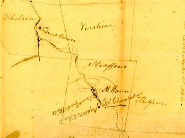
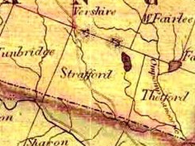 Part 2: The Most Direct Route from Norwich to Chelsea By choosing the most direct route to Chelsea from Norwich, the proprietors of the Strafford Turnpike Company probably brought about the demise of their enterprise.... (Click here if you missed Part One of the Strafford Turnpike) The route out of Norwich, which followed Blood or Bloody Brook out past Gile Mountain, headed uphill into the wilds of east Sharon, and Strafford Vermont. This was rugged country, and miles away from town centers, and there were reasons it was sparsely settled. Travel was not easy along rock ledges and through swales and mud troughs. 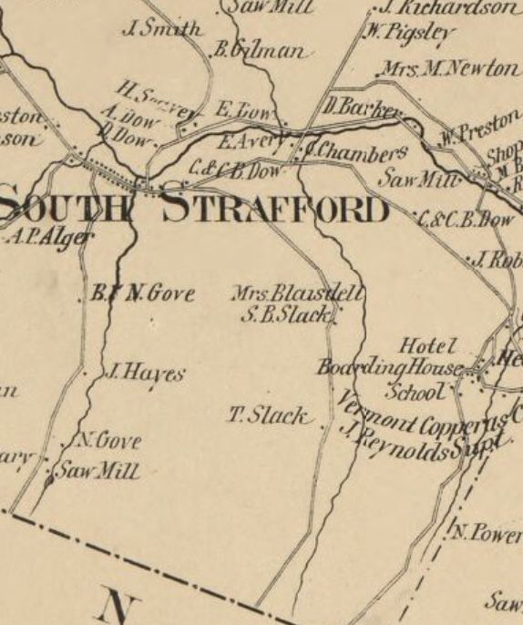 Strafford Turnpike from Sharon Town Line into Strafford, Vermont. Using the 1855 Windsor County map above, we can see that as we traveled along the Strafford Turnpike from Norwich, we would pass the homes of T. Slack, S.B. Slack, and Mrs. Blaisdell on our way back down into South Strafford. This is the path along the valley between Morrill Mountain and Copperas Hill. The turnpike connects with Mine Road before entering the village, near what is today Coburn's General Store. Once the route came out of the hills and descened into South Strafford Village, the going became easy for a while, following the West Branch of the Ompompanoosuc River westward, and uphill, gently at first, toward the river's source. 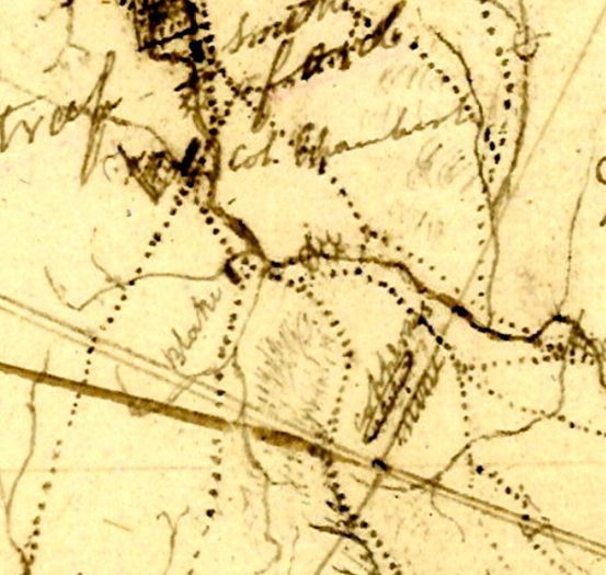 Early sketch map of the Strafford Turnpike, showing boundaries of Norwich, Sharon, and Strafford. The third dotted line from the left, at the bottom, is the Strafford Turnpike. From the map above, I could see that the turnpike followed along the West Branch of the Ompompanoosuc River, on its way to Strafford Upper Village. It appears that the home of "Col. Chamberlain" is denoted on the map in Strafford. 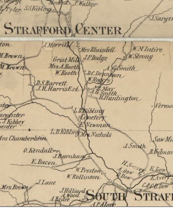 Route of Strafford Turnpike from South Strafford to "Strafford Center" or Upper Village, along the West Branch of the Ompompanoosuc River. The Windsor County map from 1855 above, was a big help in finding the route of the Strafford Turnpike. 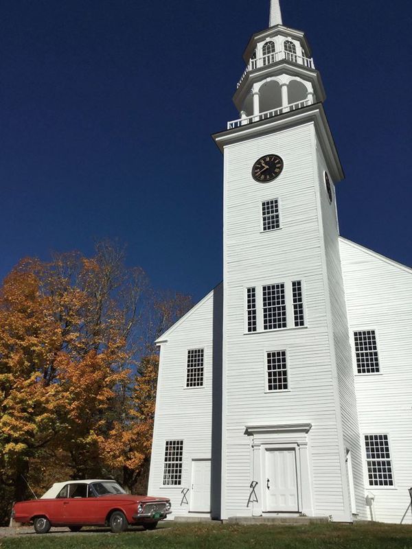 Strafford Town House, Upper Village Strafford, Vermont. 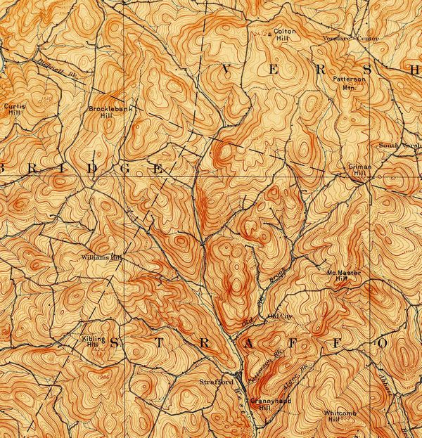 1894 USGS Topographic map showing the route of the Strafford Turnpike, from Strafford Upper Village to Vershire along Taylor Valley Road. Also helpful was the USGS map above, from 1894. The long-dashed lines represent the township boundaries. Clearly seen is the point at which the boundaries of four towns come together, (top, middle); Vershire, Strafford, Tunbridge and Chelsea. It was a fun challenge, to study the crude early sketches of the Strafford Turnpike, and other, more recent maps of the area, in order to see where the turnpike went after the Upper Village of Stafford. I had originally thought that the route would have taken the Justin Morrill Memorial Highway into Tunbridge on the Strafford Road, past Fred Tuttle's old family farm. However, I saw that the correct route ran through a corner of Vershire, avoiding Tunbridge altogether. 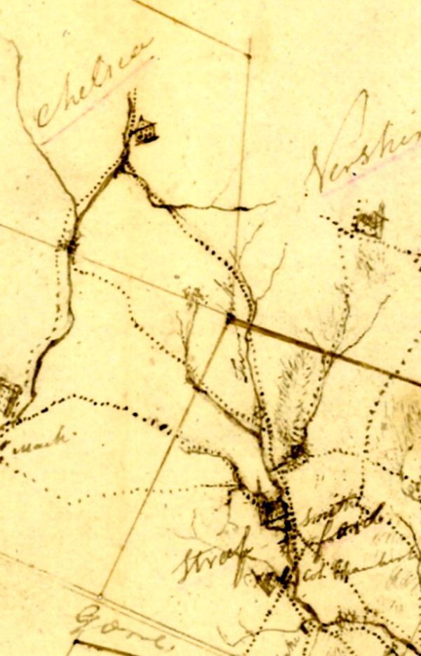 Northwest portion of early sketch/map from Strafford, through Vershire, to Chelsea, Vermont. I could see that Taylor Valley Road, along the west branch of the Ompompanoosuc River was most likely the Strafford Turnpike. Traveling along Taylor Valley Road, eventually one would enter the township of Vershire, and then begin turning westward, toward Chelsea. As Taylor Valley Road enters Vershire, the Strafford Highway turns west, and is called Turnpike Road, once again. A friend of mine lives way out on Taylor Valley Road, near the corners of Vershire, Chelsea, Tunbridge and Strafford. He has lived there for over forty years. I asked him if he ever heard that Taylor Valley Road was part of the Strafford Turnpike, and he told me the following: "Yes what I heard from the older set was that Taylor Valley Rd. and Turnpike were part of the Main road not just to Chelsea but from Boston to Montpelier and Montreal. I was told that there were 28 farms, three school houses and a mill up here in 1850. after the Civil War people moved away, to Ohio and California, etc. The saw mill that used to be across the street is rumored to have sawed the boards for the Town House and all the houses on the common." 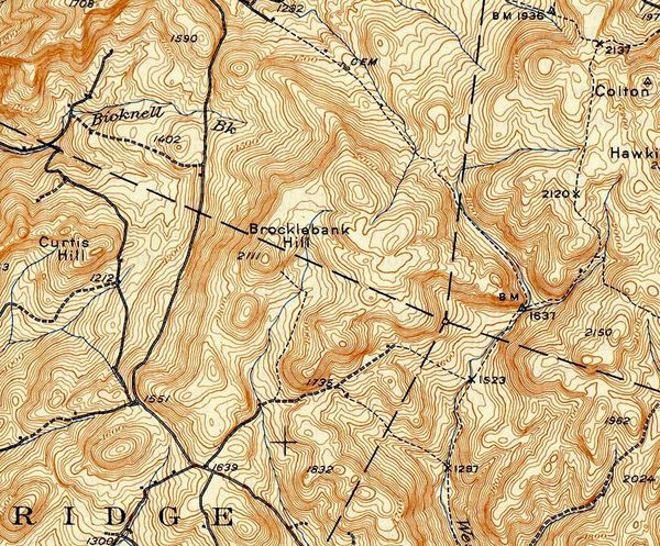 1944 USGS Map showing Strafford Highway, single dashed line. The Strafford Turnpike followed what is now Taylor Valley Road, and the west branch of the "Pompy" River, climbing higher and higher, into Vershire, and turning west, onto Turnpike road. Eventually the turnpike came to the height of the land, around 1700 feet in elevation, near the Vershire/Chelsea line, before descending into Chelsea. This area is no longer maintained, and I've been told there is a large beaver pond in the middle of the old turnpike. 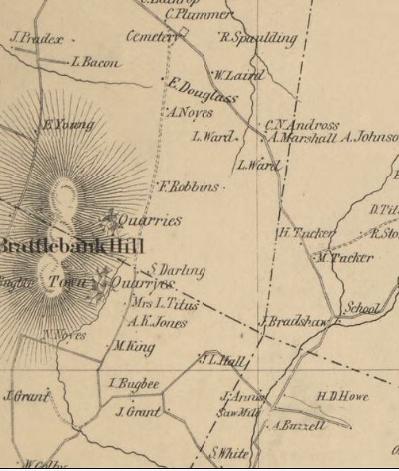 Strafford Turnpike in Strafford, Vershire, and Chelsea, east and north of "Brattlebank" Hill On the 1855 map of Windsor County, above, we can see that there were quarries along "Brattlebank Hill". Today that hill is known as Brocklebank HIll. The quarries would have given employment to some local people, and helped with the local economy. Surnames in the area are familiar, such as Howe, Hall, Titus, Bugbee, Tucker and Grant. There was a schoolhouse in Vershire, where the turnpike veered to the west, at the confluence of the Pompy west branch, with a feeder stream. As the turnpike left the high country, it followed Jenkins Brook on its way to the First Branch of the White River, at what is today known as Vermont State Route 110. The areas of higher elevation between the Pompy west branch and Jenkins Brook would have been another difficult portion of the route to keep open and maintained well enough for turnpike travel. Like the turnpike's route in Sharon, the Vershire section was probably one of the worst areas to keep open. 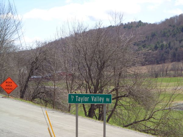 Taylor Valley Road and Justin Morrill Memorial Highway in Strafford. The old Strafford Turnpike, along the banks of the West Branch of the Ompompanoosuc River. When the Strafford Turnpike Company was formed, they were given a certain amount of time in which to get the turnpike surveyed, cleared, built, and up and running. It turned out they needed more time. The petition was granted in 1808, and work started on the route to Chelsea from Norwich. The first part of the turnpike, from the Ledyard Bridge to the Norwich Plain was easy, as the road already existed. The Vermont Legislature stipulated there would be two tollgates, and also dictated toll fares. Here is an excerpt on toll fares: "For each four wheeled pleasure carriage, drawn by one beast, twenty cents; for each four wheeled pleasure carriage drawn by two beasts thirty one cents; and for each additional beast four cents; for each two wheeled pleasure carriage drawn by one beast, sixteen cents; and for each additional beast, four cents...for all sheep or swine at the rate of three cents per dozen." 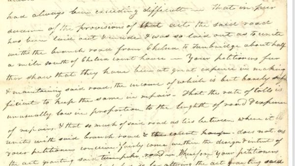 Excerpt from 1823 Letter from the Strafford Turnpike Company to the Vermont Legislature, explaining the difficulties with keeping the Company in business, and petitioning for an increase in toll fees to cover maintenance costs. The Strafford Turnpike Company began in 1808 with an idea: Create a turnpike, or toll road, from the Connecticut River in Norwich, along the most direct route, to the Chelsea Vermont Courthouse. By 1823, the company was not doing well. Tolls could barely cover the cost of road maintenance. They had chosen the most direct route they could find, but that brought them into difficult areas of high elevation with major drainage issues, that were extremely difficult to keep passable. By 1826, the Strafford Turnpike Company ceased to exist. The book, The Turnpikes of New England, by Frederic Wood, published 1919, had this to say about the Strafford Turnpike: "The Strafford Turnpike was granted the right on November 11, 1808, to build from the Connecticut River Turnpike in Norwich, diagonally across the town of Strafford, to the courthouse in Chelsea. In 1813 the company made petition to the legislature for an extension of the time within which it should finish the road, stating in explanation that it had nearly finished the turnpike, but that heavy rains had done so much damage that completion within the required time would be impossible....November 4th, 1826, the corporation was allowed to surrender its charter and the road became free". 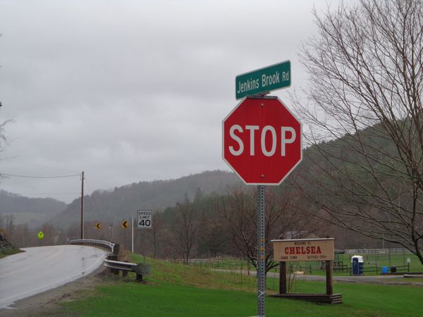 The Chelsea end of the Strafford Turnpike. Jenkins Brook Road to State Route 110, and the "Welcome to Chelsea" sign. Today, I find it fascinating that what used to be a main thoroughfare, running past family farms, sawmills and schoolhouses, is now an unused old trail, with a Beaver Pond in the middle of it. 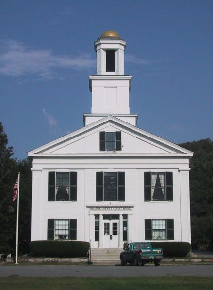 Comments 12
0 Comments
 From the Ledyard Bridge, through Norwich, Sharon, Strafford, and Vershire, and Ending at the Chelsea Courthouse. The Strafford Turnpike was, and probably still is, the shortest, most direct route from the Connecticut River in Norwich, to the Chelsea Vermont Courthouse. However, what used to be a main highway, back in the early 1800's, is now, in several places, a washed out old trail, left to the ravages of nature and time. In other places, it is still used, but cleverly disguised as "Main Street" in Norwich, or Justin Morrill Memorial Highway in Strafford. And a couple of stretches are known as "Turnpike Road". About a month ago, a neighbor brought the Strafford Turnpike to my attention. In that I love old roads around here, and hadn't heard of the Strafford Turnpike, I decided to do some investigating on my own. My neighbor gave me some research materials that came from the State of Vermont, State Archives and Records Administration. Plus, I had access to some old maps of the area. 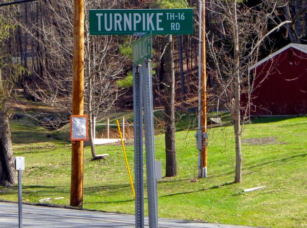 Turnpike Road in Norwich, formerly The Strafford Turnpike It turns out the Strafford Turnpike turned northwest from Main Street Norwich, onto what is now called Turnpike Road. I had never really given much thought to the name, Turnpike Road, but now it was starting to make sense! Below is an old hand drawn sketch/map of the route of the Strafford Turnpike. It doesn't look like much, but it provided some good clues. The Strafford Turnpike is indicated by a dotted line. Waterways are indicated by solid lines, and township boundary lines are also drawn in. The route ran from Norwich, through the northeast corner of Sharon, before entering Strafford. The other good clue is that, from Strafford, the route ran through the southwest corner of Vershire. 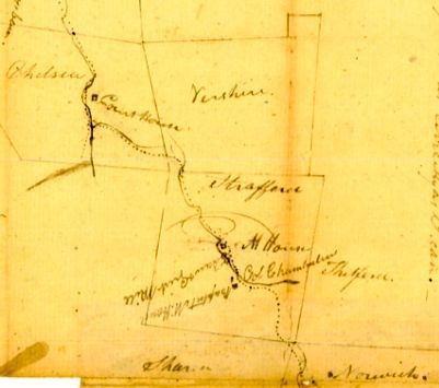 I was curious about the route from Turnpike Road out of Norwich. The map below shows another, more detailed sketch of the southeastern portion of the area that the Strafford turnpike ran through, from Norwich, through Sharon, and into Strafford. 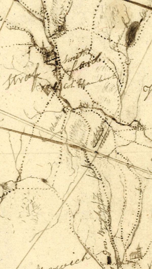 Early map of The Strafford Turnpike in Norwich, Sharon, and Strafford. About ten years ago, my wife and I hiked out the non-maintained portion of Turnpike Road. We walked along the road for a while, noting that at one point, it must have been used by lots of people, as it was wide, with old stone walls on each side, and even though it was almost beyond drivable, you could tell that at one point it had been graded and maintained. 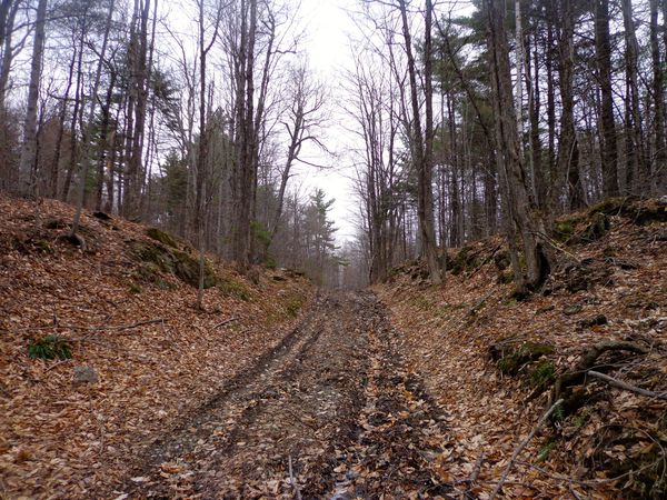 Class 4 portion of the Strafford Turnpike in Norwich, near Sharon Vermont Eventually we came to a 4-Corners of old roads. To the left, a road came in which was in about the same shape as the one that we were on. To the right, another old road, and ahead, and uphill, it appeared that the Turnpike continued on. The area was a bit wet, especially straight ahead. I went straight for a little bit, and saw an old pond, or marshy area, and then walked back to the four corners, not knowing that I had been on the Strafford Turnpike of days gone by. 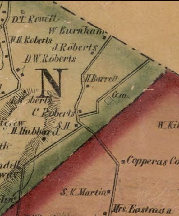 Strafford Turnpike, Copperas Road, and Chapel Hill Road, Norwich to Sharon. Cemetery we visited is drawn in on Copperas Road, upper right. From the 1855 Map of Windsor County. On the map above, from Windsor County, VT in 1855, we can see a cemetery drawn in on Copperas Road, upper right. It appears there was a schoolhouse ("S.H.") near the 4 corners, and it looks like C. Roberts lived near there, along with H. Barrett a little further up the turnpike. On our walk, we headed northeast, along an east facing ridge for a little ways. It was a nice area, with a view of Smart's Mountain in one spot, and an old graveyard with a fence. We had turned onto what used to be Copperas Road going northeast, toward the former Copper Mine. Had we gone left, we would have been on Chapel Hill Road going southwest, toward the Beaver Meadow area of Sharon and West Norwich. 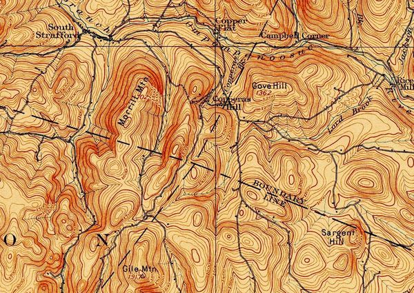 1894 USGS Topographic Map showing the Corners of Norwich (Lower Right), Sharon (Lower Left), Strafford, (Upper Left), and Thetford, (Upper Right). The 1894 map above helps us to see where Turnpike Road out of Norwich used to go. It continued on, past Gile Mountain, and into Sharon, where it came to a four corners area, which is where we had hiked. We had turned right, but the Strafford Turnpike continued straight from there, eventually coming down into South Strafford, between Copperas Hill, and Morrill Mountain. 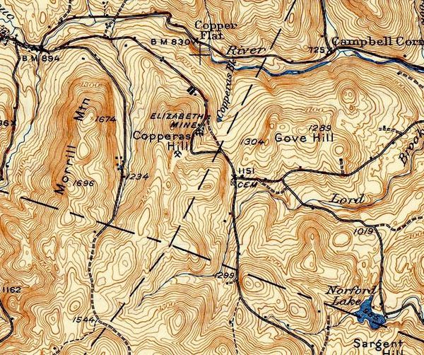 1944 USGS map showing the Strafford Turnpike, now in double-dashed lines. The map above was produced in 1944, fifty years after the 1894 map. There are some changes we can note. Copperas Road has been removed, though Elizabeth Mine is written in, near Copperas Hill. Chapel Hill Road, which had been a solid line, is now a single dashed line. And the Strafford Turnpike is now a double-dashed line, indicating an unimproved road, i.e. no longer being used much. The Strafford Turnpike still exists on the South Strafford end, but, as the saying goes, "You can't get there from here". Well, you probably could get there by walking, or on horseback, but you probably won't be driving a car to South Strafford from Turnpike Road in Norwich these days. 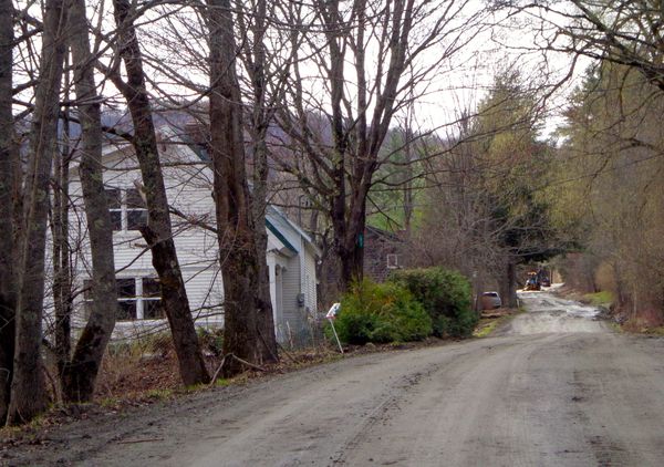 Turnpike Road in Strafford Above is a look at the South Strafford end of Turnpike Road, or the Strafford Turnpike. I took this photo this week, but didn't venture on, as the road crew was up ahead working, and it was still mud season. ******************** A Little History ****************** Back in the early 1800's, the road system in Vermont and New Hampshire was dominated by private toll roads called turnpikes. The idea was that a group of investors would petition to the legislature to form a company, to build and oversee a new turnpike, and collect tolls from travelers. Then, they would survey, clear, build and maintain a road, and collect tolls from folks for the privilege of traveling along the turnpikes, in hopes of making a profit. The term turnpike came about because at the tollgate, a gate, or "pike" was used to block access until the toll was paid. When the toll was paid, the pike was turned to the side so that the travelers could pass, hence the term, "turnpike". Here is an excerpt from the original petition to the Legislature of the State of Vermont for the Strafford Turnpike: ......." a turnpike road from Hanover bridge crossing Connecticut River to Chelsea will be of quick public utility in shortening the distance of public travel.......the right to ......make a turnpike road in the best place from said Bridge to Chelsea Court house.....under such regulations and instructions as you in your wisdom shall see fit......dated at Norwich this sixth day of October 1807." The petition was signed by William Little, Elisha Burton, and others as seen below. 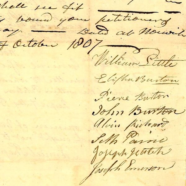 Strafford Turnpike petition signatures, 1807 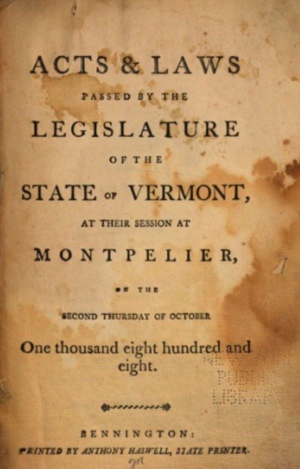 Cover page of the 1808 "Acts passed by the Legislature..." From "1808 Acts passed by the Legislature of the State of Vermont" chapter 117: "An act establishing a corporation by the name of the Strafford turnpike company. It is hereby enacted by the General Assembly of the State of Vermont, that Ebenezer Brown and Elisha Burton of Norwich, in the county of Windsor, and Asahel Chamberlain, of Strafford and Josiah Dana of Chelsea, in the county of Orange, and their associates and successors, be and they hereby are constituted a corporation, by the name of the Strafford Turnpike." ...."for the purpose of laying out, making, altering, & keeping in repair a turnpike road, from the Connecticut River turnpike road, in Norwich....in the most direct and eligible way from said turnpike, to the courthouse in Chelsea...." 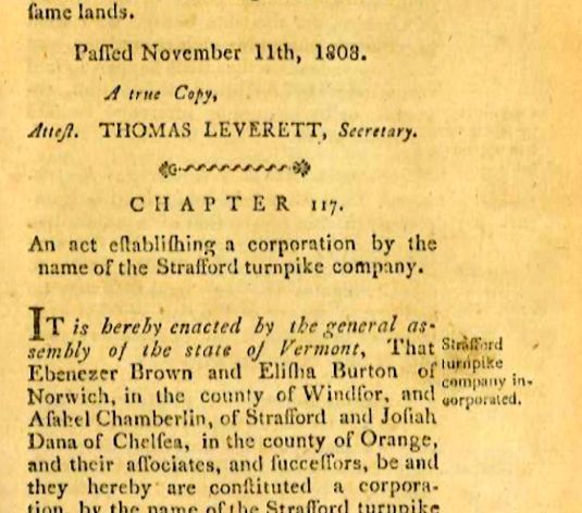 Excerpt from "Acts passed by the Legislature..." On its way, to Chelsea, the turnpike ran through five towns: Norwich, Sharon, Strafford, and Vershire, and finally, Chelsea Vermont. One of the goals of the Turnpike was to shorten the distance to the Chelsea Courthouse, shortening the time needed to travel there and back. Therefore, the route taken was supposed to be the shortest distance possible, taking into account larger hills that had to be traveled around, and wet valleys that would be better to avoid if possible. It made sense that the Turnpike would follow the main path into Norwich from the Ledyard Bridge. And it makes sense to me, now, that they turned left onto what we know today as Turnpike Road. Thanks for meandering down "Old Roads, Rivers and Rails". Feel free to click the subscribe button to get an alert when I publish Part Two of the Strafford Turnpike, and other posts to come. Click Here For Part Two of the Strafford Turnpike...From Strafford to Chelsea. Other journeys on "Old Roads Rivers and Rails" can be found at the Profile Page here: https://herecast.us/@OldRoadsRiversandRails and the post that started it all: The Montreal Express Railway Disaster of 1887 Source of historic documents: Vermont State Archives & Records Administration: https://www.sec.state.vt.us/archives-records/contact-us.aspx Thanks also to Doug Wilberding for sharing information and source documents. Map Sources: USGS: https://ngmdb.usgs.gov/topoview/viewer/#9/43.7552/-72.0744 Orange County: https://www.loc.gov/resource/g3753o.la001188/?r=-0.043,0.274,0.124,0.147,0 Windsor County: https://www.loc.gov/resource/g3753w.la001193/?r=-0.138,0.737,1.002,0.415,0 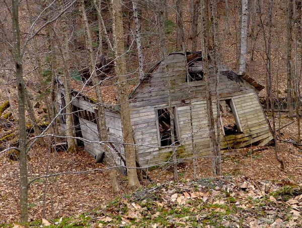 An old relic along the Strafford Turnpike that has seen better days Bob Totz Norwich, VT Comments 19
Dan Webb · 7 months ago · Report Nice read Bob ! Thanks . 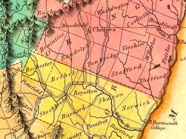 Importance of a Main Tributariy of the Connecticut River Beginning in the 1760's, much of the settlement of the Upper Valley was in the plains and hills along the Connecticut River. The earliest settlers were subsistence farmers. In those very first years they lived off what they could grow as crops, and also wild game and food, while they cleared their plot of land and began to build a crude log dwelling. These first settlers laid the groundwork for generations to come. 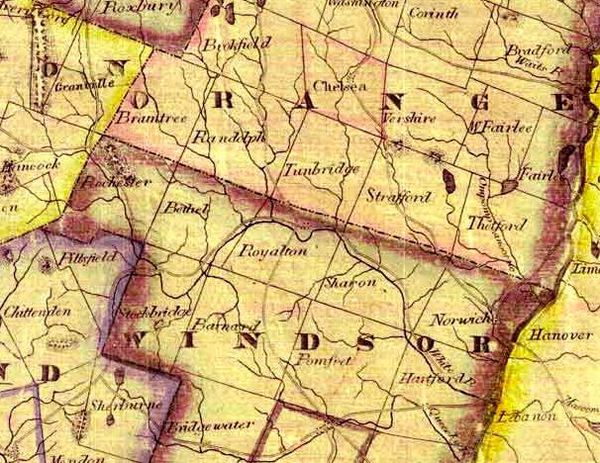 1837 White River Watershed The confluence of a main tributary river with the Connecticut River became a very important location for settlement, commerce and transportation. Places like West Lebanon, (Mascoma River), Claremont, (Sugar River), and White River Junction became increasingly vital. During the early years in the Upper Valley, saw mills and grist mills were built along the rivers and streams that fed the Connecticut River and its tributaries. Crude log cabins gave way to wood frame structures, using boards cut at the local mill. Within a couple of generations, children that had grown up in the area, began looking for new areas to settle and farm. Naturally, many traveled upstream, into the foothills of the Green and White Mountains, along the increasingly narrower valleys. Let's take a look at the White River valley. As you can see in the map above, its tributaries reach deep into the back country, up into the the Green Mountains. The streams become narrower there, and the elevation becomes higher, steeper and rockier Many inland tributaries contribute fresh, icy cold water from melting snow each Spring, to the wider valleys below. 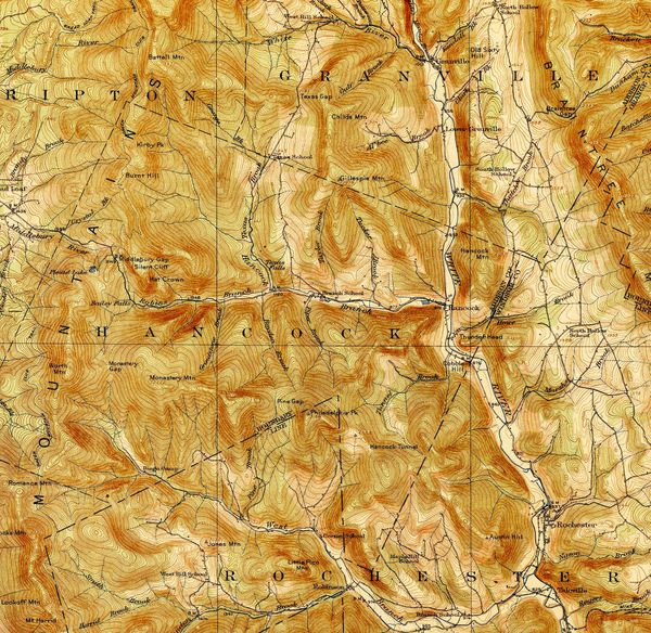 Sources of the White River in Ripton, Granville, Hancock and Rochester, Vermont. USGS Topography from 1915. 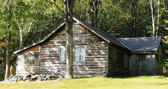 Robert Frost Cabin, Ripton, Vermont While the Upper Valley townships along the Connecticut River were settled in the early 1760's, places like Rochester, Hancock, Granville and Ripton near the headwaters of the White River weren't settled until the 1780's, a full generation later. 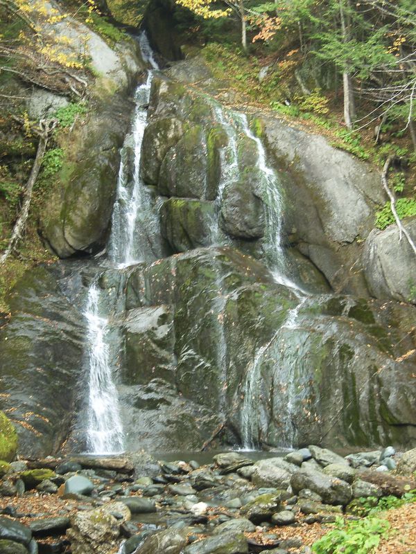 Moss Glen Falls, Granville VT From 1780 - 1810, there was a boom in population in Vermont. During these thirty years, the population of the state of Vermont increased dramatically, from 30,000 to 217,000. Like today, people needed a good place to call home, and many of them moved up into the White River Valley. Settlement was limited by the mountains, and steep slopes, but the river valleys provided beautiful land and fertile soil; a place to create a homestead. Towns like Rochester, Bethel, Royalton and Sharon developed along promising locations in the White River valley. 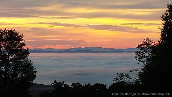 Dawn at Bethel Mountain Here are some interesting facts about the White River's watershed, courtesy of Whiteriverpartnership.org "The White River watershed encompasses 710 square miles, draining portions of Addison, Orange, Rutland, Washington and Windsor Counties, including 50,000 acres of the Green Mountain National Forest. The White River originates in the Town of Ripton on the slopes of Battell Mountain, then flows southerly and easterly before merging with the Connecticut River in the Town of Hartford." The tributaries of the White River are many, but the main branch begins at the highest point, at about 3700 feet in elevation. Alder Meadow Brook, near Granville Notch, and Patterson Brook, and Clarke Brook also feed into the White River in the high country, not far from the source of the Mad River, as the crow flies. 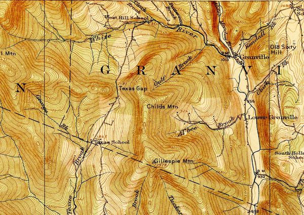 The source of the White River flows east into Granville, and then south from there, through the town of Hancock and then through Rochester, where the West Branch joins the main branch. 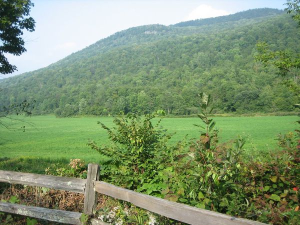 Hancock Vermont, Near Route 100 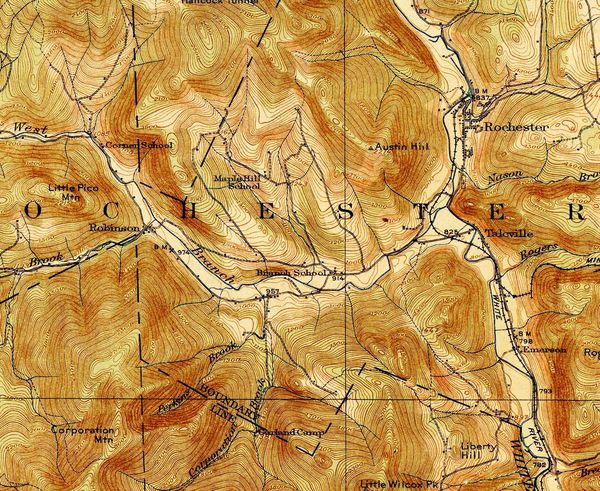 The West Branch of the White River joins the Main Branch in Rochester, Vermont. 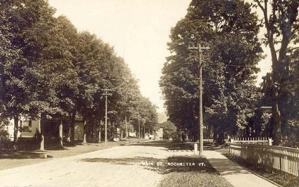 Main Street, Rochester Vermont, 1912 Below Rochester, the Tweed River flows in from Pittsfield and joins the main branch of the White River in Stockbridge. 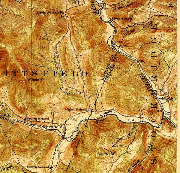 The Tweed River in Pittsfield and Stockbridge, a significant tributary of the White River 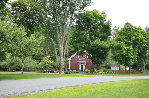 Stockbridge, Vermont From Stockbridge the White River generally flows east, into Bethel, where the Third Branch joins the Main Branch of the White River. The third branch flows down in a southerly direction through places like Braintree, and Randolph, on its way to Bethel. 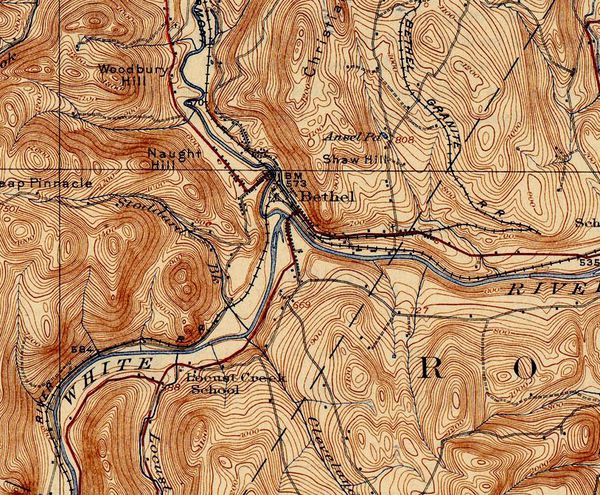 Bethel Vermont, Confluence of the White River with its Third Branch 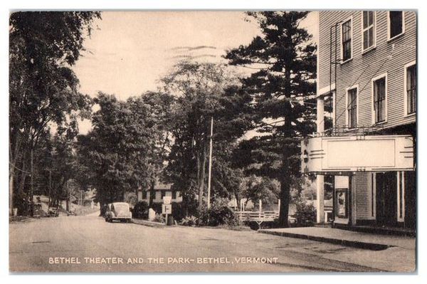 Bethel, Vermont. Photo courtesy of cinematreasures.org. After connecting with the Third Branch, the White River continues on, eventually joining the Second Branch of the White River. The Second Branch of the White River flows down from the southern portion of Williamstown, meandering through Brookfield, and East Randolph near Vermont Route 14, on it's way to its confluence with the Main Branch in North Royalton. 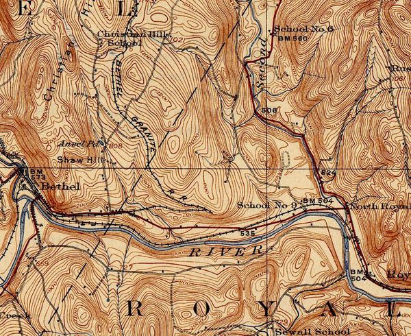 Route from Bethel to North Royalton, where the Second Branch joins the White River 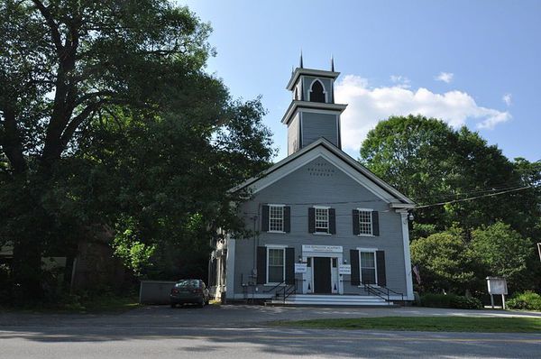 Royalton Academy building in Royalton Vermont A little further east, the Main Branch of the White River flows through historic Royalton Vermont, and is joined by the First Branch at South Royalton. The First Branch begins high above Chelsea in Washington VT. Flowing through Chelsea and Tunbridge, along Vermont Route 110, the First Branch valley is a particularly picturesque area. 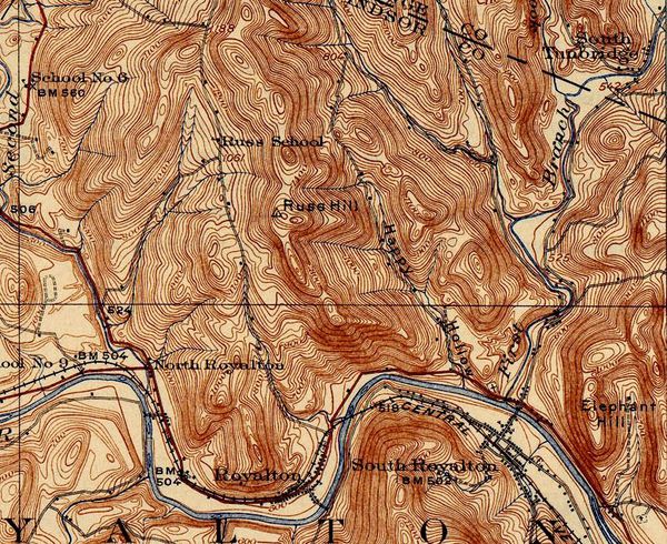 White River, 2nd Branch at North Royalton, First Branch at South Royalton. 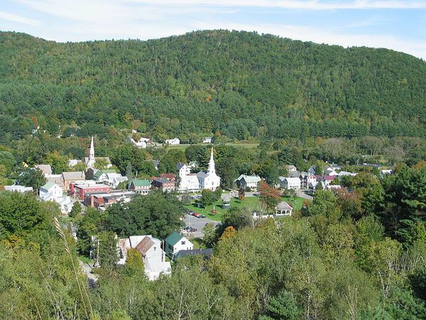 Village of South Royalton Vermont East of South Royalton, the White River, now strengthened by its branches and tributaries, flows in a southeasterly direction through the town of Sharon. 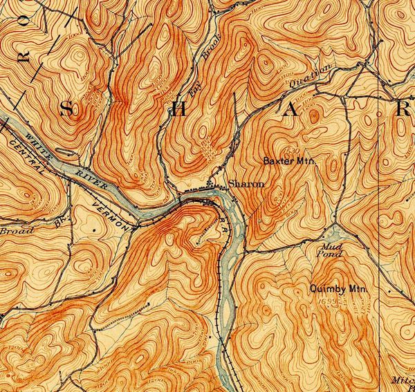 Sharon, Vermont Topography, circa 1894 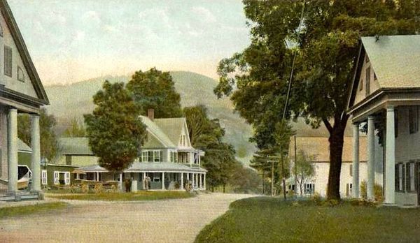 Sharon, VT Postcard from 1906. The photo above shows Sharon, Vermont in 1906. The building to the left is the Sharon Trading Post, still thriving today. 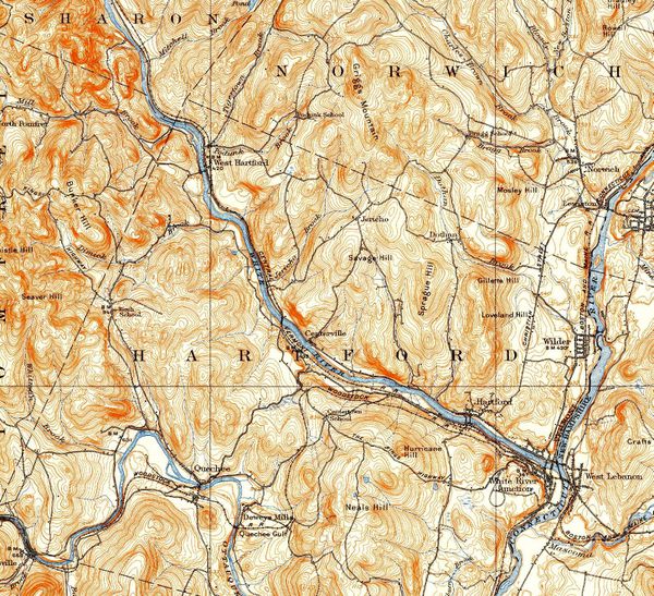 White River flowing through Sharon, and Hartford, emptying into the Connecticut River at White River Junction Vermont After Sharon, the White River flows past the northeast corner of Pomfret, and through the villages of West Hartford, and then Hartford Vermont.  Hartford Historical Society, Hartford, Vermont And from Hartford village, it's just a short trip to the Connecticut River. 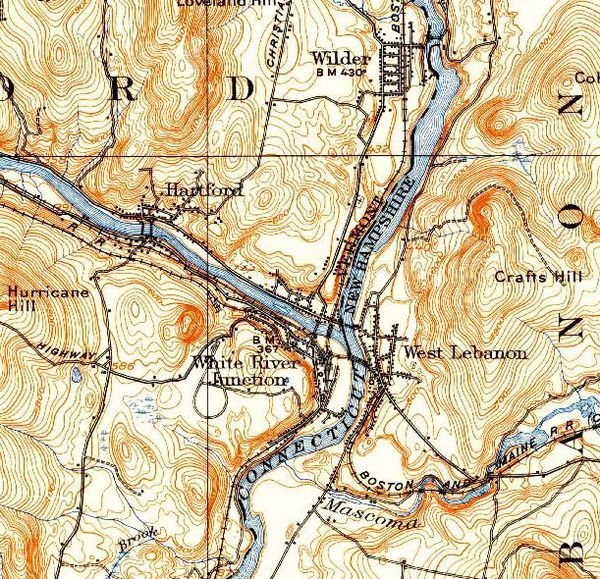 White River Junction, Vermont The location of the confluence of the White River with the Connecticut River, has historically been very important. White River Junction was a transportation and commerce center before the railroads came in the mid-1800's. In the early 1800's, Elias Lyman III ran a ferry and flatboat service in White River Junction and a toll bridge across the Connecticut River. And before that, the area was important to native populations. 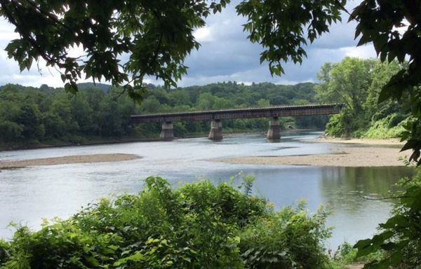 Lyman Point, White River Junction Vermont. The Confluence of the White River and the Connecticut River. Railroad bridge from WRJ to West Lebanon, New Hampshire in background. Photo by Bob Totz. Thanks for winding along on "Old Roads, Rivers and Rails".
Feel free to subscribe by sending an email to: [email protected] and get instant notifications whenever I publish a post. Happy Spring! Photos courtesy of wikimedia commons unless noted Thanks to VTRoads.com the first two map images.
|
AuthorI'm Bob Totz, retired VT postmaster, and historical geographer ARCHIVES:
October 2021
EXPANDED ARCHIVES: AUGUST 2021 1858 Johnson Map of North America MAY 2021 1795 - "Road Over the Mountain" - Part Two Historic Toll House For Sale 1795 - "Road Over the Mountain" Part One OCTOBER 2020 Finding That Special Peaceful Place AUGUST 2020 Kayaking on the Pompy JULY 2020 Pt. 2: What the Heck Are These Things? JUNE 2020 Bob's Bio... What the Heck Are These Things? Pt. 1 MAY 2020 Stone Walls and Spirits The View APRIL 2020 Sunny Brook Farm Relics: Pt 2. Sunny Brook Farm Relics: Pt 1. MARCH 2020 Signs of Norwich Pt. 2 COVID-19 Tracking Map Centertown and Valleyquest Signs of Norwich Pt. 1 "Imperfect Union" - Book Review Historic Centertown FEBRUARY 2020 King's Hwy Pt. 2 WRJ Museum at Post Mills Airport Chatauguay Vermont The Independent Farmer poem Traveling Along the King's Highway - Lebanon NH JANUARY 2020 Finding Parkhurst Cemetery In Search of Parkhurst Cemetery Affordable Housing The Old Stone Grill Two Rivers Trail-Kmart License and Registration, Please! Prohibition, Murder and Dr. Seuss Peace, Paris, & P.O. DECEMBER 2019 BLOGGER'S LINKS Welcome to Old Roads Love-Quail Hollow fun Dartmouth Cemetery SEPTEMBER 2019 E. Thetford Cemetery JUNE 2019
Taps: Meetinghouse Cemetery 4-Corners Borders Quest Old Iron Gate Stumbling Upon History Sunrise Walk MAY 2019 4 Corners Cemetery Strafford's Abandoned Foundations Art in Old Stonework APRIL 2019 Strafford Tpke Pt 2 Strafford Tpke Pt 1 White River Valley FEBRUARY 2019 Learning from Historic Maps of the Upper Valley Change in Lewiston VT JANUARY 2019 A Vermont Ski Waltz John Ledyard 1773 What is the Upper Valley? DECEMBER 2018 Dartmouth Green Music Video: Sometimes Music Video: Montreal Express Railway Disaster of 1887 |
 RSS Feed
