|
Welcome! Scroll Down for Posts and Archives.
Other Menu Options at Top |
|
|
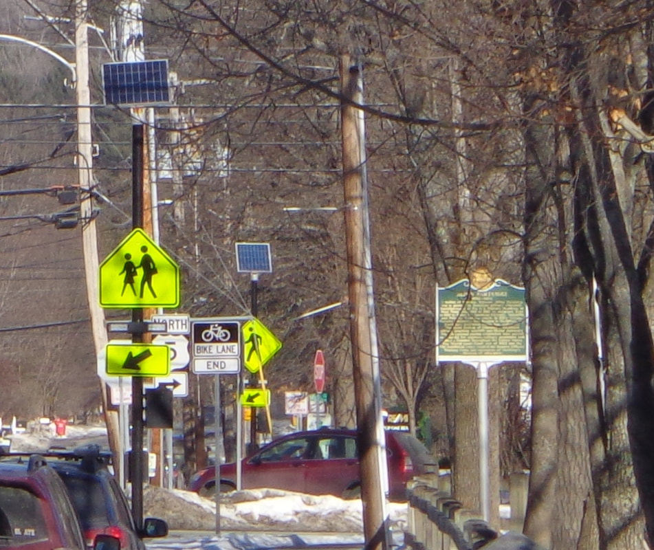 Have you ever looked carefully at the signs in your neighborhood? Most of us really don't, and can't, read all of them, especially if we're driving, and trying to concentrate on the road. We just sort of see them in the background. You don't actually have to read the letters "SPEED LIMIT" because you've seen that type of sign so often. You just focus on the big number "25". Other signs can just blend into the background, or are just too small to read anyway. However, if you walk, and pay attention, you will see that there is a lot of information directed toward you, as you stroll down the street, at least, that's how it is in Norwich Vermont these days. There are many different types of signs in Norwich. Let's explore: First, there are signs to attract potential customers to a business, such as this first one, as we head toward Hanover. 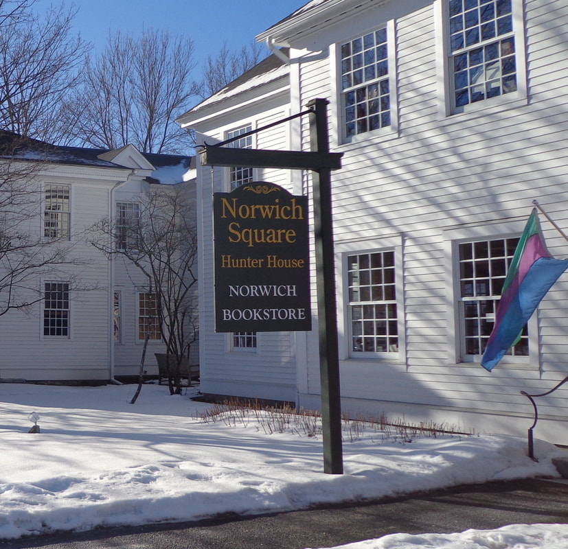 This one directs us to the bookstore, but it also let's us know that this is the Hunter House. Do you know who Hunter was? Another type of sign is the street sign, provided by our government, to help us figure out where we are, and how to get where we are going, or at least until GPS came out. At this corner, there's a common street sign, but also a granite post, in case the sign comes down. Although...the post sort of makes it look like it's the corner of Elm Street and Elm Street. 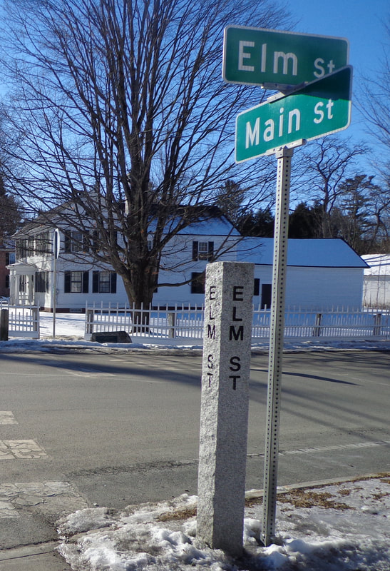 Continuing on our walk, we soon see another type of sign, also provided by our government, the safety related sign. The basic type of this particular sign came about years ago. I guess it's so that it doesn't matter what language you speak, if you can figure out the picture. But I wonder who came out with the neckless, handless and footless people-type of cartooning? It seems to have caught on well, but there's just something weird about these characters. Why don't they have hands, feet and necks?? Maybe their hands are those rectangular shaped things at the end of their left arms? Who are these people? 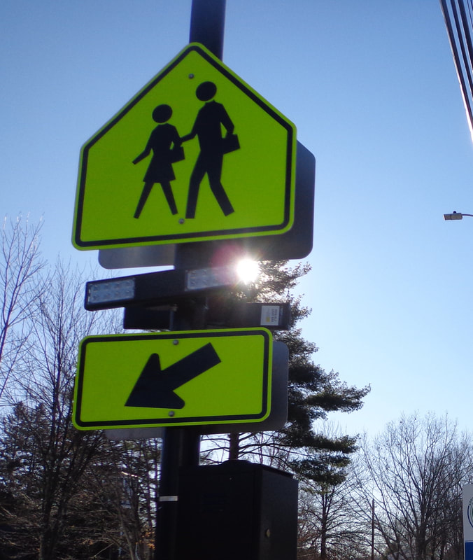 This pedestrian crossing sign has been modified with RRFBB's, a.k.a Rapidly Repeating Flashing Bright Bulbs, (or something like that). Here is also a sign provided by the government, though this one is for historical and informational purposes, as opposed to safety. I find it interesting that this one is "continued on other side"! So much to tell, so little space... 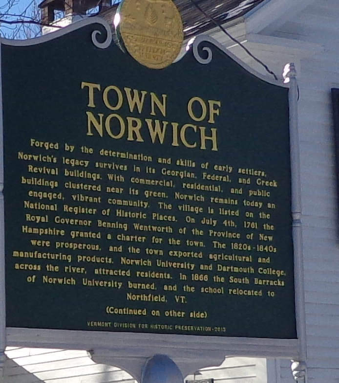 I have no idea what this "sign" (below), means, but I've been seeing a lot like them, on many utility poles these days. Can anyone interpret it, and tell us what it means in the comments section? >> 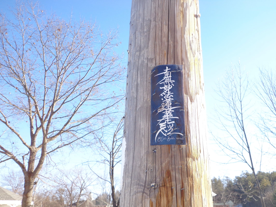 Interesting Notice on a Utility Pole in Norwich Vermont, US Route 5, Main Street. Here's one I particularly like: 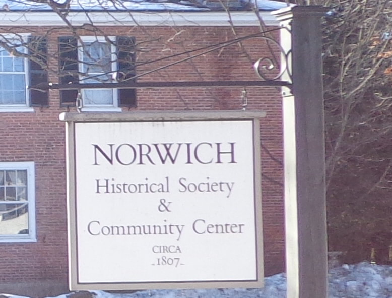 Norwich Historical Society & Community Center, CIRCA - 1807 - 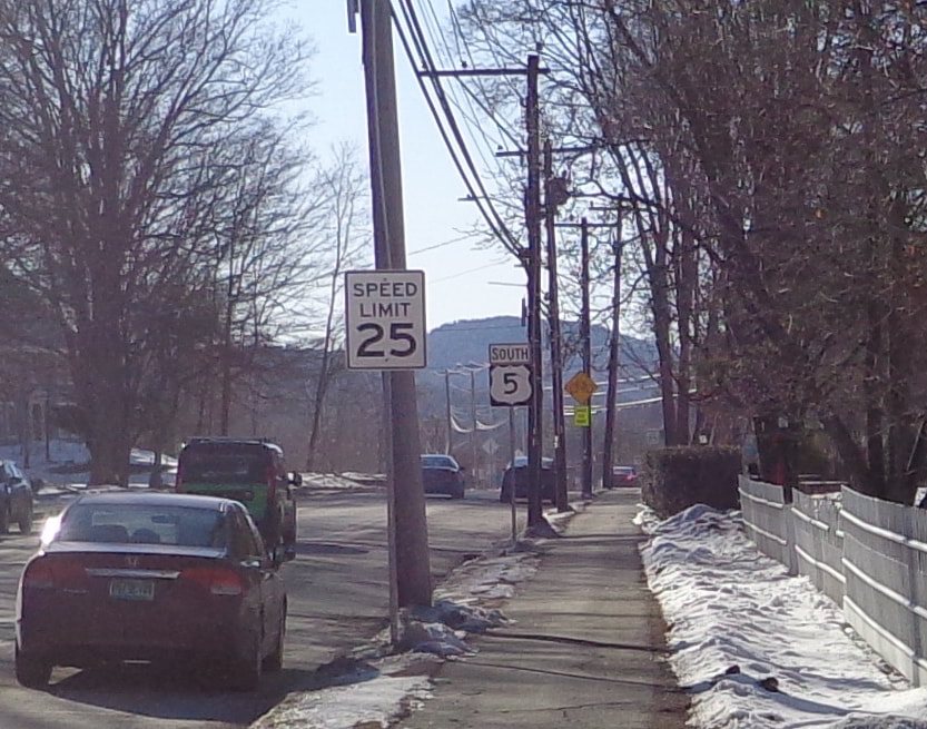 Safety: Speed Limit 25. Navigation: South US Route 5 Here's a sign for a local place of worship: 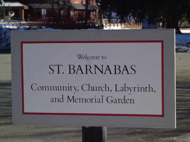 I was always taught that sharing is a good thing: 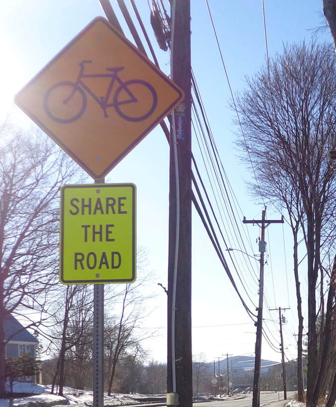 Share the Road" Signs Cropped up a Few Years Ago when Bicycle Lanes Were Introduced. A little further down the road, we come to another pedestrian crossing sign. This neckless, handless, and footless individual seems to be in a hurry, so look out!  Here's another sign I really like: " < TRAIL" The white rectangles remind us that US Route 5, and Main Street are also the Appalachian Trail. 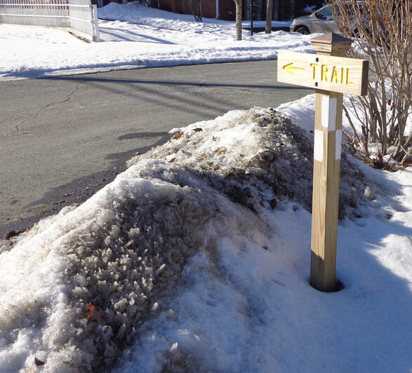 This Sign Lets You Know that You are on the Appalachian Trail. 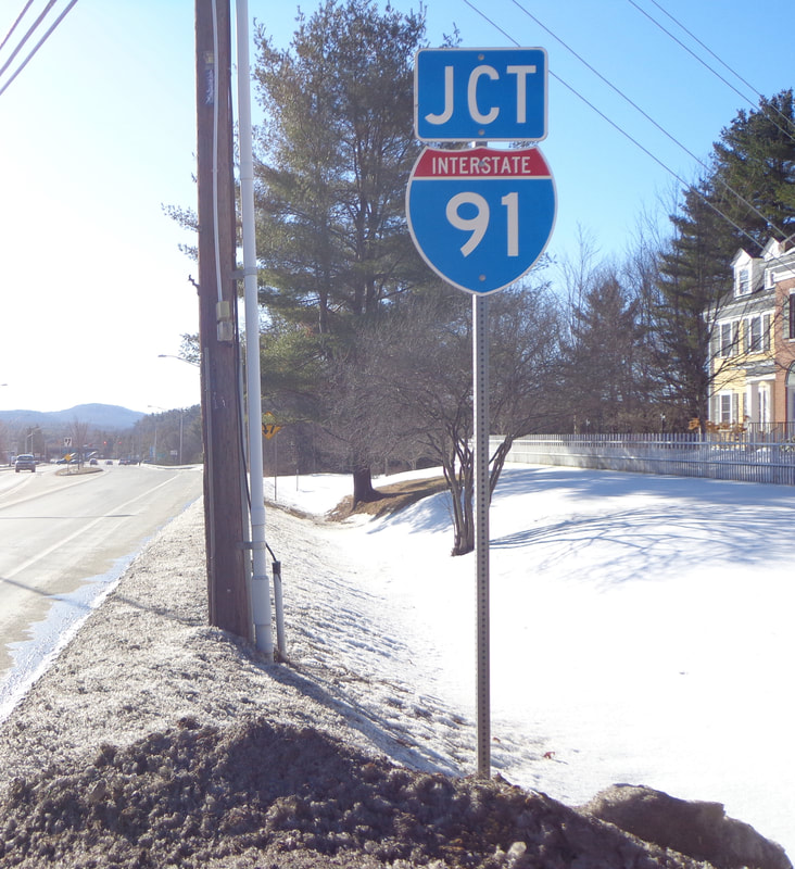 Where the Appalachian Trail and "The Dwight D. Eisenhower National System of Interstate and Defense Highways" Meet. Here's a couple safety type signs at the beginning of the median: The top one means stay to the right and don't run over the median. The lower one, a diamond shaped sign with reflectors most likely means the generic admonition: "Use Caution", which is always good advice. I have a feeling these signs weren't located here back in the 1950's. 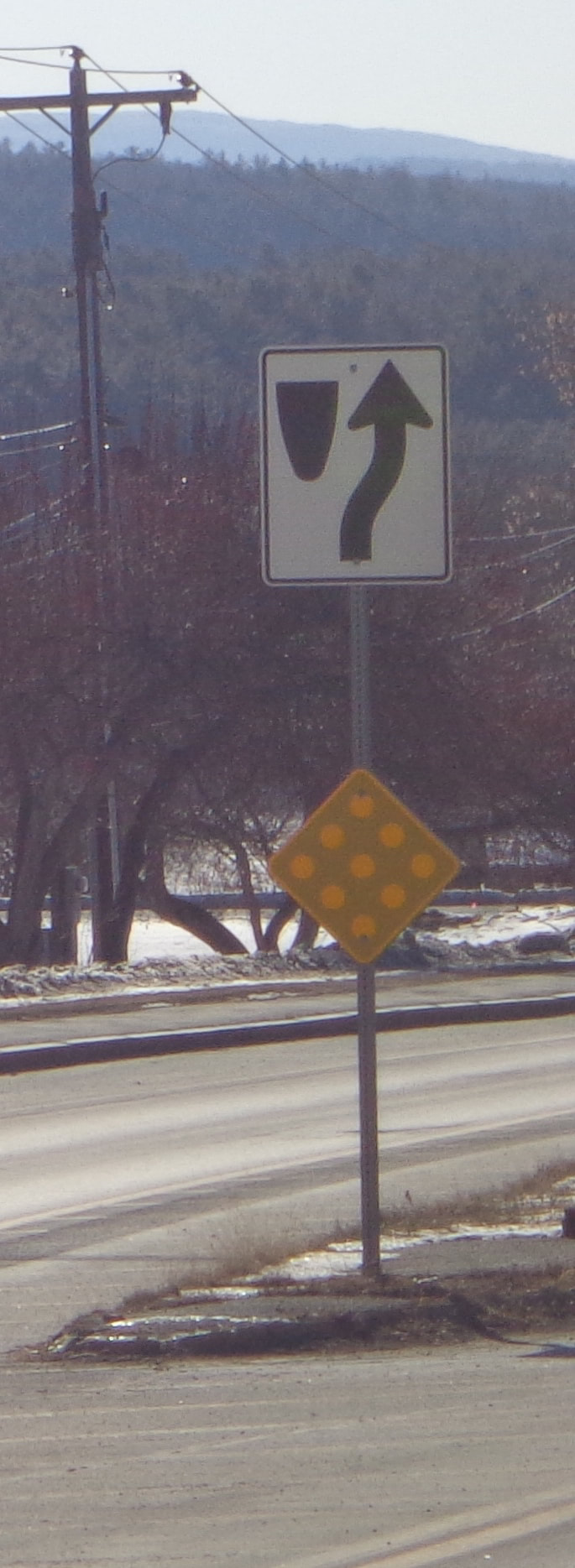 Divided Highway Begins. Use Caution Here's a safety related sign, letting you know that there will be a traffic control light up ahead. Does anyone agree with me that these lights should be flashing red on Sunday mornings, when traffic is really light? 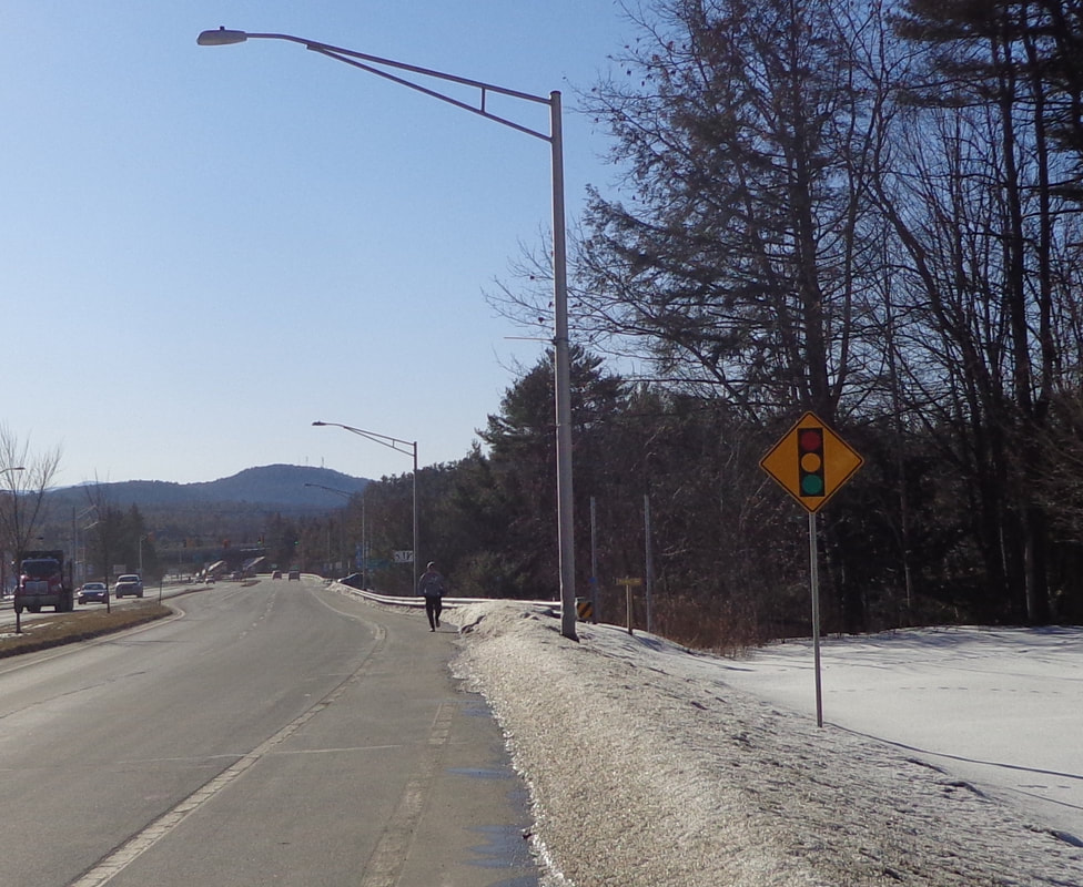 This sign is for another local trail, that heads down to the brook: 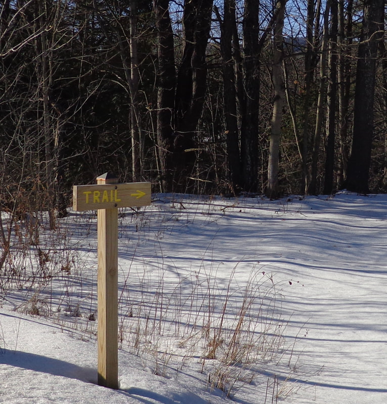 Uh oh....better check what lane you're in! 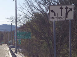 Here's one to let you know how far and in which direction to go. The small one underneath, appears to reference a "Bike Loop". 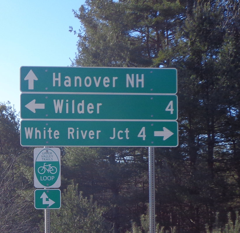 I chatted with a bicyclist a while back who spoke of the "5 and 10 Loop", with a ride to Thetford, and back through Lyme and Hanover. That sounded like a nice bicycle ride. Here's another sign I really like. How many people that live in Norwich have seen and read this memorial? I'm sure I noticed it in years past, but only subconsciously. I've lived in Norwich for thirty years, and I finally read it! I think it's really cool that this memorial was made from the bricks left in the ruins from the burned barracks in 1866. 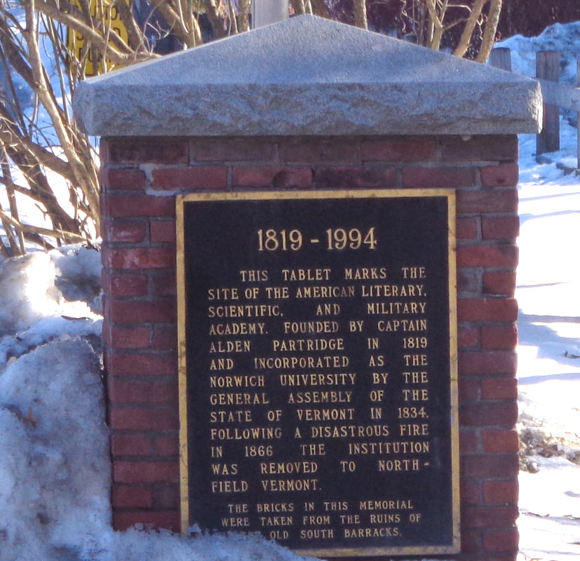 Memorial to Norwich University, on Route 5, Main Street, and the Appalachian Trail in Norwich Vermont. Thanks for walking down Old Roads, Rivers and Rails of the Upper Valley, with me, Bob Totz.
Have a comment on the post? Just click on comments and let us know what you think. NEW SUBSCRIBERS and SPONSORS are always welcome. Interested in subscribing to or sponsoring this website? Just send an email to [email protected] Thanks!
5 Comments
Douglas Shane
3/15/2020 09:13:30 am
Wonderful! How do you do it, fascinating posting after interesting posting?
Bob Totz
3/15/2020 09:42:50 am
I appreciate that very much.
Douglas Shane
3/15/2020 12:19:24 pm
Sorry, Bob, I'm not going there... You know what they say, "No man is a hero to his valet" or perhaps, to his wife.
Dan Webb
3/15/2020 09:14:48 am
I love this piece . . Very interesting observations ! Do you think the Elm St stone marker was a mistake?
Bob Totz
3/15/2020 09:40:54 am
Good question, Dan. I think it probably was done on purpose, Your comment will be posted after it is approved.
Leave a Reply. |
AuthorI'm Bob Totz, retired VT postmaster, and historical geographer ARCHIVES:
October 2021
EXPANDED ARCHIVES: AUGUST 2021 1858 Johnson Map of North America MAY 2021 1795 - "Road Over the Mountain" - Part Two Historic Toll House For Sale 1795 - "Road Over the Mountain" Part One OCTOBER 2020 Finding That Special Peaceful Place AUGUST 2020 Kayaking on the Pompy JULY 2020 Pt. 2: What the Heck Are These Things? JUNE 2020 Bob's Bio... What the Heck Are These Things? Pt. 1 MAY 2020 Stone Walls and Spirits The View APRIL 2020 Sunny Brook Farm Relics: Pt 2. Sunny Brook Farm Relics: Pt 1. MARCH 2020 Signs of Norwich Pt. 2 COVID-19 Tracking Map Centertown and Valleyquest Signs of Norwich Pt. 1 "Imperfect Union" - Book Review Historic Centertown FEBRUARY 2020 King's Hwy Pt. 2 WRJ Museum at Post Mills Airport Chatauguay Vermont The Independent Farmer poem Traveling Along the King's Highway - Lebanon NH JANUARY 2020 Finding Parkhurst Cemetery In Search of Parkhurst Cemetery Affordable Housing The Old Stone Grill Two Rivers Trail-Kmart License and Registration, Please! Prohibition, Murder and Dr. Seuss Peace, Paris, & P.O. DECEMBER 2019 BLOGGER'S LINKS Welcome to Old Roads Love-Quail Hollow fun Dartmouth Cemetery SEPTEMBER 2019 E. Thetford Cemetery JUNE 2019
Taps: Meetinghouse Cemetery 4-Corners Borders Quest Old Iron Gate Stumbling Upon History Sunrise Walk MAY 2019 4 Corners Cemetery Strafford's Abandoned Foundations Art in Old Stonework APRIL 2019 Strafford Tpke Pt 2 Strafford Tpke Pt 1 White River Valley FEBRUARY 2019 Learning from Historic Maps of the Upper Valley Change in Lewiston VT JANUARY 2019 A Vermont Ski Waltz John Ledyard 1773 What is the Upper Valley? DECEMBER 2018 Dartmouth Green Music Video: Sometimes Music Video: Montreal Express Railway Disaster of 1887 |
 RSS Feed
