|
Welcome! Scroll Down for Posts and Archives.
Other Menu Options at Top |
|
|
|
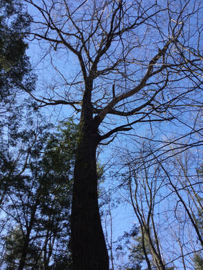
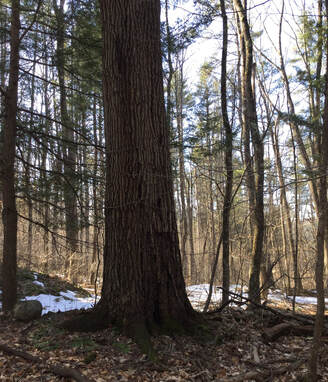
After doing my transfer station run on Wednesday, I parked the car outside the gate, near the small sand/wood chip shed. I wanted to get some exercise and fresh air before heading back home. 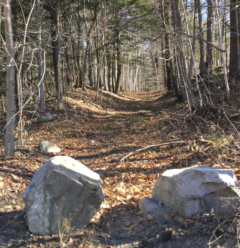 I'd seen those stones there before, blocking motor vehicle entrance, but I hadn't noticed any "No Trespassing" signs, so I thought I'd see where this trail might lead. I had a suspicion it might be a discontinued road. I headed up into the woods. 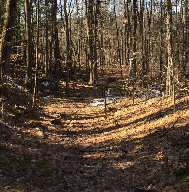 Not too long ago, a couple different people mentioned they thought there was a King's HIghway in Norwich, and that it ran up behind the Town Garage area. This was beginning to look like it could be an old town road, but I hadn't noticed it on a trail map before. 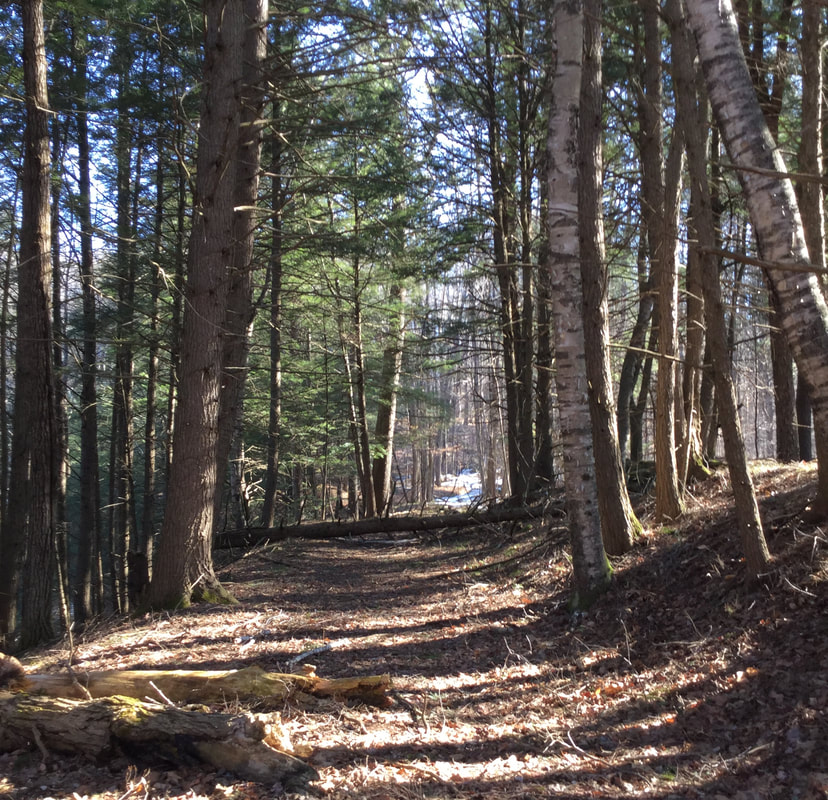 Old New England roads are often between stone walls, though sometimes the walls themselves are buried. 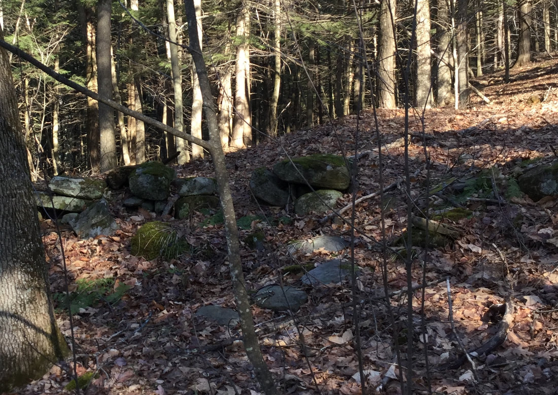 The old roadways also became depressions between the higher stone walls, from being tramped by on by people, animals, and carts and wagons of cargo, and water washing in the low points. 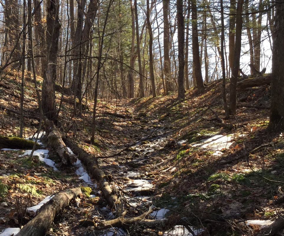 To the right I could start to see an open field. I wondered if maybe this road would lead to Olcott Road, near where the original Meetinghouse of Norwich first stood. 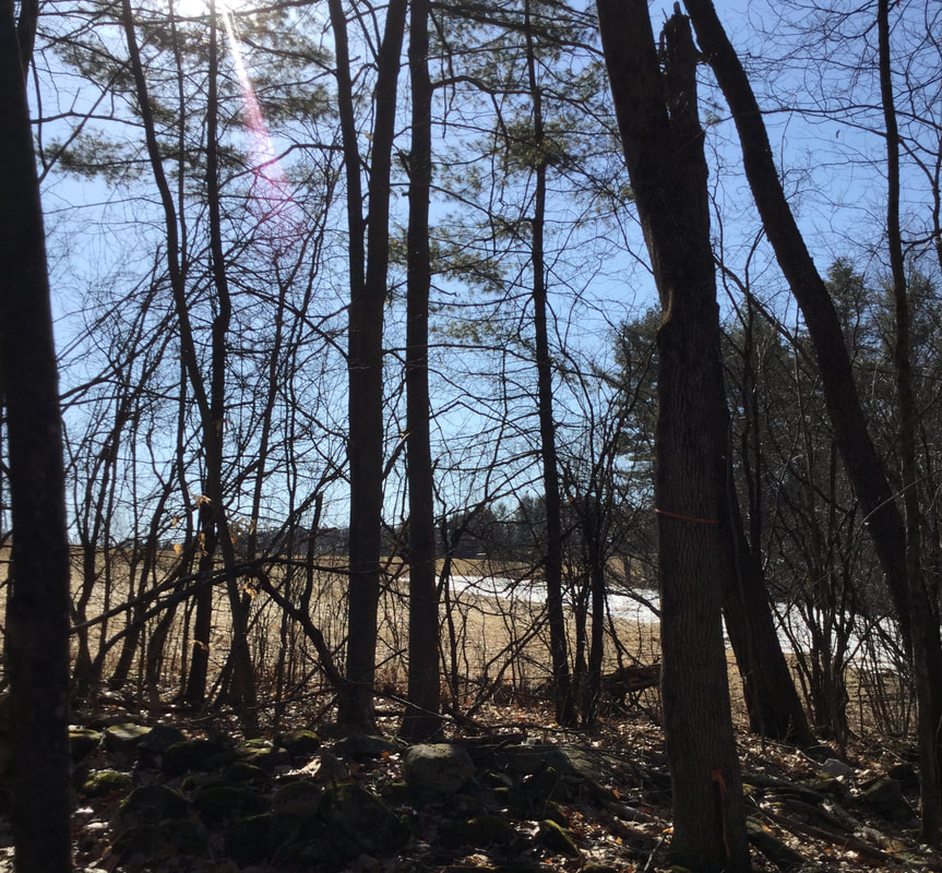 The high stone walls continued along both sides of the pathway. 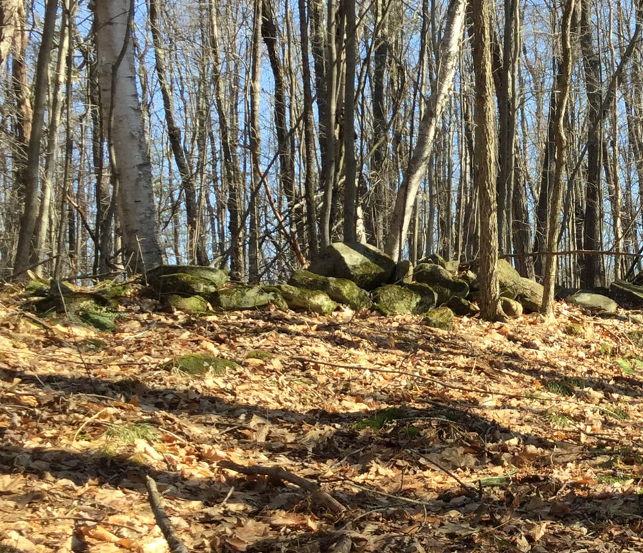 I wonder exactly when these walls were built. Maybe there's an early settler's diary at the Norwich Historical Society with an entry about working on the roadway, and moving rocks right here in this location. 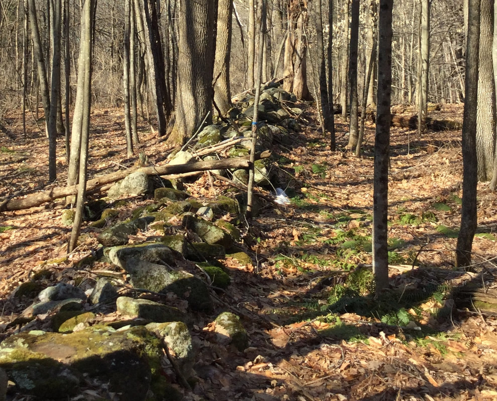 This has been a nice March for hiking. When I was out, it was mid-morning, and even though the snow was melting slowly, the ground was firm enough to walk without sloshing in slush or mud. That will be changing soon though. As I hiked around, following this old road, the ground leveled off a bit. There was a break in the wall. 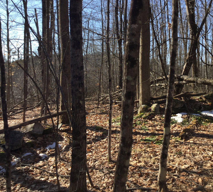 I found what looked like an old corner in the stone wall on the east side. There was an iron pin, most likely left from a survey... 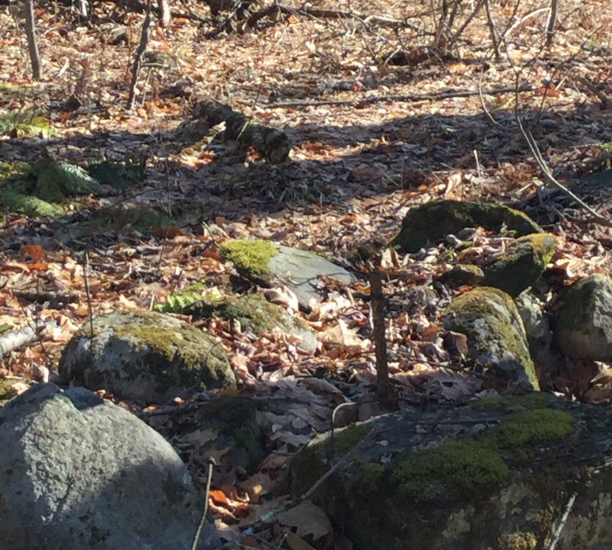 ..and what looked like a witness tree, a many trunked yellow birch giving witness to an old corner. 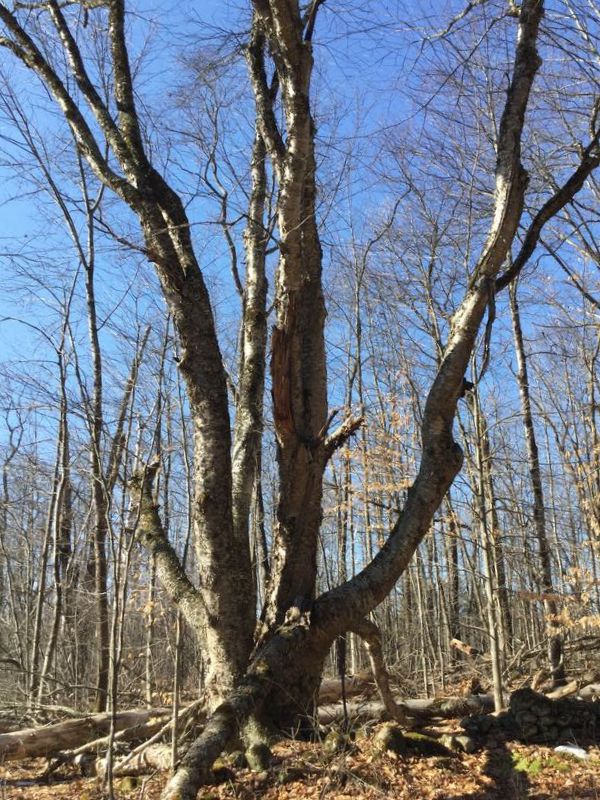 I looked around, and checked the time. I had a allotted myself a half hour for this walk, and it had already been 35 minutes, so I decided I'd better head back. 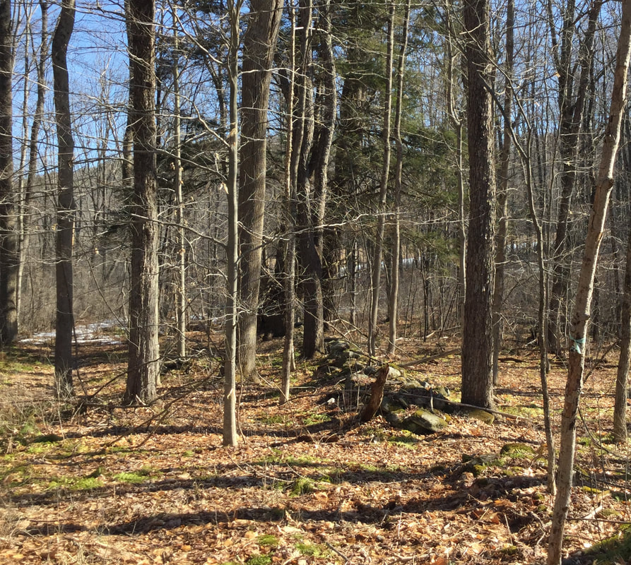 I admired the stone walls on the way back, and the wide swath of the roadway. 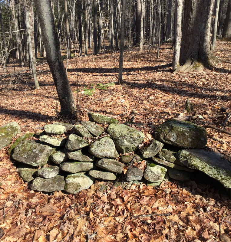 On my way back, I noticed a very large oak tree, by a turn in the road. It appeared to be the largest, oldest tree around, and it was right near a ravine, or seasonal streambed that dropped off, down to New Boston Road.
As I headed back down the last leg of the old road, toward the car, I could hear chicadees singing. When I got back home, I did a little research about this road. I don't know what it was called, but it looks like it was on the map in 1855, and was a way to get from the Meeting House to the starting point of New Boston Road, via Olcott Road. Here is a map from Google Earth: The dashed line shows the route of the road I was on. 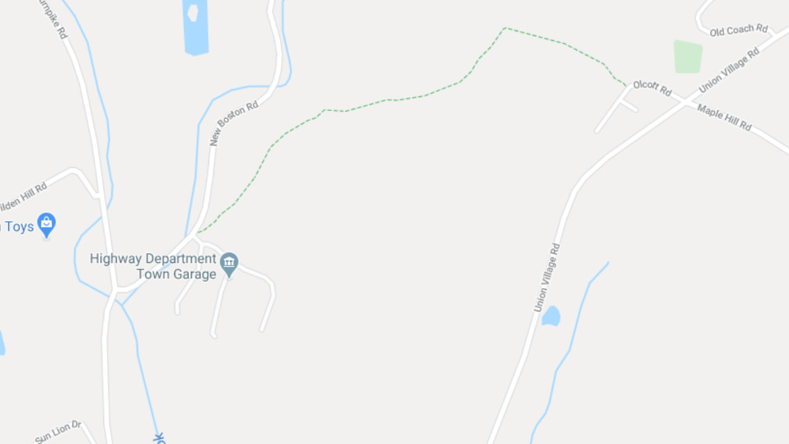 And here is the 1855 view: I circled the area in question. 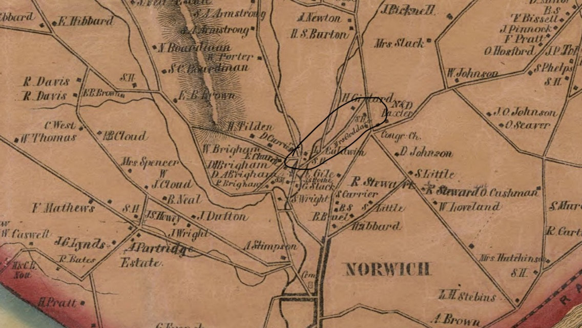 And here is the Google Earth imagery with the same area circled: 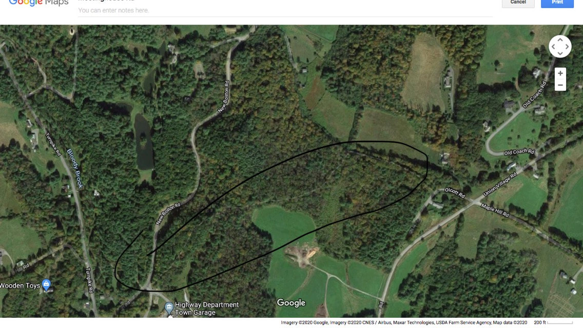 Fortunately, practicing social distancing doesn't have to mean staying out of the great outdoors. Getting excercise and fresh air is good for your body and your peace of mind, and it may even help you to sleep better at night! Thanks for hiking along Old Roads, Rivers and Rails of the Upper Valley. with me, Bob Totz If you haven't already done so, feel free to join the growing list of subscribers to this blog. Just send an email to [email protected] and we'll add you to the club. Sources: 1855 Windsor County VT map by Doton:
https://www.loc.gov/resource/g3753w.la001193/?r=0.305,0.282,0.928,0.392,0
4 Comments
demo
3/22/2020 05:39:18 am
Nice job on this article Bob and you are right about getting out and about
Bob Totz
3/22/2020 08:03:27 am
No more walking around the hospital!
Ruth Gaffey
3/22/2020 06:15:24 am
Thanks for the interesting walk
Bob Totz
3/22/2020 08:04:12 am
The trees are watching! Your comment will be posted after it is approved.
Leave a Reply. |
AuthorI'm Bob Totz, retired VT postmaster, and historical geographer ARCHIVES:
October 2021
EXPANDED ARCHIVES: AUGUST 2021 1858 Johnson Map of North America MAY 2021 1795 - "Road Over the Mountain" - Part Two Historic Toll House For Sale 1795 - "Road Over the Mountain" Part One OCTOBER 2020 Finding That Special Peaceful Place AUGUST 2020 Kayaking on the Pompy JULY 2020 Pt. 2: What the Heck Are These Things? JUNE 2020 Bob's Bio... What the Heck Are These Things? Pt. 1 MAY 2020 Stone Walls and Spirits The View APRIL 2020 Sunny Brook Farm Relics: Pt 2. Sunny Brook Farm Relics: Pt 1. MARCH 2020 Signs of Norwich Pt. 2 COVID-19 Tracking Map Centertown and Valleyquest Signs of Norwich Pt. 1 "Imperfect Union" - Book Review Historic Centertown FEBRUARY 2020 King's Hwy Pt. 2 WRJ Museum at Post Mills Airport Chatauguay Vermont The Independent Farmer poem Traveling Along the King's Highway - Lebanon NH JANUARY 2020 Finding Parkhurst Cemetery In Search of Parkhurst Cemetery Affordable Housing The Old Stone Grill Two Rivers Trail-Kmart License and Registration, Please! Prohibition, Murder and Dr. Seuss Peace, Paris, & P.O. DECEMBER 2019 BLOGGER'S LINKS Welcome to Old Roads Love-Quail Hollow fun Dartmouth Cemetery SEPTEMBER 2019 E. Thetford Cemetery JUNE 2019
Taps: Meetinghouse Cemetery 4-Corners Borders Quest Old Iron Gate Stumbling Upon History Sunrise Walk MAY 2019 4 Corners Cemetery Strafford's Abandoned Foundations Art in Old Stonework APRIL 2019 Strafford Tpke Pt 2 Strafford Tpke Pt 1 White River Valley FEBRUARY 2019 Learning from Historic Maps of the Upper Valley Change in Lewiston VT JANUARY 2019 A Vermont Ski Waltz John Ledyard 1773 What is the Upper Valley? DECEMBER 2018 Dartmouth Green Music Video: Sometimes Music Video: Montreal Express Railway Disaster of 1887 |
 RSS Feed
